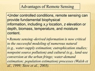
REMOTE SENSING...

BY
RAJIV AGARWAL
115090
WHAT IS REMOTE SENSING??

"Remote sensing is the science (and to some extent, art)
of acquiring
information about the Earth's surface without actually
being in contact
with it. This is done by sensing and recording reflected or
emitted energy
and processing, analyzing, and applying that information."
RS= OBSERVING WITH ARTIFICIAL EYES
DESCRIPTION: 1.

Energy Source or Illumination (A)



the
first requirement for remote sensing is to have an energy source which
illuminates or provides electromagnetic energy to the target of interest.



2.

-





Radiation and the Atmosphere (B) -

as
the energy travels from its source to the target, it will come in contact
with and interact with the atmosphere it passes through. This interaction
may take place a second time as the energy travels from the target to
the sensor.

Interaction with the Target (C)

3.
once the energy makes its way to the target through the
atmosphere, it interacts with the target depending on the properties of
both the target and the radiation.


4. Recording of Energy by the Sensor (D) - after
the energy has been scattered by, or emitted from the
target, we require a sensor (remote - not in contact with the
target) to collect and record the electromagnetic radiation.



5. Transmission, Reception, and Processing (E)
- the energy recorded by the sensor has to be
transmitted, often in electronic form, to a receiving and
processing station where the data are processed into an
image (hardcopy and/or digital).



6. Interpretation and Analysis (F) - the processed
image is interpreted, visually and/or digitally or
electronically, to extract information about the target which
was illuminated.


7. Application (G) - the final element of the
remote sensing process is achieved when
we apply the information we have been able
to extract from the imagery about the target
in order to better understand it, reveal some
new information, or assist in solving a
particular problem. These seven elements
comprise the remote sensing process from
beginning to end;
Types of sensing....
1.Active Sensing

2.Passive Sensing

ACTIVE SENSING...




Active sensors, on the other hand, provide their own energy source for
illumination. The sensor emits radiation which is directed toward the target to be
investigated. The radiation reflected from that target is detected and measured
by the sensor.

Advantages for active sensors



include the ability to obtain measurements anytime, regardless of the time of day
or season. Active sensors can be used for examining wavelengths that are not
sufficiently provided by the sun, such as microwaves, or to better control the way
a target is illuminated. However, active systems require the generation of a fairly
large amount of energy to adequately illuminate targets.....



Some examples :



active sensors are a laser fluorosensor and a synthetic
aperture radar (SAR).


PASSIVE SENSING...









Passive Sensing
So far, throughout this chapter, we have made various references to the
sun as a source of
energy or radiation. The sun provides a very convenient source of
energy for remote sensing.
The sun's energy is either reflected, as it is for visible wavelengths, or
absorbed and then reemitted,
as it is for thermal infrared wavelengths. Remote sensing systems which
measure energy that is naturally available are called passive sensors.
Passive sensors can only be used to detect energy when the naturally
occurring energy is available. For all reflected energy, this can only take
place during the time when the sun is illuminating the Earth. There is no
reflected energy available from the sun at night. Energy that is naturally
emitted (such as thermal infrared) can be detected day or night, as long
as the amount of energy is large enough to be recorded.
IN AGRI
 1.crop monitoring & damage assessment
 Ice type & concentration
 Land cover & land use
 Change in usage of land(rural -to-urban)
 Mapping
 Oceans & coastal monitoringg

OCEAN APPLICATIONS :::













Ocean applications of remote sensing include the
following:
Ocean pattern identification:
currents, regional circulation patterns, shears
frontal zones, internal waves, gravity
waves, eddies, upwelling zones, shallow water
bathymetry ,
Storm forecasting
wind and wave retrieval
Fish stock and marine mammal assessment
water temperature monitoring
water quality
ocean productivity, phytoplankton concentration and drift
ALSO SOME APPLICATIONS


















aquaculture inventory and monitoring
Oil spill
mapping and predicting oilspill extent and drift
strategic support for oil spill emergency response decisions
identification of natural oil seepage areas for exploration
Shipping
navigation routing
traffic density studies
operational fisheries surveillance
near-shore bathymetry mapping
Intertidal zone
tidal and storm effects
delineation of the land /water interface
mapping shoreline features / beach dynamics
coastal vegetation mapping
human activity / impact
Interaction Model Depicting the Relationships of the Mapping Sciences as
they relate to Mathematics and Logic, and the Physical, Biological, and
Social Sciences
Advantages of Remote Sensing
• Remote sensing is unobtrusive if the sensor passively
records the EMR reflected or emitted by the object of
interest. Passive remote sensing does not disturb the
object or area of interest.
• Remote sensing devices may be programmed to collect
data systematically, such as within a 9 9 in. frame of
vertical aerial photography. This systematic data collection
can remove the sampling bias introduced in some in situ
investigations.
Advantages of Remote Sensing
•Under controlled conditions, remote sensing can
provide fundamental biophysical
information, including x,y location, z elevation or
depth, biomass, temperature, and moisture
content.
• Remote sensing–derived information is now critical
to the successful modeling of numerous natural
(e.g., water-supply estimation; eutrophication studies;
nonpoint source pollution) and cultural (e.g., land-use
conversion at the urban fringe; water-demand
estimation; population estimation) processes (Walsh et
al., 1999; Stow et al., 2003).
Remote Sensing Instruments - Disadvantages:
•Expensive to build and operate!!!!
•Measurement uncertainty can be large
•resolution is often coarse ::

•

•88D pulse volume is over 1.5 km wide at 100 km range from
radar
•satellites
Data interpretation can be difficult
•need to understand theoretically how the instrument is making the
measurements
•need to understand measurement uncertainties
•need to have some knowledge of the phenomena you are
sampling
Thank you !!

remote sensing

  • 1.
  • 2.
    WHAT IS REMOTESENSING?? "Remote sensing is the science (and to some extent, art) of acquiring information about the Earth's surface without actually being in contact with it. This is done by sensing and recording reflected or emitted energy and processing, analyzing, and applying that information."
  • 3.
    RS= OBSERVING WITHARTIFICIAL EYES
  • 4.
    DESCRIPTION: 1. Energy Sourceor Illumination (A)  the first requirement for remote sensing is to have an energy source which illuminates or provides electromagnetic energy to the target of interest.  2. -   Radiation and the Atmosphere (B) - as the energy travels from its source to the target, it will come in contact with and interact with the atmosphere it passes through. This interaction may take place a second time as the energy travels from the target to the sensor. Interaction with the Target (C) 3. once the energy makes its way to the target through the atmosphere, it interacts with the target depending on the properties of both the target and the radiation.
  • 5.
     4. Recording ofEnergy by the Sensor (D) - after the energy has been scattered by, or emitted from the target, we require a sensor (remote - not in contact with the target) to collect and record the electromagnetic radiation.  5. Transmission, Reception, and Processing (E) - the energy recorded by the sensor has to be transmitted, often in electronic form, to a receiving and processing station where the data are processed into an image (hardcopy and/or digital).  6. Interpretation and Analysis (F) - the processed image is interpreted, visually and/or digitally or electronically, to extract information about the target which was illuminated.
  • 6.
     7. Application (G)- the final element of the remote sensing process is achieved when we apply the information we have been able to extract from the imagery about the target in order to better understand it, reveal some new information, or assist in solving a particular problem. These seven elements comprise the remote sensing process from beginning to end;
  • 7.
    Types of sensing.... 1.ActiveSensing  2.Passive Sensing 
  • 8.
    ACTIVE SENSING...   Active sensors,on the other hand, provide their own energy source for illumination. The sensor emits radiation which is directed toward the target to be investigated. The radiation reflected from that target is detected and measured by the sensor. Advantages for active sensors  include the ability to obtain measurements anytime, regardless of the time of day or season. Active sensors can be used for examining wavelengths that are not sufficiently provided by the sun, such as microwaves, or to better control the way a target is illuminated. However, active systems require the generation of a fairly large amount of energy to adequately illuminate targets.....  Some examples :  active sensors are a laser fluorosensor and a synthetic aperture radar (SAR). 
  • 10.
    PASSIVE SENSING...        Passive Sensing Sofar, throughout this chapter, we have made various references to the sun as a source of energy or radiation. The sun provides a very convenient source of energy for remote sensing. The sun's energy is either reflected, as it is for visible wavelengths, or absorbed and then reemitted, as it is for thermal infrared wavelengths. Remote sensing systems which measure energy that is naturally available are called passive sensors. Passive sensors can only be used to detect energy when the naturally occurring energy is available. For all reflected energy, this can only take place during the time when the sun is illuminating the Earth. There is no reflected energy available from the sun at night. Energy that is naturally emitted (such as thermal infrared) can be detected day or night, as long as the amount of energy is large enough to be recorded.
  • 12.
    IN AGRI  1.cropmonitoring & damage assessment  Ice type & concentration  Land cover & land use  Change in usage of land(rural -to-urban)  Mapping  Oceans & coastal monitoringg 
  • 13.
    OCEAN APPLICATIONS :::            Oceanapplications of remote sensing include the following: Ocean pattern identification: currents, regional circulation patterns, shears frontal zones, internal waves, gravity waves, eddies, upwelling zones, shallow water bathymetry , Storm forecasting wind and wave retrieval Fish stock and marine mammal assessment water temperature monitoring water quality ocean productivity, phytoplankton concentration and drift
  • 14.
    ALSO SOME APPLICATIONS                 aquacultureinventory and monitoring Oil spill mapping and predicting oilspill extent and drift strategic support for oil spill emergency response decisions identification of natural oil seepage areas for exploration Shipping navigation routing traffic density studies operational fisheries surveillance near-shore bathymetry mapping Intertidal zone tidal and storm effects delineation of the land /water interface mapping shoreline features / beach dynamics coastal vegetation mapping human activity / impact
  • 15.
    Interaction Model Depictingthe Relationships of the Mapping Sciences as they relate to Mathematics and Logic, and the Physical, Biological, and Social Sciences
  • 16.
    Advantages of RemoteSensing • Remote sensing is unobtrusive if the sensor passively records the EMR reflected or emitted by the object of interest. Passive remote sensing does not disturb the object or area of interest. • Remote sensing devices may be programmed to collect data systematically, such as within a 9 9 in. frame of vertical aerial photography. This systematic data collection can remove the sampling bias introduced in some in situ investigations.
  • 17.
    Advantages of RemoteSensing •Under controlled conditions, remote sensing can provide fundamental biophysical information, including x,y location, z elevation or depth, biomass, temperature, and moisture content. • Remote sensing–derived information is now critical to the successful modeling of numerous natural (e.g., water-supply estimation; eutrophication studies; nonpoint source pollution) and cultural (e.g., land-use conversion at the urban fringe; water-demand estimation; population estimation) processes (Walsh et al., 1999; Stow et al., 2003).
  • 18.
    Remote Sensing Instruments- Disadvantages: •Expensive to build and operate!!!! •Measurement uncertainty can be large •resolution is often coarse :: • •88D pulse volume is over 1.5 km wide at 100 km range from radar •satellites Data interpretation can be difficult •need to understand theoretically how the instrument is making the measurements •need to understand measurement uncertainties •need to have some knowledge of the phenomena you are sampling
  • 19.