Downloaded 189 times
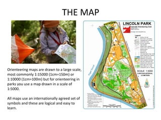
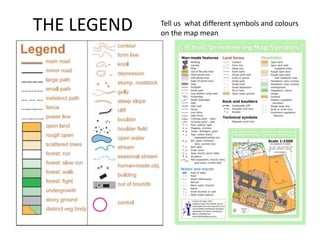

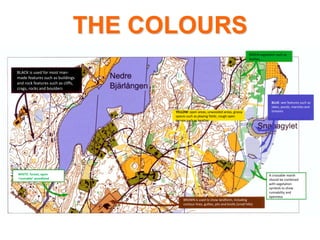


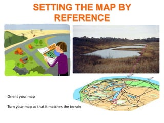

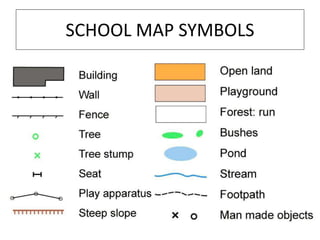
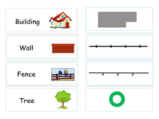


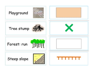

Orienteering maps use standardized symbols and scales to accurately represent terrain features. The maps are highly detailed topographical maps, typically with scales of 1:15,000 or 1:10,000. These scales mean that 1 cm on the map equals 150 or 100 meters, respectively, in real distance. Map symbols are designed to be easily readable and represent features like vegetation, water, and man-made structures using consistent colors. Orientation and proper map setting allow competitors to accurately navigate terrain using these detailed and standardized orienteering maps.


