This document provides an overview of land navigation training that includes two parts: map reading skills and compass use. Part one covers important map features like marginal information, symbols, terrain features, and determining elevation from contour lines. It emphasizes the purpose of maps for navigation and importance of checking the map date. Part two introduces navigation techniques like determining grid coordinates using a protractor and understanding military compass features. The training aims to teach service members key map reading and land navigation skills for navigating terrain and completing missions.
Introduction to Land Navigation Training by TSgt David Bernal, focusing on map reading and compass use.
Covers key concepts of map reading, including starting points, routes, and terrain awareness. Defines maps, their purpose, symbols, marginal info, and the importance of scale and sheet numbers.Explains map scales, types of maps based on scale, and bar scales for distance conversion.
Discusses contour lines, contour intervals, elevation, and how to determine elevation on maps.
Identifies major terrain features like hills, ridges, valleys, saddles, and depressions.
Defines minor terrain features such as draws, spurs, and cliffs, their significance in navigation.
Begins the navigation section, emphasizing the importance of grid coordinates on military maps.
Describes the protractor's function for measuring and plotting grid coordinates on maps.
Explains how to break down and find grid coordinates on military maps for accurate positioning.
Introduces the features and specifications of the military lensatic compass.
Detailed instructions on compass use, azimuth conversions, distance measurements, and methods.
Invitation for questions, summarizing the navigation training session.
Training Objectives
• ThisPower Point Presentation is intended to
give an overview / familiarization of land
navigation.
• Part one will address map reading skills.
• Part two will address compass use and land
navigation
3.
Part One –Map Reading
- Where am I?
- How far is it?
- Does this route support my mission?
True land navigation is knowing where you
start your journey, the terrain you will be
passing, and understanding exactly where
your journey will end.
4.
Map Reading
(FM 21-26)
Definition
Amap is a graphic representation, drawn to
scale, of a portion of the earth’s surface as
seen from above.
Man-made and natural features are
depicted by symbols, lines, colors and
forms.
5.
Purpose of aMap
A map provides information on the
existence, location and the distance
between ground features, such as
populated places and routes of travel
and communication. It also indicates
variations in terrain, heights of natural
features, and the extent of vegetation
cover.
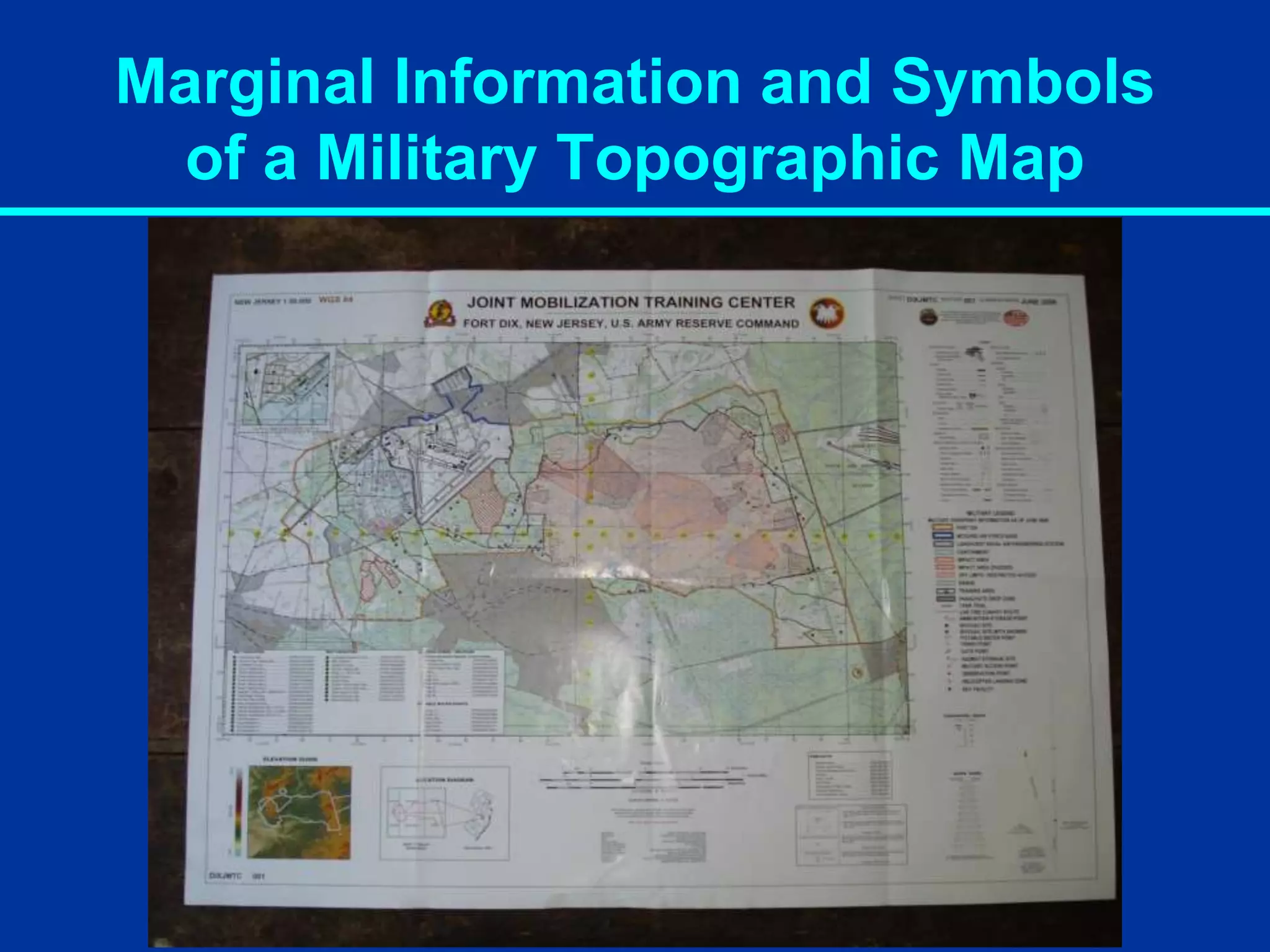
Marginal Information andSymbols
of a Military Topographic Map
IMPORTANT!!!!!
On the bottom right corner of the map, near
the key, map name, state, and quadrant
location, is the date of the map. It is vital that
you check the date of the map and
determine if any changes have occurred that
may impact your mission.
8.
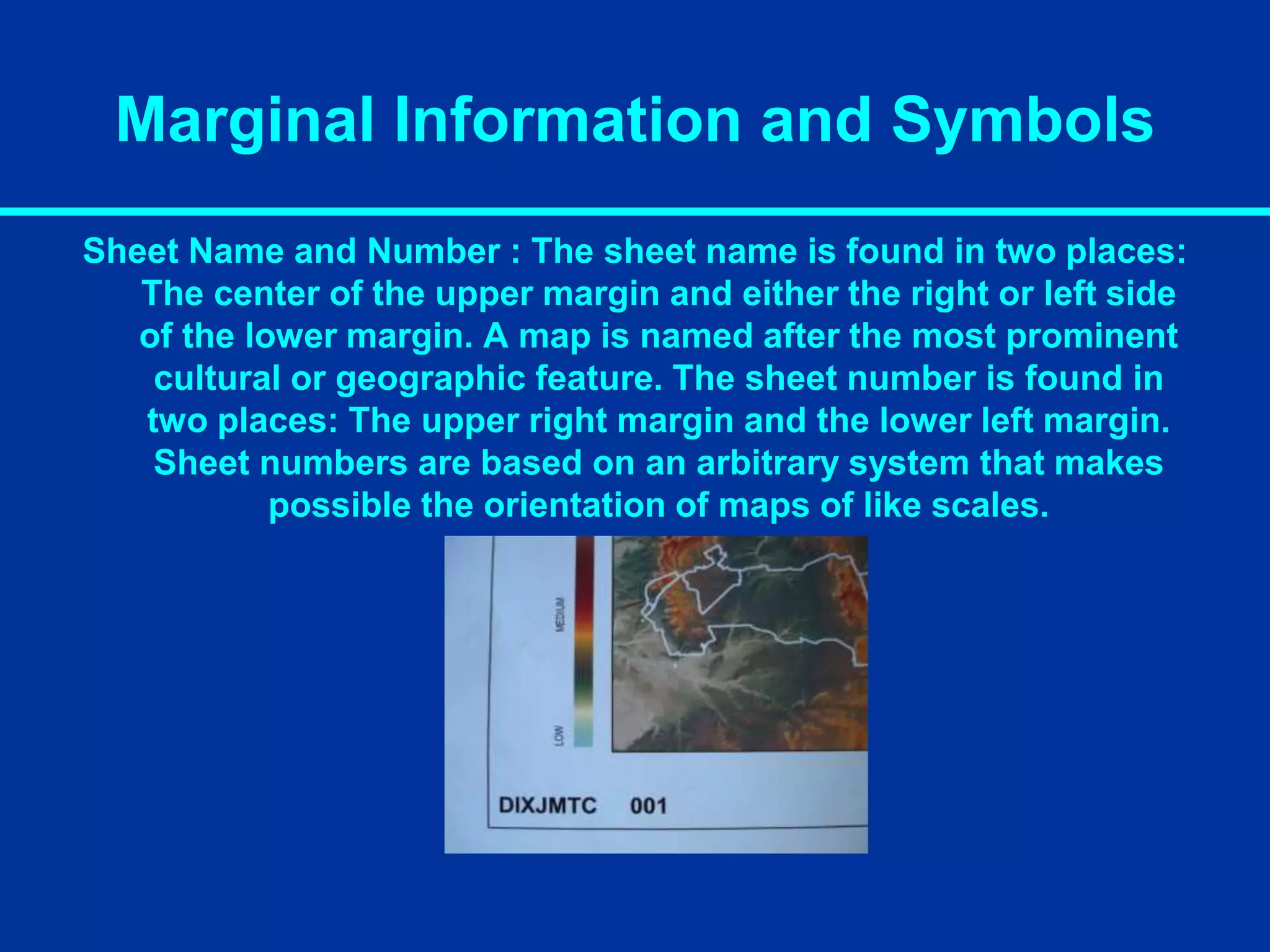
Marginal Information andSymbols
Sheet Name and Number : The sheet name is found in two places:
The center of the upper margin and either the right or left side
of the lower margin. A map is named after the most prominent
cultural or geographic feature. The sheet number is found in
two places: The upper right margin and the lower left margin.
Sheet numbers are based on an arbitrary system that makes
possible the orientation of maps of like scales.
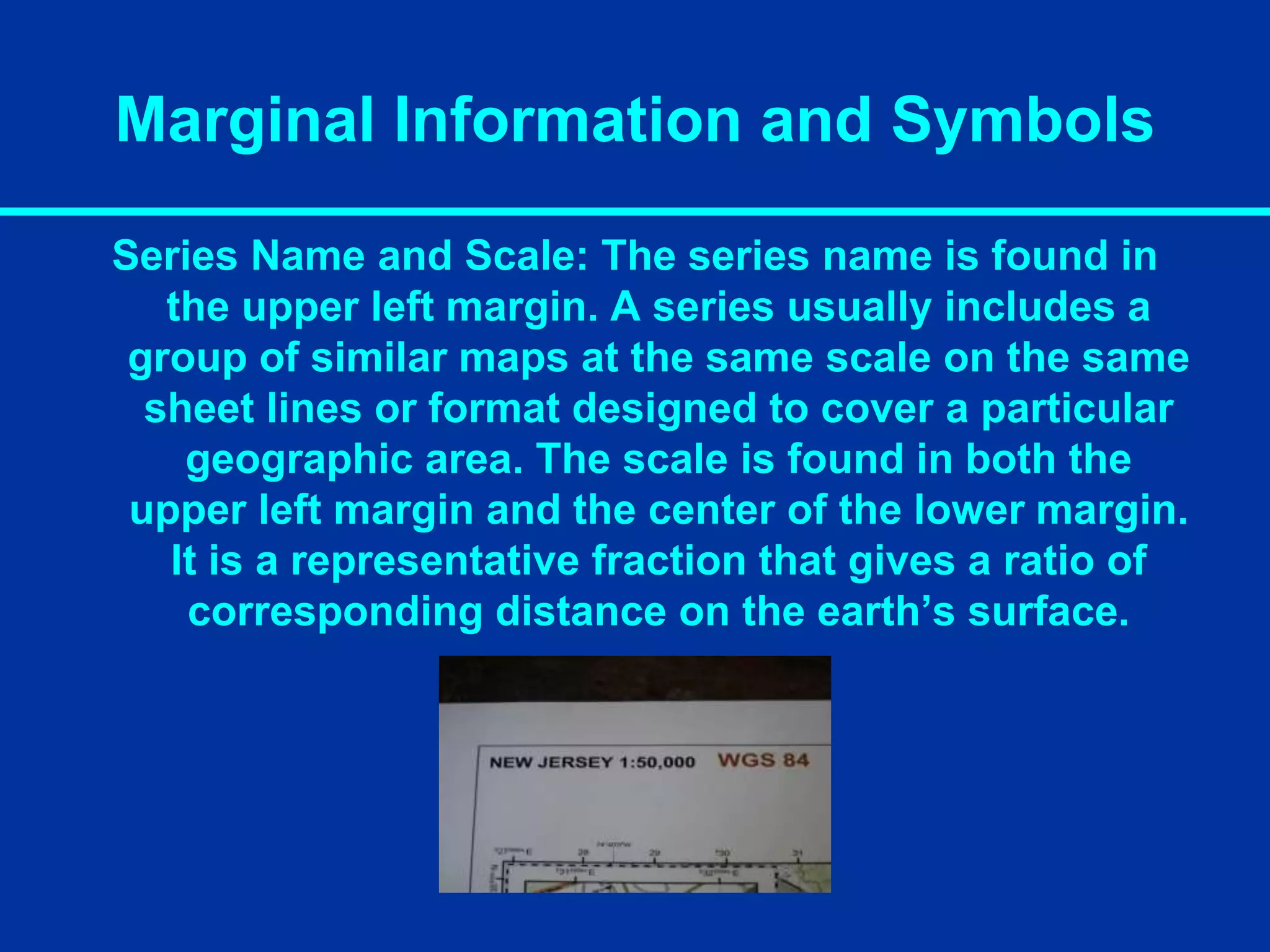
Marginal Information andSymbols
Series Name and Scale: The series name is found in
the upper left margin. A series usually includes a
group of similar maps at the same scale on the same
sheet lines or format designed to cover a particular
geographic area. The scale is found in both the
upper left margin and the center of the lower margin.
It is a representative fraction that gives a ratio of
corresponding distance on the earth’s surface.
11.
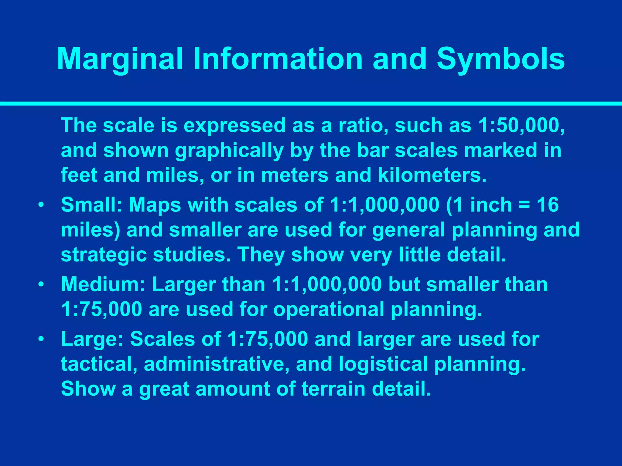
Marginal Information andSymbols
The scale is expressed as a ratio, such as 1:50,000,
and shown graphically by the bar scales marked in
feet and miles, or in meters and kilometers.
• Small: Maps with scales of 1:1,000,000 (1 inch = 16
miles) and smaller are used for general planning and
strategic studies. They show very little detail.
• Medium: Larger than 1:1,000,000 but smaller than
1:75,000 are used for operational planning.
• Large: Scales of 1:75,000 and larger are used for
tactical, administrative, and logistical planning.
Show a great amount of terrain detail.
12.
Marginal Information andSymbols
Bar Scales: Located in the center of the lower
margin: They are rulers used to convert map
distance to ground distance.
13.
Marginal Information andSymbols
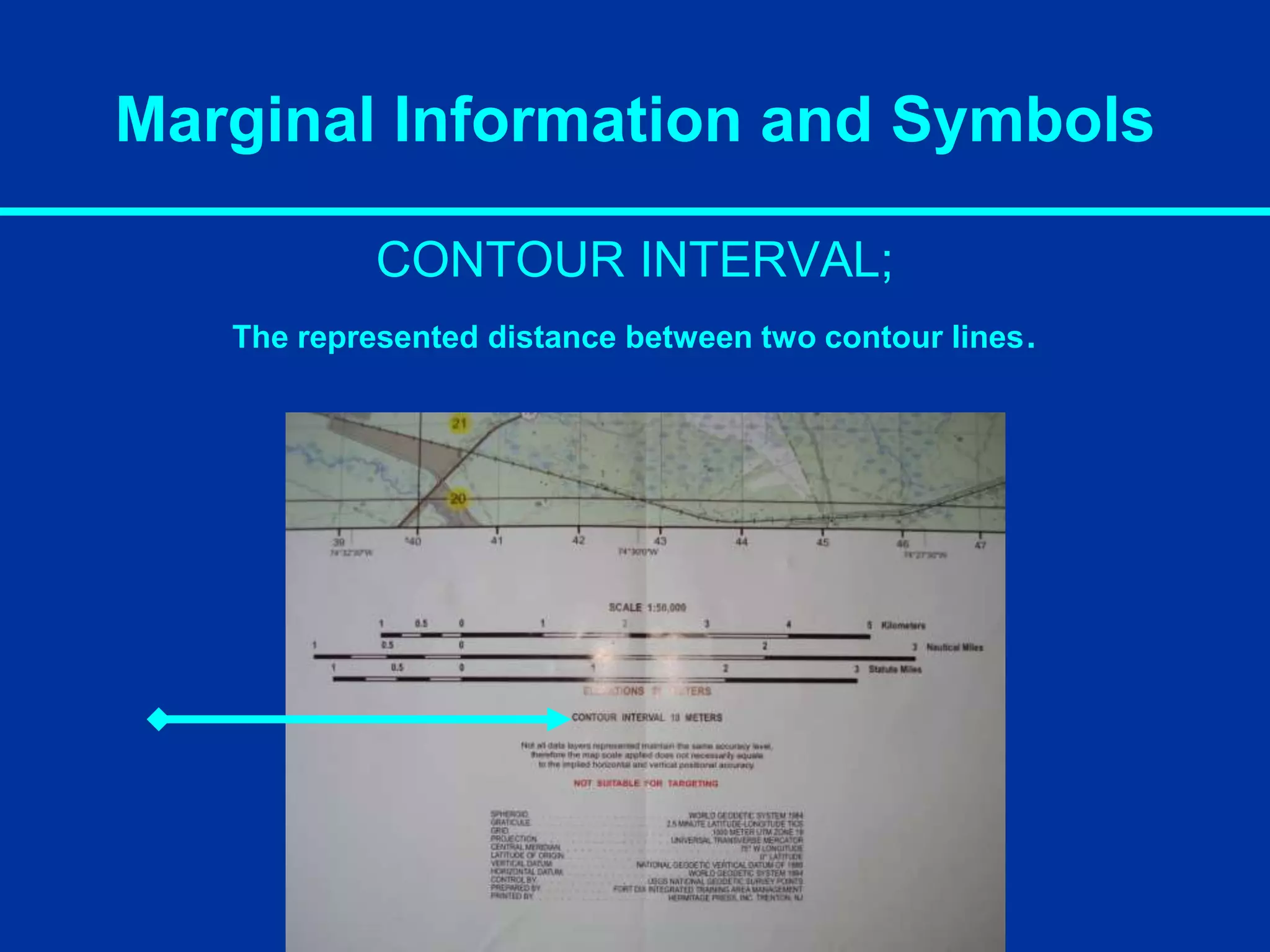
CONTOUR INTERVAL;
The represented distance between two contour lines.
14.
Marginal Information andSymbols
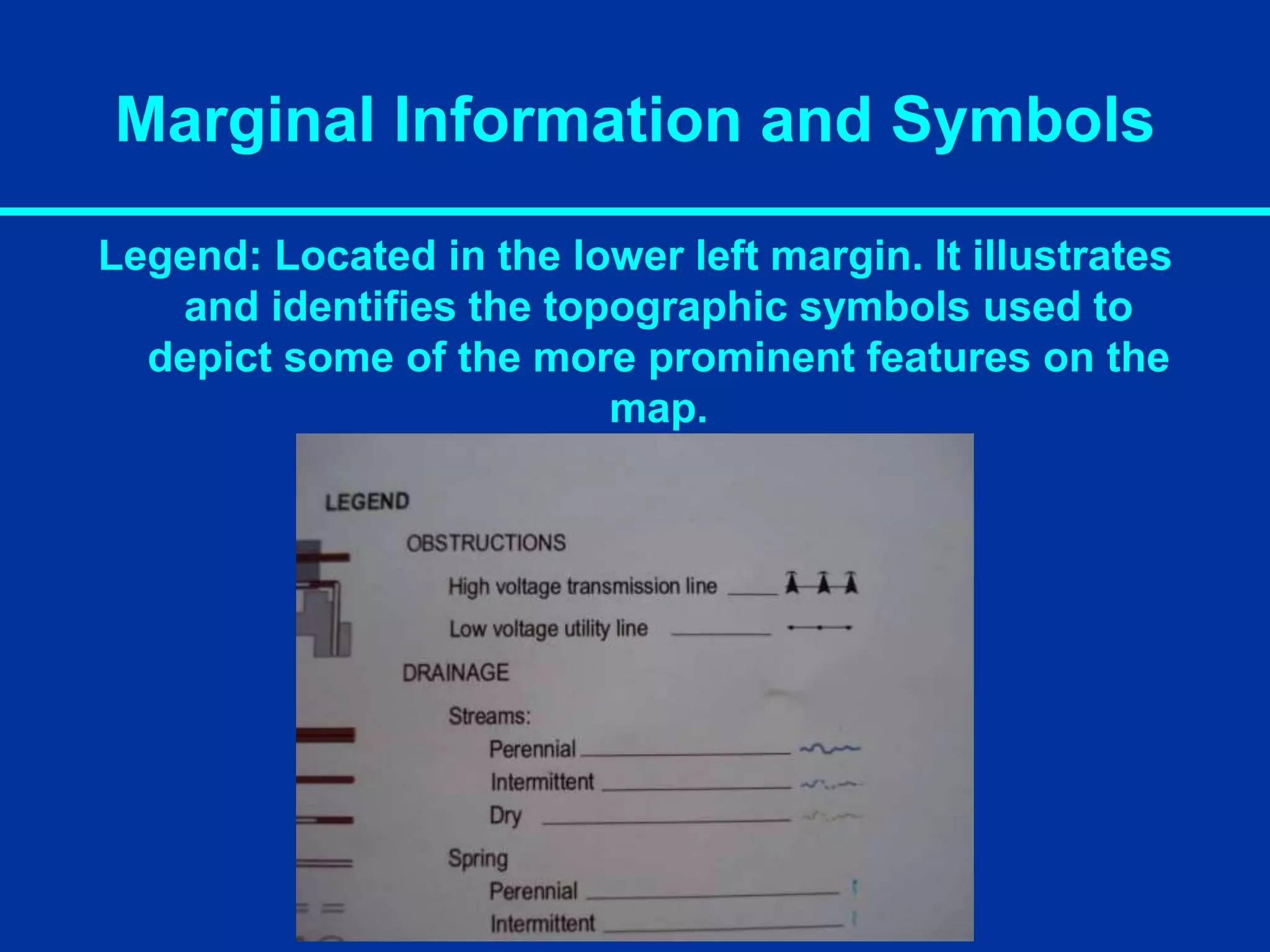
Legend: Located in the lower left margin. It illustrates
and identifies the topographic symbols used to
depict some of the more prominent features on the
map.
16.
Marginal Information andSymbols
The Five Major Colors of a Map
Brown (Contour Lines)
Black (Man Made Features, Roads, Trails)
Blue (Water Features)
Green (Vegetation)
Red (Highway and Land Grids)
The Two Minor Colors of a Map
Pink (Built-Up Areas, Civilization)
Purple (Updated Map Information)
17.
Marginal Information andSymbols
Elevation: The vertical distance that a point is above or below mean
sea level.
Index: Starting at mean sea level every fifth contour line is a heavier
line, these are known as index contour lines. They are normally
numbered. This number is the elevation of that line.
Intermediate: Contour lines falling between the index lines are called
intermediate, these lines are thinner and are not numbered.
Supplementary: These contour lines resemble dashes. They show
sudden changes in elevation of a least one-half the contour interval.
Spot: Spot elevations are marked by a “.” and will have the elevation
annotated next to it.
Terrain Features
IDENTIFY TERRAINFEATURES ON A MAP
Terrain Features are identified in the same manner
on all maps.
You must be able to recognize all terrain features to
locate a point on the ground or to navigate from one
point to another.
Terrain Features
Hill; Apoint or small area of high ground. When
you are on a hilltop the ground slopes down in
all directions.
29.
Terrain Features
Ridge: Aline of high ground with height variations along its
crest: The ridge is not simply a line of hills; all points of the
ridge crest are higher than the ground on both sides of the
ridge.
30.
Terrain Features
Valley: Reasonablylevel ground bordered on the sides by higher
ground. It may or may not contain a stream. A valley generally has
maneuver room. Contour lines indicating a valley are U shaped and
tend to parallel a stream before crossing it. The course of the contour
lines crossing a stream will generally point upstream.
31.
Terrain Features
Saddle: Adip or low point along the crest of a ridge. A saddle is
not necessarily the lower ground between two hilltops; it may
be a break along an otherwise level ridge crest.
Minor Terrain Features
Althoughthese features are not as important as
major terrain features; a navigator can plan their
route more successfully if they can identify all
features that could result in potential obstacles.
Minor terrain features are;
Draw
Spur
Cliff
34.
Minor Terrain Features
Draw:Similar to a valley except that it is normally a less developed
stream course in which there is generally no level ground and
therefore little or no maneuver room. Contour lines indicating a draw
are V shaped with the point of the V toward the head of the draw (High
Ground).
35.
Minor Terrain Features
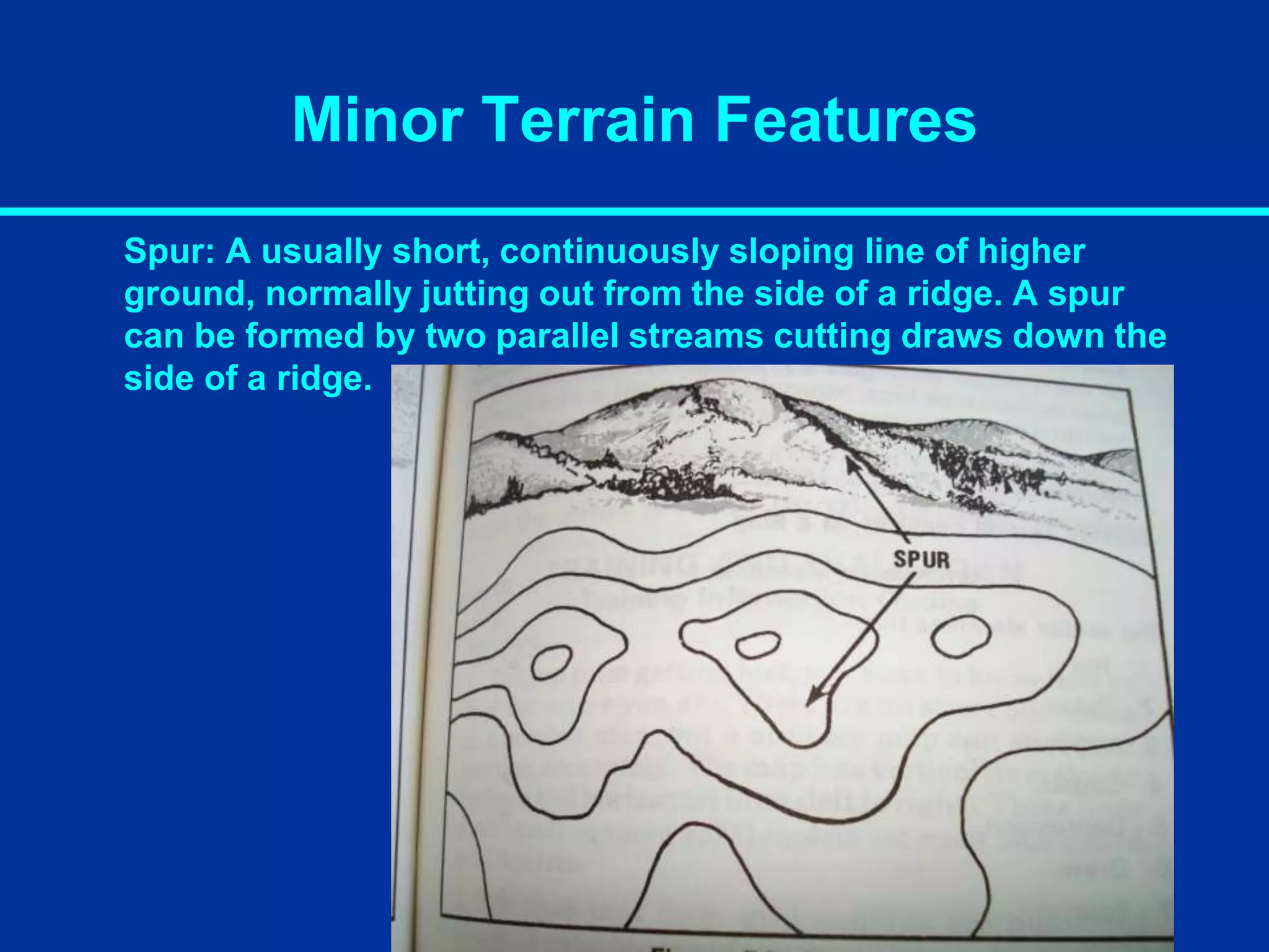
Spur:A usually short, continuously sloping line of higher
ground, normally jutting out from the side of a ridge. A spur
can be formed by two parallel streams cutting draws down the
side of a ridge.
36.
Minor Terrain Features
Cliff:A vertical or near vertical slope. A cliff may be shown on a
map by contour lines being close together, touching, or by a
ticked “carrying” contour line. The ticks always point towards
lower ground.
Part Two -Navigation
Now that we can read the map, we will now use it to find where
we are and navigate to a known point.
39.
Determine Grid Coordinatesof a Point
on a Military Map
To keep from getting lost, you have to know how to find out
where you are. A military map can help you find your location
accurately. These maps have vertical (top to bottom) and
horizontal lines (left to right).
These lines form small squares which are 1000 meters on each
side called grid squares. The lines that form these grid squares
are numbered along the outside edge of the map picture. No
two grid squares will have the same number.
The precision of a point location is shown by the number of
digits in the coordinates. The more digits - the more precise the
location.
XXXX or XX / XX = 1000 Meter Grid Square.
XXXXXX or XXX / XXX to the nearest 100 meters.
XXXXXXXX or XXXX / XXXX to the nearest 10 meters.
40.
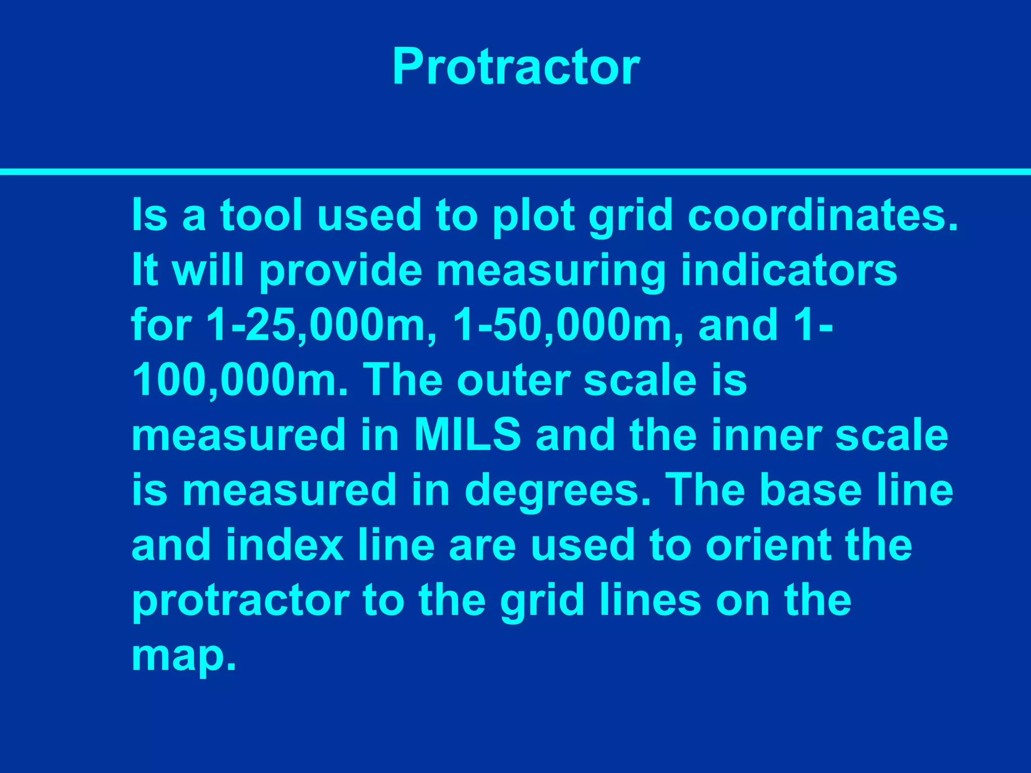
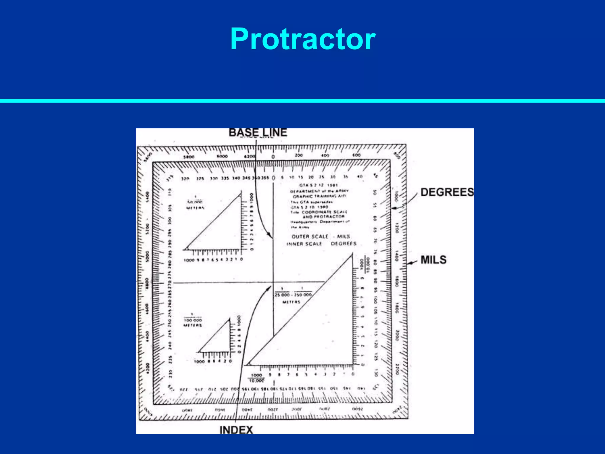
Protractor
Is a toolused to plot grid coordinates.
It will provide measuring indicators
for 1-25,000m, 1-50,000m, and 1-
100,000m. The outer scale is
measured in MILS and the inner scale
is measured in degrees. The base line
and index line are used to orient the
protractor to the grid lines on the
map.
Determine Grid Coordinatesof a Point
on a Military Map
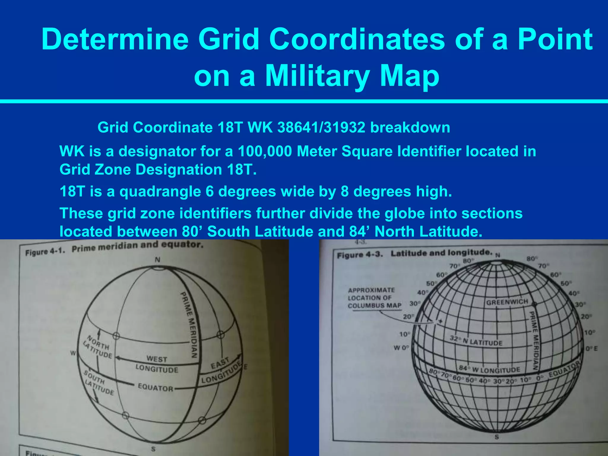
Grid Coordinate 18T WK 38641/31932 breakdown
WK is a designator for a 100,000 Meter Square Identifier located in
Grid Zone Designation 18T.
18T is a quadrangle 6 degrees wide by 8 degrees high.
These grid zone identifiers further divide the globe into sections
located between 80’ South Latitude and 84’ North Latitude.
45.
Determine Grid Coordinatesof a Point
on a Military Map
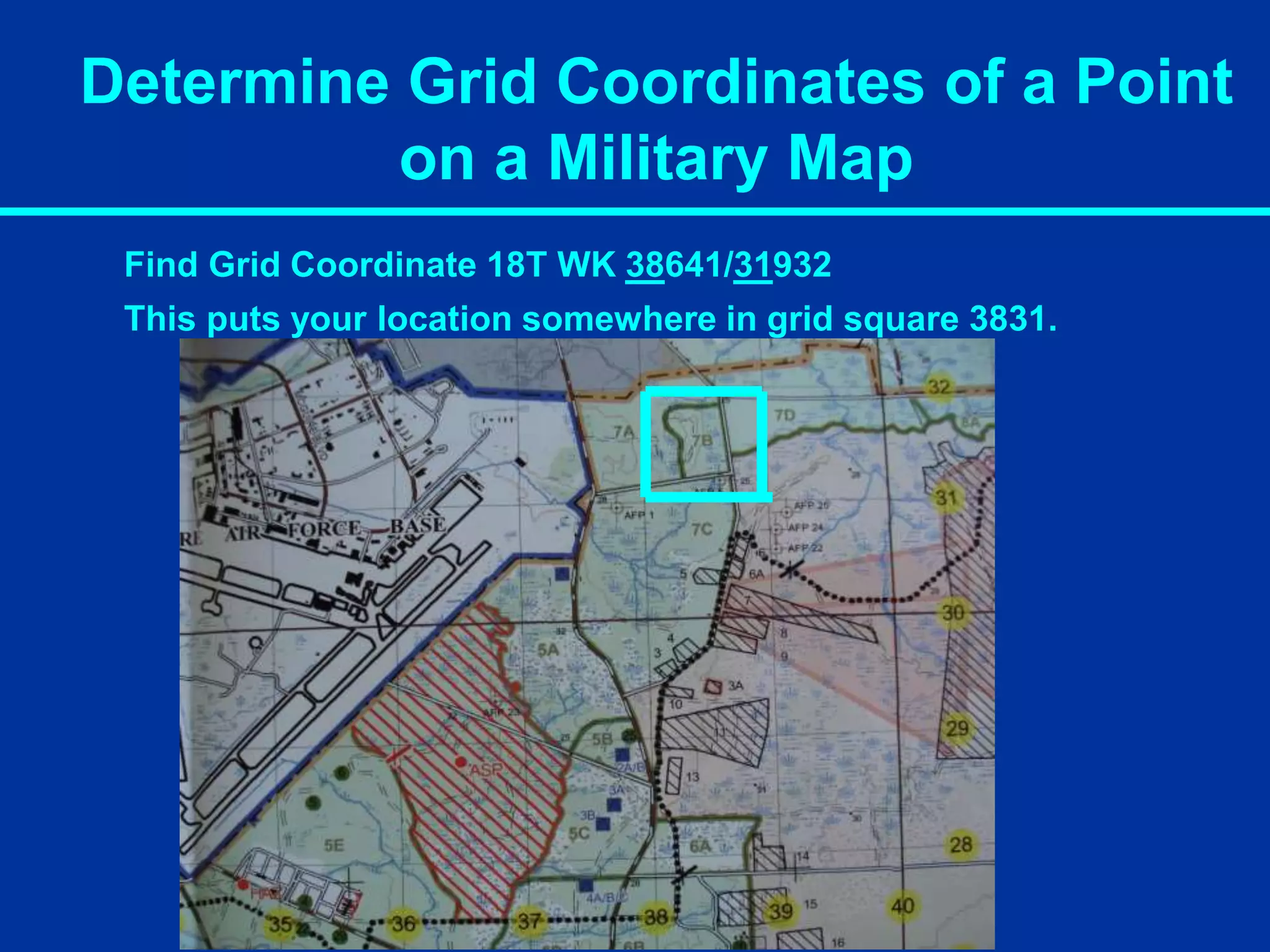
Find Grid Coordinate 18T WK 38641/31932
First move from left to right and find vertical line 38
46.
Determine Grid Coordinatesof a Point
on a Military Map
Find Grid Coordinate 18T WK 38641/31932
Then read up to 31. “In the door, up the stairs”.
47.
Determine Grid Coordinatesof a Point
on a Military Map
Find Grid Coordinate 18T WK 38641/31932
This puts your location somewhere in grid square 3831.
48.
Determine Grid Coordinatesof a Point
on a Military Map
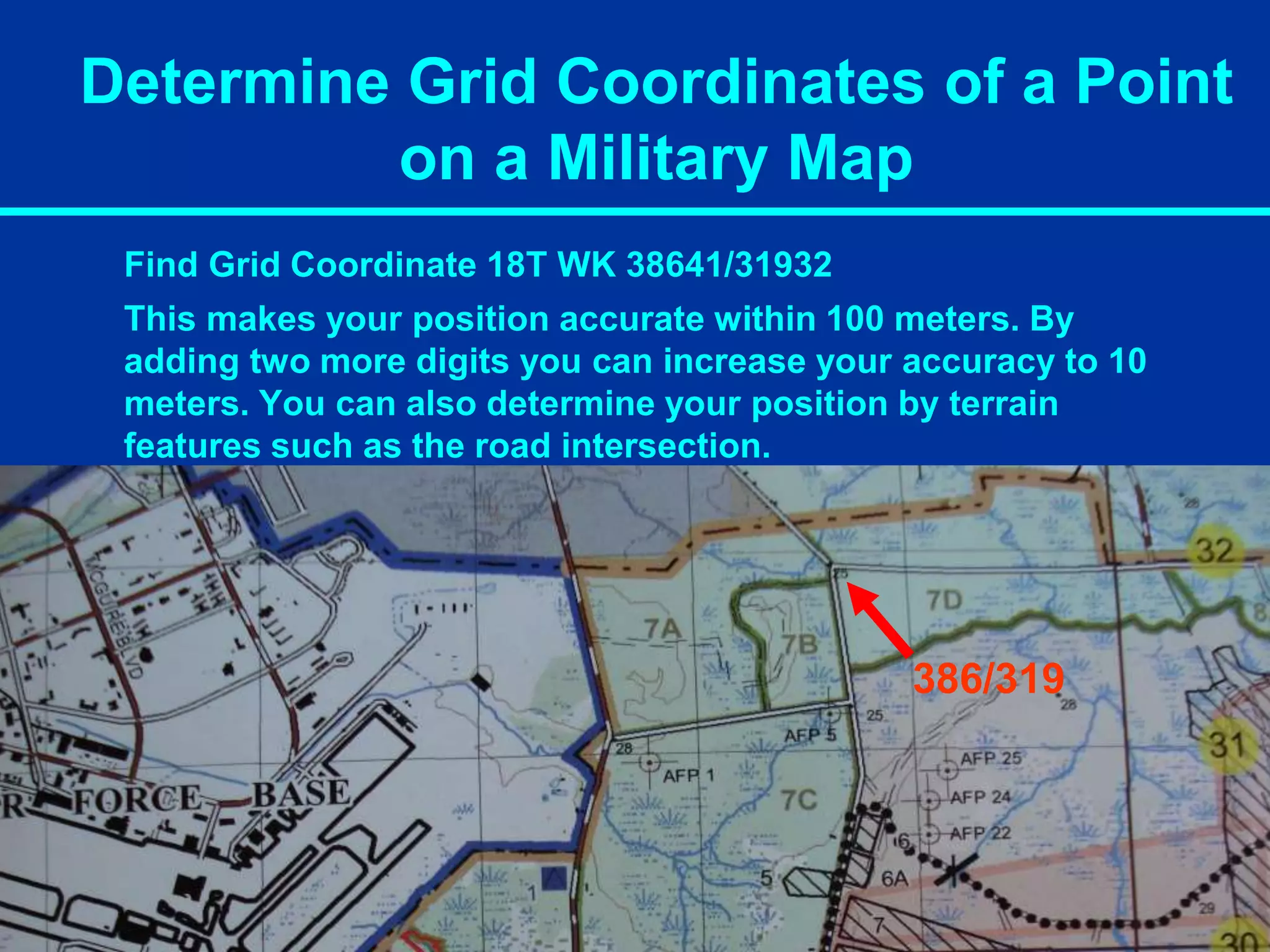
Find Grid Coordinate 18T WK 38641/31932
Add another number to each side of your coordinate to make 6
digits you now have 386 / 319. Go left to right 6 then up 9.
6
9
49.
Determine Grid Coordinatesof a Point
on a Military Map
Find Grid Coordinate 18T WK 38641/31932
This makes your position accurate within 100 meters. By
adding two more digits you can increase your accuracy to 10
meters. You can also determine your position by terrain
features such as the road intersection.
386/319
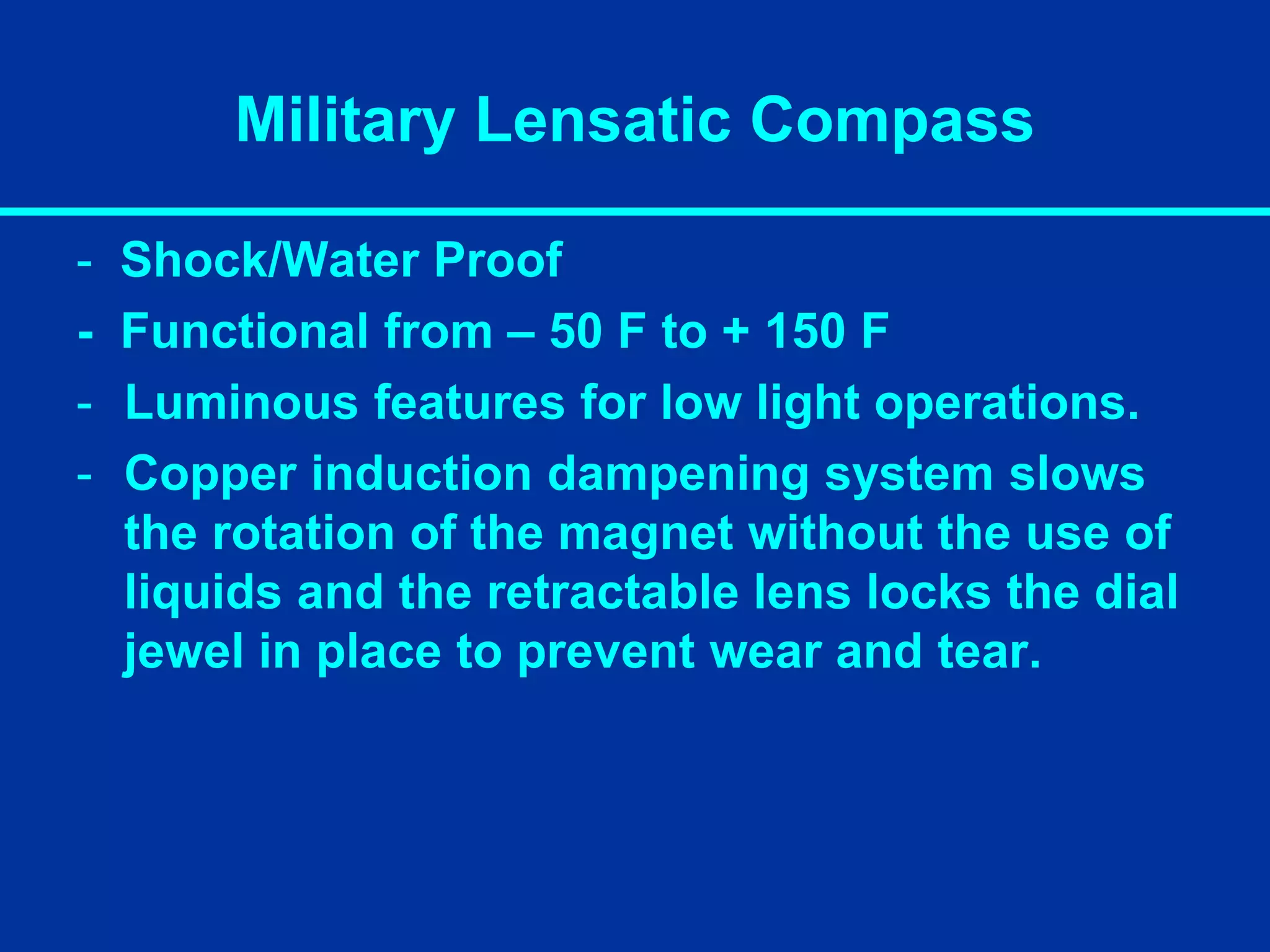
Military Lensatic Compass
-Shock/Water Proof
- Functional from – 50 F to + 150 F
- Luminous features for low light operations.
- Copper induction dampening system slows
the rotation of the magnet without the use of
liquids and the retractable lens locks the dial
jewel in place to prevent wear and tear.
COMPASS USE
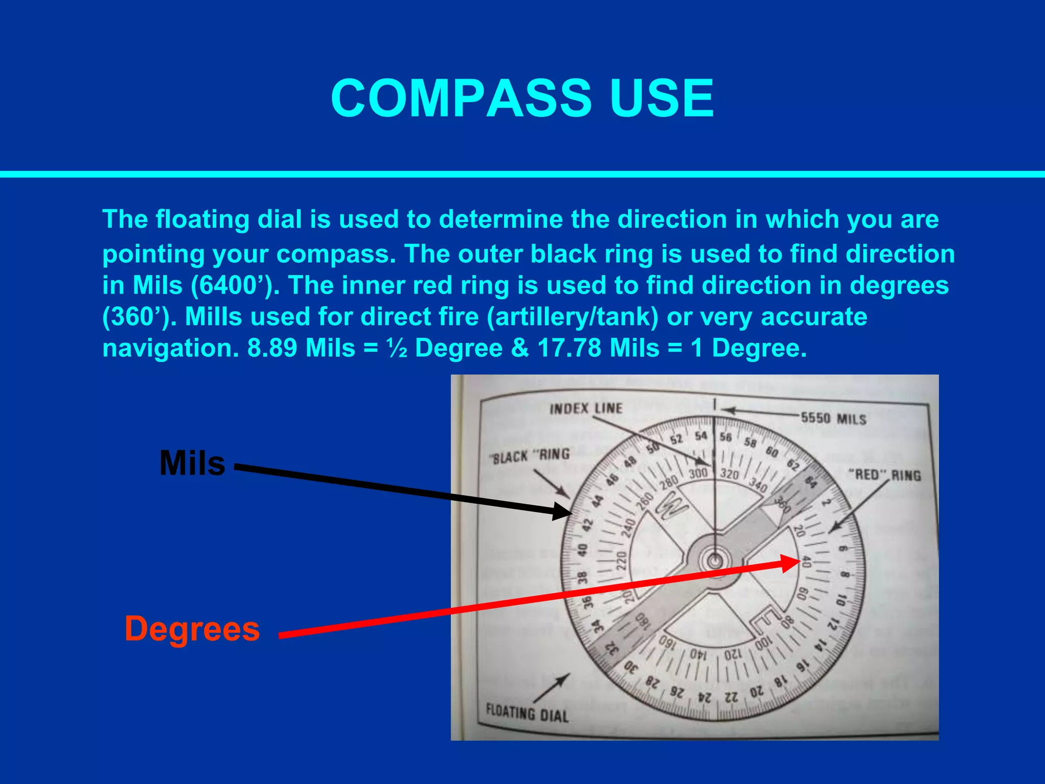
The floatingdial is used to determine the direction in which you are
pointing your compass. The outer black ring is used to find direction
in Mils (6400’). The inner red ring is used to find direction in degrees
(360’). Mills used for direct fire (artillery/tank) or very accurate
navigation. 8.89 Mils = ½ Degree & 17.78 Mils = 1 Degree.
Mils
Degrees
54.
COMPASS USE
There are360 degrees in a circle. These are marked with a tick
mark every 5 degrees. Not every tick mark is numbered. These
are determined by using the numbers that are shown.
55.
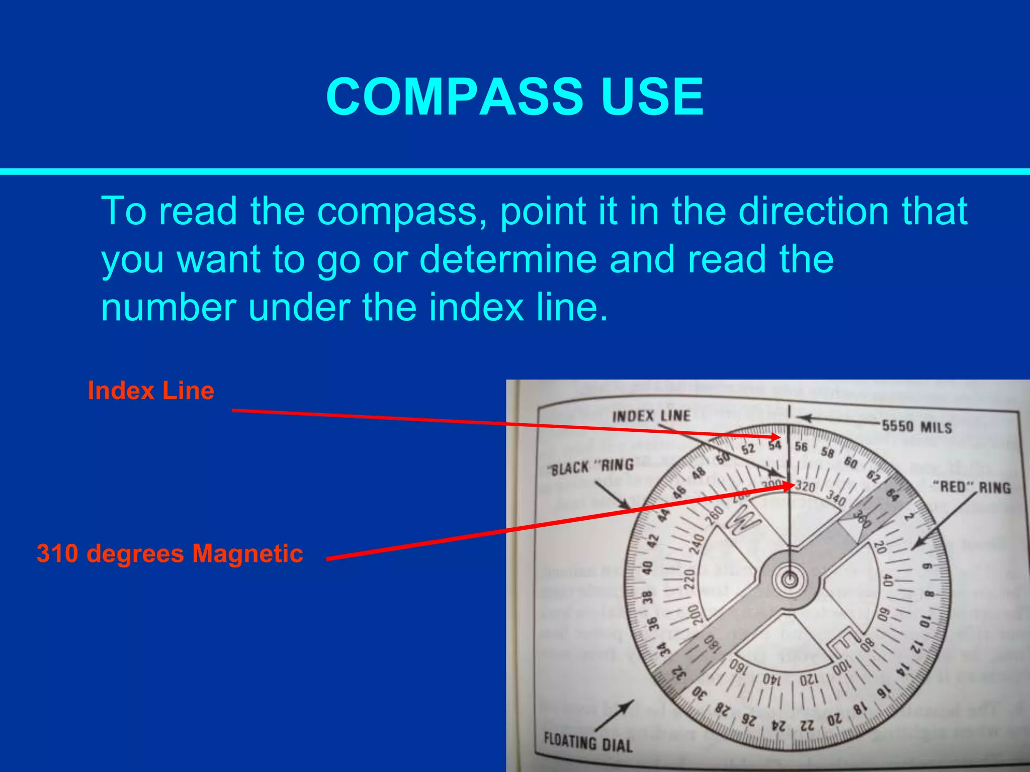
COMPASS USE
To readthe compass, point it in the direction that
you want to go or determine and read the
number under the index line.
Index Line
310 degrees Magnetic
56.
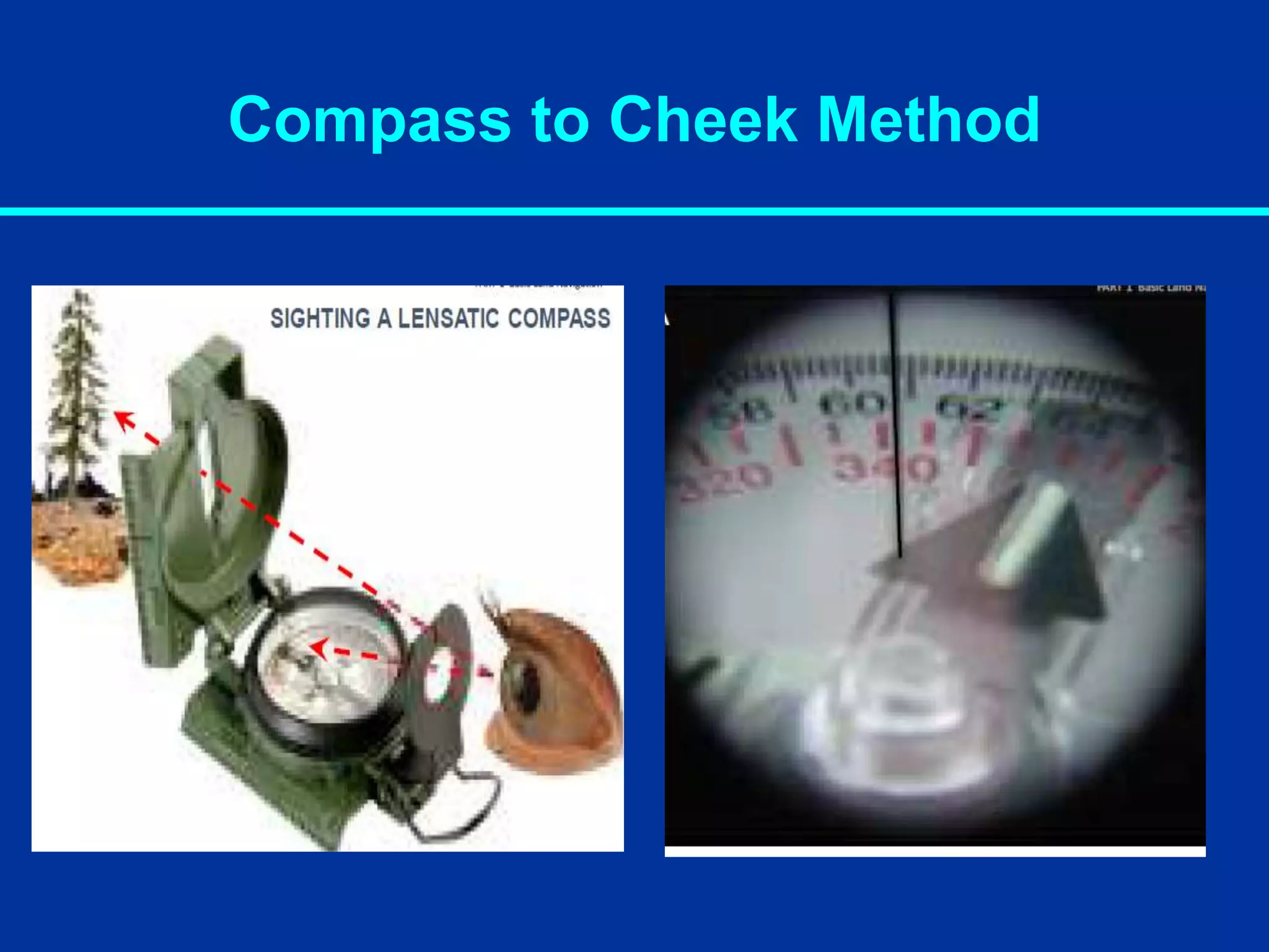
Compass to CheekMethod
Used exclusively for sighting and is the most efficient method for
taking an accurate azimuth bearing. Be careful to hold your compass
still so that the dial remains stationary while you are reading the scale.
Center-Hold Method
• Holdthe compass to your body.
• Turn your body until desired azimuth is
aligned with the black index line.
• Without turning compass, rotate the
bezel ring until the luminous bezel line
is aligned with the north arrow.
• Keep north aligned with the bezel line
and walk.
60.
The Three Norths
TrueNorth: A line from any point on the earths surface to the
north pole. Symbolized by a star on the map.
“MN” (Magnetic North): The direction to the north magnetic
pole, as indicated by the north-seeking needle of a magnetic
compass. The magnetic north is usually symbolized by a line
ending with half of an arrowhead.
“GN” (Grid North): The north that is established by using the
vertical grid lines on the map. Symbolized by the letters GN.
Used for UTM (Universal Transverse Mercator) grid by military
and rescue teams for its accuracy and simplicity.
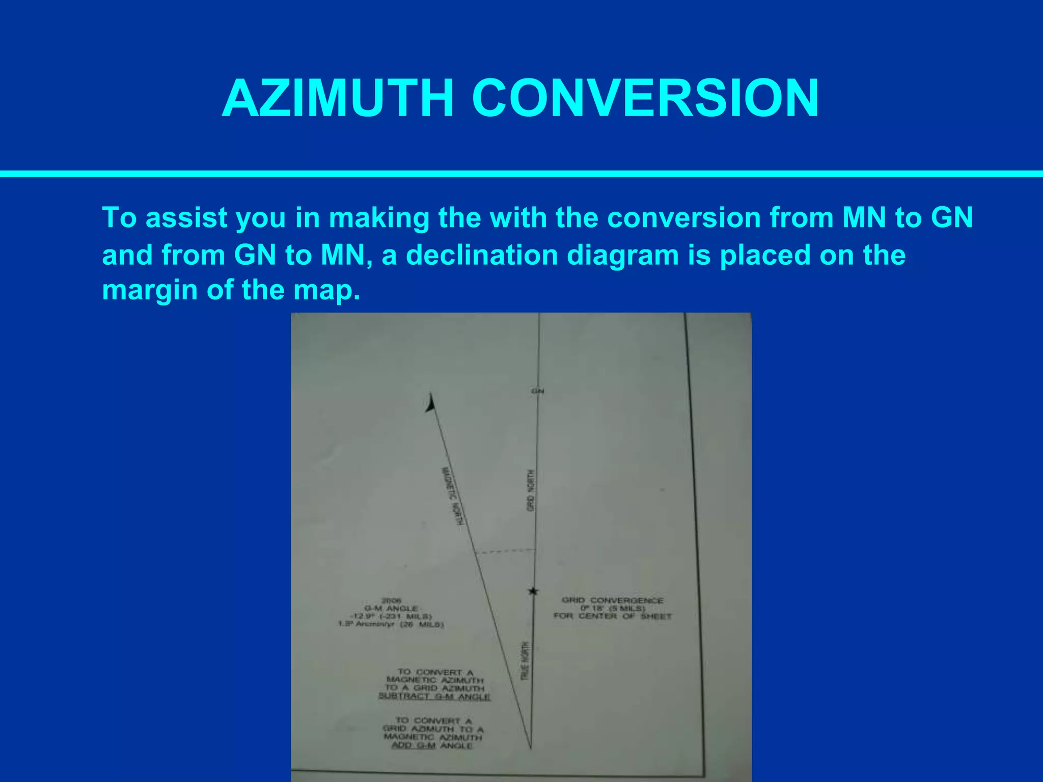
AZIMUTH CONVERSION
Your compassreads degrees in magnetic azimuths because
the needle seeks out magnetic north. And your map is oriented
to grid north. The difference between the two is the magnetic
variation or “G-M” Angle. You can not follow a GN on your
compass and you cant plot MN with a protractor.
To convert from Grid to Mag - add the G-M angle.
To convert from Mag to Grid - Subtract the G-M angle.
63.
AZIMUTH CONVERSION
To assistyou in making the with the conversion from MN to GN
and from GN to MN, a declination diagram is placed on the
margin of the map.
64.
AZIMUTH CONVERSION
Example (Groundto Map): You measure the bearing of a
landmark on the ground with a compass. It is 49° MN. The G-M
ANGLE on the Map is 24°. So MN to GN, subtract 49°- 24° = 25°
GN (Draw this on your map).
Example (Map to Ground): You measure the bearing of a point
on the map with a protractor (next slides). It is 25° GN. The G-M
ANGLE on the Map is 24°. So GN to MN ADD 25°+ 24° = 49° MN
(Put this on your compass)
**If you have MN lines drawn on your map, align the protractor
to a MN line, get the MN azimuth, and you don’t have to do a
MN conversion.**
65.
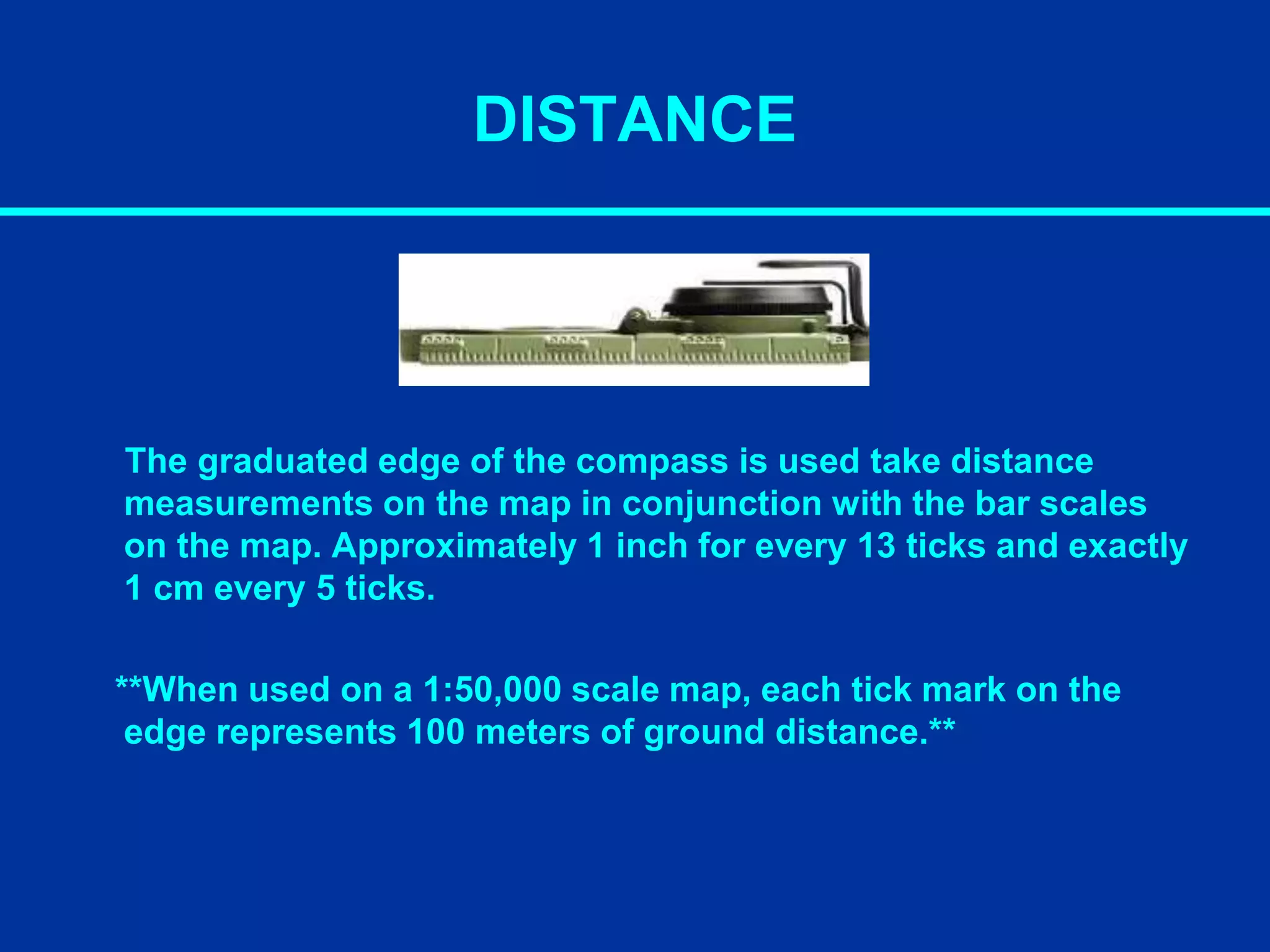
DISTANCE
The graduated edgeof the compass is used take distance
measurements on the map in conjunction with the bar scales
on the map. Approximately 1 inch for every 13 ticks and exactly
1 cm every 5 ticks.
**When used on a 1:50,000 scale map, each tick mark on the
edge represents 100 meters of ground distance.**