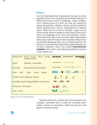
This document provides information about maps. It discusses the key components of maps including distance, direction, and symbols. Maps are drawn to scale to accurately represent distances between locations. Cardinal and intermediate directions help identify the positioning of places. Standard symbols are used on maps to efficiently represent features like buildings, roads, and water bodies. Different types of maps like physical, political, and thematic maps focus on specific information.