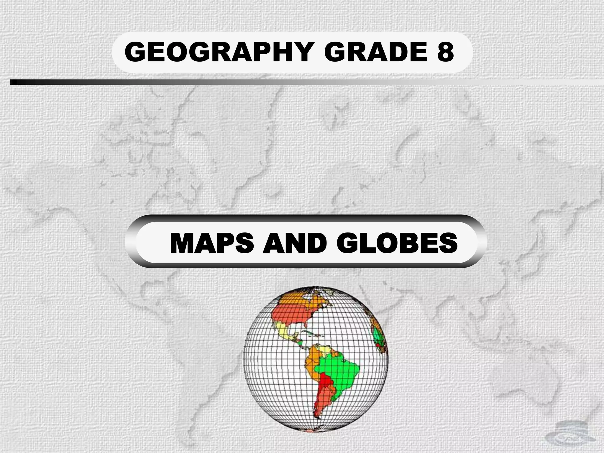
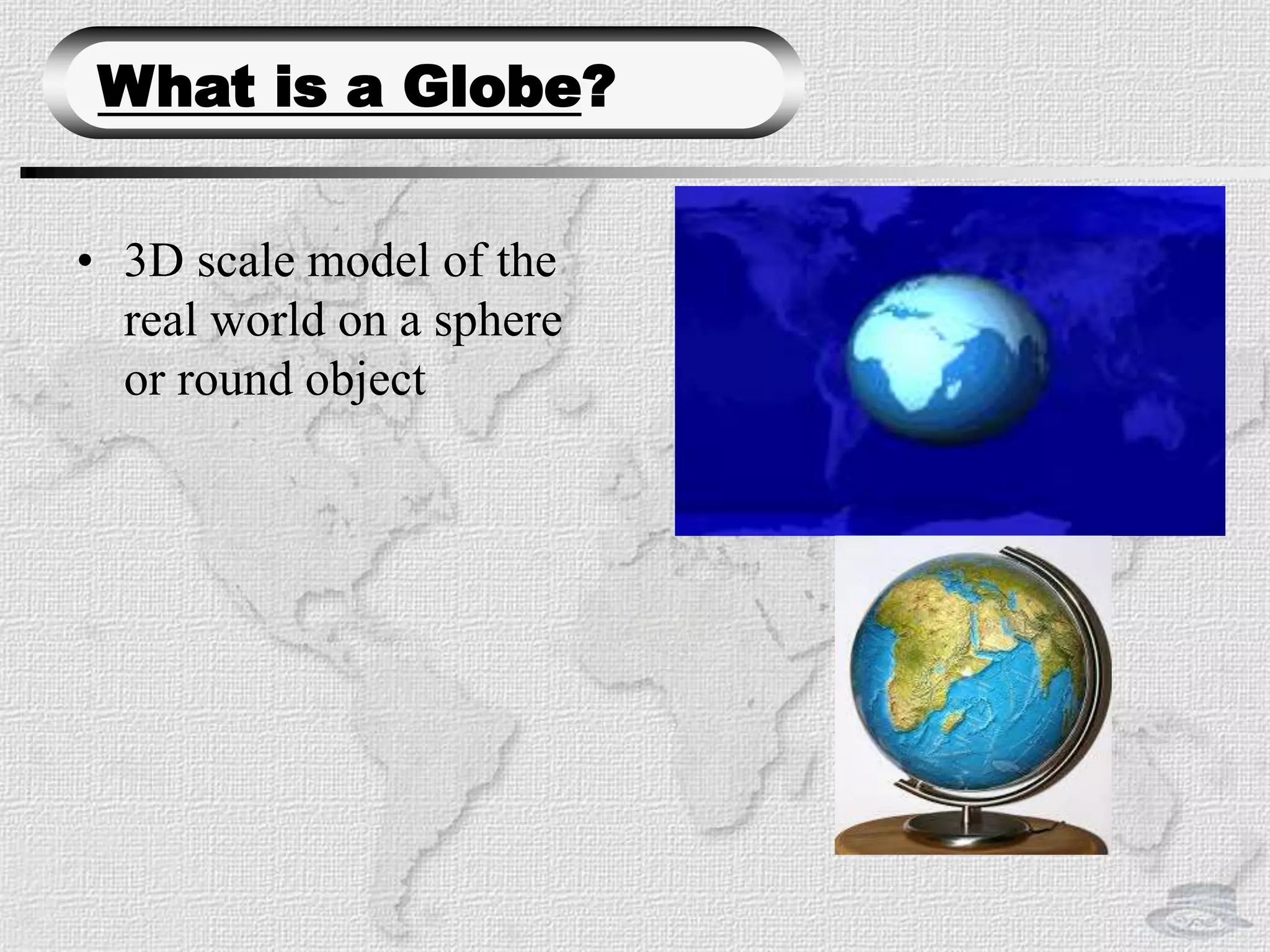
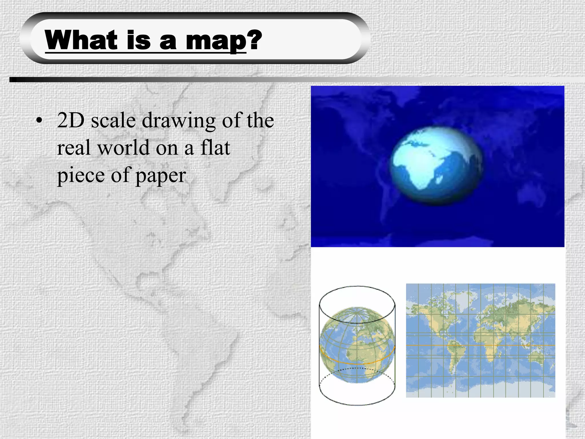
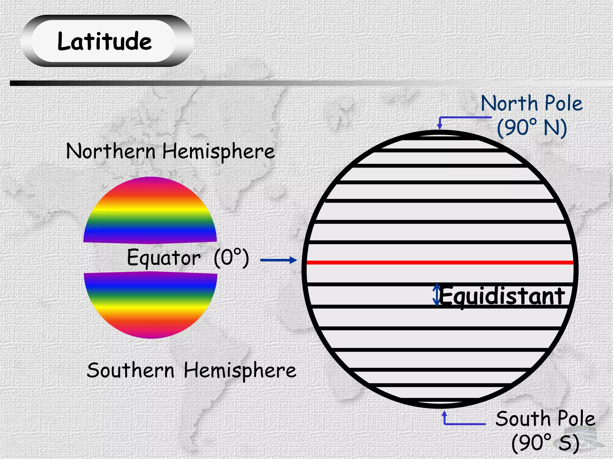
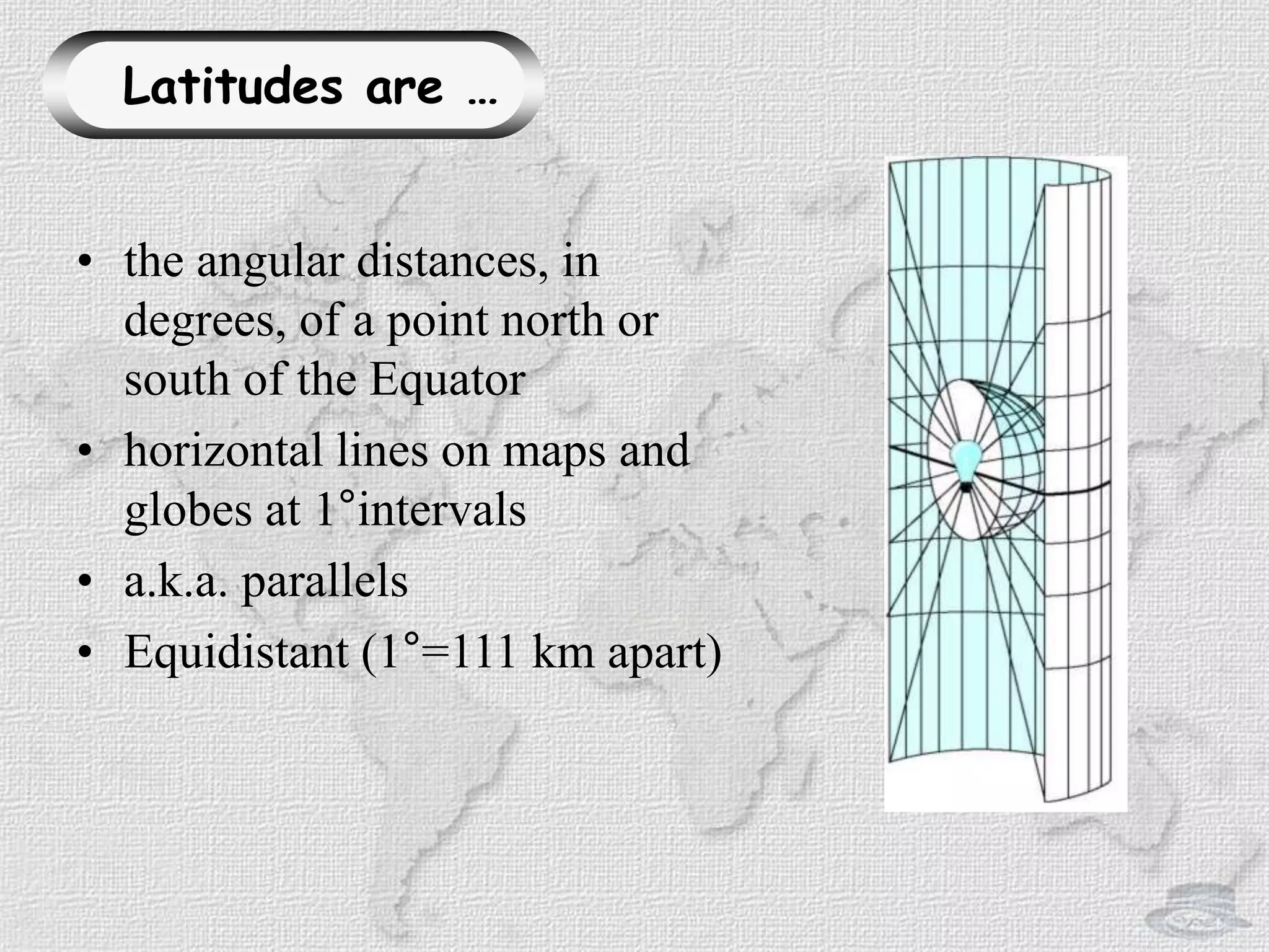
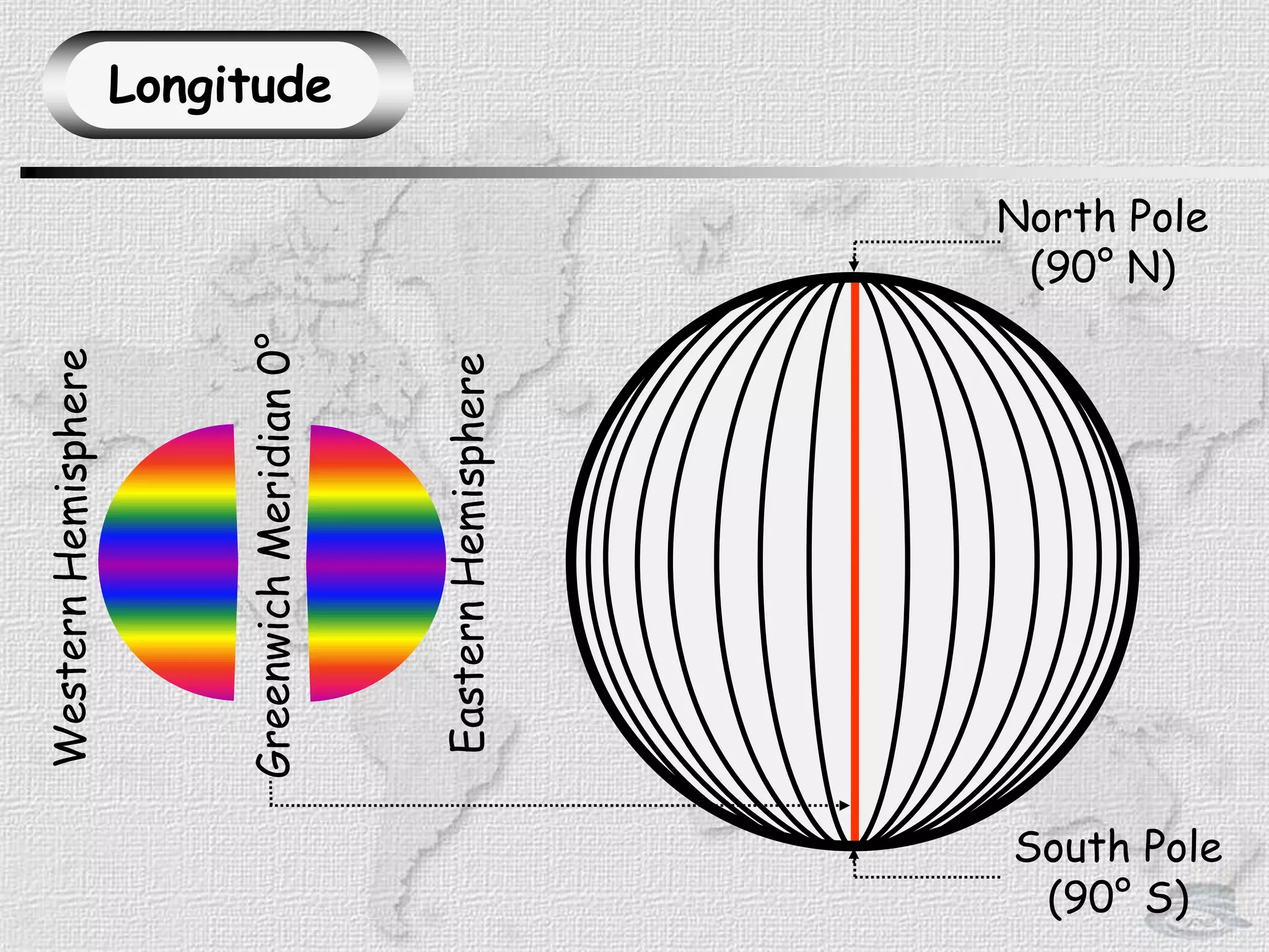
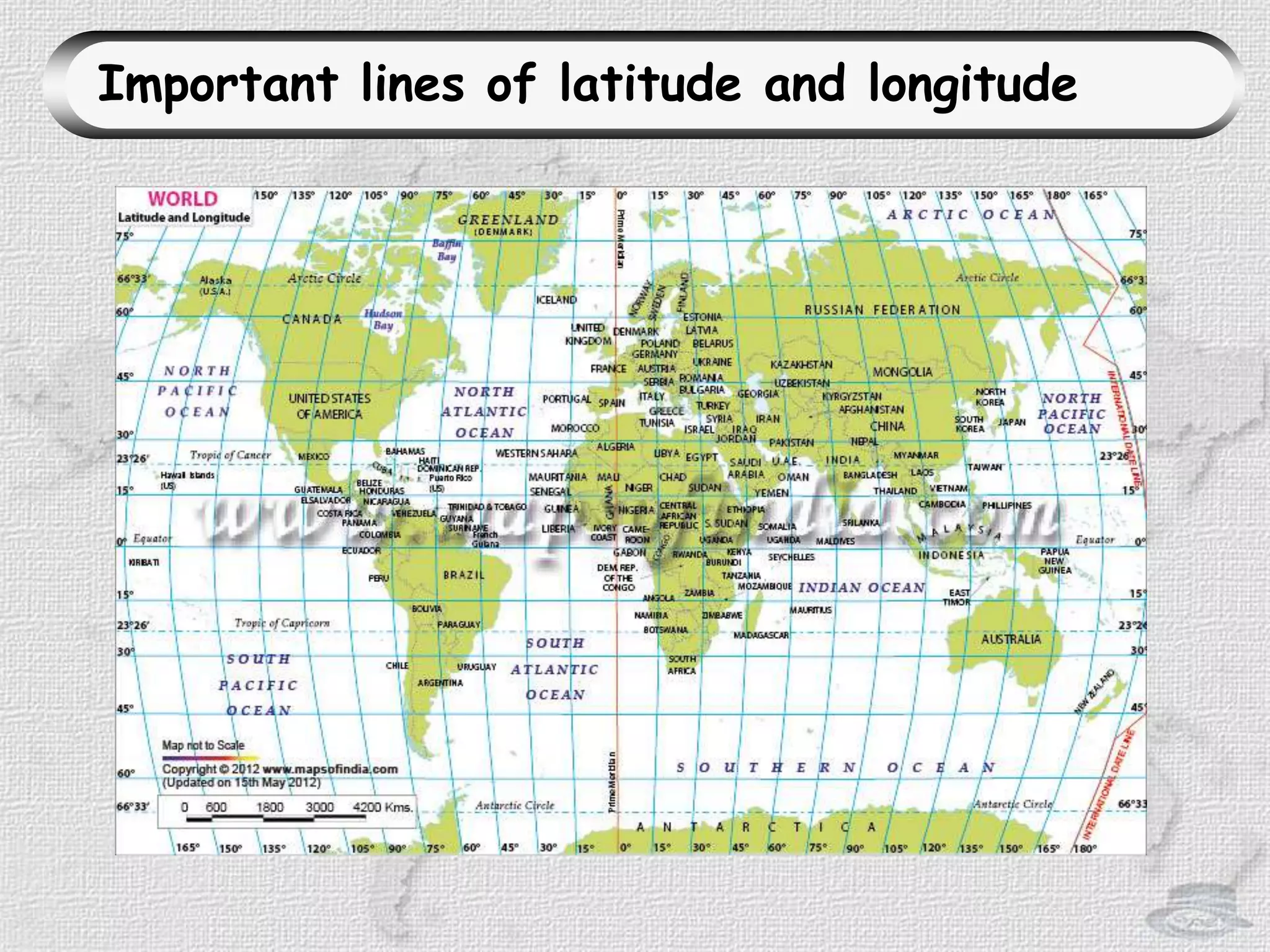
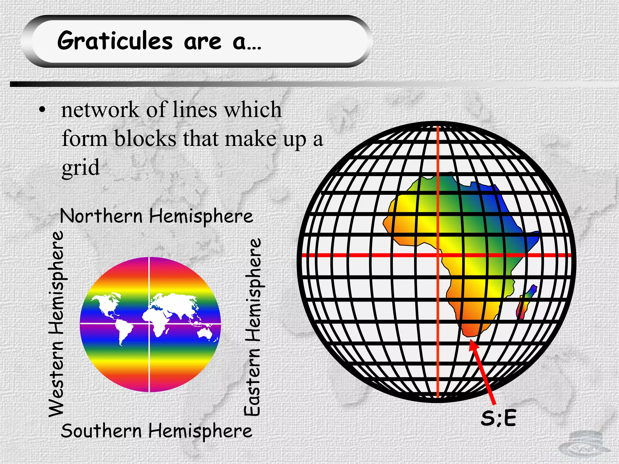
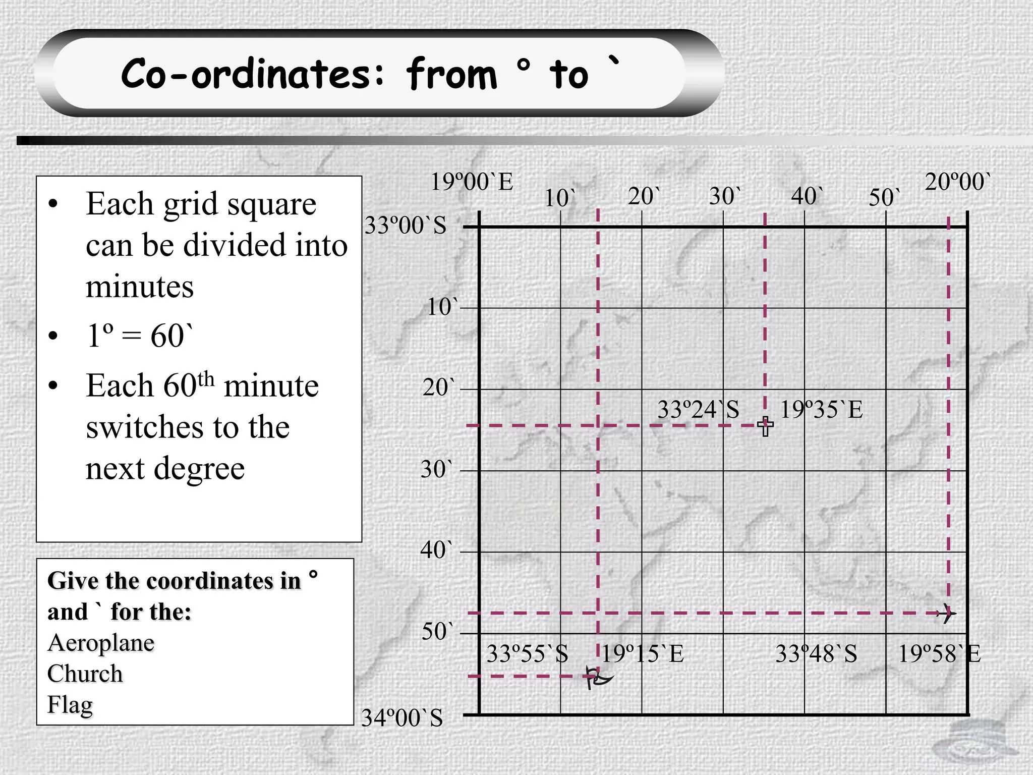
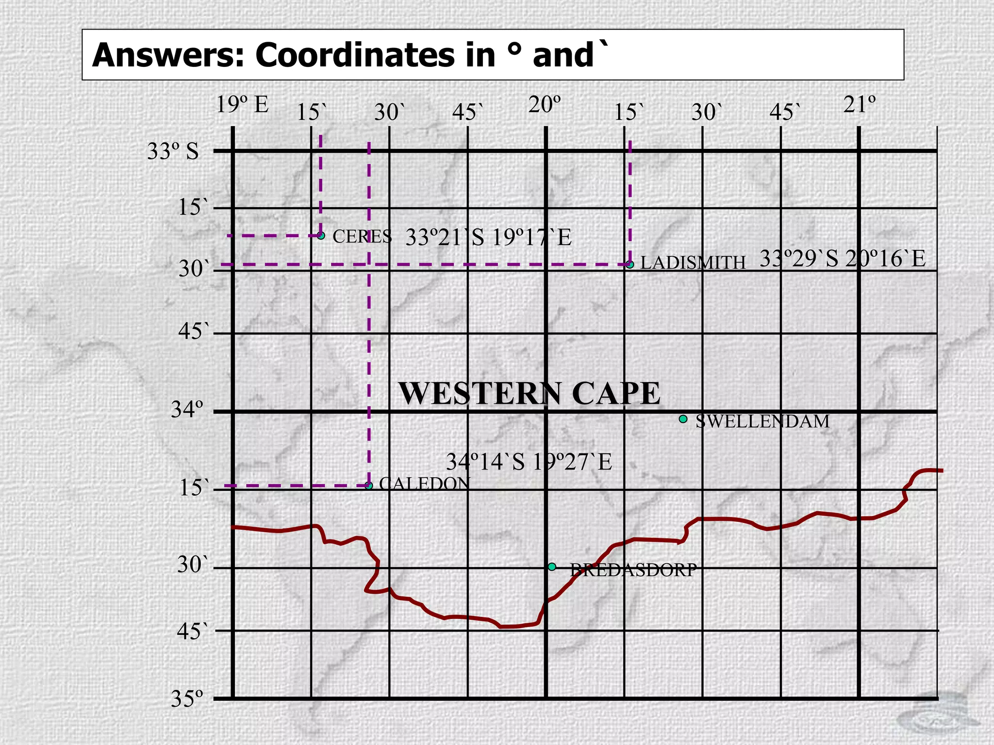
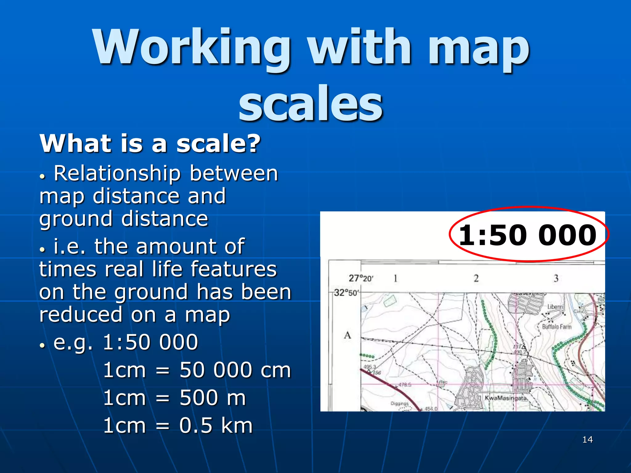
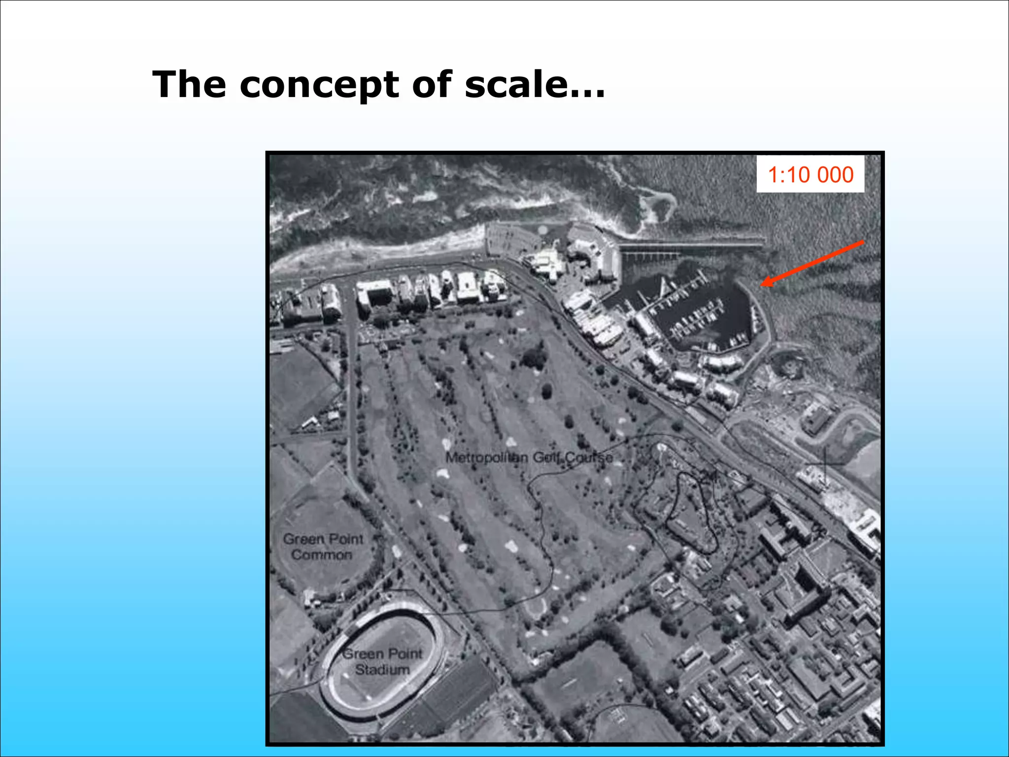
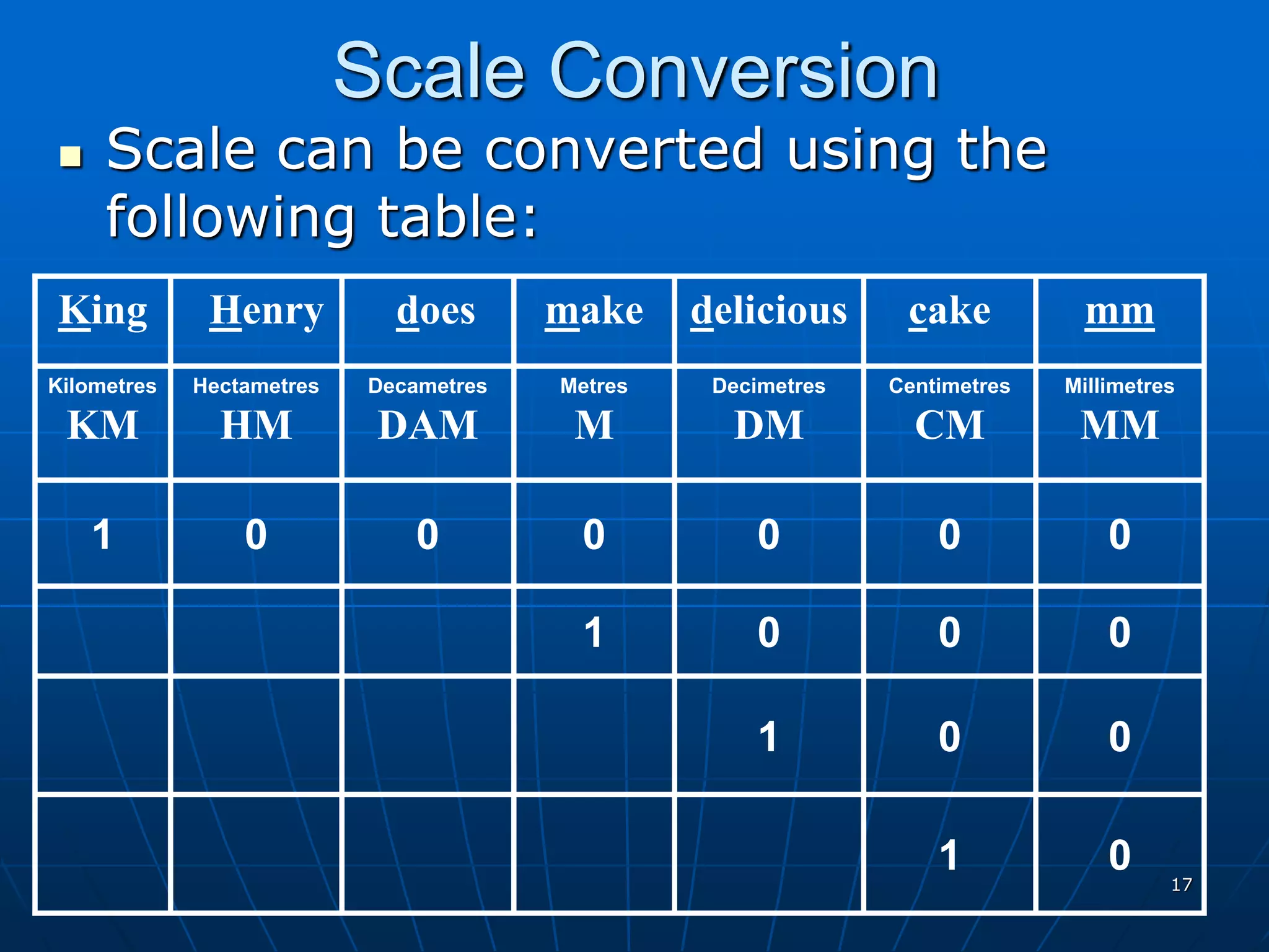
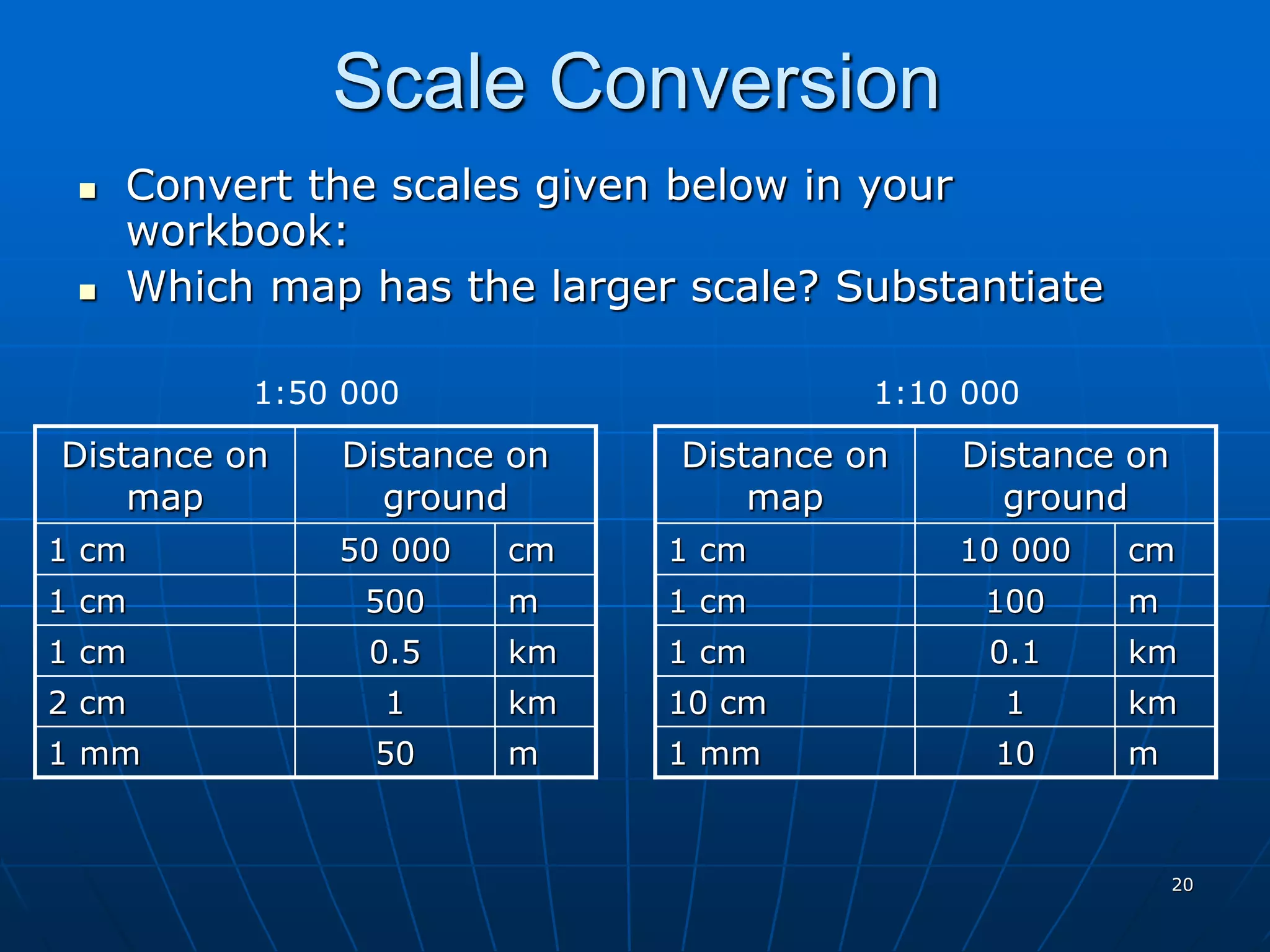
This document provides information about maps, globes, latitude, longitude and map scales. It defines a globe as a 3D model of the earth and a map as a 2D drawing on a flat surface. It describes important lines like the equator and how latitude and longitude lines are used to specify locations using coordinates. It also defines map scale as the ratio between distances on a map and in real life, and provides examples of calculating distances using different map scales.
Presentation suitable for Year 9 Geography, first lesson of map skills: definition of the maps, types of maps, political map, physical map, weather map, aerial map, resources map, road map, climatic map and topographic map. Examples from New Zealand.
This is slide show created based on a tutorial hosted by Geography World and created by Mr. Bowerman. All credit for images and information go to them. I created this for use in a 4/5 grade gifted social studies and math lesson.
This presentation will help our young geographers who are on the verge of understanding geographical skills and how do different maps help them to understand different features of the Earth and the area where they live.
Lines of Latitude and Longitude – PowerPointYaryalitsa
PowerPoint on Lines of Latitude, Lines of Longitude, Climate Zones, Equinoxes, Solstices, The Three Norths, Prime Meridian, International Date Line, Greenwich Mean Time, Coordinated Universal Time.
Lines of Latitude and Longitude – Worksheet at:
http://www.slideshare.net/yaryalitsa/lines-of-latitude-and-longitude-worksheet
Map is a drawn or printed representation of the physical features of the Earth.
It is the best tool to show, understand and analyse the features of an area. Cartography is the art and science of making maps. This module highlights many information on maps, types and their uses.
Aerial NAVIGATION and FLIGHT PLANNING.pptxEhtasham Amir
Air navigation for BS aviation
undergraduate programme . This ppt explains basic concepts of air navigation. this is used to teach BS aviation, undergrad
Combined gis 2(GEOGRAPHIC INFORMATION SYSTEM)musadoto
Distortions
• The earth is spherical, and a simple way of mapping it without distortion is to map it on a globe. However, mapping on globes is not possible.
• The transformation from the three-dimensional ellipsoid/sphere to the two-dimensional plane (flat) surface is not possible without some form of distortion.
• The distortions increase as the distance from the central point of the projection increases
• Areas smaller than 25 x 25 km:
No distortions
• Areas larger than 25 x 25 km:
Always distortions
• Map projections are used to control/minimize the distortions
Classification and properties of map projections
Properties of map projections
• Areas are everywhere correctly represented
• All distances are correctly represented
• All directions on the map are the same as on Earth
• All angles are correctly represented
• The shape of any area is correctly represented (e.g. a circle projected would remain a circle)
Similar to Social Science Grade 8 Maps and Globes.pptx (20)
Macroeconomics- Movie Location
This will be used as part of your Personal Professional Portfolio once graded.
Objective:
Prepare a presentation or a paper using research, basic comparative analysis, data organization and application of economic information. You will make an informed assessment of an economic climate outside of the United States to accomplish an entertainment industry objective.
This presentation includes basic of PCOS their pathology and treatment and also Ayurveda correlation of PCOS and Ayurvedic line of treatment mentioned in classics.
Unit 8 - Information and Communication Technology (Paper I).pdfThiyagu K
This slides describes the basic concepts of ICT, basics of Email, Emerging Technology and Digital Initiatives in Education. This presentations aligns with the UGC Paper I syllabus.
The simplified electron and muon model, Oscillating Spacetime: The Foundation...RitikBhardwaj56
Discover the Simplified Electron and Muon Model: A New Wave-Based Approach to Understanding Particles delves into a groundbreaking theory that presents electrons and muons as rotating soliton waves within oscillating spacetime. Geared towards students, researchers, and science buffs, this book breaks down complex ideas into simple explanations. It covers topics such as electron waves, temporal dynamics, and the implications of this model on particle physics. With clear illustrations and easy-to-follow explanations, readers will gain a new outlook on the universe's fundamental nature.
Biological screening of herbal drugs: Introduction and Need for
Phyto-Pharmacological Screening, New Strategies for evaluating
Natural Products, In vitro evaluation techniques for Antioxidants, Antimicrobial and Anticancer drugs. In vivo evaluation techniques
for Anti-inflammatory, Antiulcer, Anticancer, Wound healing, Antidiabetic, Hepatoprotective, Cardio protective, Diuretics and
Antifertility, Toxicity studies as per OECD guidelines
2024.06.01 Introducing a competency framework for languag learning materials ...Sandy Millin
http://sandymillin.wordpress.com/iateflwebinar2024
Published classroom materials form the basis of syllabuses, drive teacher professional development, and have a potentially huge influence on learners, teachers and education systems. All teachers also create their own materials, whether a few sentences on a blackboard, a highly-structured fully-realised online course, or anything in between. Despite this, the knowledge and skills needed to create effective language learning materials are rarely part of teacher training, and are mostly learnt by trial and error.
Knowledge and skills frameworks, generally called competency frameworks, for ELT teachers, trainers and managers have existed for a few years now. However, until I created one for my MA dissertation, there wasn’t one drawing together what we need to know and do to be able to effectively produce language learning materials.
This webinar will introduce you to my framework, highlighting the key competencies I identified from my research. It will also show how anybody involved in language teaching (any language, not just English!), teacher training, managing schools or developing language learning materials can benefit from using the framework.
Normal Labour/ Stages of Labour/ Mechanism of LabourWasim Ak
Normal labor is also termed spontaneous labor, defined as the natural physiological process through which the fetus, placenta, and membranes are expelled from the uterus through the birth canal at term (37 to 42 weeks
How to Add Chatter in the odoo 17 ERP ModuleCeline George
In Odoo, the chatter is like a chat tool that helps you work together on records. You can leave notes and track things, making it easier to talk with your team and partners. Inside chatter, all communication history, activity, and changes will be displayed.
it describes the bony anatomy including the femoral head , acetabulum, labrum . also discusses the capsule , ligaments . muscle that act on the hip joint and the range of motion are outlined. factors affecting hip joint stability and weight transmission through the joint are summarized.
5. • the angular distances, in
degrees, of a point north or
south of the Equator
• horizontal lines on maps and
globes at 1°intervals
• a.k.a. parallels
• Equidistant (1°=111 km apart)
Latitudes are …
7. • the angular distances, in
degrees, of a point east or west
of the Prime (Greenwich)
Meridian
• vertical lines on maps and
globes at 1°intervals
• a.k.a. meridians
• Equidistant only around
equator, become shorter toward
poles
Longitudes are …
10. Equator (0°)
North Pole
(90° N)
South Pole
(90° S)
Coordinates
What is a coordinate?
Point of intersection between a line
of latitude and line of longitude
• Location of places can be given in
coordinates
Coordinate
Coordinates can be given in degrees
(°), minutes (`) and seconds (``)
where lines intersect
11. 20` 30` 40`
50`
20`
10`
33º00`S
34º00`S
19º00`E 20º00`
40`
30`
50`
10`
Co-ordinates: from ° to `
• Each grid square
can be divided into
minutes
• 1º = 60`
• Each 60th minute
switches to the
next degree
Give the coordinates in °
and ` for the:
Aeroplane
Church
Flag
19º35`E
33º24`S
19º58`E
33º48`S
19º15`E
33º55`S
12. • Learners complete activity on:
• World map and
• Coordinates
• Educator provides worksheet
Learner activity
13. 33º S
34º
35º
19º E 20º 21º
15` 30` 45` 15` 30` 45`
45`
30`
15`
45`
30`
15`
CERES
SWELLENDAM
BREDASDORP
CALEDON
LADISMITH
Answers: Coordinates in ° and`
WESTERN CAPE
33º21`S 19º17`E
33º29`S 20º16`E
34º14`S 19º27`E
14. 14
Working with map
scales
1:50 000
What is a scale?
• Relationship between
map distance and
ground distance
• i.e. the amount of
times real life features
on the ground has been
reduced on a map
• e.g. 1:50 000
1cm = 50 000 cm
1cm = 500 m
1cm = 0.5 km
15. Written / Word scale
Ratio Scale or Representative Fraction
Graphic Scale (Line Scale)
1cm on the map represents 0,5 kms on the ground
Types of Scales
16. The concept of scale…
1:2 000 000
1:800 000
1:250 000
1:50 000
1:10 000
17. 17
Scale Conversion
Scale can be converted using the
following table:
0
0
1
0
0
0
0
0
0
1
0
0
0
1
0
1
Millimetres
MM
Centimetres
CM
Decimetres
DM
Metres
M
Decametres
DAM
Hectametres
HM
Kilometres
KM
mm
cake
delicious
make
does
Henry
King
18. 18
Calculating distance using scale
Measure map distance in cm
Do a quick calculation
FOR ANSWERS IN KM'S:
Map distance (cm) x Scale (denominator)
Number of cm in a km = (100 000)
FOR ANSWERS IN M'S:
Map distance (cm) x Scale (denominator)
Number of cm in a m = (100)
19. 19
Example
What is the real distance in km:
= 1,2 x 50 000
100 000
= 0.6 km
What is the real distance in metres:
= 1,2 x 50 000
100
= 600 metres
1.2 cm
Road
Scale: 1:50 000
Map distance: 1.2 cm
20. 20
Scale Conversion
Convert the scales given below in your
workbook:
Which map has the larger scale? Substantiate
km
10 cm
km
1 cm
m
1 mm
m
cm
1 cm
10 000
1 cm
Distance on
ground
Distance on
map
km
2 cm
km
1 cm
m
1 mm
m
cm
1
0.1
10
100
1
0.5
50
500
1 cm
50 000
1 cm
Distance on
ground
Distance on
map
1:50 000 1:10 000