
Recommended
More Related Content
What's hot
What's hot (20)
Similar to Classification of Surveying.pptx
Similar to Classification of Surveying.pptx (20)
Recently uploaded
Recently uploaded (20)
Classification of Surveying.pptx
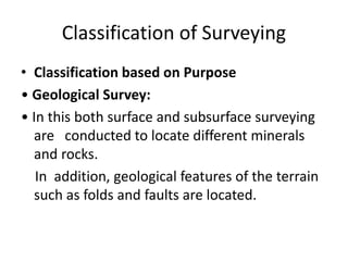
- 1. Classification of Surveying • Classification based on Purpose • Geological Survey: • In this both surface and subsurface surveying are conducted to locate different minerals and rocks. In addition, geological features of the terrain such as folds and faults are located.
- 3. Classification of Surveying • Mine Survey • Mine Survey includes include both surface and underground surveys. It is conducted for the exploration of mineral deposits and to guide tunneling and other operations associated with mining.
- 5. Classification of Surveying • Archaeological Survey It is conducted to locate relics of antiquity, civilization, kingdoms, forts, temples, etc. • Military Survey • It has a very important and critical applications in the military. Aerial surveys are conducted for this purpose. It is conducted to locate strategic positions for the purpose of army operations.
- 6. Classification of Surveying Classification based on Nature of field • Land Survey • Land Survey is done on land to prepare plan and maps of a given area. Topographical, city and cadastral surveys are some of the examples of land surveying. • Hydrological Surveying This survey is conducted on or near the body of water such as lake, river, coastal area. This Survey consists of locating shore lines of water bodies.
- 7. Classification of Surveying • Astronomical Survey • This survey is conducted for the determining of latitudes, longitudes, azimuths, local time, etc. for various places on earth by observing heavenly bodies ( sun or the stars). • Aerial Survey • An aerial survey is conducted from aircraft. Aerial cameras take photographs of the surface of the earth in overlapping strips of land. This is also known as photographic survey.
- 10. Plan and Maps • One of the basic objective of surveying is to prepare plans and maps. • Plan • A plan is the graphical representation to some scale, of the features on, near or below the surface of the earth as projected on a horizontal plane. • The horizontal plane is represented by plane of drawing sheets on which the plan is drawn to some scale. • However the surface of the earth is curved it cannot be truly represented on a plane without distortion. • In plane surveying the area involved are small, the earth‟s surface may be considered as plane and hence plan is constructed by orthographic projections. • A plan is drawn on a relatively large scale.
- 11. Plan and Maps • Map • If the scale of the graphical projection on a horizontal plane is small, the plan is called a map. Thus graphical representation is called a plan if the scale is large while it is called a map if the scale is small. • On plan, generally only horizontal distances and directions or angles are shown. On topographical map, however the vertical distances (elevations) are also represented by contour lines.
- 12. WHAT IS CHAIN SURVEING ? • Chain surveying is the type of surveying in which only linear measurements are taken in the field. • This type of surveying is done for surveys of small extent to describe the boundaries of plot of land to locate the existing features on them.
- 15. PRINCIPLE OF CHAIN SURVEYING • The principal of chain surveying is to divide the area into a number of triangles of suitable sides. • As a triangles is the only simple plane of geometrical figure which can be plotted from the lengths of the three sides even if the angels are not known. • A network of triangles (triangulation) is preferred to in chain surveying. • If the area to be surveyed is triangular in shape and if the lengths and sequence of its three sides are Recorded the plane of area can be easily drawn.
- 17. SURVEY STATIONS Survey stations are the points at the beginning and at the end of the chain line. They may also occur at any convenient position on the chain line. Such stations may be : • Main stations • Subsidiary stations • Tie stations
- 18. (1) Main stations : • Stations taken along the boundary of an area as controlling points known as ‘main stations’. • The lines joining the main stations are called ‘main survey lines’. The main survey lines should be cover the whole area to be surveyed. The main stations are denoted by with letters A,B,C,D, etc.
- 20. (2) Subsidiary stations: • Stations which are on the main survey lines or any other survey lines are known as ‘Subsidiary stations’. These stations are taken to run subsidiary lines for dividing the area into triangles , for checking the accuracy of triangles and for locating interior details. these stations are denoted by with letters S1,S2,S3,etc.
- 21. 3) Tie stations • These are also subsidiary stations taken on the • main survey lines. Lines joining the tie stations are known as ‘tie lines’. • Tie lines are taken to locate interior details. • The stations are denoted by with letters T1, T2, T3, etc.
- 22. (4) BASE LINE: • The line on which the framework of the survey is built is known as the ‘base line’ . • It is the most important line of the survey . Generally , the longest of the main survey line is considered as the base line. • This line should be measured very carefully and accurately. • In fig.BD is the base line.
- 24. (5) CHECK LINE • The line joining the apex point of a triangle to some fixed points on its base is known as the ‘check line’. • It is taken to check the accuracy of the triangle . • Sometimes this line is helps to locate interior details • .In fig. CS1, AS2are the check lines.
- 25. (6) TIE – LINE: • A line joining tie stations is termed as a tie line. • It is run to take the interior details which are far away from the main lines and also to avoid long offsets. It can also serve as check line. • In Fig. T1 T2 is the tie line.