Download as PDF, PPTX
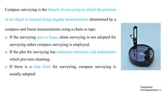

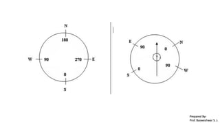
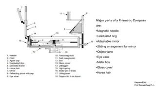
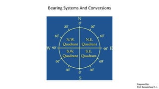
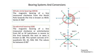
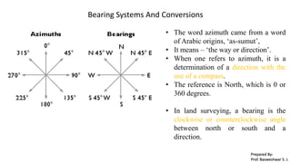
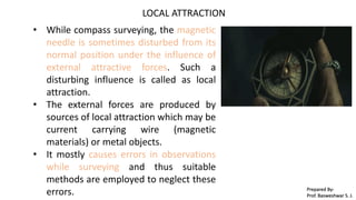
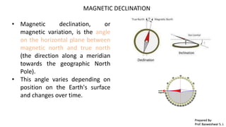
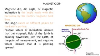
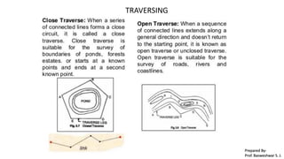
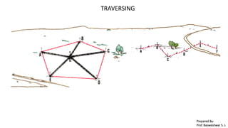

Compass surveying is a surveying method that utilizes angular measurements from a compass and linear measurements from a chain or tape, especially in large areas or challenging terrains. Key components of a prismatic compass include the magnetic needle, graduated ring, adjustable mirror, and others, with orientation determined by bearing systems. Local attraction and magnetic declination are important factors impacting accuracy, as they can affect the compass readings during surveying.

![Module-III SURVEYING-I [BTCVC304]](https://cdn.slidesharecdn.com/ss_thumbnails/module-iii-191020180049-thumbnail.jpg?width=640&height=640&fit=bounds)


![Module-I SURVEYING-I [BTCVC304]](https://cdn.slidesharecdn.com/ss_thumbnails/module-i-191020180028-thumbnail.jpg?width=640&height=640&fit=bounds)
![Module-V SURVEYING-I [BTCVC304]](https://cdn.slidesharecdn.com/ss_thumbnails/module-v-191020180056-thumbnail.jpg?width=640&height=640&fit=bounds)


