The document discusses expert land navigation skills, including navigating in different terrains like deserts, jungles, snow, and low visibility areas using techniques like dead reckoning. It also covers night navigation, emphasizing the importance of dark adaptation and protecting night vision, as well as common night navigation techniques using a lensatic compass. Sustainment of navigation skills through regular practice is also emphasized to maintain proficiency in navigation.
This is a handout for anyone interested in the 10 essential items I recommend a person should always have on them during wilderness pursuits. These items are most commonly carried on our Advanced Survival Course when few items are allowed to be carried by our students on a challenging field exercise. With these items, you are able to accomplish many tasks and live somewhat comfortably in the wild.
The Discipline of Cartography – philosophical basis and modern transformationsProf Ashis Sarkar
The discipline of cartography includes the art, science, technology and commerce of maps. It is a scientific discipline that was developed in the ancient period based on geometry, mathematics, and astronomy. Since then it has undergone a sea change in map making, preservation and user interface.
Understanding Coordinate Systems and Projections for ArcGISJohn Schaeffer
Everything you need to know to work with coordinate systems and projecting data in ArcGIS. The presentation starts by explaining the terminology, and then discusses the details you need to know to actually work successfully with coordinate systems, use the proper projections, and geographic transformations. This is a very practical look at a complex subject.
Making orienteering maps is a passion of mine. Creating base maps using on-line tools has changed an expensive time consuming jobs in to a 'breeze'. However doing the field work to bring the map to what the orienteer sees on the ground remains a time consuming task. GPS enabled computer tablets work for some. I find a great time and technology saver is the easier to use GPS watch. Here's how.
Geographic Information Systems (GIS) play a pivotal role in military operations. The concept of Command, Control, Communication and Coordination in military operations is largely dependent on the availability of accurate, spatial information to arrive at quick decisions for operational orders.
In the present digital era, GIS is an excellent tool for military commanders in the operations. The use of GIS applications in military forces has revolutionised the way in which these forces operate and function.
Instructional Goal:
Cadets who successfully complete this training will be able to prepare a METT-TC mission analysis.
Performance Objectives:
Given a list of each letter in the METT-TC acronym, cadets will select the corresponding word for each letter with 100% accuracy.
Given a sample image, cadets will identify 4 Terrain and Weather features with no errors.
Wilderness to urban and suburban survival primerKevin Estela
This is an introduction to urban and suburban survival skills and prep. It is designed to show the very basic considerations of preparation and generate thought and discussion.
Degrading al Qaeda leadership is central to American counterterrorism strategy, but the leaders today are not the same as they were in 2001. Al Qaeda leaders are no longer necessarily connected by formal networks and many operate outside of any formal affiliation to the al Qaeda network. Such a development makes it insufficient to rely solely on group membership or public identification to isolate the al Qaeda leadership group.
For more information, please visit http://www.criticalthreats.org/al-qaeda/hagen-aqim-leaders-and-networks-march-27-2014
GPS is a satellite based radio navigation system which provides continuous, all weather, worldwide navigation capability for sea, land and air applications.
http://itspiders.net
Generating a custom Ruby SDK for your web service or Rails API using Smithyg2nightmarescribd
Have you ever wanted a Ruby client API to communicate with your web service? Smithy is a protocol-agnostic language for defining services and SDKs. Smithy Ruby is an implementation of Smithy that generates a Ruby SDK using a Smithy model. In this talk, we will explore Smithy and Smithy Ruby to learn how to generate custom feature-rich SDKs that can communicate with any web service, such as a Rails JSON API.
LF Energy Webinar: Electrical Grid Modelling and Simulation Through PowSyBl -...DanBrown980551
Do you want to learn how to model and simulate an electrical network from scratch in under an hour?
Then welcome to this PowSyBl workshop, hosted by Rte, the French Transmission System Operator (TSO)!
During the webinar, you will discover the PowSyBl ecosystem as well as handle and study an electrical network through an interactive Python notebook.
PowSyBl is an open source project hosted by LF Energy, which offers a comprehensive set of features for electrical grid modelling and simulation. Among other advanced features, PowSyBl provides:
- A fully editable and extendable library for grid component modelling;
- Visualization tools to display your network;
- Grid simulation tools, such as power flows, security analyses (with or without remedial actions) and sensitivity analyses;
The framework is mostly written in Java, with a Python binding so that Python developers can access PowSyBl functionalities as well.
What you will learn during the webinar:
- For beginners: discover PowSyBl's functionalities through a quick general presentation and the notebook, without needing any expert coding skills;
- For advanced developers: master the skills to efficiently apply PowSyBl functionalities to your real-world scenarios.
Transcript: Selling digital books in 2024: Insights from industry leaders - T...BookNet Canada
The publishing industry has been selling digital audiobooks and ebooks for over a decade and has found its groove. What’s changed? What has stayed the same? Where do we go from here? Join a group of leading sales peers from across the industry for a conversation about the lessons learned since the popularization of digital books, best practices, digital book supply chain management, and more.
Link to video recording: https://bnctechforum.ca/sessions/selling-digital-books-in-2024-insights-from-industry-leaders/
Presented by BookNet Canada on May 28, 2024, with support from the Department of Canadian Heritage.
Securing your Kubernetes cluster_ a step-by-step guide to success !KatiaHIMEUR1
Today, after several years of existence, an extremely active community and an ultra-dynamic ecosystem, Kubernetes has established itself as the de facto standard in container orchestration. Thanks to a wide range of managed services, it has never been so easy to set up a ready-to-use Kubernetes cluster.
However, this ease of use means that the subject of security in Kubernetes is often left for later, or even neglected. This exposes companies to significant risks.
In this talk, I'll show you step-by-step how to secure your Kubernetes cluster for greater peace of mind and reliability.
Essentials of Automations: Optimizing FME Workflows with ParametersSafe Software
Are you looking to streamline your workflows and boost your projects’ efficiency? Do you find yourself searching for ways to add flexibility and control over your FME workflows? If so, you’re in the right place.
Join us for an insightful dive into the world of FME parameters, a critical element in optimizing workflow efficiency. This webinar marks the beginning of our three-part “Essentials of Automation” series. This first webinar is designed to equip you with the knowledge and skills to utilize parameters effectively: enhancing the flexibility, maintainability, and user control of your FME projects.
Here’s what you’ll gain:
- Essentials of FME Parameters: Understand the pivotal role of parameters, including Reader/Writer, Transformer, User, and FME Flow categories. Discover how they are the key to unlocking automation and optimization within your workflows.
- Practical Applications in FME Form: Delve into key user parameter types including choice, connections, and file URLs. Allow users to control how a workflow runs, making your workflows more reusable. Learn to import values and deliver the best user experience for your workflows while enhancing accuracy.
- Optimization Strategies in FME Flow: Explore the creation and strategic deployment of parameters in FME Flow, including the use of deployment and geometry parameters, to maximize workflow efficiency.
- Pro Tips for Success: Gain insights on parameterizing connections and leveraging new features like Conditional Visibility for clarity and simplicity.
We’ll wrap up with a glimpse into future webinars, followed by a Q&A session to address your specific questions surrounding this topic.
Don’t miss this opportunity to elevate your FME expertise and drive your projects to new heights of efficiency.
Software Delivery At the Speed of AI: Inflectra Invests In AI-Powered QualityInflectra
In this insightful webinar, Inflectra explores how artificial intelligence (AI) is transforming software development and testing. Discover how AI-powered tools are revolutionizing every stage of the software development lifecycle (SDLC), from design and prototyping to testing, deployment, and monitoring.
Learn about:
• The Future of Testing: How AI is shifting testing towards verification, analysis, and higher-level skills, while reducing repetitive tasks.
• Test Automation: How AI-powered test case generation, optimization, and self-healing tests are making testing more efficient and effective.
• Visual Testing: Explore the emerging capabilities of AI in visual testing and how it's set to revolutionize UI verification.
• Inflectra's AI Solutions: See demonstrations of Inflectra's cutting-edge AI tools like the ChatGPT plugin and Azure Open AI platform, designed to streamline your testing process.
Whether you're a developer, tester, or QA professional, this webinar will give you valuable insights into how AI is shaping the future of software delivery.
Connector Corner: Automate dynamic content and events by pushing a buttonDianaGray10
Here is something new! In our next Connector Corner webinar, we will demonstrate how you can use a single workflow to:
Create a campaign using Mailchimp with merge tags/fields
Send an interactive Slack channel message (using buttons)
Have the message received by managers and peers along with a test email for review
But there’s more:
In a second workflow supporting the same use case, you’ll see:
Your campaign sent to target colleagues for approval
If the “Approve” button is clicked, a Jira/Zendesk ticket is created for the marketing design team
But—if the “Reject” button is pushed, colleagues will be alerted via Slack message
Join us to learn more about this new, human-in-the-loop capability, brought to you by Integration Service connectors.
And...
Speakers:
Akshay Agnihotri, Product Manager
Charlie Greenberg, Host
UiPath Test Automation using UiPath Test Suite series, part 4DianaGray10
Welcome to UiPath Test Automation using UiPath Test Suite series part 4. In this session, we will cover Test Manager overview along with SAP heatmap.
The UiPath Test Manager overview with SAP heatmap webinar offers a concise yet comprehensive exploration of the role of a Test Manager within SAP environments, coupled with the utilization of heatmaps for effective testing strategies.
Participants will gain insights into the responsibilities, challenges, and best practices associated with test management in SAP projects. Additionally, the webinar delves into the significance of heatmaps as a visual aid for identifying testing priorities, areas of risk, and resource allocation within SAP landscapes. Through this session, attendees can expect to enhance their understanding of test management principles while learning practical approaches to optimize testing processes in SAP environments using heatmap visualization techniques
What will you get from this session?
1. Insights into SAP testing best practices
2. Heatmap utilization for testing
3. Optimization of testing processes
4. Demo
Topics covered:
Execution from the test manager
Orchestrator execution result
Defect reporting
SAP heatmap example with demo
Speaker:
Deepak Rai, Automation Practice Lead, Boundaryless Group and UiPath MVP
GDG Cloud Southlake #33: Boule & Rebala: Effective AppSec in SDLC using Deplo...James Anderson
Effective Application Security in Software Delivery lifecycle using Deployment Firewall and DBOM
The modern software delivery process (or the CI/CD process) includes many tools, distributed teams, open-source code, and cloud platforms. Constant focus on speed to release software to market, along with the traditional slow and manual security checks has caused gaps in continuous security as an important piece in the software supply chain. Today organizations feel more susceptible to external and internal cyber threats due to the vast attack surface in their applications supply chain and the lack of end-to-end governance and risk management.
The software team must secure its software delivery process to avoid vulnerability and security breaches. This needs to be achieved with existing tool chains and without extensive rework of the delivery processes. This talk will present strategies and techniques for providing visibility into the true risk of the existing vulnerabilities, preventing the introduction of security issues in the software, resolving vulnerabilities in production environments quickly, and capturing the deployment bill of materials (DBOM).
Speakers:
Bob Boule
Robert Boule is a technology enthusiast with PASSION for technology and making things work along with a knack for helping others understand how things work. He comes with around 20 years of solution engineering experience in application security, software continuous delivery, and SaaS platforms. He is known for his dynamic presentations in CI/CD and application security integrated in software delivery lifecycle.
Gopinath Rebala
Gopinath Rebala is the CTO of OpsMx, where he has overall responsibility for the machine learning and data processing architectures for Secure Software Delivery. Gopi also has a strong connection with our customers, leading design and architecture for strategic implementations. Gopi is a frequent speaker and well-known leader in continuous delivery and integrating security into software delivery.
GraphRAG is All You need? LLM & Knowledge GraphGuy Korland
Guy Korland, CEO and Co-founder of FalkorDB, will review two articles on the integration of language models with knowledge graphs.
1. Unifying Large Language Models and Knowledge Graphs: A Roadmap.
https://arxiv.org/abs/2306.08302
2. Microsoft Research's GraphRAG paper and a review paper on various uses of knowledge graphs:
https://www.microsoft.com/en-us/research/blog/graphrag-unlocking-llm-discovery-on-narrative-private-data/
UiPath Test Automation using UiPath Test Suite series, part 3DianaGray10
Welcome to UiPath Test Automation using UiPath Test Suite series part 3. In this session, we will cover desktop automation along with UI automation.
Topics covered:
UI automation Introduction,
UI automation Sample
Desktop automation flow
Pradeep Chinnala, Senior Consultant Automation Developer @WonderBotz and UiPath MVP
Deepak Rai, Automation Practice Lead, Boundaryless Group and UiPath MVP
JMeter webinar - integration with InfluxDB and GrafanaRTTS
Watch this recorded webinar about real-time monitoring of application performance. See how to integrate Apache JMeter, the open-source leader in performance testing, with InfluxDB, the open-source time-series database, and Grafana, the open-source analytics and visualization application.
In this webinar, we will review the benefits of leveraging InfluxDB and Grafana when executing load tests and demonstrate how these tools are used to visualize performance metrics.
Length: 30 minutes
Session Overview
-------------------------------------------
During this webinar, we will cover the following topics while demonstrating the integrations of JMeter, InfluxDB and Grafana:
- What out-of-the-box solutions are available for real-time monitoring JMeter tests?
- What are the benefits of integrating InfluxDB and Grafana into the load testing stack?
- Which features are provided by Grafana?
- Demonstration of InfluxDB and Grafana using a practice web application
To view the webinar recording, go to:
https://www.rttsweb.com/jmeter-integration-webinar
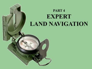
2. PART 4 Expert Land Navigation
USING THE
MILITARY
LENSATIC
COMPASS
3. PART 4 Expert Land Navigation
WARNING
This presentation is intended as a
quick summary, and not a
comprehensive resource. If you
want to learn Land Navigation in
detail, either buy a book; or get
someone, who has the knowledge
and skills, to teach you in person.
4. PART 4 Expert Land Navigation
NOTE
To get the ideas across presented on
these slides, many figures, pictures,
and calculations may not be to scale
and may be exaggerated for clarity.
5. PART 4 Expert Land Navigation
Note:
Prior to being issued any training *equipment, you will
be required to sign a “statement of liability” agreeing
to pay for anything you damage or lose.
All items will be inspected and inventoried prior to
your signature and at the end of the training day too.
If you do not intend to sign this statement, then you
may be denied training.
* You may use your own equipment.
8. PART 4 Expert Land Navigation
. . . and now on with the . . .
PRESENTATION
9. PART 4 Expert Land Navigation
LAND NAVIGATION WITH MAP
AND LENSATIC COMPASS
10. PART 4 Expert Land Navigation
LAND NAVIGATION
Why Learn Land Navigation? Training and practicing land navigation on foot
provides the following everyday navigation (how not to get lost) benefits;
- Tracking present location (Where am I ?)
- Determining Distance (How far is it and am I there yet ?)
- Sense of direction (Where do I want to go and where am I actually going ?)
- How to read a topographic map (Do I understand the map ?)
-Terrain and map association (What hill or river am I looking at ?)
- Spatial skills (Can I mentally visualize the landscape in 3D ?)
- Planning safe, practical routes (Take a long safe route or a short risky route ?)
- And more Navigational skills
The best way to learn LAND NAVIGATION is to get "dirt time", that is, get out there with a map and compass!
Navigation is not about finding yourself after you are lost (although that’s what happens sometimes); it’s about
keeping track of your position as you move away from a known point. As you move you have to remain
cognizant of the terrain you are leaving, of the terrain you are passing, and of the terrain that is ahead.
Navigation in the wilderness means knowing your starting point, your destination, and your route to get there.
These skills will allow you to venture farther off the beaten path than you ever thought before.
11. PART 4 Expert Land Navigation
THIS PRESENTATION IS DIVIDED INTO FOUR PARTS
________________________________________________________________________________________________________________________________________________________
PART 1 Basic Land Navigation
The Lensatic Compass
The Topographic Map
The Land and Map Association
PART 2 Intermediate Land Navigation
Making Sense of Direction
Tracking Present Location
Determining Travel Distance
PART 3 Advance Land Navigation
Planning to Navigate
Navigation Methods to Stay On Course
Additional Skills of Land Navigation
PART 4 Expert Land Navigation
Navigation in different types of Terrain
Night Navigation
Sustainment
13. PART 4 Expert Land Navigation
PART 4
EXPERT LAND NAVIGATION
• Navigation in Different Terrain
– Description
– Skills
• Night Navigation
– Description
– Skills
• Sustainment
– Description
– Maintaining Skills
14. PART 4 Expert Land Navigation
NAVIGATING DIFFERENT TERRAINS
DESCRIPTION
The LAND NAVIGATION information, concepts,
and skills already presented in the other lessons will
help you to navigate anywhere in the world.
However, there are some special considerations
and helpful hints that may assist you in various
SPECIAL ENVIRONMENTS. Terrains that can be
featureless, rough, dense, unpredictable footing or
ground, and unpredictable weather/visibility.
• Navigating accurately in featureless terrain takes lots of... mental concentration, patience, advanced
navigation skills, practice, and experience.
– Dead Reckoning
– Desert (Mountain, Rocky Plateau, and Sand Dune Deserts)
– Jungle
– Snow / Arctic
– Fog / limited visibility
15. PART 4 Expert Land Navigation
NAVIGATING DIFFERENT TERRAINS
DEAD RECKONING
DEAD RECKONING, where azimuth (or direction of travel) data is combined with pacing (or distance traveled)
data. With this technique, one can establish their position in featureless terrain, foul weather, or even in
complete darkness.
DEAD RECKONING is not as accurate as other forms of navigation, but it will suffice, when that is the only
resource available. In theory, Dead Reckoning works. But in reality, not as well, since it is impossible to walk
a straight line, and measuring distance (pace or time) is not precise.
• It is an estimated position
• It is a good way of not getting lost
• It narrows down the area of uncertainty
• You are not at your estimated position, just somewhere near it
• For short distances, such as a few miles, the cumulative errors are acceptable
The "dead" in dead reckoning is derived from "ded.," an abbreviation of "deduced.“ It's navigation by logical
deduction. It does not necessarily mean it's a deadly form of navigation.
Dead reckoning consists of three fundamental steps.
1. You begin your journey from a positive fix, a point you are sure of and can locate on the map.
2. From there you maintain accurate data of distance and direction traveled for each leg of your route, on a
sheet of paper.
3. You then use this data to update your position on the map.
The rules of dead reckoning: Plot your estimated position . . .
1. Every hour on the hour (30 minutes on the half hour is more accurate)
2. After every change of direction (azimuth)
3. After every rest stop
16. PART 4 Expert Land Navigation
NAVIGATING DIFFERENT TERRAINS
DEAD RECKONING
Example – you want to explore a prairie / plain with flat terrain.
1. Set compass azimuth and follow it, use the Center-Hold method.
2. Measure distance traveled by pace count, time or other method.
3. When you decide to change direction
a. Stop and take out the map.
b. Draw a course line out from your start point in the direction you traveled.
c. Measure calculated distance on the drawn line equal to the distance traveled.
d. Put a “X”, circle, or tick mark - this is your new current ESTIMATED FIXED POSITION.
4. From your new estimated fixed position, repeats the above steps.
Estimated Position # 4
Estimated Position # 7 Estimated Position # 6
270º 700m
Estimated Position # 3
Estimated Position # 2
Estimated Estimated Position # 5
Position # 8
Estimated Finish
Position # 9
Start 90º 1Km Estimated Position # 1
17. PART 4 Expert Land Navigation
NAVIGATING DIFFERENT TERRAINS
DEAD RECKONING
Other featureless (non-identifiable landmarks) landscapes to use Dead Reckoning
19. PART 4 Expert Land Navigation
NAVIGATING DIFFERENT TERRAINS
DESERT
There are three types of deserts – Mountain, Rocky Plateau, and Sand Dune Deserts.
SAND DUNE DESERTS
When operating in an area with few visual cues, restricted visibility by a sandstorm,
you must proceed by Dead Reckoning.
For short distances, or as long as they are visible, use your foot steps behind you
as a trail back azimuth reference, to keep you on course.
Distances are deceptive! That distinct landmark that seems so near may actually
be over 20 to 30 miles distant. In the dry desert air, everything will seem much
closer than it actually is.
The general rule of thumb for estimating distance and time travel is to multiply
your most conservative estimate by a factor of three.
NOTE - Animals like to stay near water sources, an oasis.
20. PART 4 Expert Land Navigation
NAVIGATING DIFFERENT TERRAINS
DESERT
There are three types of deserts – Mountain, Rocky Plateau, and Sand Dune Deserts.
ROCKY PLATEAU DESERTS
Most challenging of all, however, are the existence of hidden canyons and deep washes (arroyos) which can
impede your forward progress along a route you might have thought was easy cruising. It is not uncommon to
have to hike 10 to 20 miles out of your way to work your route around a canyon that is impassable.
To avoid some of these, study your map very carefully with your
current surroundings.
Use Dead Reckoning, very close intermediate landmarks,
Baselines, Back Azimuths, etc.
21. PART 4 Expert Land Navigation
NAVIGATING DIFFERENT TERRAINS
DESERT
There are three types of deserts – Mountain, Rocky Plateau, and Sand Dune Deserts.
MOUNTAIN DESERTS
If you know which mountain you are on, use ASPECT OF SLOPE to identify which side of a hill you are on.
By studying the map and knowing roughly where you are, a slope with the same approximate direction can
usually be quickly identified.
Aspect of Slope. To determine the aspect of slope, take a compass reading along an imaginary line that runs
straight down the slope. It should cut through each of the contour lines at about a 90° angle. By checking the
map and knowing the direction of slope where you are located, you will be able to keep track of your location,
and it will help guide your cross-country movement even when visibility is poor.
1. Take a compass bearing directly down the slope you are standing on.
2. Put the compass onto the oriented map, over the mountain you are standing on.
3. Move the compass around till you find a place where the bearing lies at right angles
to the contours, just as on the ground.
4. You now know your position lies somewhere along the bearing as it is laid out on
the map.
5. To find out exactly where, just check your altimeter. (If you have one)
Use Dead Reckoning, very close intermediate landmarks, short Baselines, Back
Azimuths, etc. to navigate terrain.
22. PART 4 Expert Land Navigation
NAVIGATING DIFFERENT TERRAINS
DESERT
OTHER MOUNTAIN DESERTS
24. PART 4 Expert Land Navigation
NAVIGATING DIFFERENT TERRAINS
JUNGLE
The jungle and many rainforests are so
dense that you will have to make use of
wildlife paths, ridge lines, streams, dry
river beds, or established human trails.
This is fine if your intended route of
travel is going the same way, but more
often than not, it isn’t.
The navigator must rely heavily upon the dead reckoning technique when
moving in the jungle.
Navigation is further complicated by the inability to make straight-line
movements.
Travel during the day and get off any established paths at night; animals
(predators) will use these same trails.
Be prepared to follow a meandering course that will take you twice as long to
cover the same ground you would have covered had you attempted a more
direct route (in a clear, easy terrain, of course). Trying a direct route in the
jungle thickets is impossible.
A lost navigator in the jungle can eventually find his way back to civilization by
following any body of water with a downstream flow.
Terrain analysis, constant use of the compass, and an accurate pace count
are essential to navigation in this environment.
26. PART 4 Expert Land Navigation
NAVIGATING DIFFERENT TERRAINS
SNOW / ARCTIC
In the winter, valley floors are often the easiest places to navigate since they are somewhat sheltered from
the wind that sweeps across the ridges, and the snow has likely covered any areas choked by underbrush.
Navigating over vast areas of smooth and often featureless snow can be exhausting and disorienting.
When the weather is good, Dead Reckoning techniques work well, even on glaciers or other open
snowfields, and use Human Reference Points, or Make a Reference Point for a Back Azimuth.
REFERENCE POINT
MADE OF SNOW
When hiking in an area near the magnetic pole, always question your compass accuracy, it can mess with
your compass.
Back up your navigational decisions and headings with celestial observation, your shadow, sundial, or watch
technique.
Snow changes things, filling in the landscape…
* Areas develop new and ever-changing contours.
* Depressions are leveled out.
* Drifts fill ravines, turning them into flats.
* Trails disappear.
* Bodies of water look like open fields.
* An ALL WHITE environment reduces depth perception and judgment of distance.
28. PART 4 Expert Land Navigation
NAVIGATING DIFFERENT TERRAINS
FOG / LOW VISIBILITY / SNOW WHITEOUT
Know where you are at all times, because visibility can deteriorate quite suddenly in any environment.
If you see a fog bank approaching or fog starting to form be sure to fix your map position.
No. 1 rule for navigating in low visibility is “Always trust your compass.”
Use Dead Reckoning, visible intermediate landmarks, human reference points, back azimuths, thumb
the map, baselines, etc.
DURING A SNOW WHITEOUT * There is the danger of suffering from vertigo in a world where there is
no clear deference between sky and ground.
* There are times it can be difficult to know whether you are moving up
or down; one useful trick is to toss a snowball ahead of you.
- If it appears to stick in mid-air, the ground ahead must slope
upward.
- If it lands lower than your feet you are on a downward slope
and need to proceed very carefully.
- If it disappears from view, back off quickly; you could be on
the edge of a steep drop, or cliff.
30. PART 4 Expert Land Navigation
NIGHT NAVIGATION
DESCRIPTION
Darkness presents its own characteristics for
Land Navigation because of limited or no visibility.
However, the techniques and principles are the
same as that used for day navigation.
The success in nighttime Land Navigation
depends on rehearsals during the planning phase
before the movement, such as detailed analysis of
the map to determine the type of terrain in which the
navigation is going to take place and the
predetermination of azimuths and distances.
Navigating at night is challenging and requires a high level of knowledge, confidence, and lots of practice
performing these skills, before heading out to the wilderness at night.
• Dark Adaptation
• Protecting Night Vision
• Scanning the terrain
• Traveling at night
• Night navigation with Lensatic Compass
31. PART 4 Expert Land Navigation
NIGHT NAVIGATION
Dark Adaptation
The first thing is to get your eyes ready for night vision navigation.
• Before heading into the dark, allow your eyes to adjust to the dark. Five minutes in the dark without
looking at bright lights is the minimum necessary, 30 minutes is better.
• Dark adaptation is affected by exposure to bright lights such as matches, flashlights, flares, and vehicle
headlights. Full recovery from this exposure may take up to 45 minutes.
• Exposure to bright sunlight during the day can impair your night vision. Wear sunglasses in bright
sunlight to prevent this. For sunglasses to be effective, all visible light must be attenuated, not just
portions of the visible spectrum. To protect night vision, provide the best comfort, allow for scanning close
to the sun, and provide normal color vision, dark sunglasses with a neutral gray tint are recommended.
• staying either in a dark area for about 30 minutes, or in a red-lighted area for about 20 minutes followed
by about 10 minutes in a dark area. The red-lighted method may save time by allowing you to check
equipment, or do some other job before moving into darkness.
• If in a white lighted area, wear red goggles for 30 minutes, before heading out in the night. Wearing red
goggles is effective because red light does not affect the eyes.
33. PART 4 Expert Land Navigation
NIGHT NAVIGATION
Protecting Night Vision
Second thing is maintain night vision during the night. Any bright light can temporarily ruin one's night vision.
• Dark adaptation is affected by exposure to bright lights such as matches, flashlights, flares, and vehicle
headlights. Full recovery from this exposure may take up to 45 minutes.
• Using a flashlight with a red lens filter will not damage your night vision.
• The fashionable eye patch worn by the pirates weren't always due to the loss of an eye. In fact many
pirates did it so that the one eye was good at seeing in the dark.
• If it becomes necessary to look into a lighted area or to use a flashlight, cover one eye so as to retain
some night vision in the eye.
• Use a red light stick to read your map or other activity during the night.
• Night vision goggles (NVG) impede dark adaptation. However, if a soldier adapts to the dark before
donning the goggles, he gains full dark adaptation in about two minutes after removing them.
34. PART 4 Expert Land Navigation
NIGHT NAVIGATION
Scanning the Terrain
Night vision scanning enables you to overcome many of the physiological limitations of your eyes and
reduce the visual illusions that so often confuses the eyes (mind).
• Practice seeing things without looking directly at them.
• The technique involves scanning from right to left or from left to right using a very slow, scanning
movement.
• At night you must avoid looking directly at a faintly visible object when trying to confirm its presence. Use
the corners of your eyes.
• Off-Center Vision. This technique requires looking 10 degrees above, below, or to either side of an
object rather than directly at it. This allows the peripheral vision to remain in contact with an object.
• Bleach-Out Effect. Even when off-center viewing is practiced, the image of an object viewed longer than
two to three seconds tends to bleach out and become one solid tone. As a result, the object is no longer
visible. To overcome this condition, you must be aware of this phenomenon and avoid looking at an
object longer than two to three seconds. By shifting your eyes from one off-center point to another, you
can continue to pick up the object in your peripheral field of vision.
• Practice what you know about seeing at night until it becomes second nature for you to use your eyes to
their best advantage.
• You can use Night Vision Binoculars as an
additional aid in scanning the landscape at night.
35. PART 4 Expert Land Navigation
NIGHT NAVIGATION
Traveling at Night
As you know there are many more hazards at night, where your visibility is limited.
• The basic technique used for night Land Navigation is dead reckoning.
• If you are using Night Vision Goggles (NVG) or Night Vision Binoculars, you can
use other day Land Navigation techniques.
• When moving around in the dark, it is safer to move slowly and slide your feet,
using your toes to sense obstacles in front of you.
• Travel at a steady pace and avoid running in the dark.
• You tend to travel slower and shorter steps, adjust your pace count.
• Check your progress and position on the map every 30 minutes.
• Lifting knees higher than normal when walking will reduce the chance of stumbling
over rocks, roots, and low branches.
• Stay off paths that wild predators use for preying on other animals.
• Navigation using the stars is recommended in some areas; however, a thorough
knowledge of constellations and location of stars is needed.
37. PART 4 Expert Land Navigation
NIGHT NAVIGATION
Lensatic Compass for Night Travel
Night Use of the Compass.
For night use, special features of the compass include
the luminous markings, the bezel ring, and two
luminous sighting dots.
Turning the bezel ring counterclockwise causes an
increase in azimuth, while turning it clockwise causes a
decrease.
The bezel ring has a stop and spring which allows turns
at 3º intervals per click and holds it at any desired
position.
38. PART 4 Expert Land Navigation
NIGHT NAVIGATION
Lensatic Compass for Night Travel
327 11
39. PART 4 Expert Land Navigation
NIGHT NAVIGATION
Lensatic Compass for Night Travel
STEP 1
a. Plot your course on the map. Say your travel is a 327º azimuth.
b. Align the North Arrow and Luminous Bezel Line with the Black Index Line.
40. PART 4 Expert Land Navigation
NIGHT NAVIGATION
Lensatic Compass for Night Travel
STEP 2
a. 360º - 327º = 33º sum
b. 33 . 3 = 11
.
c. Rotate Luminous Bezel Line 11 clicks right.
NOTE 1
If sum is not exactly divisible by 3,
then round up or down to the
nearest whole number.
* Round up – hit right of target
* Round down – hit left of target
NOTE 2
Check the bezel ring around the face of
the compass; it should make a distinct
click as it is rotated. If it does not click,
you will have to use the alternate
method for night azimuth settings.
ALTERNATE METHOD
360º - 327º = 33º sum
Set Luminous Bezel Line to 33º
41. PART 4 Expert Land Navigation
NIGHT NAVIGATION
Lensatic Compass for Night Travel
STEP 3
NOTE
Use the Luminous Sighting Dots as a visual
queue on aligning your body with the
compass during night navigation.
a. Using the Center-Hold method, rotate your
body till the North Arrow and Luminous
Bezel Line are aligned.
b. The 327º azimuth will be aligned under the
Black Index Line
CENTER-HOLD METHOD
42. PART 4 Expert Land Navigation
NIGHT NAVIGATION
Lensatic Compass for Night Travel
STEP 4
NOTE
Use the Luminous Sighting Dots as a visual queue on
aligning your body with the compass during night navigation.
a. Using the Center-Hold method, keep the North Arrow aligned
with the Luminous Bezel Line.
b. Proceed forward in the direction of the Luminous sighting Dots.
DIRECTION OF TRAVEL
44. PART 4 Expert Land Navigation
SUSTIANMENT
DESCRIPTION
Land navigation is a skill that is highly perishable. The Navigator
must continually make use of the skills they have acquired to remain
proficient in them.
Sustainment should use the building-block approach to training;
theory of land navigation; the practice of these skills; land navigation
testing, and building of navigation skills.
The purpose of setting up a sustainment program is to provide
Navigators with training that reinforces and builds on the training they
have received in the classroom and field. All Navigators should receive
this training at least twice a year.
The program also provides the Navigator with a means of identifying
the areas in which they need additional training.
The best way to maintain your LAND NAVIGATION skills is to get "dirt time", that is, get out there with a map
and compass!
• SUSTAINMENT PROGRAM
• TRAIN-THE-TRAINER PROGRAM
• SET UP A LAND NAVIGATION COURSE
45. PART 4 Expert Land Navigation
SUSTIANMENT
SUSTAINMENT PROGRAM
The sustainment program should address all skills from basic map reading to the Navigator planning and
executing a route.
1. The program should cover the following:
• Map reading instruction/review.
• Land navigation skills training.
• Dead reckoning training/practice.
• Terrain association training/practice.
• Land navigation written/field examination.
• Training and testing.
2. The program should be developed into individual
“Training Modules” so that it can be used as a whole
group program or used separately by individuals.
3. First determine the levels of proficiency and problems that the Navigators have in land navigation.
4. Evaluate by personal observation, written test, and annual training.
5. Provide training site, resources, and time for Navigators to practice land navigation.
47. PART 4 Expert Land Navigation
SUSTIANMENT
TRAIN-THE-TRAINER ROGRAM
The purpose of a Train-the-Trainer program in a group is to develop instructors that are capable of training
navigators with the confidence and skills necessary to accomplish all assigned land navigation tasks.
Development of the Program. The group should appoint a cadre of instructors to act as primary and
alternate instructors for land navigation training.
Determine which instructors conduct which module of training and have them practice until they are fully
prepared to give the training.
These instructors act as training cadre for the entire group. They train their peer instructors to instruct the
subordinate members, and they certify each instructor’s training program.
Use the training modules the group has developed and have the students go through each module of training
until they can demonstrate expertise.
Conduct of Training. Conduct training at the lowest level possible.
49. PART 4 Expert Land Navigation
SUSTIANMENT
SET UP A LAND NAVIGATION COURSE
There are basic guidelines to use when setting up a course.
Determine the Standards. The group determines the standards for the course. Recommended standards
are as follows:
• A course is made up of routes (lanes) - no less than 3 lanes, no more than 5 lanes.
• Total distance of a lane - no less than 2,700 meters, no more than 11,000 meters.
• Total number of position stakes (legs) for each lane - no less than 7, no more than 9.
• Distance between stakes - no less than 300 meters, no more than 1,200 meters.
• Time allowed - no less than three hours, no more than four hours.
Decide on the Terrain. The group should use terrain that is similar to terrain they will be using in actual
expeditions / wilderness trips, but, terrain should be different each time training is conducted.
• The training area for a course needs to be at least 25 square kilometers (5Km x 5Km).
Perform a Map and Ground Reconnaissance. Check the terrain to determine position stake locations, to
look for hazards, and to develop training briefings.
The following sequence can be used to develop any type of land navigation course. The difference in each
course depends on the groups guidance.
(1) Plot the locations of your position stakes on a map.
(2) Fabricate position stakes. (what type of material to use – easily visible from a far distance or less visible)
(3) Survey the locations of your position stakes.
(4) Certify the course by having your subject matter experts (SMEs) negotiate each lane of the course.
(5) Prepare course requirement sheets and print them.
(6) Complete a risk assessment of the training area.
(7) Begin teaching.
50. PART 4 Expert Land Navigation
SUSTIANMENT
SET UP A LAND NAVIGATION COURSE
There are basic guidelines to use when setting up a course.
STANDARDS: The candidate must navigate using the compass from a start point, through several
intermediate points (stake points), to a finish point, and record the position stake number for each point
within 4 hours. the following information must be annotated for record purposes:
• Start time.
• From start point to point 1: degrees magnetic, meters,
and position stake number.
• From point 1 to point 2: degrees magnetic, meters, and
position stake number.
• From point 2 to point 3, etc, to finish point: degrees
magnetic, meters, and position stake number.
• Stop time and elapsed time in hours and minutes.
51. PART 4 Expert Land Navigation
SUSTIANMENT
SET UP A LAND NAVIGATION COURSE
EXAMPLE #1 SETTING UP A COURSE.
Navigator A training lane #1 – Proceed to SP1, SP5, SP4, SP2, SP7, SP6, SP8, FINISH Point
Navigator B training lane #2 – Proceed to SP3, SP8, SP6, SP1, SP2, SP4, SP5, FINISH Point
Navigator C training lane #3 – Proceed to SP9, SP3, SP5, SP1, SP2, SP4, SP1, FINISH Point
= Stake Points (which may or may not be shown on the student’s map depending on skill level)
THIS IS HOW EACH
NAVIGATOR SHOULD FINISH
SP6
SP8 ON THEIR ANSWER SHEET
A Navigator A
SP1 SP1 (250º / 400m / 15min)
SP2 SP5 (169º / 1050m / 47min)
SP4 (055º / 1000m / 30min)
SP7
FINISH SP2 (337º / 400m / 15min)
SP3 B SP7 (107º / 450m / 23min)
SP4 SP6 (325º / 600m / 35min)
C ROAD SP8 (267º / 1400m / 1hr 28min)
FINISH (115º / 1100m / 1hr 5min)
Navigator B
Same process above.
SP9
SP5 Navigator C
Same process above.
1 ½ 0 1 KM
52. PART 4 Expert Land Navigation
SUSTIANMENT
SET UP A LAND NAVIGATION COURSE
EXAMPLE #2 SETTING UP A COURSE.
Navigator A training lane #1 – Proceed 235º 500m, 112º 1300m, 352º 800m, 230º 1800m
Navigator B training lane #2 – Proceed 287º 350m, 104º 1300m, 330º 850m, 220º 1650m
Navigator C training lane #3 – Proceed 046º 700m, 108º 1400m, 331º 850m, 232º 1850m
= Stake Points (which may or may not be shown on the student’s map depending on skill level)
THIS IS HOW EACH
SP7
SP8
SP9
NAVIGATOR SHOULD FINISH
ON THEIR ANSWER SHEET
A Navigator A SP2, SP6, SP9, FB
Navigator B SP3, SP5, SP7, FC
SP1 Navigator C SP1, SP4, SP8, FA
SP2
SP3 IF THE NAVIGATOR HAS A DIFFERENT
B ANSWER, THIS IS
WHERE THEY MADE ERRORS IN
C SP4 CALCULATING THEIR “POSITION”
ROAD SP5
SP6 AND LAND NAVIGATION
“STAYING ON COURSE”.
FINISH A EXAMPLE Navigator A reached SP1
FINISH B vice of SP2. From there, SP4, SP9, FA
FINISH C (Navigator drifts to the right).
1 ½ 0 1 KM
53. PART 4 Expert Land Navigation
SUSTIANMENT
SET UP A LAND NAVIGATION COURSE
EXAMPLE #3 SETTING UP A COURSE.
Navigator A training lane #1 – UTM Coordinates 55906 428261, 56073 428194, 56059 428307, 55866 428171
Navigator B training lane #2 – UTM Coordinates 55906 428248, 56084 428205, 56025 428307, 55880 428158
Navigator C training lane #3 – UTM Coordinates 55906 428274, 56095 428213, 56040 428307, 55852 428186
= Stake Points (which may or may not be shown on the student’s map depending on skill level)
THIS IS HOW EACH
SP7
SP8
SP9
NAVIGATOR SHOULD FINISH
ON THEIR ANSWER SHEET
4283
A Navigator A SP2, SP6, SP9, FB
Navigator B SP3, SP5, SP7, FC
SP1 Navigator C SP1, SP4, SP8, FA
SP2
SP3 IF THE NAVIGATOR HAS A DIFFERENT
B ANSWER, THIS IS
WHERE THEY MADE ERRORS IN
C SP4 CALCULATING THEIR “POSITION”
ROAD SP5
SP6 4282 AND LAND NAVIGATION
“STAYING ON COURSE”.
FINISH A EXAMPLE Navigator A reached SP1
FINISH B vice SP2. From there, SP4, SP9, FA
FINISH C (Navigator drifts to the right).
4281
558 559 560 561
55. PART 4 Expert Land Navigation
Note:
Prior to being issued any training *equipment, you will
be required to sign a “statement of liability” agreeing
to pay for anything you damage or lose.
All items will be inspected and inventoried prior to
your signature and at the end of the training day too.
If you do not intend to sign this statement, then you
may be denied training.
* You may use your own equipment.
56. PART 4 Expert Land Navigation
TESTING
Now it is time for the following . . .
• Written exam
• Hands-on / Outdoors exam
57. PART 4 Expert Land Navigation
THE END OF
LAND NAVIGATION
PRESENTATION
PART 4