This presentation by Dr Anilkumar, Scientist in Charge, Community Agro Bio Diversity Centre, MSSRF, Wayanad made at the Kerala Environment Congress, Trivandrum organised by the Centre for Environment and Development describes their experiences on the sustainable management of the Kuttanad farming system
Manures, Fertilizers and Soil Fertility Management ASOIL5311 Notes IGKVISHAN DEWANGAN
Introduction and importance of organic manures, properties and methods of preparation of
bulky and concentrated manures. Green/leaf manuring. Fertilizer recommendation
approaches. Integrated nutrient management.
Chemical fertilizers: classification, composition and properties of major nitrogenous,
phosphatic, potassic fertilizers, secondary & microtrient fertilizers, Complex ertilizers,
nano fertilizers Soil amendments, Fertilizer Storage, Fertilizer Control Order.
History of soil fertility and plant nutrition. criteria of essentiality. role, deficiency and toxicity
symptoms of essential plant nutrients, Mechanisms of nutrient transport to plants, factors
affecting nutrient availability to plants. Chemistry of soil nitrogen, phosphorus, potassium,
calcium, magnesium, sulphur and micronutrients. Soil fertility evaluation, Soil testing.
Critical levels of different nutrients in soil. Forms of nutrients in soil, plant analysis, rapid
plant tissue tests. Indicator plants. Methods of fertilizer recommendations to crops. Factor
influencing nutrient use efficiency (NUE), methods of application under rainfed and irrigated
conditions
Igkv 5 semester notes, ASOIL5311 Hindi medium notes, ASOIL5311 English medium notes, ASOIL notes, igkv 3 year notes, IGKV NOTES agriculture notes, bsc ag 5 semester notes, Manures, Fertilizers and Soil Fertility Management ASOIL5311 Notes IGKV, Manures, Fertilizers and Soil Fertility Management notes
Application of Remote Sensing in AgricultureUTTAM KUMAR
Remote sensing has been found to be a valuable tool in evaluation, monitoring and management of land, water and crop resources. The launching of the Indian remote sensing satellite (IRS) has enhanced the capabilities for better utilization of this technology and significant progress has been made in soil and land cover mapping, land degradation studies, monitoring of waste land, assessment of crop conditions crop acreage and production estimates
Conservation tillage, Practices used in Conservation Tillagescience book
This is presentation on topic of Conservation Tillage, it gives You information about conservation tillage, types of conservation tillage, Practices used in conservation tillage. It enhanced Your knowledge about conservation tillage.
Multilayer Cropping : Ideal approach for better yield and increasing farm incomeAntaraPramanik
In India mostly farmers (about 85%)comes under small and marginal farmers. In near future, availability of land for cultivation will be reduce with increasing population and rapid urbanization, degradation of land due to soil erosion and soil salinity.
As per estimate, in India more than 95% holding will be under the category of small and marginal holders by 2050 (Agrawal R.L., 1995) .
For solution of this problem, multi storied cropping system will be a potential and efficient option to provide food, nutritional and income security to the growing population of India (Awasthi O.P. et.al., 2008) . This has possible because of the diverse agro climatic condition, enormous biodiversity, wide variation in soil fertility, large cultivable land area in the geographical boundary of India. Multi-layer Cropping is a system of growing crops together of different heights at the same time on the same piece of land. It is also referred as multi-storied cropping or multi-tier cropping. Multilayer Cropping is based on the principle of high-density planting and making the ultimate and efficient use of manure, water, land, labour and vertical space.
This system of cropping also works on the principles of minimization of production cost and inputs use, development of organic and sustainable farming system in order to mitigate the use of chemicals and ensuring the food and nutritional security to each household.
Multilayer system of cropping is sustainable method of cropping that is cost effective and requires less labour . Therefore, people should be made aware of this type of farming system.
We know that many farmers in different countries are unwillingly killing themselves because they work hard in their land but they don’t get good production.
Farmers who are willing to do work are deprived of different resources like irrigation and good area of agricultural land. In this scenario, they can be motivated to do multi-layer system of cropping which can ultimately solves all these problem.
This system of cropping can helps to uplift the economic condition of farmer. The Multilayer Cropping System is indeed a boon to small & marginal farmers.
Impact of climate change on tea plantation 10.5.2018 Mrityunjay Choubeymrityunjay choubey
Mrityunjay Choubey, Senior Scientific Officer, presented during State Media Workshop on Climate Change,held from May 10th – 12th 2018 at Darjeeling (W.B.).
A Ramsar Site is a wetland site designated of international importance under the Ramsar Convention. they are ecologically sensitive and rich in biodiversity. this presentation deals with the Ramsar Sites in Kerala, India.
23rd November 1976: The convention on wetlands came into force for Pakistan
1976: Total wetland surface area 7,800 sq km with 9 wetlands of global significance
2001: Number raised to 16
2013:Among 1,888 Ramsar sites, 19 sites of Pakistan bear global importance
Total surface area of Pakistan Ramsar sites is 1,343,627 hectares
Pakistan’s 19 sites Internationally recognized by Ramsar Convention (RC) Bureau
2PK009
Astola (Haft Talar) Island, Balochistan
Russel’s viper (Echis carinatus astolae), is an endemic species and a highly poisonous snake, which is reported only from this Island
Deh Akro-II wetland supports more than 18 species of mammals, 16 species of reptiles, 14 species of fish, and 101 species of birds and regularly supports over 20,000 waterbirds. The fauna includes waterfowl, crocodiles, otters and fish.
The surrounding hills are the home of Urial, Sindh wild goat, Chinkara gazelle, Wolf, Jackal, Common fox, Pangolin and numerous other birds and reptiles.
The Indus river dolphin is one of the world's rarest mammal and most endangered cetaceans. Only about 1,000 of this unique species exist today in the lower reaches of the Indus River in Pakistan.Water pollution, poaching and habitat fragmentation due to dams and irrigation systems are all threatening the dolphin's survival. WWF works to conserve their habitat and has been involved in a number of rescue missions where individual dolphins find themselves trapped in canals
wetlands. ramsar sites of kera;a..general info about the wetlands, its type, significane...etc...similarly about Ramsar sites, its criterias and detaios about 3 important sites of kerala
Sundarbans-an introduction by Dibash debDibash Deb
The Sundarbans mangrove forest, one of the largest such forests in the world (140,000 ha), lies on the delta of the Ganges, Brahmaputra and Meghna rivers on the Bay of Bengal. The area is known for its wide range of fauna, including 260 bird species, the Bengal tiger and other threatened species such as the estuarine crocodile and the Indian python.
Rangelands and its importance and economic share in pakistan economyUmair Rasheed
Pakistan Rangelands and its importance with economy shares.
Rangelands importance with the detail and its pics and can be available on my whatsapp num if not downloading here
Case study of Gokarna Multi-village scheme, Kumta, Karnataka_IIM-B_2023.pdfIndia Water Portal
Ensuring sustainability of rural drinking water systems: Case presentation from a national symposium organised by IIM Bangalore, appointed by the center as the JJM chair for O&M, Arghyam and eGovernments Foundation on 2nd November 2023.
Financial sustainability of schemes managed by PHED in Punjab_Krishnakumar Th...India Water Portal
Ensuring sustainability of rural drinking water systems: Case presentation from a national symposium organised by IIM Bangalore, appointed by the center as the JJM chair for O&M, Arghyam and eGovernments Foundation on 2nd November 2023.
Functioning of Single Village Drinking Water Supply Schemes in Rural Odisha_G...India Water Portal
Ensuring sustainability of rural drinking water systems: Case presentation from a national symposium organised by IIM Bangalore, appointed by the center as the JJM chair for O&M, Arghyam and eGovernments Foundation on 2nd November 2023.
Managing drinking water infrastructure in West Bengal Gram Panchayats_Sujata ...India Water Portal
Ensuring sustainability of rural drinking water systems: Case presentation from a national symposium organised by IIM Bangalore, appointed by the center as the JJM chair for O&M, Arghyam and eGovernments Foundation on 2nd November 2023.
Social behavioural change to drive community ownership_ Divyang Waghela_Tata ...India Water Portal
Ensuring sustainability of rural drinking water systems: Case presentation from a national symposium symposium organised by IIM Bangalore, appointed by the center as the JJM chair for O&M, Arghyam and eGovernments Foundation on 2nd November 2023.
Karnataka plans to ensure every rural household tap water connection by 2024. In 2021-22, the State plans to provide 25 lakh tap water connections in its rural areas.
Presently, Karnataka has 91.19 lakh rural households, out of which only 28.44 lakh (31.2%) have tap water supply. So far, 23 panchayats and 676 villages in the State have been declared ‘Har Ghar Jal’. 95% schools and 95% anganwadi centres, 84% ashramshalas, 91% gram panchayat buildings and 92% health centres have piped water connections in Karnataka. The State plans to cover the learning centres, GP building and Health centres in next few months. There is urgent need for grey water management and behaviour change among people so that water, which is a limited resource, is used judiciously. The state plans to cover 17,111 villages falling under the priority category i.e. drought prone and desert region, SC/ ST dominated habitations, Aspirational districts, etc. in the current financial year.
This document covers the IEC material being developed to build capacities on water source strengthening/ augmentation, water supply, greywater treatment & reuse, and operation & maintenance of in-village water supply systems, water quality monitoring and surveillance etc.
The state has to involve the local village community/ gram panchayats and or user groups in planning, implementation, management, operation and maintenance of water supply systems in villages to ensure long-term sustainability thereby help achieve drinking water security. It has started IEC campaign through community engagement in all villages.
Over the last decade, demand for spring management has increased as traditional spring sources have started drying up or becoming contaminated. In response, communities, NGOs and state agencies began dedicated spring protection programmes. In the Himalayas, the State of Sikkim and organizations such as Central Himalayan Action and Research Group (CHIRAG) and People Science Institute (PSI) started identifying and protecting spring recharge areas around 2007. The difference between these programmes and many other previous efforts is that they went beyond supply-side improvements to focus on the use of hydrogeology to map springsheds for targeted interventions.
The Advanced Centre for Water Resources Development and Management (ACWADAM), a research and capacity-building organization comprised of hydrogeologists and other experts began lending their expertise and building capacity of stakeholders. ACWADAM provides technical support, training and materials in hydrogeology to all network partners as well as others in India and the region. Similar programmes began independently in most of the mountain regions of India. Arghyam, a funding organization that was supporting many of these programmes, noticed that these disparate initiatives shared commonalities despite geographic diversity. They thus organized and funded a meeting of these various organizations in June 2014, and the Springs Initiative was born.
The springs initiative aims to tackle the current water crisis and to ensure safe and sustainable access to water for all, by promoting responsible and appropriate management of aquifers, springsheds, and watersheds and conserving ecosystems in partnership with communities, governments and other stakeholders.
This presentation has been developed as a part of the springs initiative to promote an understanding of springs and their role in mountainous areas.
Community mobilization and institutional framework including monitoring mecha...India Water Portal
Over the last decade, demand for spring management has increased as traditional spring sources have started drying up or becoming contaminated. In response, communities, NGOs and state agencies began dedicated spring protection programmes. In the Himalayas, the State of Sikkim and organizations such as Central Himalayan Action and Research Group (CHIRAG) and People Science Institute (PSI) started identifying and protecting spring recharge areas around 2007. The difference between these programmes and many other previous efforts is that they went beyond supply-side improvements to focus on the use of hydrogeology to map springsheds for targeted interventions.
The Advanced Centre for Water Resources Development and Management (ACWADAM), a research and capacity-building organization comprised of hydrogeologists and other experts began lending their expertise and building capacity of stakeholders. ACWADAM provides technical support, training and materials in hydrogeology to all network partners as well as others in India and the region. Similar programmes began independently in most of the mountain regions of India. Arghyam, a funding organization that was supporting many of these programmes, noticed that these disparate initiatives shared commonalities despite geographic diversity. They thus organized and funded a meeting of these various organizations in June 2014, and the Springs Initiative was born.
The springs initiative aims to tackle the current water crisis and to ensure safe and sustainable access to water for all, by promoting responsible and appropriate management of aquifers, springsheds, and watersheds and conserving ecosystems in partnership with communities, governments and other stakeholders.
This presentation has been developed as a part of the springs initiative to promote an understanding of springs and their role in mountainous areas.
Concept and approach of springshed development and management 22 jan 2020India Water Portal
Over the last decade, demand for spring management has increased as traditional spring sources have started drying up or becoming contaminated. In response, communities, NGOs and state agencies began dedicated spring protection programmes. In the Himalayas, the State of Sikkim and organizations such as Central Himalayan Action and Research Group (CHIRAG) and People Science Institute (PSI) started identifying and protecting spring recharge areas around 2007. The difference between these programmes and many other previous efforts is that they went beyond supply-side improvements to focus on the use of hydrogeology to map springsheds for targeted interventions.
The Advanced Centre for Water Resources Development and Management (ACWADAM), a research and capacity-building organization comprised of hydrogeologists and other experts began lending their expertise and building capacity of stakeholders. ACWADAM provides technical support, training and materials in hydrogeology to all network partners as well as others in India and the region. Similar programmes began independently in most of the mountain regions of India. Arghyam, a funding organization that was supporting many of these programmes, noticed that these disparate initiatives shared commonalities despite geographic diversity. They thus organized and funded a meeting of these various organizations in June 2014, and the Springs Initiative was born.
The springs initiative aims to tackle the current water crisis and to ensure safe and sustainable access to water for all, by promoting responsible and appropriate management of aquifers, springsheds, and watersheds and conserving ecosystems in partnership with communities, governments and other stakeholders.
This presentation has been developed as a part of the springs initiative to promote an understanding of springs and their role in mountainous areas.
To arrest the decline in groundwater levels, Atal Bhujal Yojana or Atal Jal - perhaps India’s largest community led groundwater management program till date - was launched in December 2019. This presentation deals with capacity building planned under the scheme, the responsibilities for capacity building, identified needs for capacity building, skill development/ workshop/ handholding, training institutions, awareness creation and IEC.
WRI’s brand new “Food Service Playbook for Promoting Sustainable Food Choices” gives food service operators the very latest strategies for creating dining environments that empower consumers to choose sustainable, plant-rich dishes. This research builds off our first guide for food service, now with industry experience and insights from nearly 350 academic trials.
"Understanding the Carbon Cycle: Processes, Human Impacts, and Strategies for...MMariSelvam4
The carbon cycle is a critical component of Earth's environmental system, governing the movement and transformation of carbon through various reservoirs, including the atmosphere, oceans, soil, and living organisms. This complex cycle involves several key processes such as photosynthesis, respiration, decomposition, and carbon sequestration, each contributing to the regulation of carbon levels on the planet.
Human activities, particularly fossil fuel combustion and deforestation, have significantly altered the natural carbon cycle, leading to increased atmospheric carbon dioxide concentrations and driving climate change. Understanding the intricacies of the carbon cycle is essential for assessing the impacts of these changes and developing effective mitigation strategies.
By studying the carbon cycle, scientists can identify carbon sources and sinks, measure carbon fluxes, and predict future trends. This knowledge is crucial for crafting policies aimed at reducing carbon emissions, enhancing carbon storage, and promoting sustainable practices. The carbon cycle's interplay with climate systems, ecosystems, and human activities underscores its importance in maintaining a stable and healthy planet.
In-depth exploration of the carbon cycle reveals the delicate balance required to sustain life and the urgent need to address anthropogenic influences. Through research, education, and policy, we can work towards restoring equilibrium in the carbon cycle and ensuring a sustainable future for generations to come.
Natural farming @ Dr. Siddhartha S. Jena.pptxsidjena70
A brief about organic farming/ Natural farming/ Zero budget natural farming/ Subash Palekar Natural farming which keeps us and environment safe and healthy. Next gen Agricultural practices of chemical free farming.
Diabetes is a rapidly and serious health problem in Pakistan. This chronic condition is associated with serious long-term complications, including higher risk of heart disease and stroke. Aggressive treatment of hypertension and hyperlipideamia can result in a substantial reduction in cardiovascular events in patients with diabetes 1. Consequently pharmacist-led diabetes cardiovascular risk (DCVR) clinics have been established in both primary and secondary care sites in NHS Lothian during the past five years. An audit of the pharmaceutical care delivery at the clinics was conducted in order to evaluate practice and to standardize the pharmacists’ documentation of outcomes. Pharmaceutical care issues (PCI) and patient details were collected both prospectively and retrospectively from three DCVR clinics. The PCI`s were categorized according to a triangularised system consisting of multiple categories. These were ‘checks’, ‘changes’ (‘change in drug therapy process’ and ‘change in drug therapy’), ‘drug therapy problems’ and ‘quality assurance descriptors’ (‘timer perspective’ and ‘degree of change’). A verified medication assessment tool (MAT) for patients with chronic cardiovascular disease was applied to the patients from one of the clinics. The tool was used to quantify PCI`s and pharmacist actions that were centered on implementing or enforcing clinical guideline standards. A database was developed to be used as an assessment tool and to standardize the documentation of achievement of outcomes. Feedback on the audit of the pharmaceutical care delivery and the database was received from the DCVR clinic pharmacist at a focus group meeting.
Characterization and the Kinetics of drying at the drying oven and with micro...Open Access Research Paper
The objective of this work is to contribute to valorization de Nephelium lappaceum by the characterization of kinetics of drying of seeds of Nephelium lappaceum. The seeds were dehydrated until a constant mass respectively in a drying oven and a microwawe oven. The temperatures and the powers of drying are respectively: 50, 60 and 70°C and 140, 280 and 420 W. The results show that the curves of drying of seeds of Nephelium lappaceum do not present a phase of constant kinetics. The coefficients of diffusion vary between 2.09.10-8 to 2.98. 10-8m-2/s in the interval of 50°C at 70°C and between 4.83×10-07 at 9.04×10-07 m-8/s for the powers going of 140 W with 420 W the relation between Arrhenius and a value of energy of activation of 16.49 kJ. mol-1 expressed the effect of the temperature on effective diffusivity.
UNDERSTANDING WHAT GREEN WASHING IS!.pdfJulietMogola
Many companies today use green washing to lure the public into thinking they are conserving the environment but in real sense they are doing more harm. There have been such several cases from very big companies here in Kenya and also globally. This ranges from various sectors from manufacturing and goes to consumer products. Educating people on greenwashing will enable people to make better choices based on their analysis and not on what they see on marketing sites.
Willie Nelson Net Worth: A Journey Through Music, Movies, and Business Venturesgreendigital
Willie Nelson is a name that resonates within the world of music and entertainment. Known for his unique voice, and masterful guitar skills. and an extraordinary career spanning several decades. Nelson has become a legend in the country music scene. But, his influence extends far beyond the realm of music. with ventures in acting, writing, activism, and business. This comprehensive article delves into Willie Nelson net worth. exploring the various facets of his career that have contributed to his large fortune.
Follow us on: Pinterest
Introduction
Willie Nelson net worth is a testament to his enduring influence and success in many fields. Born on April 29, 1933, in Abbott, Texas. Nelson's journey from a humble beginning to becoming one of the most iconic figures in American music is nothing short of inspirational. His net worth, which estimated to be around $25 million as of 2024. reflects a career that is as diverse as it is prolific.
Early Life and Musical Beginnings
Humble Origins
Willie Hugh Nelson was born during the Great Depression. a time of significant economic hardship in the United States. Raised by his grandparents. Nelson found solace and inspiration in music from an early age. His grandmother taught him to play the guitar. setting the stage for what would become an illustrious career.
First Steps in Music
Nelson's initial foray into the music industry was fraught with challenges. He moved to Nashville, Tennessee, to pursue his dreams, but success did not come . Working as a songwriter, Nelson penned hits for other artists. which helped him gain a foothold in the competitive music scene. His songwriting skills contributed to his early earnings. laying the foundation for his net worth.
Rise to Stardom
Breakthrough Albums
The 1970s marked a turning point in Willie Nelson's career. His albums "Shotgun Willie" (1973), "Red Headed Stranger" (1975). and "Stardust" (1978) received critical acclaim and commercial success. These albums not only solidified his position in the country music genre. but also introduced his music to a broader audience. The success of these albums played a crucial role in boosting Willie Nelson net worth.
Iconic Songs
Willie Nelson net worth is also attributed to his extensive catalog of hit songs. Tracks like "Blue Eyes Crying in the Rain," "On the Road Again," and "Always on My Mind" have become timeless classics. These songs have not only earned Nelson large royalties but have also ensured his continued relevance in the music industry.
Acting and Film Career
Hollywood Ventures
In addition to his music career, Willie Nelson has also made a mark in Hollywood. His distinctive personality and on-screen presence have landed him roles in several films and television shows. Notable appearances include roles in "The Electric Horseman" (1979), "Honeysuckle Rose" (1980), and "Barbarosa" (1982). These acting gigs have added a significant amount to Willie Nelson net worth.
Television Appearances
Nelson's char
Willie Nelson Net Worth: A Journey Through Music, Movies, and Business Ventures
Kuttanad below sea level farming system (KBSFS)_Dr Anilkumar (The Kerala Environment Congress)_2012
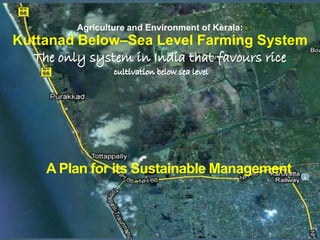
1. Agriculture and Environment of Kerala:
Kuttanad Below–Sea Level Farming System
A Plan for its Sustainable Management
2. A deltA Region ca 900sq. km
500 km2 of the area with agricultural fields situated below sea
level
FAO has recognized the Kuttanad
Heritage Agriculture (KHA) as a
Globally Important Agricultural
Heritage System.
The recognition of the Globally
important agriculture heritage
status necessitates revitalization of
some of the vital conservation and
enhancement actions of the past
that are relevant to address the
concerns of sustainable food
security, climate change adaptation
and ecosystem services
management.
3. A Complex Mosaic of Fragmented
Agricultural
Coastal backwaters
Rivers
Paddy fields,
Marshes
Ponds,
Garden lands
Edges
Corridors and
WATER WAYS
(remarkably networked)
4. the largest wetland
use system in the
west coast of
Indian peninsula
and perhaps the
largest below sea
level cultivation of
Paddy in the
world!
Major Land/Water Use
Agriculture and Inland Fisheries
7. 3.Wetlands: A landscape with levels ranging from 0.60m to
2.00m below MSL, part of which are reclaimed lands and form the
traditional paddy cultivation areas
Karapadam, Kayal padam and Kari padam according to the structure,
function and land use.
Karapadam of ca. 16280 ha with over 600 reclaimed stretches of
rice paddies
Kayal Land is about 9,464 ha area at elevations 1.0 m to 2.0 m
below MSL
Kari Lands, the Purakkad kari is an area of 3,500 ha with 43
padasekharams
8. Kayal
Puncha Vayals
/Padasekharams/
reclaimed lands for
paddy cultivation
9. Local level efforts since long
time
Became a trend by 1870s
Its full potential by later part of
19th century
By early 20th Century about
2226 ha and by 1930s 5261 ha
reclaimed
Reclamation stopped by 1980’s
Ca. 15000 ha of
reclaimed land
Ca 40,000 ha of natural land
One of the huge sized
padasekharams is about 2500
acres
10. Construction of Polders and
Land reclamation
Identification of the shallow regions in
the vast stretches of Vembanad Lake
Marking the boundaries
The bund construction and
maintenance are the most skilful tasks,
for which an array of long and stout
coconut poles would be hammered deep
enough into the lake bed in two rows,
normally in 1.5 m to 2-5 m width
enveloping the entire area and fenced
with bamboo mats on either side.
The channels of the bund then would be
filled to the desired height, first with
sand, followed by twigs, sedges
interspersed with high quality clay that
dug from 20-25 m deep bottom of lakes.
11.
12. The padasekhara
committees are made
responsible for the annual
maintenance of bunds.
Normally bunds would
breach during high flood
and high tides.
Since last 20-30 years
some of the
padasekharams are
protected with
permanent outer bunds
with granite pitching.
13.
14. Traditionally,
huge and
strong water
wheels of about
12 feet diameter
with blade
width of 1 to 1.5
feet were used,
which pedaled
by 12-14 men
who would sit
on and work
from a gallery
erected for this
purpose.
15. Modern Method of dewatering is done with special pump called petti
and para, driven by oil engines or electric motors in each
padasekharam. Electric pump sets of 30-50 HP are used.
16. Mixed agro-ecosystems such as backwaters, rivers, vast
stretches of paddy fields, marshes, ponds, garden lands,
edges, corridors and water ways-the characteristic feature
of Kuttanad Wetland Agricultural Landscape.
Plant and animal germplasm (of food and medicinal
value like several edible wild greens and healing herbs) The
delicacy like meat of turtle, frogs and different species of
birds is still available though it is legally controlled)
Insects, pests and fungi (Enormous diversity available
now after the practice of high intensive farming!)
Soil biodiversity, microbes (not much known)
18. Largely of Rice (Now
only the released
varieties- Jyothi and
Uma. In the past
puthari champavu
and jeeraka
champavu)
19. Plant and animal germplasm (of food and
medicinal value like several edible wild greens
and healing herbs) The delicacy like meat of
turtle, frogs and different species of birds is still
available though it is legally controlled)
Insects, pests and fungi
Insects, pests and fungi (Enormous diversity
available now after the practice of high
intensive farming!)
Soil biodiversity, microbes (not much known)
20. The plant and animal diversity
present in the bushes in
isolated patches and water
are employed in various ways
for their food and agricultural
needs- Food, drink and for
healing purpose, livelihood
and cultural needs.
Traditional diet included
primarily rice, fish, prawns,
crabs, mussels, duck meat,
coconut and cassava.
21. Habit of using deep mined clay
for healing their small wounds
and cuts and
Herbal medicine was known for
poisonous bites. Abundantly
grown screw pines and a
sedge
Screw pine, Typha in the region
offered enough raw material
Mat weaving – a livelihood
option for the women
22. The wild biodiversity of the region is
rich! It ranges from mixed wetland
ecosystems to the associated above
ground and below ground flora, fauna
and microbial diversity.
The 11 km long stretch of mangrove
vegetation still found close to
Kumarakom supports a diverse array
of mangrove and mangrove associates.
Pathiramanal is a large repository of
migratory fishes and birds and several
species of mangroves, birds and fish
species.
A bird count in 2009 listed out 27942
birds belonging to 56 wetland and
wetland associated bird species.
The Kayal is home to the third largest
population of more than 20,000
waterfowls that visit India
23. Endangered species of
waterfowl that have been
identified from the region
are:
spot billed pelican,
oriental darter,
water cock
black billed tern.
24. The region is an ideal
habitat for variety of
finfish, shellfish, and
several varieties of
prawns, black clams,
white clams and
shrimps. Many fish
species are reported to
be depended upon the
wetland for food,
spawning and nursery.
the esteemed golden catfish of Kuttanad
25. The aquatic species
include:
24 spp of green algae,
10 blue green algae,
one species of yellow brown
algae,
13 desmids and 19 diatoms
202 angiosperm species,
which include 14
mangroves and 30
mangrove associates.
8 species of pteridophyta
26. Kuttanadan Rice
The rice cultivation
area of Kuttanad shares
about 25 % of the
State’s total rice
production area and
contributes nearly 37 %
of the rice production
of the state. Owing to
its primacy in rice area
and production,
Kuttanad had been
long time referred as
“The Rice Bowl” of
Kerala.
27. The Kuttanadan Agricultural Landscape, including the
Punja Rice System that surrounded with estuaries, flood
plains, Kayals, ponds and canal networks known for its
diverse fish wealth.
Vembanad Fish Count 2009 identified 65 species of fin
fish and 14 species of shell fish from the region (ATREE
2009).
The fresh water environment closer to rice fields and the
canals provide abundance of Pearl spots, perchlets, fresh
water giant prawns or attukonju and freshwater catfishes
28. Giant freshwater prawn Macrobrachium rosenbergii, which grows up to the size of
40 cm and locally known as Kuttanadan konchu is a highly valuable species
The total annual production of this species in 80’s was reported as 100 tons per
annum. There are now successful attempts to increase spawning of this species
by scientists.
29. Karimeen, the Pearl spot is another major delicacy of Kuttanad and now it is
Kerala's state fish. The Kuttanad region is considered the tharavad (family
home) of the fish. Kerala now produces only 2,000 tons of Karimeen.
30. Some of the endangered fish species of the region are
the endemic carp of Central Travancore, Labeo
dussumieri (Tooli/Pullan), the esteemed golden catfish
of Kuttanad,
Horobagrus brachysoma (Manjakoori),
the riverine coldwater fish,
Gonoproktopterus curmuca (Kooral),
Wallago attu (Attuvaala), the glass perch,
Parambassis dayi (Nandan),
Macropodus cupanus, and
Nandus nandus (Andikalli).
31. The highly Endangered
endemic species in the fresh
water reaches include
Channa micropeltes (Manal
waaha), C. leucopunctatus
(Puliwaaha) Pristolepis
malabaricus (Pannakarimeen),
Ompok bimaculatus and
Clarias dussumie (Mushi).
32. Rice –fish rotation
is now popular in
the region as
double cropping of
rice turned to be
less lucrative and
more damaging to
environment. The
second crop
(March to
October) is now
taken for rearing of
fish (various carps)
33. Four species of Clams:
Villoritta cyprinoids,
Meretrix casta,
Paphia malabarica and
Sunetta scripta) are
reported from the
region, in which Black
clam (Villoritta
cyprinoids)
Its production was
estimated about 31430
ton in 2000.
34. The ideal condition of
the system allows
Duck farming in a
promising way.
Famous local
breeds Kuttanadan
duck are:
Chara and
Chempalli and the
introduced breeds
are Kuttanadan
White, White
Pecking and White
Muscovi.
35. In garden lands Coconut agroforestry is also followed where coconut is grown
with fruit trees like mango, jack and roots and tubers like yams and taros. The
palm is also used for tapping toddy, which is another attraction of the region.
Apart it contributes to profound scenic beauty
36. Traditional Food basket of people of
Kuttanad included four major
items-
1. Kizhangue (tuber, mainly
cassava),
2. Karimeen (pearl spot),
3. Konju (Giant freshwater
prawn),
4. Kakka (clams), and
5. Kallu (toddy- An
alcoholic beverage).
37. Transportation, recreation
apart from crucial
regulating service the
system plays is the
control of the
hydrology of
the entire
region.
39. Kuttanad – A ‘Water Desert’
Fresh water supply is hugely
defective:
Pollution,
Urban encroachment,
Land reclamation for
agriculture and tourism,
Fragmentation by
transportation routes,
untreated human sewage
from dense settlements, and
Intensive agricultural run-offs
including fertilizers and
pesticides.
Almost all areas in Kuttanad are
reeling under severe shortage
of potable water. The people
of this water logged area
virtually starve for quality
potable water.
40. A barrage
commissioned in 1975
and construction of
an adjoining earthen
bund in the
vembanad lake with a
view to regulate salt
water intrusion into
inland for enabling
cultivation of a
second crop of paddy
and construction of
canals, roads, culverts
and bridges and
development of
waterways in an
unscientific manner
have significantly
affected the dynamic
nature of this wetland
and reduced the
natural tidal flow
considerably.
42. The major challenges identified by MSSRF about a few years
back to bring back the KHA are :
(i) Declining surface area of waterways including the
Vembanad Lake
(ii) Flood management,
(iii) Control and regulation of saline water intrusion,
(iv) Choked waterways and the consequent problems in
water availability and drainage to agriculture, and to
human health, sanitation and clean drinking water,
(v) Pollution of water body due to many factors including
alien invasive species, and
(vi) Degrading ecosystem services and goods like water
recharge, pollution control, fishery and loss of
biodiversity.
43. M.S. Swaminathan Research Foundation three years
ago recommended promotion of this region as a
Special Agricultural Zone for strengthening location
specific research and extension system for the
prosperity of the Kuttanad region
44. to educate the farmers and fisher communities to enhance their knowledge- base
and capacity in integrated land and water management particularly in (i) polder
system of landscape building and management of sea water intrusion; (ii) below
sea level farming, and (iii) sustainable garden-land agriculture and fisheries
through participatory research and communication approaches
(Education and Training oriented);
to develop sustainable livelihood options by maximizing the production of rice
cultivation and fisheries and bringing back the rice- bowl of Kerala status of this
region by finding opportunities for utilization of modern technologies for the
community members, particularly youth in processing and value addition in
rice, fishery and other agricultural produces.
(Livelihoods and Development oriented);
to undertake scientific research and bringing out high quality results on the
issues and problems related to three high priority topics (i) below sea level
farming and the related area of water resource management pertain to both
inland and sea waterscapes; (ii) integrated fisheries inclusive of prawn culture
and (iii) specially focused research on Climate Change scenario analysis in
relation with the hydrology of the region, biodiversity, water and landscape
management & agriculture.
(Research, Documentation and Policy oriented);
45. The major intervention to achieve this objective is
establishment of a fully functional world class
Training Institute for bringing a critical mass of
scholars from different disciplines to undertake
training and capacity building initiatives in the
focal areas of ReKHA Council.
46. Creating an economic stake in conservation is an
important strategy to promote sustainable income
generation in villages and revitalize the heritage.
Applied Research into this direction supported with
new bio-chemical explorations to value-chain
studies and policy initiatives will be explored.
47. Revitalization of the ecological foundations essential
for sustainable agriculture in Kuttanad,
Enhancement in productivity and reduction in the cost
of production through higher factor productivity in rice
cultivation, coconut gardening, roots and vegetable
cultivation and fisheries.
Introduction of agro-processing and value addition
initiatives primarily to rice, coconut and fish.
48. Launching of Bio-Enterprises Initiative by
establishing Demonstration Villages, Aqua Parks and
Bio Parks for sustainable utilization of targeted
resource such as rice, coconut and fish (including
prawn) in cooperation with appropriate government,
non-government and academic institutions.
These could be spread out in strategic locations of the
region- one at Lower Kuttanad (Monkombu),One at
Middle Kuttanad (Kumarakom) and one at Upper
Kuttanad (Haripad) which as the Hub of the Initiative*
49. Enlarging the markets for traditional foods and herbal
products through Cooperatives/ SHGs and by finding
niche markets, by promoting brand names where
appropriate.
Traditional Food basket of people of Kuttanad
included six major items- Kizhangue (tuber, mainly
cassava that cultivated locally is far superior in cooking
quality and taste), Karimeen (pearl spot), Konju (Giant
freshwater prawn), Kakka (clams), Karikku (tender
coconut) and Kallu (toddy);
50. Promoting organic farming methods of cultivation and
linking the organic rice, coconut, fish/prawn and
medicinal plants with value-added marketing
techniques such as adoption of market-accepted
certification procedures.
51. Undertaking scientific research and bringing out
high quality results on the issues and problems
related to three high priority topics
(i) below sea level farming and the related area of
water resource management pertain to both
inland and sea waterscapes;
(ii) integrated fisheries inclusive of prawn culture
and one rice –one fish cultivation;
(iii) Climate Change scenario analysis in relation
with the hydrology of the region, biodiversity,
water and landscape management & agriculture.
52. Facilitate establishment of a Heritage Museum for Kuttanad
Agriculture by exhibiting all the known tools and equipment and
demonstration of the earlier agricultural practices. Producing technical
and popular multi-media publications related to the activities of KHA
for example the Kuttanadan folk songs and arts for public reference will
also be a major activity component;
Extending Consultations and Policy advocacy to public organizations
and community institutions and policy makers respectively in the
operational process of coastal area sustainable agriculture with focal
themes of coastal agriculture/fisheries and climate risk management.
Facilitating formation of networks and collaborations with
organizations and departments of public and private sector and
community institutions for discussions, meetings and policy dialogue
etc;
53. It is urgent and important to bring back the vibrancy of Kuttanad
Wetland Agriculture System by addressing the issues listed out in
this paper and to contribute the national development goal of food
and nutrition security, and the state objective of reinstating the top
one rice- bowl status of this region.
The existing major Institutions in sustainable agriculture and
waterscape management need to be strengthened and supported in
funding, human resources and research directions.;
Once the activities listed out are implemented with appropriate
administrative and monitoring mechanisms it would be possible to
bring back the KHA to its past glory..
The Implementation Council should strongly advocate for
promoting ‘sustainable wetland agriculture development’ through
active involvement of youth and adults in on-farm and non-farm
livelihood interventions including community centered water
tourism and suitable bio-resource and water based enterprises.