Download as PDF, PPTX
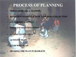
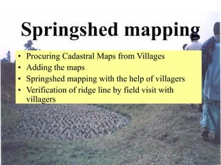
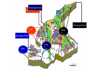
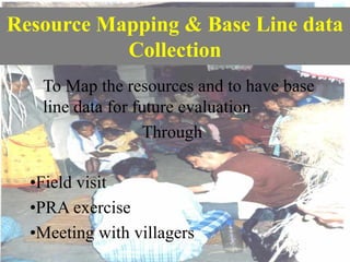
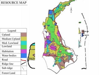
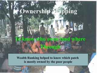
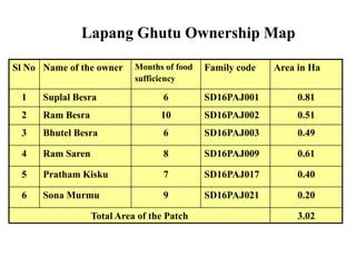
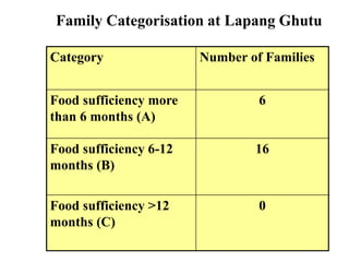
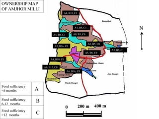
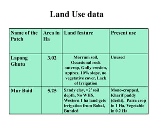
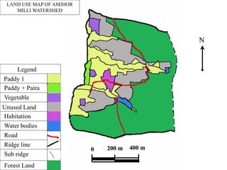
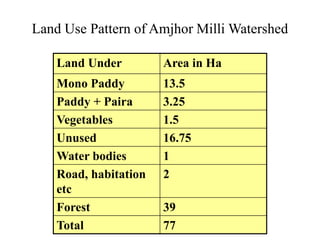
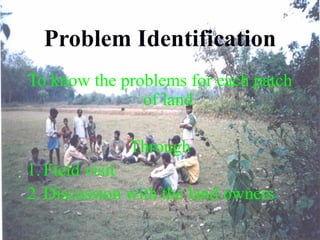
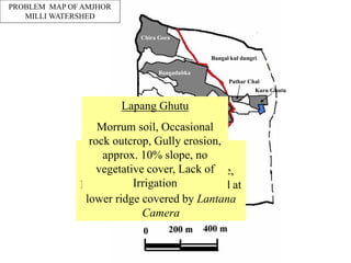
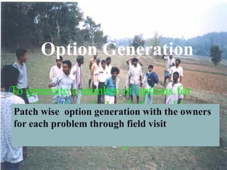
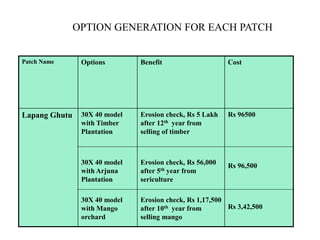
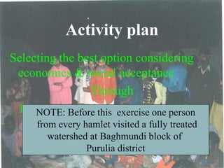
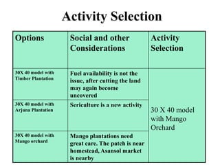
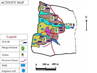

The document outlines a participatory planning process for springshed management, including techniques like resource mapping and problem identification through community engagement. It details the collection of baseline data, ownership mapping, and option generation to address land issues and improve food sufficiency for local families. Additionally, the document presents an activity plan with various land use options aimed at enhancing sustainability and economic benefits in the Amjhor Milli watershed area.


