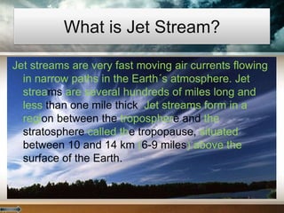
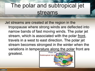
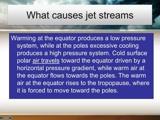
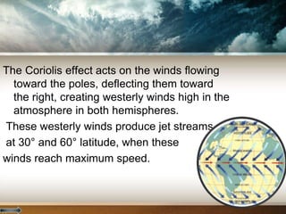
What is Jet Stream?
Jet streams are very fast moving air currents flowing
in narrow paths in the Earth´s atmosphere. Jet
streams are several hundreds of miles long and
less than one mile thick. Jet streams form in a
region between the troposphere and the
stratosphere called the tropopause, situated
between 10 and 14 km (6-9 miles) above the
surface of the Earth.
There are two jet streams that are usually
used to forecast weather; the tropical jet
stream located near 30 degrees latitude,
and the polar jet stream located at
60 degrees latitude. Jet streams are
produced by two air masses of contrasting
temperature at the tropopause and the
rotation of the Earth.
The polar and subtropical jet
streams
Jet streams are created at the region in the
tropopause where strong winds are deflected into
narrow bands of fast moving winds. The polar jet
stream, which is associated with the polar front,
travels in a west to east direction. The polar jet
stream becomes strongest in the winter when the
variations in temperature along the polar front are
greatest.
The subtropical jet stream forms in a region between 20°
and 30° latitude, where warm air is carried toward the
pole by the Hadley cell. The polar jet stream forms at
about 10 km (6.2 miles) of altitude, while the subtropical
jet stream is produced at a higher altitude, close to 13
km (8.8 miles).
What causes jet streams
Warming at the equator produces a low pressure
system, while at the poles excessive cooling
produces a high pressure system. Cold surface
polar air travels toward the equator driven by a
horizontal pressure gradient, while warm air at
the equator flows towards the poles. The warm
air at the equator rises to the tropopause, where
it is forced to move toward the poles.
The Coriolis effect acts on the winds flowing
toward the poles, deflecting them toward
the right, creating westerly winds high in the
atmosphere in both hemispheres.
These westerly winds produce jet streams
at 30° and 60° latitude, when these
winds reach maximum speed.
How do jet streams affect the
weather?
Jet streams, which are rapidly moving
ribbons of air 6 to 9 miles above the Earth,
influence the weather by separating warm
and cold air and pushing weather systems
around the globe. The movement of a jet
stream affects temperatures and
precipitation. Meteorologists describe jet
streams as resembling rivers in their flow.
The average jet stream is a band of wind traveling
between 120 and 250 miles per hour. Each jet
stream is up to several hundred miles wide and
thousands of miles long.
Each winter, the polar jet stream moves south and
grows stronger as the North Pole grows colder.
Each winter, the polar jet stream reaches the
United States, influencing weather in much of
the country.
Those hiking Mount
Everest, the world's
tallest mountain,
sometimes
encounter the jet
stream in the form
of powerful, icy
winds. These winds
are sometimes so
high and cold that
they are forced to
remain in their tents
until they subside.
Indian Monsoon is a very complex phenomenon
with various factors influencing it. Monsoon
simply means Mausam or seasonal reversal
of winds during summer to winter. Winds
blow towards the sub-continent in summers
via Indian Ocean and Bay of Bengal and its
direction reverses in winter. Actually during
summer the Tibetan plateau gets heated to a
great extent with low pressure being
developed over it and consequently the wind
rises and this wind travels southward and
descends into Mascerene High near
Mozambique in Africa.
This is called Tropical Easterly Jet and is a
temporary jet stream which occurs in summers.
It affects the Indian monsoon as the stronger it is
it pushes the winds towards Indian sub-continent
and monsoon strengthens.
Another permanent stream which affects Indian
Monsoon is Sub-Tropical Westerly Jet. It
prevails over northern part of India in winter and
is responsible for creating High Pressure over
there.
But in summers it gets divided into two parts and
north part goes upwards and south part
sometimes still remains over north India. This
southern portion of Sub-Tropical westerly jet
resists Indian monsoon and it does not allow the
winds to from over there as It maintains the high
pressure in north India and when this southern
part completely moves northwards will the low
pressure develop in north India and monsoon
will get strengthened. Thus these two jet
streams affects Indian Monsoon.
AIRPLANES FLYING BACKWARDS? Just how strong
the winds can be in jet streams was discovered
during Word War II, when American bombers tried
flying from the U.S. to Japan and found they couldn't
make any progress flying against the strong winds.
Today, aircraft routinely adjust their altitude to either
fly with the wind in the jet stream, or move to a
different altitude to avoid flying against it.
WORLD RECORD WIND
SPEED The highest wind
speed ever recorded on
the surface of the Earth
was 231 mph on April 12
1934, atop Mt.
Washington, New
Hampshire. This high-
elevation weather station
experienced the winds of
an extremely strong jet
stream that had
descended to the top of
the mountain.
By: Himank
Singh

Jet stream

  • 2.
    What is JetStream? Jet streams are very fast moving air currents flowing in narrow paths in the Earth´s atmosphere. Jet streams are several hundreds of miles long and less than one mile thick. Jet streams form in a region between the troposphere and the stratosphere called the tropopause, situated between 10 and 14 km (6-9 miles) above the surface of the Earth.
  • 3.
    There are twojet streams that are usually used to forecast weather; the tropical jet stream located near 30 degrees latitude, and the polar jet stream located at 60 degrees latitude. Jet streams are produced by two air masses of contrasting temperature at the tropopause and the rotation of the Earth.
  • 4.
    The polar andsubtropical jet streams Jet streams are created at the region in the tropopause where strong winds are deflected into narrow bands of fast moving winds. The polar jet stream, which is associated with the polar front, travels in a west to east direction. The polar jet stream becomes strongest in the winter when the variations in temperature along the polar front are greatest.
  • 5.
    The subtropical jetstream forms in a region between 20° and 30° latitude, where warm air is carried toward the pole by the Hadley cell. The polar jet stream forms at about 10 km (6.2 miles) of altitude, while the subtropical jet stream is produced at a higher altitude, close to 13 km (8.8 miles).
  • 6.
    What causes jetstreams Warming at the equator produces a low pressure system, while at the poles excessive cooling produces a high pressure system. Cold surface polar air travels toward the equator driven by a horizontal pressure gradient, while warm air at the equator flows towards the poles. The warm air at the equator rises to the tropopause, where it is forced to move toward the poles.
  • 7.
    The Coriolis effectacts on the winds flowing toward the poles, deflecting them toward the right, creating westerly winds high in the atmosphere in both hemispheres. These westerly winds produce jet streams at 30° and 60° latitude, when these winds reach maximum speed.
  • 8.
    How do jetstreams affect the weather? Jet streams, which are rapidly moving ribbons of air 6 to 9 miles above the Earth, influence the weather by separating warm and cold air and pushing weather systems around the globe. The movement of a jet stream affects temperatures and precipitation. Meteorologists describe jet streams as resembling rivers in their flow.
  • 9.
    The average jetstream is a band of wind traveling between 120 and 250 miles per hour. Each jet stream is up to several hundred miles wide and thousands of miles long. Each winter, the polar jet stream moves south and grows stronger as the North Pole grows colder. Each winter, the polar jet stream reaches the United States, influencing weather in much of the country.
  • 10.
    Those hiking Mount Everest,the world's tallest mountain, sometimes encounter the jet stream in the form of powerful, icy winds. These winds are sometimes so high and cold that they are forced to remain in their tents until they subside.
  • 12.
    Indian Monsoon isa very complex phenomenon with various factors influencing it. Monsoon simply means Mausam or seasonal reversal of winds during summer to winter. Winds blow towards the sub-continent in summers via Indian Ocean and Bay of Bengal and its direction reverses in winter. Actually during summer the Tibetan plateau gets heated to a great extent with low pressure being developed over it and consequently the wind rises and this wind travels southward and descends into Mascerene High near Mozambique in Africa.
  • 13.
    This is calledTropical Easterly Jet and is a temporary jet stream which occurs in summers. It affects the Indian monsoon as the stronger it is it pushes the winds towards Indian sub-continent and monsoon strengthens. Another permanent stream which affects Indian Monsoon is Sub-Tropical Westerly Jet. It prevails over northern part of India in winter and is responsible for creating High Pressure over there.
  • 14.
    But in summersit gets divided into two parts and north part goes upwards and south part sometimes still remains over north India. This southern portion of Sub-Tropical westerly jet resists Indian monsoon and it does not allow the winds to from over there as It maintains the high pressure in north India and when this southern part completely moves northwards will the low pressure develop in north India and monsoon will get strengthened. Thus these two jet streams affects Indian Monsoon.
  • 15.
    AIRPLANES FLYING BACKWARDS?Just how strong the winds can be in jet streams was discovered during Word War II, when American bombers tried flying from the U.S. to Japan and found they couldn't make any progress flying against the strong winds. Today, aircraft routinely adjust their altitude to either fly with the wind in the jet stream, or move to a different altitude to avoid flying against it.
  • 16.
    WORLD RECORD WIND SPEEDThe highest wind speed ever recorded on the surface of the Earth was 231 mph on April 12 1934, atop Mt. Washington, New Hampshire. This high- elevation weather station experienced the winds of an extremely strong jet stream that had descended to the top of the mountain.
  • 17.