ITS presentation final
•Download as PPTX, PDF•
0 likes•419 views

The document proposes an intelligent urban traffic control system for Kajang, Malaysia to address traffic congestion issues. It analyzes 4 intersections experiencing long queues and delays during peak hours. Data collection and traffic surveys were conducted to determine optimum cycle times, green splits, and offsets. A proposed advanced traffic management system is described using sensors, variable message signs, and centralized control to monitor traffic flow, detect incidents, and disseminate real-time information to drivers. Upgrading existing controllers with new technologies and coordination is recommended to optimize traffic flow in Kajang.

Recommended
Recommended
More Related Content
What's hot
Viewers also liked
Viewers also liked (8)
Similar to ITS presentation final
Similar to ITS presentation final (20)
Recently uploaded
Recently uploaded (20)
ITS presentation final
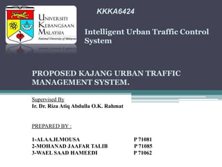
- 1. KKKA6424 Intelligent Urban Traffic Control System PROPOSED KAJANG URBAN TRAFFIC MANAGEMENT SYSTEM. Supervised By Ir. Dr. Riza Atiq Abdulla O.K. Rahmat PREPARED BY : 1-ALAA.H.MOUSA P 71081 2-MOHANAD JAAFAR TALIB P 71085 3-WAEL SAAD HAMEEDI P 71062
- 2. Introduction • kajang is located in the eastern part of selangor, Malaysia. Its away 21 km to the south from the Malaysian capital city kuala Lumpur Kajang town has grown rapidly in the past several decades. • Continuous traffic growth through developed areas and difficulties in building new transportation infrastructure have caused a need for careful monitoring of operating conditions on existing transportation facilities.
- 3. PROBLEM STATEMENT • The major problems in Kajang are traffic congestions and long queues at intersections during peak hours. • Increasing of traveling times due to increasing numbers of road users and limited resources provided by current infrastructures. • Inability of existing method in determining traffic demand and provide suitable time split when the traffic volume exceeds its capacity is another main factor which lead to traffic congestion. • these problems are mainly due to poor coordination
- 4. STUDY OBJECTIVE o To propose solution to traffic congestion in Kajang by optimizing traffic flows along a few selected arterial routes. The solution shall include: • To upgrade current situation of traffic flow in Kajang town • To ensure the safety of the traffic users • To give real time information to the users • To propose mechanism of action during incident/breakdown • To have better service of traffic in Kajang town
- 5. STUDY FOCUS AREA The study has focus on the locations are recognized as the followings: • Intersection 1: near to kajang stadium and kajang satay restaurant • Intersection 2: near to kajang police station • Intersection 3: near to prescot hotel • Intersection 4: near to kajang hospital and metro point mall
- 6. Site Visit and Visual Appraisal • in order to get first hand knowledge • to evaluate the actual site problems. • Existing traffic data, documents and drawings was examined to obtain the information of the selected intersections. • Preliminary data such as number of lanes, distance between intersection, phasing sequences, signal timing, and traffic volume are collected during the site visit.
- 7. Traffic Survey & Analysis • Determine the best control methodology for the intersection. • Determine the optimum cycle time, green time split and offset time. Time of study: • We started to collect the data by visiting the intersections evening (5:30 __ 6:30PM), which is the peak hour volume.
- 8. Output The output of the study consists of the followings: • To set a suitable Cycle Time and Offset Time for the purpose of regulating travel speed. • To introduce solution for upgrading existing traffic control system which would optimize traffic flows in Kajang.
- 9. STUDY METHODOLOGY The study consists of five main activities as shown below:
- 10. DATA COLLECTION (TRAFFIC SURVEY) • The survey has been carried out manually at the selected intersection. Two types of traffic count • Peak Hours Junction Classified Volumetric Count • Mid-block 16-hours Classified Volumetric Count to determine optimum cycle timing and green time split plan. In addition, Travel Time Survey and Queue Length and Delay survey are required to determine the optimum offset.
- 11. Adopted Passenger Car Unit (pcu) factors.
- 12. Phase 1 3736 Phase 2 590 Phase 2 1263 Phase 3 1056 Phase 3 497 Phase 4 296 Phase 1 1398 Phase 3 788 Phase 1 1078 138 m 388 m Intersection 2 Phase 1 1020 Phase 2 991 Phase 2 1173 Phase 3 2002 Intersection 1 Intersection 3 Intersection 4 283 m
- 13. DETERMINATION OF OPTIMUM CYCLE TIME & OPTIMUM GREEN TIME SPLIT: • For optimum time, Webster method is used for calculation as it is a widely used and easily understood method. The Webster formula is given as follows (Webster & Cobbe 1966): 𝐶𝑜.=1.5 𝐿+5/1− 𝑌 • Where; • Co = Optimum cycle time in second. • L = Lost time in one cycle which includes all red time and start up delay. • For Malaysian condition, 3 to 4 seconds per phase can be used. • Y= Summation of critical flow ratio with saturation flows at all approaches.
- 18. DETERMINATION OF OFFSET • McShane et. al. has modified the formula by taking into account the initial start-up delay and also the existing vehicle waiting for the green light. The ideal offset has to be modified as follows: • 𝑡- 𝑖𝑑𝑒𝑎𝑙.= ( 𝐿/ 𝑆)-(Qh+Loss1). Where; • Q = number of vehicles queued per lane, vehicle • H = discharge hadway of queue vehicle in seconds/vehicle. • L = distance between intrsections in meter • S = speed in m/s • Loss1= loss time associated with vehicles starting from rest at the first downstream signal
- 20. Intersection 4 Intersection 1 Intersection 2 Intersection 3
- 21. Traffic Control system Proposed Advanced Traffic control Systems Overview: • the application of advanced and emerging technologies (computers, sensors, control, communications, and electronic devices) in transportation to save lives, time, money, energy and the environment. • The goal of ITS in road transport is to achieve improvements in mobility, safety, and the productivity of the transportation system • Advanced Traffic Management Systems (ATMS) have proven to be one of the most successful components in accomplishing these objectives.
- 22. types of systems and functionality that can be provided through Advanced Traffic Management Systems. Information Collection Strategic traffic management and control requires information about the operational state and characteristics of traffic flow. • Traffic Flow or Volume – the number of vehicles passing a point per unit of time; • Vehicle Speed – the distance traveled by a vehicle per unit of time, usually expressed in km/h; • Traffic Density – the number of vehicles occupying a road lane per unit of length at a given point in time;
- 23. Occupancy similar to traffic density, usually expressed as a percentage representing the percentage of time a detection zone on the road is occupied Incident • an unplanned event that occurs within a roadway (on the traveled portion, shoulder or roadside) • Relevant details of an incident include date/time, location, direction of travel, type of impact
- 24. Weather Conditions Relevant details on current Weather Conditions such as: • wind speed, humidity, temperature, visibility, etc. • many different types of detectors/sensors are available, including roadway sensors and vehicle probes.
- 25. Roadway Sensors Roadway sensors can be divided into several categories: • embedded or intrusive (i.e., embedded in the pavement), • non-intrusive (i.e., installed off the pavement), and environmental. The following is a list of the more commonly used sensors: Inductive Loop Magnetometer Road Surface Sensors
- 26. Surface Street Control monitoring, control and management of traffic operations on municipal streets and arterials. • The primary application of ITS within Surface Street Control is the management of signalized intersection control and the assignment of right-of-way for all users of the transportation network including vehicles (e.g., passenger cars, trucks, transit vehicles, emergency response vehicles, maintenance vehicles, etc.), cyclists and pedestrians.
- 27. Highway Control Highway Control uses roadside equipment and communications to monitor traffic conditions on the highway network for traffic management, incident detection and management and access control.
- 28. Regional Traffic Control The major objectives of Regional Traffic Control Systems are to: • Reduce delays and collision risks • Disseminate information to motorists about the freeway/arterial corridor condition to improve safety and mobility, and enable diversion • Maintain the freeway/arterial corridor at an operating level by efficient implementation of traffic control strategies
- 30. Smart surveillance system Sensing technologies • Sensing systems for ITS are vehicle and infrastructure based networked systems Video vehicle detection • video detection systems such as those used in automatic number plate recognition do not involve installing any components directly into the road surface
- 31. Junction Electronic Eyes (J-Eyes) • Operators watching the video images can intervene to avoid congestion-causing situations such as illegal parking. Acoustic – Acoustic detectors • Use microphones and signal processing technology to listen for sounds made by passing vehicles to determine the presence of a vehicle.
- 32. Video Image Processing (VIP) • Video image processing utilizes images provided by video cameras installed near the roadway. “Machine Vision” algorithms are combined with computerized pattern recognition software to detect passing vehicles Closed Circuit Television (CCTV) Cameras cameras are used to monitor traffic flow conditions and verify traffic congestion and incidents.
- 33. Variable message signs (vms) • Message signs are used to communicate different types of information: about recurring events, such as alternate routes around bottlenecks during rush hours; • About non-recurring events, such as construction, lane closures or detours; • About roadside facilities and attractions such as parking availability and recommended routes for sporting and entertainment events; • Weather and other natural events such as rockslides or floods; • Traffic management operations such as the activation of HOV or HOT lanes, ramp meters or the presence of tolls and; • The speed of a vehicle.
- 34. How They Affect Driver Behavior • A study conducted showed that message signs could cause a significant number of drivers to change their routes. For example, the longer the queue length posted on the message sign, the greater the number of drivers who diverted. Credibility and clarity are very important if variable message signs are to have an effect on drivers' behavior. Where are they implemented? • As with highway advisory radio, the frequent companion technology for variable message signs, • variable signs are often used to tell drivers about conditions in closed or fixed systems such as turnpikes, tunnels, bridges, airports and causeways.
- 36. Public Transport Management system Advance public transport system APTS technologies are a collection of technologies that increase the efficiency and safety of public transportation systems and offer users greater access to information on system operations.
- 37. Automatic Vehicle Location Systems • Improved dispatch and operational efficiency; • Improved overall reliability of service; • Quicker responses to disruptions in service, such as vehicle failure or unexpected congestion; • Quicker response to threats of criminal activity (via silent alarm activation by the driver); and • Extensive information provided at a lower cost for future planning purposes.
- 38. Transit Operations Software This software helps the operator monitor the fleet’s effectiveness in meeting demand, identify incidents, manage response, and restore service more effectively. Geographic Information Systems . A GIS is a special type of computerized database management system in which geographic databases are related to one another to allow an operator to immediately locate bus stops or subway stations or to determine the best route from one point to another when assisting transit passengers.
- 39. Automatic Passenger Counters • collect data on passenger boardings and alightings by time and location. APCs may contain mechanisms for delivering this information to the transit operations center for monitoring the level of demand in real time. Traffic Signal Priority Systems • is a technology by which a traffic signal may be held green (or made green earlier than scheduled) so that a vehicle may pass through the intersection more quickly. • Applying this technology to buses allows for an increased number of people to pass through an intersection during a light cycle • .It also helps with the management of bus routes that have short headways and helps to alleviate “bunching”— a situation where one or more buses find themselves too closely following one another.
- 40. Traveler Information Systems • Combine computer and communications technologies to provide vehicle information to travelers at home, at work, on the roadside, or at bus and rail transit stations. • The information allows travelers to choose the most efficient and convenient modes of travel. • Travelers can access real-time schedules and congestion information through telephones, cable television, variable message signs, kiosks, or personal computers.
- 41. Transportation Demand Management • The goal of demand management is to maximize the capacity of the current transportation network in order to meet the increase in the demand for transportation services. The Transit Intelligent Vehicle Initiative (IVI) • Advanced safety and information systems are applied to help drivers operate transit vehicles more safely and effectively. • The current focus of Transit IVI is to test these technologies on buses and transit vehicles; rail vehicles will be considered in the future.
- 42. Communications Internet Access • In Kajang Municipal area, Municipal Council and JKR (together get the budget) need to extend the webpage facilities to enable the traffic information updated hourly or more frequent to their existing webpage. • The webpage also can provides information on incidents, reports of road closures, road works or any events impacting on traffic flows in the Kajang City Car Navigation System • in Malaysia recently the Navigation system become popular to the car user, nevertheless the system is not interacting with the life traffic at the road. • at this time the navigation system only guide the user to the destination either faster, nearest, toll highway and non toll highway. • The new technology in this system, allow the system to link to the traffic website. From there, they can access the information about the traffic condition and guide the user to the smooth route.
- 44. Call Centre • Kajang Municipal Council and JKR suggested to set-up one medium size call centre or control centre to provide information and control the traffic in Kajang area especially at Kajang City Centre. • It can provide automated half-hourly to hourly reports of traffic situation as well as reporting of major situation in Kajang City. • Traffic information on main route is also automatically updated to the interactive voice response system. • If the traveller require more personal response call agents at the Call Centre will also be on hand to answer specific queries within the Kajang city.
- 45. Radio / TV Station • Traveller can also get the information of the current traffic condition from the radio and TV station. • Nowadays, many radio and TV station concern about their listener and viewer demand that wish to know about the traffic condition at the morning and evening peak hours. • the radio and TV can collaborate with Traffic Control Centre for the Kajang City as example below:-
- 46. SMS/MMS System or Personal Digital Assistant • By cooperating with the telecommunication service provider, the traffic condition can be attained by the communication tools which are hand phone and personal digital assistant (PDA). • The traveller can send SMS or MMS to get the information about traffic flow. • They also can subscribe the information about traffic flow at the peak hours for monthly payment from the telecommunication service provider.
- 47. Cost
- 48. Cost
- 50. CONCLUSION • Most of the existing traffic controllers are based on vehicle-actuated system. • This system is good for isolated intersection if the maximum time of each phase is calculated to optimize traffic flows. • Multi-plan timing system could be set based on computed timing that gives optimum traffic flows. • The optimization procedure includes individual controller setting and offset timing to minimize stopping and maximize flows that give progressive flows with maximum bandwidth. • Optimizing existing traffic controllers are relatively easy although it requires surveys and on site setting. • However to maintain optimum operation, constant monitoring is needed especially if power supply is not stable. • It is undeniable that setting up a ITS system in this Kajang town area would be a very wise decision as it will help to lessen the congestion in Kajang and also will benefits the town here as has smoother traffic flow.
- 51. RECOMMENDATIONS Initial and maintenance works to optimize existing traffic controllers consume a great deal of time and energy. the traffic flows could be optimized in real time automatically. Our recommends are: • Upgrade the existing controllers with microprocessors • Install advanced sensors • Install communication system to facilitate data exchanges between traffic controllers to optimizing traffic flows. Other recommendation if the congestion still cannot be manage by this system are stated below: • Introduce Response team during peak hour by Municipal Council or JKR to control the traffic during accident happen at site and as part of the reported team from site to Control centre or caller room • To introduce of prohibition for heavy vehicles through the highway at peak times especially backhoe and industrial/construction machine.