Downloaded 167 times


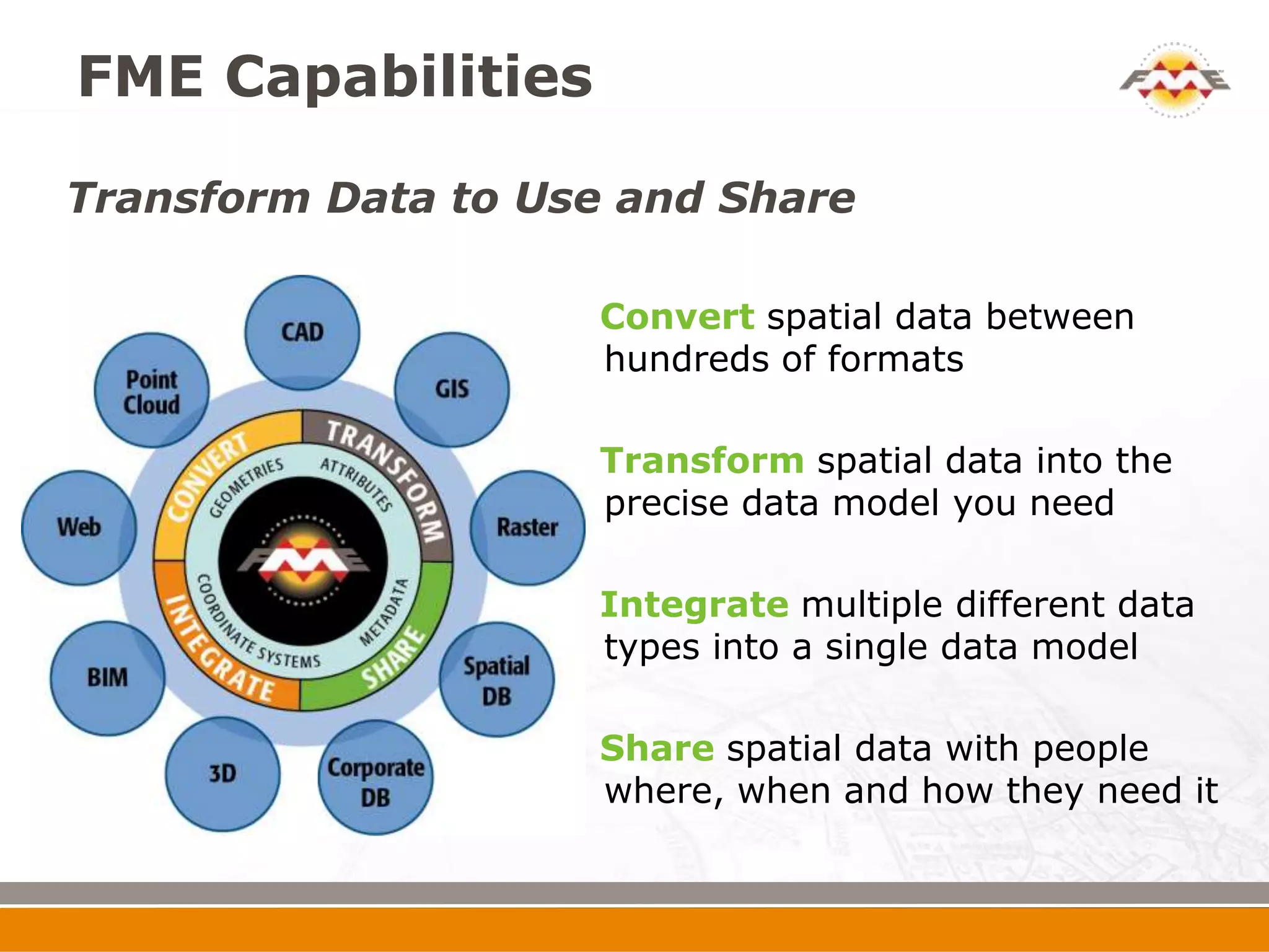
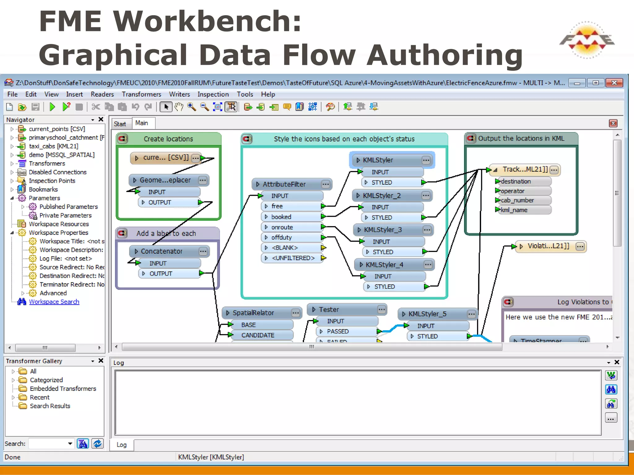
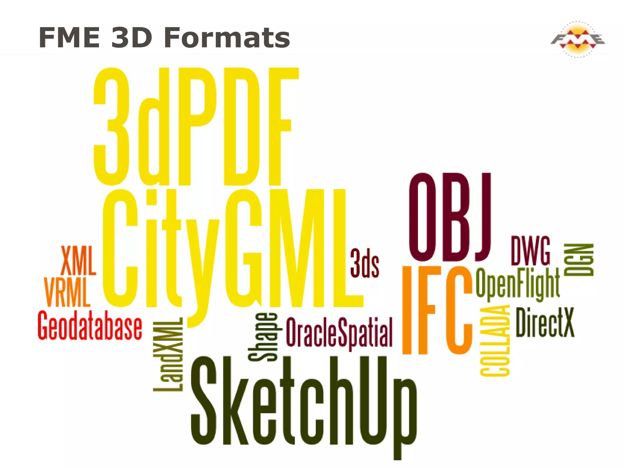

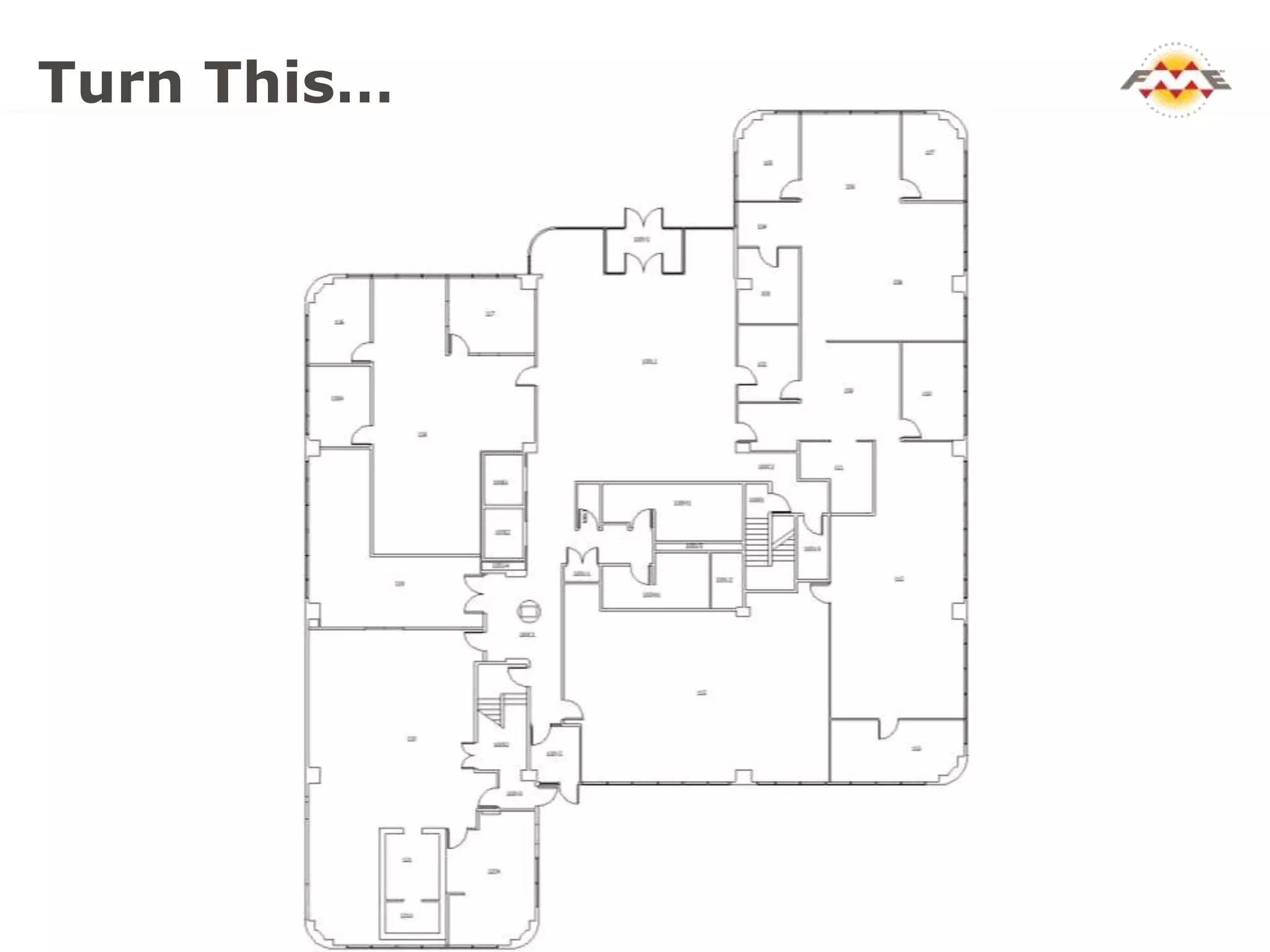
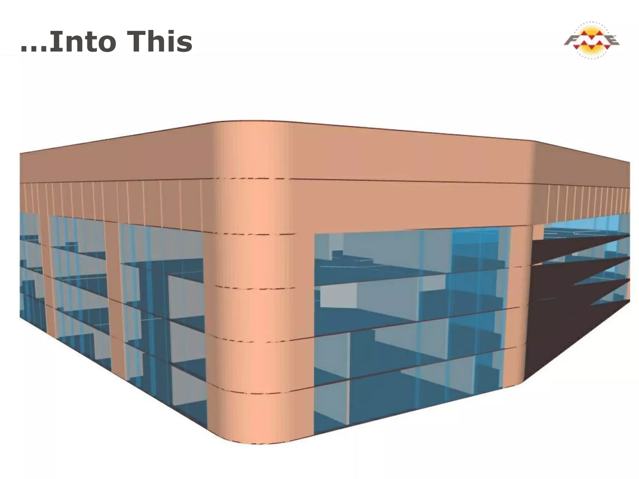

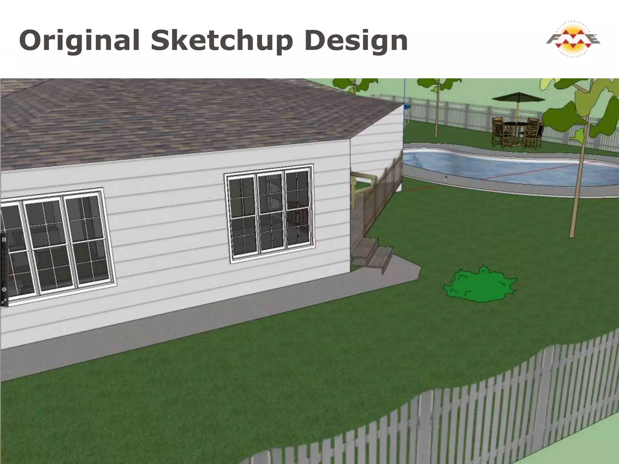
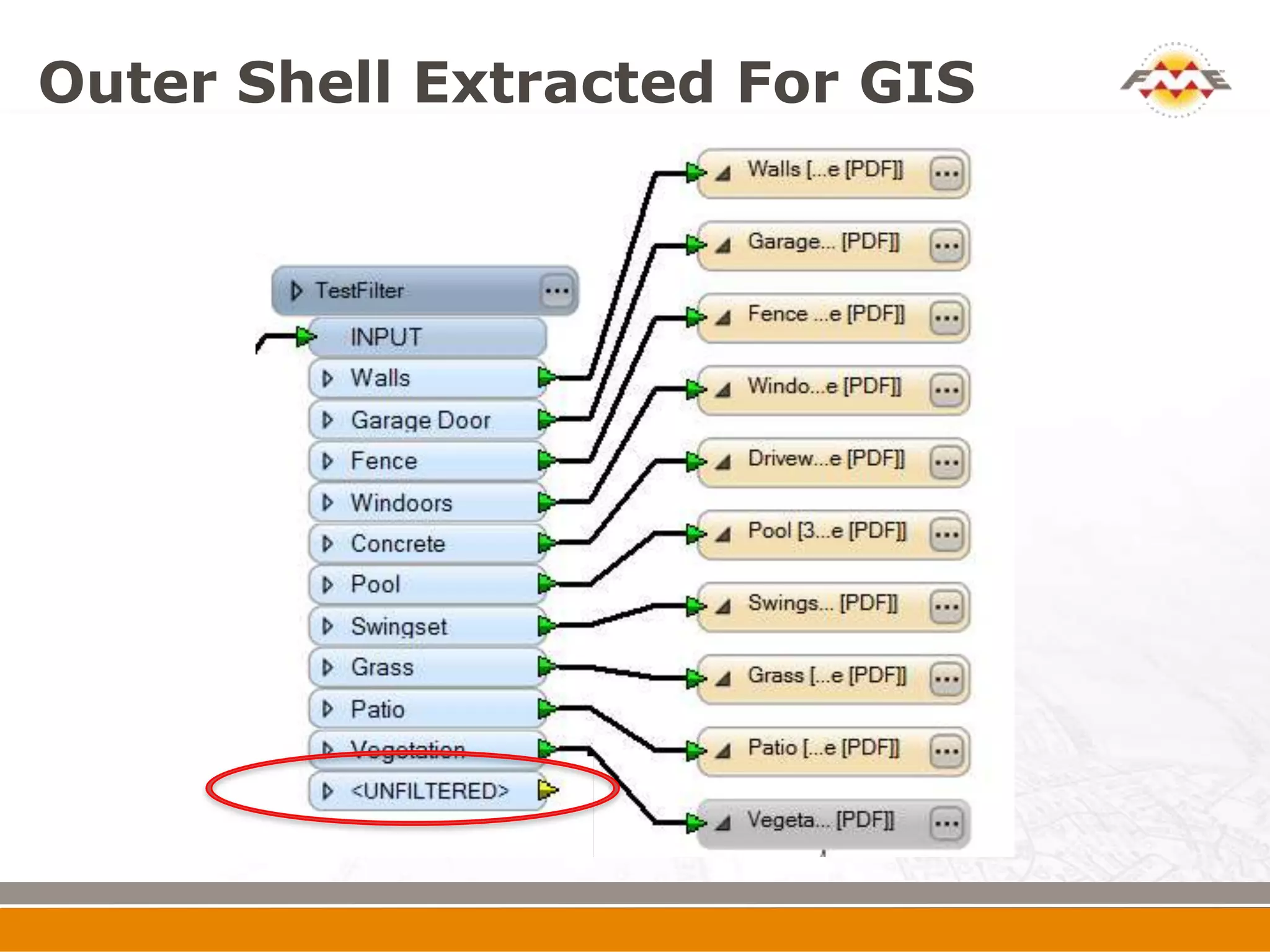
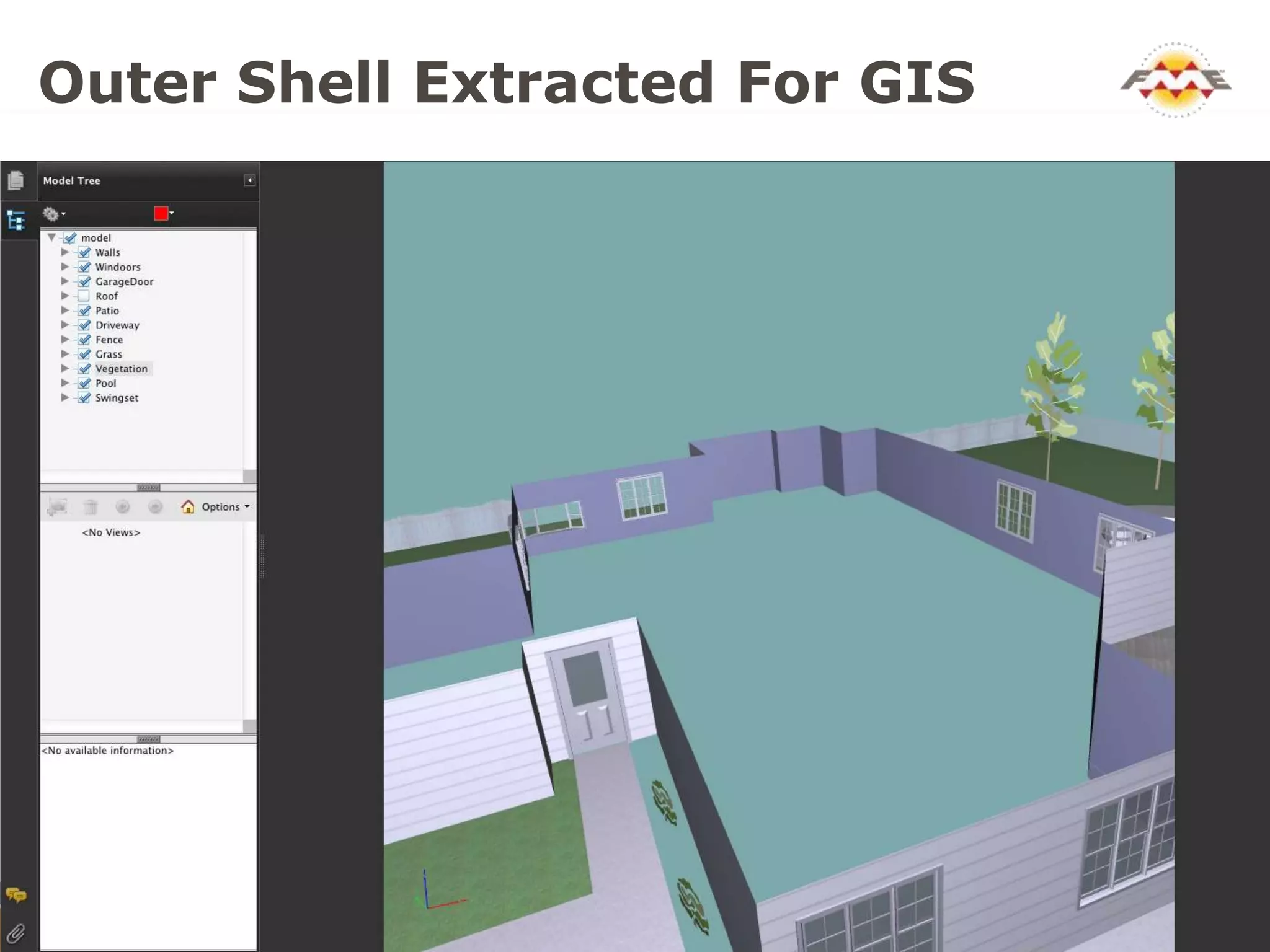
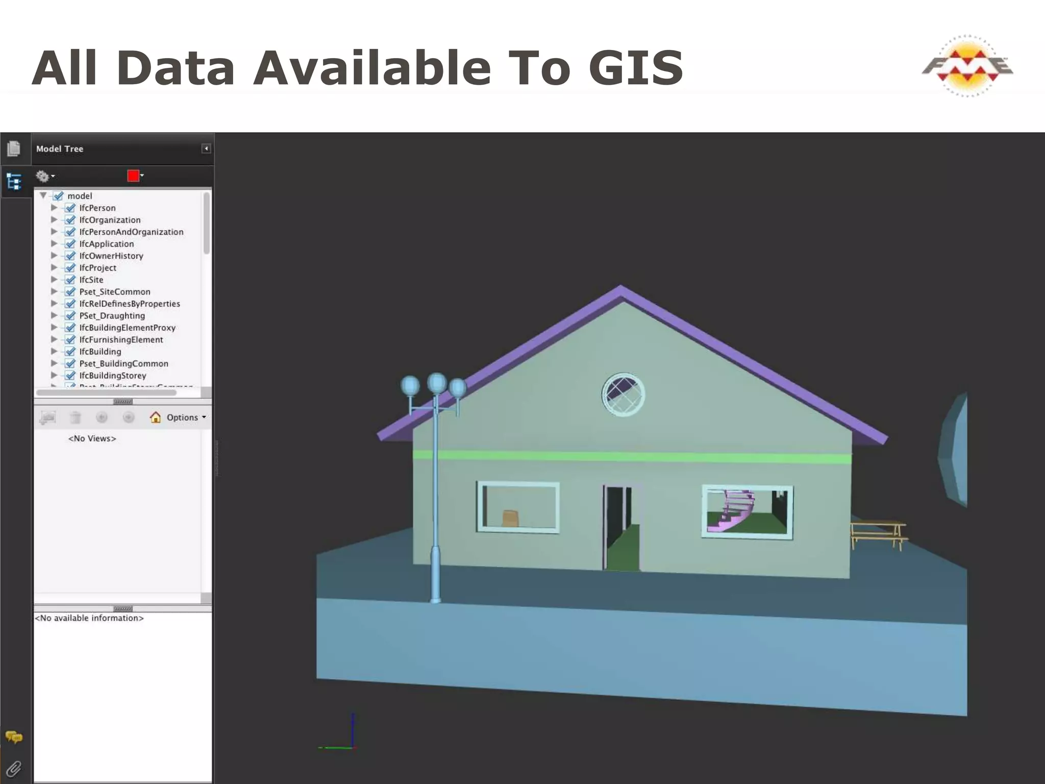
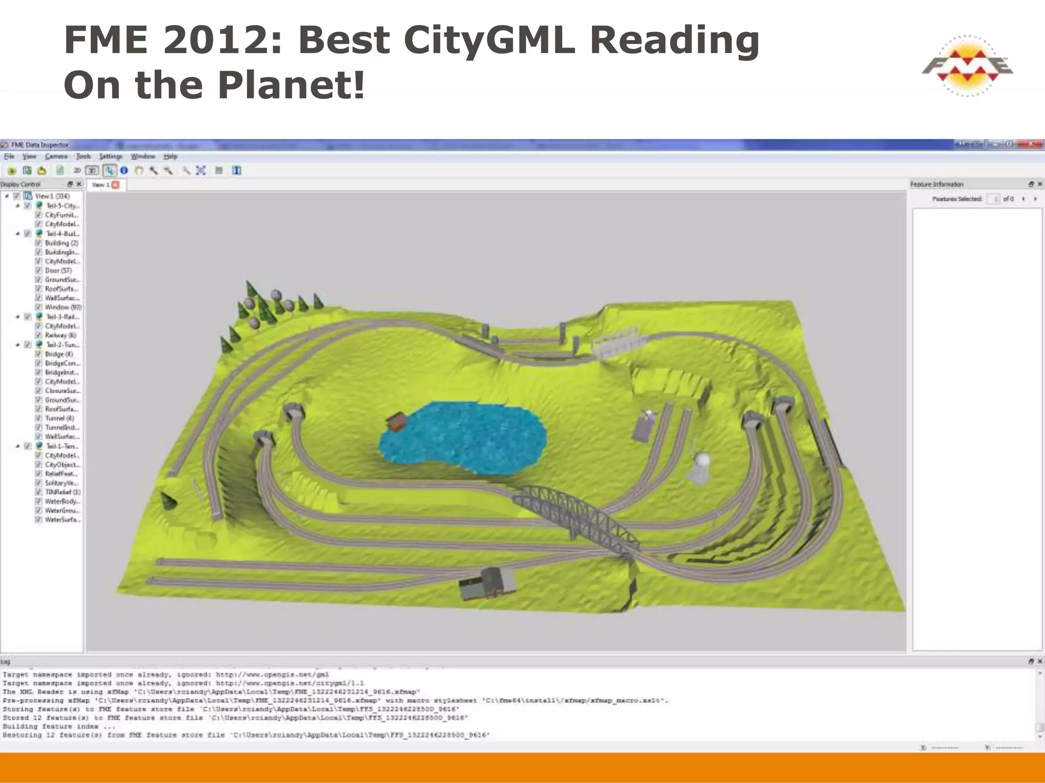
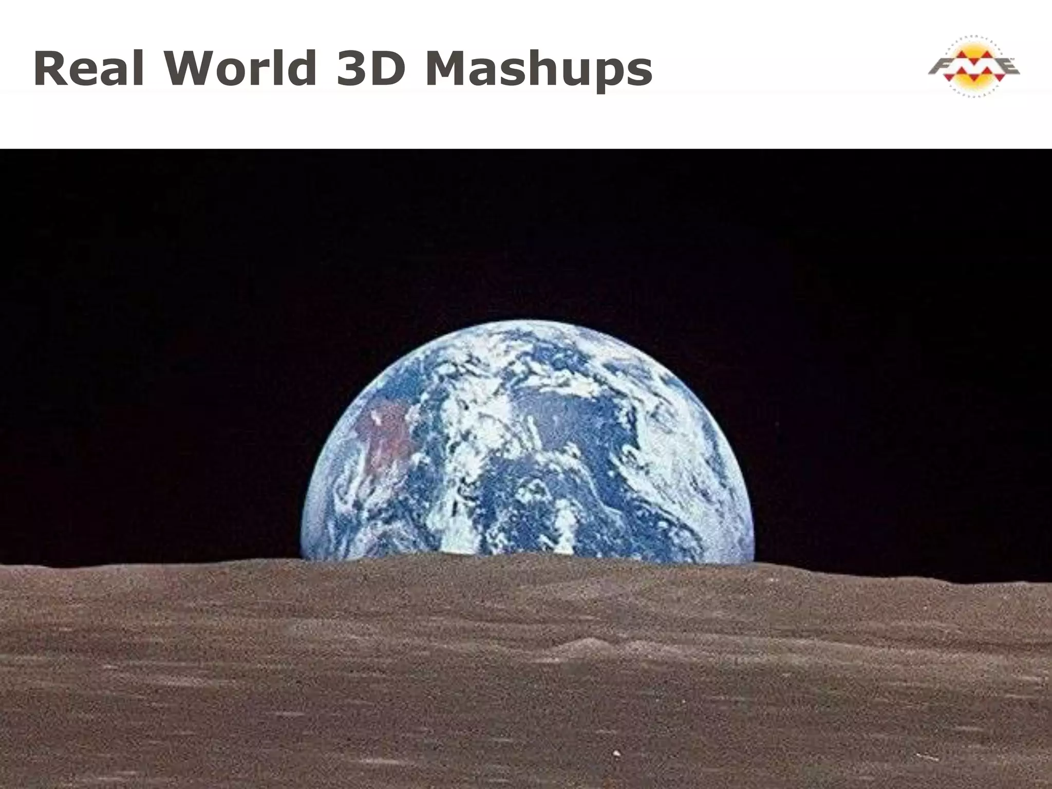
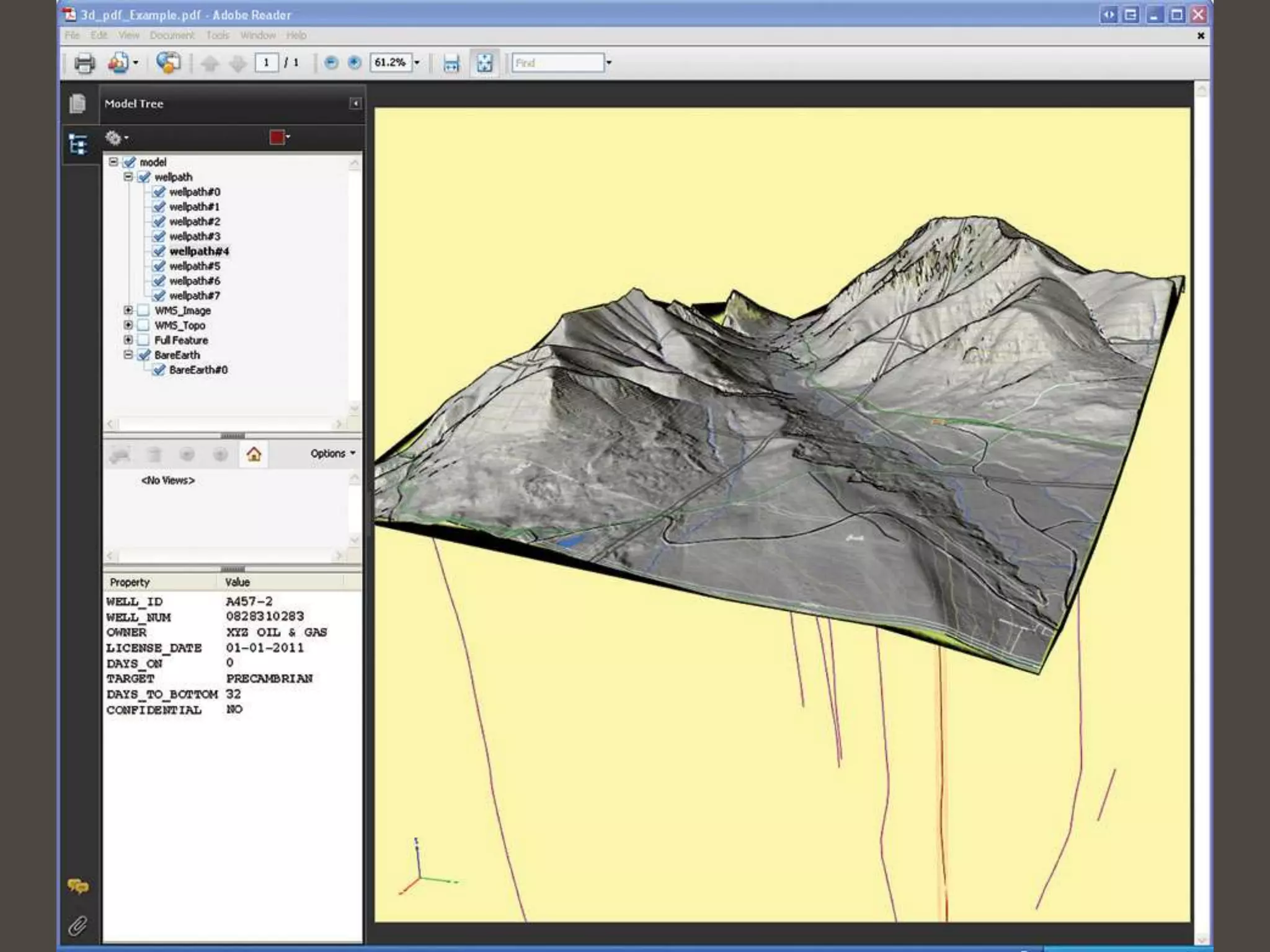

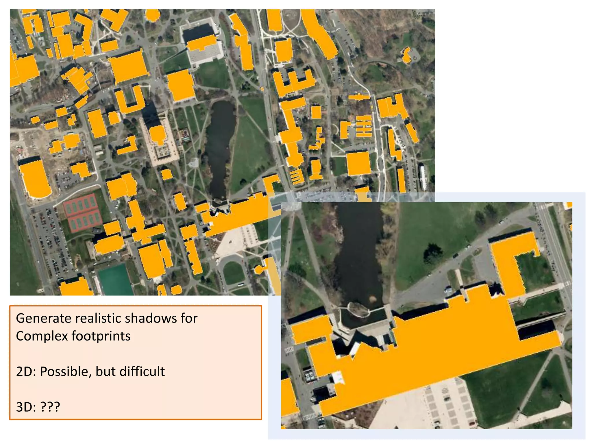
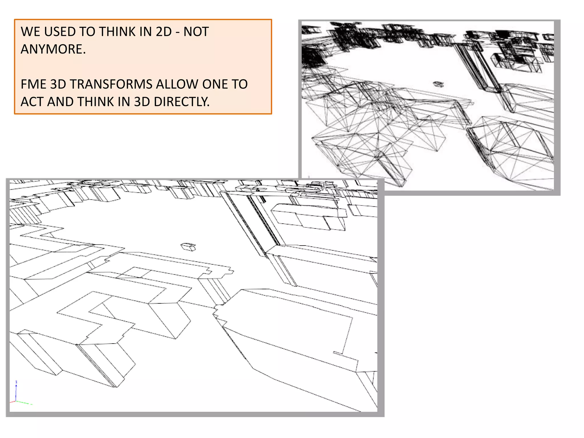
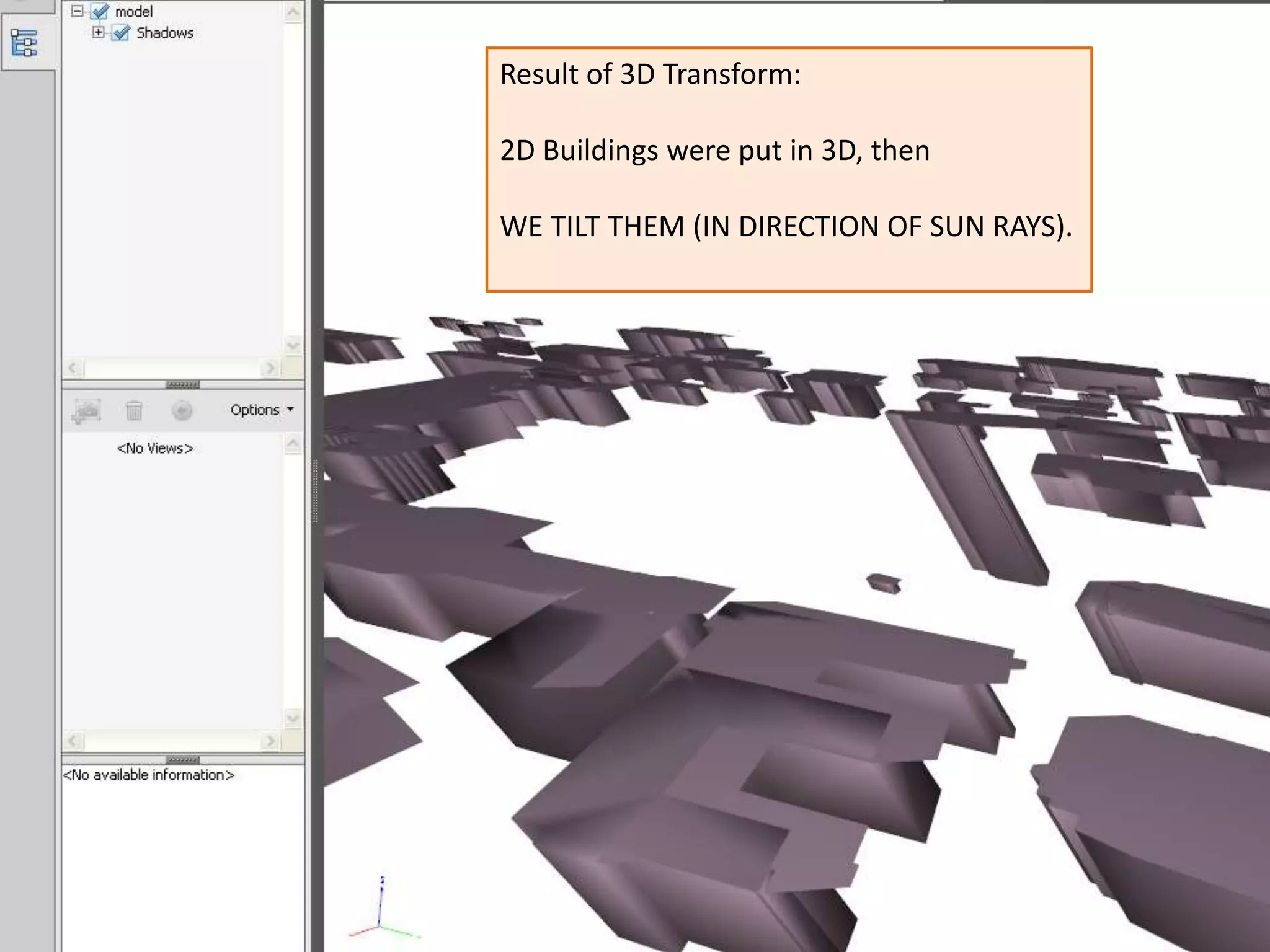
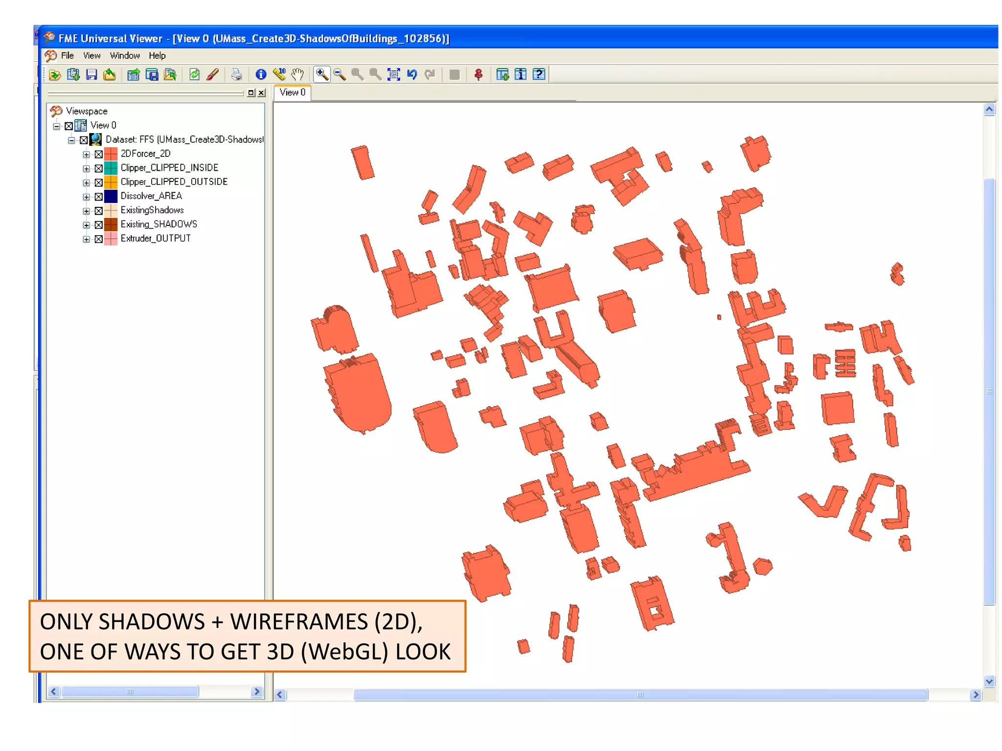
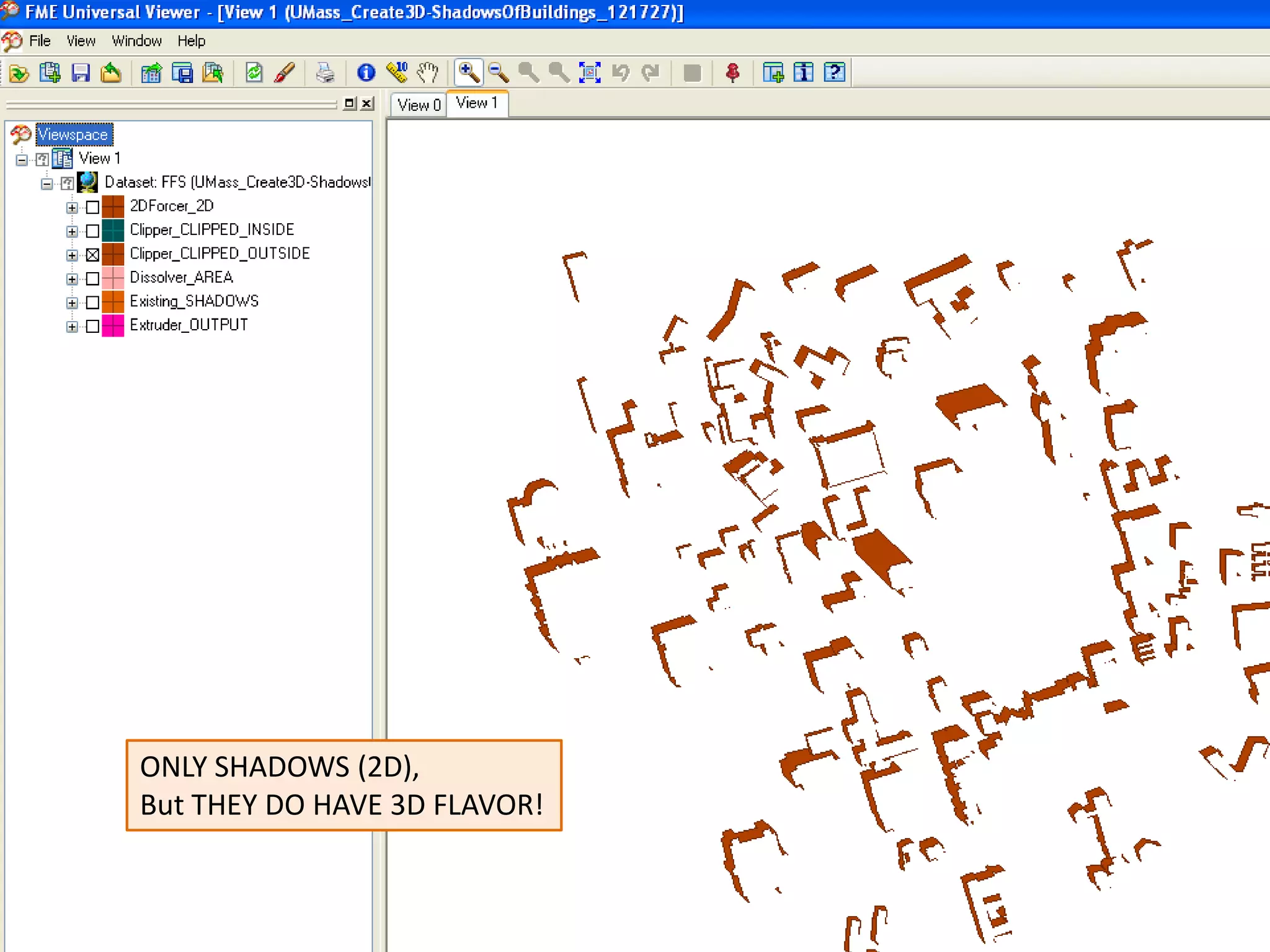
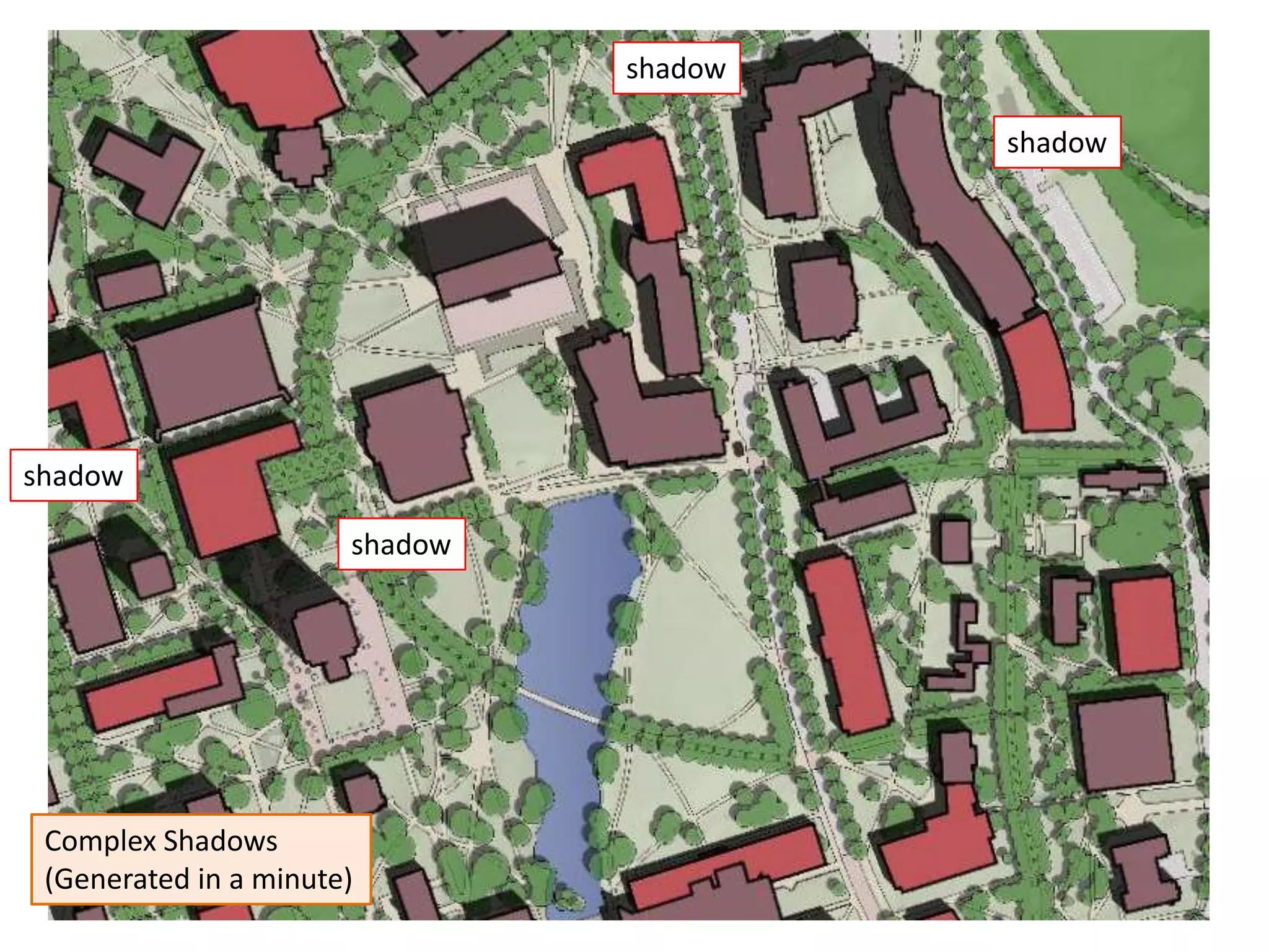

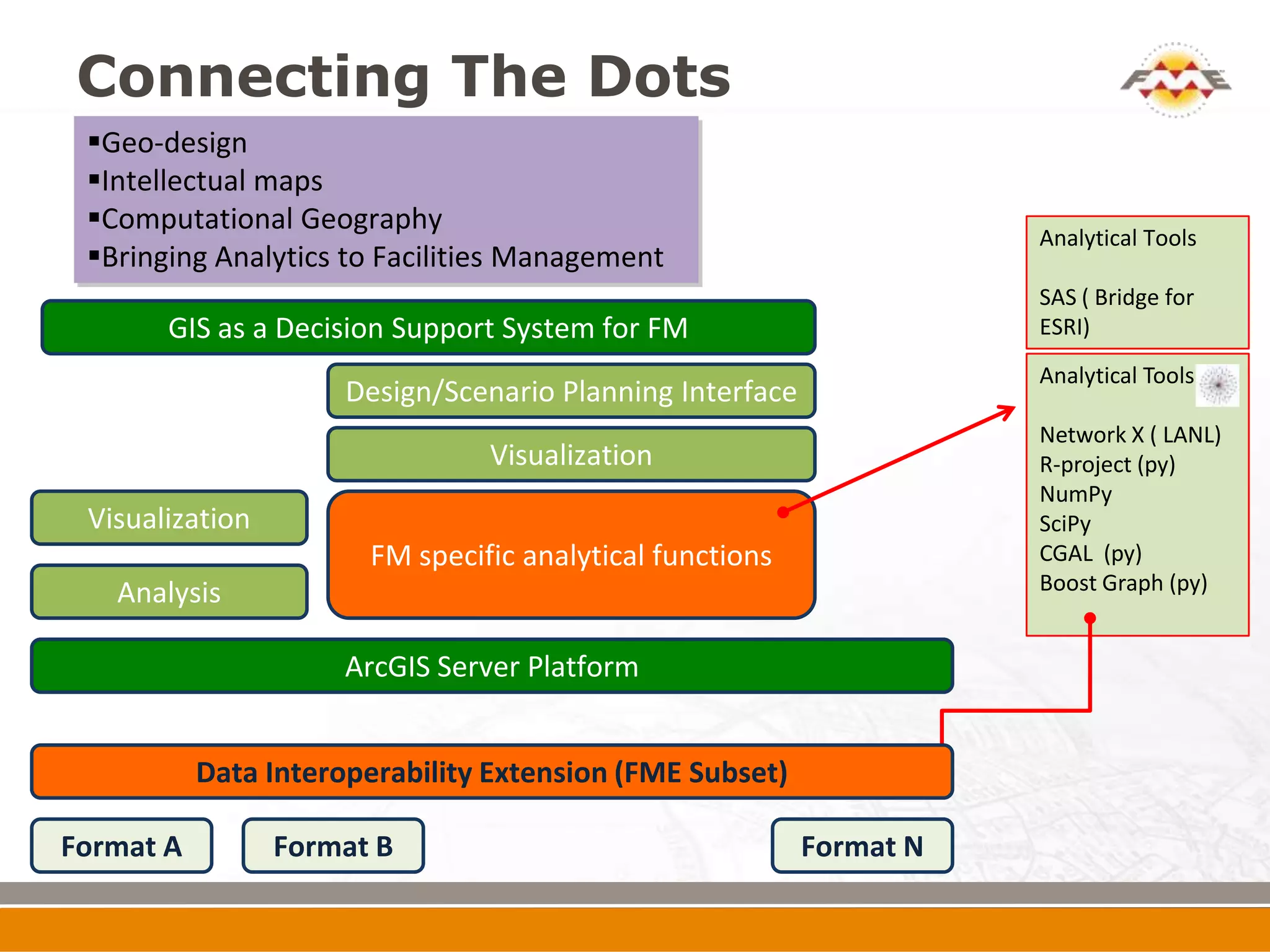
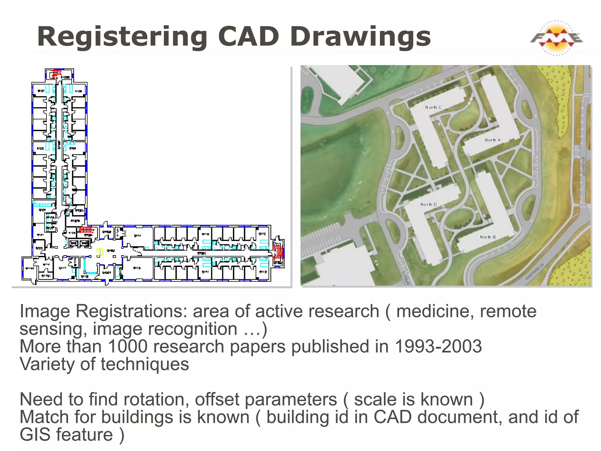
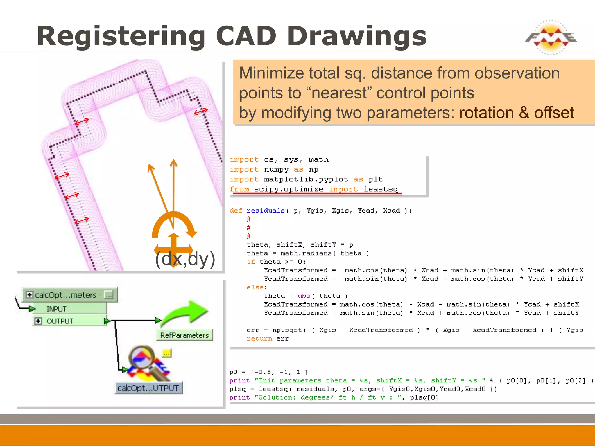
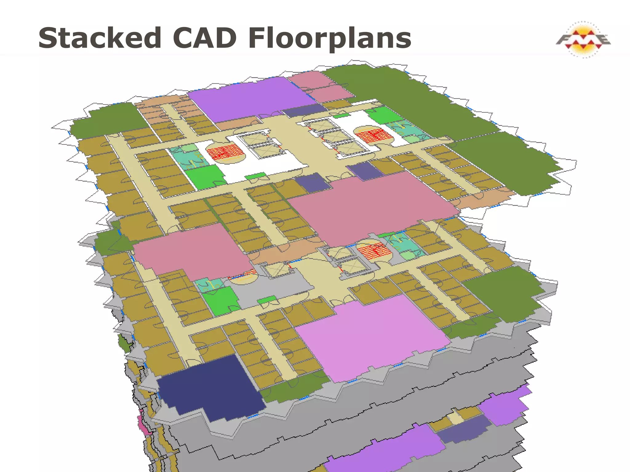
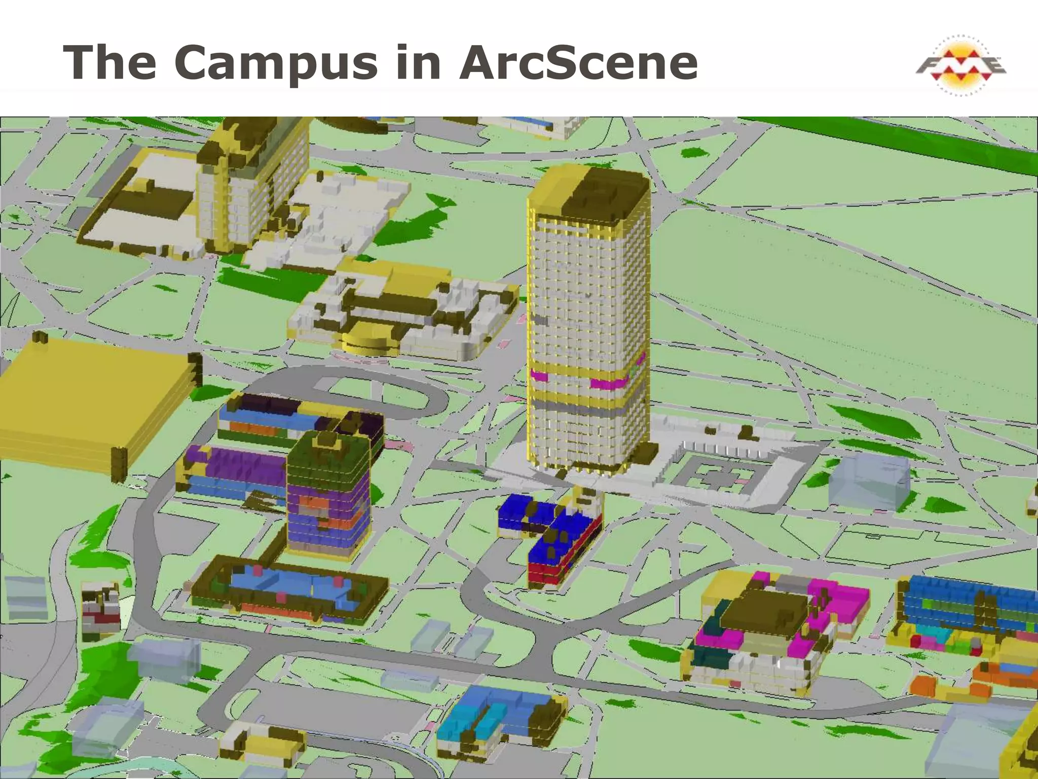
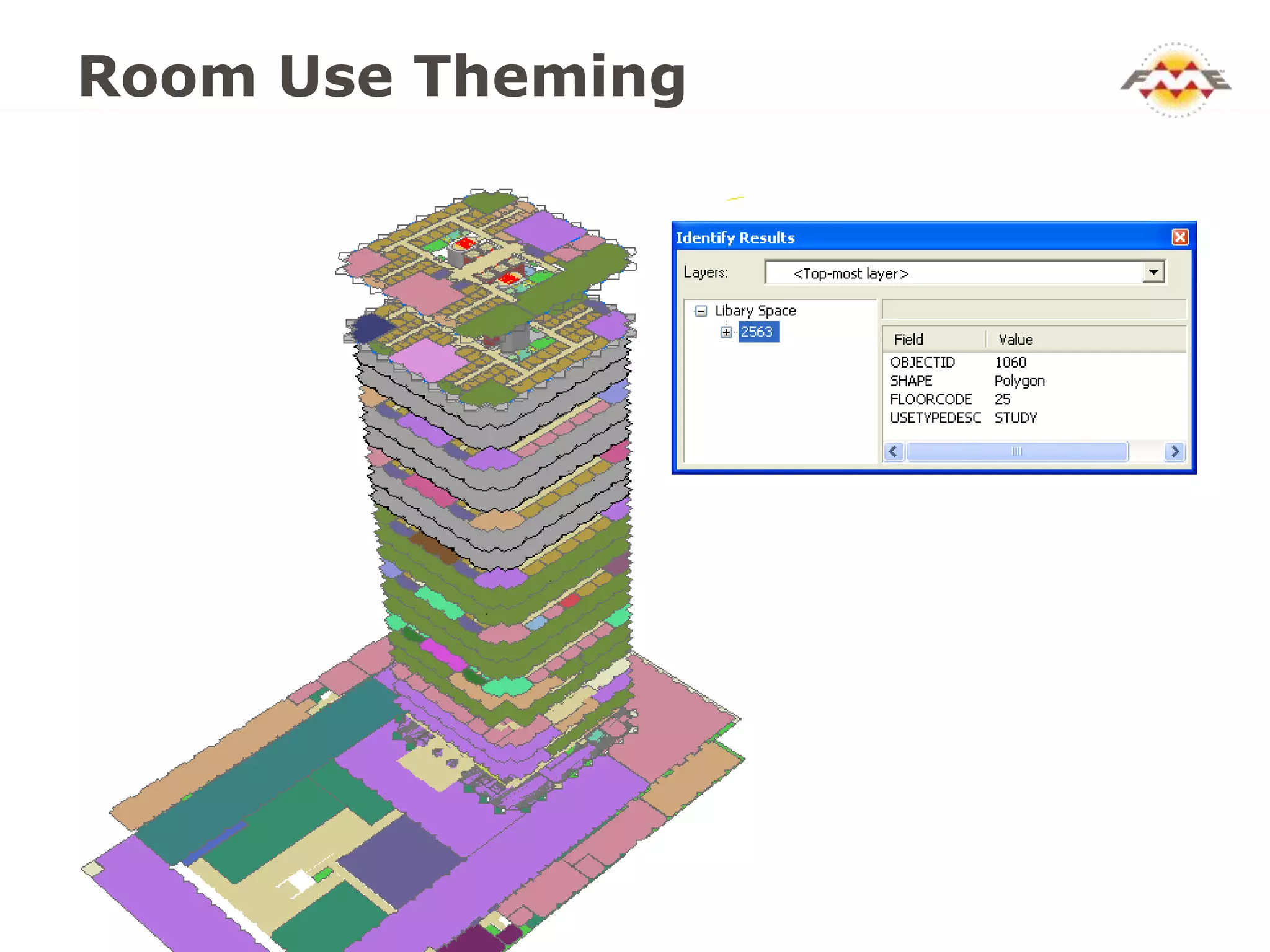
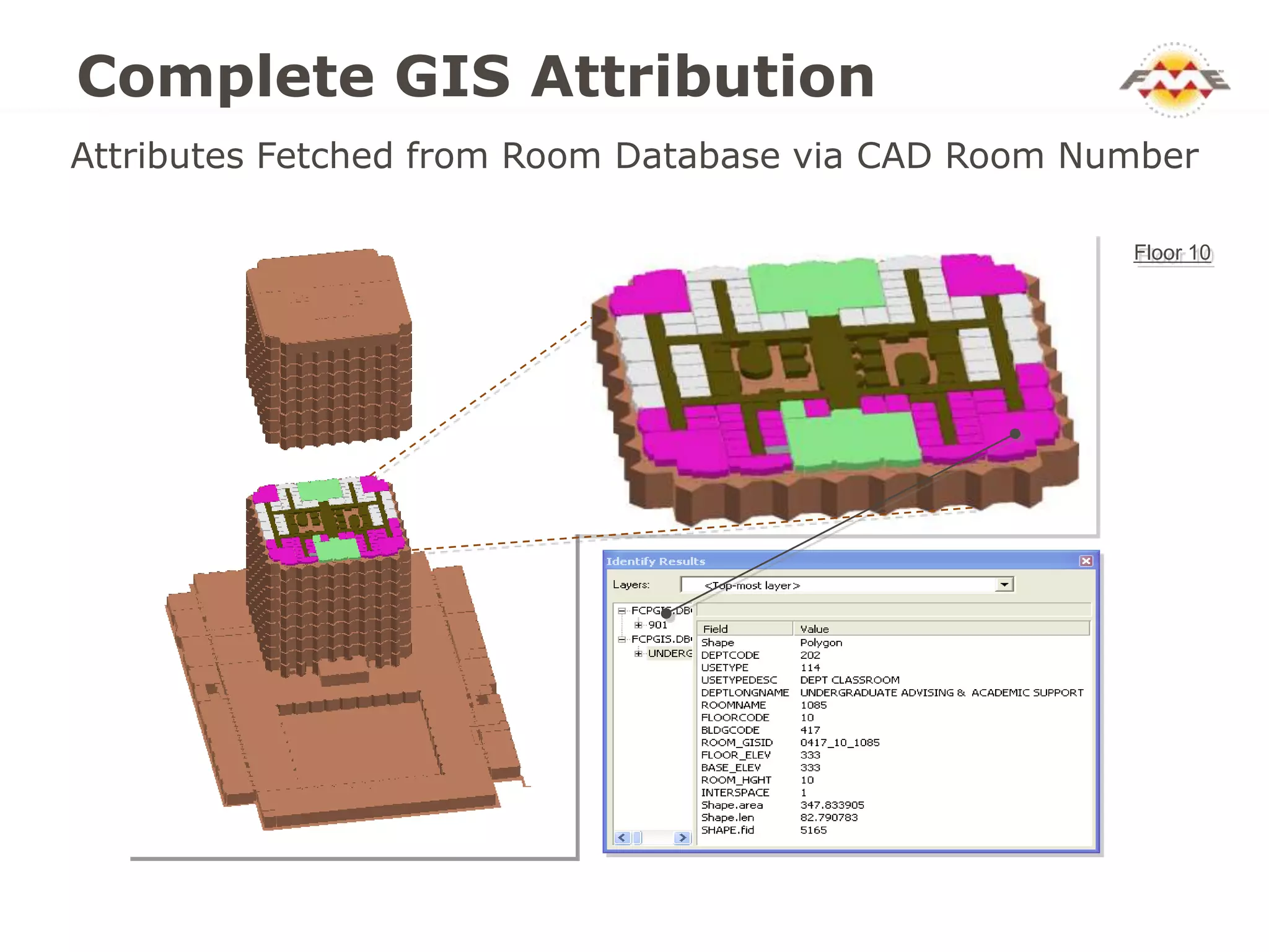
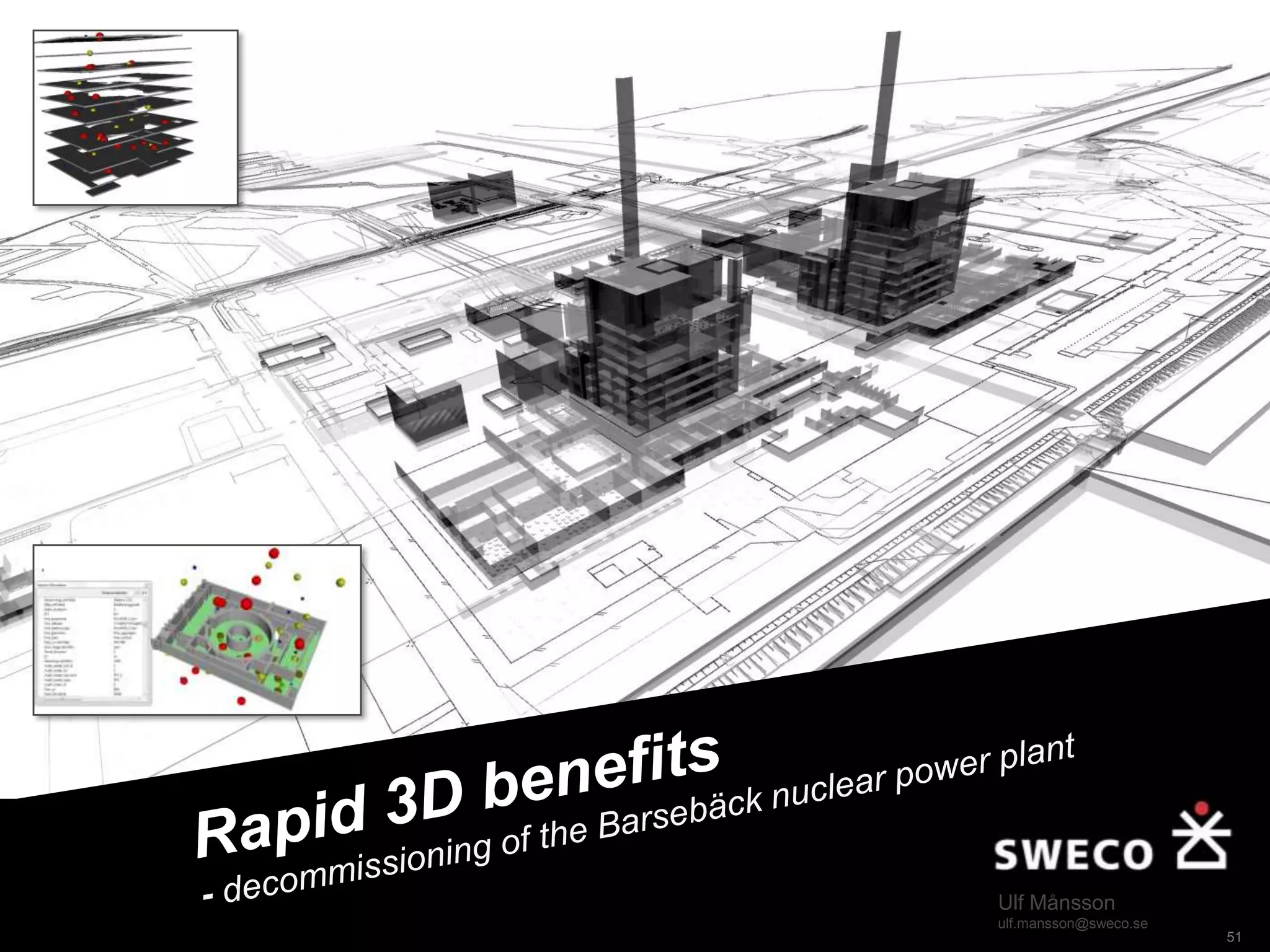
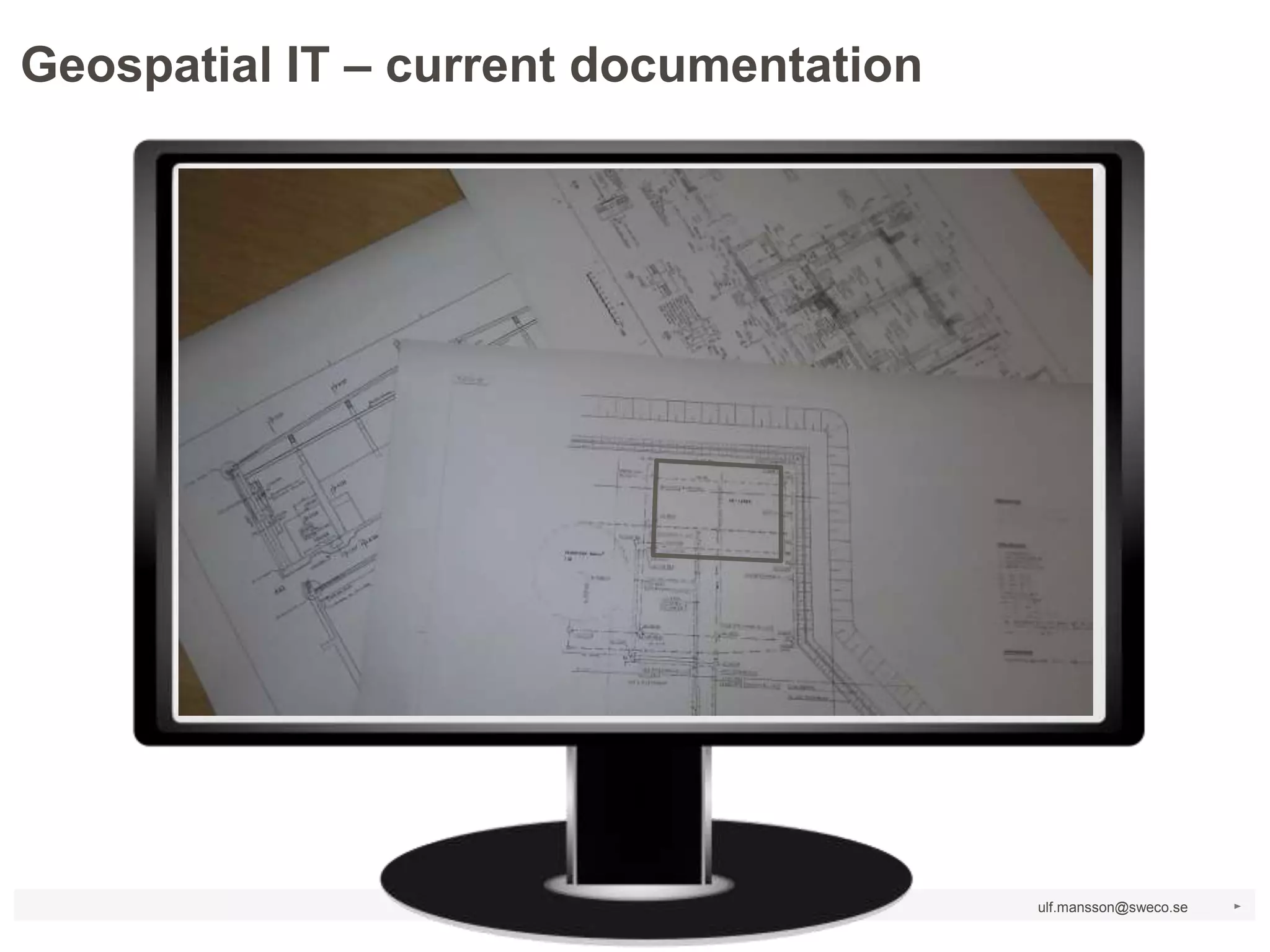
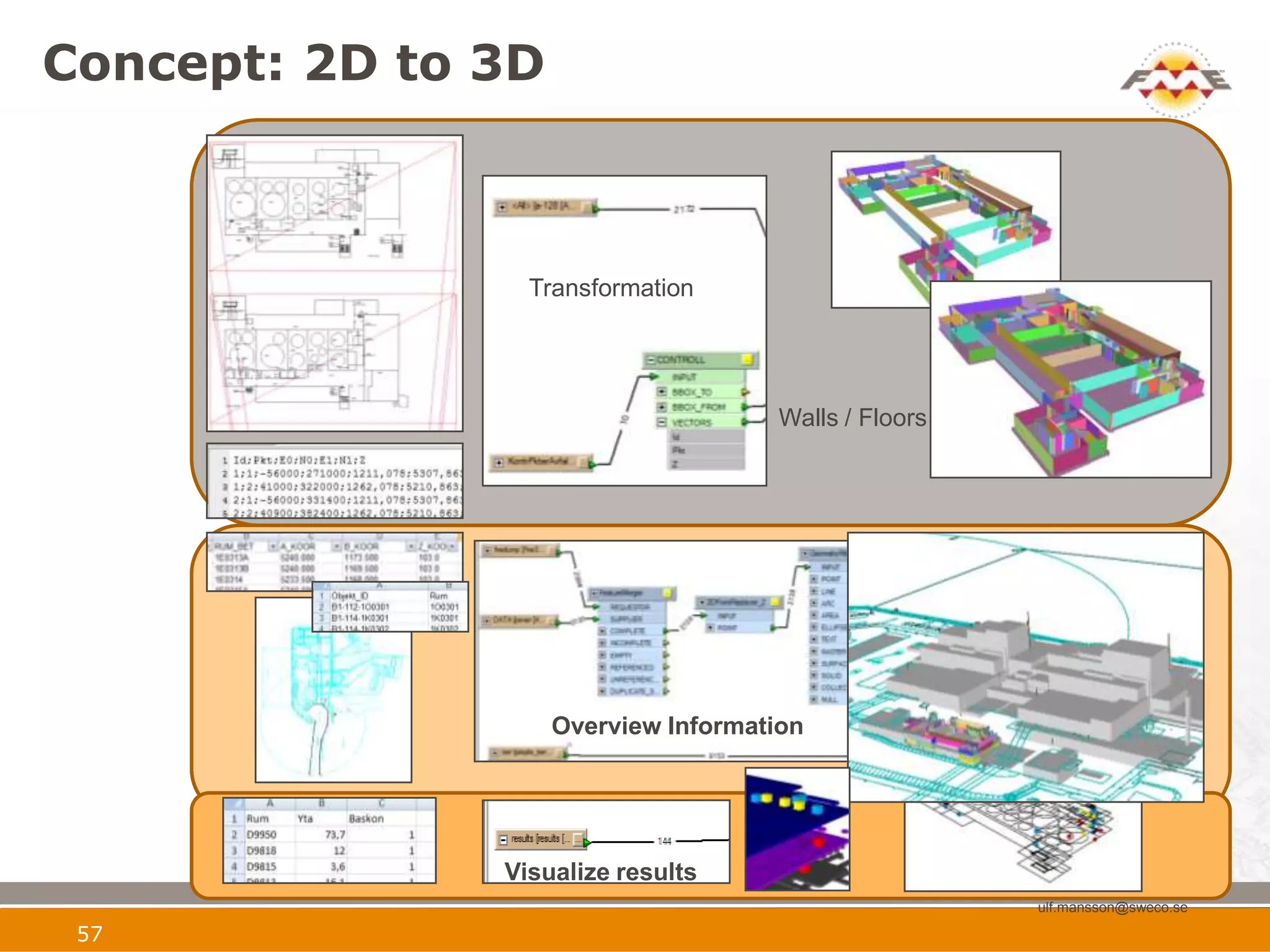
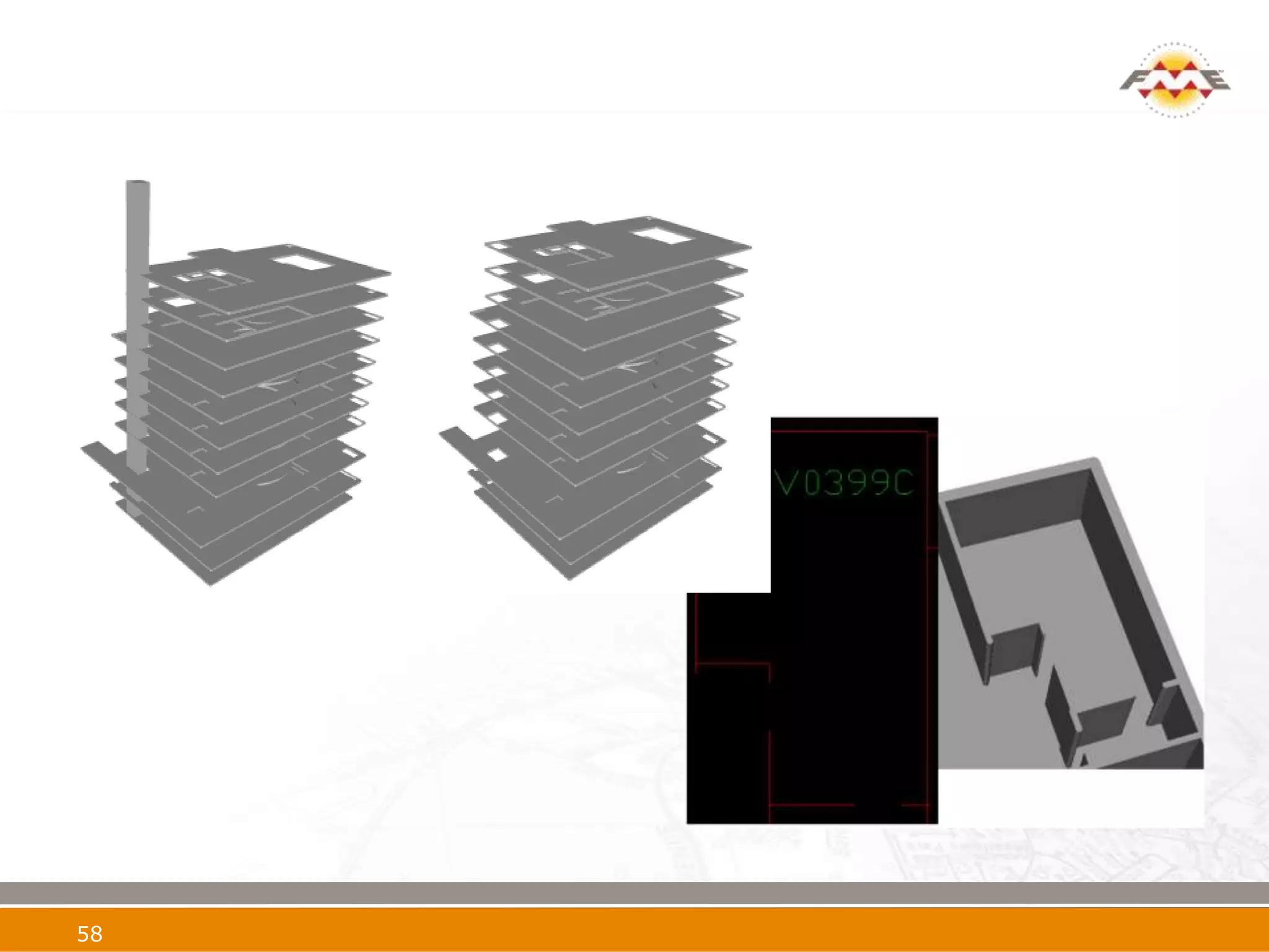
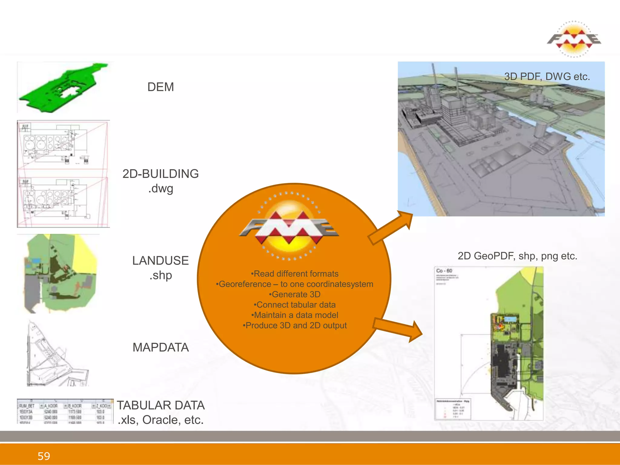
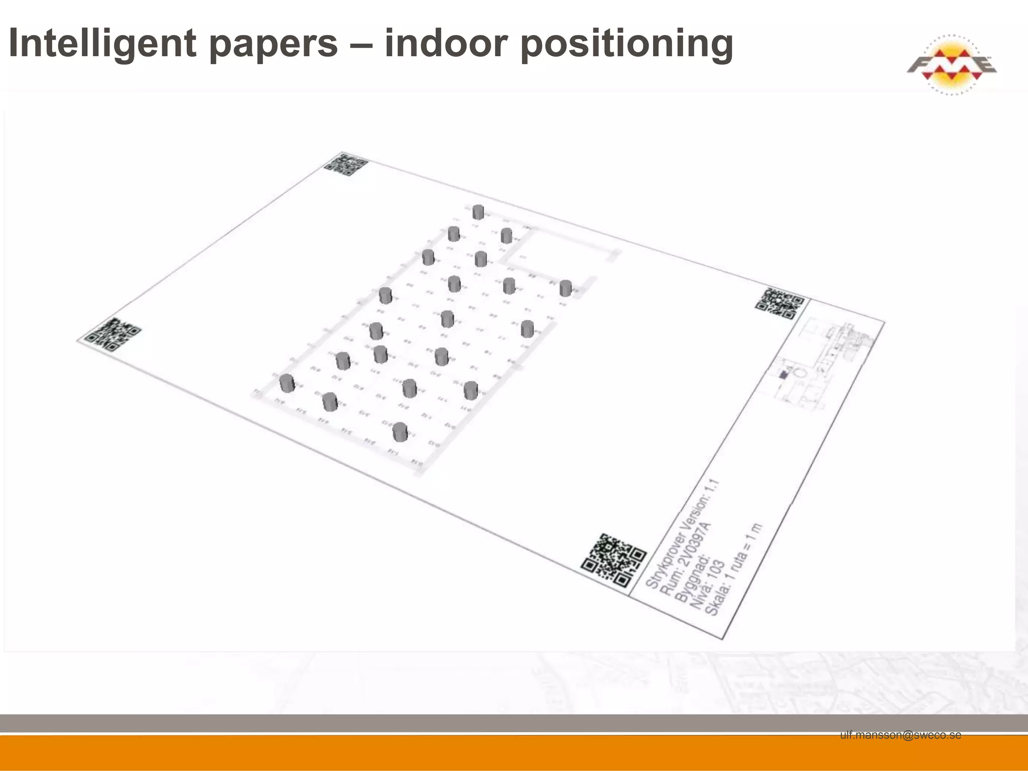
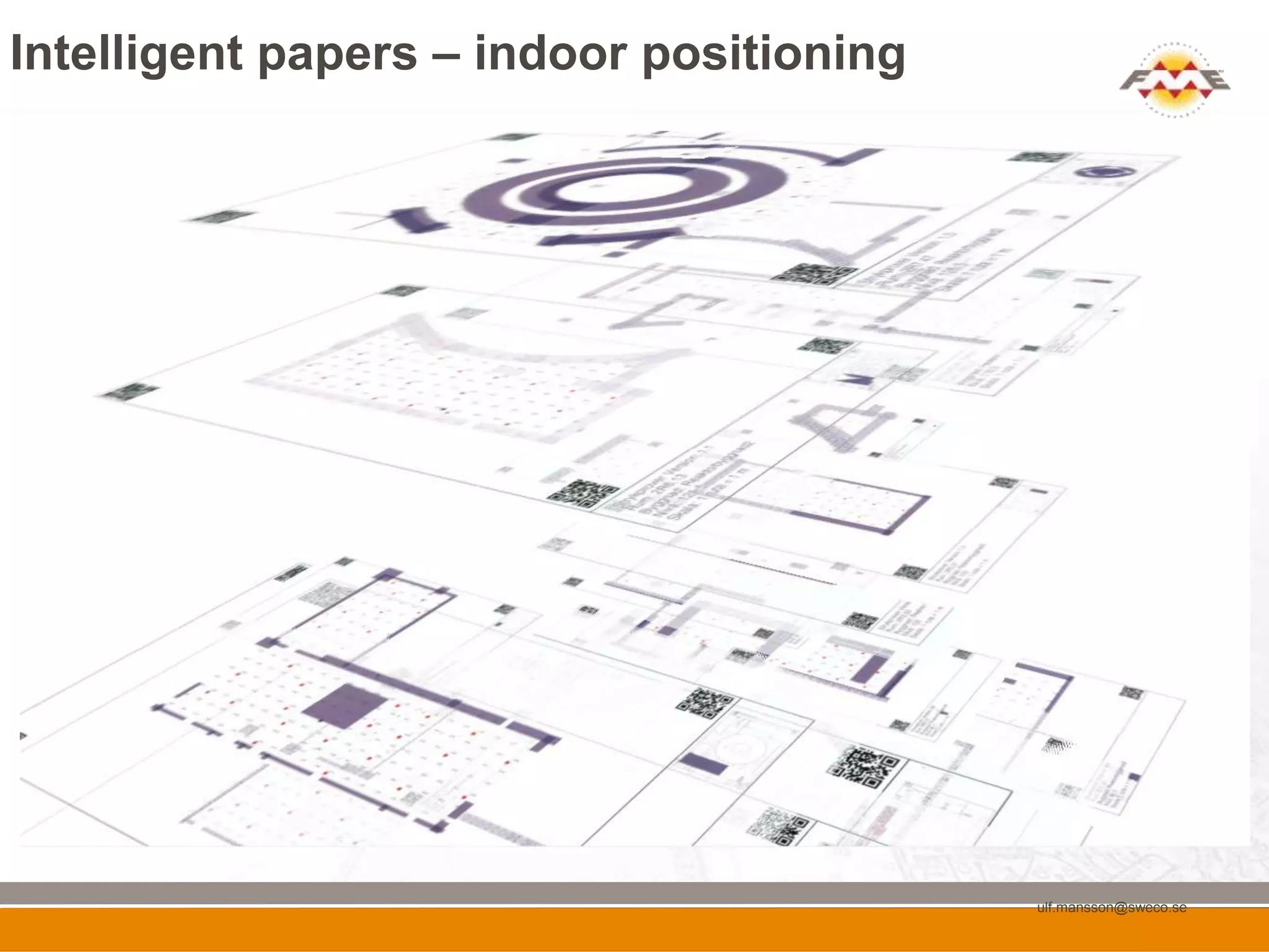
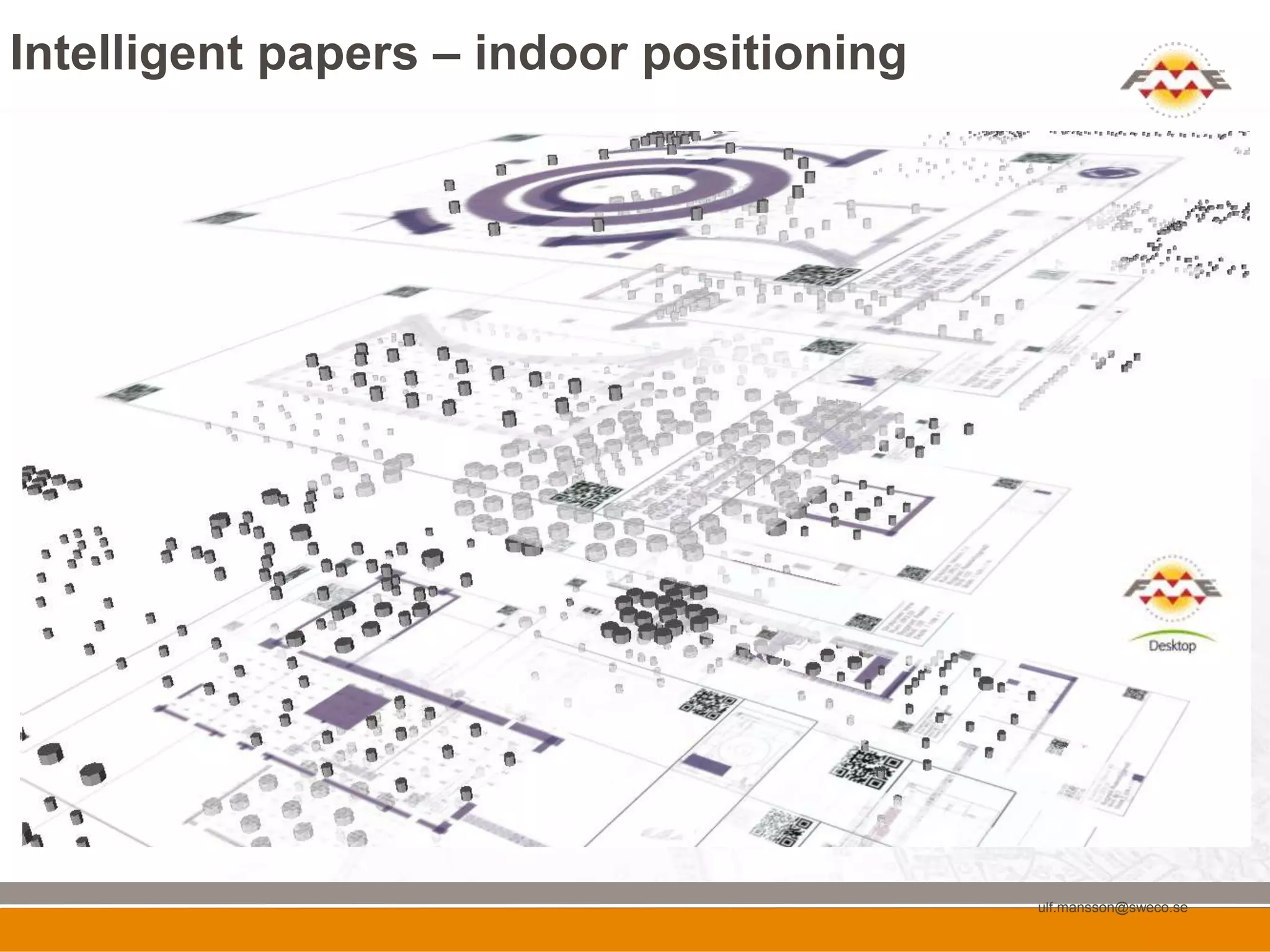
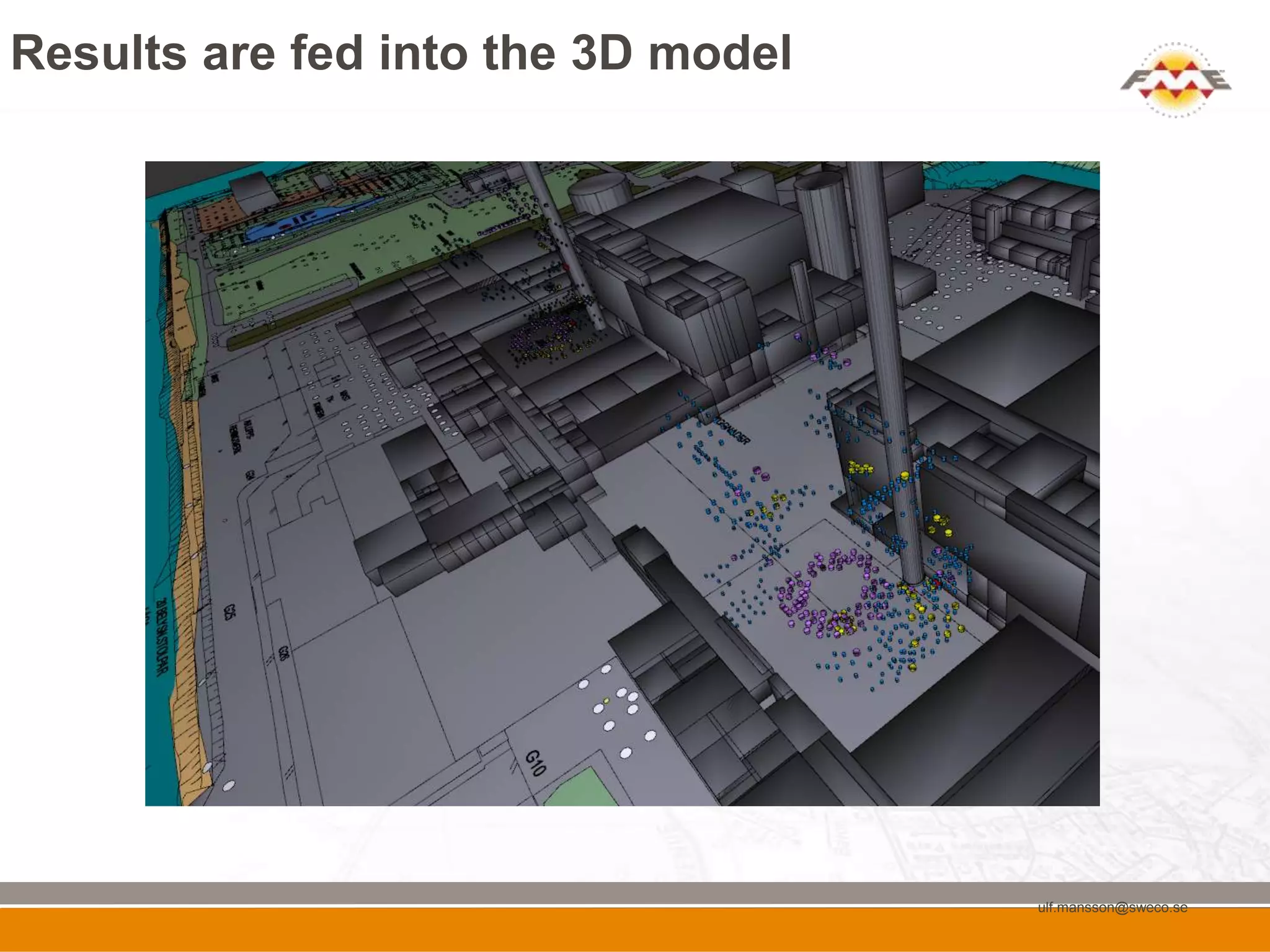
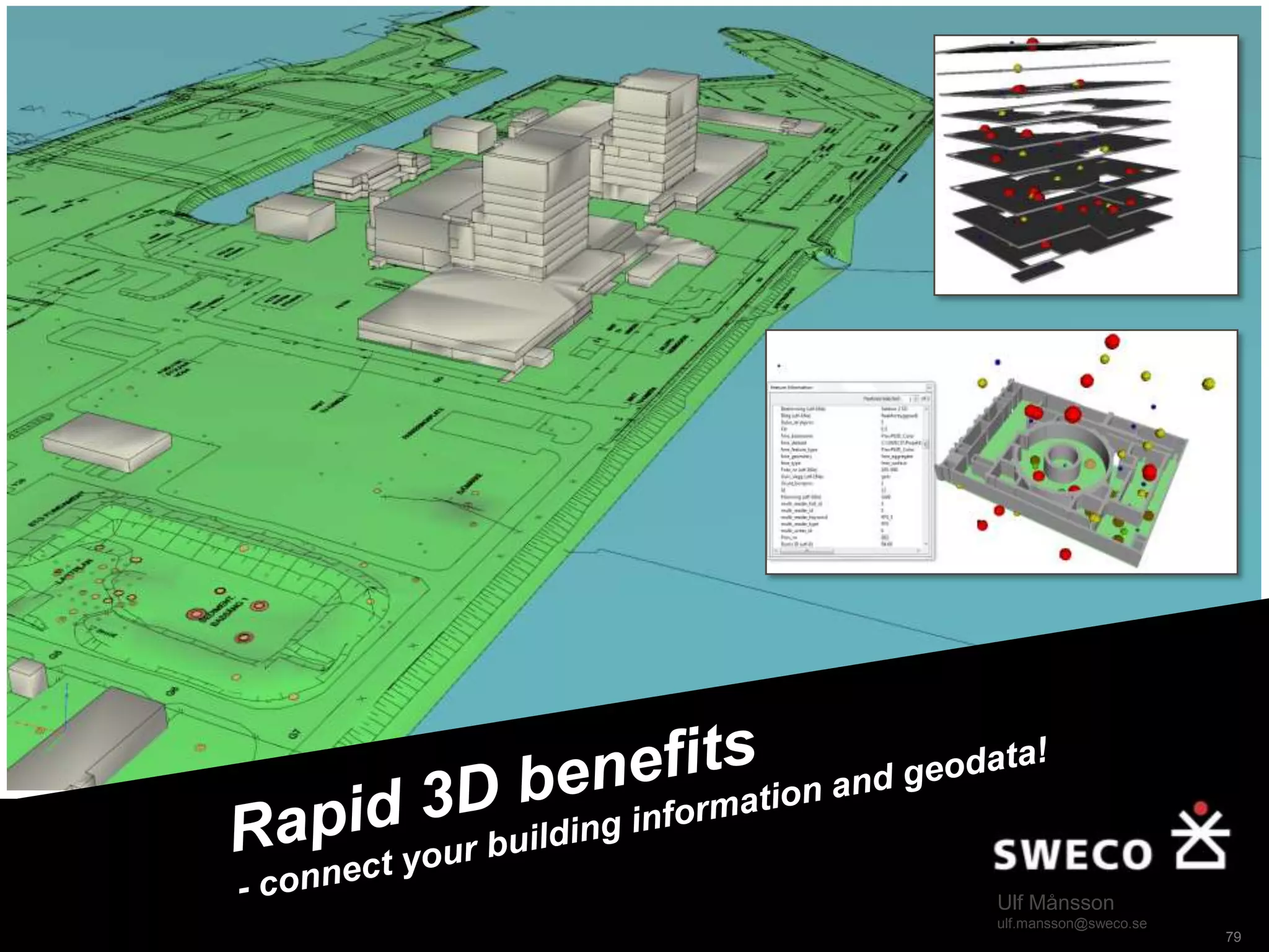
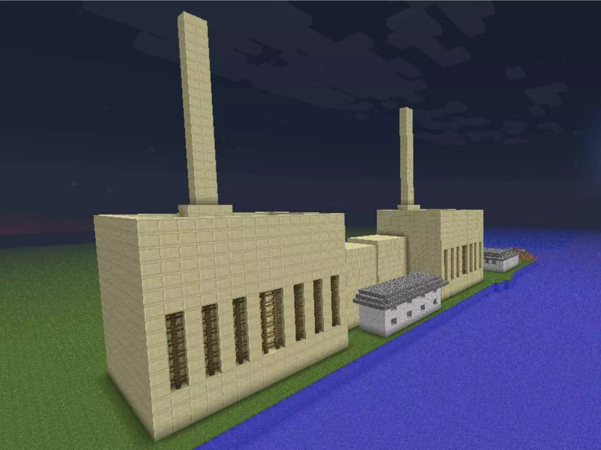
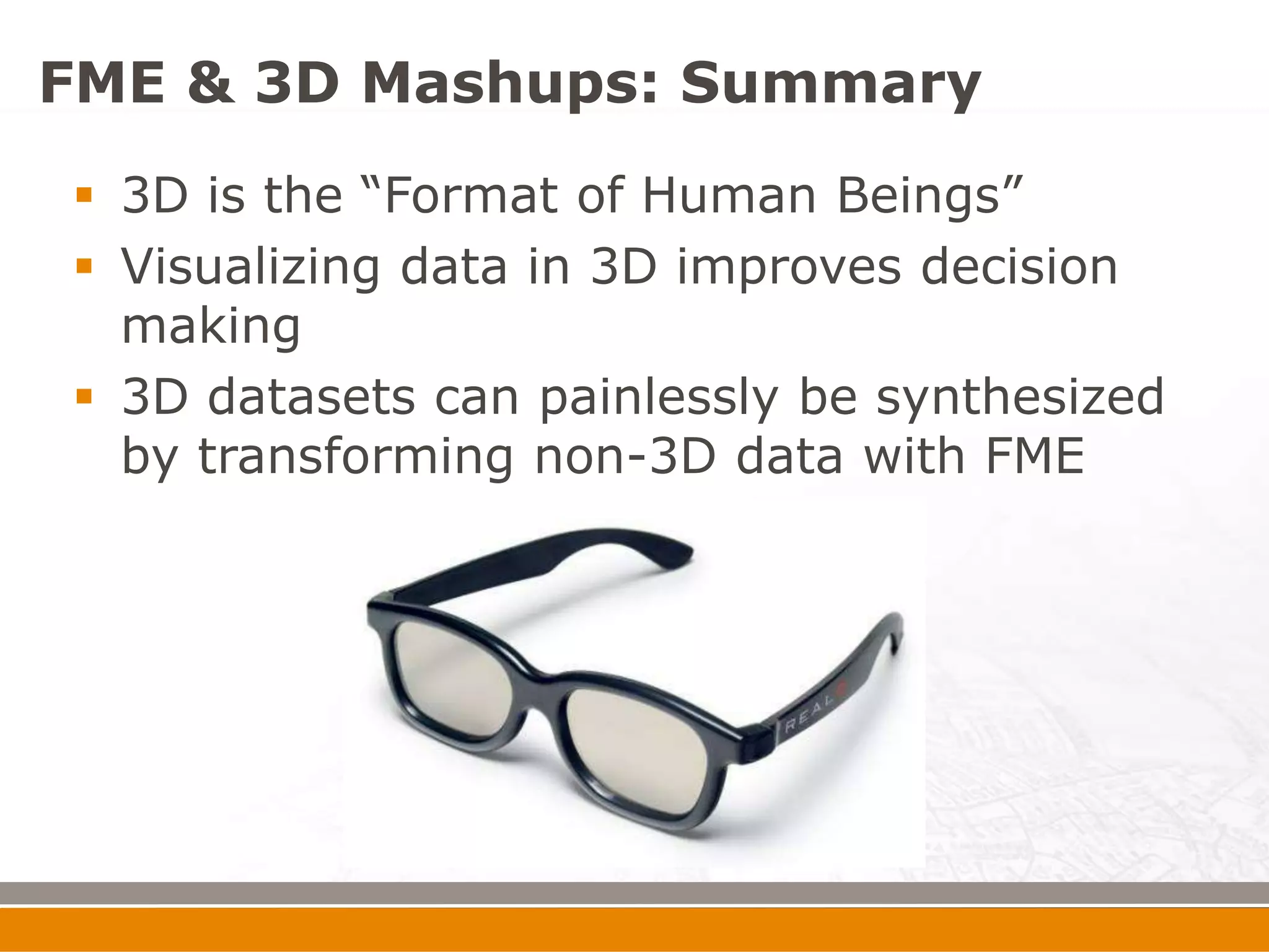
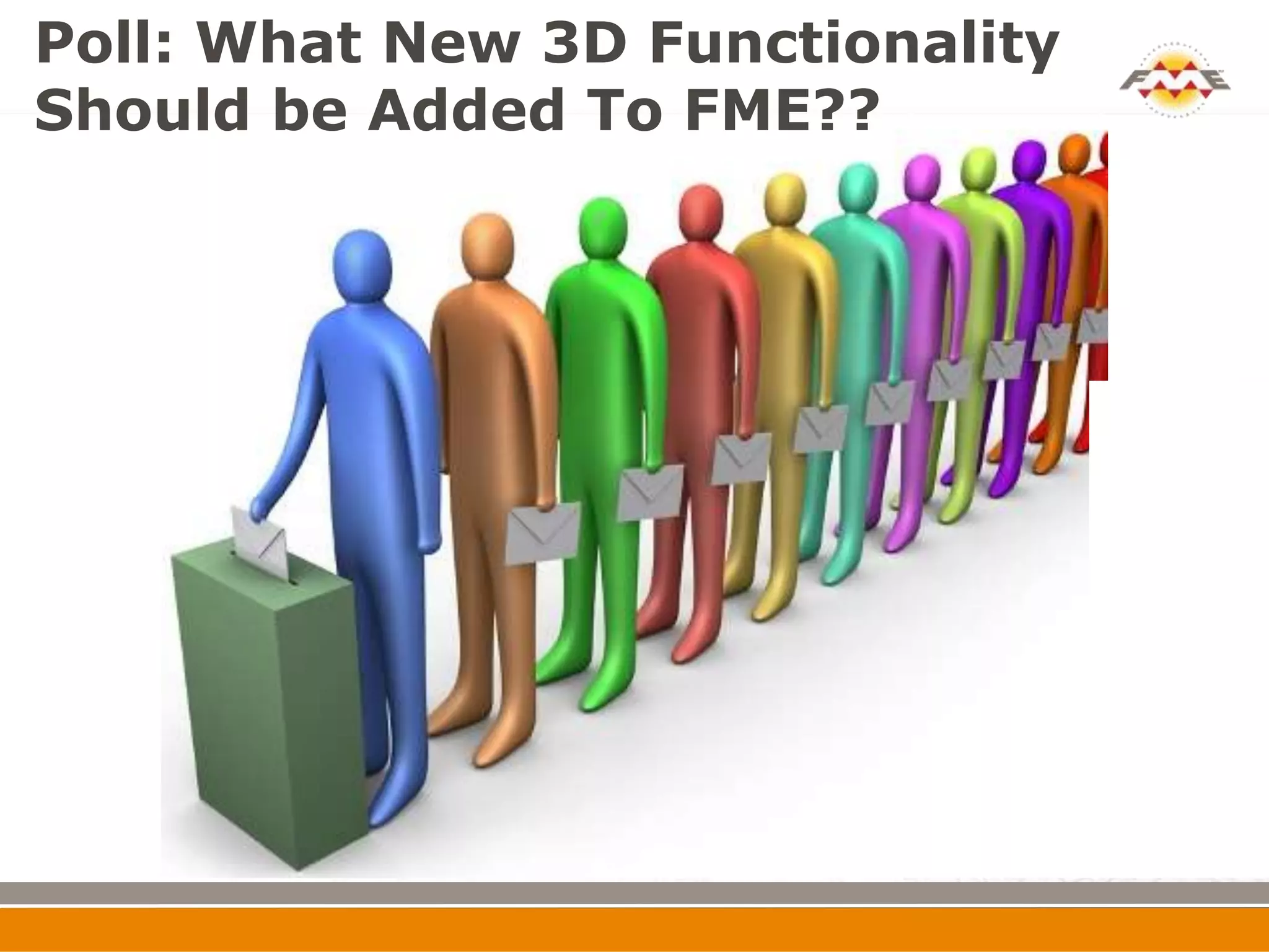


The document outlines a webinar on creating 3D mashups by integrating GIS, CAD, and BIM, featuring key speakers from Safe Software and Sweco. It explains the capabilities of FME in transforming spatial data into usable formats, generating 3D models, and emphasizes the importance of visualizing data in 3D to enhance decision-making. Various applications and tools for integrating and managing 3D data are discussed, alongside a call for feedback on future functionalities of FME.


