Download as PDF, PPTX

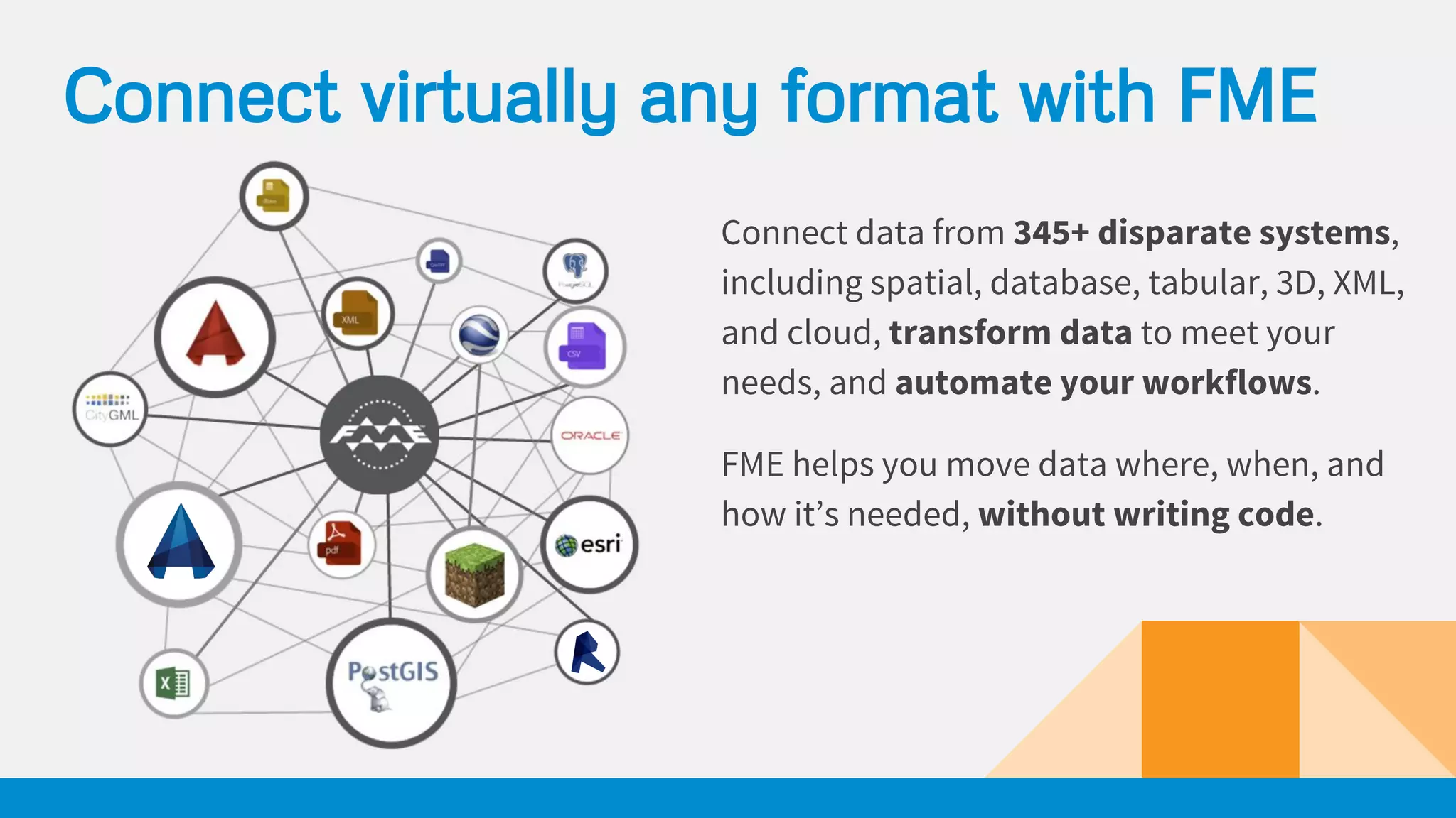


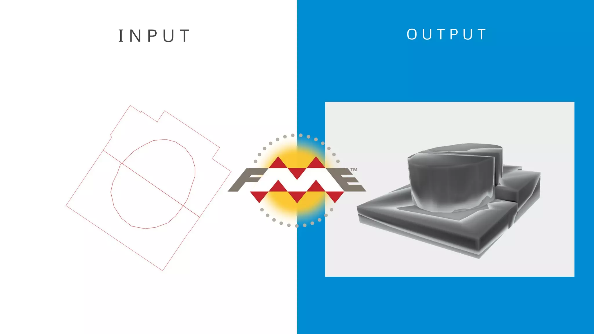


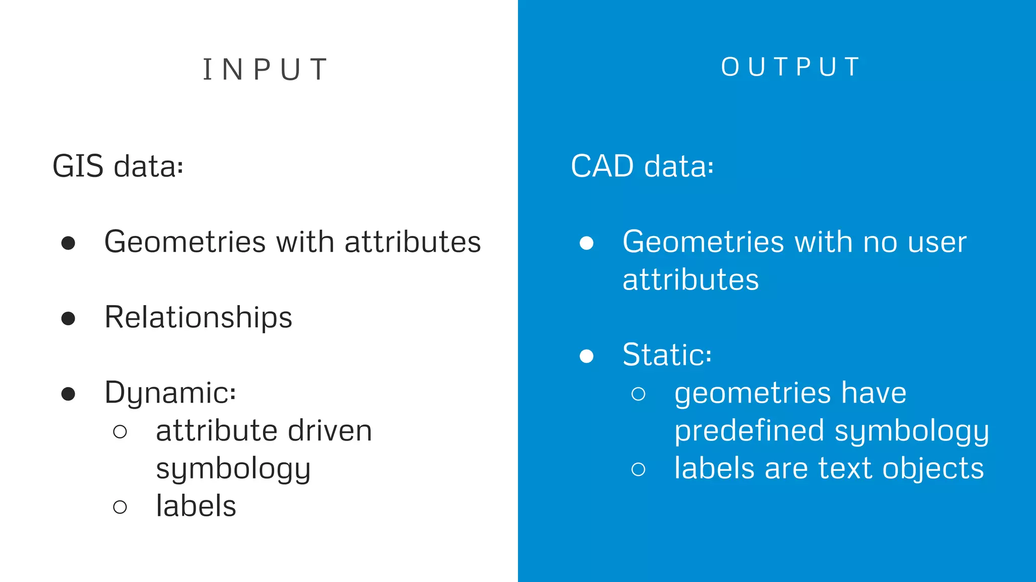

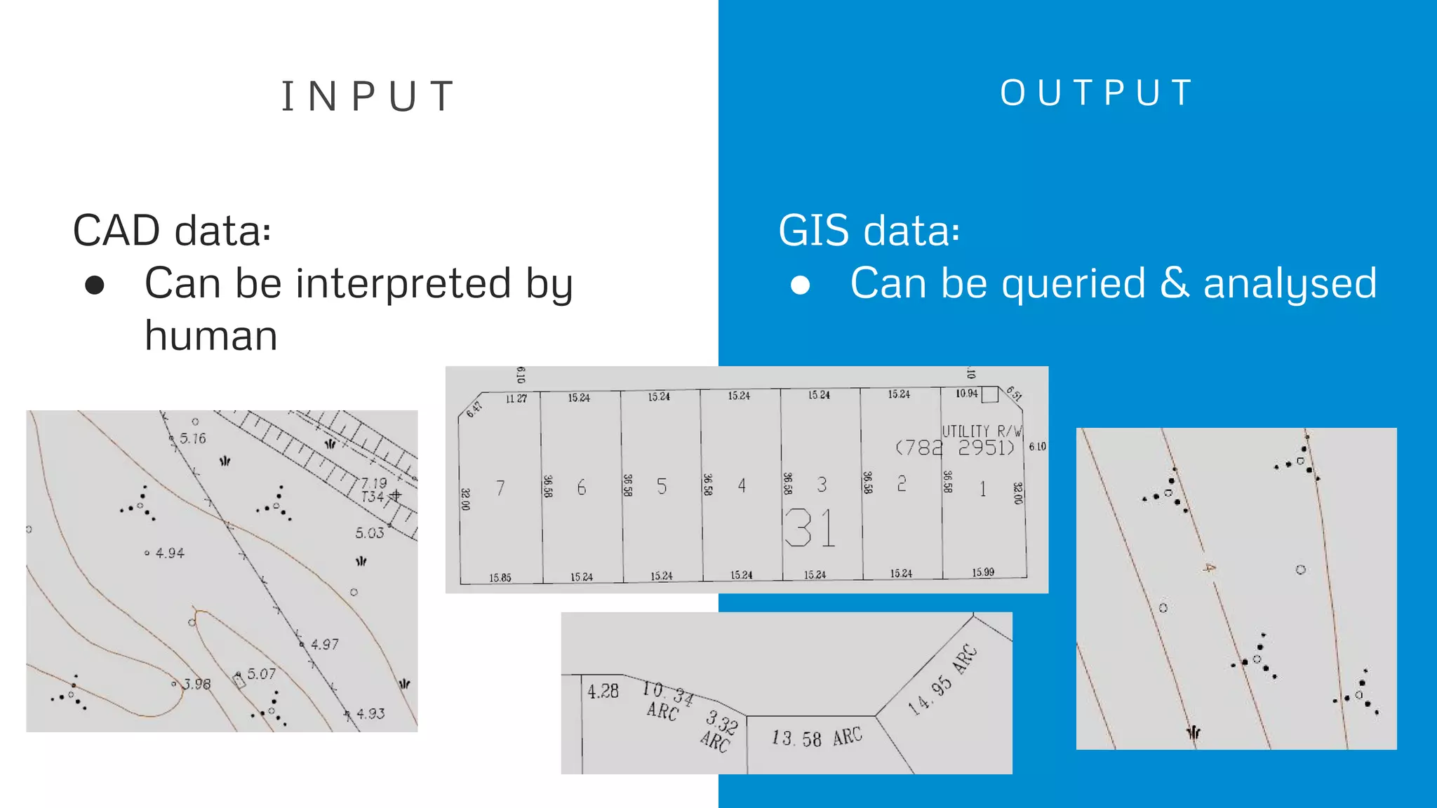


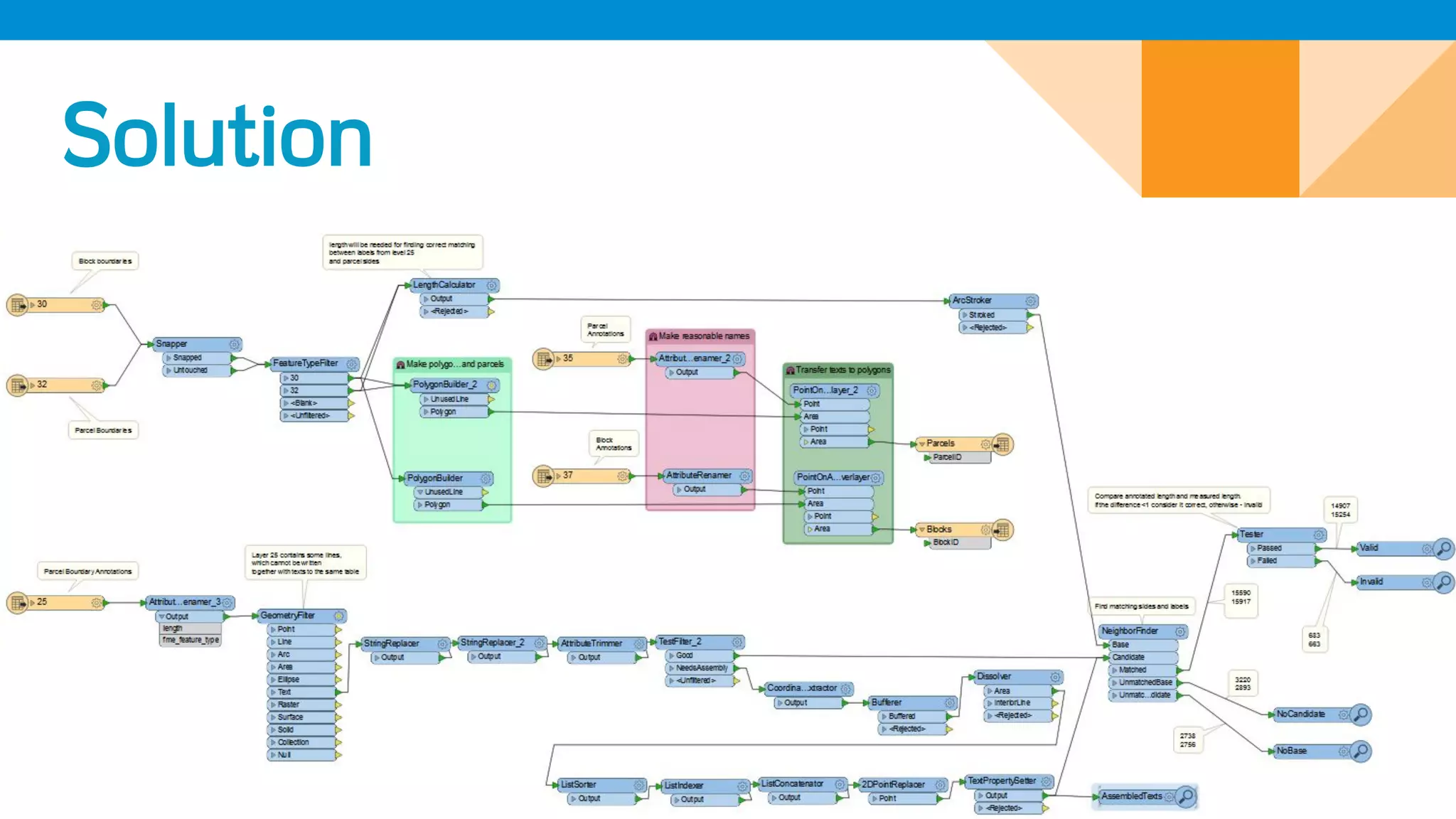

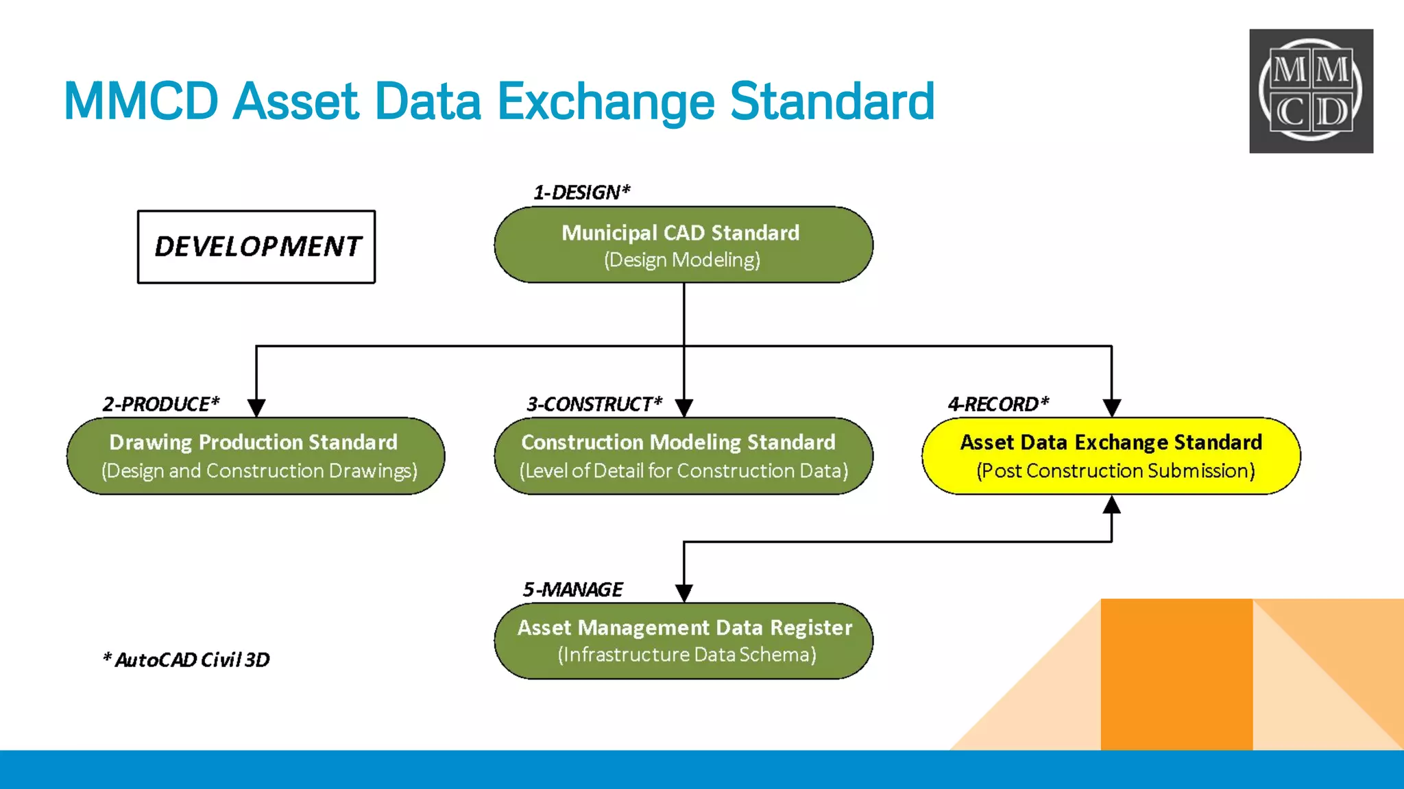

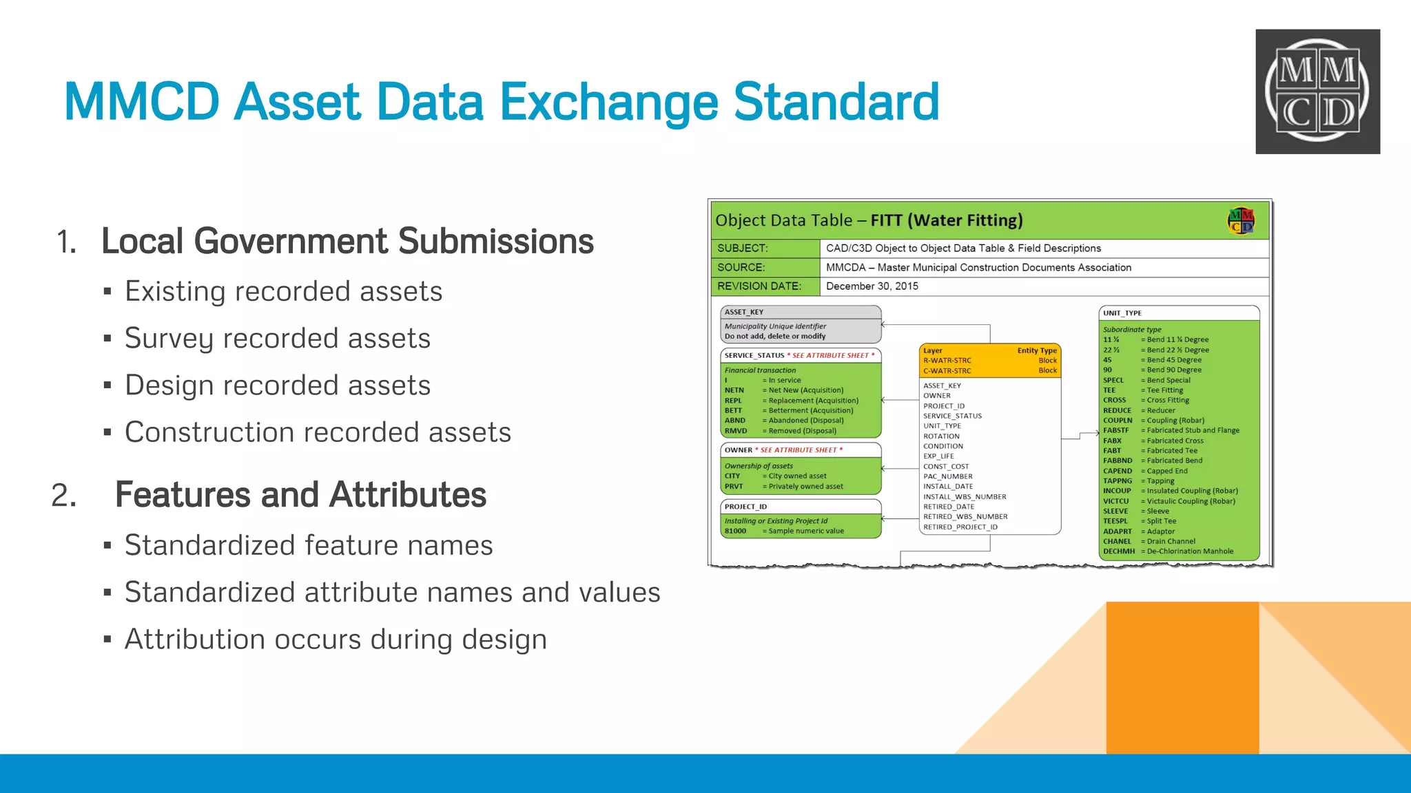
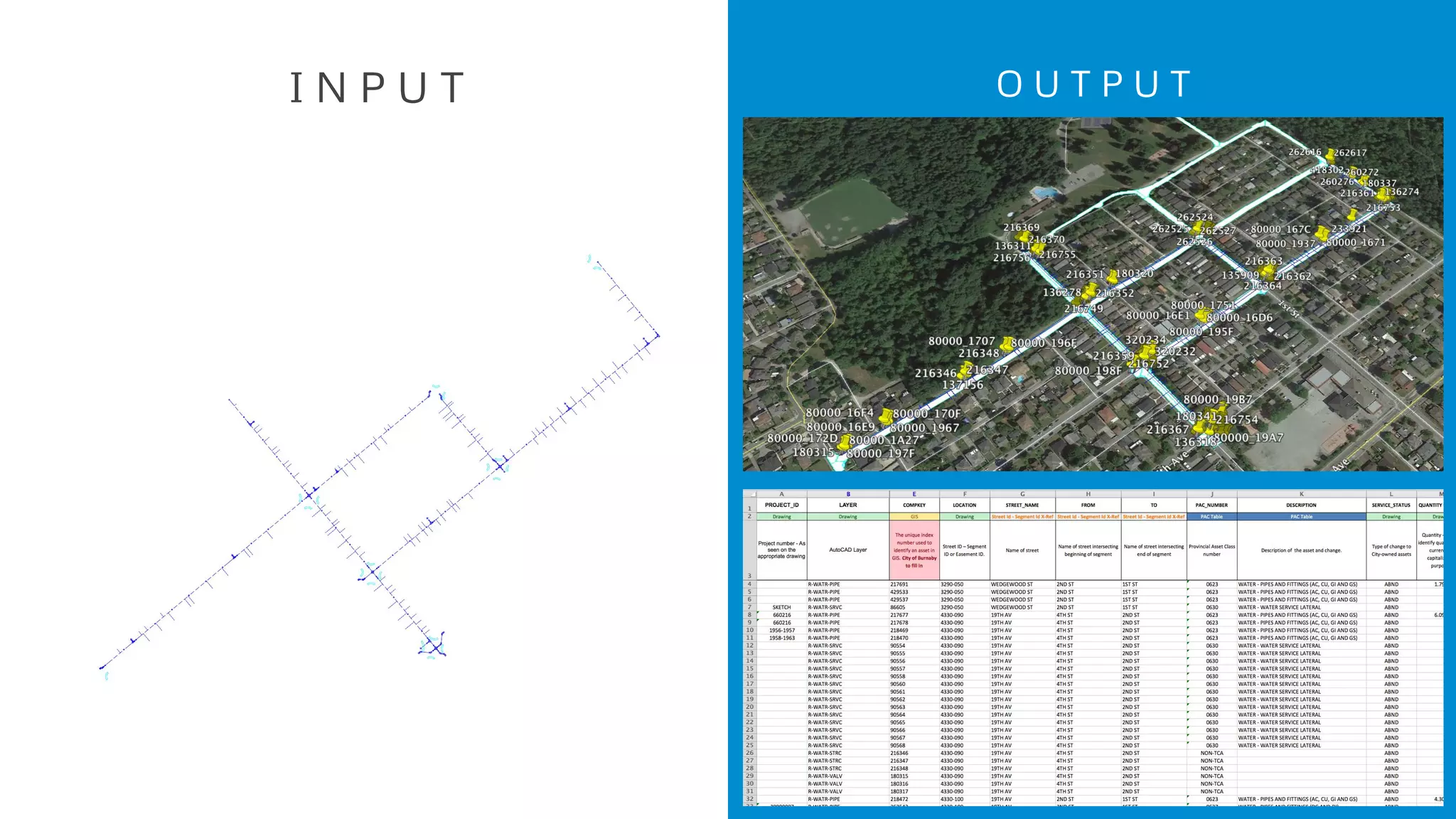


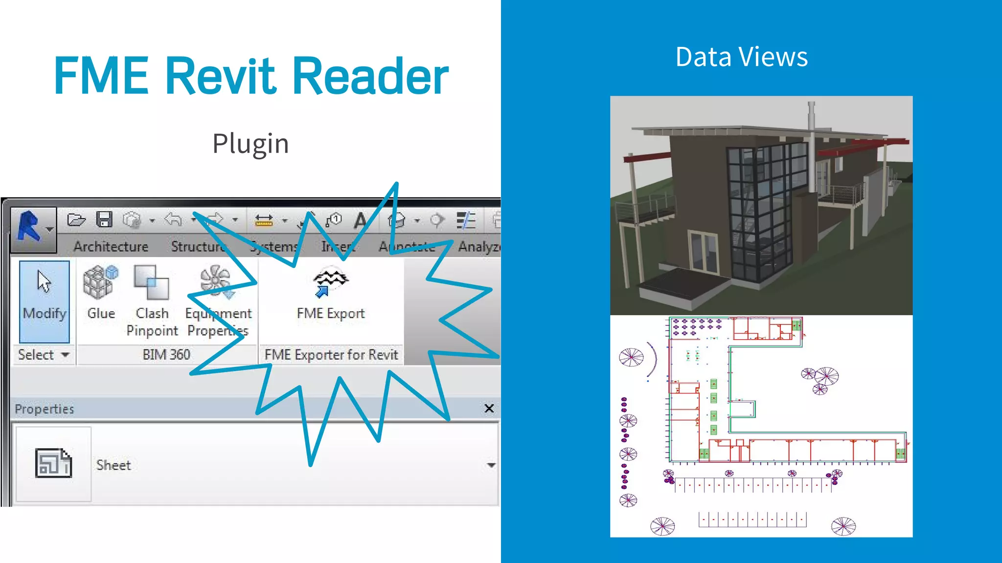


The document discusses leveraging Autodesk products with FME to automate workflows and transform data across various formats, including GIS and CAD. It presents multiple problems and solutions related to data management, including validating CAD files and automating data imports. Additionally, it highlights the importance of data governance and provides resources for further learning about FME capabilities.