Download as PDF, PPTX


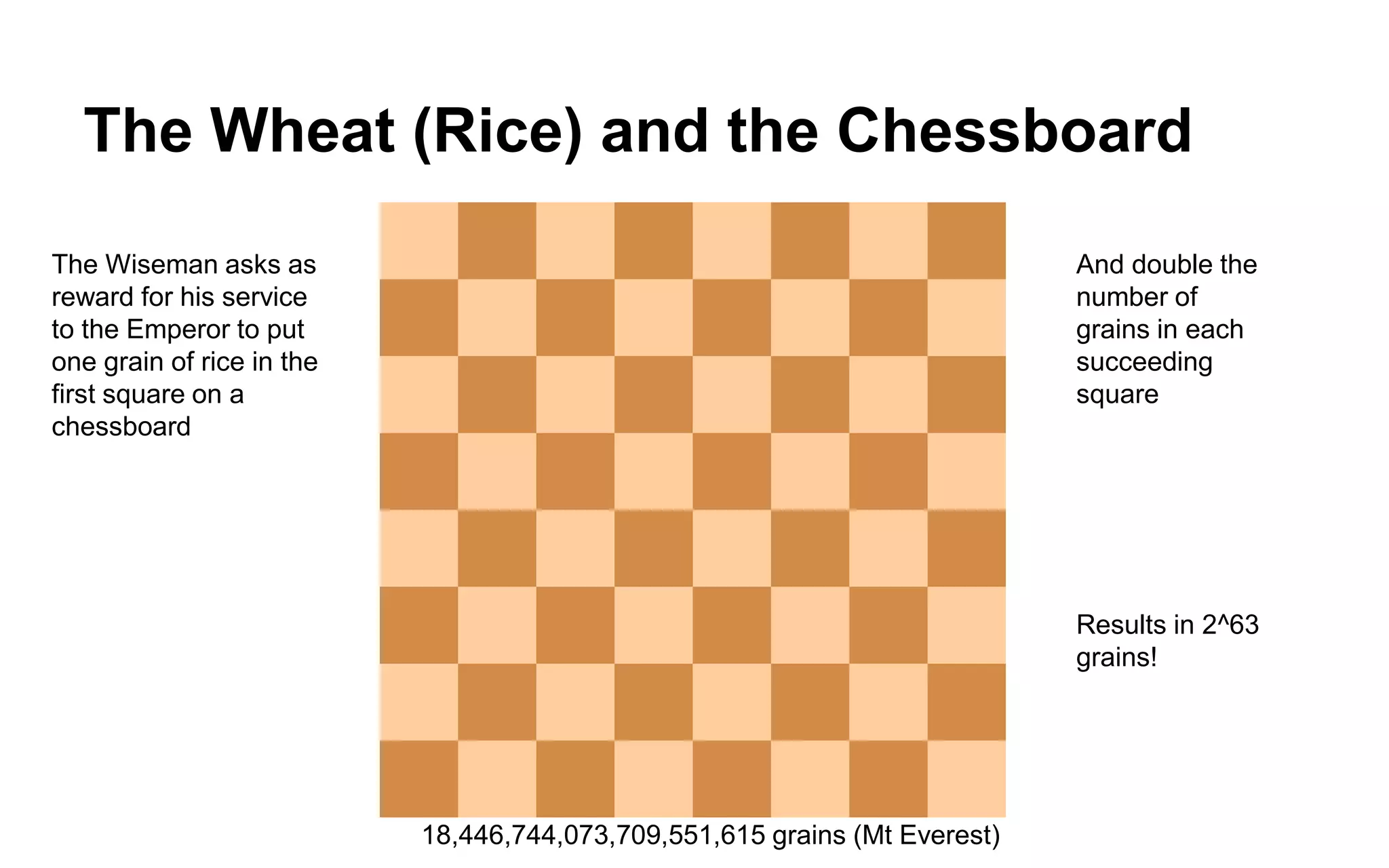
![CityGML | Characteristics
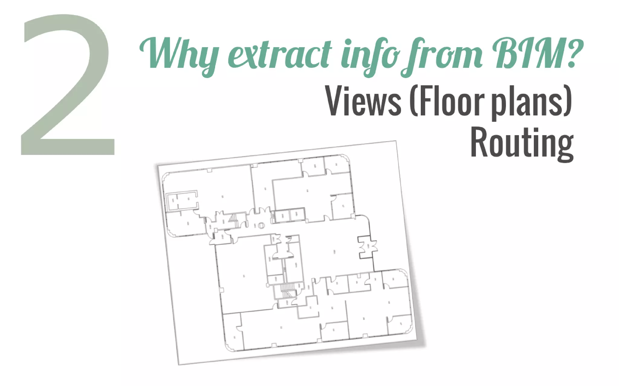
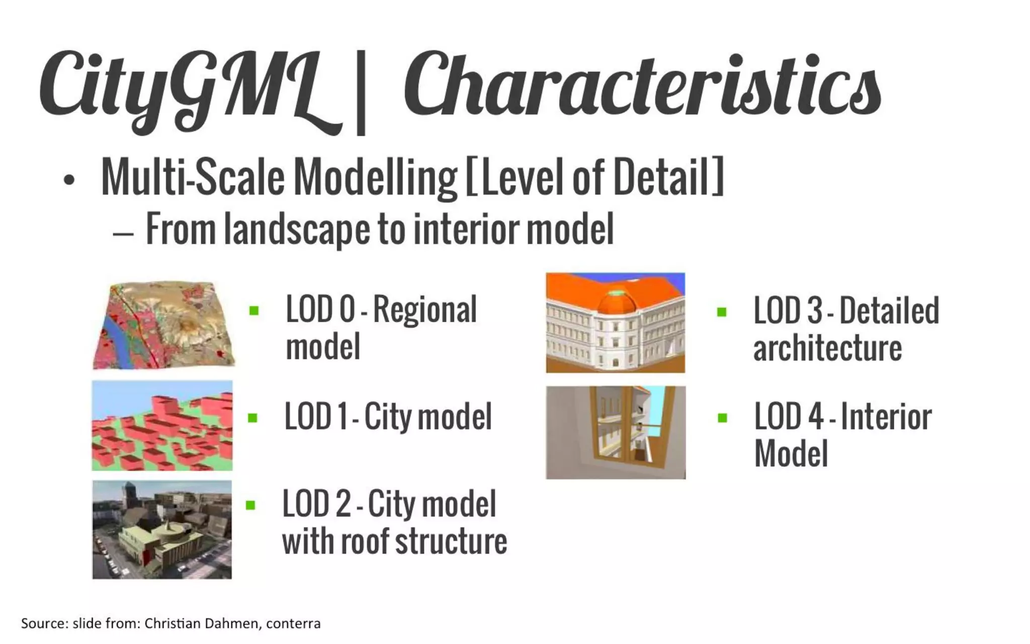
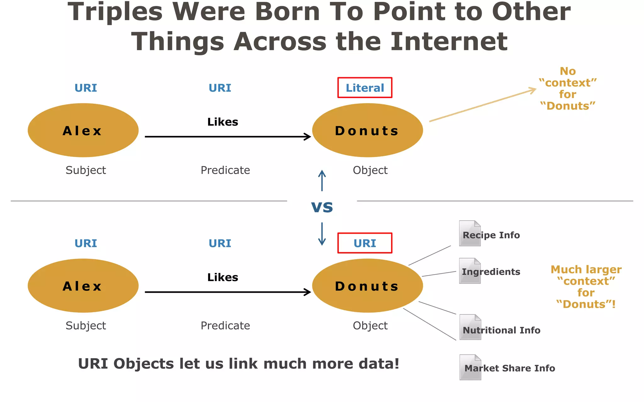
Multi-Scale Modelling [Level of Detail]
From landscape to interior model
LOD 0 – Regional model
LOD 1 – City model
LOD 2 – City model with roof structure
LOD 3 – Detailed architecture
LOD 4 – Interior Model
Source: slide from: Christian Dahmen, conterra](https://image.slidesharecdn.com/bimtolinkedcitygmlsep2014-140922161939-phpapp02/75/BIM-Conversion-Analysis-Workshop-Story-of-the-I-35W-Bridge-Collapse-31-2048.jpg)
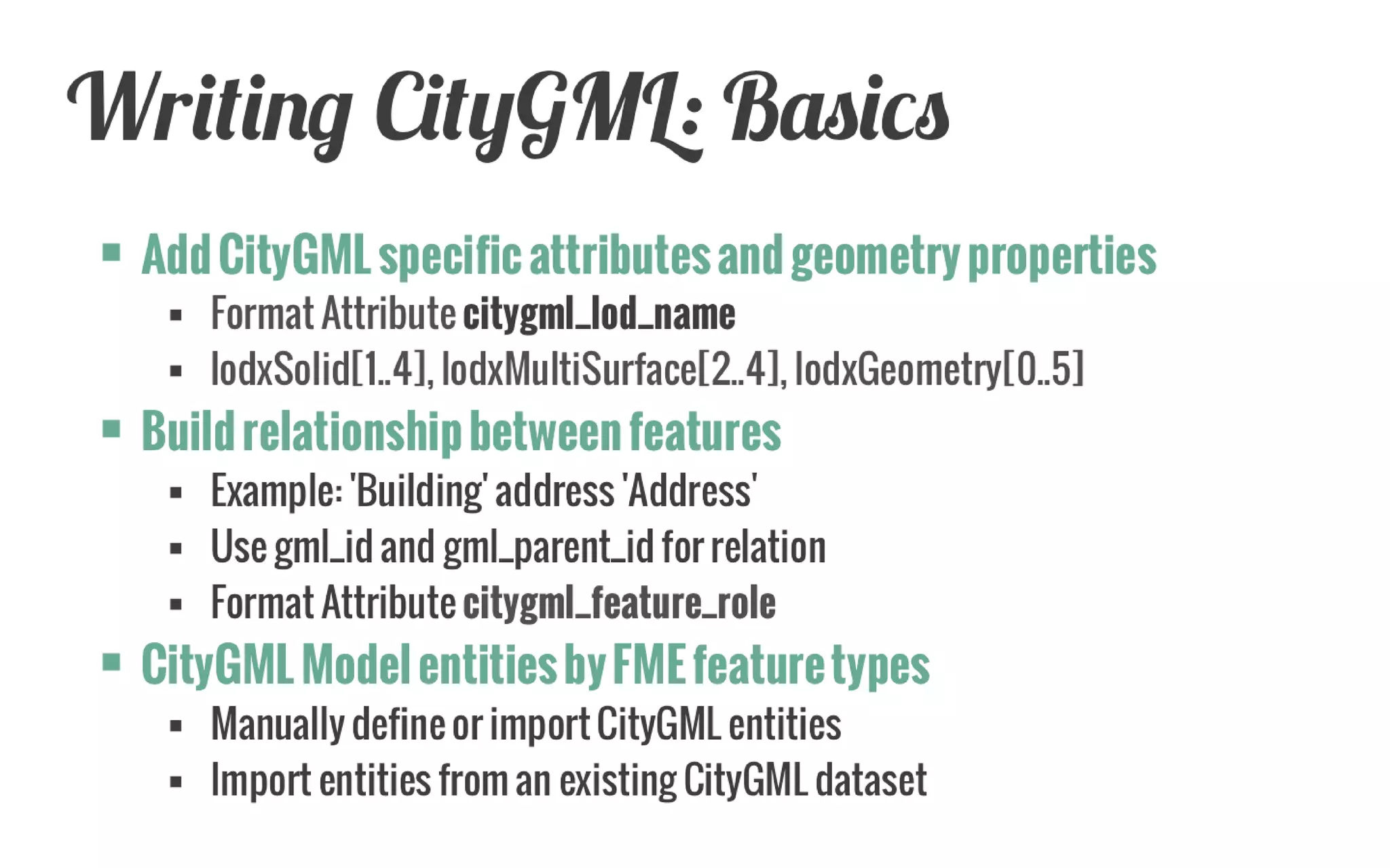
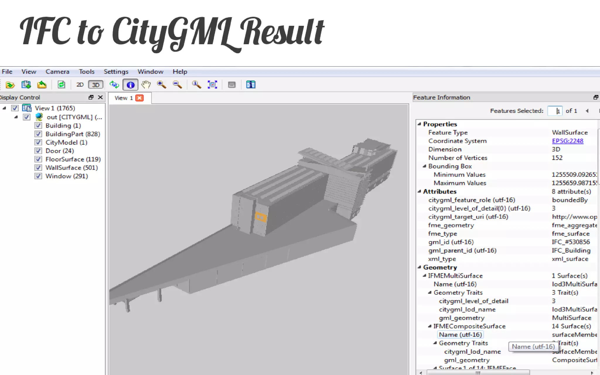
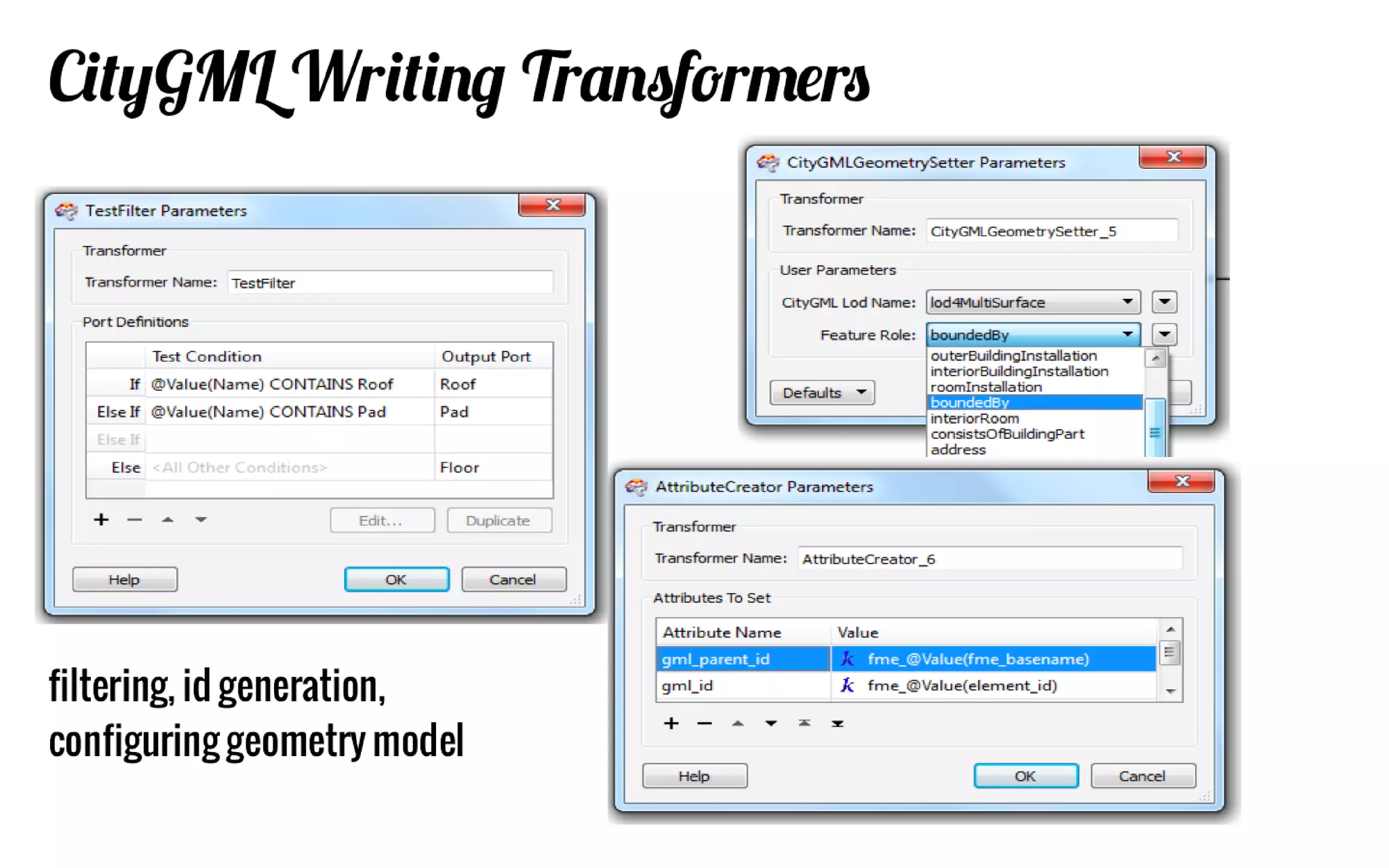
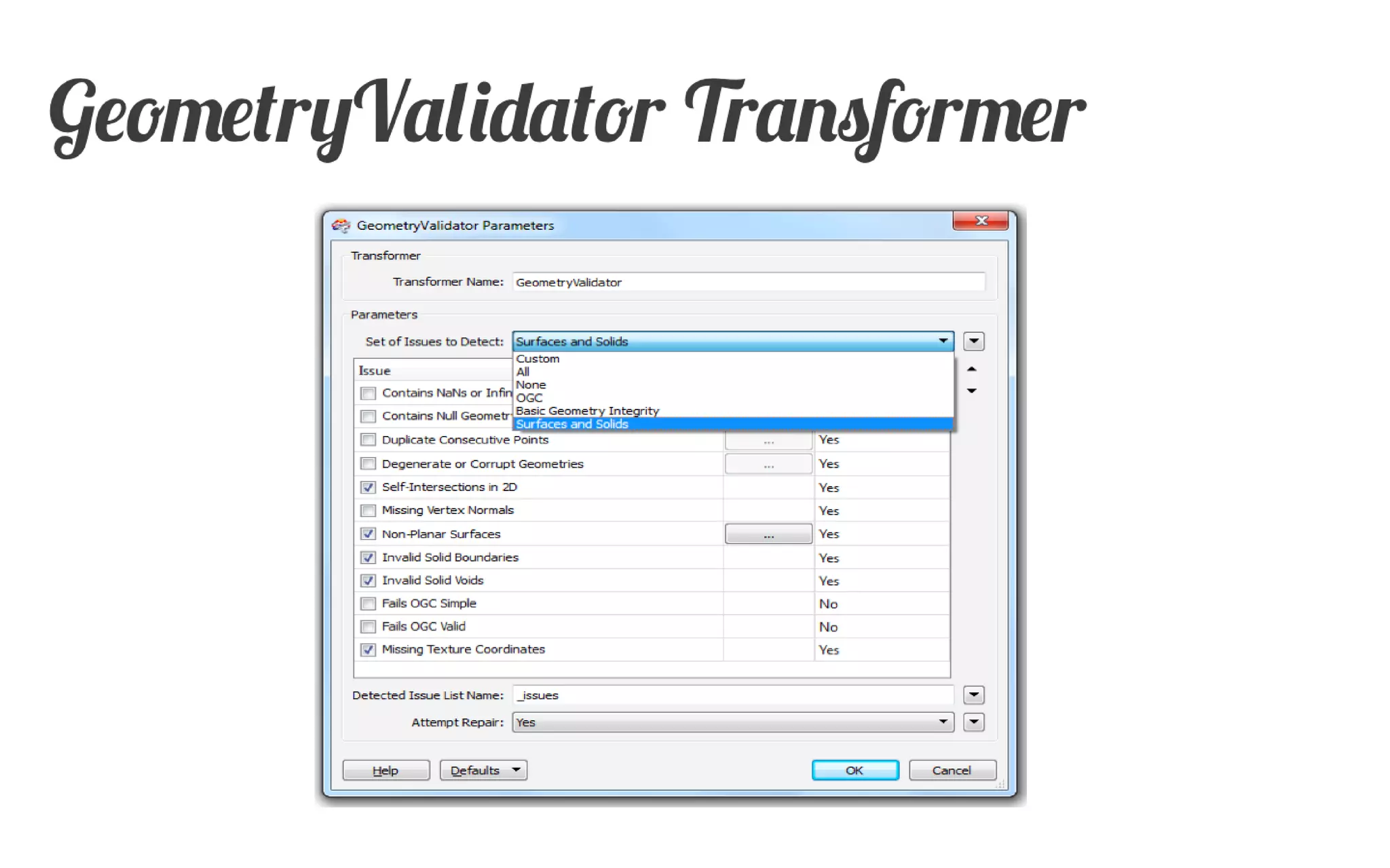
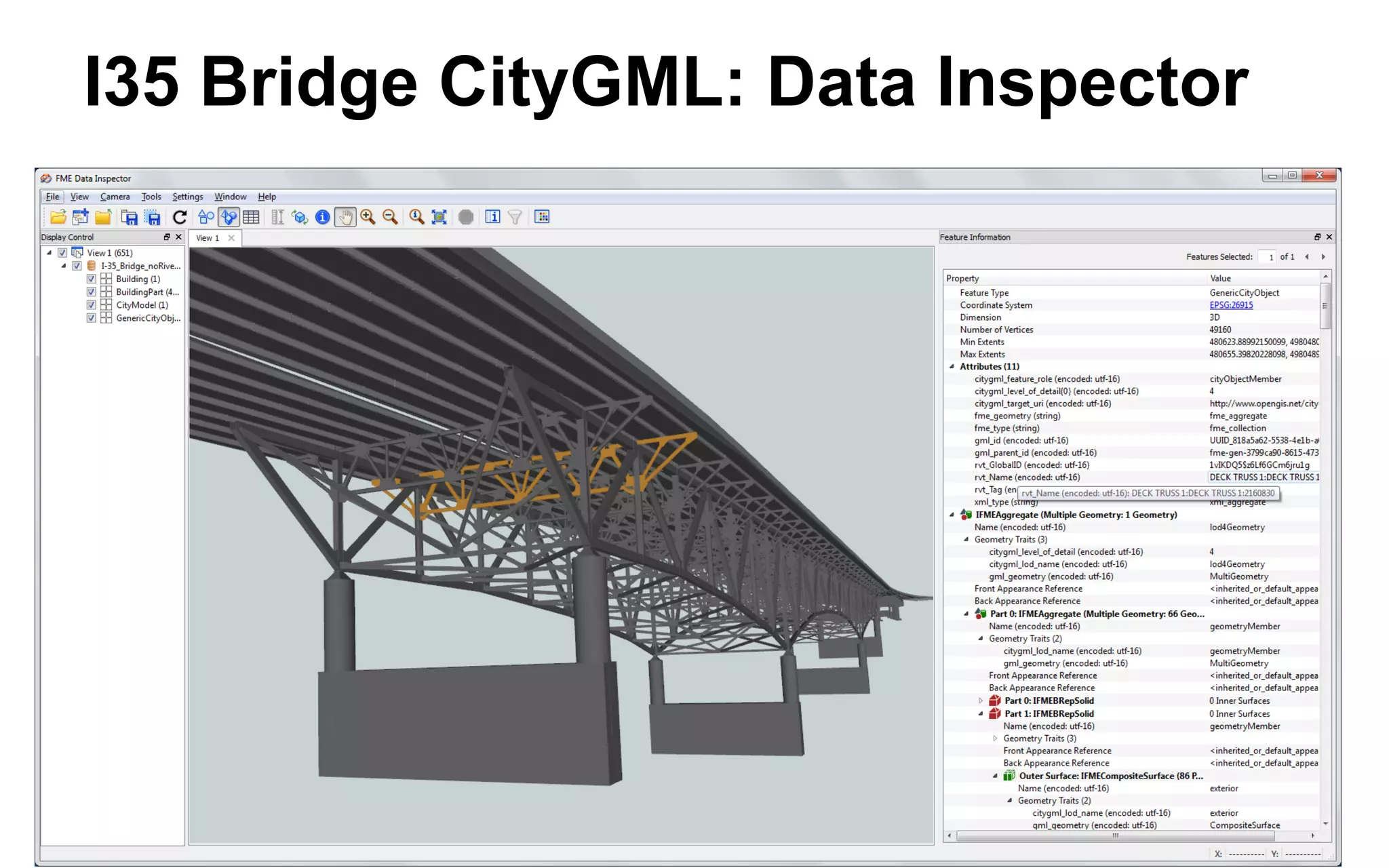
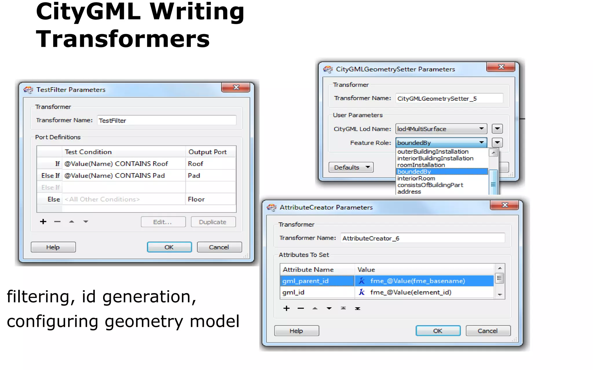
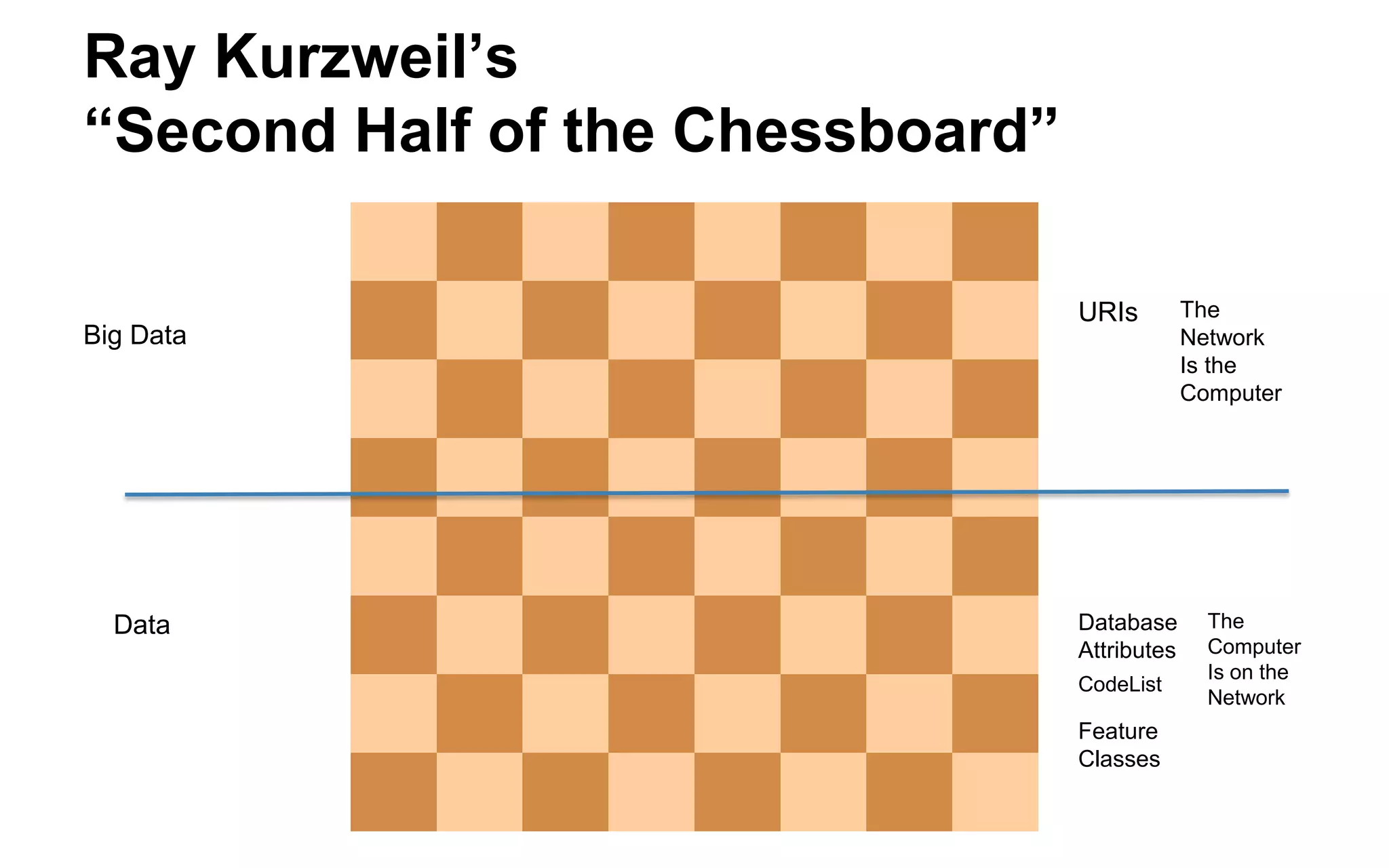
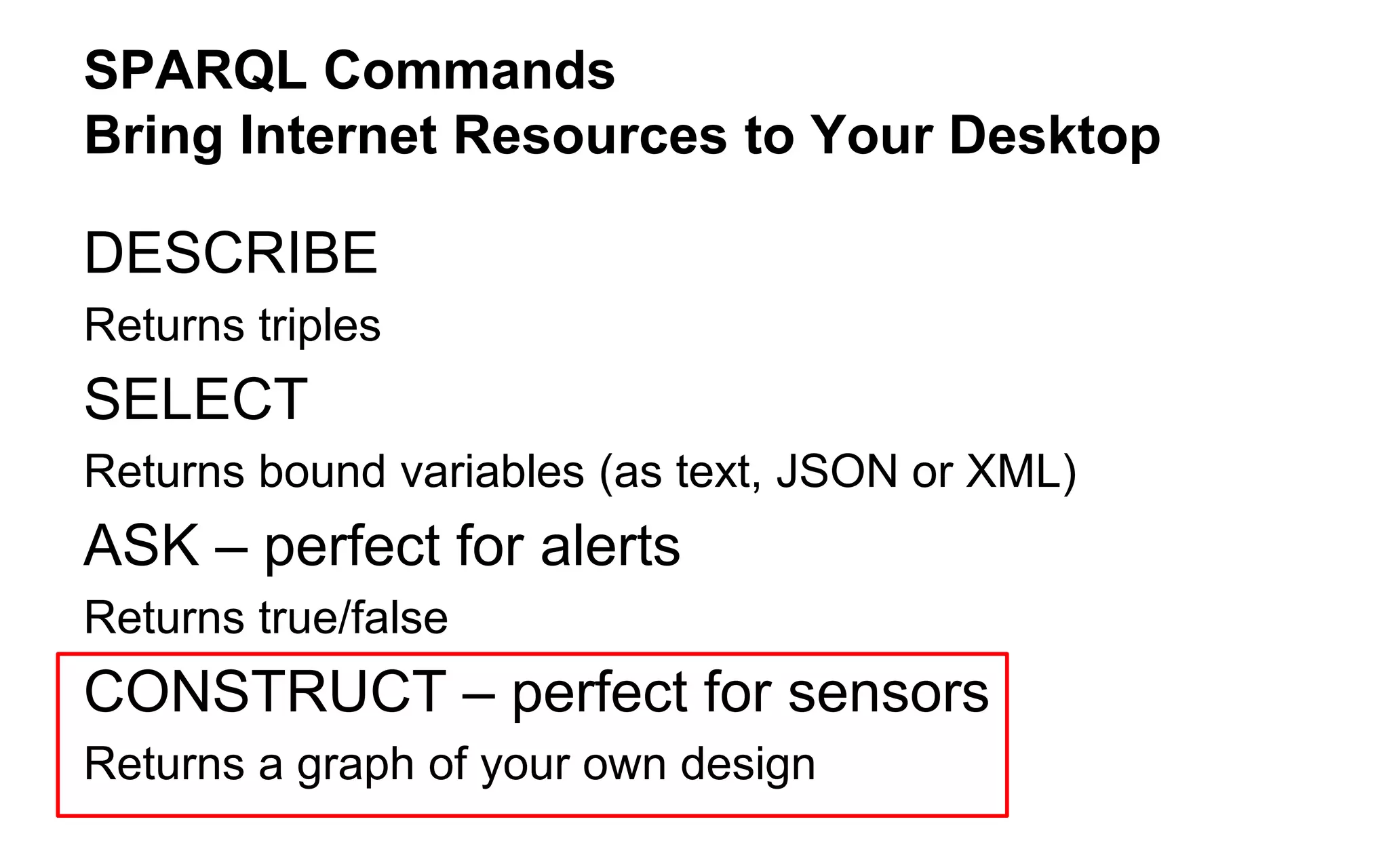
![Add CityGML specific attributes and geometry properties
Format Attribute citygml_lod_name
lodxSolid[1..4], lodxMultiSurface[2..4], lodxGeometry[0..5]
Build relationship between features
Example: 'Building' address 'Address'
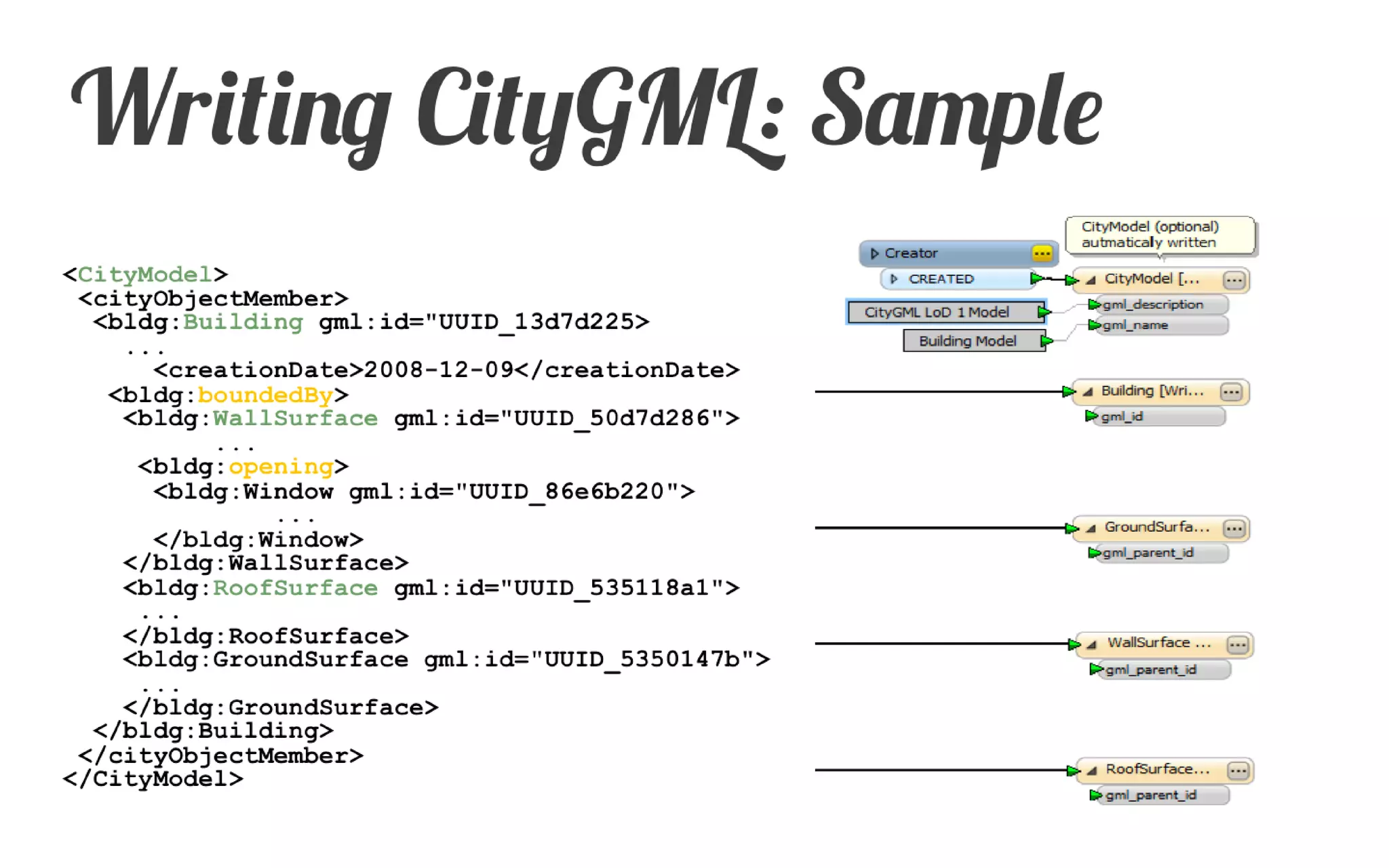
Use gml_id and gml_parent_id for relation
Format Attribute citygml_feature_role
CityGML Model entities by FME feature types
Manually define or import CityGML entities
Import entities from an existing CityGML dataset
Writing CityGML: Basics](https://image.slidesharecdn.com/bimtolinkedcitygmlsep2014-140922161939-phpapp02/75/BIM-Conversion-Analysis-Workshop-Story-of-the-I-35W-Bridge-Collapse-39-2048.jpg)


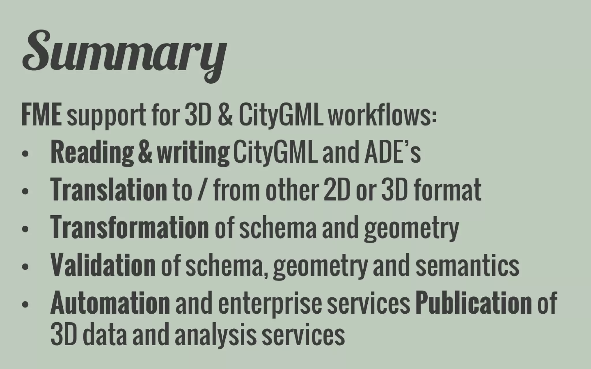
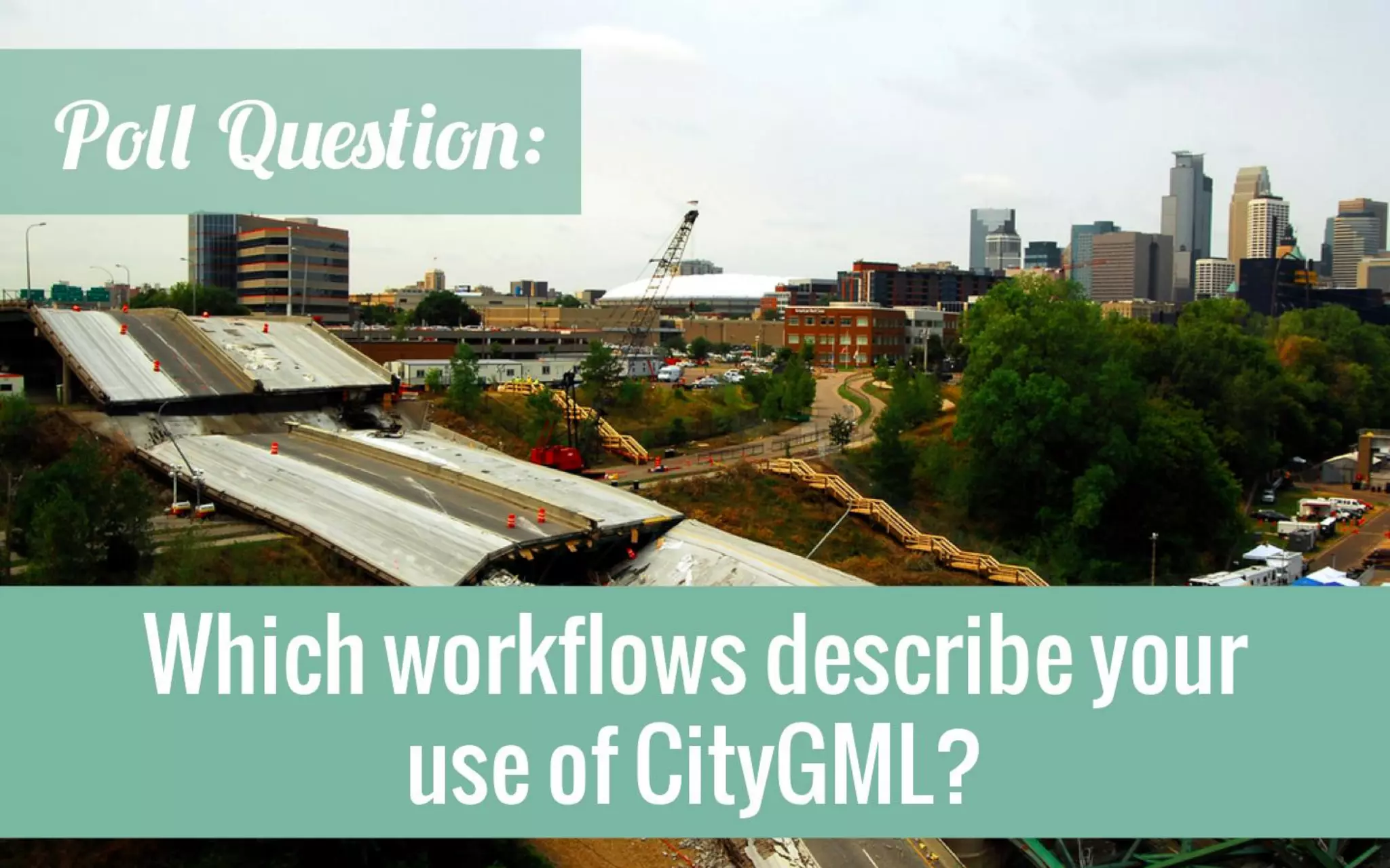


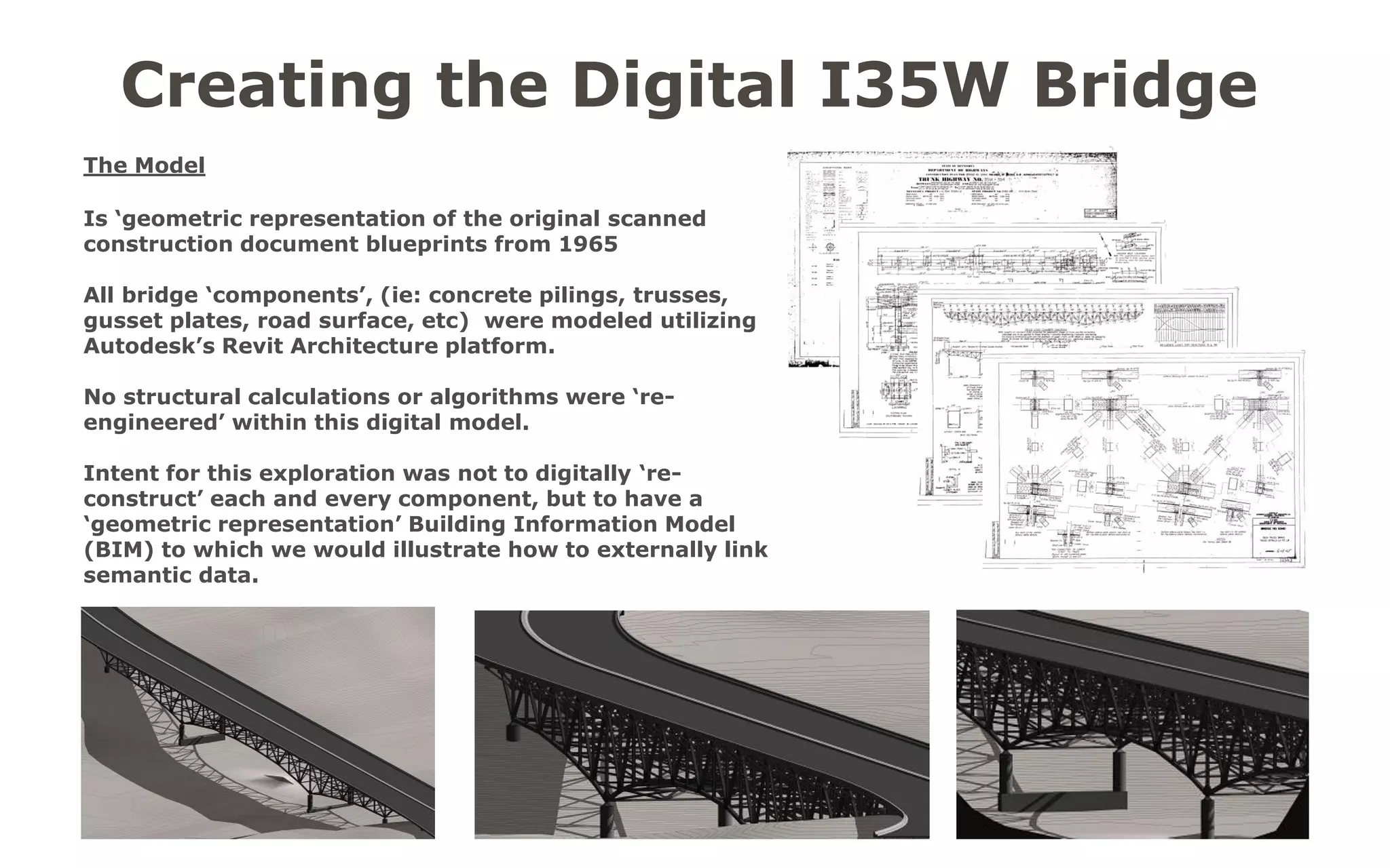
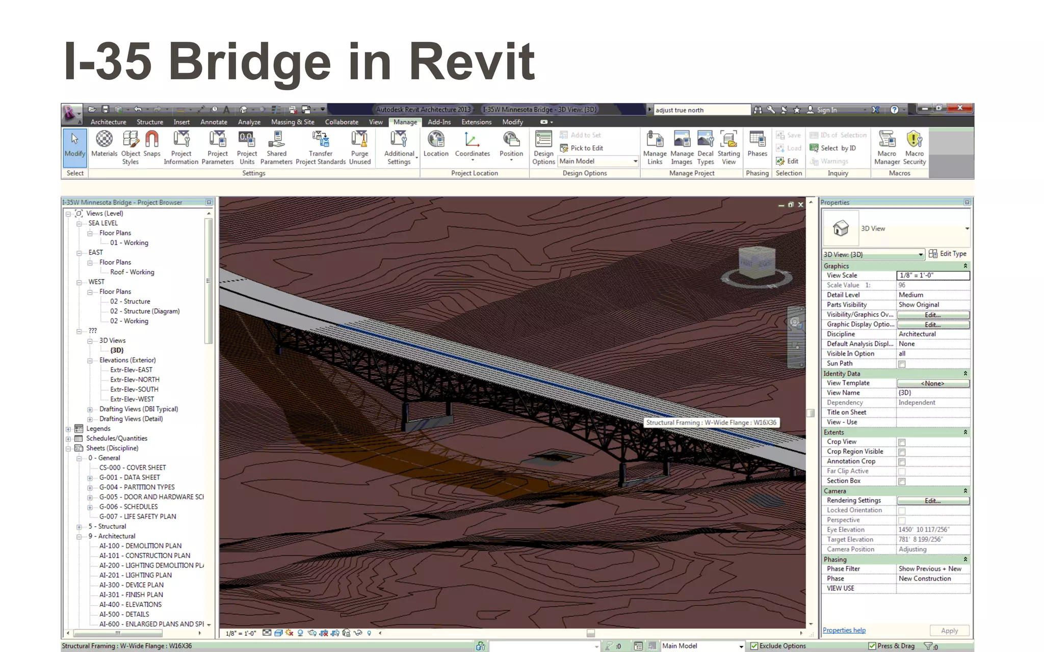
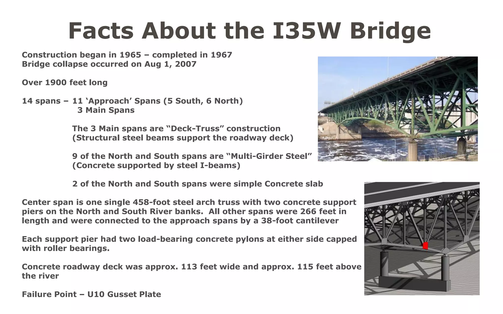
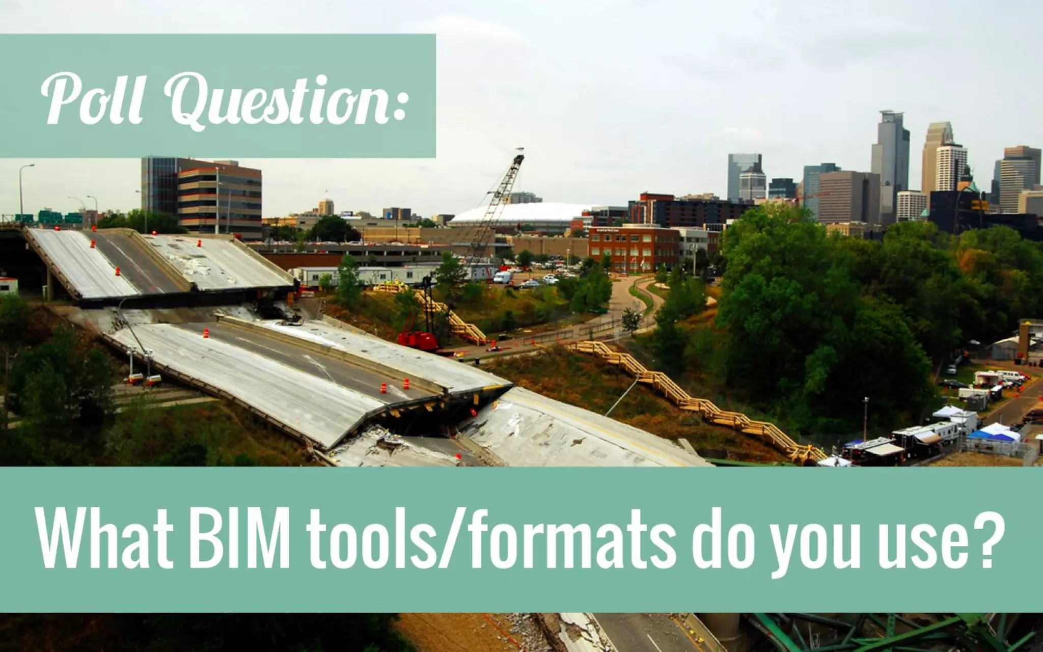


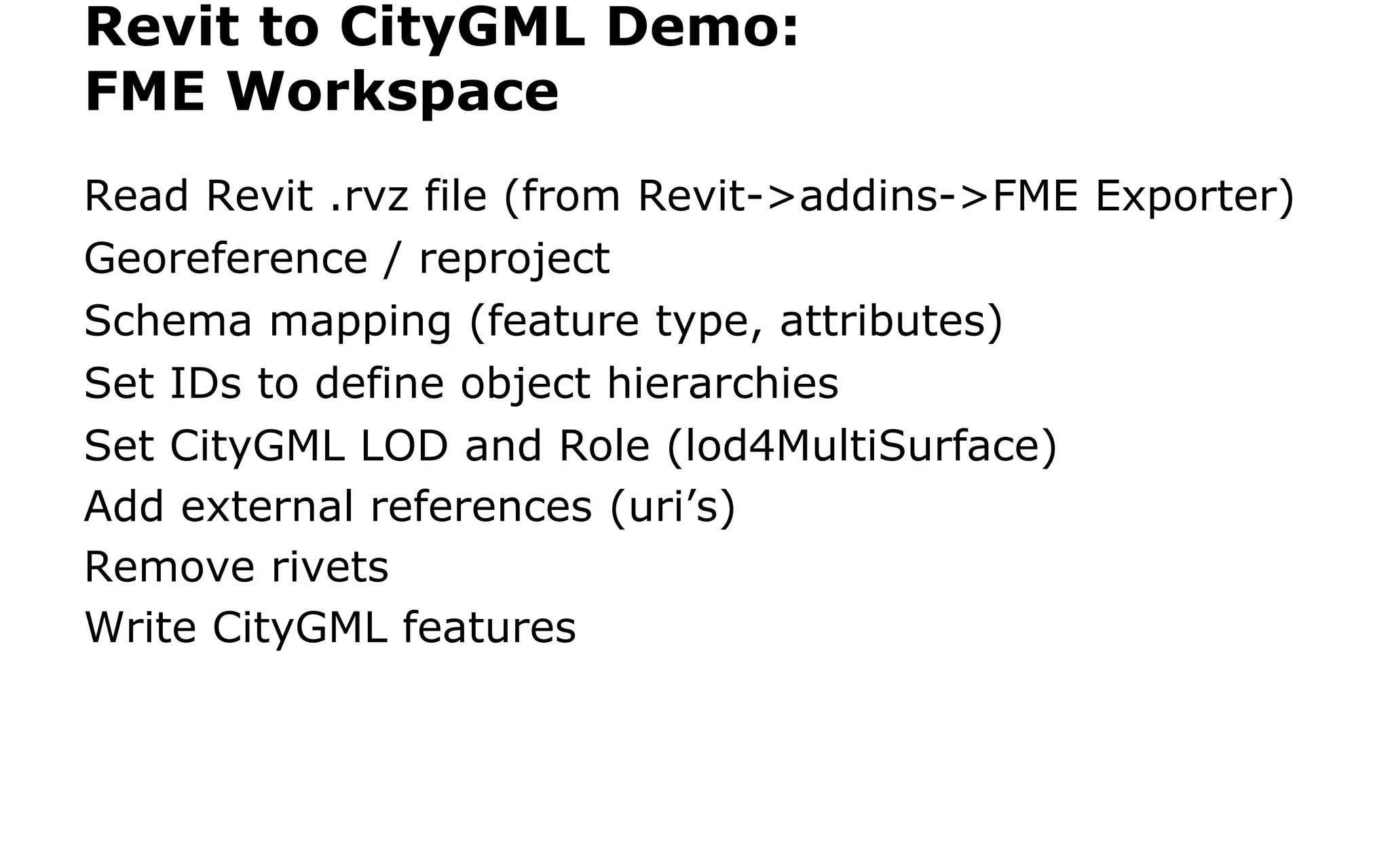
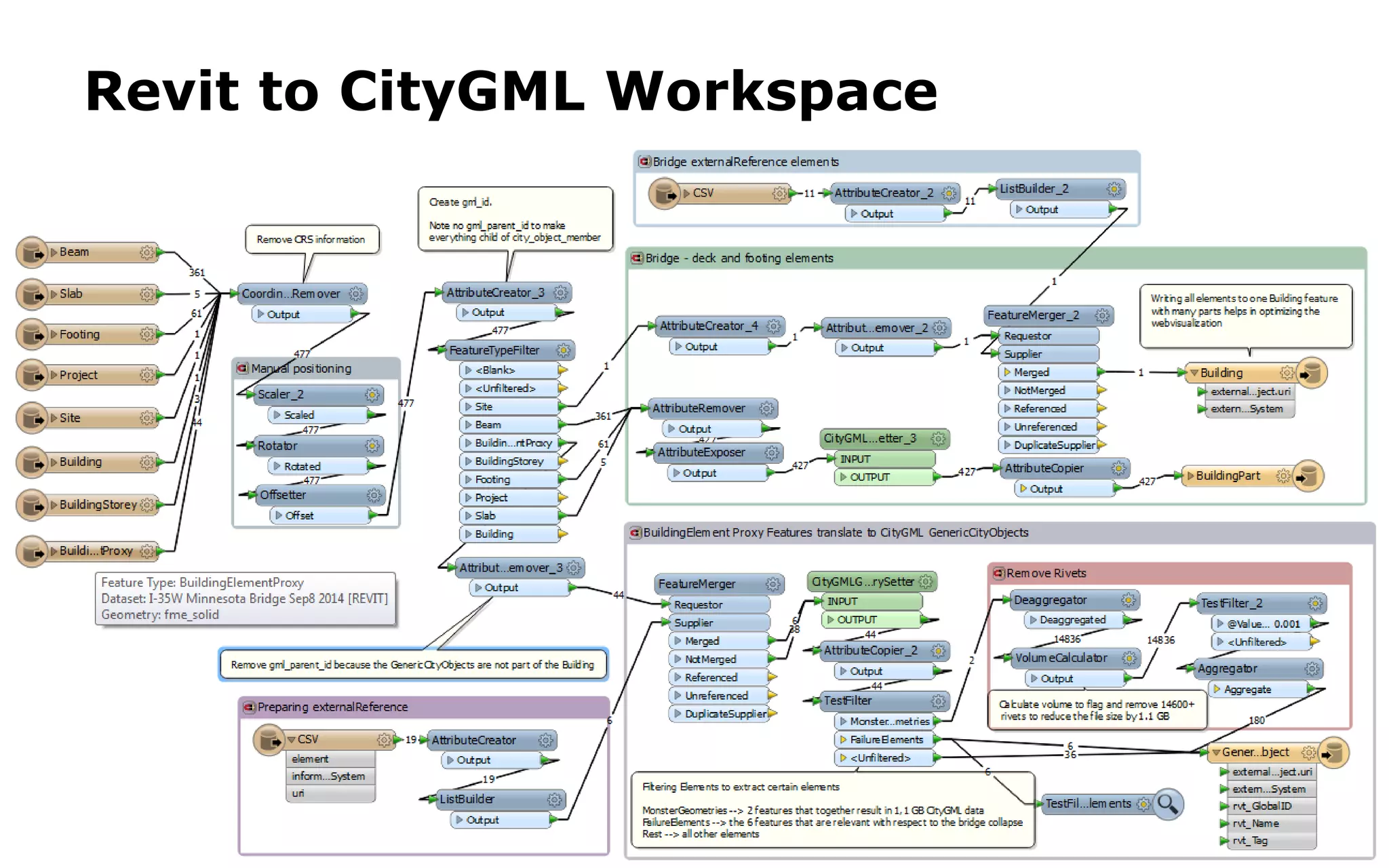
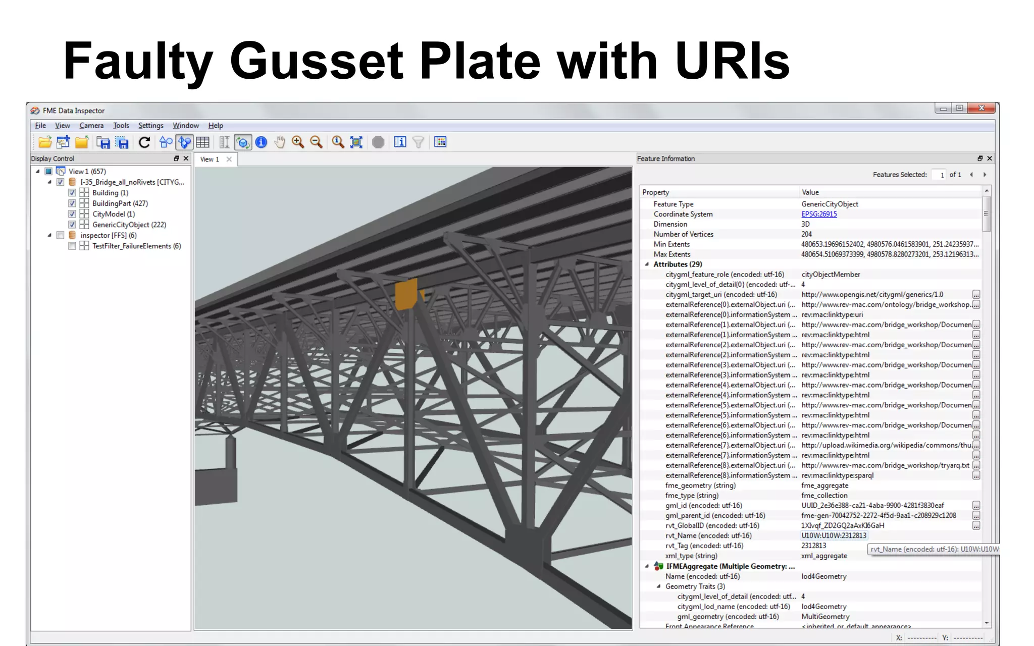
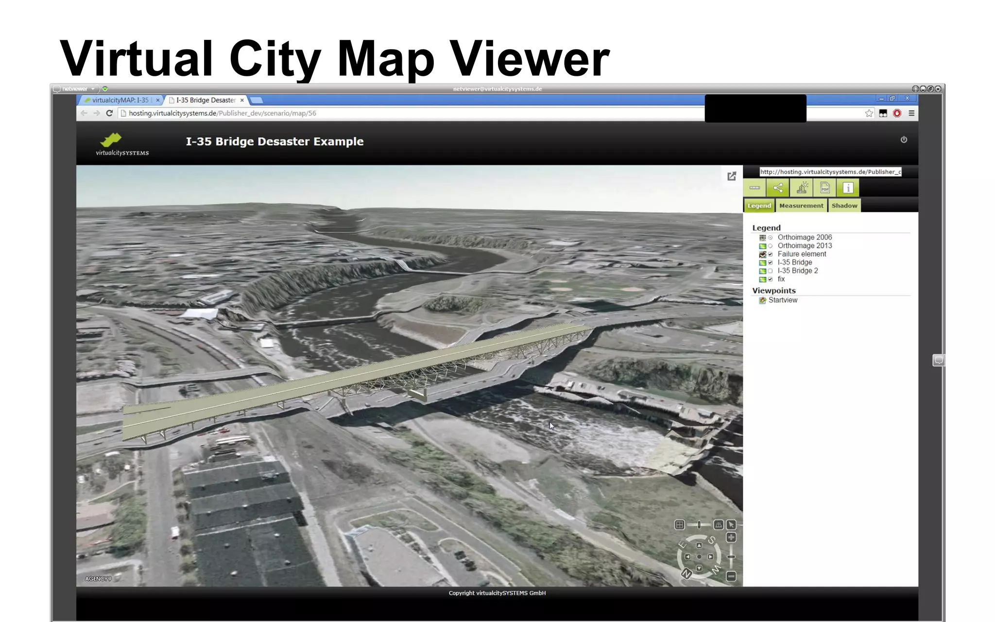
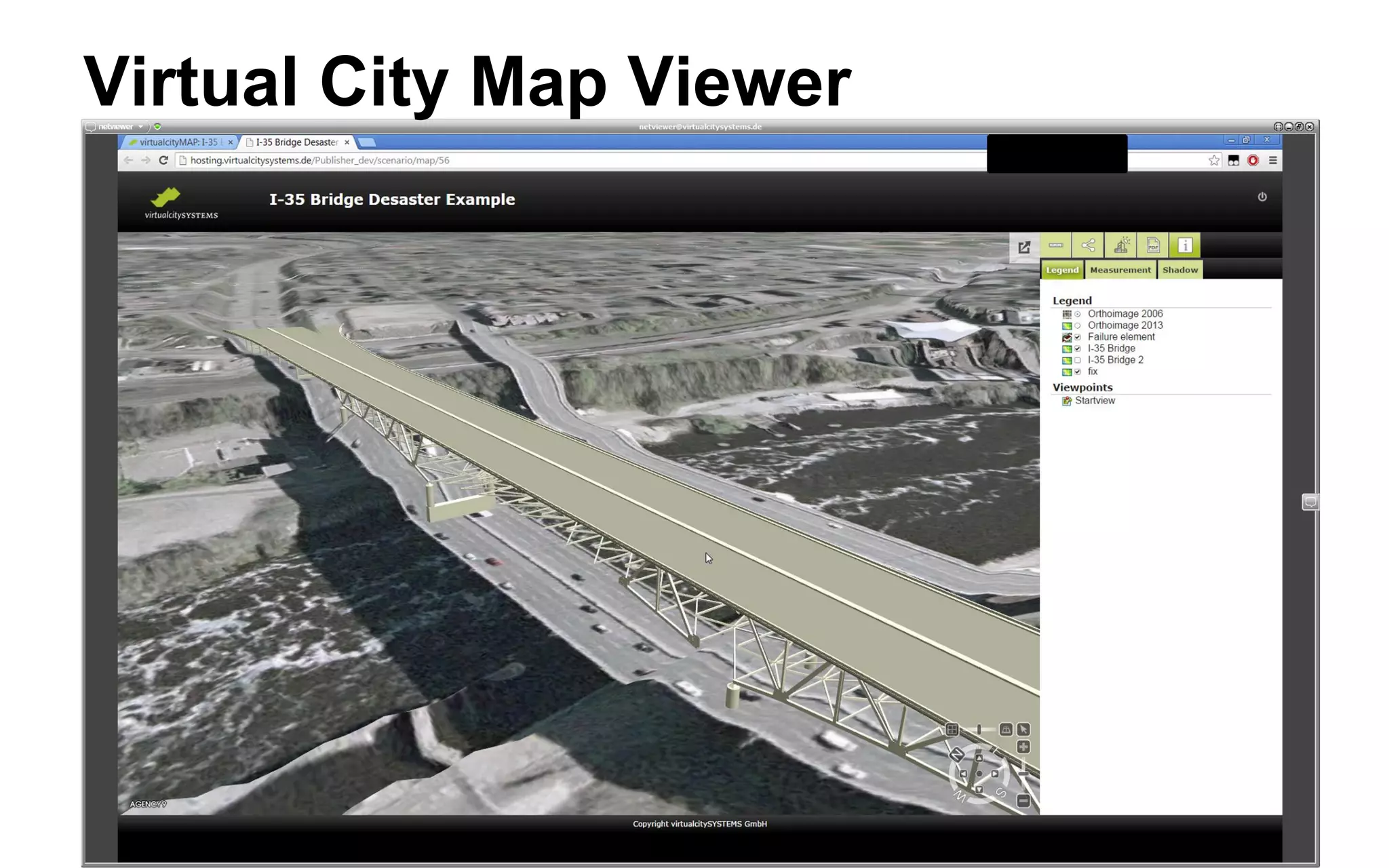
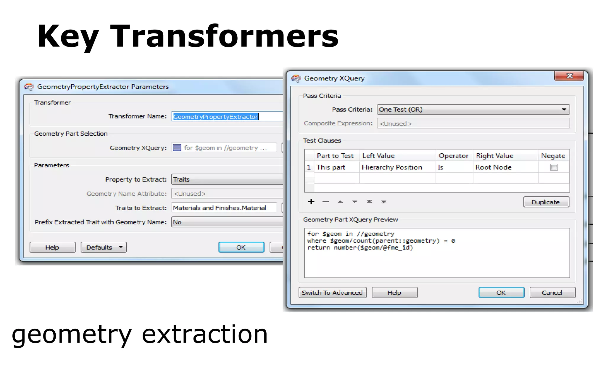
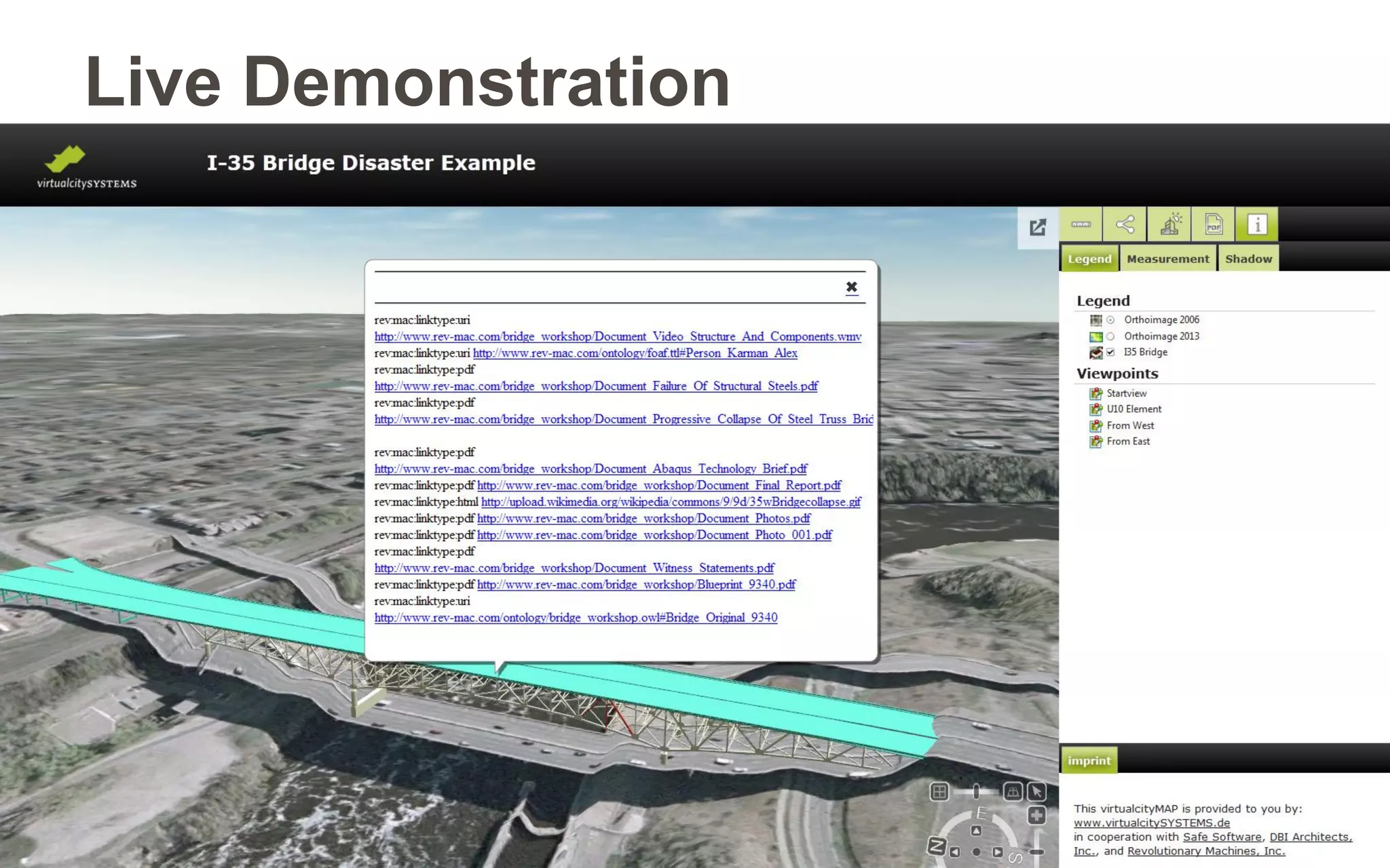


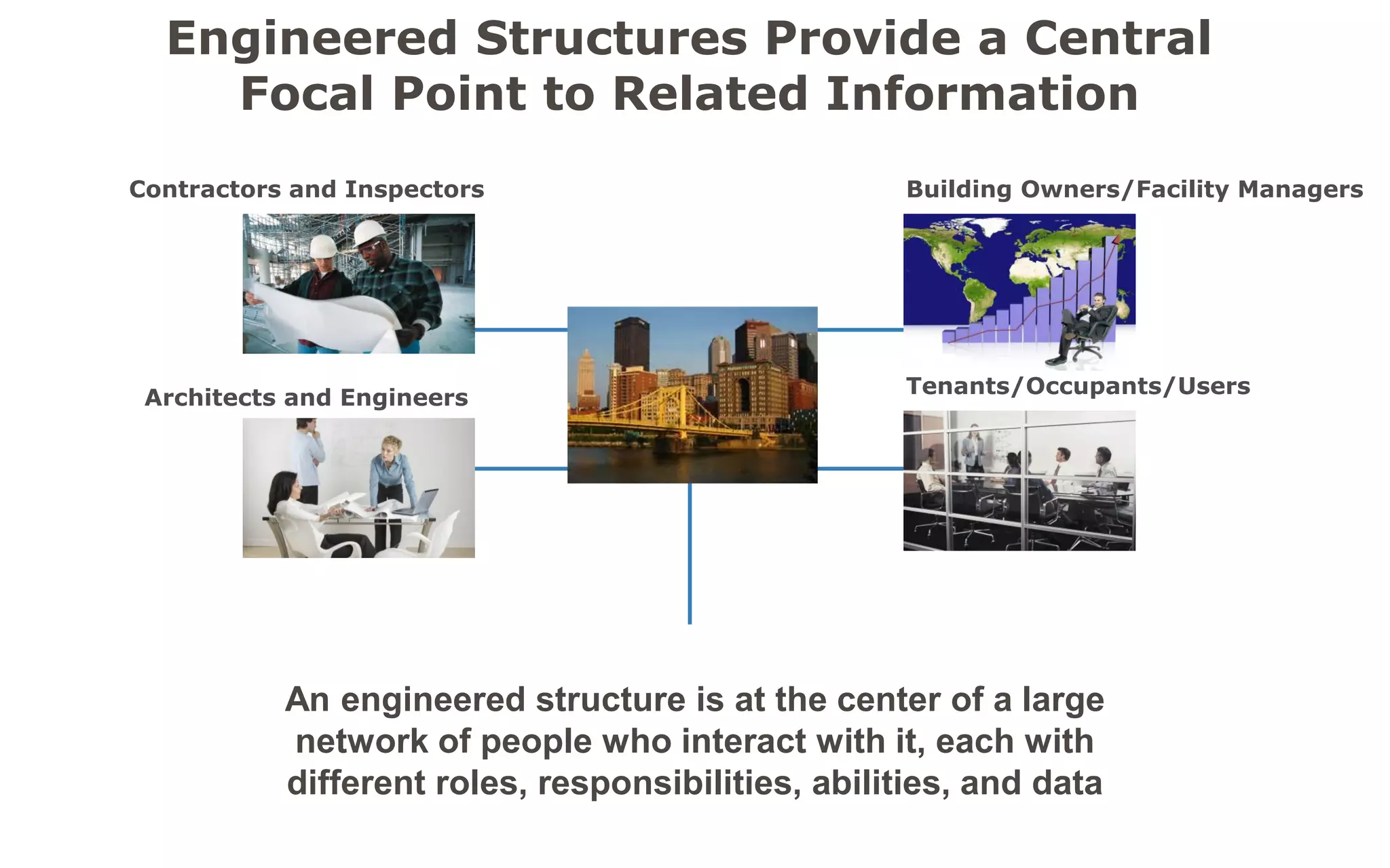
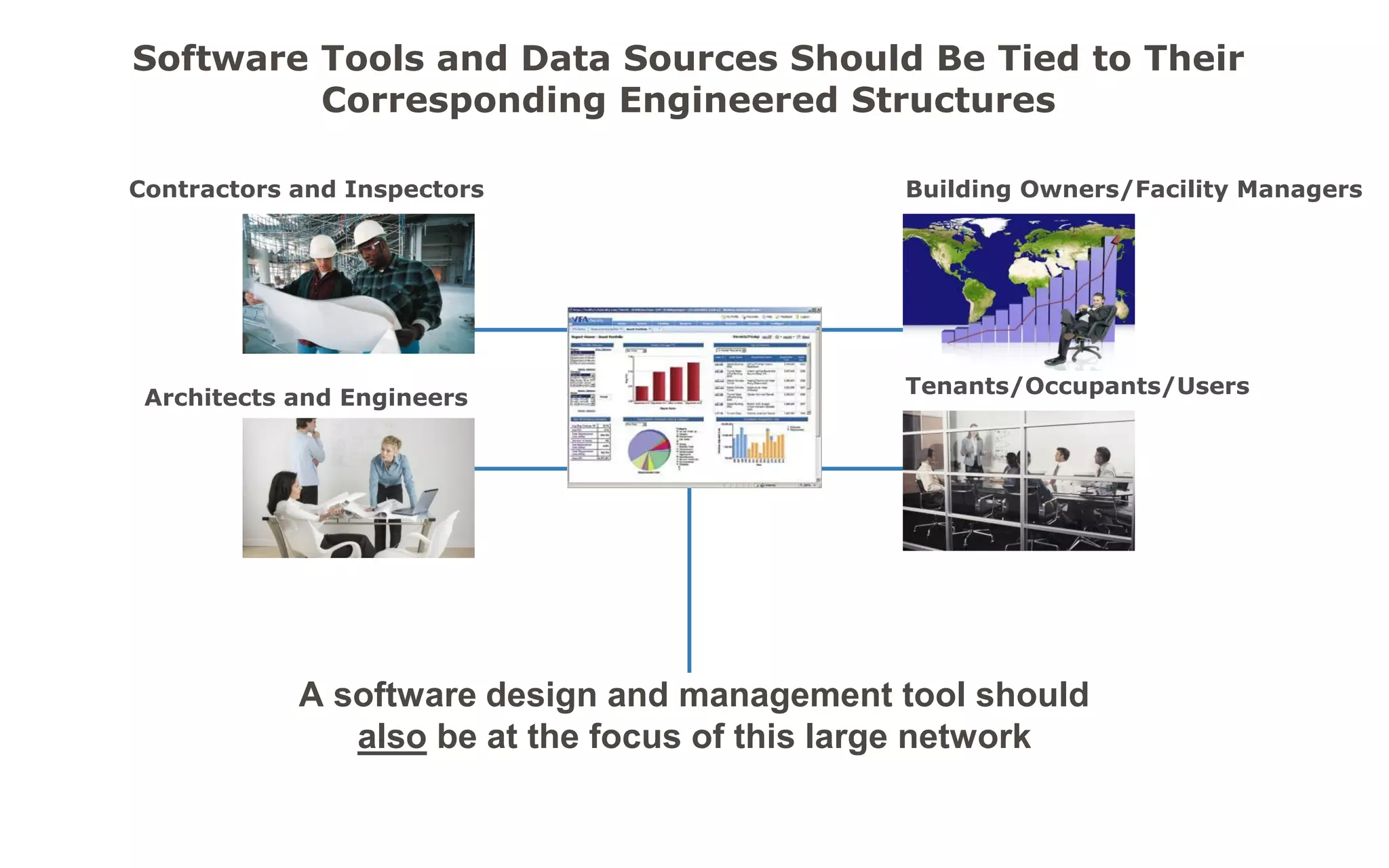
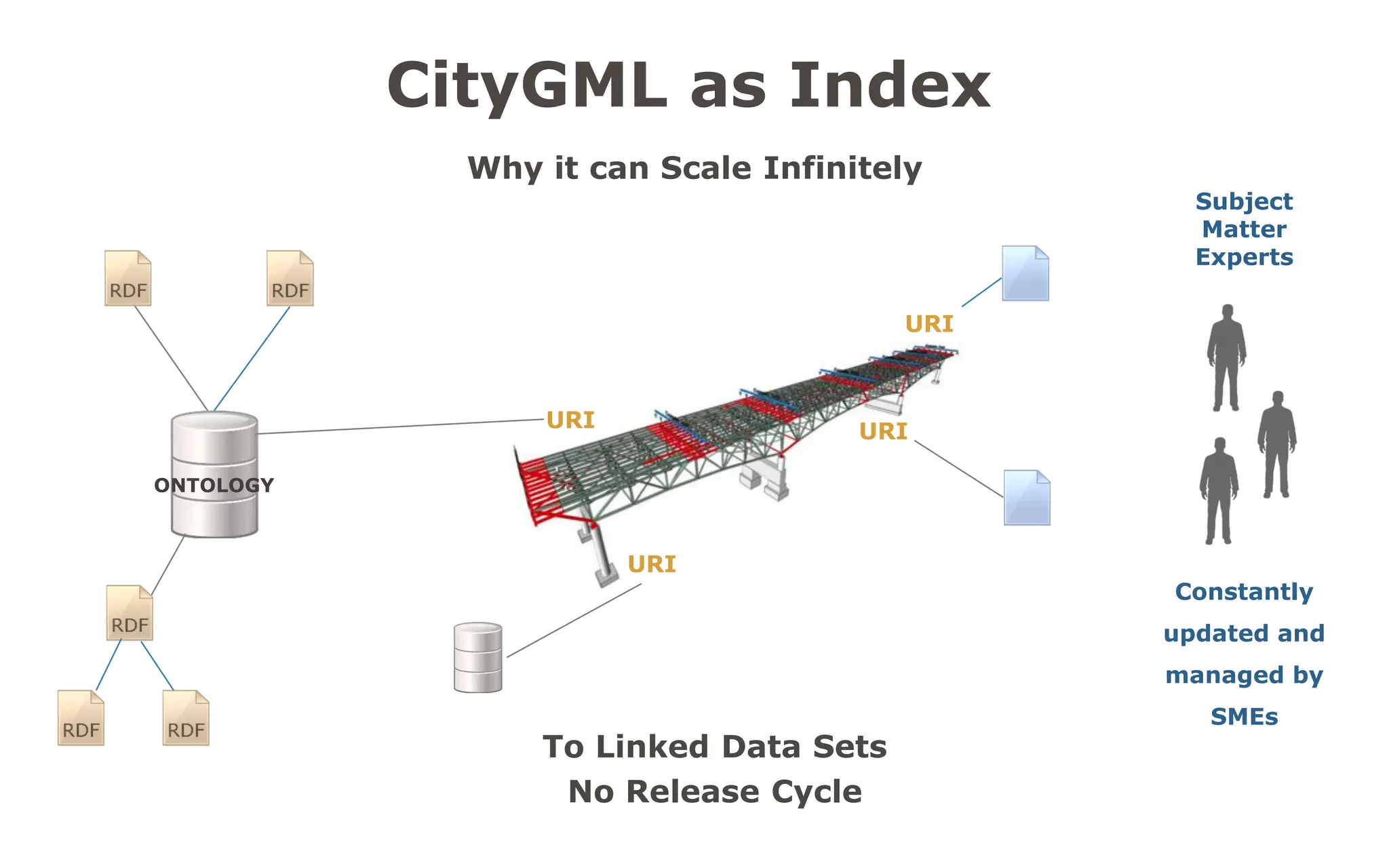
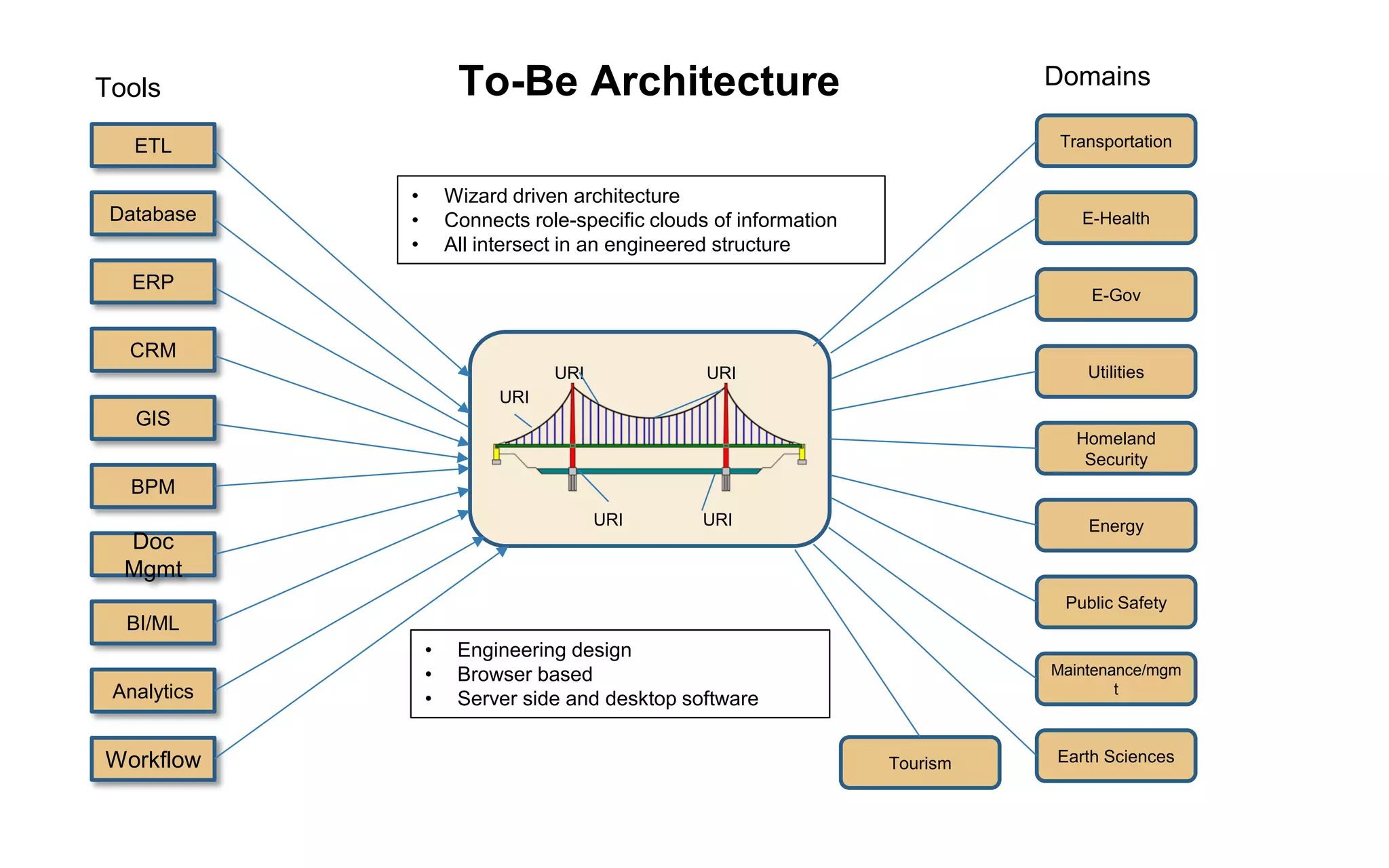
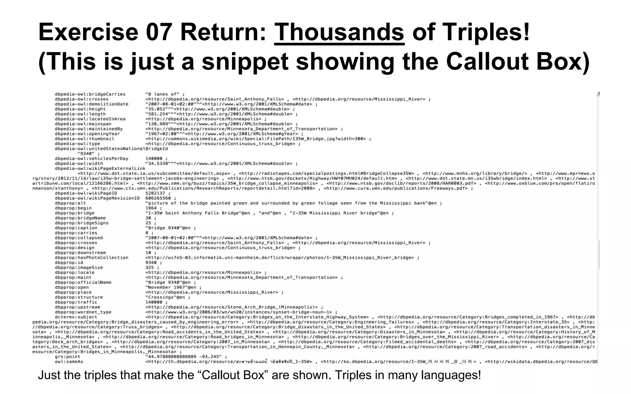
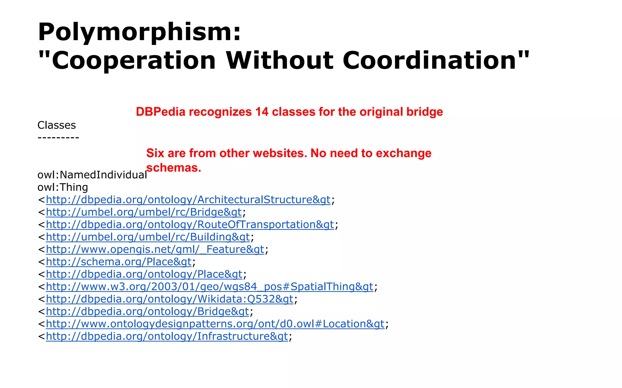
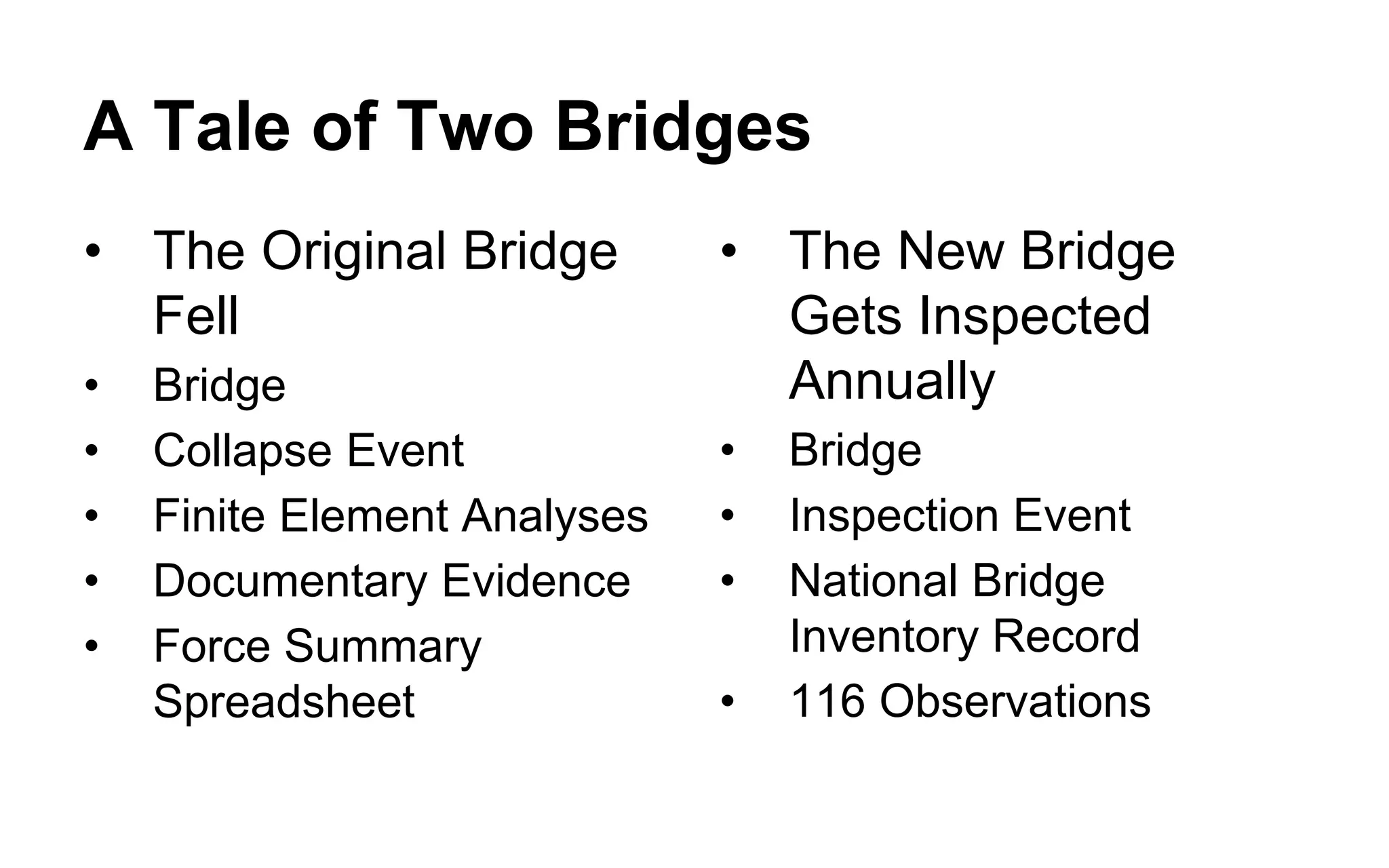
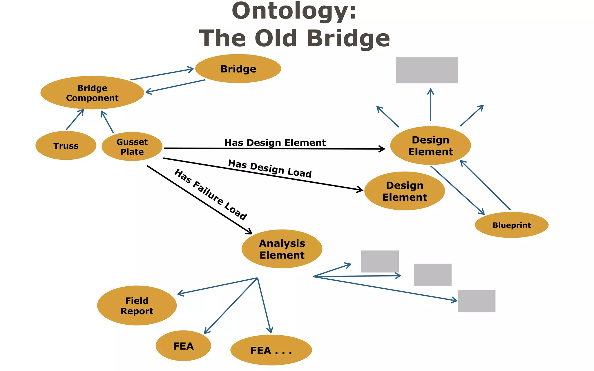
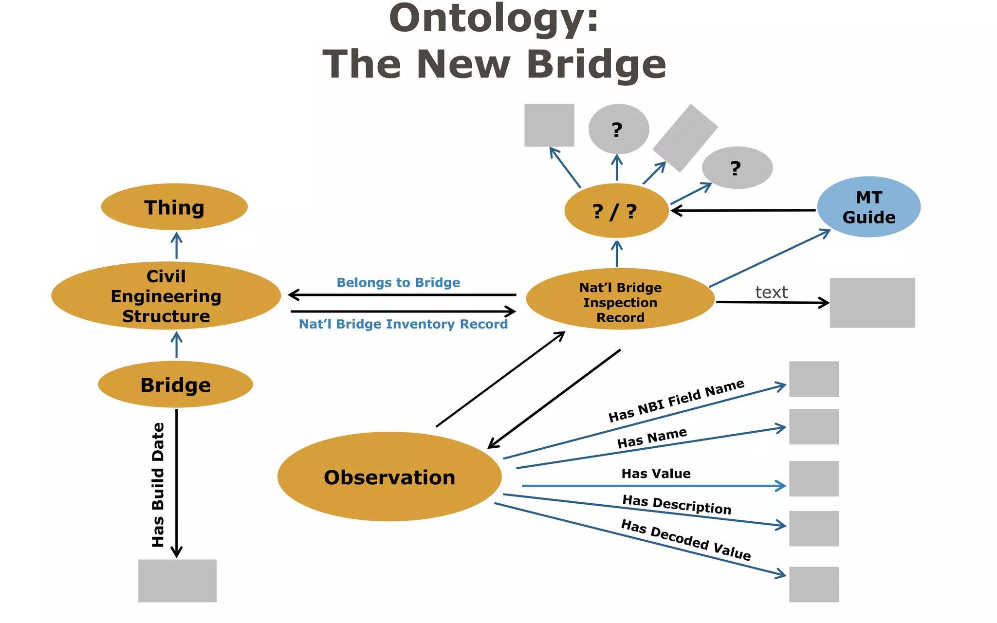
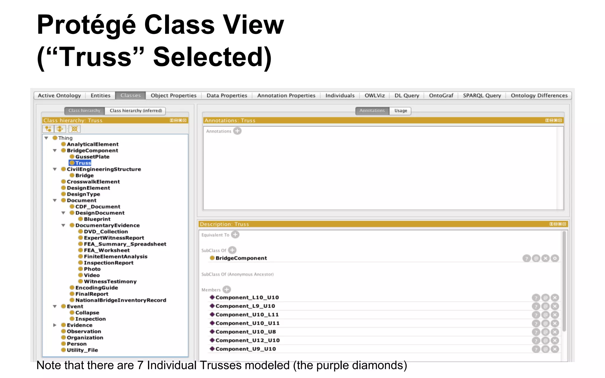
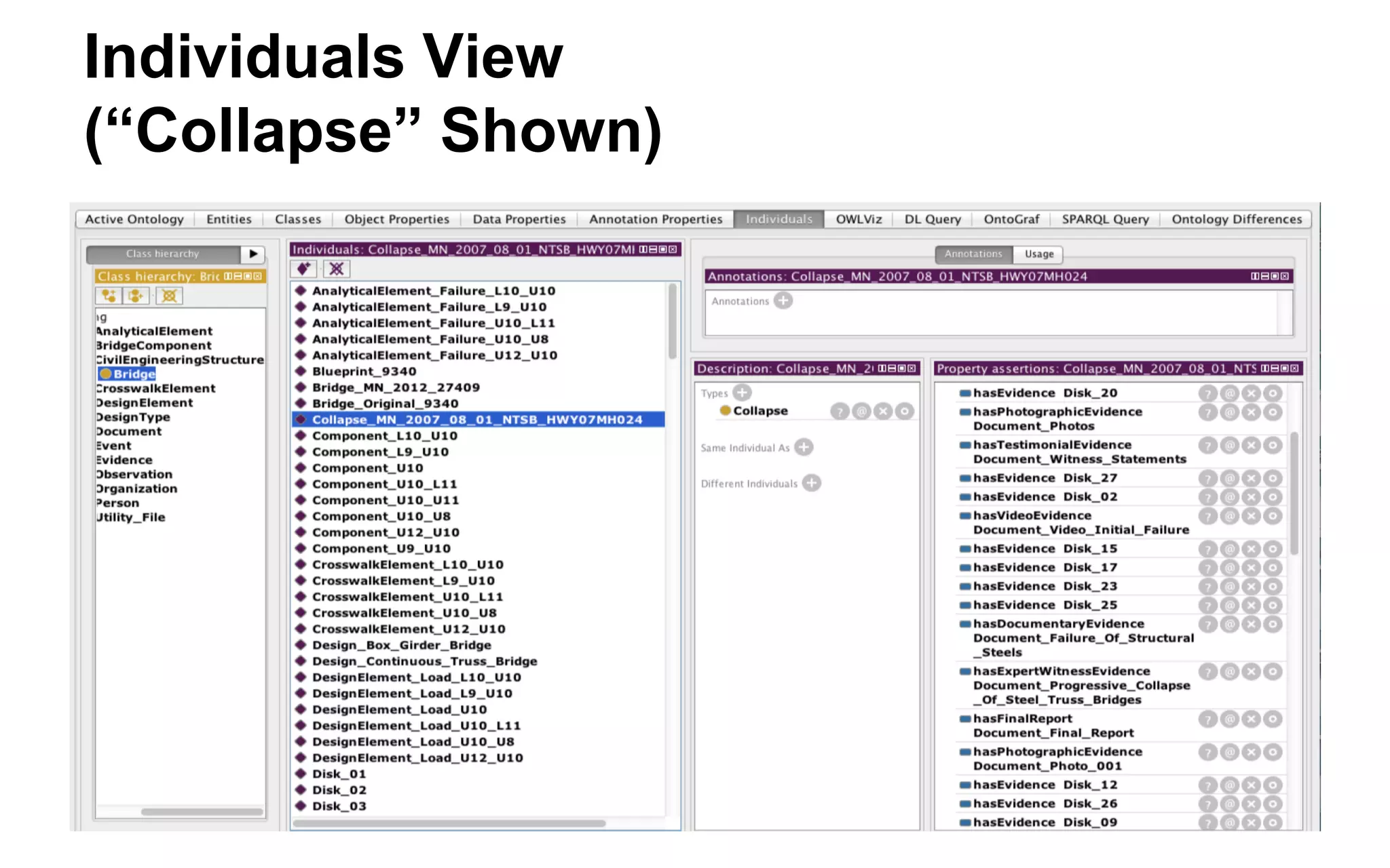
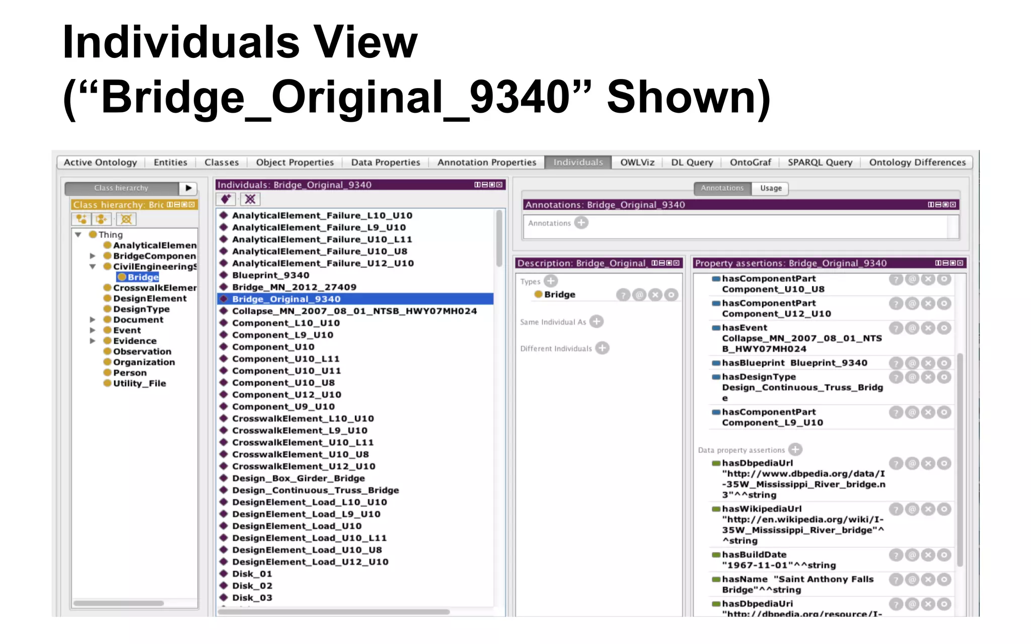
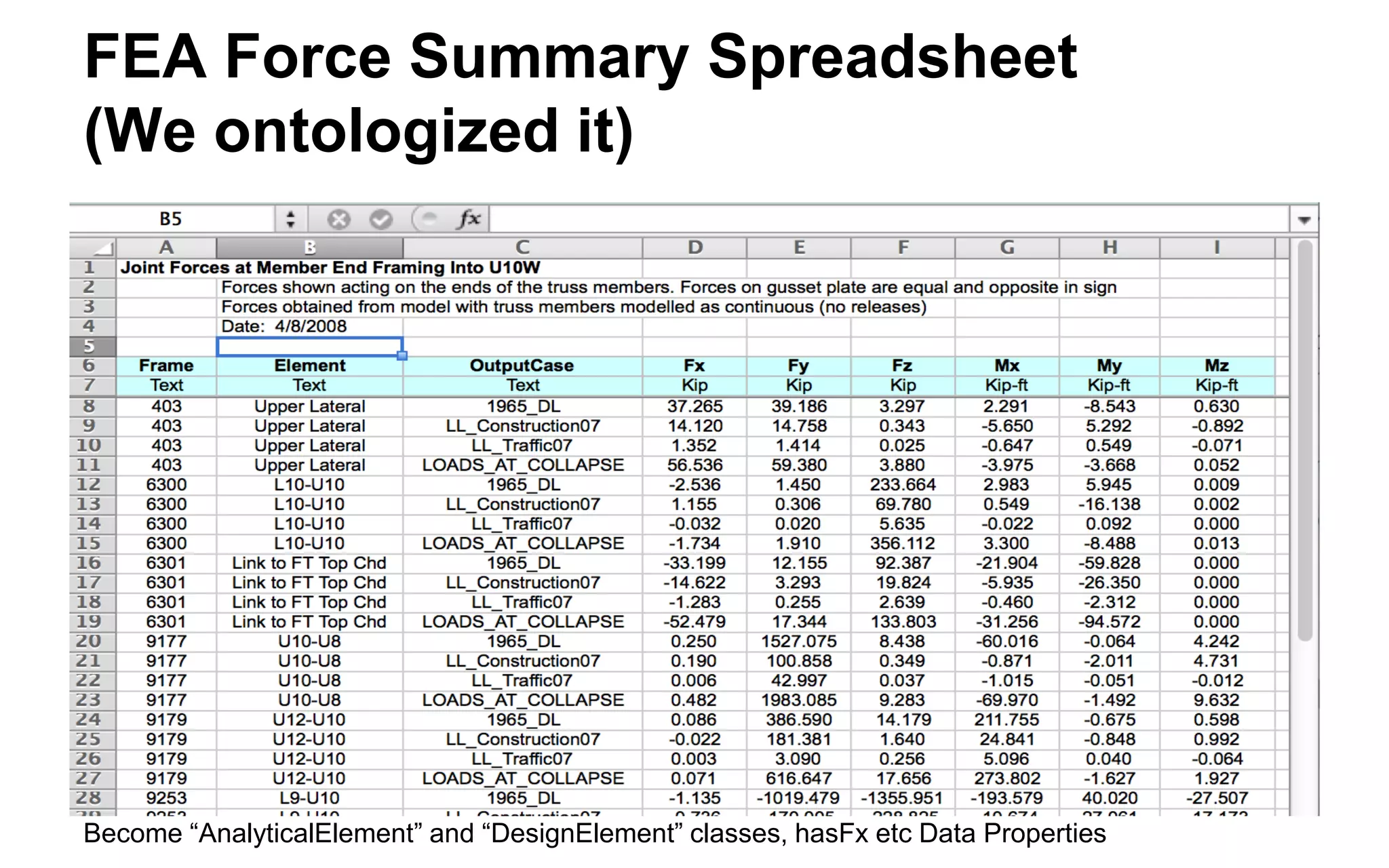


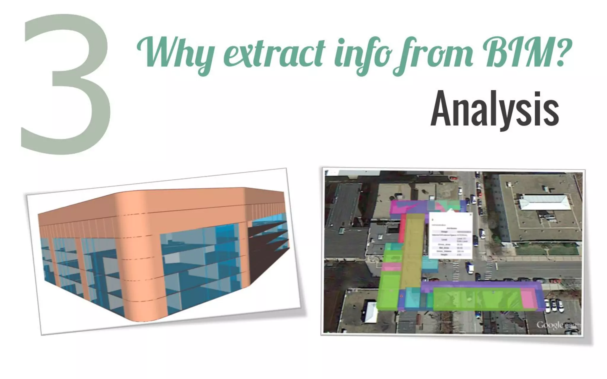
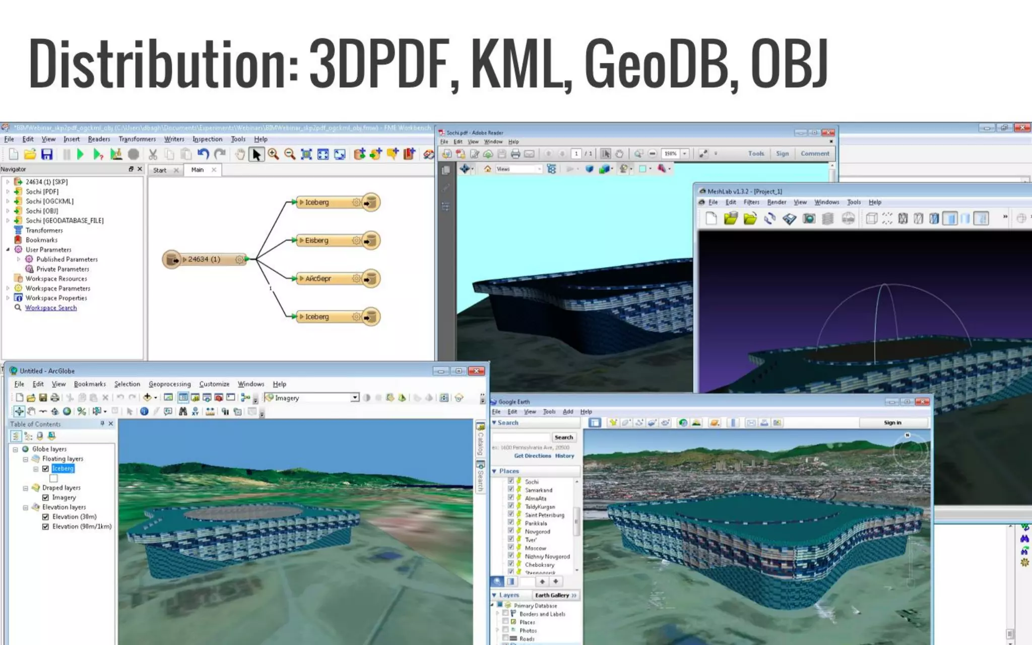
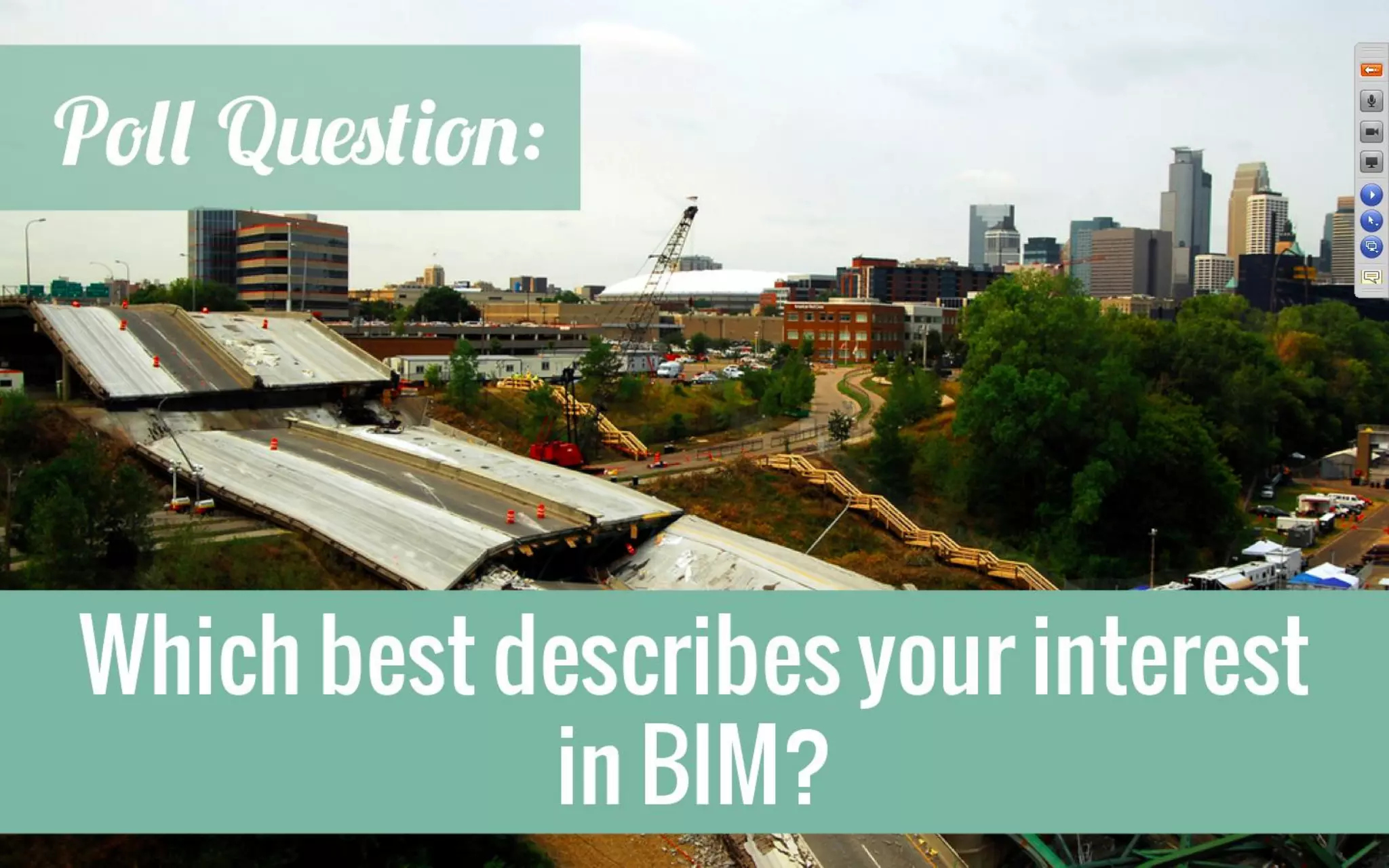
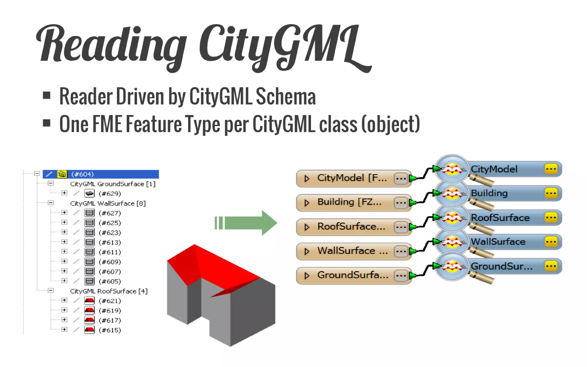
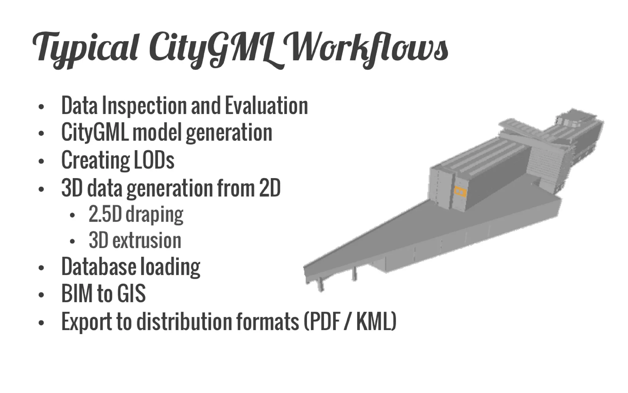
The document discusses capabilities of the FME software for working with 3D geospatial data and CityGML models. It provides examples of workflows for converting BIM and CAD files to CityGML and analyzing 3D city models. Specifically, it describes how FME was used to convert a Revit model of the collapsed I-35W bridge in Minneapolis to a CityGML model and link bridge components to external semantic data about the bridge failure for analysis.


