Discover how to solve the most common problems with BIM and GIS integration. See how to easily move data between IFC, Autodesk Revit, SketchUp 2015, Esri ArcGIS, AutoCAD, and more. You'll also learn how to use automated techniques to get simplified BIM geometries into GIS, combine attribute or tabular data with existing models, perform space extraction, QC data, and much more.
BIM and GIS Integration: A 'How-To' with FMESafe Software
Discover how you can combine the power of BIM and GIS with FME. Learn about FME's support for Autodesk Revit (NEW!), Esri ArcGIS, SketchUp, MapInfo, IFC and hundreds of other formats and applications. Plus, learn how FME enables intelligent data integration, for example: detect and load only a building's outer shell, calculate the volume of spaces, or extract the children of spaces and create a spreadsheet list – all of these possible as part of an automated workflow.
With urban populations expected to double by 2050, an increasingly urgent need exists for implementing sustainable urban design and infrastructure rehabilitation initiatives. Digital 3D models of our urban infrastructure form part of the solution as engineers, architects and geospatial professionals collaborate and share information across the infrastructure lifecycle. This presentation explores the reasons behind developing such a model and examines the convergence of the information and technology needed to make it real such as Smart Infrastructure Modeling (SIM), CAD, GIS and BIM. Demonstrations and plenty of eye-candy will be used to highlight the benefits. The presentation concludes with an examination of today’s trends and future opportunities as they relate to the emerging digital cities phenomena.
BIM Workflows: How to Build from CAD & GIS for InfrastructureSafe Software
BIM workflows give facilities managers, architects, and engineers key information for better-informed infrastructure planning and management. But how do you migrate to a BIM system when your current data is stored in CAD? Through a real-world international airport example, find out how CAD and engineering data can be centralized in a Document Management System (Autodesk Vault) and GIS database (SQL Server Spatial) using FME, and learn how to create BIM workflows from CAD data.
Integration of BIM and GIS: From Ideal to RealitySANGHEE SHIN
I gave this talk at the Smart Geo Expo Conference that was co-organized by LH Corp and OGC. In this talk I've tried to share the real experiences of BIM & GIS integration in real projects.
AAM Group presentation at the Esri User Conference 2016.
The presentation discusses the convergence of GIS, CAD and BIM and how this aids in Urban Planning and Management
Design and Development of BIM on GIS Interoperability Open Platformslhead1
ecently, Construction data has evolved from CAD to BIM and BIM becomes more important data used in various fields like facility management and 3D GIS construction, so there is an increasing need for developing technologies that can be effectively used in post-construction steps. There are lots of trials to model and service not only geographical terrain and outdoor but also indoor space. From this perspective, establishment of BIM and GIS interoperable method and development of service platform became the most important core technology. On this research, spatial data linkage model has been devised to smoothly implement the interoperability between two different kinds of data - BIM data and GIS data.
The platform basically displays BIM data based on 3D GIS such as WorldWind Java developed by NASA and Google Earth. It is also possible to interactively move in and out the buildings and also to see the outside of the building when a user is inside the building and inside of the building while a user is outside the building. Besides, the platform makes users look up the objects of buildings and properties of objects one by one, floor by floor, by similar properties, or all. Users can also edit the properties of objects and do spatial queries for analysis of the data.
This project is co research project of KICT(Korea Institute of Construction Technology) and Gaia3D and working closely together to develop BIM and GIS Interoperability Open-Platform for the integration of BIM and GIS data since 2012 and have developed the system for smooth operation of big size 3D BIM data and GIS data about plenty of buildings in areas or cities, not just one building. Now, core technologies to integrate BIM into GIS are successfully developed and we will keep improving the system step by step. KICT and Gaia3D together have designed and developed BIM and GIS interoperability open-platform based on the spatial data linkage model. Links between BIM data and GIS data enables efficient and seamless management of indoor and outdoor information at the same time and it also could be used for various services such as real estates and AR (Augmented Reality) services. Gaia3D develops 3D facility management system for Antarctic King Sejong science station to efficiently manage the facilities and publicly promote the station using BIM on GIS system with open source GIS software.
presentation by Paul Wilkinson to CIMCIG BIM conference, Building Centre, London WC1 on Wednesday 25 April 2012.
Presentation explains what BIM is (and isn't), and outlines why it has become important in 2012, as the UK construction industry looks to meet a UK Government BIM deadline by 2016.
Integrating BIM & GIS - Closing the Data Loop, September 2019Esri Ireland
The integration of BIM and GIS enables users to unlock the value in diverse data sets to enable applications including citizen engagement, sustainability analysis, disaster preparedness and much more operational and management uses. Esri Ireland and Pentagon Solutions are partnering to showcase the power of the BIM and GIS integration at a series of events, the first ones which took place in Dublin and Belfast from September 24th - 25th 2019.
This first of a kind collaboration demonstrated the workflows between ArcGIS and BIM technology for planning, design and asset ownership of digital projects. Both Esri Ireland and Pentagon Solutions believe that the integration of these game changing technologies, will prove beneficial for many.
If this is an area that is of interest to you or your organisation, you can get in touch with us via mapsmakesense@esri-ireland.ie.
Description of the development and result of the ADE extension of CityGML for BIM and IFC data. This work is implemented in the open source BIMserver (bimserver.org) and presented at the FOSS4G congres in Sydney Au 2010
Building Information Modelling is changing the way the engineering, architecture and construction industry is operating.
The availability of BIM models provide a very rich source of data but due to the use of specific data models and standards integrating this data with GIS introduces challenges.
In this presentation we introduce BIM and the major differences with GIS, we give an overview of the standards in the BIM end Geo domain, introduce the major open source BIM tools and demonstrate the integration of BIM models in a GIS environment.
How to Easily Read and Write CityGML Data Using FME Safe Software
CityGML has the potential to broaden the amount and quality of spatial data that is available for use in 3D modelling software. Across the globe, an increasing number of cities and companies are building virtual 3D city models for use in various areas including urban planning, disaster management, navigation and environmental simulations. Learn how FME can help you easily convert, restructure, integrate and distribute this CityGML data to use and share in more than 300 different formats.
What does BIM mean for Civil Engineers?Chun Keung Ng
BIM is a norm for the building industry. How about for infrastructures? Some countries are over confident on the implementation of BIM in both building and civil engineering industries. Is the BIM technology for infrastructures mature and easily available? Are the professionals ready for BIM?
BIM status report 2016 - BIM use casesDaan Moreels
BIM use cases presented by Besix and deBIMspecialist during the BIM manifest event in Brussels, October 2015
Video about real-time collaboration from www.gdaas.com
Guest Lecture: "BIM & Sustainability" for the MSc. BIM & Integrated Design Summer School 2016. University of Salford, Manchester, United Kingdom
Covers:
1. Sustainable Design
2. BIM for Sustainable Design Decision Making
3. BIM for Sustainable Design Compliance (BREEAM example)
4. BIM for Sustainable Design Performance (Passivhaus example)
Revit Modeling India is a precursor in the application of the BIM software, methods and processes in the building engineering and construction sectors holding on to current project BIM requirements. Our experience with outsourcing has enabled us to understand the requirements of international customers and constantly provide reliable engineering services for a wide spectrum of industries. Revit Modeling India offers complete solutions for BIM technology from 3D modeling in Revit, 4D-enabling the manipulation of models through time, 5D-incorporating cost data, nD-extrapolating energy utilization and sustainability performance.
HKIBIM Networking Seminar on April 28, 2014 at Lecture Theatre LT-01, IVE (Morrison Hill), 6 Oi Kwan Road, Wan Chai, Hong Kong.
This HKIBIM networking Seminar provides the opportunity for all attendees to interact with the speaker and the local BIM community
Guest Speaker: Mr. Igor Starkov - Co-founder and President of EcoDomus Inc.
Mr. Igor Starkov President EcoDomus, Inc.
Mr. Starkov is a computer scientist and entrepreneur with over 25 years of experience in software development, including 14 years of experience leveraging technology to improve construction project delivery and management of the built environment.
Mr. Starkov’s experience in the AEC, IT, and Facilities Management arenas and his in-depth knowledge of BIM, COBie, and Lean workflows provide him with the unique capability of creating versatile information-enabled solutions.
Mr. Starkov co-founded EcoDomus in 2008, and made the company the leading provider of Lifecycle BIM solutions. EcoDomus is working with the clients around the world, including Google, Disney, US Government (GSA), Fedearl Aviation Administration (US), University of Southern California, Singapore's Ministry of Health (MOHH), NTT Facilities (Japan), and many others.
Seminar title: Building Information Modelling for Handover and Facilities Management
Current processes of designing and building new facility, operating and maintaining it are full of gaps, and valuable data is lost. The biggest problems exist with delivery of intelligent “as-built” information to the owner of a new facility, and keeping “as-maintained” BIM up-to-date. This session will explain how to populate and maintain data created during design & construction stage (including BIM in the field), enhance it during construction and commissioning using Lean processes, and incorporate into Facility Operations & Maintenance using COBie standard. Then we will review several case studies outlining how the leading facility owners use BIM for Facility Management.
Supporting Organizations:
BSOMES - http://www.bsomes.org.hk/
BuildingSmart Hong Kong - http://www.buildingsmart.org.hk/
CIAT-HK- http://www.ciat.org.hk/
CIC - http://www.hkcic.org/
HKIS - http://www.hkis.org.hk/
HKIBIM Website: www.hkibim.org
HKIBIM Facebook: https://www.facebook.com/hkibim
HKIBIM Linkedin: http://bit.ly/HKIBIM
Richard Petrie, Chief Executive of buildingSMART International presents the organisation and its chapters, open standards, bSDD and the developing of common sloutions for the construction sector.
Extend the Value of Your BIM Data with FME: Part 1Safe Software
BIM contains useful data that can be shared, analyzed, and stored for project management and efficiency purposes.
However, the information stored often doesn’t get used to its full potential because of the complexity of BIM workflows and interoperability with other formats and applications.
That’s where FME comes in. FME extends the value of BIM data by enabling it to be used in more places, in more ways, by more people.
In this webinar, we’ll share real case studies of how BIM users around the world are maximizing its potential.
You'll see how FME users are accomplishing common BIM transformation tasks like:
- Extracting & converting BIM data to share, analyze and store across hundreds of formats
- Transforming, integrating, and validating BIM
- Automating BIM workflows
- Amplify your data by combining the power of BIM with the power of FME.
Converting between CAD and GIS is a common requirement for projects involving infrastructure, buildings, city plans, and more. Unfortunately, the workflow presents many challenges, like translating geometry, attributes, annotations, symbology, geolocation, and other elements. So how do you allow data to flow freely between these disparate data types, without losing the precision offered by CAD and the spatial context offered by GIS?
This webinar will explore the power of automated data integration workflows for CAD and GIS. First, we’ll discuss challenges and scenarios for CAD-to-GIS translations, and demo how to use FME to power a digital plan submission portal that validates CAD data and integrates it into the central GIS repository. Next, we’ll discuss challenges and scenarios for GIS-to-CAD conversions, and demo how to build an automated FME workflow for requesting CAD data from GIS.
Bridging Between CAD & GIS - 8 Ways to Automate Your Data Integration.pdfSafe Software
Converting between CAD and GIS is a common requirement for projects involving infrastructure, buildings, city plans, and more. Unfortunately, the workflow presents many challenges, like translating geometry, attributes, annotations, symbology, geolocation, and other elements. So how do you allow data to flow freely between these disparate data types, without losing the precision offered by CAD and the spatial context offered by GIS? This talk will explore the power of automated data integration workflows for CAD and GIS. First, we’ll discuss challenges and scenarios for CAD-to-GIS translations, and demo how to use FME to power a digital plan submission portal that validates CAD data and integrates it into the central GIS repository. Next, we’ll discuss challenges and scenarios for GIS-to-CAD conversions, and demo how to build an automated FME workflow for requesting CAD data from GIS. At the end of the talk, you'll know how to achieve harmony between CAD & GIS by automating its integration.
Extend the life of a BIM model in GIS+FM with Revit reader_finalSafe Software
Arkance Systems is the one of major CAx, BIM, GIS provider in Europe, with solutions based mainly on Autodesk technologies. Arkance Systems is a part of big international group - Groupe Monnoyeur. Our GIS division is delivering GIS solutions mostly to private enterprises, utilizing mainly own Arkance Systems technology - twiGIS. Besides usual utility-GIS (water, wastewater, heat, telco), we are focusing our GIS solutions on facility management of large public and industrial areas like airports, exhibition grounds, manufacturing plants, power plants, etc. Our main goal is to provide tools and solutions for reliable data management lifecycle and especially for effective data distribution and accessibility for the end users.
As most of the GIS data (especially in utilities and facility management) are describing buildings and infrastructure coming from the construction activities, the nature of the data inputs is changing rapidly in these days: the usual CAD documentation is being replaced with BIM models. Therefore we have adjusted our tools for smooth BIM – GIS connection with these goals:
Keep BIM model live through the whole building lifecycle (e.g. not just export the data and let the model die)
Let BIM people use their tools in the most vanilla way (BIM modeler like Revit, CDE like BIM 360)
Let the GIS users use the data from CAD, GIS, and BIM in the same way, with no difference to where the data originated
So far, we have built a BIM connector to our twiGIS doing the entire job. The connector is based on Safe Software’s FME with heavy use of the new Revit Reader. The flexibility of the workspace definition enables us to adjust the BIM-GIS mapping to any flavor of any of the sides.
Our talk will focus on the following topics:
Introduction of twiGIS and its BIM connector – why and how
Details on how the Revit reading is done in FME
Pitfalls and highlights of the BIM to GIS transformation
Open questions and outlook
Improve Operational Efficiency in AEC with Data IntegrationSafe Software
With the fast-rising adoption of digital technologies, architecture, engineering, and construction (AEC) companies have started to leverage data to achieve operational ease by integrating data across systems, streamlining project workflows, and making data accessible.
Join us as we walk through the AEC project lifecycle and explore how FME can help you increase operational efficiency at each stage of the project. Through customer stories and live demos, we will explore tips for overcoming common data challenges using FME including:
- Creating data transformation workflows, such as CAD to GIS, point clouds to 3D models, and integrating data for facilities management.
- Automating data integration workflows without any coding.
We will run a Q&A session at the end to answer any questions you might have. Make sure to tune in!
Let's integrate CAD/BIM/GIS on the same platform: A practical approach in rea...SANGHEE SHIN
I gave this keynote talk at 3D GeoInfo conference held at Singapore on 25th September 2019. I shared my experiences in integrating CAD/BIM/GIS on the web platform and introduced mago3D from the technical point of view.
ArcGIS Data Interoperability: Tips for LiDAR, 3D, and BIMSafe Software
Discover how to master 3D data and ArcGIS using the Data Interoperability extension. Learn more about transforming LiDAR point clouds, creating 3D buildings from 2D geometries, and converting BIM data formats in ArcGIS for optimal visualization and analysis.
Slides used in a Digimap webinar on 4th March 2015. Content covered data in CAD format from Digimap service and tips on using the data in AutoCAD.
Digimap is a subscription service for UK Further and Higher Education. http://digimap.edina.ac.uk
Bridging Between CAD & GIS: 6 Ways to Automate Your Data IntegrationSafe Software
Converting between CAD and GIS is a common requirement for projects involving infrastructure, buildings, city plans, and more. Unfortunately, the workflow presents many challenges, like translating geometry, attributes, annotations, symbology, geolocation, and other elements.
So how do you allow data to flow freely between these disparate data types, without losing the precision offered by CAD and the spatial context offered by GIS?
This webinar will explore the power of automated data integration workflows for CAD and GIS.
First, we’ll discuss challenges and scenarios for CAD-to-GIS translations, and demo how to use FME to power a digital plan submission portal that validates CAD data and integrates it into the central GIS repository. Next, we’ll discuss challenges and scenarios for GIS-to-CAD conversions, and demo how to build an automated FME workflow for requesting CAD data from GIS.
At the end of the webinar, you'll know how to achieve harmony between CAD & GIS by automating its integration.
Bridging Between CAD & GIS: 6 Ways to Automate Your Data Integrationmarketing932765
Converting between CAD and GIS is a common requirement for projects involving infrastructure, buildings, city plans, and more. Unfortunately, the workflow presents many challenges, like translating geometry, attributes, annotations, symbology, geolocation, and other elements.
So how do you allow data to flow freely between these disparate data types, without losing the precision offered by CAD and the spatial context offered by GIS?
This webinar will explore the power of automated data integration workflows for CAD and GIS.
First, we’ll discuss challenges and scenarios for CAD-to-GIS translations, and demo how to use FME to power a digital plan submission portal that validates CAD data and integrates it into the central GIS repository. Next, we’ll discuss challenges and scenarios for GIS-to-CAD conversions, and demo how to build an automated FME workflow for requesting CAD data from GIS.
At the end of the webinar, you'll know how to achieve harmony between CAD &GIS by automating its integration.
Bridging Between CAD & GIS: 6 Ways to Automate Your Data Integrationmarketing932765
Converting between CAD and GIS is a common requirement for projects involving infrastructure, buildings, city plans, and more. Unfortunately, the workflow presents many challenges, like translating geometry, attributes, annotations, symbology, geolocation, and other elements.
So how do you allow data to flow freely between these disparate data types, without losing the precision offered by CAD and the spatial context offered by GIS?
This webinar will explore the power of automated data integration workflows for CAD and GIS.
First, we’ll discuss challenges and scenarios for CAD-to-GIS translations, and demo how to use FME to power a digital plan submission portal that validates CAD data and integrates it into the central GIS repository. Next, we’ll discuss challenges and scenarios for GIS-to-CAD conversions, and demo how to build an automated FME workflow for requesting CAD data from GIS.
At the end of the webinar, you'll know how to achieve harmony between CAD & GIS by automating its integration.
Extend the Value of Your BIM (& Revit) Data with FME: Part 2Safe Software
In the first webinar, you saw how FME users around the world are maximizing the potential of their BIM Data. By enabling you to extract, convert, and validate BIM data, FME extends the value of BIM by enabling it to be used in more places, in more ways, by more people.
Join us for the step-by-step process, with a special focus on Revit examples, that demonstrates how to:
- Optimize Revit Models
- Extract and simplify floor plans
- Extract attributes from Revit for use in spreadsheets
- Utilize the latest Native Revit Reader updates in FME
- Automate BIM Workflows
With QA throughout the webinar, you'll be able to get all your BIM questions answered.
Similar to 
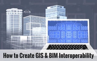
How to Create GIS and BIM Interoperability (20)
Essentials of Automations: The Art of Triggers and Actions in FMESafe Software
In this second installment of our Essentials of Automations webinar series, we’ll explore the landscape of triggers and actions, guiding you through the nuances of authoring and adapting workspaces for seamless automations. Gain an understanding of the full spectrum of triggers and actions available in FME, empowering you to enhance your workspaces for efficient automation.
We’ll kick things off by showcasing the most commonly used event-based triggers, introducing you to various automation workflows like manual triggers, schedules, directory watchers, and more. Plus, see how these elements play out in real scenarios.
Whether you’re tweaking your current setup or building from the ground up, this session will arm you with the tools and insights needed to transform your FME usage into a powerhouse of productivity. Join us to discover effective strategies that simplify complex processes, enhancing your productivity and transforming your data management practices with FME. Let’s turn complexity into clarity and make your workspaces work wonders!
Essentials of Automations: Optimizing FME Workflows with ParametersSafe Software
Are you looking to streamline your workflows and boost your projects’ efficiency? Do you find yourself searching for ways to add flexibility and control over your FME workflows? If so, you’re in the right place.
Join us for an insightful dive into the world of FME parameters, a critical element in optimizing workflow efficiency. This webinar marks the beginning of our three-part “Essentials of Automation” series. This first webinar is designed to equip you with the knowledge and skills to utilize parameters effectively: enhancing the flexibility, maintainability, and user control of your FME projects.
Here’s what you’ll gain:
- Essentials of FME Parameters: Understand the pivotal role of parameters, including Reader/Writer, Transformer, User, and FME Flow categories. Discover how they are the key to unlocking automation and optimization within your workflows.
- Practical Applications in FME Form: Delve into key user parameter types including choice, connections, and file URLs. Allow users to control how a workflow runs, making your workflows more reusable. Learn to import values and deliver the best user experience for your workflows while enhancing accuracy.
- Optimization Strategies in FME Flow: Explore the creation and strategic deployment of parameters in FME Flow, including the use of deployment and geometry parameters, to maximize workflow efficiency.
- Pro Tips for Success: Gain insights on parameterizing connections and leveraging new features like Conditional Visibility for clarity and simplicity.
We’ll wrap up with a glimpse into future webinars, followed by a Q&A session to address your specific questions surrounding this topic.
Don’t miss this opportunity to elevate your FME expertise and drive your projects to new heights of efficiency.
The Zero-ETL Approach: Enhancing Data Agility and InsightSafe Software
In the ever-evolving landscape of data management, Zero-ETL is an approach that is reshaping how businesses handle and integrate their data. This webinar explores Zero-ETL, a paradigm shift from the traditional Extract, Transform, Load (ETL) process, offering a more streamlined, efficient, and real-time data integration method.
We will begin with an introduction to the concept of Zero-ETL, including how it allows direct access to data in its native environment and real-time data transformation, providing up-to-date information with significantly reduced data redundancy.
Next, we'll take you through several demonstrations showing how Zero-ETL can deliver real-time data and enable the free movement of data between systems. We will also discuss the various tools that support all aspects of Zero-ETL, providing attendees with an understanding of how they can adopt this innovative approach in their organizations.
Lastly, the session will conclude with an interactive Q&A segment, allowing participants to gain deeper insights into how Zero-ETL can be tailored to their specific business needs and how they can get started today.
Join us to discover how Zero-ETL can elevate your organization's data strategy.
Cloud Frontiers: A Deep Dive into Serverless Spatial Data and FMESafe Software
Following the popularity of “Cloud Revolution: Exploring the New Wave of Serverless Spatial Data,” we’re thrilled to announce this much-anticipated encore webinar.
In this sequel, we’ll dive deeper into the Cloud-Native realm by uncovering practical applications and FME support for these new formats, including COGs, COPC, FlatGeoBuf, GeoParquet, STAC, and ZARR.
Building on the foundation laid by industry leaders Michelle Roby of Radiant Earth and Chris Holmes of Planet in the first webinar, this second part offers an in-depth look at the real-world application and behind-the-scenes dynamics of these cutting-edge formats. We will spotlight specific use-cases and workflows, showcasing their efficiency and relevance in practical scenarios.
Discover the vast possibilities each format holds, highlighted through detailed discussions and demonstrations. Our expert speakers will dissect the key aspects and provide critical takeaways for effective use, ensuring attendees leave with a thorough understanding of how to apply these formats in their own projects.
Elevate your understanding of how FME supports these cutting-edge technologies, enhancing your ability to manage, share, and analyze spatial data. Whether you’re building on knowledge from our initial session or are new to the serverless spatial data landscape, this webinar is your gateway to mastering cloud-native formats in your workflows.
Cloud Frontiers: A Deep Dive into Serverless Spatial Data and FMESafe Software
Following the popularity of "Cloud Revolution: Exploring the New Wave of Serverless Spatial Data," we're thrilled to announce this much-anticipated encore webinar.
In this sequel, we'll dive deeper into the Cloud-Native realm by uncovering practical applications and FME support for these new formats, including COGs, COPC, FlatGeoBuf, GeoParquet, STAC, and ZARR.
Building on the foundation laid by industry leaders Michelle Roby of Radiant Earth and Chris Holmes of Planet in the first webinar, this second part offers an in-depth look at the real-world application and behind-the-scenes dynamics of these cutting-edge formats. We will spotlight specific use-cases and workflows, showcasing their efficiency and relevance in practical scenarios.
Discover the vast possibilities each format holds, highlighted through detailed discussions and demonstrations. Our expert speakers will dissect the key aspects and provide critical takeaways for effective use, ensuring attendees leave with a thorough understanding of how to apply these formats in their own projects.
Elevate your understanding of how FME supports these cutting-edge technologies, enhancing your ability to manage, share, and analyze spatial data. Whether you're building on knowledge from our initial session or are new to the serverless spatial data landscape, this webinar is your gateway to mastering cloud-native formats in your workflows.
From Event to Action: Accelerate Your Decision Making with Real-Time AutomationSafe Software
Imagine a world where information flows as swiftly as thought itself, making decision-making as fluid as the data driving it. Every moment is critical, and the right tools can significantly boost your organization’s performance. The power of real-time data automation through FME can turn this vision into reality.
Aimed at professionals eager to leverage real-time data for enhanced decision-making and efficiency, this webinar will cover the essentials of real-time data and its significance. We’ll explore:
FME’s role in real-time event processing, from data intake and analysis to transformation and reporting
An overview of leveraging streams vs. automations
FME’s impact across various industries highlighted by real-life case studies
Live demonstrations on setting up FME workflows for real-time data
Practical advice on getting started, best practices, and tips for effective implementation
Join us to enhance your skills in real-time data automation with FME, and take your operational capabilities to the next level.
From Event to Action: Accelerate Your Decision Making with Real-Time AutomationSafe Software
Imagine a world where information flows as swiftly as thought itself, making decision-making as fluid as the data driving it. Every moment is critical, and the right tools can significantly boost your organization's performance. The power of real-time data automation through FME can turn this vision into reality.
Aimed at professionals eager to leverage real-time data for enhanced decision-making and efficiency, this webinar will cover the essentials of real-time data and its significance. We'll explore:
FME's role in real-time event processing, from data intake and analysis to transformation and reporting
An overview of leveraging streams vs. automations
FME's impact across various industries highlighted by real-life case studies
Live demonstrations on setting up FME workflows for real-time data
Practical advice on getting started, best practices, and tips for effective implementation
Join us to enhance your skills in real-time data automation with FME, and take your operational capabilities to the next level.
Beyond Boundaries: Leveraging No-Code Solutions for Industry InnovationSafe Software
Hiring and retaining software development talent is next to impossible for AEC firms and other industries alike.
Join us and guest speakers from HOK, a leader in the AEC industry, as they share their success in navigating the tight talent market through the use of no-code solutions and FME.
Discover how HOK approached the process of building a custom tool to automate the creation of projects and user management for Trimble Connect and ProjectSight.
Using a mix of traditional and no-code in FME, our guest speakers will reveal how the team bridged the resource gap and used the available talent pool, producing the mission-critical web app “Trajectory”.
They will also dive into details, illustrating first-hand how JSON data was used as a “glue” between two development groups.
Learn how embracing FME as a no-code solution can unlock potential within your teams, foster collaboration, and drive efficiency.
Powering Real-Time Decisions with Continuous Data StreamsSafe Software
In an era where making swift, data-driven decisions can set industry leaders apart, understanding the world of data streaming and stream processing is crucial. During this webinar, we'll explore:
Stream Processing Overview: Dive into what stream processing entails and the value it brings organizations.
Stream vs. Batch Processing: Learn the key differences and benefits of stream processing compared to traditional batch processing, highlighting the efficiency of real-time data handling.
Mastering Data Volumes: Discover strategies for effectively managing both high and low volume data streams, ensuring optimal performance.
Boosting Operational Excellence: Explore how adopting data streaming can enhance your organization's operational workflows and productivity.
Spatial Data's Role in Streams: Understand the importance of spatial data in stream processing for more informed decision-making.
Interactive Demos: Watch practical demos, from dynamic geofencing to group-based processing.
Plus, we’ll show you how you can do it without coding! Register now to take the first step towards more informed, timely, and precise decision-making for your organization.
The Critical Role of Spatial Data in Today's Data EcosystemSafe Software
In today's data-driven landscape, integrating spatial data is becoming increasingly crucial for organizations aiming to harness the full potential of their data. Spatial data offers unique insights based on location, making it a fundamental component for addressing various challenges across different sectors, including urban planning, environmental sustainability, public health, and logistics.
Our webinar delves into the indispensable role of spatial data in data management and analysis. We'll showcase how omitting spatial data from your data strategy not only weakens your data infrastructure, but also limits the depth of your insights. Through real-world case studies, we'll highlight the transformative impact of spatial data, demonstrating its ability to uncover complex patterns, trends, and relationships.
Join us for this introductory-level webinar as we explore the critical importance of spatial data integration in driving strategic decision-making processes. By the end of the webinar, you'll gain a renewed perspective on how spatial data is essential for confronting and overcoming challenges across various domains.
Cloud Revolution: Exploring the New Wave of Serverless Spatial DataSafe Software
Once in a while, there really is something new under the sun. The rise of cloud-hosted data has fueled innovation in spatial data storage, enabling a brand new serverless architectural approach to spatial data sharing. Join us in our upcoming webinar to learn all about these new ways to organize your data, and leverage data shared by others. Explore the potential of Cloud Native Geospatial Formats in your workflows with FME, as we introduce five new formats: COGs, COPC, FlatGeoBuf, GeoParquet, STAC and ZARR.
Learn from industry experts Michelle Roby from Radiant Earth and Chris Holmes from Planet about these cloud-native geospatial data formats and how they can make data easier to manage, share, and analyze. To get us started, they’ll explain the goals of the Cloud-Native Geospatial Foundation and provide overviews of cloud-native technologies including the Cloud-Optimized GeoTIFF (COG), SpatioTemporal Asset Catalogs (STAC), and GeoParquet.
Following this, our seasoned FME team will guide you through practical demonstrations, showcasing how to leverage each format to its fullest potential. Learn strategic approaches for seamless integration and transition, along with valuable tips to enhance performance using these formats in FME.
Discover how these formats are reshaping geospatial data handling and how you can seamlessly integrate them into your FME workflows and harness the explosion of cloud-hosted data.
Igniting Next Level Productivity with AI-Infused Data Integration WorkflowsSafe Software
Learn where FME meets AI in this upcoming webinar to offer you incredible time savings. This webinar is tailored to ignite imaginations and offer solutions to your data integration challenges. As the new digital era sets sail on the winds of AI, the tangibility of its integration in our daily schema is unfolding.
Segment 1, titled “AI: The Good, the Bad and the FME” by Darren Fergus of Locus, navigates through the realms of AI, scrutinizing its pervasive impact while underscoring the symbiotic potential of FME and AI. Join in an engaging demonstration as FME and ChatGPT collaboratively orchestrate a PowerPoint narrative, epitomizing the alliance of AI with human ingenuity.
In Segment 2, “Integrating GeoAI Models in FME” by Dennis Wilhelm and Dr. Christopher Britsch of con terra GmbH, the spotlight veers towards operationalizing AI in our daily tasks through FME. A practical approach to embedding GeoAI Models into FME Workspaces is unveiled, showcasing the ease of incorporating AI-driven methodologies into your FME workflows, skyrocketing productivity levels.
To follow, Segment 3, "Unleash generative AI on your terms!" by Oliver Morris of Avineon-Tensing. While the prospects of Generative AI are thrilling, security and IT reservations, especially with 'phone home' tools, are genuine concerns. However, with open-source tools, you can locally harness large language models. In this demo, we'll unravel the magic of local AI deployment and its seamless integration into an FME workspace.
Bonus! Dmitri will join us for a fourth segment to tie us off, showcasing what he has been up to this week, including using OpenAI API for texturing in FME, amoung other projects.
Join us to explore the synergy of FME and AI: opening portals to a realm of revolutionized productivity and enriched user experiences.
The Zero-ETL Approach: Enhancing Data Agility and InsightSafe Software
In the ever-evolving landscape of data management, Zero-ETL is an approach that is reshaping how businesses handle and integrate their data. This webinar explores Zero-ETL, a paradigm shift from the traditional Extract, Transform, Load (ETL) process, offering a more streamlined, efficient, and real-time data integration method.
We will begin with an introduction to the concept of Zero-ETL, including how it allows direct access to data in its native environment and real-time data transformation, providing up-to-date information with significantly reduced data redundancy.
Next, we'll take you through several demonstrations showing how Zero-ETL can deliver real-time data and enable the free movement of data between systems. We will also discuss the various tools that support all aspects of Zero-ETL, providing attendees with an understanding of how they can adopt this innovative approach in their organizations.
Lastly, the session will conclude with an interactive Q&A segment, allowing participants to gain deeper insights into how Zero-ETL can be tailored to their specific business needs and how they can get started today.
Join us to discover how Zero-ETL can elevate your organization's data strategy.
Mastering MicroStation DGN: How to Integrate CAD and GISSafe Software
Dive deep into the world of CAD-GIS integration with our expert-led webinar. Discover how to seamlessly transfer data between Bentley MicroStation and leading GIS platforms, such as Esri ArcGIS. This session goes beyond mere CAD/GIS conversion, showcasing techniques to precisely transform MicroStation elements including cells, text, lines, and symbology. We’ll walk you through tags versus item types, and understanding how to leverage both. You’ll also learn how to reproject to any coordinate system. Finally, explore cutting-edge automated methods for managing database links, and delve into innovative strategies for enabling self-serve data collection and validation services.
Join us to overcome the common hurdles in CAD and GIS integration and enhance the efficiency of your workflows. This session is perfect for professionals, both new to FME and seasoned users, seeking to streamline their processes and leverage the full potential of their CAD and GIS systems.
Geospatial Synergy: Amplifying Efficiency with FME & EsriSafe Software
Dive deep into the world of geospatial data management and transformation in our upcoming webinar focusing on the powerful integration of FME and Esri technologies. This insightful session comprises two compelling segments aimed at enhancing your geospatial workflows, while minimizing operational hurdles.
In the first segment, guest speaker Jan Roggisch from Locus unveils how Auckland Council triumphed over the challenges of handling large, frequent data updates on ArcGIS Online using FME. Discover the journey from manual data handling to an automated, streamlined process that reduced server downtime from minutes to seconds: setting a new standard for local government organizations.
The second segment, led by James Botterill from 1Spatial, unveils the magic of incorporating ArcPy into your FME workflows. Delve into real-world scenarios where ArcGIS geoprocessing is harmoniously orchestrated within FME using the PythonCaller. Gain insights into raster-vector data conversion, spatial analysis, and a host of practical tips and tricks that empower you to leverage the combined capabilities of FME and Esri for efficient data manipulation and conversion.
Join us to explore the remarkable possibilities that open up when FME and Esri technologies converge – enhancing your ability to manage and transform geospatial data with unprecedented efficiency.
Introducing the New FME Community Webinar - Feb 21, 2024 (2).pdfSafe Software
Join us at Safe Software as we unveil the exciting new FME Community platform.
Picture yourself entering a vibrant, interconnected world, where every click brings you closer to a fellow FME enthusiast, a new idea, or a solution that could revolutionize your workflow.
Since its inception, the FME Community has been a dynamic hub for knowledge sharing, where thousands of users converge to exchange insights, engage in stimulating discussions, and collaboratively solve challenges. Now, envision this community reimagined - retaining the features you know and love, but infused with new, cutting-edge functionalities designed to make your experience even more enriching and effortless. The Community is also planned to soon act as a central hub for all FME community acticity across the web.
This webinar is your personal tour through this enhanced FME Community landscape. Whether you're an experienced user familiar with every nook and cranny of the old platform, or you're setting foot in this community for the first time, our webinar will ensure you navigate the new terrain with ease and confidence. Discover how to maximize your engagement, tap into the wealth of resources available, and contribute to the growing tapestry of FME innovation.
Join us in celebrating the future of FME collaboration, where your next breakthrough idea, insightful article, or spirited discussion awaits. Don't miss this opportunity to be a part of the evolution of the FME Community!
Breaking Barriers & Leveraging the Latest Developments in AI TechnologySafe Software
Explore how to best leverage the latest of AI technology in our upcoming webinar, where we delve into advancements and trends in the field since our previous AI webinars in 2023. Join us for a session filled with fresh insights and practical knowledge. We're stitching together the final threads of this presentation as we speak, keeping pace with AI's breakneck speed. Expect a session brimming with the freshest insights, releases and breakthroughs in AI – right up to the minute! A spotlight of this session is set to include Dmitri Bagh’s exploration of innovative AI integrations with FME, ranging from generating 3D features for augmented reality using Dall-E, to enhancing urban planning with orthoimagery completion, and showcasing the power of AI in workspace analysis and geoart creation.
Whether you're new to AI or an experienced practitioner, this webinar is tailored to keep you at the forefront of AI innovation. Get ready for a session that is as informative as it is inspiring, equipping you with the tools to excel in the dynamic world of artificial intelligence.
Best Practices to Navigating Data and Application Integration for the Enterpr...Safe Software
Navigating the complexities of managing vast enterprise data across multiple systems can be challenging. This webinar is your guide to navigating and simplifying enterprise integration.
As a technology leader, you may grapple with legacy systems, shadow IT, and budget constraints. Data and personnel silos often impede technological progress. FME champions integrating superior business systems to bolster your organization's digital strength – efficiently and affordably, using your current team and accessible services.
Join us and partner guest speakers from Seamless in an engaging session exploring the essential roles of data and systems in modern enterprises. We'll provide insights on achieving high-quality data management, establishing strong governance, and enabling teams to manage their data effectively. Delve into strategies for ensuring high-quality data and building robust governance structures, with tips and tricks along the way.
This webinar features real-life case studies demonstrating success in diverse industries. Learn cutting-edge strategies for data governance and system integration. Don't miss this opportunity to gain valuable insights and best practices for transforming your data governance and system integration processes.
Cloud Revolution: Exploring the New Wave of Serverless Spatial DataSafe Software
Once in a while, there really is something new under the sun. The rise of cloud-hosted data has fueled innovation in spatial data storage, enabling a brand new serverless architectural approach to spatial data sharing. Join us in our upcoming webinar to learn all about these new ways to organize your data, and leverage data shared by others. Explore the potential of Cloud Native Geospatial Formats in your workflows with FME, as we introduce five new formats: COGs, COPC, FlatGeoBuf, GeoParquet, STAC and ZARR.
Learn from industry experts Michelle Roby from Radiant Earth and Chris Holmes from Planet about these cloud-native geospatial data formats and how they can make data easier to manage, share, and analyze. To get us started, they’ll explain the goals of the Cloud-Native Geospatial Foundation and provide overviews of cloud-native technologies including the Cloud-Optimized GeoTIFF (COG), SpatioTemporal Asset Catalogs (STAC), and GeoParquet.
Following this, our seasoned FME team will guide you through practical demonstrations, showcasing how to leverage each format to its fullest potential. Learn strategic approaches for seamless integration and transition, along with valuable tips to enhance performance using these formats in FME.
Discover how these formats are reshaping geospatial data handling and how you can seamlessly integrate them into your FME workflows and harness the explosion of cloud-hosted data.
Navigating the Metaverse: A Journey into Virtual Evolution"Donna Lenk
Join us for an exploration of the Metaverse's evolution, where innovation meets imagination. Discover new dimensions of virtual events, engage with thought-provoking discussions, and witness the transformative power of digital realms."
Into the Box Keynote Day 2: Unveiling amazing updates and announcements for modern CFML developers! Get ready for exciting releases and updates on Ortus tools and products. Stay tuned for cutting-edge innovations designed to boost your productivity.
In software engineering, the right architecture is essential for robust, scalable platforms. Wix has undergone a pivotal shift from event sourcing to a CRUD-based model for its microservices. This talk will chart the course of this pivotal journey.
Event sourcing, which records state changes as immutable events, provided robust auditing and "time travel" debugging for Wix Stores' microservices. Despite its benefits, the complexity it introduced in state management slowed development. Wix responded by adopting a simpler, unified CRUD model. This talk will explore the challenges of event sourcing and the advantages of Wix's new "CRUD on steroids" approach, which streamlines API integration and domain event management while preserving data integrity and system resilience.
Participants will gain valuable insights into Wix's strategies for ensuring atomicity in database updates and event production, as well as caching, materialization, and performance optimization techniques within a distributed system.
Join us to discover how Wix has mastered the art of balancing simplicity and extensibility, and learn how the re-adoption of the modest CRUD has turbocharged their development velocity, resilience, and scalability in a high-growth environment.
How to Position Your Globus Data Portal for Success Ten Good PracticesGlobus
Science gateways allow science and engineering communities to access shared data, software, computing services, and instruments. Science gateways have gained a lot of traction in the last twenty years, as evidenced by projects such as the Science Gateways Community Institute (SGCI) and the Center of Excellence on Science Gateways (SGX3) in the US, The Australian Research Data Commons (ARDC) and its platforms in Australia, and the projects around Virtual Research Environments in Europe. A few mature frameworks have evolved with their different strengths and foci and have been taken up by a larger community such as the Globus Data Portal, Hubzero, Tapis, and Galaxy. However, even when gateways are built on successful frameworks, they continue to face the challenges of ongoing maintenance costs and how to meet the ever-expanding needs of the community they serve with enhanced features. It is not uncommon that gateways with compelling use cases are nonetheless unable to get past the prototype phase and become a full production service, or if they do, they don't survive more than a couple of years. While there is no guaranteed pathway to success, it seems likely that for any gateway there is a need for a strong community and/or solid funding streams to create and sustain its success. With over twenty years of examples to draw from, this presentation goes into detail for ten factors common to successful and enduring gateways that effectively serve as best practices for any new or developing gateway.
Cyaniclab : Software Development Agency Portfolio.pdfCyanic lab
CyanicLab, an offshore custom software development company based in Sweden,India, Finland, is your go-to partner for startup development and innovative web design solutions. Our expert team specializes in crafting cutting-edge software tailored to meet the unique needs of startups and established enterprises alike. From conceptualization to execution, we offer comprehensive services including web and mobile app development, UI/UX design, and ongoing software maintenance. Ready to elevate your business? Contact CyanicLab today and let us propel your vision to success with our top-notch IT solutions.
We describe the deployment and use of Globus Compute for remote computation. This content is aimed at researchers who wish to compute on remote resources using a unified programming interface, as well as system administrators who will deploy and operate Globus Compute services on their research computing infrastructure.
Paketo Buildpacks : la meilleure façon de construire des images OCI? DevopsDa...Anthony Dahanne
Les Buildpacks existent depuis plus de 10 ans ! D’abord, ils étaient utilisés pour détecter et construire une application avant de la déployer sur certains PaaS. Ensuite, nous avons pu créer des images Docker (OCI) avec leur dernière génération, les Cloud Native Buildpacks (CNCF en incubation). Sont-ils une bonne alternative au Dockerfile ? Que sont les buildpacks Paketo ? Quelles communautés les soutiennent et comment ?
Venez le découvrir lors de cette session ignite
Unleash Unlimited Potential with One-Time Purchase
BoxLang is more than just a language; it's a community. By choosing a Visionary License, you're not just investing in your success, you're actively contributing to the ongoing development and support of BoxLang.
Globus Connect Server Deep Dive - GlobusWorld 2024Globus
We explore the Globus Connect Server (GCS) architecture and experiment with advanced configuration options and use cases. This content is targeted at system administrators who are familiar with GCS and currently operate—or are planning to operate—broader deployments at their institution.
Code reviews are vital for ensuring good code quality. They serve as one of our last lines of defense against bugs and subpar code reaching production.
Yet, they often turn into annoying tasks riddled with frustration, hostility, unclear feedback and lack of standards. How can we improve this crucial process?
In this session we will cover:
- The Art of Effective Code Reviews
- Streamlining the Review Process
- Elevating Reviews with Automated Tools
By the end of this presentation, you'll have the knowledge on how to organize and improve your code review proces
Prosigns: Transforming Business with Tailored Technology SolutionsProsigns
Unlocking Business Potential: Tailored Technology Solutions by Prosigns
Discover how Prosigns, a leading technology solutions provider, partners with businesses to drive innovation and success. Our presentation showcases our comprehensive range of services, including custom software development, web and mobile app development, AI & ML solutions, blockchain integration, DevOps services, and Microsoft Dynamics 365 support.
Custom Software Development: Prosigns specializes in creating bespoke software solutions that cater to your unique business needs. Our team of experts works closely with you to understand your requirements and deliver tailor-made software that enhances efficiency and drives growth.
Web and Mobile App Development: From responsive websites to intuitive mobile applications, Prosigns develops cutting-edge solutions that engage users and deliver seamless experiences across devices.
AI & ML Solutions: Harnessing the power of Artificial Intelligence and Machine Learning, Prosigns provides smart solutions that automate processes, provide valuable insights, and drive informed decision-making.
Blockchain Integration: Prosigns offers comprehensive blockchain solutions, including development, integration, and consulting services, enabling businesses to leverage blockchain technology for enhanced security, transparency, and efficiency.
DevOps Services: Prosigns' DevOps services streamline development and operations processes, ensuring faster and more reliable software delivery through automation and continuous integration.
Microsoft Dynamics 365 Support: Prosigns provides comprehensive support and maintenance services for Microsoft Dynamics 365, ensuring your system is always up-to-date, secure, and running smoothly.
Learn how our collaborative approach and dedication to excellence help businesses achieve their goals and stay ahead in today's digital landscape. From concept to deployment, Prosigns is your trusted partner for transforming ideas into reality and unlocking the full potential of your business.
Join us on a journey of innovation and growth. Let's partner for success with Prosigns.
AI Pilot Review: The World’s First Virtual Assistant Marketing SuiteGoogle
AI Pilot Review: The World’s First Virtual Assistant Marketing Suite
👉👉 Click Here To Get More Info 👇👇
https://sumonreview.com/ai-pilot-review/
AI Pilot Review: Key Features
✅Deploy AI expert bots in Any Niche With Just A Click
✅With one keyword, generate complete funnels, websites, landing pages, and more.
✅More than 85 AI features are included in the AI pilot.
✅No setup or configuration; use your voice (like Siri) to do whatever you want.
✅You Can Use AI Pilot To Create your version of AI Pilot And Charge People For It…
✅ZERO Manual Work With AI Pilot. Never write, Design, Or Code Again.
✅ZERO Limits On Features Or Usages
✅Use Our AI-powered Traffic To Get Hundreds Of Customers
✅No Complicated Setup: Get Up And Running In 2 Minutes
✅99.99% Up-Time Guaranteed
✅30 Days Money-Back Guarantee
✅ZERO Upfront Cost
See My Other Reviews Article:
(1) TubeTrivia AI Review: https://sumonreview.com/tubetrivia-ai-review
(2) SocioWave Review: https://sumonreview.com/sociowave-review
(3) AI Partner & Profit Review: https://sumonreview.com/ai-partner-profit-review
(4) AI Ebook Suite Review: https://sumonreview.com/ai-ebook-suite-review
Top Features to Include in Your Winzo Clone App for Business Growth (4).pptxrickgrimesss22
Discover the essential features to incorporate in your Winzo clone app to boost business growth, enhance user engagement, and drive revenue. Learn how to create a compelling gaming experience that stands out in the competitive market.
OpenFOAM solver for Helmholtz equation, helmholtzFoam / helmholtzBubbleFoamtakuyayamamoto1800
In this slide, we show the simulation example and the way to compile this solver.
In this solver, the Helmholtz equation can be solved by helmholtzFoam. Also, the Helmholtz equation with uniformly dispersed bubbles can be simulated by helmholtzBubbleFoam.
Custom Healthcare Software for Managing Chronic Conditions and Remote Patient...Mind IT Systems
Healthcare providers often struggle with the complexities of chronic conditions and remote patient monitoring, as each patient requires personalized care and ongoing monitoring. Off-the-shelf solutions may not meet these diverse needs, leading to inefficiencies and gaps in care. It’s here, custom healthcare software offers a tailored solution, ensuring improved care and effectiveness.
Exploring Innovations in Data Repository Solutions - Insights from the U.S. G...Globus
The U.S. Geological Survey (USGS) has made substantial investments in meeting evolving scientific, technical, and policy driven demands on storing, managing, and delivering data. As these demands continue to grow in complexity and scale, the USGS must continue to explore innovative solutions to improve its management, curation, sharing, delivering, and preservation approaches for large-scale research data. Supporting these needs, the USGS has partnered with the University of Chicago-Globus to research and develop advanced repository components and workflows leveraging its current investment in Globus. The primary outcome of this partnership includes the development of a prototype enterprise repository, driven by USGS Data Release requirements, through exploration and implementation of the entire suite of the Globus platform offerings, including Globus Flow, Globus Auth, Globus Transfer, and Globus Search. This presentation will provide insights into this research partnership, introduce the unique requirements and challenges being addressed and provide relevant project progress.
4. FME Software by Safe Software Inc.
“[FME] is really a good tool to solve all
my problems.”
5. Why use BIM?
➔ 3D digital representations of
infrastructure
➔ Includes descriptive info (dimensions,
materials, manufacturers, etc.)
➔ Aids in proper design, construction,
operation, and maintenance
➔ Drawback: files size and complexity
make data difficult to repurpose
6. Why use GIS?
➔ Map and analyze geographic features
➔ Uses location and imagery
➔ Conveys data on a large scale
➔ Data models, attributes, simple
geometries, and domains
7. BIM in GIS
“One BIM Model uses ¼ the
space of my entire 3D City
Model!”
Dan Campbell,
City of Vancouver
8. How can FME Help?
BIM data is very complex.
BIM Software Exports
- Overly complex (IFC)
- Overly simplified (DWG)
With FME
- Keep info you need
- Discard info you don’t
9. BIM to GIS at
Mount Vernon
VIRGINIA, USA
Patrick Gahagan, Esri
Quinn Evans Architects
Mount Vernon Ladies’ Association
CASE STUDY
10. Mount Vernon
• George Washington’s home, constructed between 1758 and
1778
• Mount Vernon Ladies’ Association tasked with restoration,
interpretation, and preservation of grounds and structures
• Mansion laser scanned to create architectural-quality HBIM in
Revit by Quinn Evans Architects
11. BIM to GIS via FME (Data Interop)
• Revit: Add coordinates and
rotation from project north
to true north
• Export to Revit Archive(.rvz)
with FME Revit Exporter,
attributes to spreadsheet
• Import to ArcGIS with Data
Interoperability Extension
(FME)
• Reconnect attribution
14. Stakeholder Access to Information
• Browser delivery provides
data to everyone, even
fire suppressant system
designer
• Historical data identifies
plaster from 1950 vs. 1787
• Framing details assist with
optimal routing
15. A navigable, queriable world provides minute detail and the big picture to all
stakeholders – BIM/GIS pros or not.
35. Key Takeaways:
Removing detail is necessary for efficient
viewing.
Understanding geometry hierarchy is useful
when working with BIM.
GQuery (Geometry XQuery) can increase the
utility of many transformers.
38. Key Takeaways:
● A starting point BIM model can be
quickly created from GIS
● IFCProperty Set Definitions are created
in the workspace using transformers
● IFC Property Sets are stored as part of
the geometries in IFC and are populated
from GIS attributes
41. Key Takeaways:
IFC data can be extracted to Excel and
edited.
FME can merge changes back into IFC.
Change your BIM data without using your
BIM tools!
42. Training & Knowledge Transfer
Getting Started Free Online
Courses
Free Self-Paced
Learning
• Tutorials
• Webinars
• Hands-on,
instructor lead
training
• On-demand courses
• Demos & Knowledge
Base
S A F E . C O M / T R A I N I N G