Downloaded 41 times


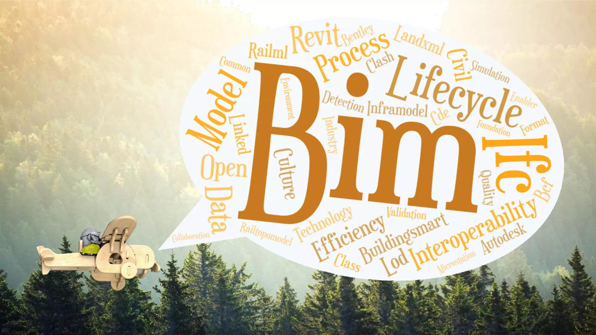
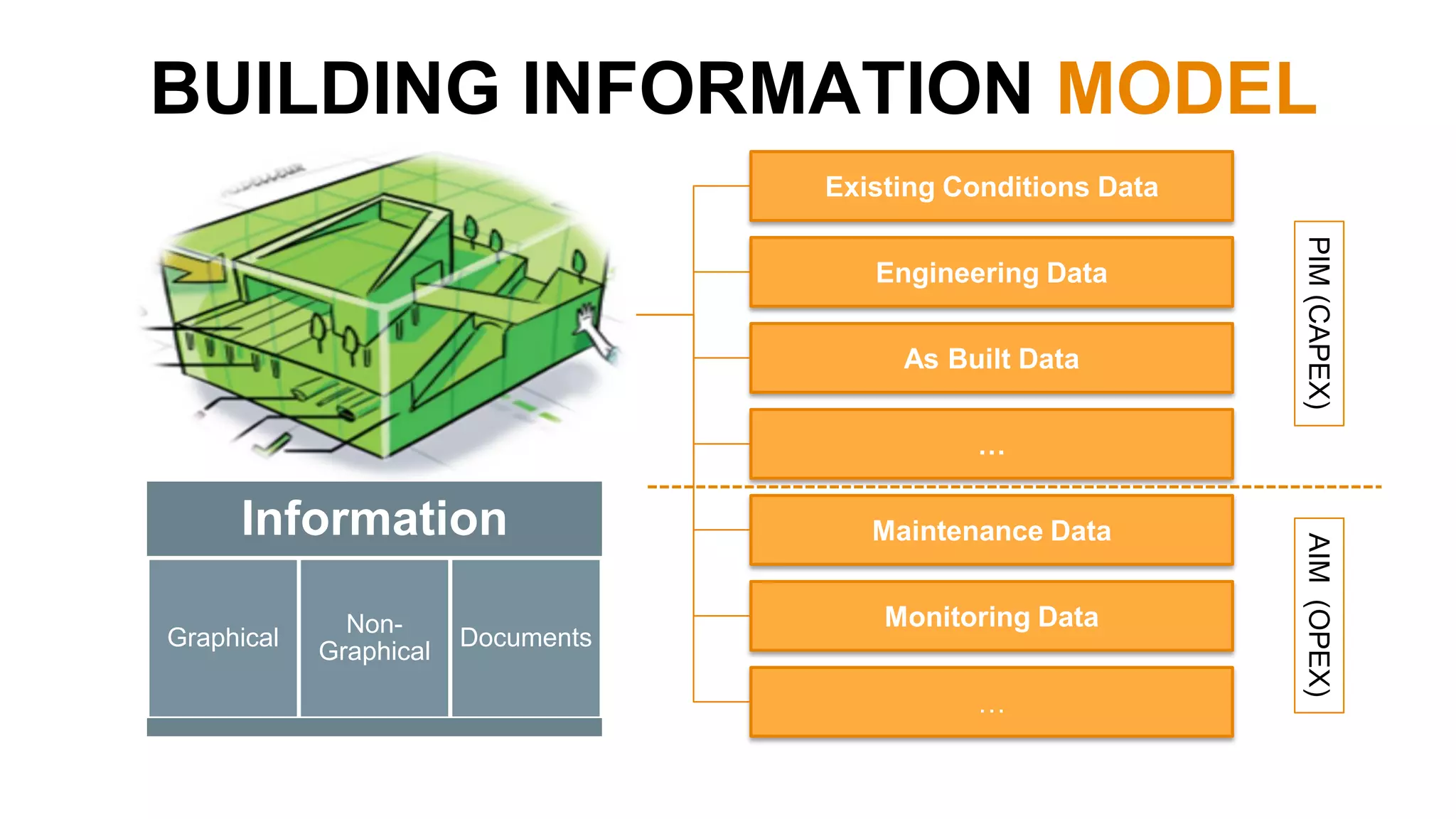
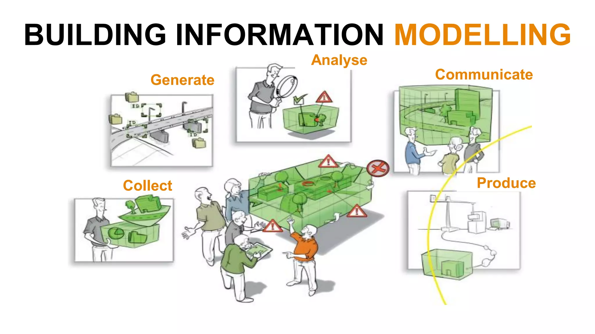
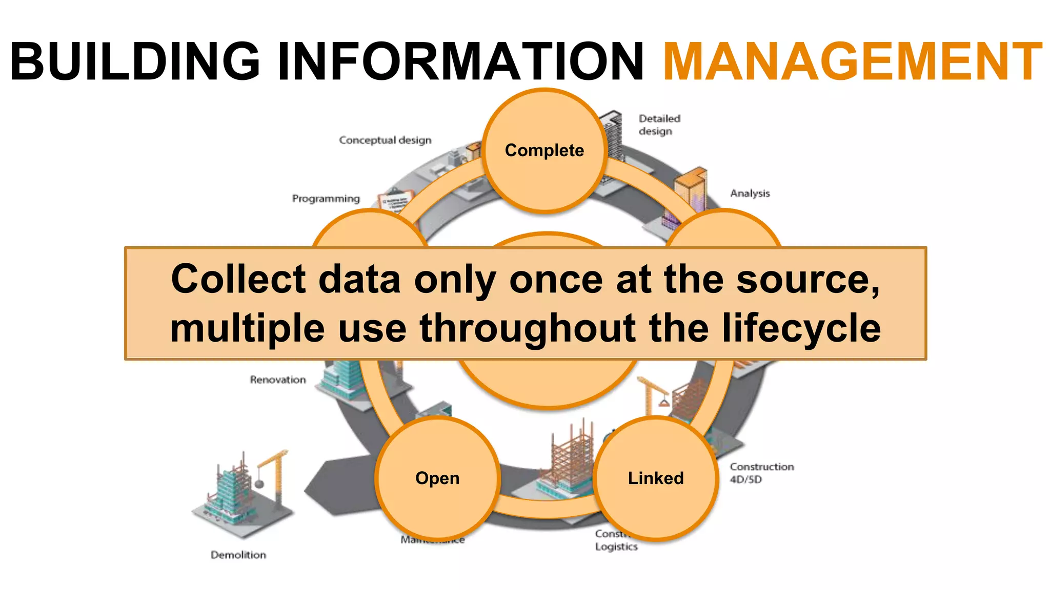
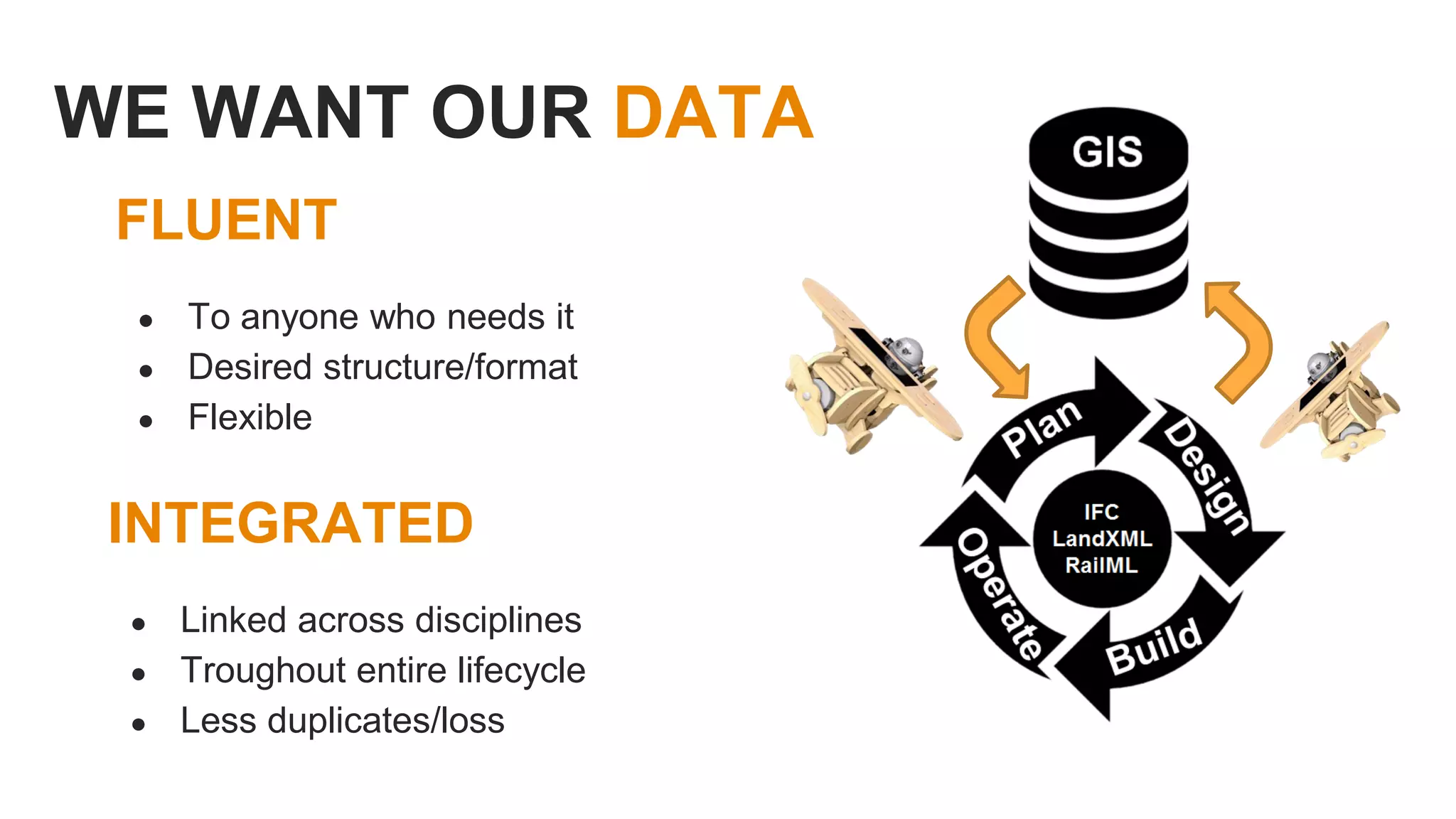
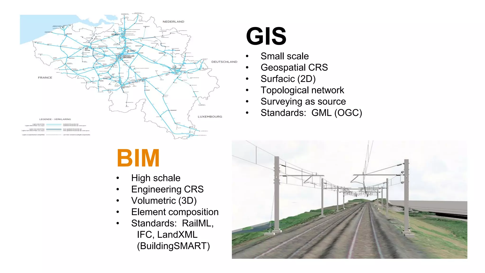
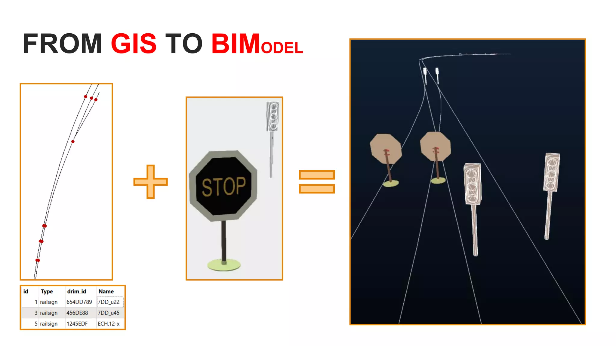
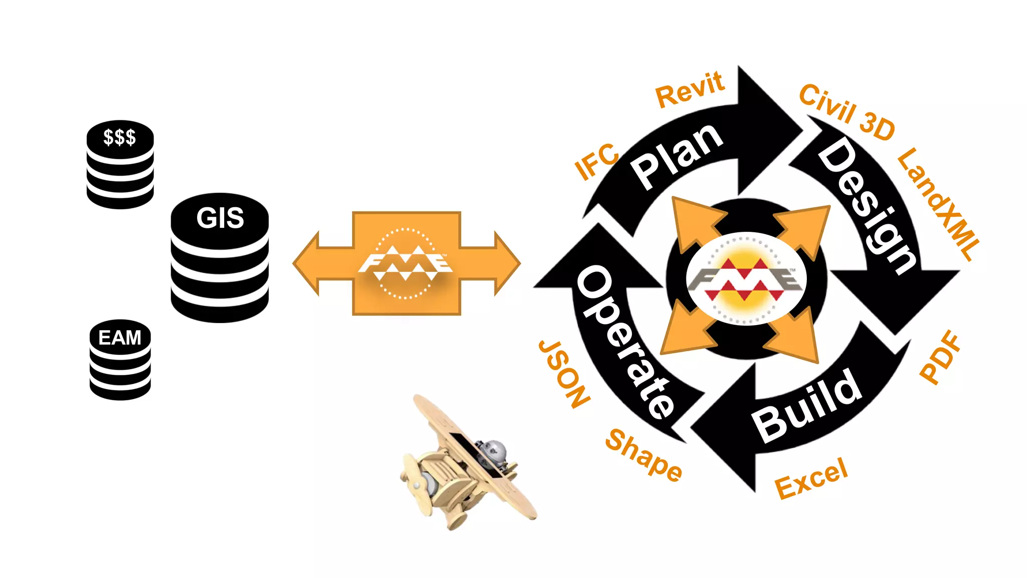
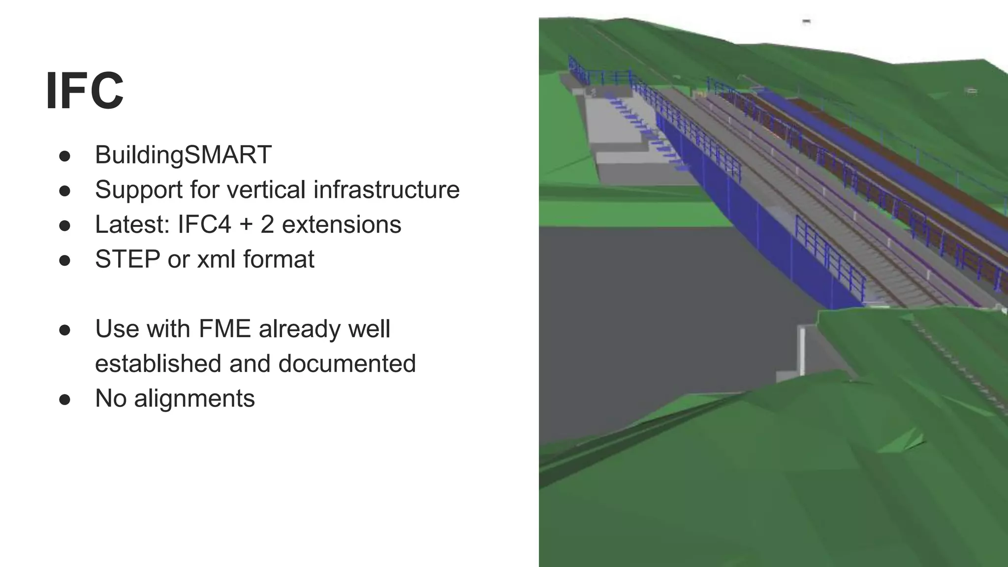
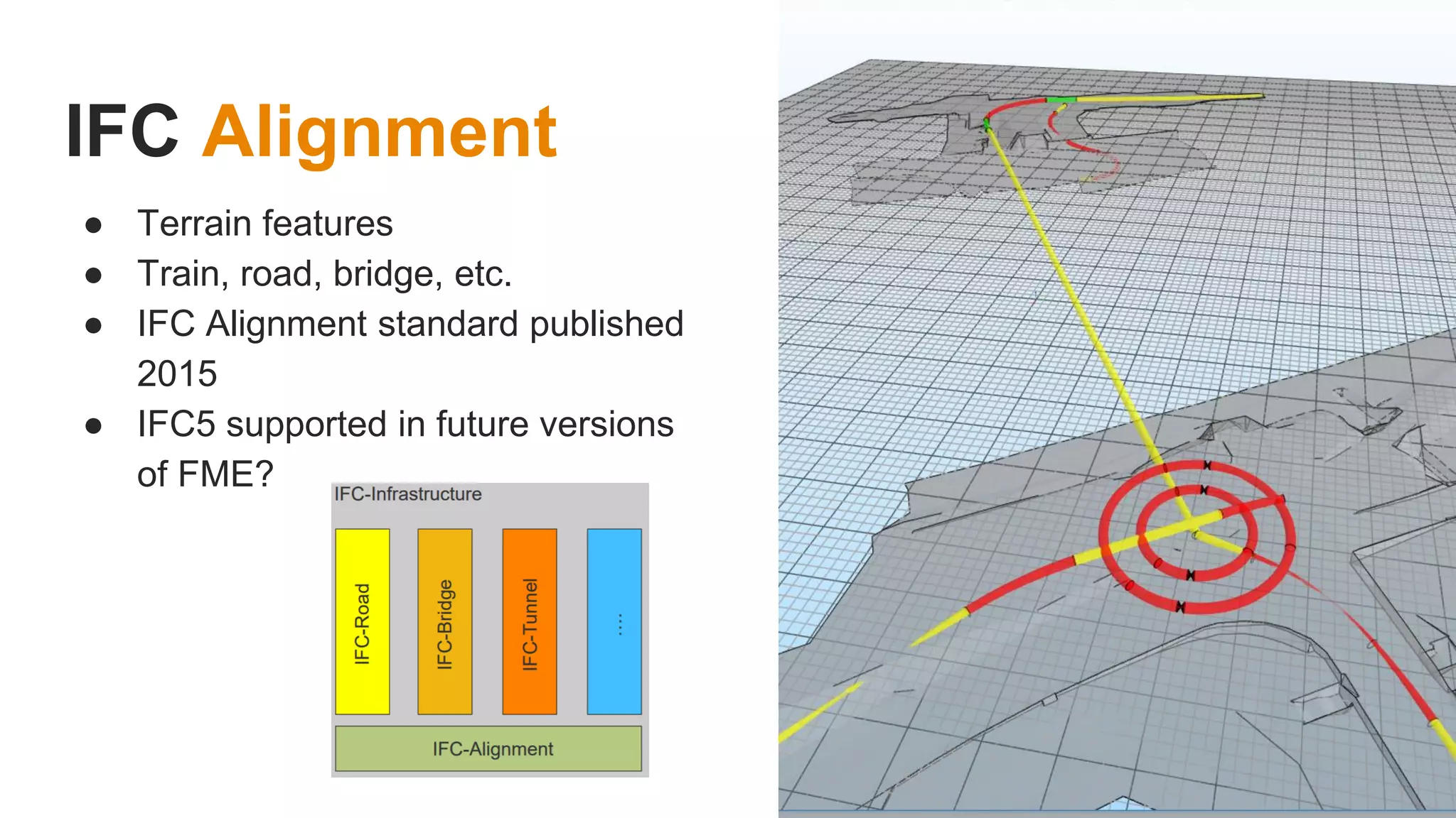
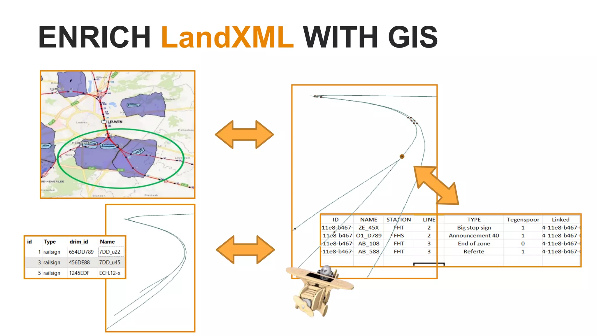
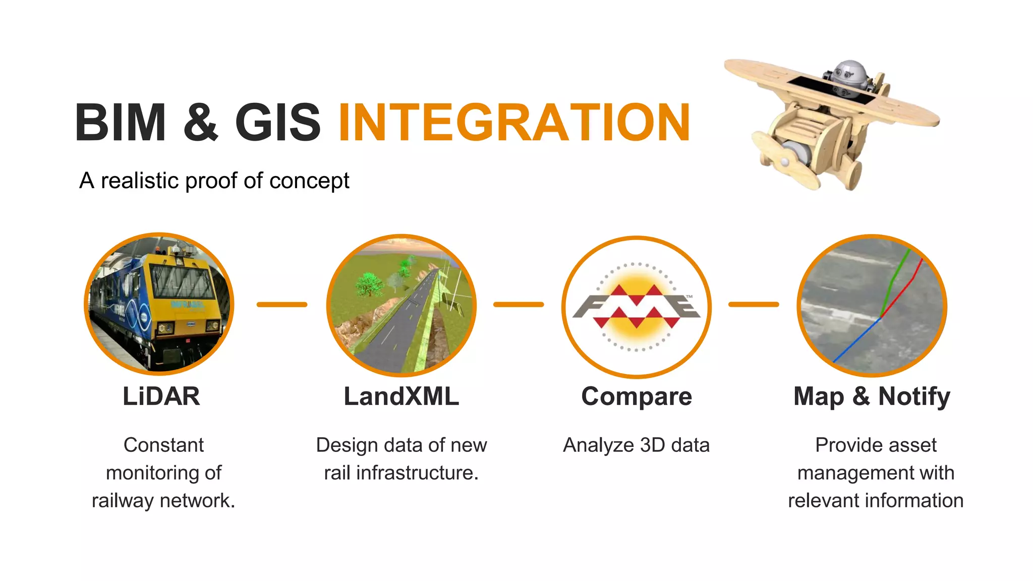
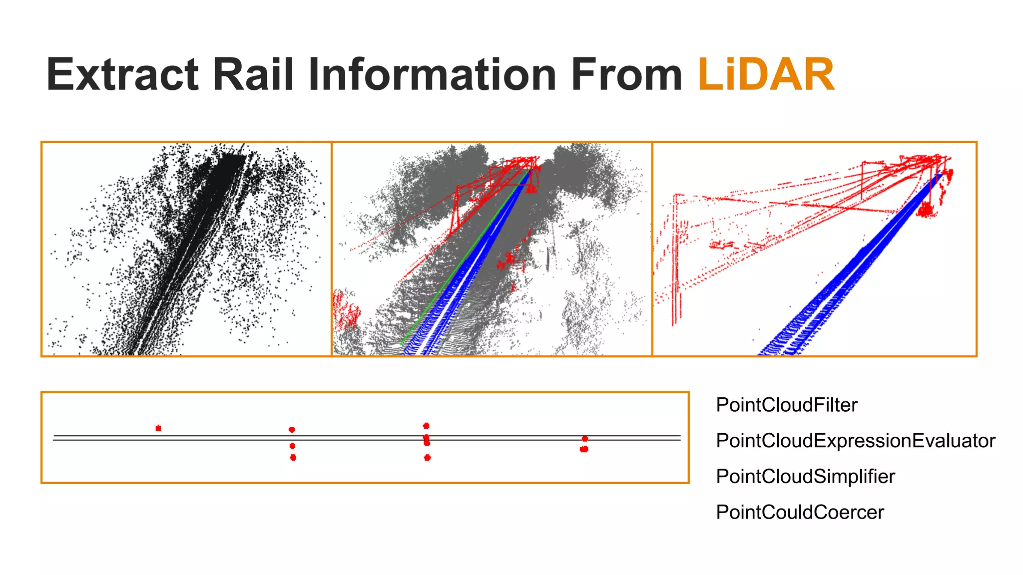
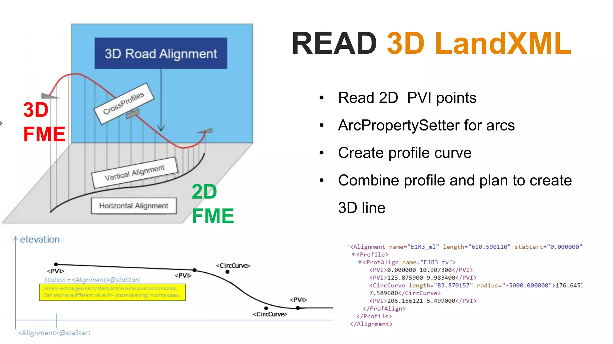
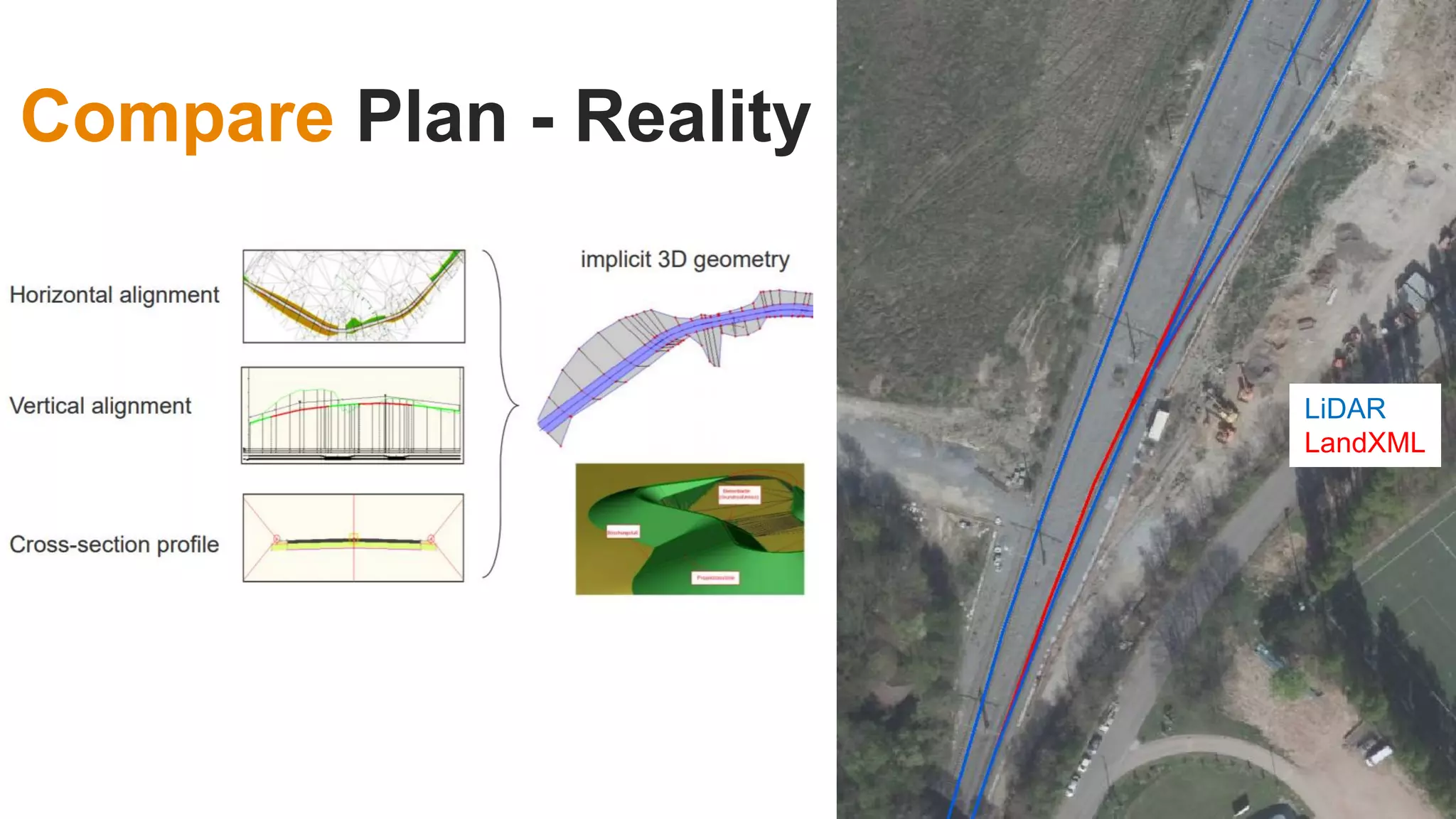
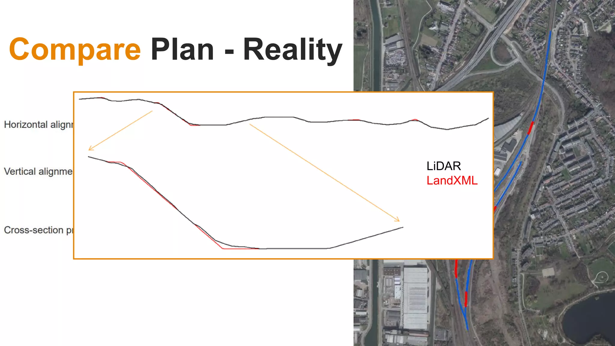
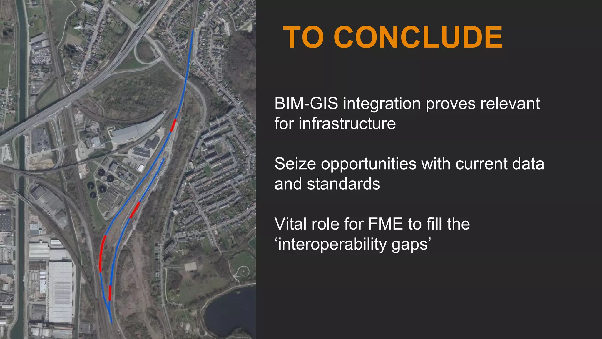


This document discusses bridging the gap between geographic information systems (GIS) and building information modeling (BIM) to build a sustainable railway network using consistent digital information. It proposes collecting data once at the source and sharing it throughout the asset lifecycle. Current GIS and BIM standards like InfraGML, IFC, and LandXML are examined for integrating railway design data with 3D reality models from lidar scans. The document demonstrates a proof of concept for extracting rail information from point clouds, reading 3D LandXML designs, and comparing plans to reality. It concludes that BIM-GIS integration is relevant for infrastructure and that software like FME can help fill interoperability gaps.