Downloaded 19 times


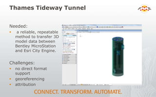
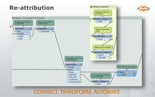


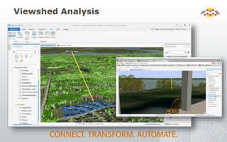


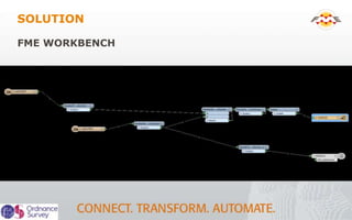


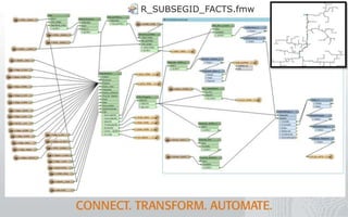
![Gas
Gathering System
R_GGS_FACTS.fmw
[R_GGS_FACTS]
SEGMENT_ID
R_SEGID_FACTS.fmw
[R_SEGID_FACTS]
GISID_ID
R_GISID_FACTS.fmw
[R_GISID_FACTS]
SUBSEG_ID
R_SUBSEGID_FACTS.fmw
[R_SUBSEGID_FACTS]](https://image.slidesharecdn.com/fmearoundtheworld2015-150407170710-conversion-gate01/85/FME-Around-the-World-48-320.jpg)


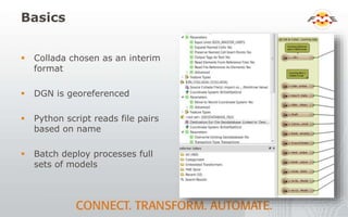
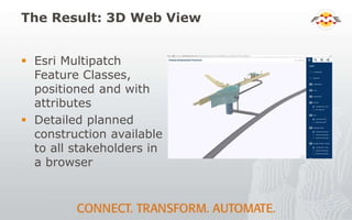
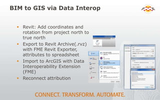
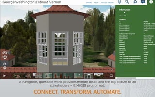
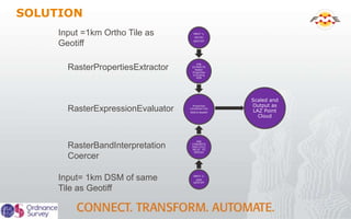
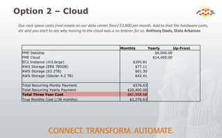
![Option 1 – On Site Upgrade
Monthly Yearly Up-Front
DIS Server Space $3,200.00
FME Dekstop $6,000.00
FME Server $12,000.00
Dell Hardware $100,000.00
SQL Server
Windows Server Std (Software Assurance)[5] $595.00
Windows Sevrer Enterprise (Software Assurance) [1] $385.00
Microsoft SQL Server (Software Assurance) $270.00
Microsoft SQL Server Standard Edition (Licenses) $294.00
Microsoft Server Std Edition (License) [6] $1,662.00
Microsoft Windows Server Enterprise Ed (Licences)
[5] $4,490.00
Symantec $680.00
Tape Backups (No server) $2,000.00
Total Recurring Montly Payment $3,200.00
Total Recurring Yearly Payment $26,376.00
Total One Time Cost (Every 3 yrs) $102,000.00
Total Three Year Cost $296,328.00
True Monthly Cost (/36 months) $8,231.33
Intangiable Costs
Hardware Maintenance Time
DIS Process
Non-Scaleable](https://image.slidesharecdn.com/fmearoundtheworld2015-150407170710-conversion-gate01/85/FME-Around-the-World-73-320.jpg)


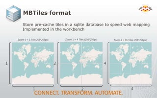
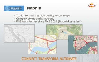
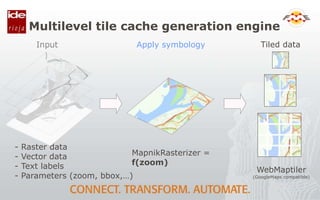
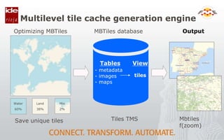
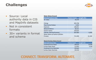
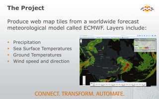
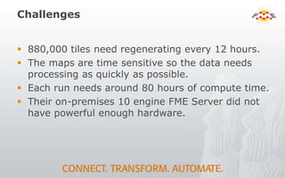
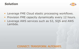
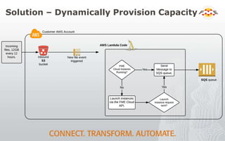
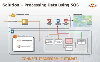
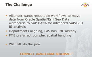
The document summarizes using FME for several mapping and geospatial data projects. It describes using FME to generate web map tiles from meteorological forecast models for Pelmorex in near real-time. It also discusses using FME Cloud to dynamically provision compute capacity for tile generation every 12 hours to process large amounts of data. Finally, it mentions that the approach costs $80 per run compared to $300,000 if done on-premises.


