SlideShare a Scribd company logo
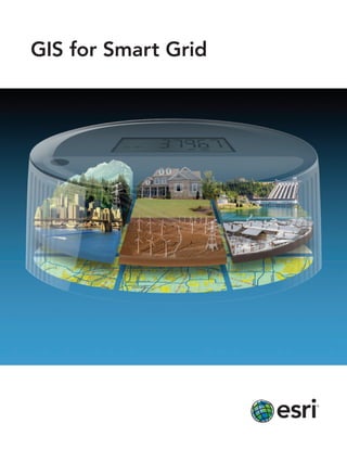
GIS for Smart Grid
The Geographic Approach                                                      ™


    to the Smart Grid
To implement a smart grid, utilities will need the sturdy foundation of geographic information system (GIS)
technology from Esri. GIS helps you answer questions and solve problems related to smart grid implementation.

Utility operators will need GIS to make the best decisions about key issues such as collecting data, managing
smart meter and sensor installation, analyzing customer behavior, and incorporating renewable energy. When
viewed in the context of geography, data is quickly understood and easily shared. Furthermore, GIS technology
can be integrated into any enterprise information system framework.

Simply put, GIS makes it possible for utilities to build and operate a smart grid.


GIS Makes the Smart Grid Smart


Data Management
Utilities already rely on GIS to manage assets
and outages and map the location of overhead
and underground circuits. GIS links utility asset
data with customer information to streamline
the rollout of smart grid work orders.
With GIS, utilities can capture the mashup
of information related to the smart grid,           Planning and Analysis
from customer behavior and the placement of         To see whether a smart grid deployment is effective, utilities use
smart meters to the location of electric vehicle    GIS to analyze marketing campaigns and study customer
chargers and renewable resources. Managing          behavior patterns along with demand response. With a rich set of
data within GIS ensures the degree of accuracy      easy-to-use spatial analysis tools, GIS helps determine the optimal
required for smart grid functionality.              location for smart grid components such as smart meters,
                                                    sensors, and cell relays. GIS can also help identify vulnerabilities,
                                                    weigh asset investments, and gauge customer response to a
                                                    smart grid implementation.
Workforce Automation
A smart grid relies on accurate data. Mobile
GIS is the surest way to move data quickly
to and from the field and the office. The
productivity of a smart grid implementation
can be increased by using GIS to schedule
and dispatch utility crews. A GIS allows
utilities to monitor the location and status of
fieldwork. From the field, crews have access
to a set of application templates for recording
and reporting the progress of smart grid
hardware installation.

                                                  Situational Awareness
                                                  Utilities bring it all together with GIS to view and track smart grid
                                                  deployment and operation. Through GIS-based graphic outputs
                                                  and Web-based reporting, they are able to quickly monitor and dem-
                                                  onstrate how the organization is progressing on smart grid activities.
                                                  GIS provides a Web-based dashboard that shows the status of any
                                                  project, alerts staff to variances in the schedule, monitors
                                                  investments, and locates new work orders.


Learn more. Read case studies, explore options,
and connect with an expert at esri.com/smartgrid.
About Esri                                                                                   Our Focus                                                                               Contact Esri

Since 1969, Esri has been helping                                                            Esri software is used by hundreds                                                       1-800-GIS-XPRT (1-800-447-9778)
organizations map and model our                                                              of thousands of organizations that                                                      Phone: 909-793-2853
world. Esri’s GIS software tools                                                             apply GIS to solve problems and                                                         Fax: 909-793-5953
and methodologies enable these                                                               make our world a better place to                                                        info@esri.com
organizations to effectively analyze                                                         live. We pay close attention to our                                                     esri.com
and manage their geographic                                                                  users to ensure they have the best
                                                                                                                                                                                     Offices worldwide
information and make better                                                                  tools possible to accomplish their
                                                                                                                                                                                     esri.com/locations
decisions. They are supported by our                                                         missions. A comprehensive suite of
experienced and knowledgeable staff                                                          training options offered worldwide
and extensive network of business                                                            helps our users fully leverage their
partners and international distributors.                                                     GIS applications.

A full-service GIS company, Esri                                                             Esri is a socially conscious business,
supports the implementation of GIS                                                           actively supporting organizations
technology on desktops, servers,                                                             involved in education, conservation,
online services, and mobile devices.                                                         sustainable development, and
These GIS solutions are flexible,                                                            humanitarian affairs.
customizable, and easy to use.


                                                                     380 New York Street
                                                                     Redlands, CA 92373-8100 USA


Copyright © 2011 Esri. All rights reserved. Esri, the Esri globe logo, ArcGIS, ArcMap, ArcInfo, The Geographic Approach, @esri.com, and esri.com are trademarks, registered
trademarks, or service marks of Esri in the United States, the European Community, or certain other jurisdictions. Other companies and products mentioned herein may be trademarks
or registered trademarks of their respective trademark owners.

123167
INLD2M1/11dh                                                                                                                                                                                                       Printed in USA

More Related Content

What's hot

Rail-net Indian railway internet
Rail-net Indian railway internetRail-net Indian railway internet
Rail-net Indian railway internet
Rahul Kumar
 
Apresentação Semáforo Interativo
Apresentação Semáforo InterativoApresentação Semáforo Interativo
Apresentação Semáforo Interativo
bismarque2
 
Smart Grid Introduction
Smart Grid Introduction Smart Grid Introduction
Smart Grid Introduction
Nilesh Dhage
 
Tracxn - Photonics Startup Landscape
Tracxn -  Photonics Startup LandscapeTracxn -  Photonics Startup Landscape
Tracxn - Photonics Startup Landscape
Tracxn
 

What's hot (20)

Rail-net Indian railway internet
Rail-net Indian railway internetRail-net Indian railway internet
Rail-net Indian railway internet
 
Introduction to Smart Grid.pptx
Introduction to Smart Grid.pptxIntroduction to Smart Grid.pptx
Introduction to Smart Grid.pptx
 
smart Grid
smart Gridsmart Grid
smart Grid
 
Solar tracker
Solar trackerSolar tracker
Solar tracker
 
Apresentação Semáforo Interativo
Apresentação Semáforo InterativoApresentação Semáforo Interativo
Apresentação Semáforo Interativo
 
20170920_日本太陽光電發展概況
20170920_日本太陽光電發展概況20170920_日本太陽光電發展概況
20170920_日本太陽光電發展概況
 
The SmartGrid concept: a way to increase energy efficiency
The SmartGrid concept: a way to increase energy efficiencyThe SmartGrid concept: a way to increase energy efficiency
The SmartGrid concept: a way to increase energy efficiency
 
Smart grid new
Smart grid newSmart grid new
Smart grid new
 
Solar Inverters
 Solar Inverters Solar Inverters
Solar Inverters
 
Space based solar power system
Space based solar power systemSpace based solar power system
Space based solar power system
 
Summer Internship Report on PLC
Summer Internship Report on PLCSummer Internship Report on PLC
Summer Internship Report on PLC
 
Smart Grid Introduction
Smart Grid Introduction Smart Grid Introduction
Smart Grid Introduction
 
INTRODUCTION TO ENERGY SERVICES
INTRODUCTION TO ENERGY SERVICESINTRODUCTION TO ENERGY SERVICES
INTRODUCTION TO ENERGY SERVICES
 
Hybrid Smart Grid System for Renewable energy
Hybrid Smart Grid System for Renewable energyHybrid Smart Grid System for Renewable energy
Hybrid Smart Grid System for Renewable energy
 
Vehicle to Grid Technology
Vehicle to Grid TechnologyVehicle to Grid Technology
Vehicle to Grid Technology
 
Tracxn - Photonics Startup Landscape
Tracxn -  Photonics Startup LandscapeTracxn -  Photonics Startup Landscape
Tracxn - Photonics Startup Landscape
 
Artificial intelligence in power system
Artificial intelligence in power systemArtificial intelligence in power system
Artificial intelligence in power system
 
IOT in electrical engineering
IOT in electrical engineeringIOT in electrical engineering
IOT in electrical engineering
 
Seminar Report on Smart charging strategy for an electric vehicle fleet to r...
Seminar Report  on Smart charging strategy for an electric vehicle fleet to r...Seminar Report  on Smart charging strategy for an electric vehicle fleet to r...
Seminar Report on Smart charging strategy for an electric vehicle fleet to r...
 
artificial intelligence in power plants.
artificial intelligence in power plants.artificial intelligence in power plants.
artificial intelligence in power plants.
 

Viewers also liked

Viewers also liked (7)

GIS presentation
GIS presentationGIS presentation
GIS presentation
 
What’s new in the smart grid - Latest developments and trends and what it mea...
What’s new in the smart grid - Latest developments and trends and what it mea...What’s new in the smart grid - Latest developments and trends and what it mea...
What’s new in the smart grid - Latest developments and trends and what it mea...
 
GIS data structure
GIS data structureGIS data structure
GIS data structure
 
Smart grid communications
Smart grid communicationsSmart grid communications
Smart grid communications
 
ppt on Smart Grid
ppt on Smart Gridppt on Smart Grid
ppt on Smart Grid
 
Gis (geographic information system)
Gis (geographic information system)Gis (geographic information system)
Gis (geographic information system)
 
Smart grid ppt
Smart grid pptSmart grid ppt
Smart grid ppt
 

Similar to GIS for Smart Grid

Oil & gas
Oil & gasOil & gas
Oil & gas
yoki78
 
Oil & gas
Oil & gasOil & gas
Oil & gas
yoki78
 
MCS GEOTECH (P) LTD gis solutions
MCS GEOTECH (P) LTD gis solutionsMCS GEOTECH (P) LTD gis solutions
MCS GEOTECH (P) LTD gis solutions
MCS GEOTECH (P) LTD
 

Similar to GIS for Smart Grid (20)

Gis for Electric Distribution
Gis for Electric DistributionGis for Electric Distribution
Gis for Electric Distribution
 
GIS for Electric Transmission
GIS for Electric TransmissionGIS for Electric Transmission
GIS for Electric Transmission
 
Improving Citizen Engagement: Gov 2.0
Improving Citizen Engagement: Gov 2.0Improving Citizen Engagement: Gov 2.0
Improving Citizen Engagement: Gov 2.0
 
ArcGIS
ArcGISArcGIS
ArcGIS
 
ArcGIS
ArcGISArcGIS
ArcGIS
 
Situational awareness
Situational awarenessSituational awareness
Situational awareness
 
GIS for Facilities Overview
GIS for Facilities OverviewGIS for Facilities Overview
GIS for Facilities Overview
 
Oil & gas
Oil & gasOil & gas
Oil & gas
 
Oil & gas
Oil & gasOil & gas
Oil & gas
 
MCS GEOTECH (P) LTD gis solutions
MCS GEOTECH (P) LTD gis solutionsMCS GEOTECH (P) LTD gis solutions
MCS GEOTECH (P) LTD gis solutions
 
Esri Technology for National Intelligence
Esri Technology for National IntelligenceEsri Technology for National Intelligence
Esri Technology for National Intelligence
 
Esri News for State and Local Government Winter 2012/2013 issue
Esri News for State and Local Government Winter 2012/2013 issueEsri News for State and Local Government Winter 2012/2013 issue
Esri News for State and Local Government Winter 2012/2013 issue
 
The Changing Face of Asia's Geospatial Intelligence
The Changing Face of Asia's Geospatial Intelligence The Changing Face of Asia's Geospatial Intelligence
The Changing Face of Asia's Geospatial Intelligence
 
ArcGIS: Better Aeronautical Data Management
ArcGIS: Better Aeronautical Data ManagementArcGIS: Better Aeronautical Data Management
ArcGIS: Better Aeronautical Data Management
 
ArcGIS as a Platform
ArcGIS as a PlatformArcGIS as a Platform
ArcGIS as a Platform
 
Boost Mining Profits with Esri
Boost Mining Profits with EsriBoost Mining Profits with Esri
Boost Mining Profits with Esri
 
GIS Platform for National Security
GIS Platform for National SecurityGIS Platform for National Security
GIS Platform for National Security
 
ArcGIS for Local Government
ArcGIS for Local GovernmentArcGIS for Local Government
ArcGIS for Local Government
 
Esri News for Facilities -- Summer 2012
Esri News for Facilities -- Summer 2012Esri News for Facilities -- Summer 2012
Esri News for Facilities -- Summer 2012
 
Maximizing the Effectiveness of NPOs
Maximizing the Effectiveness of NPOsMaximizing the Effectiveness of NPOs
Maximizing the Effectiveness of NPOs
 

More from Esri

Aena Aeropuerto Adolfo Suárez-Barajas crea potentes aplicaciones para sus cli...
Aena Aeropuerto Adolfo Suárez-Barajas crea potentes aplicaciones para sus cli...Aena Aeropuerto Adolfo Suárez-Barajas crea potentes aplicaciones para sus cli...
Aena Aeropuerto Adolfo Suárez-Barajas crea potentes aplicaciones para sus cli...
Esri
 

More from Esri (20)

INIA- CISA: Análisis de las amenazas en la fauna silvestre
INIA- CISA: Análisis de las amenazas en la fauna silvestreINIA- CISA: Análisis de las amenazas en la fauna silvestre
INIA- CISA: Análisis de las amenazas en la fauna silvestre
 
Aena Aeropuerto Adolfo Suárez-Barajas crea potentes aplicaciones para sus cli...
Aena Aeropuerto Adolfo Suárez-Barajas crea potentes aplicaciones para sus cli...Aena Aeropuerto Adolfo Suárez-Barajas crea potentes aplicaciones para sus cli...
Aena Aeropuerto Adolfo Suárez-Barajas crea potentes aplicaciones para sus cli...
 
Plataforma Smart City de Móstoles
Plataforma Smart City de MóstolesPlataforma Smart City de Móstoles
Plataforma Smart City de Móstoles
 
ArcGIS Online para Organizaciones
ArcGIS Online para OrganizacionesArcGIS Online para Organizaciones
ArcGIS Online para Organizaciones
 
Molina de Segura se convierte en una smart city
Molina de Segura se convierte en una smart cityMolina de Segura se convierte en una smart city
Molina de Segura se convierte en una smart city
 
Portal for ArcGIS
Portal for ArcGISPortal for ArcGIS
Portal for ArcGIS
 
GIS-Based Web Services Provide Rapid Analysis and Dissemination of Maritime Data
GIS-Based Web Services Provide Rapid Analysis and Dissemination of Maritime DataGIS-Based Web Services Provide Rapid Analysis and Dissemination of Maritime Data
GIS-Based Web Services Provide Rapid Analysis and Dissemination of Maritime Data
 
An Effective Tool for Drinking Water Protection
An Effective Tool for Drinking Water ProtectionAn Effective Tool for Drinking Water Protection
An Effective Tool for Drinking Water Protection
 
GeoCollector for ArcPad
GeoCollector for ArcPadGeoCollector for ArcPad
GeoCollector for ArcPad
 
GeoCollector for ArcGIS for Windows Mobile
GeoCollector for ArcGIS for Windows MobileGeoCollector for ArcGIS for Windows Mobile
GeoCollector for ArcGIS for Windows Mobile
 
Data Appliance for ArcGIS
Data Appliance for ArcGISData Appliance for ArcGIS
Data Appliance for ArcGIS
 
Esri and BlackBridge
Esri and BlackBridgeEsri and BlackBridge
Esri and BlackBridge
 
GeoPlanner for ArcGIS
GeoPlanner for ArcGISGeoPlanner for ArcGIS
GeoPlanner for ArcGIS
 
Esri and AccuWeather
Esri and AccuWeatherEsri and AccuWeather
Esri and AccuWeather
 
Esri and Airbus Defense & Space
Esri and Airbus Defense & SpaceEsri and Airbus Defense & Space
Esri and Airbus Defense & Space
 
Esri US Data Fact Sheet
Esri US Data Fact SheetEsri US Data Fact Sheet
Esri US Data Fact Sheet
 
ArcGIS for Server on Microsoft Azure Jumpstart
ArcGIS for Server on Microsoft Azure JumpstartArcGIS for Server on Microsoft Azure Jumpstart
ArcGIS for Server on Microsoft Azure Jumpstart
 
ArcGIS for the Military--Maritime Operations
ArcGIS for the Military--Maritime OperationsArcGIS for the Military--Maritime Operations
ArcGIS for the Military--Maritime Operations
 
Esri Geoportal Server
Esri Geoportal ServerEsri Geoportal Server
Esri Geoportal Server
 
ArcGIS GeoEvent Extension for Server
ArcGIS GeoEvent Extension for ServerArcGIS GeoEvent Extension for Server
ArcGIS GeoEvent Extension for Server
 

Recently uploaded

Recently uploaded (20)

Unsubscribed: Combat Subscription Fatigue With a Membership Mentality by Head...
Unsubscribed: Combat Subscription Fatigue With a Membership Mentality by Head...Unsubscribed: Combat Subscription Fatigue With a Membership Mentality by Head...
Unsubscribed: Combat Subscription Fatigue With a Membership Mentality by Head...
 
Mission to Decommission: Importance of Decommissioning Products to Increase E...
Mission to Decommission: Importance of Decommissioning Products to Increase E...Mission to Decommission: Importance of Decommissioning Products to Increase E...
Mission to Decommission: Importance of Decommissioning Products to Increase E...
 
JMeter webinar - integration with InfluxDB and Grafana
JMeter webinar - integration with InfluxDB and GrafanaJMeter webinar - integration with InfluxDB and Grafana
JMeter webinar - integration with InfluxDB and Grafana
 
UiPath Test Automation using UiPath Test Suite series, part 3
UiPath Test Automation using UiPath Test Suite series, part 3UiPath Test Automation using UiPath Test Suite series, part 3
UiPath Test Automation using UiPath Test Suite series, part 3
 
Speed Wins: From Kafka to APIs in Minutes
Speed Wins: From Kafka to APIs in MinutesSpeed Wins: From Kafka to APIs in Minutes
Speed Wins: From Kafka to APIs in Minutes
 
Assuring Contact Center Experiences for Your Customers With ThousandEyes
Assuring Contact Center Experiences for Your Customers With ThousandEyesAssuring Contact Center Experiences for Your Customers With ThousandEyes
Assuring Contact Center Experiences for Your Customers With ThousandEyes
 
De-mystifying Zero to One: Design Informed Techniques for Greenfield Innovati...
De-mystifying Zero to One: Design Informed Techniques for Greenfield Innovati...De-mystifying Zero to One: Design Informed Techniques for Greenfield Innovati...
De-mystifying Zero to One: Design Informed Techniques for Greenfield Innovati...
 
From Siloed Products to Connected Ecosystem: Building a Sustainable and Scala...
From Siloed Products to Connected Ecosystem: Building a Sustainable and Scala...From Siloed Products to Connected Ecosystem: Building a Sustainable and Scala...
From Siloed Products to Connected Ecosystem: Building a Sustainable and Scala...
 
Exploring UiPath Orchestrator API: updates and limits in 2024 🚀
Exploring UiPath Orchestrator API: updates and limits in 2024 🚀Exploring UiPath Orchestrator API: updates and limits in 2024 🚀
Exploring UiPath Orchestrator API: updates and limits in 2024 🚀
 
AI for Every Business: Unlocking Your Product's Universal Potential by VP of ...
AI for Every Business: Unlocking Your Product's Universal Potential by VP of ...AI for Every Business: Unlocking Your Product's Universal Potential by VP of ...
AI for Every Business: Unlocking Your Product's Universal Potential by VP of ...
 
FIDO Alliance Osaka Seminar: Passkeys and the Road Ahead.pdf
FIDO Alliance Osaka Seminar: Passkeys and the Road Ahead.pdfFIDO Alliance Osaka Seminar: Passkeys and the Road Ahead.pdf
FIDO Alliance Osaka Seminar: Passkeys and the Road Ahead.pdf
 
Demystifying gRPC in .Net by John Staveley
Demystifying gRPC in .Net by John StaveleyDemystifying gRPC in .Net by John Staveley
Demystifying gRPC in .Net by John Staveley
 
GenAISummit 2024 May 28 Sri Ambati Keynote: AGI Belongs to The Community in O...
GenAISummit 2024 May 28 Sri Ambati Keynote: AGI Belongs to The Community in O...GenAISummit 2024 May 28 Sri Ambati Keynote: AGI Belongs to The Community in O...
GenAISummit 2024 May 28 Sri Ambati Keynote: AGI Belongs to The Community in O...
 
Slack (or Teams) Automation for Bonterra Impact Management (fka Social Soluti...
Slack (or Teams) Automation for Bonterra Impact Management (fka Social Soluti...Slack (or Teams) Automation for Bonterra Impact Management (fka Social Soluti...
Slack (or Teams) Automation for Bonterra Impact Management (fka Social Soluti...
 
Transcript: Selling digital books in 2024: Insights from industry leaders - T...
Transcript: Selling digital books in 2024: Insights from industry leaders - T...Transcript: Selling digital books in 2024: Insights from industry leaders - T...
Transcript: Selling digital books in 2024: Insights from industry leaders - T...
 
UiPath Test Automation using UiPath Test Suite series, part 1
UiPath Test Automation using UiPath Test Suite series, part 1UiPath Test Automation using UiPath Test Suite series, part 1
UiPath Test Automation using UiPath Test Suite series, part 1
 
PHP Frameworks: I want to break free (IPC Berlin 2024)
PHP Frameworks: I want to break free (IPC Berlin 2024)PHP Frameworks: I want to break free (IPC Berlin 2024)
PHP Frameworks: I want to break free (IPC Berlin 2024)
 
Builder.ai Founder Sachin Dev Duggal's Strategic Approach to Create an Innova...
Builder.ai Founder Sachin Dev Duggal's Strategic Approach to Create an Innova...Builder.ai Founder Sachin Dev Duggal's Strategic Approach to Create an Innova...
Builder.ai Founder Sachin Dev Duggal's Strategic Approach to Create an Innova...
 
Kubernetes & AI - Beauty and the Beast !?! @KCD Istanbul 2024
Kubernetes & AI - Beauty and the Beast !?! @KCD Istanbul 2024Kubernetes & AI - Beauty and the Beast !?! @KCD Istanbul 2024
Kubernetes & AI - Beauty and the Beast !?! @KCD Istanbul 2024
 
Bits & Pixels using AI for Good.........
Bits & Pixels using AI for Good.........Bits & Pixels using AI for Good.........
Bits & Pixels using AI for Good.........
 

GIS for Smart Grid

  • 2. The Geographic Approach ™ to the Smart Grid To implement a smart grid, utilities will need the sturdy foundation of geographic information system (GIS) technology from Esri. GIS helps you answer questions and solve problems related to smart grid implementation. Utility operators will need GIS to make the best decisions about key issues such as collecting data, managing smart meter and sensor installation, analyzing customer behavior, and incorporating renewable energy. When viewed in the context of geography, data is quickly understood and easily shared. Furthermore, GIS technology can be integrated into any enterprise information system framework. Simply put, GIS makes it possible for utilities to build and operate a smart grid. GIS Makes the Smart Grid Smart Data Management Utilities already rely on GIS to manage assets and outages and map the location of overhead and underground circuits. GIS links utility asset data with customer information to streamline the rollout of smart grid work orders. With GIS, utilities can capture the mashup of information related to the smart grid, Planning and Analysis from customer behavior and the placement of To see whether a smart grid deployment is effective, utilities use smart meters to the location of electric vehicle GIS to analyze marketing campaigns and study customer chargers and renewable resources. Managing behavior patterns along with demand response. With a rich set of data within GIS ensures the degree of accuracy easy-to-use spatial analysis tools, GIS helps determine the optimal required for smart grid functionality. location for smart grid components such as smart meters, sensors, and cell relays. GIS can also help identify vulnerabilities, weigh asset investments, and gauge customer response to a smart grid implementation.
  • 3. Workforce Automation A smart grid relies on accurate data. Mobile GIS is the surest way to move data quickly to and from the field and the office. The productivity of a smart grid implementation can be increased by using GIS to schedule and dispatch utility crews. A GIS allows utilities to monitor the location and status of fieldwork. From the field, crews have access to a set of application templates for recording and reporting the progress of smart grid hardware installation. Situational Awareness Utilities bring it all together with GIS to view and track smart grid deployment and operation. Through GIS-based graphic outputs and Web-based reporting, they are able to quickly monitor and dem- onstrate how the organization is progressing on smart grid activities. GIS provides a Web-based dashboard that shows the status of any project, alerts staff to variances in the schedule, monitors investments, and locates new work orders. Learn more. Read case studies, explore options, and connect with an expert at esri.com/smartgrid.
  • 4. About Esri Our Focus Contact Esri Since 1969, Esri has been helping Esri software is used by hundreds 1-800-GIS-XPRT (1-800-447-9778) organizations map and model our of thousands of organizations that Phone: 909-793-2853 world. Esri’s GIS software tools apply GIS to solve problems and Fax: 909-793-5953 and methodologies enable these make our world a better place to info@esri.com organizations to effectively analyze live. We pay close attention to our esri.com and manage their geographic users to ensure they have the best Offices worldwide information and make better tools possible to accomplish their esri.com/locations decisions. They are supported by our missions. A comprehensive suite of experienced and knowledgeable staff training options offered worldwide and extensive network of business helps our users fully leverage their partners and international distributors. GIS applications. A full-service GIS company, Esri Esri is a socially conscious business, supports the implementation of GIS actively supporting organizations technology on desktops, servers, involved in education, conservation, online services, and mobile devices. sustainable development, and These GIS solutions are flexible, humanitarian affairs. customizable, and easy to use. 380 New York Street Redlands, CA 92373-8100 USA Copyright © 2011 Esri. All rights reserved. Esri, the Esri globe logo, ArcGIS, ArcMap, ArcInfo, The Geographic Approach, @esri.com, and esri.com are trademarks, registered trademarks, or service marks of Esri in the United States, the European Community, or certain other jurisdictions. Other companies and products mentioned herein may be trademarks or registered trademarks of their respective trademark owners. 123167 INLD2M1/11dh Printed in USA