Shannon Park Redevelopment Plan Remodeling with Esri CityEngineCOGS Presentations
The project aims at transferring a community redevelopment plan as done by the student in 2010, including its general layout, transportation system, dwelling types, and spatial organization, into a 3D simulation model within Esri CityEngine. The project has a two-fold goal: 1) to explore 3D GIS application in urban planning and community design, and 2) to explore Esri CityEngine as a powerful tool of building 3D communities.
Presentation 'about the (very nearby) future of GIS' for GeoScience students, Universiteit Utrecht. I had a few recommended skill and recommendations as well, will blog about that later.
Create Minecraft Worlds with ArcGIS and the Data Interoperability ExtensionSafe Software
GIS professionals are experiencing excellent results combining GIS and gaming worlds such as Minecraft to engage wider and younger audiences to solve real problems. City planning, crisis management (floods, fires, etc.) and other tasks become fun and accessible to the public. Attendees will discover how to move IFC, Revit, CityEngine, and all kinds of other data through ArcGIS and into Minecraft using the ArcGIS Data Interoperability Extension. Implemented customer examples will be presented alongside strategies and tips, equipping attendees to implement these skills themselves.
3D GIS brings enhanced depth into data collection and analysis by incorporating a z-value into mapping. Most commonly, that means including elevation data, but users have many options for adding layers of information.
While 3D models are more difficult to create and maintain than 2D ones, there are myriad 3D GIS applications where this technology is greatly beneficial.
The 3D-GIS in the Cloud main purpose is to evaluate the use-efficiency of both existing and planned spatial space.
mago3D, A Brand-New Web Based Open Source GeoBIM PlatformSANGHEE SHIN
This is an introduction to mago3D, a web based open source GeoBIM platform developed by Gaia3D, Inc. This presentation was given at Geo Business event on 22nd, May. For details about mago3D, please visit http://mago3d.com
Spatial is (not) special - Adventures in location-based dataThierry Gregorius
Delivered to the BCS Data Management forum, an overview of GIS/Geospatial trends, the need for spatial integrity, why spatial intelligence doesn't need a map, and creative curveballs like the enduring benefits of analog tools and handmade craftsmanship.
The Future of Maps for Mobility / Geography2050Janine Yoong
While high-resolution satellite imagery is the foundation of digital mapping, the demands of urban mobility require highly accurate, frequently updated data from a different vantage point – the ground. Recent advances in street-level imagery collection and data extraction are lifting up new trends in location-based services, smart cities, and autonomous vehicles. As map technologists push the boundaries of machine intelligence for extracting data from images, human collaboration will drive the creation of maps for mobility for all.
My closing keynote at GISRUK 2019 - a call to arms for a human approach in a digital world, reflecting in a light-hearted and personal way on GIS industry trends, careers and how to succeed in GIS deployments and applications.
GISRUK is an annual GIS research conference attracting around 200 academic researchers from around the UK and beyond, each year held at a different university. The 2019 conference took place in Newcastle upon Tyne in April 2019. Info: https://gis.geos.ed.ac.uk/gisruk/gisruk.html
State of mago3D, An Open Source Based Digital Twin PlatformSANGHEE SHIN
I gave this talk at the FOSS4G Thailand 2019 which was held at Chulalongkorn University, Bangkok on 4th Nov 2019. I talked about the recent achievements and improvements of mago3D project, an open source based Digital Twin platform. mago3D(http mago3d.com) is relatively new project first released in July 2017. The ultimate goal of mago3D is developing an open source based digital twin platform that can replicate and simulate the real world objects, processes, and phenomena on web environment. mago3D has been used in various industry sectors including ship building, urban management, indoor data management, and national defense. In this talk I showcased several real projects that used the mago3D and shared what I learnt from these projects. Also I introduced new features and future plan of mago3D.
Esri CityEngine & Minecraft: Engaging Citizens in 3D City PlanningErin Lemky
Researchers at VU, Amsterdam are leveraging Esri CityEngine and Minecraft to increase citizen engagement in neighborhood design & planning. Inspired by UN-Habitat’s Block by Block, the project combines 2D & 3D datasets to create a 3D model in CityEngine. This GIS output becomes a canvas of the city in Minecraft, offering a gaming-style geodesign tool that citizens and their children can interact with. This presentation will explore how 2D data can be leveraged in 3D with Esri CityEngine.
Integrating BIM & GIS - Closing the Data Loop, September 2019Esri Ireland
The integration of BIM and GIS enables users to unlock the value in diverse data sets to enable applications including citizen engagement, sustainability analysis, disaster preparedness and much more operational and management uses. Esri Ireland and Pentagon Solutions are partnering to showcase the power of the BIM and GIS integration at a series of events, the first ones which took place in Dublin and Belfast from September 24th - 25th 2019.
This first of a kind collaboration demonstrated the workflows between ArcGIS and BIM technology for planning, design and asset ownership of digital projects. Both Esri Ireland and Pentagon Solutions believe that the integration of these game changing technologies, will prove beneficial for many.
If this is an area that is of interest to you or your organisation, you can get in touch with us via mapsmakesense@esri-ireland.ie.
DESIGNING WITH DATA FOR HUMANS
Designers and UX professionals have the opportunity and skills to shape data so it’s understandable, manageable and positively affects lives.
Ivo Gasparotto has worked on a team at GE Capital to create an intuitive application for users to manage and manipulate massive amounts of business and operations-related data. The team produced a user-centered application that allows access to data and surfaces unique insights into their business. Ivo will share what he’s learned about using design to make data more meaningful for people in the ways they do business and connect with the world.
Seismic Vulnerability Assessment Using Field Survey and Remote Sensing Techni...Maurizio Pollino
P. Ricci, G. M. Verderame, G. Manfredi, M. Pollino, F. Borfecchia, L. De Cecco, S. Martini, C. Pascale, E. Ristoratore and V. James (2011).
Presented at "Computational Science and Its Applications - ICCSA 2011 International Conference", Santander, Spain, June 20-23, 2011.
In this presentation, a seismic vulnerability assessment at large scale is described, within the SIMURAI project. A field survey was carried out in order to gather detailed information about geometric characteristics, structural typology and age of construction of each single building. An airborne Remote Sensing (RS) mission was also carried out over the municipality of Avellino, providing a detailed estimate of 3D geometric parameters of buildings through a quite fast and easy to apply methodology integrating active LIDAR technology, aerophotogrammetry and GIS techniques. An analytical seismic vulnerability assessment procedure for Reinforced Concrete buildings is illustrated and applied to the building stock considering (i) field survey data (assumed as a reference) and (ii) LIDAR data combined with census data as alternative sources of information, according to a multilevel approach. A comparison between the obtained results highlights an acceptable scatter when data provided by RS techniques are used.
Application of Remote Sensing Techniques for Change Detection in Land Use/ La...iosrjce
IOSR Journal of Applied Geology and Geophysics (IOSR-JAGG) is a double blind peer reviewed International Journal that provides rapid publication (within a month) of articles in all areas of Applied Geology and Geophysics. The journal welcomes publications of high quality papers on theoretical developments and practical applications in Applied Geology and Geophysics. Original research papers, state-of-the-art reviews, and high quality technical notes are invited for publications.
This slideshow was presented at the Ampelos 2013 International Symposium in Santorini.
It's goal is to inform about recent developments in the field of Remote Sensing, that can be used as a supplement to vine grower's/wine maker's experience and knowledge, to aid him/her in achieving better results.
The complete title of the study is: Advanced remote sensing techniques & high spatial and spectral resolution data for Precision Viticulture.
This ppt contains a detailed analysis about the Motion sensing and Detecting methods.
It Further draws the attention of Different types of Motion Sensing.
It also adds light to the upcoming technologies using the motion sensing methods..
BETTER DOWNLOAD THE PPT FOR BETTER UNDERSTANDING AND CLEAR VISUAL APPERANCE FOR THE PRESENTATION..
Mago3D - An innovative AEC/GIS integration platform that can service millions...SANGHEE SHIN
This talk was given at the Geospatial World Forum 2018.
This slides introduce a brand new live 3D geo-platform called mago3D that can integrate BIM/AEC(Architecture, Engineering, Construction) and 3D GIS in a web browser. mago3D can manage and visualize millions of 3D objects from different sources in a web browser without installing any plugin or ActiveX. 2 main cores of mago3D are mago3D.js and F4D format. mago3D.js is a set of JavaScript that expands existing WebGL Globe's functionality and usability. mago3D.js increases rendering quality and speed. mago3D.js runs on top of AGI's Cesium.js and NASA Web World Wind at the moment. One of big hurdle to integrate AEC and 3D GIS simultaneously is handling and visualizing the massive 3D objects. To overcome this hurdle, new format called F4D has been devised. F4D is a sort of 3D service format that contains LOD, pre-processed occlusion culling information, and visibility indexes. Currently industry standard IFC(Industry Foundation Classes), JT(Jupiter Tessellation), and popular 3D formats such as OBJ, 3DS, COLLADA DAE can be converted to F4D format. mago3D has been successfully used in several industries including ship building, FM(Facility Management), constructions so far. Real success story of mago3D will be presented during the talk.
Creating, Managing and Sharing 3D Cities with FMESafe Software
Decades after GIS went 3D for the first time, currently there is an enormous hype on creating and managing smart 3D Virtual Cities. Driven by the ongoing integration of BIM, CAD and GIS data, data transformation capabilities are more important than ever before. This presentation will examine basic concepts on 3D Data modelling and data standards like CityGML, Esri’s 3D City Information Model and IFC (Industry Foundation Classes). Examples illustrate how LiDAR data sets can be used to generate terrain models and 3D Data Models in combination with 2D GIS and CAD data. In addition, strategies for sharing and publishing 3D content will be demonstrated. Attendees will get an understanding of how 3D data integration tasks can be solved with FME.
Introduction to mago3D, an Open Source Based Digital Twin PlatformSANGHEE SHIN
This talk was given at the Busan Eco Delta City(Korea National Pilot Smart City) technical workshop held on 18th July. I talked about introduction and history of mago3D, some core technologies, real cases, and lessons learnt in this workshop.
What we've done so far with mago3D, an open source based 'Digital Twin' platf...SANGHEE SHIN
mago3D = {Indoor, Outdoor} + {Overground, Underground} + {Objects, Phenomena} + {Static, Dynamic}
It would be awesome if you can have a virtual replica of real world that you can play with and do the simulation to see what would happen. That is 'Digital Twin', the ultimate goal of mago3D!
At the FOSS4G NA 2019, I talked about the recent achievements and improvements of mago3D project, an open source based 'Digital Twin' platform. mago3D(http://mago3d.com) is relatively new project that was first released in July 2017. The ultimate goal of mago3D project is developing an open source based digital twin platform that can replicate and simulate the real world objects, processes, and phenomena on web environment. mago3D is on its way to achieve this goal now. Currently mago3D more focuses on managing and visualization of various types of 3D data ranging from simple box style extrusion model, point clouds, realistic mesh, to complex BIM(Building Information Modeling), AEC(Architecture, Engineering, Construction) data. mago3D supports industry standards 3D formats such as IFC, CityGML, IndoorGML, 3DS, Collada DAE, OBJ, LAS, JT, and so on. mago3D has been used in various industry sectors including ship building, urban management, indoor data management, and national defense. In this talk I showcased several real projects that had employed the mago3D and talked about what I'd learned during this projects. I also talked more about the future plan of mago3D towards visualizing/simulating of {static and dynamic data}, {underground and overground features}, {indoor and outdoor spaces}, {objects and phenomena} at the same time on web browser.
As a tech-savvy country, there're lots of discussions and activities around digital twin in Korea. I also shared my real experiences on this in this talk.
An introduction to the 3D digital city model data management solution CityGRID. From Met GeoInfo, this true 3D RDBMS software provides tools for creation, management and visualisation of 3D city models.
Streaming LiDAR: The Intersection of Geospatial & GamingMerrick & Company
This presentation was given at the Winter Meeting of the Management Association for Private Photogrammetric Surveyors (MAPPS) in La Jolla, California on Wednesday, February 12, 2014.
Epistemic Interaction - tuning interfaces to provide information for AI supportAlan Dix
Paper presented at SYNERGY workshop at AVI 2024, Genoa, Italy. 3rd June 2024
https://alandix.com/academic/papers/synergy2024-epistemic/
As machine learning integrates deeper into human-computer interactions, the concept of epistemic interaction emerges, aiming to refine these interactions to enhance system adaptability. This approach encourages minor, intentional adjustments in user behaviour to enrich the data available for system learning. This paper introduces epistemic interaction within the context of human-system communication, illustrating how deliberate interaction design can improve system understanding and adaptation. Through concrete examples, we demonstrate the potential of epistemic interaction to significantly advance human-computer interaction by leveraging intuitive human communication strategies to inform system design and functionality, offering a novel pathway for enriching user-system engagements.
UiPath Test Automation using UiPath Test Suite series, part 3DianaGray10
Welcome to UiPath Test Automation using UiPath Test Suite series part 3. In this session, we will cover desktop automation along with UI automation.
Topics covered:
UI automation Introduction,
UI automation Sample
Desktop automation flow
Pradeep Chinnala, Senior Consultant Automation Developer @WonderBotz and UiPath MVP
Deepak Rai, Automation Practice Lead, Boundaryless Group and UiPath MVP
GDG Cloud Southlake #33: Boule & Rebala: Effective AppSec in SDLC using Deplo...James Anderson
Effective Application Security in Software Delivery lifecycle using Deployment Firewall and DBOM
The modern software delivery process (or the CI/CD process) includes many tools, distributed teams, open-source code, and cloud platforms. Constant focus on speed to release software to market, along with the traditional slow and manual security checks has caused gaps in continuous security as an important piece in the software supply chain. Today organizations feel more susceptible to external and internal cyber threats due to the vast attack surface in their applications supply chain and the lack of end-to-end governance and risk management.
The software team must secure its software delivery process to avoid vulnerability and security breaches. This needs to be achieved with existing tool chains and without extensive rework of the delivery processes. This talk will present strategies and techniques for providing visibility into the true risk of the existing vulnerabilities, preventing the introduction of security issues in the software, resolving vulnerabilities in production environments quickly, and capturing the deployment bill of materials (DBOM).
Speakers:
Bob Boule
Robert Boule is a technology enthusiast with PASSION for technology and making things work along with a knack for helping others understand how things work. He comes with around 20 years of solution engineering experience in application security, software continuous delivery, and SaaS platforms. He is known for his dynamic presentations in CI/CD and application security integrated in software delivery lifecycle.
Gopinath Rebala
Gopinath Rebala is the CTO of OpsMx, where he has overall responsibility for the machine learning and data processing architectures for Secure Software Delivery. Gopi also has a strong connection with our customers, leading design and architecture for strategic implementations. Gopi is a frequent speaker and well-known leader in continuous delivery and integrating security into software delivery.
DevOps and Testing slides at DASA ConnectKari Kakkonen
My and Rik Marselis slides at 30.5.2024 DASA Connect conference. We discuss about what is testing, then what is agile testing and finally what is Testing in DevOps. Finally we had lovely workshop with the participants trying to find out different ways to think about quality and testing in different parts of the DevOps infinity loop.
GraphRAG is All You need? LLM & Knowledge GraphGuy Korland
Guy Korland, CEO and Co-founder of FalkorDB, will review two articles on the integration of language models with knowledge graphs.
1. Unifying Large Language Models and Knowledge Graphs: A Roadmap.
https://arxiv.org/abs/2306.08302
2. Microsoft Research's GraphRAG paper and a review paper on various uses of knowledge graphs:
https://www.microsoft.com/en-us/research/blog/graphrag-unlocking-llm-discovery-on-narrative-private-data/
Transcript: Selling digital books in 2024: Insights from industry leaders - T...BookNet Canada
The publishing industry has been selling digital audiobooks and ebooks for over a decade and has found its groove. What’s changed? What has stayed the same? Where do we go from here? Join a group of leading sales peers from across the industry for a conversation about the lessons learned since the popularization of digital books, best practices, digital book supply chain management, and more.
Link to video recording: https://bnctechforum.ca/sessions/selling-digital-books-in-2024-insights-from-industry-leaders/
Presented by BookNet Canada on May 28, 2024, with support from the Department of Canadian Heritage.
Smart TV Buyer Insights Survey 2024 by 91mobiles.pdf91mobiles
91mobiles recently conducted a Smart TV Buyer Insights Survey in which we asked over 3,000 respondents about the TV they own, aspects they look at on a new TV, and their TV buying preferences.
Software Delivery At the Speed of AI: Inflectra Invests In AI-Powered QualityInflectra
In this insightful webinar, Inflectra explores how artificial intelligence (AI) is transforming software development and testing. Discover how AI-powered tools are revolutionizing every stage of the software development lifecycle (SDLC), from design and prototyping to testing, deployment, and monitoring.
Learn about:
• The Future of Testing: How AI is shifting testing towards verification, analysis, and higher-level skills, while reducing repetitive tasks.
• Test Automation: How AI-powered test case generation, optimization, and self-healing tests are making testing more efficient and effective.
• Visual Testing: Explore the emerging capabilities of AI in visual testing and how it's set to revolutionize UI verification.
• Inflectra's AI Solutions: See demonstrations of Inflectra's cutting-edge AI tools like the ChatGPT plugin and Azure Open AI platform, designed to streamline your testing process.
Whether you're a developer, tester, or QA professional, this webinar will give you valuable insights into how AI is shaping the future of software delivery.
Generating a custom Ruby SDK for your web service or Rails API using Smithyg2nightmarescribd
Have you ever wanted a Ruby client API to communicate with your web service? Smithy is a protocol-agnostic language for defining services and SDKs. Smithy Ruby is an implementation of Smithy that generates a Ruby SDK using a Smithy model. In this talk, we will explore Smithy and Smithy Ruby to learn how to generate custom feature-rich SDKs that can communicate with any web service, such as a Rails JSON API.
JMeter webinar - integration with InfluxDB and GrafanaRTTS
Watch this recorded webinar about real-time monitoring of application performance. See how to integrate Apache JMeter, the open-source leader in performance testing, with InfluxDB, the open-source time-series database, and Grafana, the open-source analytics and visualization application.
In this webinar, we will review the benefits of leveraging InfluxDB and Grafana when executing load tests and demonstrate how these tools are used to visualize performance metrics.
Length: 30 minutes
Session Overview
-------------------------------------------
During this webinar, we will cover the following topics while demonstrating the integrations of JMeter, InfluxDB and Grafana:
- What out-of-the-box solutions are available for real-time monitoring JMeter tests?
- What are the benefits of integrating InfluxDB and Grafana into the load testing stack?
- Which features are provided by Grafana?
- Demonstration of InfluxDB and Grafana using a practice web application
To view the webinar recording, go to:
https://www.rttsweb.com/jmeter-integration-webinar
Accelerate your Kubernetes clusters with Varnish CachingThijs Feryn
A presentation about the usage and availability of Varnish on Kubernetes. This talk explores the capabilities of Varnish caching and shows how to use the Varnish Helm chart to deploy it to Kubernetes.
This presentation was delivered at K8SUG Singapore. See https://feryn.eu/presentations/accelerate-your-kubernetes-clusters-with-varnish-caching-k8sug-singapore-28-2024 for more details.
Dev Dives: Train smarter, not harder – active learning and UiPath LLMs for do...UiPathCommunity
💥 Speed, accuracy, and scaling – discover the superpowers of GenAI in action with UiPath Document Understanding and Communications Mining™:
See how to accelerate model training and optimize model performance with active learning
Learn about the latest enhancements to out-of-the-box document processing – with little to no training required
Get an exclusive demo of the new family of UiPath LLMs – GenAI models specialized for processing different types of documents and messages
This is a hands-on session specifically designed for automation developers and AI enthusiasts seeking to enhance their knowledge in leveraging the latest intelligent document processing capabilities offered by UiPath.
Speakers:
👨🏫 Andras Palfi, Senior Product Manager, UiPath
👩🏫 Lenka Dulovicova, Product Program Manager, UiPath
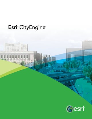
3. Create stunning city models in less time with
Esri®
CityEngine®
software—the tool of choice for 3D city
modeling in urban planning, architecture, simulation, game
development, and film production. CityEngine delivers a
full suite of industry-leading procedural tools to aggregate
geospatial data, lay out and edit street networks, generate
and modify buildings, create 3D road profiles and distribute
street furniture, control the shape of the skyline, and
analyze urban planning projects.
Our World Is in 3D
esri.com/cityengine
4. Download your free, 30-day trial now.
esri.com/CityEngineTrial
Step 1
Geodatabase/2D
Information
Step 2
3D Streets, Blocks,
and Parcels (import
or creation)
Step 3
3D Extrusion, Roof
Generation, and
Street Furniture
Step 4
Texturing and
Façade Creation
(details)
Step 5
Finished 3D City
Shared on the Web
and Updated in the
Geodatabase
5.
6. Share 3D city scenes.
3D Zoning Regulations
GIS Data Support (compatible with ArcGIS®
)
Rapidly build accurate and visually compelling city models
by aggregating and enhancing geographic information
system (GIS) data using simple drag-and-drop operations.
Import and export attributed GIS data such as streets,
footprints, or 3D buildings using the Esri file geodatabase
or shapefile format. In addition, CityEngine imports real-
world data from OpenStreetMap.
Dynamic City Layouts
CityEngine comes with a comprehensive toolset for the
quick creation of dynamic city layouts. Intuitive editing tools
are provided to design, draw, and modify curved streets,
blocks, and parcels—with immediate visual feedback.
Procedural Engine (2D to 3D)
Procedural modeling based on rules offers unlimited
possibilities to interactively generate 3D models of
buildings or zoning regulations, texture façades, or
distribute street furniture on a citywide scale. Rules are
authored in the Rule Editor (based on node or text).
3D Editor (for multipatches)
Easy-to-use editing tools are provided for quick sketching
and texturing of 3D models (e.g., multipatch). The
resultant 3D geometries can be efficiently saved in the file
geodatabase.
esri.com/cityengine
Top Benefits
7. Now: Density 2.6
Proposal 1: Density 3.1
Proposal 2: Density 6.8
3D Visualization in the Browser
CityEngine scenes can be published directly on the web
for sharing 3D models, analysis results, or design proposals
with decision makers or the public. Since CityEngine output
is based on WebGL technology, no plug-in is required for
most browsers.
Custom Report Generation
To compare planning proposals and analyze designs,
customized rule-based reports can be generated (e.g.,
automatically calculate quantities such as density or gross
floor area). Reports are updated instantaneously.
Façade Wizard
Quickly create rules out of a photograph with this simple
and easy-to-use visual façade authoring tool. The resultant
façade rules are size independent and can be extended
(e.g., with detailed window assets).
Python
Streamline repetitive or pipeline-specific tasks with the
integrated Python®
scripting interface.
Industry-Standard 3D Formats
CityEngine supports KML, COLLADA, Autodesk®
FBX®
,
Wavefront OBJ, DXF, 3DS, or RenderMan®
RIB for 3D data
exchange. FBX and COLLADA support advanced material
handling, asset instancing, and multiple UV sets.
Training Materials
Architects, urban planners, GIS professionals, game
developers, and computer graphic artists can avail
themselves of several videos and tutorials that show the
basics and key concepts of CityEngine. Sample projects of
ancient, contemporary, and future cities at different levels
of detail are also available.
Available for All Platforms
CityEngine is available for Windows®
(32/64 bit), Mac®
OSX
(64 bit), and Linux®
(64 bit).
Data Model Templates for Cities
Esri provides harmonized information models of 3D GIS
datasets that bring local government operations to life for
city staff and citizens. With CityEngine, these datasets—
including uniquely customizable zoning regulations—can
be visualized, edited, and shared in 3D.
Features