The future of GIS as we know it
•Download as PPTX, PDF•
0 likes•2,606 views

Presentation 'about the (very nearby) future of GIS' for GeoScience students, Universiteit Utrecht. I had a few recommended skill and recommendations as well, will blog about that later.

Recommended
More Related Content
What's hot
What's hot (20)
Similar to The future of GIS as we know it
Similar to The future of GIS as we know it (20)
More from Jan Willem van Eck
More from Jan Willem van Eck (20)
Recently uploaded
Recently uploaded (20)
The future of GIS as we know it
- 1. The Future of GIS as we know it Guestlecture U of Utrecht Faculty of GeoSciences
- 2. egoquoting Our past has known many futures Do note:
- 3. Just following a few GIS trends and current realities So:
- 6. Geographic information Combing layers of data Gaining new insights
- 11. Organisatiebreed Transformeert de rol van GIS ArcGIS GIS-professionals
- 12. Organisatiebreed Transformeert de rol van GIS Bestuurders Klanten/burgers Mobiele werkersKenniswerkers Enterprise Integratie ArcGIS GIS-professionals
- 13. T E C H N O L O G Y E V E R Y W H E R E ubiquitous H U M A N S E N S O R S big data W O R K I N G T O G E T H E R in an enterprise
- 19. ArcGIS Online 3D voor iedereen in web scenes
- 20. ArcGIS 3D Basemap multi-view 3D basiskaart Realistisch Thematisch AnalytischCanvas
- 21. Rotterdam Canvas Basislaag voor eigen informatie
- 22. Rotterdam Solar Potential Aanvullende content
- 23. A National 3D Scene See Kadaster progress report
- 24. O P E N D A T A transforms GIS M A P S A R E N O T R E A L I T Y and should not be too realistic C O N T E N T I S T H E O X Y G E N of the ecosystem
- 28. ArcGIS is flexibel in gebruik ongeacht locatie en device Geïntegreerd Eenvoudig Open Desktop Web Device
- 34. M A P S & A P P S 1-2-3 : answer! A P L A T F O R M to serve the complete organisation A N Y time where device
- 36. "We can't bring everyone to GIS, but we sure can bring GIS to everyone." Chris Capelli Esri Partner Conference 2014
- 37. The Future of GIS as we know it Guestlecture U of Utrecht Faculty of GeoSciences June 18th 2014
- 38. Good read!
Editor's Notes
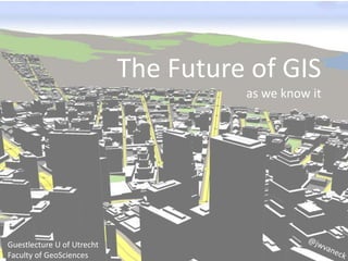
- Image snapped from schematic city 2 from CityEngine Tutorial U Utrecht, Faculty of GeoSciences, http://www.uu.nl/faculty/geosciences/en/studying/Mastersprogrammes/Pages/default.aspx, 18 june 2014
- http://www.newscientist.com/article/dn19200-twitter-mood-maps-reveal-emotional-states-of-america.html
- http://andsynchrony.net/projects/generating-utopia/
- http://www.arcgis.com/apps/MapTour/index.html?appid=c82b8a0f394c44e9809b979bacd5e9b2&webmap=7531af009f104cbba5b2c2d496d5419f
- http://edemo.esri.nl/javascript/AGO4O/BasicViewer_elevation/index.html a simple viewing app.
- http://www.arcgis.com/home/webmap/viewer.html?webmap=3e9bd580d342456ba58b7f3b3b734e44
- Finally, the Analytic view – adding textures or analytical surfaces – like rooftop solar potential.
- http://solutions.arcgis.com/state-government/fish-wildlife/
- http://wlhs.maps.arcgis.com/apps/StorytellingSwipe/index.html?appid=365684f0088a46b8b16eab2c46eb6fe7&webmap=88122bdfd00042e18941c841ac393704
- http://sjov.maps.arcgis.com/apps/MapTour/index.html?appid=4b64c561e8934c1287aef7107e53a404&webmap=6acd0871b4a74b118838855a01ce1f1f http://www.arcgis.com/home/item.html?id=4b64c561e8934c1287aef7107e53a404
- Image snapped from schematic city 2 from CityEngine Tutorial U Utrecht, Faculty of GeoSciences, http://www.uu.nl/faculty/geosciences/en/studying/Mastersprogrammes/Pages/default.aspx, 18 june 2014
- A good read! http://www.esri.com/news/arcwatch/0211/future-of-gis.html