Downloaded 114 times

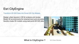
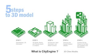
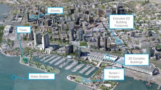
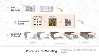
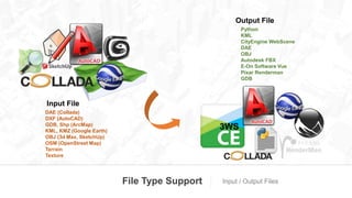
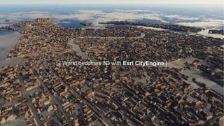


Esri CityEngine is a 3D modeling software that transforms 2D GIS data into 3D city models through a procedural modeling workflow. It allows users to quickly create 3D models of urban environments using real-world 2D data. The software extrudes 2D features like building footprints, roads, and terrain to generate initial 3D geometry which is then refined using procedural rules to add detail before exporting the finished 3D city model. CityEngine models can be shared online and updated directly within a GIS database.