What is EGNOS? How does it work?
•
1 like•1,952 views

Presented by Jean-Marc Piéplu (EGNOS Exploitation Program Manager) in Toulouse - France at EGNOS flight event, 6-7 May 2015
Report
Share
Report
Share
Download to read offline

Recommended
TROCA.pptx
TROCA and play audiometry are testing methods used to assess hearing in children, especially those who are difficult to test. [1] TROCA uses tangible rewards to encourage correct responses to tones, while discouraging incorrect responses. [2] Play audiometry frames hearing tests as games involving motor responses, smiles, and praise to assess hearing in young children ages 2 to 5. [3] The methods aim to engage children in testing through developmentally appropriate play activities to obtain reliable measures of their hearing ability.
Acoustic communication using ofdm
hai.. friends.I think it may helpful to understanding the concept of acoustic communication using OFDM
Fm combiner
This document discusses FM combiners, which allow multiple FM radio channels to transmit over a single antenna. It begins by defining a combiner and explaining why they are used to reduce costs and comply with regulatory requirements. There are two main types of combiners - branched and balanced combiners. Balanced combiners use hybrid rings and bandpass or notch filters in each leg to combine signals while preventing interference. Key specifications for combiners include isolation between channels, insertion loss, group delay, return loss, and frequency response. Tuning the positions of components like cavity rods is important to balance performance across parameters. Leading manufacturers of combiners include RFS, Sira, Exir, and Jampro.
Central Auditory Function: Willeford Test Battery
High-band-pass segment (2000-3000 Hz) of spondaic words
Present at 30/40* dB S
Location Based Services for Mobiles: Technologies and Standards
In this tutorial, the state of art of mobile location based services (LBS) will be explored in terms of technologies, standards and implementations. There are five major parts in this proposed tutorial. Within the first part, an introduction to LBS is presented along with an overview of the growing LBS market. Two examples of LBS, E911 and telematics, are emphasized. In the second part, LBS from a network operator perspective is discussed with a survey of wireless location technologies, the exploration of location management in cellular network, and LBS standards activities. The architecture and operation of the network-dependent LBS control plane of CDMA2000 and UMTS networks are reviewed, respectively. In the third part, the IP-based LBS user plane is discussed from a service provide perspective. An overview of the related standards by OMA and 3GPP2 is given and the principles of LBS user plane are illustrated from multiple application scenarios. In the fourth part, several implementation issues of LBS are discussed as well as development examples. In the fifth part, the security and privacy issues of mobile LBS are discussed from an end user perspective along with related practices and regulations. Finally, the further works and standard activities for LBS are presented.
RF Antenna Planning
Radio Access Network Functions
Radio Access Network Responsibilities
Antenna Configuration Requirements
RF Antenna Planning
Nominal Radio Plan For Kocaeli University
52528672 microwave-planning-and-design
The document provides an overview of microwave radio planning and link design. It discusses topics such as PCM and E1 overview, digital multiplexing standards PDH and SDH, digital microwave systems, microwave link performance objectives, antennas, propagation, planning, interference management, and frequency allocation. The course contents include topology planning, diversity techniques, link budgeting, performance prediction using path profiles and LOS surveys.
Frequency hopping rohit
This document discusses frequency hopping in wireless communication systems. It begins by explaining that in frequency hopping systems, each call hops between a defined set of frequencies to reduce the impact of poor signal quality on any single frequency. This provides frequency diversity and averages out interference. The document then discusses various types of frequency hopping including baseband and synthesizer hopping. It also covers topics like why frequency hopping is used, factors like multipath fading and interference, and specifications of frequency hopping systems including hopping sequences, mobile allocation lists, and fractional loading.
Radio waves
Radio waves are electromagnetic waves that can transmit data over long distances. They transmit signals by fluctuating evenly through space on certain frequencies. The radio uses a transmitter to encode signals into radio waves using sine waves, and a receiver to decode the sine waves back into the original signal. Different technologies like radio, television, cell phones, and WiFi use radio waves to transmit signals through the air or space.
Spectrum monitoring techniques
This document discusses spectrum monitoring techniques that can be used to ensure reliable communications and manage assigned spectrum. The key techniques discussed are:
1) Observing spectrum to interactively analyze signals of interest.
2) Recording spectrum for later analysis to identify usage patterns, unauthorized signals, or changes over time.
3) Recording and comparing spectra over time to identify new or removed signals using trace math.
Signals of interest that may be identified include accidental interference, intentional interference like GPS jammers, and illicit signals like pirate radio broadcasts. Setting up the spectrum analyzer properly is important for effective monitoring.
Bhim Sen Singh_Resume-RAN FM Engineer
Bhim Sen Singh has over 10 years of experience in telecommunications as a RAN/BSS fault management engineer. He currently works for Reliance Jio as an assistant manager handling fault management, troubleshooting, and alarm management for their 4G LTE and Wi-Fi networks. Previously he worked for Nokia Solutions and Networks, Huawei, and Airtel managing 2G, 3G, and 4G network faults and alarms. He has expertise in various RAN equipment from Samsung, Nokia, and Huawei.
The Global Positioning System (GPS)
The Global Positioning System (GPS) is a satellite-based navigation system that can be used to locate positions anywhere on earth made up of a network of 24 satellites placed into orbit
What is Amateur Radio
This document summarizes the key aspects of amateur radio service (ARS) in the Philippines. It outlines the requirements to acquire an amateur radio license including seminar attendance and examination. It describes the different license classes based on age and examination passed, and the associated frequency bands and power levels permitted. Key regulations governing amateur radio operation and penalties for violations are also summarized.
Fm combiner
This document discusses FM combiners, which allow multiple FM radio channels to transmit over a single antenna. It begins by defining a combiner and explaining why they are used. There are two main types of combiners - branched and balanced combiners. Balanced combiners use hybrid rings and bandpass or notch filters in each leg to combine signals while preventing interference. The document outlines the components, functionality, characteristics, and tuning considerations for FM combiners. It also lists some leading manufacturers and concludes with acknowledging the reader.
underwater wireless communication.
This document presents information on underwater wireless communication. It discusses how acoustic waves can be used for underwater wireless transmission instead of radio waves due to water's inhibiting effects on radio waves. The document outlines the working, applications, advantages and disadvantages of underwater wireless communication using acoustic waves and acoustic modems. It provides figures showing different acoustic modems and the network architecture. The conclusion states that underwater wireless using acoustic waves can achieve high data rates with lower path loss compared to other methods.
MTD & Laryngeal Massage
Laryngeal massage may be an effective treatment for primary muscle tension dysphonia (MTD). MTD occurs when there is excess musculoskeletal tension in the larynx, either as a primary cause or secondary cause of voice problems. Indirect tension reduction techniques often fail to reduce stubborn laryngeal tension. Laryngeal massage aims to manually assess and reduce contracted muscle tone and abnormal laryngeal positioning during voicing through a series of cautious steps with the active participation of the patient to improve vocal quality in daily use. Raising awareness of bodily sensations may help prevent future muscle tension.
Making mixtures of solids and liquids
The document describes an experiment to make mixtures of solids and liquids. Students are instructed to half-fill test tubes with water and add pinches of various solids (salt, oil, sugar, copper sulfate). They observe whether each solid "disappears" or dissolves in the water. The conclusion discusses the definitions of solutions, solutes, and solvents. When a solid dissolves in a liquid, it is the solute and the liquid is the solvent, forming a solution. An undissolved mixture is a suspension.
Gsm basics
The document provides an overview of cellular communications and GSM networks. It discusses the need for cellular networks due to limitations of fixed line phones, introduces concepts like frequency reuse and channelization, and describes the components and architecture of GSM networks including mobile stations, base station controllers, switches and databases. It also summarizes the evolution of GSM standards and technology.
AIRCOM LTE Webinar 4 - LTE Coverage
This webinar provides a basic overview of LTE radio coverage, focusing on early stages of LTE, types of cell and coverage dependencies.
Handover parameters in_lte
This document discusses handover parameters in LTE networks. It begins by introducing handover and its importance for maintaining quality of service as users move between different areas in a network. It then describes various metrics used to optimize handover, including signal strength measurements reported by user equipment to base stations. Key parameters that control the handover process are explained, such as reference signal power, quality, thresholds, timers and offsets. Event A3, which triggers handover when a neighbor cell is better than the serving cell, is discussed in depth. The document concludes by emphasizing the need for self-optimizing algorithms to automatically configure these handover parameters and improve network performance.
Routing over ericsson mini link
Introduction to Ericsson Mini-Link world with a well explained examples on traffic routing, LPF indicators, SW upgrade, Loops, and cards replacement
WinProp propagation modeling and network planning tool
WinProp is a commercial simulation software suite used for radio frequency (RF) propagation modelling and wireless network planning. It consists of ProMan for propagation modeling, WallMan for building databases, and AMan for antenna patterns. Example case studies presented propagation modeling of heterogeneous networks in Dar es Salaam using WinProp and Matlab. Indoor picocell deployment was also modeled. The presentation concluded with an overview and demo of WinProp's graphical user interface and example planning projects.
eMBMS for LTE
eMBMS is evolved Multimedia Broadcast and Multicast Services that allows efficient one-to-many transmission of common content over LTE networks. It uses simulcast transmission from multiple cells within an MBSFN area that appears as a single transmission to users. eMBMS leverages the LTE infrastructure for cost-effective delivery of live video/audio streaming, file downloads and other multimedia broadcasts to a large audience. It provides throughput as high as 17Mbps using 10MHz of shared LTE spectrum for both unicast and broadcast traffic.
EGNOS Data Access Service (EDAS) v2.1
The EGNOS Data Access Service Service Definition Document presents the characteristics of the services offered to users by EDAS, including a detailed description of all the necessary information for users to get access to EDAS services and benefit from them.
EGNOS and WAAS Factsheet
Geodesy and GNSS:
A fact sheet detailing the European Geostationary Navigation Overlay Service (EGNOS) and the United States' Wide Area Augmentation System (WAAS).
Produced in fulfilment of MSc Geospatial & Mapping Sciences at the University of Glasgow (2015).
Global positioning system
The GPS system uses a constellation of satellites that orbit the Earth and transmit precise time and location data. GPS receivers triangulate their position by calculating the distance to multiple satellites using the travel time of signals. The US government maintains GPS for civilian and military use worldwide. Key applications include navigation for vehicles, ships and aircraft as well as uses in mapping, agriculture, recreation and more. The system provides location and timing data to users with an accuracy as precise as a few meters or centimeters depending on the receiver.
GPS
GPS is a global navigation satellite system that provides location and time information to GPS receivers anywhere on Earth. It consists of three segments - the space segment with 24 satellites orbiting Earth, the control segment of ground stations that monitor the satellites, and the user segment of GPS receivers used by individuals. GPS works by precisely measuring the travel time of signals from multiple satellites to triangulate the receiver's position. It provides accurate positioning 24/7 globally and has many applications including navigation, mapping, and tracking.
How does GPS work, what is geocaching?
GPS geocaching presentation 2006 during english course at Campus FH-Wels.at
answers you quickly the following questions:
how does GPS work? / what is geocaching?
How GPS works
The document summarizes how GPS works by using a network of 24 satellites orbiting 20,200 km above Earth that transmit timing signals used by GPS receivers to calculate location. A GPS receiver needs signals from at least 3 satellites to determine its position coordinates with an accuracy of around 10 meters horizontally and 15 meters vertically for standard GPS. More precise GPS systems use carrier phase measurements from dual-frequency receivers along with corrections for atmospheric delays to achieve sub-centimeter accuracy.
Latest trends in satellite communication
Satellite communication uses satellites to provide communication links between various points on Earth. Approximately 2000 satellites currently orbit Earth, relaying signals carrying voice, video, and data worldwide. Satellites operate in low, medium, and geostationary orbits and are launched from sites around the world. India has launched 76 satellites since 1975 to support applications like Earth observation, weather forecasting, military uses, and TV broadcasting. Major organizations involved include ISRO, Antrix, and private companies like Dhruva Space and Transpace Technologies.
More Related Content
What's hot
Radio waves
Radio waves are electromagnetic waves that can transmit data over long distances. They transmit signals by fluctuating evenly through space on certain frequencies. The radio uses a transmitter to encode signals into radio waves using sine waves, and a receiver to decode the sine waves back into the original signal. Different technologies like radio, television, cell phones, and WiFi use radio waves to transmit signals through the air or space.
Spectrum monitoring techniques
This document discusses spectrum monitoring techniques that can be used to ensure reliable communications and manage assigned spectrum. The key techniques discussed are:
1) Observing spectrum to interactively analyze signals of interest.
2) Recording spectrum for later analysis to identify usage patterns, unauthorized signals, or changes over time.
3) Recording and comparing spectra over time to identify new or removed signals using trace math.
Signals of interest that may be identified include accidental interference, intentional interference like GPS jammers, and illicit signals like pirate radio broadcasts. Setting up the spectrum analyzer properly is important for effective monitoring.
Bhim Sen Singh_Resume-RAN FM Engineer
Bhim Sen Singh has over 10 years of experience in telecommunications as a RAN/BSS fault management engineer. He currently works for Reliance Jio as an assistant manager handling fault management, troubleshooting, and alarm management for their 4G LTE and Wi-Fi networks. Previously he worked for Nokia Solutions and Networks, Huawei, and Airtel managing 2G, 3G, and 4G network faults and alarms. He has expertise in various RAN equipment from Samsung, Nokia, and Huawei.
The Global Positioning System (GPS)
The Global Positioning System (GPS) is a satellite-based navigation system that can be used to locate positions anywhere on earth made up of a network of 24 satellites placed into orbit
What is Amateur Radio
This document summarizes the key aspects of amateur radio service (ARS) in the Philippines. It outlines the requirements to acquire an amateur radio license including seminar attendance and examination. It describes the different license classes based on age and examination passed, and the associated frequency bands and power levels permitted. Key regulations governing amateur radio operation and penalties for violations are also summarized.
Fm combiner
This document discusses FM combiners, which allow multiple FM radio channels to transmit over a single antenna. It begins by defining a combiner and explaining why they are used. There are two main types of combiners - branched and balanced combiners. Balanced combiners use hybrid rings and bandpass or notch filters in each leg to combine signals while preventing interference. The document outlines the components, functionality, characteristics, and tuning considerations for FM combiners. It also lists some leading manufacturers and concludes with acknowledging the reader.
underwater wireless communication.
This document presents information on underwater wireless communication. It discusses how acoustic waves can be used for underwater wireless transmission instead of radio waves due to water's inhibiting effects on radio waves. The document outlines the working, applications, advantages and disadvantages of underwater wireless communication using acoustic waves and acoustic modems. It provides figures showing different acoustic modems and the network architecture. The conclusion states that underwater wireless using acoustic waves can achieve high data rates with lower path loss compared to other methods.
MTD & Laryngeal Massage
Laryngeal massage may be an effective treatment for primary muscle tension dysphonia (MTD). MTD occurs when there is excess musculoskeletal tension in the larynx, either as a primary cause or secondary cause of voice problems. Indirect tension reduction techniques often fail to reduce stubborn laryngeal tension. Laryngeal massage aims to manually assess and reduce contracted muscle tone and abnormal laryngeal positioning during voicing through a series of cautious steps with the active participation of the patient to improve vocal quality in daily use. Raising awareness of bodily sensations may help prevent future muscle tension.
Making mixtures of solids and liquids
The document describes an experiment to make mixtures of solids and liquids. Students are instructed to half-fill test tubes with water and add pinches of various solids (salt, oil, sugar, copper sulfate). They observe whether each solid "disappears" or dissolves in the water. The conclusion discusses the definitions of solutions, solutes, and solvents. When a solid dissolves in a liquid, it is the solute and the liquid is the solvent, forming a solution. An undissolved mixture is a suspension.
Gsm basics
The document provides an overview of cellular communications and GSM networks. It discusses the need for cellular networks due to limitations of fixed line phones, introduces concepts like frequency reuse and channelization, and describes the components and architecture of GSM networks including mobile stations, base station controllers, switches and databases. It also summarizes the evolution of GSM standards and technology.
AIRCOM LTE Webinar 4 - LTE Coverage
This webinar provides a basic overview of LTE radio coverage, focusing on early stages of LTE, types of cell and coverage dependencies.
Handover parameters in_lte
This document discusses handover parameters in LTE networks. It begins by introducing handover and its importance for maintaining quality of service as users move between different areas in a network. It then describes various metrics used to optimize handover, including signal strength measurements reported by user equipment to base stations. Key parameters that control the handover process are explained, such as reference signal power, quality, thresholds, timers and offsets. Event A3, which triggers handover when a neighbor cell is better than the serving cell, is discussed in depth. The document concludes by emphasizing the need for self-optimizing algorithms to automatically configure these handover parameters and improve network performance.
Routing over ericsson mini link
Introduction to Ericsson Mini-Link world with a well explained examples on traffic routing, LPF indicators, SW upgrade, Loops, and cards replacement
WinProp propagation modeling and network planning tool
WinProp is a commercial simulation software suite used for radio frequency (RF) propagation modelling and wireless network planning. It consists of ProMan for propagation modeling, WallMan for building databases, and AMan for antenna patterns. Example case studies presented propagation modeling of heterogeneous networks in Dar es Salaam using WinProp and Matlab. Indoor picocell deployment was also modeled. The presentation concluded with an overview and demo of WinProp's graphical user interface and example planning projects.
eMBMS for LTE
eMBMS is evolved Multimedia Broadcast and Multicast Services that allows efficient one-to-many transmission of common content over LTE networks. It uses simulcast transmission from multiple cells within an MBSFN area that appears as a single transmission to users. eMBMS leverages the LTE infrastructure for cost-effective delivery of live video/audio streaming, file downloads and other multimedia broadcasts to a large audience. It provides throughput as high as 17Mbps using 10MHz of shared LTE spectrum for both unicast and broadcast traffic.
What's hot (15)
WinProp propagation modeling and network planning tool
WinProp propagation modeling and network planning tool
Viewers also liked
EGNOS Data Access Service (EDAS) v2.1
The EGNOS Data Access Service Service Definition Document presents the characteristics of the services offered to users by EDAS, including a detailed description of all the necessary information for users to get access to EDAS services and benefit from them.
EGNOS and WAAS Factsheet
Geodesy and GNSS:
A fact sheet detailing the European Geostationary Navigation Overlay Service (EGNOS) and the United States' Wide Area Augmentation System (WAAS).
Produced in fulfilment of MSc Geospatial & Mapping Sciences at the University of Glasgow (2015).
Global positioning system
The GPS system uses a constellation of satellites that orbit the Earth and transmit precise time and location data. GPS receivers triangulate their position by calculating the distance to multiple satellites using the travel time of signals. The US government maintains GPS for civilian and military use worldwide. Key applications include navigation for vehicles, ships and aircraft as well as uses in mapping, agriculture, recreation and more. The system provides location and timing data to users with an accuracy as precise as a few meters or centimeters depending on the receiver.
GPS
GPS is a global navigation satellite system that provides location and time information to GPS receivers anywhere on Earth. It consists of three segments - the space segment with 24 satellites orbiting Earth, the control segment of ground stations that monitor the satellites, and the user segment of GPS receivers used by individuals. GPS works by precisely measuring the travel time of signals from multiple satellites to triangulate the receiver's position. It provides accurate positioning 24/7 globally and has many applications including navigation, mapping, and tracking.
How does GPS work, what is geocaching?
GPS geocaching presentation 2006 during english course at Campus FH-Wels.at
answers you quickly the following questions:
how does GPS work? / what is geocaching?
How GPS works
The document summarizes how GPS works by using a network of 24 satellites orbiting 20,200 km above Earth that transmit timing signals used by GPS receivers to calculate location. A GPS receiver needs signals from at least 3 satellites to determine its position coordinates with an accuracy of around 10 meters horizontally and 15 meters vertically for standard GPS. More precise GPS systems use carrier phase measurements from dual-frequency receivers along with corrections for atmospheric delays to achieve sub-centimeter accuracy.
Latest trends in satellite communication
Satellite communication uses satellites to provide communication links between various points on Earth. Approximately 2000 satellites currently orbit Earth, relaying signals carrying voice, video, and data worldwide. Satellites operate in low, medium, and geostationary orbits and are launched from sites around the world. India has launched 76 satellites since 1975 to support applications like Earth observation, weather forecasting, military uses, and TV broadcasting. Major organizations involved include ISRO, Antrix, and private companies like Dhruva Space and Transpace Technologies.
How GPS Works
GPS uses trilateration to determine location based on distances to at least three satellites. Each satellite transmits its precise location and time of transmission. The GPS receiver uses the speed of light and transmission time to calculate distances, allowing it to determine its position at the intersection of distance spheres from multiple satellites. Accuracy relies on precise timekeeping of satellites and receivers.
Global Positioning System
It depicts the basic information about GPS technology and its various uses in engineering and other fields. May be useful for students of engineering and for presentation.
The global positioning system an overview
The document provides an overview of the Global Positioning System (GPS). It describes GPS as having three segments: the space segment consisting of 24 satellites in six orbital planes, the control segment which tracks the satellites and provides them with updated information, and the user segment of receivers. It explains how GPS works by transmitting timing signals from the satellites, which users can use to calculate their position by measuring distances to multiple satellites. Sources of error and applications of GPS are also summarized.
Ppt local tracking and gps
LT and GPS allow for tracking of objects and people using satellites and receivers. The GPS system consists of 24 operational satellites controlled from stations on Earth that communicate with receivers to determine location via trilateration of distances. While useful for applications like fleet management and emergency response, GPS has drawbacks like cost and inability to track powered-down or insulated receivers.
Global Positioning System
The document provides an overview of the Global Positioning System (GPS). It describes how GPS works using trilateration based on signal timing from multiple satellites. It discusses the space, control, and user segments. It also covers GPS signals, frequencies, accuracy issues, and methods to improve accuracy such as augmentation systems. Applications of GPS are outlined for civilian, military, and other uses.
Global Positioning System (GPS)
A group presentation for the Technology Strategy and Organisation module focusing on the Global Positioning System (GPS) .
"GPS" Global Positioning System [PDF]
This presentation is about GPS... what is it?why GPS? , how it works? and the applications of GPS. By Mostafa Hussien
facebook profile: http://www.facebook.com/mstfahsin
Twitter @MSTFAHSIN
Tumblr mostafahussien.tumblr.com
Gps tracking system
The document describes a GPS tracking system that uses GPS technology to determine the precise location of assets. It explains that a GPS tracking unit attaches to an asset and records its position at regular intervals, storing or transmitting the location data. This allows the asset's location to be viewed in real time or analyzed later on a map using tracking software. The document also provides background on GPS technology and its origins for defense purposes using satellite navigation. It describes the components used in a sample GPS tracking system including microcontrollers, GPS modules, resistors, capacitors and LCDs.
Global Positioning System
This document provides an overview of the Global Positioning System (GPS). It discusses what GPS is, its evolution, how it works, and its three segments: the space segment consisting of 24 satellites, the control segment of 5 ground stations, and the user segment of GPS receivers. The document outlines the information contained in GPS signals, how triangulation is used to determine position, and sources of errors like the ionosphere. It also discusses differential GPS, applications of GPS, and concludes with a bibliography.
Global positioning System
The document provides an introduction to GPS (Global Positioning System). It discusses how early humans navigated using methods like piles of stones or stars, and the development of modern navigation ideas like radar and sonar. It describes the history of GPS, which was developed by the US Department of Defense, launched its first satellites in 1978, and became fully operational in 1995. The document explains that GPS uses triangulation based on distance measurements to satellites to determine precise locations on Earth. It provides examples of GPS applications for military and civilian uses such as navigation, mapping, and tracking fishing fleets.
Gps ppt
GPS is a satellite-based navigation system consisting of 24 satellites operated by the US Department of Defense. It provides positioning anywhere in the world without subscription fees. GPS determines location by measuring the time it takes signals from satellites to reach a receiver and using that to calculate the distance to the satellites, whose locations are known. Combining distance measurements to multiple satellites triangulates the receiver's position.
GPS ppt.
The document provides an overview of GPS (Global Positioning System), including its history, core components, working principles, accuracy limitations, and applications. GPS is a satellite-based navigation system consisting of 3 segments - space, control, and user. It works by precisely measuring the time it takes signals from GPS satellites to reach a GPS receiver and triangulating its position based on distances to 4 or more satellites. Various methods can improve its accuracy to within a few centimeters.
Viewers also liked (19)
Similar to What is EGNOS? How does it work?
Egnos galileo uasd-santo_domingo_2016_lisi_v02
Presentation on European GNSS activities at UASD (Universidad Autonoma de Santo Domingo), 4 February 2016
E.G.N.O.S.
This document discusses the European Geostationary Navigation Overlay Service (EGNOS), which is a Satellite-Based Augmentation System (SBAS) that works with GPS to provide more precise positioning. EGNOS is run by the European Space Agency, European Commission, and Eurocontrol. It processes data from a network of ground stations to generate corrections for GPS errors and integrity information that is transmitted through geostationary satellites to improve positioning accuracy to within two meters.
Space & Security Conference - EGNOS: Present and Future Services
Presentation made by M. Musmeci, Head of Galileo Management Office of Telespazio, during the Session 4 about Satelline Navigation, made in occasion of Space & Security Conference held in Athene on June 20.
Galileo
The Galileo programme is a collaboration of the European Union with ESA to improve the technological independence of Europe and establish international standards for Global Navigation Satellite Systems (GNSS). Telespazio plays a leading role in the development of the programme, having built, at the Fucino Space Centre, one of the Galileo Control Centre (GCC), which will manage the programme’s constellation and mission.
The Galileo Programme
Galileo is Europe’s programme for a global navigation satellite system, providing a highly
accurate, guaranteed global positioning service, interoperable with the US GPS and Russian
Glonass systems. It consists of 30 satellites and ground infrastructure.
Galileo concept of operations, first iov leop and initial operations
Presentation at the SpaceOps conference in Stockolm, June 2012, about the first launch of Galileo satellites.
Galileo is the European global navigation satellite system (GNSS), funded by the European Commission and developed by the European Space Agency.
Icl gnss helsinki-2014_lisi_v02
My invited keynote presentation at the International Conference on Localization and GNSS (ICL GNSS 2014), held at Helsinki on 24-26 June 2014.
EGNOS growing market in Agriculture and fostering new opportunities in Mapping
The document discusses EGNOS, Europe's Satellite Based Augmentation System. It provides an overview of EGNOS, its architecture and service area. It then discusses opportunities for EGNOS in applications such as precision agriculture, mapping, and surveying. EGNOS provides free, meter-level positioning accuracy across most of Europe via satellites or terrestrial data links. The document promotes the use of EGNOS for applications that require positioning accuracy from 1-5 meters.
Companies which attended Fundamental Elements Info Day
This document provides information about QinetiQ's Secured Navigation (SecNav) capabilities. It summarizes QinetiQ as a provider of solutions that allow users to reliably receive and trust positioning, navigation and timing information in demanding environments where that information is mission-critical. It mentions capabilities like high accuracy in difficult environments, resilience to interference, robustness to use multiple constellations/frequencies/services, and high dynamics. It also notes QinetiQ's broad skills in GNSS, security and engineering that allow it to provide consulting, research and development, and customized solutions in addition to products.
20th kabandconference 2014_lisi_v03
My presentation "Global Navigation Satellite Systems and/or Multi-sensor Fusion Platform? A Look into the Future of Positioning, Navigation and Timing" at the 20th Ka-Band and Broadband Communications, Navigation and Earth Observation Conference, Vietri (Italy), 3-5 October 2014.
Munich Satellite Navigation Summit Spaceopal 2016
Spaceopal GmbH is a joint venture between DLR GfR mbH and Telespazio SpA established in 2009 in Munich, Germany to manage Galileo satellite navigation operations on behalf of the European Commission and ESA. Spaceopal operates the Galileo constellation and ground infrastructure from two control centers, managing satellite launches, operations, maintenance and initial service validation to provide positioning and timing services to users. Since 2010, Spaceopal has successfully launched and supported 12 Galileo satellites and aims to expand the constellation to 18 satellites by the end of 2016.
CLOSEYE PROJECT
Collaborative evaLuation Of border Surveillance Technologies in maritime Environment bY pre-operational validation of innovativE solutions
CLOSEYE comes to life with the aim of providing the EU with an operational and technical framework that increases situational awareness and improves the reaction capability of authorities surveying the external borders of the EU.
As the first Pre-Operational Validation project in FP7 security theme, the Project pursued the validation of innovative services (improved detection though Passive Radar DVB-T and SAT Images, Enhanced Command and Control Functionalities and services, extended range cost-effective surveillance through MRI Aircraft integrating Videos and Tracks, SAT Communications) applicable to the surveillance of the EU Maritime Borders in real operational environment following the Common Application of Surveillance Tools concept, established by EUROSUR.
The project was divided into 2 Lots, the first of which managed by Leonardo through the “Union Temporal the Empresa” with INDRA. Results of the experimental campaigns are used to orient decision makers and agencies’ buyers in the procurement process to get cost effective solutions to manage Mediterranean borders.
El programa Galileo de la Agencia Espacial Europea
Presentación de Javier Benedicto, Jefe del Proyecto Galileo en la Agencia Espacial Europa, en el 31º Encuentro de de la Economía Digital y las Telecomunicaciones: La realidad digital de España, celebrado en la UIMP en septiembre de 2017
Galileo: System and Applications
Galileo is Europe's initiative for a global satellite navigation system providing precise positioning under civilian control. It will be interoperable with GPS and GLONASS, consisting of 30 satellites plus spares when complete. Precise timing from Galileo's onboard atomic clocks, accurate to 1 second every 3 million years, will support applications like power grids, financial networks, UAVs, autonomous vehicles, and emergency response.
Galileo - The European GNSS
Galileo is the European GNSS constellation and it contributes to the user positioning adding more satellites, which number directly impacts on the Dilution of precision (DOP), or geometric dilution of precision (GDOP). It is a term used in satellite navigation and geomatics engineering to specify the additional multiplicative effect of navigation satellite geometry on positional measurement precision.
Sogei2014 lisi v01
"EGNOS and Galileo: towards an Integrated European PNT Infrastructure", presentation at the International Workshop on "GNSS technologies advances in a multi-constellation framework“, SOGEI, Roma, 26 September 2014
H2020 Status of Galileo and Egnos
Since last year:
THIRD SUCCESSFUL QUAD LAUNCH in July 2018 with ARIANE V
26 Satellites in orbit
Initial SERVICES beyond expectation
New procurement initiated for subsequent satellites
Commercial Service re-baselined
Emergency Warning Service under definition
Launch of User Consultation Platform
Towards Galileo 2nd GENERATION decision
ZONeSEC final pilot demonstration - invitation and agenda
We are preparing the Final Demonstration of the ZONeSEC system! You are heartily welcome to check out the details of the event (see official invitation below), which will be hosted by Attikes Diadromes (highway operator) in Athens, on 25th and 26th October. If you're interested in joining us, please send a short description of your expertise and motivation for attending the event to Lavinia Cadar at cadar@crisisplan.nl by Monday 24th EOB. You might be selected for one of the free invitations available (i.e. travel and accommodation costs covered by the ZONeSEC consortium)!
EENA 2018 - GRALLE, a EU initiative for a Galileo-based Emergency Warning Sys...
EENA 2018 - GRALLE, a EU initiative for a Galileo-based Emergency Warning Sys...EENA (European Emergency Number Association)
GRALLE is a EU-funded initiative to develop a Galileo-based emergency warning system. It would use Galileo satellites to broadcast alerts directly to mobile apps, providing reliable and low-latency warnings without an internet connection. The consortium developing GRALLE has completed requirements and signal design. They are now implementing a demonstrator and plan tests in 2017, with the goal of full operations starting in 2023.The SMAT Project: an Advanced Environment Monitoring System
The SMAT Project: an Advanced Environment Monitoring System , from Phase 1 to Phase 2- Aerospace and Defence Meetings 2013
Similar to What is EGNOS? How does it work? (20)
Space & Security Conference - EGNOS: Present and Future Services
Space & Security Conference - EGNOS: Present and Future Services
Galileo concept of operations, first iov leop and initial operations
Galileo concept of operations, first iov leop and initial operations
EGNOS growing market in Agriculture and fostering new opportunities in Mapping
EGNOS growing market in Agriculture and fostering new opportunities in Mapping
Companies which attended Fundamental Elements Info Day
Companies which attended Fundamental Elements Info Day
El programa Galileo de la Agencia Espacial Europea
El programa Galileo de la Agencia Espacial Europea
ZONeSEC final pilot demonstration - invitation and agenda
ZONeSEC final pilot demonstration - invitation and agenda
EENA 2018 - GRALLE, a EU initiative for a Galileo-based Emergency Warning Sys...
EENA 2018 - GRALLE, a EU initiative for a Galileo-based Emergency Warning Sys...
The SMAT Project: an Advanced Environment Monitoring System
The SMAT Project: an Advanced Environment Monitoring System
More from The European GNSS Agency (GSA)
EGNOS service for payment and liability critical road applications
Presentation from the webinar on the Invitation to tender: EGNOS service for payment and liability-critical road applications. More information about the tender: https://www.gsa.europa.eu/newsroom/news/invitation-tender-egnos-service-payment-and-liability-critical-road-applications
Enhanced GNSS Receiver/User Terminal - Webinar (Fundamental Elements Call)
Enhanced GNSS Receiver/User Terminal - Webinar (Fundamental Elements Call)The European GNSS Agency (GSA)
On 9 October 2019, a webinar on the Fundamental Elements Call “Enhanced GNSS Receiver/User Terminal” was held to provide applicants with additional details on the proposal preparation.The Regulatory Perspective Towards GNSS Adoption in Rail- ERA
The document discusses the regulatory perspective on adopting GNSS (global navigation satellite systems) in rail systems. It notes that rail needs to innovate to remain competitive and that GNSS can help decrease costs and increase efficiency by providing train positioning without the need for trackside infrastructure. However, it also discusses technical challenges for GNSS in rail like signal interference and obscured signals. The document emphasizes that innovation and interoperability are not contradictory in rail, and that a compatible evolution of onboard systems is needed while ensuring safety throughout the innovation process.
Smart cargo
The document summarizes a project by Rail Cargo Group to outfit rail cargo wagons with GPS and Galileo devices by the end of 2020, calling the wagons "smart things." The first GPS device was mounted on March 15, 2019. An IoT platform will integrate location data to enable use cases like tracking cargo locations, optimizing maintenance schedules, and providing customers with more information. Improving positioning accuracy in challenging rail environments can help boost efficiency in rail logistics.
DGNSS & Autonomous Rail Transport Mobility - Optimization
The document discusses digital mapping and tracking technologies for rail transport. It describes how detailed digital maps of railways can help enforce safety rules and how tracking assets digitally can alert authorities if anything exits unauthorized. It also discusses how movement and coupling optimization can minimize accident risks and costs through predictive maintenance and automated train driving. The technologies aim to remove human error from logistics operations and reduce rail incident risks.
GSA project roadmap summary and next steps
The document discusses coordinating R&D efforts towards including European GNSS signals within ERTMS rail signalling to: 1) satisfy end users by providing an interoperable and stable solution; 2) reduce ERTMS capital and operational costs; and 3) improve flexibility and attractiveness of ERTMS. It also describes gathering user requirements to feed into Galileo and EGNOS evolutions and promoting the use of E-GNSS for non-safety applications like cargo tracking and predictive maintenance.
X2RAIL2 and other S2R projects
The document discusses antitrust guidelines for a meeting between rail industry competitors on the X2Rail-2 and other Shift2Rail projects. It notes that while some collaboration is legal and beneficial, agreements between competitors that restrict competition are prohibited. It provides guidance on avoiding inappropriate topics of discussion like prices, production levels, customer relationships, costs and other sensitive business information. Participants are advised to adhere strictly to the published agenda and not use meetings to reach agreements that impair independent business judgment or competition.
ESA stems system suitability study for train positioning using ERTMS
This document summarizes a system suitability study called STEMS that assessed the use of GNSS (global navigation satellite systems) for train positioning in the European Rail Traffic Management System (ERTMS). The study was led by NSL and aimed to: (1) review requirements for virtual balise detection using GNSS in ERTMS; (2) assess the suitability of current SBAS (satellite-based augmentation systems) for ERTMS with virtual balise detection; and (3) propose a methodology for a safety case for SBAS use in ERTMS virtual balise applications. The study found that SBAS can provide fault detection and improved accuracy for train positioning compared to GNSS alone.
Sia GNSS contribution to rail asset management
The document describes the SIA project which aims to develop four new services to provide prognostic health information for railway assets. The services will integrate sensors on vehicles to monitor wheel-rail and pantograph-catenary interaction, a data hub for positioning and communications, degradation models, and a visualization platform. This will allow early detection of issues like wheel flats or broken rails to support maintenance planning by infrastructure managers and train operating companies.
ERSAT Projects – E-GNSS based solution for Low density lines and its certific...
ERSAT Projects – E-GNSS based solution for Low density lines and its certific...The European GNSS Agency (GSA)
The ERSAT project aims to develop and certify an ERTMS solution using GNSS technology for low-density rail lines in Italy. The goals are to reduce maintenance costs by 30% by replacing older signaling systems with ERTMS, and deploy ERTMS nationwide by 2035. ERSAT has developed and tested satellite-based ERTMS technologies and defined a 2017-2023 master plan to activate a first commercial line by 2020 using public augmentation services, upgrade an existing line, and standardize solutions through European cooperation. Certification guidelines have been established and experts are involved to certify the satellite-based ERTMS solution for commercial operations.STARS Project – GNSS performances, rail environment characterisation and conc...
STARS Project – GNSS performances, rail environment characterisation and conc...The European GNSS Agency (GSA)
The STARS project aimed to characterize railway environments to allow full implementation of GNSS in safety critical rail applications. It developed a methodology for field measurements, conducted an unprecedented measurement campaign at diverse locations, and created tools to analyze environmental factors impacting GNSS performance. The project also investigated economic impacts, ERTMS requirements, and the potential for evolved EGNOS services to fully support safety critical rail applications. STARS provided conclusions and recommendations to support further GNSS development in rail.Integrating GNSS within another safety critical transport mode
Presentation by Luc Tytgat, Strategy and Safety Management Director, EASA.
Space 4 Rail Event - Gnss for aviation
Six challenges to ensure digital transformation
This Smart Region ambition of the regional council is declined into five operational pillars driving our action in terms of digital transformation of territories and organizations.
Autonomous emergency manoeuvring
Development and evaluation of systems built-in or to be used by trucks for secure road
transport of (dangerous) goods. Preventing trucks and transport of goods to be misused for other purposes such as terror attacks
Sensor observation of urban life
WHY SOUL? AIRBORNE DISEASES! 600 Million
People with respiratory diseases and are increasing every year
200 Billion €/year
Direct and indirect costs
25% have airborne diseases
7.8 Million Children Reported respiratory allergies
Testbed in aarhus for precision positioning and autonomous systems (tapas)
Testbed in aarhus for precision positioning and autonomous systems (tapas)The European GNSS Agency (GSA)
TAPAS
• Developed in collaboration between SDFE, DTU Space and City of Aarhus
• An open research and development platform for precise positioning
• TAPAS takes the research out of the laboratory and offers test opportunities in a reality scenario in a densely populated urban areaCooperative its and advanced location and navigation solution for signalling ...
Cooperative its and advanced location and navigation solution for signalling ...The European GNSS Agency (GSA)
ITS (Intelligent Transportation Systems): add information and communications technology to transport infrastructures and vehicles in an effort to improve their safety, reliability, efficiency and quality.Cloudy boss
Our core solution to ERP’s woes is Next , the world’s first eDLT solution platform... an hyper-scalable, secure, and powerful solution to manage the complex ecosystems of nodes and centralized organisations, that delivers far more functionality than the most sophisticated ERP system on the planet.
French SmartPort
The port of Marseille Fos handled 81 million tons of cargo in 2017 and is a major economic engine for the local region, generating 3.5 billion euros in added value and over 41,500 port jobs. The port has initiated the Brain Port Community, a collaborative project between academic and industry partners, to promote digital transformation and create new opportunities in the port and logistics sector through innovation. The Brain Port Community focuses on projects in areas like automation, big data, logistics, energy, and the environment to make the port more intelligent, efficient, green and innovative.
Make your logistic assets smarter exploit their full potential with the inter...
Make your logistic assets smarter exploit their full potential with the inter...The European GNSS Agency (GSA)
More than 9 billion logistic assets carrying goods all over the world. Space technology to enhance our MAG.More from The European GNSS Agency (GSA) (20)
EGNOS service for payment and liability critical road applications
EGNOS service for payment and liability critical road applications
Enhanced GNSS Receiver/User Terminal - Webinar (Fundamental Elements Call)
Enhanced GNSS Receiver/User Terminal - Webinar (Fundamental Elements Call)
The Regulatory Perspective Towards GNSS Adoption in Rail- ERA
The Regulatory Perspective Towards GNSS Adoption in Rail- ERA
DGNSS & Autonomous Rail Transport Mobility - Optimization
DGNSS & Autonomous Rail Transport Mobility - Optimization
ESA stems system suitability study for train positioning using ERTMS
ESA stems system suitability study for train positioning using ERTMS
ERSAT Projects – E-GNSS based solution for Low density lines and its certific...
ERSAT Projects – E-GNSS based solution for Low density lines and its certific...
STARS Project – GNSS performances, rail environment characterisation and conc...
STARS Project – GNSS performances, rail environment characterisation and conc...
Integrating GNSS within another safety critical transport mode
Integrating GNSS within another safety critical transport mode
Testbed in aarhus for precision positioning and autonomous systems (tapas)
Testbed in aarhus for precision positioning and autonomous systems (tapas)
Cooperative its and advanced location and navigation solution for signalling ...
Cooperative its and advanced location and navigation solution for signalling ...
Make your logistic assets smarter exploit their full potential with the inter...
Make your logistic assets smarter exploit their full potential with the inter...
Recently uploaded
LLM Fine Tuning with QLoRA Cassandra Lunch 4, presented by Anant
Slides for the 4th Presentation on LLM Fine-Tuning with QLoRA Presented by Anant, featuring DataStax Astra
Embedded machine learning-based road conditions and driving behavior monitoring
Car accident rates have increased in recent years, resulting in losses in human lives, properties, and other financial costs. An embedded machine learning-based system is developed to address this critical issue. The system can monitor road conditions, detect driving patterns, and identify aggressive driving behaviors. The system is based on neural networks trained on a comprehensive dataset of driving events, driving styles, and road conditions. The system effectively detects potential risks and helps mitigate the frequency and impact of accidents. The primary goal is to ensure the safety of drivers and vehicles. Collecting data involved gathering information on three key road events: normal street and normal drive, speed bumps, circular yellow speed bumps, and three aggressive driving actions: sudden start, sudden stop, and sudden entry. The gathered data is processed and analyzed using a machine learning system designed for limited power and memory devices. The developed system resulted in 91.9% accuracy, 93.6% precision, and 92% recall. The achieved inference time on an Arduino Nano 33 BLE Sense with a 32-bit CPU running at 64 MHz is 34 ms and requires 2.6 kB peak RAM and 139.9 kB program flash memory, making it suitable for resource-constrained embedded systems.
学校原版美国波士顿大学毕业证学历学位证书原版一模一样
原版一模一样【微信:741003700 】【美国波士顿大学毕业证学历学位证书】【微信:741003700 】学位证,留信认证(真实可查,永久存档)offer、雅思、外壳等材料/诚信可靠,可直接看成品样本,帮您解决无法毕业带来的各种难题!外壳,原版制作,诚信可靠,可直接看成品样本。行业标杆!精益求精,诚心合作,真诚制作!多年品质 ,按需精细制作,24小时接单,全套进口原装设备。十五年致力于帮助留学生解决难题,包您满意。
本公司拥有海外各大学样板无数,能完美还原海外各大学 Bachelor Diploma degree, Master Degree Diploma
1:1完美还原海外各大学毕业材料上的工艺:水印,阴影底纹,钢印LOGO烫金烫银,LOGO烫金烫银复合重叠。文字图案浮雕、激光镭射、紫外荧光、温感、复印防伪等防伪工艺。材料咨询办理、认证咨询办理请加学历顾问Q/微741003700
留信网认证的作用:
1:该专业认证可证明留学生真实身份
2:同时对留学生所学专业登记给予评定
3:国家专业人才认证中心颁发入库证书
4:这个认证书并且可以归档倒地方
5:凡事获得留信网入网的信息将会逐步更新到个人身份内,将在公安局网内查询个人身份证信息后,同步读取人才网入库信息
6:个人职称评审加20分
7:个人信誉贷款加10分
8:在国家人才网主办的国家网络招聘大会中纳入资料,供国家高端企业选择人才
Use PyCharm for remote debugging of WSL on a Windo cf5c162d672e4e58b4dde5d797...
This document serves as a comprehensive step-by-step guide on how to effectively use PyCharm for remote debugging of the Windows Subsystem for Linux (WSL) on a local Windows machine. It meticulously outlines several critical steps in the process, starting with the crucial task of enabling permissions, followed by the installation and configuration of WSL.
The guide then proceeds to explain how to set up the SSH service within the WSL environment, an integral part of the process. Alongside this, it also provides detailed instructions on how to modify the inbound rules of the Windows firewall to facilitate the process, ensuring that there are no connectivity issues that could potentially hinder the debugging process.
The document further emphasizes on the importance of checking the connection between the Windows and WSL environments, providing instructions on how to ensure that the connection is optimal and ready for remote debugging.
It also offers an in-depth guide on how to configure the WSL interpreter and files within the PyCharm environment. This is essential for ensuring that the debugging process is set up correctly and that the program can be run effectively within the WSL terminal.
Additionally, the document provides guidance on how to set up breakpoints for debugging, a fundamental aspect of the debugging process which allows the developer to stop the execution of their code at certain points and inspect their program at those stages.
Finally, the document concludes by providing a link to a reference blog. This blog offers additional information and guidance on configuring the remote Python interpreter in PyCharm, providing the reader with a well-rounded understanding of the process.
International Conference on NLP, Artificial Intelligence, Machine Learning an...
International Conference on NLP, Artificial Intelligence, Machine Learning and Applications (NLAIM 2024) offers a premier global platform for exchanging insights and findings in the theory, methodology, and applications of NLP, Artificial Intelligence, Machine Learning, and their applications. The conference seeks substantial contributions across all key domains of NLP, Artificial Intelligence, Machine Learning, and their practical applications, aiming to foster both theoretical advancements and real-world implementations. With a focus on facilitating collaboration between researchers and practitioners from academia and industry, the conference serves as a nexus for sharing the latest developments in the field.
Understanding Inductive Bias in Machine Learning
This presentation explores the concept of inductive bias in machine learning. It explains how algorithms come with built-in assumptions and preferences that guide the learning process. You'll learn about the different types of inductive bias and how they can impact the performance and generalizability of machine learning models.
The presentation also covers the positive and negative aspects of inductive bias, along with strategies for mitigating potential drawbacks. We'll explore examples of how bias manifests in algorithms like neural networks and decision trees.
By understanding inductive bias, you can gain valuable insights into how machine learning models work and make informed decisions when building and deploying them.
Electric vehicle and photovoltaic advanced roles in enhancing the financial p...
Climate change's impact on the planet forced the United Nations and governments to promote green energies and electric transportation. The deployments of photovoltaic (PV) and electric vehicle (EV) systems gained stronger momentum due to their numerous advantages over fossil fuel types. The advantages go beyond sustainability to reach financial support and stability. The work in this paper introduces the hybrid system between PV and EV to support industrial and commercial plants. This paper covers the theoretical framework of the proposed hybrid system including the required equation to complete the cost analysis when PV and EV are present. In addition, the proposed design diagram which sets the priorities and requirements of the system is presented. The proposed approach allows setup to advance their power stability, especially during power outages. The presented information supports researchers and plant owners to complete the necessary analysis while promoting the deployment of clean energy. The result of a case study that represents a dairy milk farmer supports the theoretical works and highlights its advanced benefits to existing plants. The short return on investment of the proposed approach supports the paper's novelty approach for the sustainable electrical system. In addition, the proposed system allows for an isolated power setup without the need for a transmission line which enhances the safety of the electrical network
KuberTENes Birthday Bash Guadalajara - K8sGPT first impressions
K8sGPT is a tool that analyzes and diagnoses Kubernetes clusters. This presentation was used to share the requirements and dependencies to deploy K8sGPT in a local environment.
ACEP Magazine edition 4th launched on 05.06.2024
This document provides information about the third edition of the magazine "Sthapatya" published by the Association of Civil Engineers (Practicing) Aurangabad. It includes messages from current and past presidents of ACEP, memories and photos from past ACEP events, information on life time achievement awards given by ACEP, and a technical article on concrete maintenance, repairs and strengthening. The document highlights activities of ACEP and provides a technical educational article for members.
一比一原版(CalArts毕业证)加利福尼亚艺术学院毕业证如何办理
CalArts毕业证学历书【微信95270640】CalArts毕业证’圣力嘉学院毕业证《Q微信95270640》办理CalArts毕业证√文凭学历制作{CalArts文凭}购买学历学位证书本科硕士,CalArts毕业证学历学位证【实体公司】办毕业证、成绩单、学历认证、学位证、文凭认证、办留信网认证、(网上可查,实体公司,专业可靠)
(诚招代理)办理国外高校毕业证成绩单文凭学位证,真实使馆公证(留学回国人员证明)真实留信网认证国外学历学位认证雅思代考国外学校代申请名校保录开请假条改GPA改成绩ID卡
1.高仿业务:【本科硕士】毕业证,成绩单(GPA修改),学历认证(教育部认证),大学Offer,,ID,留信认证,使馆认证,雅思,语言证书等高仿类证书;
2.认证服务: 学历认证(教育部认证),大使馆认证(回国人员证明),留信认证(可查有编号证书),大学保录取,雅思保分成绩单。
3.技术服务:钢印水印烫金激光防伪凹凸版设计印刷激凸温感光标底纹镭射速度快。
办理加利福尼亚艺术学院加利福尼亚艺术学院毕业证文凭证书流程:
1客户提供办理信息:姓名生日专业学位毕业时间等(如信息不确定可以咨询顾问:我们有专业老师帮你查询);
2开始安排制作毕业证成绩单电子图;
3毕业证成绩单电子版做好以后发送给您确认;
4毕业证成绩单电子版您确认信息无误之后安排制作成品;
5成品做好拍照或者视频给您确认;
6快递给客户(国内顺丰国外DHLUPS等快读邮寄)
-办理真实使馆公证(即留学回国人员证明)
-办理各国各大学文凭(世界名校一对一专业服务,可全程监控跟踪进度)
-全套服务:毕业证成绩单真实使馆公证真实教育部认证。让您回国发展信心十足!
(详情请加一下 文凭顾问+微信:95270640)欢迎咨询!子小伍玩小伍比山娃小一岁虎头虎脑的很霸气父亲让山娃跟小伍去夏令营听课山娃很高兴夏令营就设在附近一所小学山娃发现那所小学比自己的学校更大更美操场上还铺有塑胶跑道呢里面很多小朋友一班一班的快快乐乐原来城里娃都藏这儿来了怪不得平时见不到他们山娃恍然大悟起来吹拉弹唱琴棋书画山娃都不懂却什么都想学山娃怨自己太笨什么都不会斟酌再三山娃终于选定了学美术当听说每月要交元时父亲犹豫了山娃也说爸算了吧咱学校一学期才转
CHINA’S GEO-ECONOMIC OUTREACH IN CENTRAL ASIAN COUNTRIES AND FUTURE PROSPECT
The rivalry between prominent international actors for dominance over Central Asia's hydrocarbon
reserves and the ancient silk trade route, along with China's diplomatic endeavours in the area, has been
referred to as the "New Great Game." This research centres on the power struggle, considering
geopolitical, geostrategic, and geoeconomic variables. Topics including trade, political hegemony, oil
politics, and conventional and nontraditional security are all explored and explained by the researcher.
Using Mackinder's Heartland, Spykman Rimland, and Hegemonic Stability theories, examines China's role
in Central Asia. This study adheres to the empirical epistemological method and has taken care of
objectivity. This study analyze primary and secondary research documents critically to elaborate role of
china’s geo economic outreach in central Asian countries and its future prospect. China is thriving in trade,
pipeline politics, and winning states, according to this study, thanks to important instruments like the
Shanghai Cooperation Organisation and the Belt and Road Economic Initiative. According to this study,
China is seeing significant success in commerce, pipeline politics, and gaining influence on other
governments. This success may be attributed to the effective utilisation of key tools such as the Shanghai
Cooperation Organisation and the Belt and Road Economic Initiative.
DEEP LEARNING FOR SMART GRID INTRUSION DETECTION: A HYBRID CNN-LSTM-BASED MODEL
As digital technology becomes more deeply embedded in power systems, protecting the communication
networks of Smart Grids (SG) has emerged as a critical concern. Distributed Network Protocol 3 (DNP3)
represents a multi-tiered application layer protocol extensively utilized in Supervisory Control and Data
Acquisition (SCADA)-based smart grids to facilitate real-time data gathering and control functionalities.
Robust Intrusion Detection Systems (IDS) are necessary for early threat detection and mitigation because
of the interconnection of these networks, which makes them vulnerable to a variety of cyberattacks. To
solve this issue, this paper develops a hybrid Deep Learning (DL) model specifically designed for intrusion
detection in smart grids. The proposed approach is a combination of the Convolutional Neural Network
(CNN) and the Long-Short-Term Memory algorithms (LSTM). We employed a recent intrusion detection
dataset (DNP3), which focuses on unauthorized commands and Denial of Service (DoS) cyberattacks, to
train and test our model. The results of our experiments show that our CNN-LSTM method is much better
at finding smart grid intrusions than other deep learning algorithms used for classification. In addition,
our proposed approach improves accuracy, precision, recall, and F1 score, achieving a high detection
accuracy rate of 99.50%.
Recently uploaded (20)
LLM Fine Tuning with QLoRA Cassandra Lunch 4, presented by Anant
LLM Fine Tuning with QLoRA Cassandra Lunch 4, presented by Anant
Embedded machine learning-based road conditions and driving behavior monitoring
Embedded machine learning-based road conditions and driving behavior monitoring
gray level transformation unit 3(image processing))
gray level transformation unit 3(image processing))
john krisinger-the science and history of the alcoholic beverage.pptx
john krisinger-the science and history of the alcoholic beverage.pptx
Use PyCharm for remote debugging of WSL on a Windo cf5c162d672e4e58b4dde5d797...
Use PyCharm for remote debugging of WSL on a Windo cf5c162d672e4e58b4dde5d797...
International Conference on NLP, Artificial Intelligence, Machine Learning an...
International Conference on NLP, Artificial Intelligence, Machine Learning an...
Electric vehicle and photovoltaic advanced roles in enhancing the financial p...
Electric vehicle and photovoltaic advanced roles in enhancing the financial p...
KuberTENes Birthday Bash Guadalajara - K8sGPT first impressions
KuberTENes Birthday Bash Guadalajara - K8sGPT first impressions
Engineering Drawings Lecture Detail Drawings 2014.pdf
Engineering Drawings Lecture Detail Drawings 2014.pdf
Generative AI leverages algorithms to create various forms of content
Generative AI leverages algorithms to create various forms of content
CHINA’S GEO-ECONOMIC OUTREACH IN CENTRAL ASIAN COUNTRIES AND FUTURE PROSPECT
CHINA’S GEO-ECONOMIC OUTREACH IN CENTRAL ASIAN COUNTRIES AND FUTURE PROSPECT
Introduction to AI Safety (public presentation).pptx
Introduction to AI Safety (public presentation).pptx
DEEP LEARNING FOR SMART GRID INTRUSION DETECTION: A HYBRID CNN-LSTM-BASED MODEL
DEEP LEARNING FOR SMART GRID INTRUSION DETECTION: A HYBRID CNN-LSTM-BASED MODEL
What is EGNOS? How does it work?
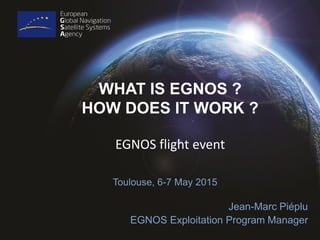
- 1. WHAT IS EGNOS ? HOW DOES IT WORK ? Toulouse, 6-7 May 2015 Jean-Marc Piéplu EGNOS Exploitation Program Manager EGNOS flight event
- 2. 2 EGNOS (European Geostationary Navigation Overlay Service) Navigation Land Earth Station (NLES): …uplinks error corrections to EGNOS satellites… GPS (and Galileo) Satellite Constellation Ranging and Integrity Monitoring Stations (RIMS) : …receive GPS data & send to MCC… Mission Control Centre (MCC) …processes GPS data to determine errors… EGNOS Geo-stationary Satellite …relays error corrections to users… HPL VPL HPL/VPL: Protection levels with integrity better than 1/10 Million per 150 sec
- 3. EGNOS Operational System: EGNOS V2 – 38 monitoring stations (RIMS) deployed in Europe and North Africa – 6 Uplink stations (NLES) deployed in Belgium, Luxembourg, France, Italy, Nederland – 2 main Mission Control Centres (Madrid, Rome) – 1 Engineering & Tests Center (Toulouse) – 1 Service Provision Centre (Madrid)
- 4. EGNOS Ground Infrastructure GEO Uplink Station (NLES) Luxembourg Monitoring Station (RIMS) Svalbard Monitoring Station (RIMS) Azores
- 5. EGNOS Safety Of Life Service performances Monday 4 May 2015
- 6. EGNOS Exploitation: organisation European Commission Program supervision European GNSS Agency (GSA) Program management European Space Agency (ESA) System Evolutions EGNOS Service Provider (ESSP) Service Provision Operations, Maintenance European Aviation Safety Agency (EASA) Safety oversight Delegation Industry V2 (development) Working Arrangement Industry (maintenance) Industry V3 (development) Sites Operations Communications Service Contract Certification Process
- 7. EGNOS and other SBAS: Next Generation Single frequency GPS-only WAAS+EGNOS+MSAS Dual-Frequency GPS-only Extension scenario Dual-Frequency GPS-Galileo Extension scenario