1
INTRODUCTION
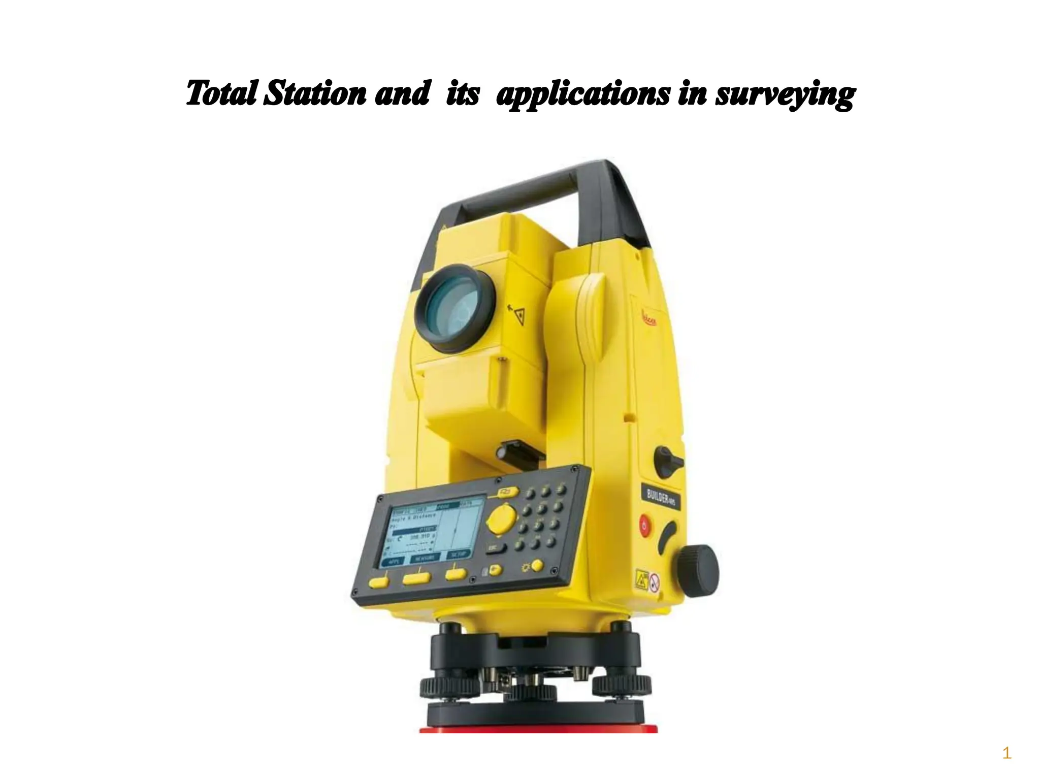
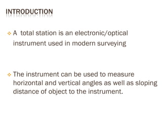
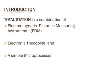
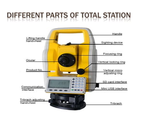
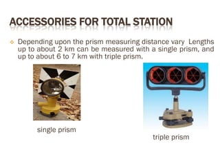
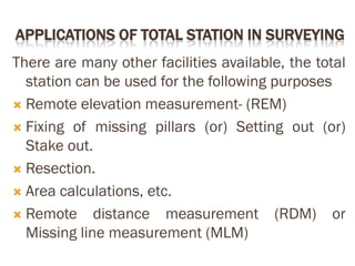
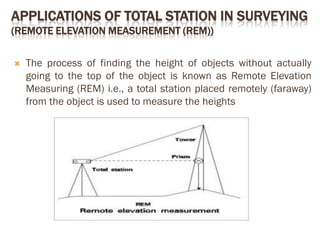
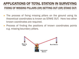
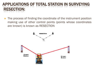
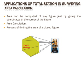
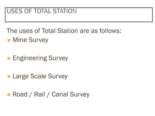
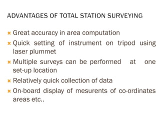
 A total station is an electronic/optical
instrument used in modern surveying
 The instrument can be used to measure
horizontal and vertical angles as well as sloping
distance of object to the instrument.
INTRODUCTION
TOTAL STATION is a combination of
 Electromagnetic Distance Measuring
Instrument (EDM)
 Electronic Theodolite and
 A simple Microprocessor
INTRODUCTION
 It also has a memory card to store the data. It
also consists of battery socket which houses
the battery.
 A fully charged battery works for about 3 to 8
hrs continuously
DIFFERENT PARTS OF TOTAL STATION
ACCESSORIES FOR TOTAL STATION
 Depending upon the prism measuring distance vary Lengths
up to about 2 km can be measured with a single prism, and
up to about 6 to 7 km with triple prism.
single prism
triple prism
FUNCTIONS PERFORMED BY TOTAL STATIONS
 Total Stations, with their micro processors, can
perform a variety of functions and computations,
depending on how they are programmed. The
capabilities vary with different instruments, but
some standard computations include:
 Averaging multiple angle and distance
measurements.
 Correcting electronically measured distances from
prism constant, atmospheric pressure, and
temperature.
FUNCTIONS PERFORMED BY TOTAL STATIONS
 Making curvature and refraction corrections to
elevations determine by trigonometric levelling.
 Reducing slope distances to their horizontal and
vertical components.
 Calculating point elevations from the vertical
distance components (supplemented with
keyboard input of instrument and reflector
heights).
 Computing coordinates of survey points from
horizontal angle and horizontal distance
ACCURACY OF A TOTAL STATION:
 Accuracy depending upon the instrument and
varies from instrument to instrument
 The angular accuracy varies from1″ to 20 ″.
 Distance accuracy depends upon two factors.
 Instrumental error which ranges from
+ / – 10mm to + / – 2mm.
ACCURACY OF A TOTAL STATION:
 Error due to the length of measurement.
It can be from + / – 10mm to + / – 2mm per
kilometer.
 1 prism, 2.5–2.7 km2 prisms
 5-7 km3 prisms
ACCURACY OF A TOTAL STATION:
 The accuracy achieved with total station is mainly
depends on operator procedure of Careful centering
and leveling of the instrument
 Accurate pointing at targets.
 Taking averages of multiple angle measurements made
in both direct and reverse positions
 Peripheral equipment that can affect accuracy includes
 Tribrachs
 Optical plummets
 Prism and
 Prism poles
 Tribrachs must provide a snug fit without slippage
OPERATION OF TOTAL STATION
 Because the Total Station contains delicate
electronic components they are not as rugged as
ordinary Theodolite. They must be packed and
transported carefully, handled gently and carefully
removed form their cases.
 The setting of Total Station over the station mark is
similar to an ordinary Theodolite. This includes
 Centering
 Leveling
 Removal of parallax
APPLICATIONS OF TOTAL STATION IN SURVEYING
There are many other facilities available, the total
station can be used for the following purposes
 Remote elevation measurement- (REM)
 Fixing of missing pillars (or) Setting out (or)
Stake out.
 Resection.
 Area calculations, etc.
 Remote distance measurement (RDM) or
Missing line measurement (MLM)
APPLICATIONS OF TOTAL STATION IN SURVEYING
(REMOTE ELEVATION MEASUREMENT (REM))
 The process of finding the height of objects without actually
going to the top of the object is known as Remote Elevation
Measuring (REM) i.e., a total station placed remotely (faraway)
from the object is used to measure the heights
APPLICATIONS OF TOTAL STATION IN SURVEYING
FIXING OF MISSING PILLARS (OR) SETTING OUT (OR) STAKE OUT:
 The process of fixing missing pillars on the ground using its
theoretical coordinates is known as STAKE OUT. Here two other
known coordinates are required.
 Process of finding the positions of known coordinates points
e.g. missing boundary pillars.
 The process of finding the coordinate of the instrument position
making use of other control points (points whose coordinates
are known) is known as RESECTION
APPLICATIONS OF TOTAL STATION IN SURVEYING
RESECTION:
APPLICATIONS OF TOTAL STATION IN SURVEYING
AREA CALCULATION:
 Area can be computed of any figure just by giving the
coordinates of the corner of the figure.
 Area Calculation.
 Process of finding the area of a closed figure.
The uses of Total Station are as follows:
 Mine Survey
 Engineering Survey
 Large Scale Survey
 Road / Rail / Canal Survey
 Great accuracy in area computation
 Quick setting of instrument on tripod using
laser plummet
 Multiple surveys can be performed at one
set-up location
 Relatively quick collection of data
 On-board display of mesurents of co-ordinates
areas etc..

Total station surveying and its application

  • 1.
  • 2.
    INTRODUCTION  A totalstation is an electronic/optical instrument used in modern surveying  The instrument can be used to measure horizontal and vertical angles as well as sloping distance of object to the instrument.
  • 3.
    INTRODUCTION TOTAL STATION isa combination of  Electromagnetic Distance Measuring Instrument (EDM)  Electronic Theodolite and  A simple Microprocessor
  • 4.
    INTRODUCTION  It alsohas a memory card to store the data. It also consists of battery socket which houses the battery.  A fully charged battery works for about 3 to 8 hrs continuously
  • 5.
    DIFFERENT PARTS OFTOTAL STATION
  • 6.
  • 7.
    ACCESSORIES FOR TOTALSTATION  Depending upon the prism measuring distance vary Lengths up to about 2 km can be measured with a single prism, and up to about 6 to 7 km with triple prism. single prism triple prism
  • 8.
    FUNCTIONS PERFORMED BYTOTAL STATIONS  Total Stations, with their micro processors, can perform a variety of functions and computations, depending on how they are programmed. The capabilities vary with different instruments, but some standard computations include:  Averaging multiple angle and distance measurements.  Correcting electronically measured distances from prism constant, atmospheric pressure, and temperature.
  • 9.
    FUNCTIONS PERFORMED BYTOTAL STATIONS  Making curvature and refraction corrections to elevations determine by trigonometric levelling.  Reducing slope distances to their horizontal and vertical components.  Calculating point elevations from the vertical distance components (supplemented with keyboard input of instrument and reflector heights).  Computing coordinates of survey points from horizontal angle and horizontal distance
  • 10.
    ACCURACY OF ATOTAL STATION:  Accuracy depending upon the instrument and varies from instrument to instrument  The angular accuracy varies from1″ to 20 ″.  Distance accuracy depends upon two factors.  Instrumental error which ranges from + / – 10mm to + / – 2mm.
  • 11.
    ACCURACY OF ATOTAL STATION:  Error due to the length of measurement. It can be from + / – 10mm to + / – 2mm per kilometer.  1 prism, 2.5–2.7 km2 prisms  5-7 km3 prisms
  • 12.
    ACCURACY OF ATOTAL STATION:  The accuracy achieved with total station is mainly depends on operator procedure of Careful centering and leveling of the instrument  Accurate pointing at targets.  Taking averages of multiple angle measurements made in both direct and reverse positions  Peripheral equipment that can affect accuracy includes  Tribrachs  Optical plummets  Prism and  Prism poles  Tribrachs must provide a snug fit without slippage
  • 13.
    OPERATION OF TOTALSTATION  Because the Total Station contains delicate electronic components they are not as rugged as ordinary Theodolite. They must be packed and transported carefully, handled gently and carefully removed form their cases.  The setting of Total Station over the station mark is similar to an ordinary Theodolite. This includes  Centering  Leveling  Removal of parallax
  • 14.
    APPLICATIONS OF TOTALSTATION IN SURVEYING There are many other facilities available, the total station can be used for the following purposes  Remote elevation measurement- (REM)  Fixing of missing pillars (or) Setting out (or) Stake out.  Resection.  Area calculations, etc.  Remote distance measurement (RDM) or Missing line measurement (MLM)
  • 15.
    APPLICATIONS OF TOTALSTATION IN SURVEYING (REMOTE ELEVATION MEASUREMENT (REM))  The process of finding the height of objects without actually going to the top of the object is known as Remote Elevation Measuring (REM) i.e., a total station placed remotely (faraway) from the object is used to measure the heights
  • 16.
    APPLICATIONS OF TOTALSTATION IN SURVEYING FIXING OF MISSING PILLARS (OR) SETTING OUT (OR) STAKE OUT:  The process of fixing missing pillars on the ground using its theoretical coordinates is known as STAKE OUT. Here two other known coordinates are required.  Process of finding the positions of known coordinates points e.g. missing boundary pillars.
  • 17.
     The processof finding the coordinate of the instrument position making use of other control points (points whose coordinates are known) is known as RESECTION APPLICATIONS OF TOTAL STATION IN SURVEYING RESECTION:
  • 18.
    APPLICATIONS OF TOTALSTATION IN SURVEYING AREA CALCULATION:  Area can be computed of any figure just by giving the coordinates of the corner of the figure.  Area Calculation.  Process of finding the area of a closed figure.
  • 19.
    The uses ofTotal Station are as follows:  Mine Survey  Engineering Survey  Large Scale Survey  Road / Rail / Canal Survey
  • 20.
     Great accuracyin area computation  Quick setting of instrument on tripod using laser plummet  Multiple surveys can be performed at one set-up location  Relatively quick collection of data  On-board display of mesurents of co-ordinates areas etc..