A study on best practices of Water Supply infrastructures in 3 Indian cities and 2 International cities- towards the partial fulfillment of credits for the course CB1- Infrastructure and Transport Planning at the School of Planning and Architecture, New Delhi (November 2019)
Research paper PLANNING STRATEGIES FOR STORMWATER MANAGEMENT FOR URBAN AREAS:...Prerna Jasuja
With the growing population and increasing water
demand for various purposes in urban areas, the cities fall
prey to the water crisis and management issues which
include three components, namely freshwater supply,
wastewater treatment, and stormwater management. Urban
stormwater is surface runoff generated during any rain or
snowmelt. Stormwater management has shifted from being
a technical problem handled by engineers at water utilities to
close integration with urban planning in the USA, Singapore,
and China. This paper highlights such practices in these
three countries, taking one of their implemented examples. It
intends to discuss and analyze the integration within urban
plans of blue and green infrastructure and the artificial
drainage system in urban areas to maintain stormwater
quantity, quality, water security, and means to keep minimal
damage to nature post-urban development. Indian cities
have yet to address the incorporation of Stormwater
management with their spatial planning. The strategies
applied by the three countries can be used as a learning
a lesson in the Indian context.
The strategies included creating large pedestrian zones along lake edge, developing on outer road by strengthening existing road network, creating approximately 2 km of access streets as
well as new access point of lake front enhancing recreational potential by improving public facilities and encouraging overall development within the precinct.
Master Plan Amritsar - 2031 (Accessibility in Peri-Urban areas)liquorstud
Presented in NOSPLAN - 2014 (Smavesh)
“City for All- Proposals and the experiences towards the right to the city”.
Charlotte Mathivete.
But the increasing variety of the urban–rural relationships in the peri- urban areas challenges the policy makers to deal with the complexity of providing access to these areas.
The city Amritsar engulfs the tourist influx worldwide into its magnetic field due to its religious and the historical importance. The proposals in the master plan include the heritage walk, industrial, educational hub etc. Therefore “Master Plan Amritsar - 2031” focusing on the theme accessibility in the peri-urban areas is activity oriented approach at the macro level of the areas in the urbanisable limit of the city Amritsar. The population of the peri urban area is 4.18 lakhs and covering the area of 51426 hectares. The proposed land use in the planning area is residential 43%, circulation 15%, commercial 5%, public-semi public 11%, industrial 11% and recreational 15%. The study has the approach covering accessibility from the major proposed nodes and along the roads in the planning area and the MC limits.
In the lieu of the above the accessibility is analyzed by taking the distance of the radius 5km, 10km and 15km from the center as per the guidelines of the G.O.I and further supported by the demarcation of the four zones along the within the major roads. The accessibility along the roads is identified taking into account the travel characteristic that is the real journey time taken by the commuters.The accessibility to the peri –urban areas is also related with the different aspects then taking account of the commercial centers the shopping areas are sufficient, college need to be proposed to fulfill the requirement, in the terms of the transportation the peri- urban is linked through the outer ring roads; due to the proposal of the sports complex the recreational facilities are also well accessed; but on the darker side the health facilities are least accessible to the peri-urban areas.
So analyzing the access to peri- urban area and concluding as a whole the proposals are located taking the parameters such as directional growth of the city, location of the major roads such as NH, existing activity nodes. Therefore the proposed commercial centers are located in Manawala, Verka and Bal Kalan; recreational centers along the ring road and the NH; educational facilities i.e. two colleges along the Batala road and the Ajnala road; hospitals along the NH and ring road.
Sabarmati Riverfront Development ProjectFabiha Rahman
Sabarmati Riverfront:
An urban regeneration and environment improvement initiative
Transforming river from a geographical divider to a focal point for leisure and recreation
Recognized in the list of ‘100 Most Innovative Projects’
What is an urban Lake? How do I engage with my local lake? How do we work together to protect and rejuvenate our urban lake? Using Bangalore's example, and building on the work by many urban lake groups, citizens and Biome Environmental Trust, here is an introduction to urban lakes and how we as citizens can engage with our common pool urban natural resources. For more information, contact water@biome-solutions.com.
Area Appreciation Studio - 2021 - SPAD M.PlanLakshman R
SEE THIS PPT IN SLIDESHOW MODE
About project
This project was an individual studio project named Area Appreciaton.
The main objective was to learn how to look and evaluate an area from a planners perspective.
So we were asked to select an area of about 1 Sqkm near our place of stay and appreciate several aspects related to spatial planning, quality of life etc.
I have selected Shakarpur and a part of Laxmi Nagar. Had a very hectic time but it was all fun and worth it!
BWSSB presentation - Water Supply Realities BnagaloreADDA
This SlideShare is a Presentation done by BWSSB on the Water supply Scenario in Bangalore during "Water Workshop organised" organised by ApartmentADDA on Dec 6th, 2009.
First part of the Slideshare briefs on
• Water Resources in Bangalore
• Alternative Resources
• Customer Friendly Initiatives
• Geographical Information system
• Bangalore water supply and sewerage Project
The second part deals with Bangalore's sanitation, Waste water Treatment Plants, Sewage Treatment Plants.
To get more details on the presentation, check the link here
http://apartmentadda.com/blog/dec-6-2009-water-workshop/resources/
The slide includes 1.Introduction to Disaster, 2.Disaster Impact and Response, 3.Relief Phase of Disaster, 4.Disaster Mitigation, 5.Disaster Preparedness 6.Personal Protection in different types of Disaster, 7.Man-made Disasters, 8. Policies concerned with disaster management 9.Worst Disasters in India 10. Organizations concerned with disaster management.
A total of 130+ slides will give a detailed idea of the disaster and its management.
Disaster management- case study on 26 July 2005 Mumbai floodmadhura92
Presentation gives brief about Mumbai 26 July 2005 flood case study- Introduction, Factors aggravated for flood, casualty & damage, rescue operation carried out, mitigation measures, assessment done by government, guidelines for immediate action, long term strategies
Philippine Initiatives on the Applications of Space Technology on Hazard Mit...UN-SPIDER
Jose Edgardo L. Aban, Ph.D.
Technical Secretariat
a presentation given by Science and Technology Coordinating Council-Committee on Space Technology Applications (STCC-COSTA) during UN-SPIDER workshop in China, 5-7 December, 2007
Disaster management plans are traditionally made to manage disasters. Effective management of disasters requires getting information to the right place at the right time using latest technologies. Leverage learning by local organizations, NGO’s and youth is one effective tool to improve disaster management outcomes. However, there are cognitive, organizational and social barriers that prevent these organizations from learning. Organizational culture is another important aspect to enhance learning and learning literature. In this connection, this paper emphasizes the need for National Disaster Management Force at all levels of society similar to the NSS and NCC in achieving effective disaster management. The necessity of need based systems and procedures, to expedite the transfer of technology to each and every citizen of the country; to implement effective rules and regulations; to design policies; to improve interdisciplinary approach in combating disasters are discussed. An effort is made to propose a futuristic approach to cater the challenges in disaster mitigation and management for safe and resilient India.
SPACE-BASED INFORMATION FOR DISASTER MANAGEMENT AND MITIGATION IN INPE-BRASIL UN-SPIDER
NUCLEUS OF RESEARCH AND APPLICATION OF GEOTECNOLOGIES IN NATURAL DISASTERS AND EXTREME EVENTS. Presentation given by Tania Maria Sausen GEODESASTRES-SUL / INPE-CRS during
Disaster Risk Reduction and ManagementRyann Castro
Please Feel Free to Download and Share. Just Acknowledge me as the Owner. May it serve you well.
R.A. 10121
THE PHILIPPINE DISASTER RISK REDUCTION AND MANAGEMENT SYSTEM MAY 27, 2010
An Act Strengthening The Philippine Disaster Risk Reduction and Management System, providing for the National Disaster Risk Reduction and Management Framework, and Institutionalizing the Disaster Risk Reduction and Management Plan, appropriating funds therefor and for other purposes (DRRM Act 2010)
Krishna Vatsa - Resilience-based approach to Flood Risk Management in South AsiaGlobal Risk Forum GRFDavos
Panel II: “Approaches to Infrastructure Resiliency in Different National Contexts”
Krishna Vatsa, Regional Disaster Risk Reduction Advisor, South Asia UN Development Programme, Bangkok, Thailand
This presentation talks about the Water Uses, Water Forms and Distribution, Availability, Fresh Water Shortage, Water Use Problems and Conflicts Increase Water Supply, Floods and Drought
It talks about the shortage of water all across the globe. So people should use it effectively without unnecessary wastage.
Landforms of bangladesh and their relation to natural hazardsJahangir Alam
Landforms of Bangladesh and their Relation to natural hazards:
Bangladesh is situated between 23 34’ and 26 38’ North latitude and 88 01’ and 92 41’East longitude.
The topography is flat with elevation not exceeding 10 meters above mean sea level.
Floodplain and piedmont plains occupy almost 80 percent of the land area.
It is a low-lying, riverine country located in South Asia with a largely marshy jungle coastline of 580 km (360 mi) on the northern littoral of the Bay of Bengal.
Bangladesh has a tropical monsoon climate characterized by heavy seasonal rainfall, high temperatures, and high humidity.
To know about the land forms of Bangladesh.
To know about the hazards of Bangladesh.
To find out the relationship between landforms and Hazards.
Topography is a configuration of a land surface including it’s relief and contours, the distribution of mountains and valleys , the patterns of rivers and other natural features that produce the landscape .
There are three distinctive natural features in Bangladesh.
A broad alluvial plain subject to frequent flooding.
A slightly elevated relatively older plain
A small hill region drained by fant flowing rivers.
Similar to DISASTER MITIGATION &MANAGEMENT: Case study of SURAT Flood As national & Bangladesh Flood As International (20)
Immunizing Image Classifiers Against Localized Adversary Attacksgerogepatton
This paper addresses the vulnerability of deep learning models, particularly convolutional neural networks
(CNN)s, to adversarial attacks and presents a proactive training technique designed to counter them. We
introduce a novel volumization algorithm, which transforms 2D images into 3D volumetric representations.
When combined with 3D convolution and deep curriculum learning optimization (CLO), itsignificantly improves
the immunity of models against localized universal attacks by up to 40%. We evaluate our proposed approach
using contemporary CNN architectures and the modified Canadian Institute for Advanced Research (CIFAR-10
and CIFAR-100) and ImageNet Large Scale Visual Recognition Challenge (ILSVRC12) datasets, showcasing
accuracy improvements over previous techniques. The results indicate that the combination of the volumetric
input and curriculum learning holds significant promise for mitigating adversarial attacks without necessitating
adversary training.
CFD Simulation of By-pass Flow in a HRSG module by R&R Consult.pptxR&R Consult
CFD analysis is incredibly effective at solving mysteries and improving the performance of complex systems!
Here's a great example: At a large natural gas-fired power plant, where they use waste heat to generate steam and energy, they were puzzled that their boiler wasn't producing as much steam as expected.
R&R and Tetra Engineering Group Inc. were asked to solve the issue with reduced steam production.
An inspection had shown that a significant amount of hot flue gas was bypassing the boiler tubes, where the heat was supposed to be transferred.
R&R Consult conducted a CFD analysis, which revealed that 6.3% of the flue gas was bypassing the boiler tubes without transferring heat. The analysis also showed that the flue gas was instead being directed along the sides of the boiler and between the modules that were supposed to capture the heat. This was the cause of the reduced performance.
Based on our results, Tetra Engineering installed covering plates to reduce the bypass flow. This improved the boiler's performance and increased electricity production.
It is always satisfying when we can help solve complex challenges like this. Do your systems also need a check-up or optimization? Give us a call!
Work done in cooperation with James Malloy and David Moelling from Tetra Engineering.
More examples of our work https://www.r-r-consult.dk/en/cases-en/
Water scarcity is the lack of fresh water resources to meet the standard water demand. There are two type of water scarcity. One is physical. The other is economic water scarcity.
Sachpazis:Terzaghi Bearing Capacity Estimation in simple terms with Calculati...Dr.Costas Sachpazis
Terzaghi's soil bearing capacity theory, developed by Karl Terzaghi, is a fundamental principle in geotechnical engineering used to determine the bearing capacity of shallow foundations. This theory provides a method to calculate the ultimate bearing capacity of soil, which is the maximum load per unit area that the soil can support without undergoing shear failure. The Calculation HTML Code included.
Student information management system project report ii.pdfKamal Acharya
Our project explains about the student management. This project mainly explains the various actions related to student details. This project shows some ease in adding, editing and deleting the student details. It also provides a less time consuming process for viewing, adding, editing and deleting the marks of the students.
Explore the innovative world of trenchless pipe repair with our comprehensive guide, "The Benefits and Techniques of Trenchless Pipe Repair." This document delves into the modern methods of repairing underground pipes without the need for extensive excavation, highlighting the numerous advantages and the latest techniques used in the industry.
Learn about the cost savings, reduced environmental impact, and minimal disruption associated with trenchless technology. Discover detailed explanations of popular techniques such as pipe bursting, cured-in-place pipe (CIPP) lining, and directional drilling. Understand how these methods can be applied to various types of infrastructure, from residential plumbing to large-scale municipal systems.
Ideal for homeowners, contractors, engineers, and anyone interested in modern plumbing solutions, this guide provides valuable insights into why trenchless pipe repair is becoming the preferred choice for pipe rehabilitation. Stay informed about the latest advancements and best practices in the field.
Saudi Arabia stands as a titan in the global energy landscape, renowned for its abundant oil and gas resources. It's the largest exporter of petroleum and holds some of the world's most significant reserves. Let's delve into the top 10 oil and gas projects shaping Saudi Arabia's energy future in 2024.
About
Indigenized remote control interface card suitable for MAFI system CCR equipment. Compatible for IDM8000 CCR. Backplane mounted serial and TCP/Ethernet communication module for CCR remote access. IDM 8000 CCR remote control on serial and TCP protocol.
• Remote control: Parallel or serial interface.
• Compatible with MAFI CCR system.
• Compatible with IDM8000 CCR.
• Compatible with Backplane mount serial communication.
• Compatible with commercial and Defence aviation CCR system.
• Remote control system for accessing CCR and allied system over serial or TCP.
• Indigenized local Support/presence in India.
• Easy in configuration using DIP switches.
Technical Specifications
Indigenized remote control interface card suitable for MAFI system CCR equipment. Compatible for IDM8000 CCR. Backplane mounted serial and TCP/Ethernet communication module for CCR remote access. IDM 8000 CCR remote control on serial and TCP protocol.
Key Features
Indigenized remote control interface card suitable for MAFI system CCR equipment. Compatible for IDM8000 CCR. Backplane mounted serial and TCP/Ethernet communication module for CCR remote access. IDM 8000 CCR remote control on serial and TCP protocol.
• Remote control: Parallel or serial interface
• Compatible with MAFI CCR system
• Copatiable with IDM8000 CCR
• Compatible with Backplane mount serial communication.
• Compatible with commercial and Defence aviation CCR system.
• Remote control system for accessing CCR and allied system over serial or TCP.
• Indigenized local Support/presence in India.
Application
• Remote control: Parallel or serial interface.
• Compatible with MAFI CCR system.
• Compatible with IDM8000 CCR.
• Compatible with Backplane mount serial communication.
• Compatible with commercial and Defence aviation CCR system.
• Remote control system for accessing CCR and allied system over serial or TCP.
• Indigenized local Support/presence in India.
• Easy in configuration using DIP switches.
Welcome to WIPAC Monthly the magazine brought to you by the LinkedIn Group Water Industry Process Automation & Control.
In this month's edition, along with this month's industry news to celebrate the 13 years since the group was created we have articles including
A case study of the used of Advanced Process Control at the Wastewater Treatment works at Lleida in Spain
A look back on an article on smart wastewater networks in order to see how the industry has measured up in the interim around the adoption of Digital Transformation in the Water Industry.
NO1 Uk best vashikaran specialist in delhi vashikaran baba near me online vas...Amil Baba Dawood bangali
Contact with Dawood Bhai Just call on +92322-6382012 and we'll help you. We'll solve all your problems within 12 to 24 hours and with 101% guarantee and with astrology systematic. If you want to take any personal or professional advice then also you can call us on +92322-6382012 , ONLINE LOVE PROBLEM & Other all types of Daily Life Problem's.Then CALL or WHATSAPP us on +92322-6382012 and Get all these problems solutions here by Amil Baba DAWOOD BANGALI
#vashikaranspecialist #astrologer #palmistry #amliyaat #taweez #manpasandshadi #horoscope #spiritual #lovelife #lovespell #marriagespell#aamilbabainpakistan #amilbabainkarachi #powerfullblackmagicspell #kalajadumantarspecialist #realamilbaba #AmilbabainPakistan #astrologerincanada #astrologerindubai #lovespellsmaster #kalajaduspecialist #lovespellsthatwork #aamilbabainlahore#blackmagicformarriage #aamilbaba #kalajadu #kalailam #taweez #wazifaexpert #jadumantar #vashikaranspecialist #astrologer #palmistry #amliyaat #taweez #manpasandshadi #horoscope #spiritual #lovelife #lovespell #marriagespell#aamilbabainpakistan #amilbabainkarachi #powerfullblackmagicspell #kalajadumantarspecialist #realamilbaba #AmilbabainPakistan #astrologerincanada #astrologerindubai #lovespellsmaster #kalajaduspecialist #lovespellsthatwork #aamilbabainlahore #blackmagicforlove #blackmagicformarriage #aamilbaba #kalajadu #kalailam #taweez #wazifaexpert #jadumantar #vashikaranspecialist #astrologer #palmistry #amliyaat #taweez #manpasandshadi #horoscope #spiritual #lovelife #lovespell #marriagespell#aamilbabainpakistan #amilbabainkarachi #powerfullblackmagicspell #kalajadumantarspecialist #realamilbaba #AmilbabainPakistan #astrologerincanada #astrologerindubai #lovespellsmaster #kalajaduspecialist #lovespellsthatwork #aamilbabainlahore #Amilbabainuk #amilbabainspain #amilbabaindubai #Amilbabainnorway #amilbabainkrachi #amilbabainlahore #amilbabaingujranwalan #amilbabainislamabad
Industrial Training at Shahjalal Fertilizer Company Limited (SFCL)MdTanvirMahtab2
This presentation is about the working procedure of Shahjalal Fertilizer Company Limited (SFCL). A Govt. owned Company of Bangladesh Chemical Industries Corporation under Ministry of Industries.
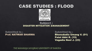
DISASTER MITIGATION &MANAGEMENT: Case study of SURAT Flood As national & Bangladesh Flood As International
1. CASE STUDIES : FLOOD
THE MAHARAJA SAYAJIRAO UNIVERSITY OF BARODA
Submitted to :
Prof. NATWAR SHARMA
Submitted by :
Bhensdadia Umang V. (01)
Patel Abhi R. (15)
Vagadia Neel J. (23)
2.
3. INDEX
• OBJECTIVES
• INRTODUCTION
-LOCATON OF SURAT AND UKAI
-SALIENT FEATURES OF UKAI DAM
• VARIOUS DATA RELATED SURAT FLOOD-2006
-FLOOD HISTORY AT SURAT
-SCENARIO OF FLOOD DURING AUGUST-2006
-FLOOD PREVENTION PLANS
• IT WAS A PREVENTABLE DISASTER
-REASONS FOR FLOOD-2006
-WHAT COULD HAVE BEEN DONE..?
- WHY UKAI AUTHORITIES DID NOT RELEASE 3 LAKH CUSECS FROM 1ST AUGUST..?
• CONCLUSION
4. INTRODUCTION
-Surat city is situated at the delta region of river Tapi
(India).
-The river Tapi is originating from a mountain Satpuda
and flowing through three states Maharastra, Madhya
Pradesh and Gujarat.
-The river Tapi is merging to the Arabian Sea at about
15 kms away from Surat city.
-Ukai dam controls the flow of water and water level in
the river Tapi, which is 100 kms away from Surat city.
-The dam is constructed at Ukai, Tal: Songadh, Dist:
Surat. It is constructed for irrigation purpose mainly
and also served the purpose of flood control,
generation of hydropower and supply of industrial and
drinking water.
5. SALIENT FEATURES OF UKAI RESERVOIR
-Location : Songadh, Surat district
-River : Tapi
-Catchment Area : 62 225 sq km
Gujarat : 1 337 sq km (2.15 %)
Maharashtra 51 254 sq km (82.37 %)
Madhya Pradesh 9 634 sq km (15.48%)
-Design flood discharge : 49 490 cumecs (1.75
million cusecs)
-Year of completion : 1972
-Gross storage capacity : 8.511 BCM
-Live storage capacity : 7.092 BCM
-FRL : 105.16 m (345 ft)
-Riverbed level : 47.87 m (157.05 ft)
-Installed power generation capacity : 905 MW
6. SURAT FLOOD-2006
1) Flood history at Surat
FLOOD
EVENT
DISCHARGE
(LAC CUSECS)
WATER LEVEL AT
HOPE BRIDGE
PERIOD
1883 10.5 11.05 JULY
1884 8.46 10.05 SEPTEMBER
1894 8.01 10.33 JULY
1942 8.60 10.56 AUGUST
1944 11.84 11.32 AUGUST
1945 10.24 11.09 AUGUST
1949 8.42 10.49 SEPTEMBER
1959 12.94 11.55 SEPTEMBER
1968 15.5 12.08 AUGUST
1994 5.25 10.10 AUG.-SEPT.
1998 7.0 11.40 SEPTEMBER
2006 9.09 12.40 AUGUST
7. 2) Scenario of flood during August-2006
DATE LEVEL AT UKAI
(FT.)
INFLOW AT
UKAI
(CUSECS)
DISCHARGE
FROM
UKAI
(CUSECS)
WATER LEVEL AT WIER
CUM CAUSE WAY (m)
WATER LEVEL AT
HOPE BRIDGE (m)
DANGER LEVEL
345 FT.
DANGER LEVEL
6m
DANGER LEVEL
9.5 m
01/08/200
6
331.54 62903 1200 6.71 2.30
02/08/200
6
333.09 75263 1200 6.88 2.36
03/08/200
6
334.44 73715 23784 7.20 1.90
04/08/200
6
335.06 73413 23680 7.02 2.20
05/08/200
6
335.42 150047 125464 6.97 0.90
06/08/200
6
337.12 503027 352056 9.70 6.90
07/08/200 342.98 1166390 829829 - 11.90
8. REASONS FOR SURAT FLOOD 2006:
1) Heavy rainfall in upstream catchment area
2) Ukai reservoir level
When we compared the Ukai reservoir levels just before the monsoon and at the end
of July for the last four years, we were surprised to find that the levels at Ukai dam
were the highest this year in last four years, both with respect to the level just before
the monsoon and also at the end of July, as is clear from the table below.
YEAR LOWEST LEVEL BEFORE MONSOON LEVEL AT THE
END OF JULYLEVEL (m) DATE
2003 89.91 JUNE 17 94.56
2004 88.02 JULY 25 88.16
2005 85.37 JUNE 24 94.26
2006 90.71 JUNE 29 97.8
9. 3) Water released from Ukai reservoir
It is disturbing to know that even as late
as on Aug 6 evening, the water releases
from Ukai reservoir were just 254780
cusecs when the level had already built up
to 102.57 m, that is reservoir was 83.6%
full at 5.528 BCM live storage. A day
earlier the releases were shockingly low
at 23640 cusecs. This was when during
the eight days preceding this, all the
talukas of Nandurbar district had received
over 25 mm rainfall at least for 4-5 days
including an instance of 260 mm rainfall
in a day and seven instances when rainfall
was over 100 mm. Surgana taluka in
Nashik was also getting similar pattern of
rainfall.
DATE TIME INFLOWS
(CUSECS)
OUTFLOW
(CUSECS)
WATER
LEVEL
(m)
AUGUST 5 8 AM 85958 26664 102.20
8 PM 48554 23640 102.26
AUGUST 6 8 AM 75087 124920 102.14
8 PM 330216 254780 102.57
AUGUST 7 8 AM 853679 409004 103.46
8 PM 1072680 816036 104.22
AUGUST 8 8 AM 1053133 844092 104.97
8 PM 961466 907316 105.33
AUGUST 9 8 AM 856000 850000 105.34
8 PM 711757 650000 105.38
12. WHAT COULD HAVE BEEN DONE AT DAM AUTHORITY
LEVEL?
Had the Ukai dam authorities released 300000 cusecs of water
starting from Aug 1, the reservoir level at Ukai would have been
reduced by over 3 BCM by the morning of Aug 6 and the level of
water at the dam would have been 94.2 m (about 2.34 BCM
storage). After this even with all the additional water coming in,
continued outflow of 3-4 lakh cusecs would have been sufficient
to ensure that reservoir does not get full and there would have
been no big flood disaster in SURAT district.
14. • Bangladesh is a country in SE Asia
that suffers annual Flooding.
• The floodwaters bring alluvial
sediment which makes the delta and
floodplains very fertile.
• Floods frequently severe causing loss
of life and economic damage.
• Extreme poverty and geographic
pressure increase the suffering.
• Much of the country´s budget must be
used for recovery.
15. • The flood hazard is due to its
geography: the country is one
huge delta.
• Floodplain contains 250
perennial rivers, of which 56
originate outside the country
(Tibet, Bhutan, India and
Nepal).
• Only 7,5% of the total
catchment area is within the
country and 90% of discharge
originates Elsewhere.
16. There are Three main rivers in Bangladesh
• The Ganges, whose lower course is known as the Padma / basin
area 1,1 million km, length 2478 km, average maximum
discharge 299 000 cumecs.
• The Brahmaputra, whose lower reaches are known as the
Jamuna / basin area 0,9 km, length 2900 km, average discharge
317 000 cumecs.
• The Meghna, east of the Padma-Jumuna area, length 800 km,
half of which lies in Bangladesh.
17. Types of Floods in Bangladesh
• Flash floods carry a heavy sediment load, raising the level of river beds, and
are caused by heavy monsoon rains falling on mountains and hill next to the
floodplain.
• River floods occur between May and September as a result of heavy regional
storms or melting of the Himalayan snowpack's.
• Rainfall floods result from localized precipitation during the monsoon rains,
mostly in low-lying areas.
• Cyclonic floods are sea floods and occur when cyclones from the Bay of
Bengal create a storm surge which moves inland.
18. Causes
• Himalaya snow melt, deforestation leads to soil erosion from increased
surface run-off.
• Silt builds up in rivers, raising water level.
• Monsoon season, tropical storms.
• 80% of Bangladesh is a flood plain.
The Human Causes of the Floods
• Deforestation.
• Dam building.
• Urbanization.
• Global warming.
19. Deforestation: - The forests play a major role in the hydrology off the upland drainage basins absorbing
water from the ground,, binding the soil particles and reducing the impact off rain droplets on the ground
surface. The removal off the forest cover has reduced interception and increased landslides, soil erosion
and overland flow. It has been estimated that soil is being lost 400 times faster in deforested areas and is
raising the river bed off the Brahmaputra by 5cm per Year.
Dam building: - The building off the Famaka Dam in India in 1971 is blamed for the raising off the river bed
off the Hughley River, a tributary off the Ganges. During the dry season the dam reduces the discharge off
the river encouraging sedimentation on the river bed and increasing the risk off flooding.
Urbanization: - In Bangladesh recent development schemes involving the construction off the networks off
roads and embankments have probably added obstacles to the free drainage off water from the land.
Global warming: - Some people attach considerable blame to global warming and a rise in sea level.. The
Bangladesh floods in 1998 were notable for their long duration off 56 days. This was blamed by some on
the higher sea levels which meant that the surface water on the floodplain took longer to infiltrate. The
same people also attribute the especially high rainfalls in the Himalayas in 1998 to the increased global
temperature.
20. Effects
• Half the countries surface affected, people dead/injured.
• Families suffering without food, shelter, fresh water, medicines.
• Trying to save livestock.
• Having to live on boats-cramped conditions.
• Transport routes destroyed.
• Disease and reliance on aid.
21. Influence on inhabitants
• Flooding is part off the normal life for the people in Bangladesh.
• Farming is finely tuned to sessional variations in discharge, and
damage only occurs by natural disasters such as floods and cyclones,
which are unexpected.
22. Background/Key Facts 1998 flood
• Over 1300 people killed.
• 25 million made homeless.
• The Govt. began work on a Flood Action Plan (FAP) It was hoped the scheme would
provide a long term solution to the countries flooding problems.
23.
24. Why does Bangladesh flood?
• Split answers into Physical and Human causes.
Source: BBC
Bangladesh is a delta. The
low level of the delta land
means that the country is
prone to flooding. 75% of
Bangladesh is at or below
just 10 metres in height.
Bangladesh also suffers
regularly from
substantial flooding
caused by monsoon rains
and melting snows from
the Himalayas.
Source: World
Infozone.com
Freshwater floods occur when a watershed receives so much water that it
cannot drain into the soil quickly enough to take the water away.
Bangladesh has three mighty rivers, the Ganges, the Jamuna and the
Meghna.
Most floods follow heavy rain or melting snow, frozen ground and already
high river levels. The floods in Bangladesh begin through a combination
of heavy monsoon rains flooding the rivers and abnormally high tides in
the Bay of Bengal preventing floodwater from running off the land and
into the sea.
The likelihood of flooding can be increased by human activities too, such
as too many trees being cut down, stripping the land bare of the vital top
soil which slows and drains water. Also, In built-up areas with a lot of
concrete roads and houses, there are fewer places for water to go and less
soil for water to drain into. So planners in cities prone to flooding have to
develop ways of channelling water to cope with potential floods.
Source: Global Express.org
25. Where does the flooding occur?
• Identify specific regions that are worst hit.
26. What are the effects of the floods?
• Split answers into positive and negative.
Bangladesh-Floods
More than 450 people have died and more than 30 million
people in Bangladesh are affected by the recent floods. Of the
country's 64 districts, 43 are affected by the rising waters.
Around 40 per cent of the county's capital, Dhaka, is covered
in water and Government figures report more than 150,000
homes have been destroyed and more than half a million
acres of crops destroyed.
Floodwaters place the population at risk from a range of
water-borne diseases, including diarrhoea, dysentery, typhoid
and cholera. Outbreaks of diarrhoea have already been
reported, especially in the capital, where sewers mix with
floodwater and water supplies are contaminated.
Although Bangladesh is used to floods, this year levels and
coverage has been far worse than normal and the monsoon
season has only just started.
World Vision UK
The deltas of the Ganges and Brahmaputra
rivers in South Asia flood on a seasonal
basis. The flooding keeps the soil fertile
because the rivers deposit silt which forms
fertile soil each year. Partly because of the
flooding, it is one of the most densely
populated areas of the world with millions
of people in Nepal, Northern India and
Bangladesh depending on the rivers and
fertile soils for their livelihoods.
Tear Fund UK
27.
28. The Flood Action Plan (FAP) was set up in 1990 supported by several wealthy countries and the World Bank. Its aim
was to reduce the impact of the floods that occurred annually in Bangladesh. The FAP’s objectives were to set up
regional planning groups to study and monitor local river processes, followed by the construction of huge
embankments to protect the land, initially from river flooding. It was intended to construct coastal embankments to
protect from storm surges brought by cyclones but these have not been completed. As a result the FAP is not
considered to have been a complete success. Over 3 million people have been killed by coastal flooding in the last 30
years.
The first findings of the FAP in 1995 stated that, while the flood protection scheme was economically desirable for
urban areas, it was not a good idea in rural areas, which are dependent upon fishing and farming.
How have decision makers respond to the flooding?
29. What issues are faced in implementing strategies in countries like Bangladesh?
Whilst the embankments have been strengthened, increased in height and extended in many
places, the FAP has come across several problems, such as:
1. The Bangladeshi Government cannot afford the high maintenance costs of the scheme
2. The embankments are at risk of erosion from the rivers
3. River channelization by FAP embankments has increased the risk of flood damage for downstream areas
4. An estimated 8 million people were forced to move due to the FAP. These were people who relied on
farming and fishing to support themselves.
5. Today, smaller, more sustainable projects tend to be favoured such as flood embankments to protect
important urban areas (like Dhaka), improved forecasting and early warning systems and the building of
flood shelters (areas of raised land to provide a save haven for people in times of flood).
BBC Bite size
30. Solutions to the Flood Hazard
Flood action plan 1990-1995 sponsored by World Bank involving:
• Surveying all main rivers and flood areas.
• Raising embankments on west bank of the Brahmaputra.
• Upgrading of embankments on the east bank.
• Five projects using mathematical models and remote sensing to model drainage basin flows.
• Studies of economic, environmental and social problems.
Flood Forecasting
• Increase radar stations in the hills and developing links to a flood forecasting centre.
• Controlled flooding where land can receive flood waters through sluice gates.
• Coastal embankments and polders (low-lying tract of land enclosed by embankments ).
31. • Self-help “flood-proofing“ which means the development of
irrigated agriculture during the dry season to avoid the monsoon
risk , plus escape centers o high ground, specially designed school
buildings, elevated roads and market-places.
• Dredging the channels- but this is too expensive and the channels
would soon become choked again in one season.
• Special bunds (embankment) to protect the capital city Dhaka.
• Dam construction upstream and groundwater abstraction to
create storage in the soil for monsoon rains.
32. The Impacts and Responses
• The flooding in 1998 flooded over 57% off the land area.
• Over 1000 people were killed and millions made homeless.
• In Assam in the north-east more than one million people lost their homes in the
Nalbari district 240 village's were submerged.
• Large amounts off farmland and many properties were washed Away.
• An embankment protecting Sandwip, a large coastal island, was breached by a high
tide marooning 1200 families.
• Acute shortages off drinking water and food.
• Infections affected large numbers off people along with outbreaks off diamhoea and
other diseases.
33. The short-term response to the floods:
The Impacts and Responses
By the Bangladesh government
• Distributed money and 400 tones of rice.
• Provided relief supplies of fresh water and sanitation services.
• Appealed for national unity and calm in the wake of the disaster and the general strike which took
place in response to the flooding and accusations that the government failed to get basic goods to
the people Affected.
By the governments of other countries
Many countries around the world gave aid to Bangladesh during the flood disaster.
Some of the donors included:
• The UK with steel bridge materials and 100 000 million tones of wheat.
• Canada with 12500 million tones of wheat and money for medicines, water tablets, house repair, sanitation
and for rehabilitation of farming and fishing.
• Egypt with money for medicine.
• Saudi Arabia sent two cargo planes with food, medicines, blankets and Tents.
34. By The Disaster Forum (a network of aid agencies)
• Provided boats to rescue people and
move them and their belongings to
higher land.
• Supplied medicines to treat and
prevent the spread of diseases.
• Médecins Sans Frontières use six
mobile teams in boats to travel
around in one district where the
population was literally living on the
water.
• Supplied clean drinking water by
repairing wells.
• Monitored the health situation and
set up a medical treatment centre.
• Distributed fodder for livestock.
• Distributed food, plastic sheeting and
water purification tablets.
• Planned a rehabilitation programmed
to repair and construct housing and
sanitation.
35. Conclusion
• Managing the flood hazard is a challenge for government and hydraulic
engineers. In Bangladesh there is still uncertainty over the main causes of the
flood hazard, and further research is required to identify important factors and
the effects of proposed structural solutions. Building embankments and bunds is
particularly controversial: they can prevent floodwaters draining from fields and
back into rivers, and they have an impact on fish stocks, a vital resource in a
country where 5 million depend on fishing for their livelihood.
• Bangladesh faces triple problems in the future: sea level rises, delta subsidence
and reduced delta growth. The net effect by 2100 could be a 3 meter rise of the
sea level and a 2 km retreat of the shore, resulting in a 26% reduction of habitat
land with 27% of the population displaced and GDP reduced by two-thirds.
36. What planners can do?
SHORT TERM MEASURES :
• Every reservoir is operated as per the rule book prescribed. It is essential to
follow the rule book without any deviation, to manage the water quantities of the
reservoir. Unnecessary storing the excess water towards the end of the monsoon
season reduces the flood absorption capacity of the reservoir and poses a
potential flood hazard.
• A network of warning sirens is to be installed in the flood prone areas of the
region. These should be able to warn the public at large, giving at least 5 hours
time to act for protection. This should have linkage with releases from Reservoir.
• Detailed contour map (levels) of the city should be properly marked on the
distinct objects in the city with colour codes indicating different water levels
during different intensities of floods.
• River training works and flood control works should be completed on priority.
37. LONG TERM MEASURES :
• In order to reduce the releases from the Ukai
Reservoir, diversion canals at the appropriate
locations on its upstream should be provided.
• It is necessary to develop a mathematical model for
flood routing for the entire River Channel Network.
• The encroachments along the banks of the river
have to be removed.
• The present rule book for Reservoir can be
reviewed and can be transformed to
comprehensive guidelines encompassing the
alternatives and their scope of operation during
emergency situations and at the same time
providing the water optimally so as to support the
socio-economic life of City.
• Provide partial flood embankments.
38. • Create flood plains and overflow
areas of river :
There was a time when
floodplains covered large stretches
along European rivers. Today,
because of urban sprawl, less than
half remain. We need to restore
these floodplains because of their
significant role in flood protection,
water management and nature
conservation. Essentially, what
floodplains do is retain and absorb
water, thereby shielding nearby
towns from the effects of heavy
rainfall.
39. FLOOD REDUCTION PLAN
1) Desilting from Reservoir
Due to silting in the reservoir the dead storage capacity of dam has been reduced. The
average rate of silting is 1 ft. per year. It is difficult to completely remove mud and silt
from the reservoir, however silt removal devices can be installed to minimize the
silting effects.
2) Increasing the carrying capacity of river.
The effective waterway of river has been reduced over years due to silting. The
dredging of river in certain reaches and other suitable measures can be implemented
to increase the carrying capacity of the river.
3) Construction of flood protection wall
It is necessary to provide flood protection wall on both the banks of river to protect
the residential areas. The existing flood protection wall may not be sufficient in
respect of length and height as well as it is in a damaged condition.
40. 4) Recharge of groundwater
It is necessary to construct widely spread groundwater recharge wells after proper
planning and design in the flood affected area, which can absorb some portion of
the flood water. The recharged water will also be useful for increasing the
groundwater storage, improving the quality of groundwater and control of sea
water intrusion.
5) Spreading of flood water on saline Soil
It is also proposed to divert the floodwater to the existing saline soil areas outside
the city. Such a diversion is possible by construction of suitable diversion channels.
The diverted water will serve the purpose of reclamation of saline soil through
leaching.
41. STRUCTURAL MITIGATION MEASURES :
1. Levees:
A levee is an embankment constructed by engineers
out of organic materials such as earth and stone, in order
to prevent the flooding from a free flowing body of water
in a specific location such as a residential community.
2. Flood walls:
Flood walls are constructed out of materials such as
concrete or steel in order to control the flow of
flood waters and prevent the flooding of specific areas.
3. Dams:
The primary purpose of this structure unlike a levee is
to retain water, not to manage flood water. A dam can
produce hydroelectricity as well as regulate water
levels by opening and closing the retaining doors.
Flood walls:
Levees:
42. STRUCTURAL MITIGATION MEASURES :
4. Reservoirs:
The man-made lakes produced as a result of the creation
of a dam which can slow the flow of the river
downstream. Furthermore, a reservoir can be used for
fresh water for a community as well as a preserve for fish
and wildlife.
5. Reducing bed roughness:
This method of mitigation smooths the bed of the river,
which allows for the river to flow faster and reduces
the likelihood of a flood.
6. Altering stream channels:
This strategy is similar to reducing the river bed's
roughness. It additionally creates a "V" in the river's
bottom. This deepens, as well as increases, the speed of
the river, reducing the risk of flooding because the water
flows away from the floodplain areas quicker.
Reducing bed roughness:
43. NON-STRUCTURAL MITIGATION MEASURES :
1. Land use planning and zoning tools:
Local municipalities can institute zoning laws
in their comprehensive plans in order to
prevent development of residential and
commercial properties in high risk flood
prone areas. This planning can further
restrict where buildings can be constructed,
as well as if these buildings must be flood-
proofed. Flood-proofing is a process that
involves raising the foundation of the
building, berms, flood walls, and/or sealant
in order to prevent or reduce the damages
inflicted from flood waters. Lastly,
local municipalities can
impose eminent domain upon a landowner if
their property has been deemed as a
high recurrence property.
Reducing bed roughness:
44. NON-STRUCTURAL MITIGATION MEASURES :
2. Environmentally sensitive area protection:
Areas such as wetlands can be protected by local municipalities by preventing development in
those areas. Furthermore, through the use of eminent domain, a local municipality can reclaim
areas and return them to their natural states.
3. Flood forecasting and warning methods:
By using methods, such as a stream gauge, local officials can determine whether or not a river or
creek will flood based on the level of the water and how quickly it is rising.
4. Planning:
By a local municipality creating a comprehensive and all hazard mitigation plan, communities
can reduce the risk of flood damages to property and life.