Development control regulations kochi report
•
6 likes•4,563 views

The document summarizes the development control regulations for the Kochi City Region in Kerala, India. It provides an overview of the planning area and divisions, estimated future land requirements, development concepts and strategies, land use categories and regulations, and transport proposals. Key points include that the planning area covers Kochi city and surrounding areas, there is a need for more recreational, commercial, and transportation lands, and the goal is to develop Kochi as a global city with diversified industries and improved regional transport links.

Recommended
Recommended
More Related Content
What's hot
What's hot (20)
Similar to Development control regulations kochi report
Similar to Development control regulations kochi report (20)
More from Geeva Chandana
More from Geeva Chandana (20)
Recently uploaded
Recently uploaded (20)
Development control regulations kochi report
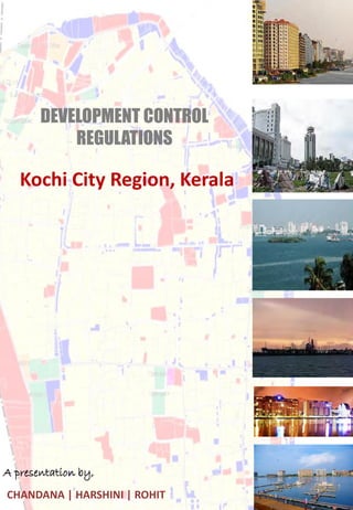
- 1. DEVELOPMENT CONTROL REGULATIONS Kochi City Region, Kerala A presentation by, CHANDANA | HARSHINI | ROHIT
- 2. DEVELOPMENT CONTROL REGULATIONS - KOCHI • Prepared by Department of Town and Country Planning, Government of Kerala. • Latest DCR – Development Plan for Kochi city region 2031. • Kochi City Region (KCR) considered as the Planning Area in this Development Plan comprises of Kochi City and the immediate surrounding area, which is within the influence of the developments in the city and vice versa. • Areas in KCR: FACTS Area of Kochi : 94.88 Sq.Km Population : 5.95Lakh (2001 census) Population density : 6277 persons / sq.km (2001 data) Has dominant central commercial area, extending in linear fashion along MG road and Banerji road, spreading towards – Broadway, Foreshore road and market area – “ City Centre” Kaloor-Palarivattom area, Edappally, Vyttila, Thripunithura and Kadavanthara have developed as commercial centres FACTS:
- 3. ESTIMATED FUTURE LAND REQUIREMENT FOR VARIOUS USES IN THE PLANNING AREA INFERENCE: Uses having Existing (net) / UDPFI ratio below 0.5 are considered to be grossly inadequate. Thus Recreational spaces, Commercial spaces, Transportation and Public & Semi-public uses are found grossly inadequate in the existing land use pattern.
- 4. DEVELOPMENT CONCEPTS AND STRATEGIES Can be developed as global city – destination for investments. Diversified development potential – Port related activities, industries, IT, Tourism, Trade etc., Planned efforts to address the floating population into the city Major urban centers – given impetus for development to arrest the influx of floating population – develops other towns. Transit oriented development corridors – to stimulate the growth of other growth centers – attract population and to reduce the dependence on Kochi Unplanned urban sprawl – arrested / regulated Urbanizing peripheral areas Separate strategies to be devised for areas immediately around Kochi city region. Regional transport – improved and mass transport – strengthened. Improve different modes of transport – pedestrian friendly city. Scope for densification of the city – based on population and activities. Vast potential for water front development Hierarchy of facilities in planning area. Informal sector can be designated areas within the planning areas. Can be developed as multi-nodal city region – broadly within the concept of “City within City”.
- 5. ESTIMATED FUTURE LAND REQUIREMENT FOR VARIOUS USES IN THE PLANNING AREA
- 6. DETAILS OF PLANNING DIVISIONS o Planning Division 1 - Fort Kochi and Mattancherry, o Planning Division 2 - Wellington Island and o Planning Division 3 - Ernakulam Main land. o Planning Division 4 - Panchayats of Chellanam and Kumbalangi o Planning Division 5 – Panchayats of Maradu and Kumbalam o Planning Division 6 – Thrippunithura Municipality and Thiruvankulam Panchayat o Planning Division 7 – Vadavukode- Puthenkurisu Panchayat o Planning Division 8 – Kalamassery Municipality and Thrikkakara Panchayat o Planning Division 9 – Eloor Panchayat o Planning Division 10 – Panchayats of Cheranellur and Varappuzha o Planning Division 11 – Panchayats of Elamkunnappuzha, Mulavukadu, Njarakkal and Kadamkkudy EXAMPLE: 1. Fort Kochi and Mattanchery i. Traditional town area with heritage precincts/buildings ii. High density mixed used development iii. Place of tourism importance iv. Poor infrastructure & connectivity 2. Wellington Island i. Harbour and Navy related are the principal activities with major part of the island under these two activities ii. West and East Kochi areas are linked through the island
- 7. SAMPLE PLANNING FOR DIFFERENT DIVISIONS
- 8. LAND USE CATEGORIES The Land Use Categories adopted for Kochi City Region (KCR) are as follows: (1) Predominantly Residential (i) Low density residential – R1 (ii) High density residential – R2 (2) Predominantly Commercial (i) Community Centre – C1 (ii) Sub Centre – C2 (iii) City Centre – C3. (3) Predominantly Industrial (i) IT/ ITES – M1 (ii) Medium and Large Industries – M2 (4) Public and Semi Public - P (5) Transport – T (6) Heritage Conservation - H (7) Parks, Open Spaces and Recreational – O (8) Paddy lands and wetlands –W (9) Agriculture (Dry cultivation ) - A
- 9. FSI and GROUND COVERAGE Source: Kerala Municipality Building rules
- 10. PLOT ACCESS Source: Kerala Municipality Building rules
- 11. PARKING Source: Kerala Municipality Building rules
- 12. PARKING Source: Kerala Municipality Building rules
- 13. SETBACK Source: Kerala Municipality Building rules
- 14. PREDOMINATELY RESIDENTIAL LOW DENSITY RESIDENTIAL (R1)
- 15. PREDOMINATELY RESIDENTIAL HIGH DENSITY RESIDENTIAL (R2)
- 17. PREDOMINATELY COMMERCIAL SUB CENTER (C2) AND CITY CENTER (C3)
- 18. INFORMATION TECHNOLOGY BUILDINGS Of the total built-up area in such buildings, at least 70% of the area should be earmarked for this purpose and the remaining could be utilized for supporting activities like restaurants, food courts, meeting rooms, guest houses, recreational facilities. Information Technology Park refers to integrated township, which would contain Information technology buildings, as well as other buildings. In the Information Technology Park, 70% of the land area is to be set aside for the construction of Information Technology buildings and the remaining land area could be utilized for all the supporting activities. The buildings for the supporting activities could include residential buildings, recreational facilities, educational 62 facilities, convention centres, and hospitals. Hardware industries- manufacturing, assembly and servicing. Permitted subject to compatibility to surrounding developments – 1. Service industries and light manufacturing 2. Retail shopping, 3. Individual residential 4. Educational facilities, convention centres,hospitals, hotels and other social infrastructure subject to a total built-up area of 300sqm. 5. Recreational facilities including parks and play grounds. Restricted 1. Vehicle fuel retailing stations 2. Public utility installation. 3. Bus and truck terminals. 4. All uses mentioned in 3b,3c & 3d of Section (i)above exceeding total built-up area of 300sq.m limiting to 500 sq.m. Prohibited All uses not specifically covered under sections (i) and (ii) above
- 19. OTHER LANDUSE CATEGORIES Detailed guidelines for permitting the restricted uses will be issued by the Chief Town Planner separately and such detailed guidelines will become part of this Development Regulations.
- 20. FORM GREATER COCHIN DEVELOPMENT AUTHORITY COMMERCIAL SECTOR A total of 375000 sq.Ft of built up space has been developed in different areas as part of city centre development & as part of Detailed Town Planning Schemes. HOUSING SECTOR Constructed about 5000 Nos. of dwelling units for different income group within the Greater Cochin Region. Housing Loan given to about 15000 families scattered all over the Region. 700 Houses constructed and allotted to low income families for rehabilitation. 1700 Nos. of residential plots developed and sold to individuals.135 Acres of land given to different Government / quasi-Government agencies for group housing. All the prestigious planned housing coloniesing Cochin have been developed by GCDA. This includes, Panampilly Nagar, Gandhi Nagar,Kasthurba Nagar,Shastri Nagar,Indira Nagar,Subash Nagar etc
- 21. FORM GREATER COCHIN DEVELOPMENT AUTHORITY PARKS AND OPEN SPACES City level parks, residential area level parks and play fields have been developed as part of Detailed Town Planning Schemes and as part of all the housing schemes. This includes the International Stadium of 75000 capacity with an investment of 100 Core constructed in a record time of 515 days, open air auditorium at Marine drive, a large maiden for public meetings, exhibitions etc, cultural centre in memory of late poet Sri. Changampuzha etc. A total of 75 Acres has been developed & set apart under this sector by GCDA. IT SECTOR Smart city near Kakkanadu Bio- Technology park at Kalamassery
- 22. OTHER SPECIAL PROVISIONS FOR LARGE SCALE DEVELOPMENTS Large scale development proposals in an area not less than 4 Ha, exceeding investment of Rs 50 crore, which provide direct employment to 500 people must satisfy the following conditions: • The developer shall produce project cum feasibility report and Environmental impact Assessment - committee meeting. • The developer shall produce before the committee all required clearances from State and Central Govt. agencies concerned. • Adequate provision - water supply, sewerage, solid waste management etc. Separate sewage treatment plant and solid waste management measures • Adequate MoU between the developer and the secretary of the local body concerned shall be undertaken to bring this into effect. • Maximum F.A.R shall be 2 and minimum access width shall be 15m. • The project shall be completed within a period of 3 years if not specified otherwise. APPLICABLE TO SPECIFIC TRANSPORTATION CORRIDORS More mixing of uses and intensity of development, mainly in residential areas, is permitted along major transportation corridors. (i) Roads having a width of 22 m and above upto a depth of 150m, the permissible FAR for buildings under residential occupancies will be 2. If the existing width of any of these roads is less than the width proposed in the Development Plan, this provision shall be applicable as and when the roads are widened and upgraded to the widths proposed in the Development Plan. (ii) Roads having a width of 12m and aboveIn Low density residential area (R1), on either side of these roads, to a depth of 75m from the boundary of the road, the permissible FAR for buildings under residential occupancies will be 2.
- 23. TRANSPORT PROPOSAL Kochi is uniquely served with different modes of transportation on air, water and land. The transportation system may be classified broadly into: 1. intercity linkages, 2. regional linkages, 3. city level linkages depending on their predominant function and area of operation • INTER CITY LINKAGE – Air transport , Port and Harbor ,railway and National highway • REGIONAL LINKAGE – o Regional link road connect the urban areas of all other region o Water transport network Kochi has a good network of inland waterway system consisting of backwaters, canals, lagoons and estuaries. o City Level Traffic Network The city level movement of goods and passengers in Kochi is effected through the city road system and inland waterways
- 24. TRANSPORT PROPOSAL TYPE OF ROAD LENGTH (Km) PERCENTAGE Arterial road 16.90 2.75 Sub – arterial road 53.00 8.63 Collector Street 151.40 24.66 Local Streets 392.67 100 DISTRIBUTION ACCORDING TO THE CLASSIFICATION INLAND WATER TRANSPORT
- 25. TRANSPORT PROPOSAL DEVELOPMENT STRATEGIES FOR TRAFFIC AND TRANSPORTATION : The development strategies for traffic and transportation in Kochi is worked out with the aim to support the concept of making Kochi City Region a ‘Global City’ • At Regional level Promoting transit oriented development Strengthening regional linkages • At planning division level Promote mass transport system in the planning area • Road network development scheme Promoting transit oriented development Corridor Strengthening of regional roads -27- 22M Major roads – 27M – 22M Other important roads- 18-15M
- 26. SAMPLE PROPOSAL OF ROAD WIDTHS
- 27. THANKYOU