Downloaded 170 times


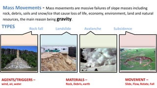


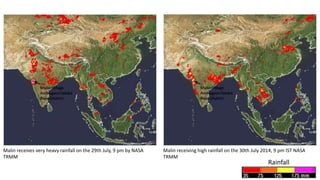


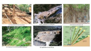


Landslides are a type of mass movement that causes significant damage and loss of life. The document discusses landslides, their causes such as heavy rainfall, erosion, deforestation, and construction activities. It provides examples of deadly landslides in India like the 2014 Malin landslide in Pune that killed over 160 people. Guidelines for landslide hazard mitigation include creating landslide hazard maps, developing early warning systems, adopting safe land use practices, and implementing engineering stabilization measures. Preventive measures involve controlling slope angles, improving drainage, protecting weak geological structures, and considering the effects of water during development planning.


