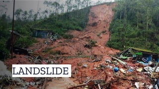
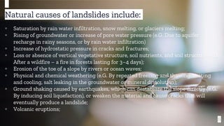
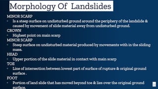
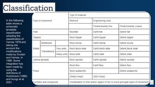
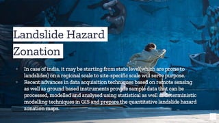
The document discusses landslides, defining them as various forms of mass ground movement, such as rock falls and mudflows, and highlighting their potential to generate tsunamis. It outlines natural and human-induced causes of landslides, various classifications of landslide morphology, and suggests methods for mitigation and hazard assessment using GIS and remote sensing. Additionally, it emphasizes the importance of early warning systems and community awareness in minimizing risks associated with landslides.