A low cost landslide method for mitigating landslide risk, in an urban community. Initiative operationalized through a Framework Agreement between the National Disaster Office of Jamaica the General Counsel of Martinique.
The document summarizes an environmental project to protect the St. Lawrence River from groundwater contamination originating from a former landfill site along the river shore in Montreal. For the west sector, a groundwater containment and treatment system will be installed, including a hydraulic barrier of wells, pumping of contaminated groundwater, and on-site treatment. For the east sector, a retaining wall will be constructed along the shoreline to contain petroleum hydrocarbons, and a system of pumping wells and recovery stations will be established to capture the contaminants. Construction of both projects is scheduled to begin in summer 2016.
This document discusses landslip prevention and mitigation works for two sites in Hong Kong - the Sham Tseng San Tsuen Site and the Hong Lok Yuen and Wu Uk sites. For the Sham Tseng site, the works include soil nails, rigid barriers, baffles, flexible barriers, and landscaping. For the Hong Lok Yuen site, the works include soil nails, rigid barriers, and flexible barriers, with constraints from the residential neighborhood. For the Wu Uk site, the works include soil nails and buttressing to mitigate open hillslope landslides and boulder fall hazards.
This document provides information about the Office National des Forêts (ONF), France's national forestry office:
1. The ONF manages 4.7 million hectares of forest land in France and 8 million hectares overseas, employing over 9,500 people.
2. It aims to balance economic, environmental, and social responsibilities in forest management. Economically, it sells over 16.9 million cubic meters of timber annually. Environmentally, it focuses on biodiversity, soil/water protection, and certification. Socially, it facilitates public access and protects against natural hazards.
3. Soil compaction from forestry machinery is a concern. The EFFORTE project studied how soil
This document discusses the use of tiresoil, which is a material made from used tires and soil, for civil engineering applications. It was invented in 1976 by a French engineer and has been used in over 1000 structures worldwide. Tiresoil provides environmental benefits by reusing old tires, economic benefits by reducing construction costs, and performs well in tests and real-world examples. It has been used for retaining walls, embankments, slope stabilization, and more. The document outlines the history and inventor of tiresoil, its uses and benefits, testing results, and various construction examples from around the world.
The city of Minneapolis implemented a concrete pavement preservation program to repair its aging concrete streets and extend their lifespan using techniques like slab stabilization, full and partial depth repair, dowel bar retrofit, and diamond grinding. The program prioritizes streets for repair based on age, condition, and equity considerations. Work is done both by city crews and contractors using indefinite delivery contracts to allow flexibility. Initial projects in the Waite Park neighborhood cost $2.6 million for concrete repairs and $500,000 for diamond grinding. The preserved streets are expected to last another 25 years, providing 65-70 years of lifespan at a low annual cost.
The Ohio DOT specifies longitudinal diamond grooving (which helps reduce hydroplaning, increases drainage at the tire/pavement interface and aids in vehicle control) on concrete bridge decks. The superior safety performance encouraged the department to use the technique on several sections of asphalt pavement.
This document discusses landslides, including their causes, types, effects, indicators, prevention, and safety measures. It defines landslides as the downward movement of soil, rock, and vegetation under gravity. Key points include that landslides occur when resisting forces are less than driving forces, and can be triggered by heavy rainfall, earthquakes, erosion, deforestation, and human activities like excavation. The document outlines common landslide types and describes their impacts, such as damage to infrastructure, loss of life, and secondary hazards like flooding. It provides guidance on landslide hazard mapping, mitigation strategies, and safety precautions during landslide events.
This document presents a landslide susceptibility map created for Sri Lanka using a bivariate statistical method. Six factors that influence landslide susceptibility are identified: lithology, soil type, landuse, slope, aspect, and curvature. GIS software is used to generate weighted maps for each factor based on statistical analysis of landslide occurrences. These weighted maps are then combined through map algebra to create a final landslide hazard susceptibility map for Sri Lanka. The workflow involves data preparation steps like rasterization of vector data, reclassification of aspect, slope and curvature, followed by zonal statistics analysis and calculation of weight values to produce individual weighted maps for each factor, which are then summed to obtain the final susceptibility map.
GIS-3D Analysis of Susceptibility Landslide Disaster in Upstream Area of Jene...AM Publications
The assessment of landslide hazard and risk has become a topic of major interest for both geoscientists and engineering professionals as well as for local communities and administrations in many parts of the world. Recently, Geographic Information Systems (GIS), with their excellent spatial data processing capacity, have attracted great attention in natural disaster assessment. In this paper, an assessment of landslide hazard at Upper Area of Jeneberang Watershed has been studied using GIS technology. By simulating the potential landslide according the minimum safety factor value using GIS, it can be expected that great contribution as a basic decision making for many prevention works before future landslide occurs at upstream area of Jeneberang River Watershead, South Sulawesi, Indonesia
Marjanović, M: Advanced Landslide Assessment of the Halenkovice Experimental ...indogpr
This presentation summarizes advanced landslide assessment methods applied at the Halenkovice experimental site in the Czech Republic. A variety of data collection and modeling methods were used, including field surveys, remote sensing, statistical analyses, and machine learning techniques like support vector machines. The results show improved accuracy over earlier regression models, though further refinements are still needed, like increasing the number of folds in model optimization and exploring multi-class scenarios. Overall, the study demonstrates the promise of comprehensive, multi-method landslide assessments for informing land use planning and hazard management.
ROC curves are used to evaluate machine learning algorithms and visualize the tradeoff between true positives and false positives. An ROC curve plots the true positive rate against the false positive rate for different discrimination thresholds. The area under the ROC curve (AUC) provides a single measure of performance, with higher values indicating better classification. While ROC curves are commonly used, precision-recall curves may provide a better evaluation for some applications by focusing on precision and recall rather than false positives.
Landslides are a type of mass movement that causes significant damage and loss of life. The document discusses landslides, their causes such as heavy rainfall, erosion, deforestation, and construction activities. It provides examples of deadly landslides in India like the 2014 Malin landslide in Pune that killed over 160 people. Guidelines for landslide hazard mitigation include creating landslide hazard maps, developing early warning systems, adopting safe land use practices, and implementing engineering stabilization measures. Preventive measures involve controlling slope angles, improving drainage, protecting weak geological structures, and considering the effects of water during development planning.
This document describes a project on road safety done by students of the Department of Electrical Engineering at Gujarat Power Engineering and Research Institute. It involves three canvases where they empathized with users of roads to understand risks, ideated potential solutions, and developed product concepts aimed at improving safety. In the first canvas, they identified stakeholders like drivers, traffic police and activities like driving, parking that impact safety. The second canvas explored solutions like better signage and speed limits. Their final canvas focused on developing vehicle features using sensors and notifications to prevent accidents and alert authorities.
The document describes the Analytic Hierarchy Process (AHP), a technique for structuring complex decisions. It involves breaking the decision down into a hierarchy, then using pairwise comparisons to determine the relative importance of criteria and alternatives. The example provided illustrates Judy Grim using AHP to choose a new computer system. She identifies hardware, software, and vendor support as criteria. Alternatives are three computer systems. Pairwise comparisons assign weights to criteria and ratings to alternatives on each criterion. The highest rated alternative is selected.
This document discusses landslides, including their classification, causes, and mitigation strategies. It defines a landslide as the downward and outward movement of slope-forming materials along surfaces of separation. Landslides are classified based on depth, type of movement, and speed. Key causes of landslides include geological weaknesses, erosion, rainfall, excavation, earthquakes, and volcanic eruptions. Main mitigation strategies involve hazard mapping, land use planning, retaining walls, drainage control, engineered structures, vegetation, and insurance. Increasing slope stability also requires preventing rising groundwater levels in landslide areas.
Long-life concrete pavements in several countries were studied to identify techniques for achieving longer-lasting concrete pavements in the US. Key findings included the use of standard catalog designs optimized for 30+ year service lives, higher strength concrete mixtures with up to 4 aggregate size bins, and exposed aggregate surfaces for lower noise. Construction practices like two-lift paving allowed for recycling and provided durable surfaces, while maintenance was minimal due to the long design lives before rehabilitation. The scan identified opportunities to adapt proven international techniques to improve pavement performance and extend the life of US infrastructure.
Building materials, Basic civil engineering ,unit-1Parimal Jha
This document provides information on the syllabus for the subject Basic Civil Engineering & Mechanics at Chhattisgarh Engineering College in Durg, India. It includes the course objectives, units of study, and details on topics like building materials, construction, surveying, forces, and truss analysis. The first unit discusses different types of bricks and cement, along with their properties and tests. Common building materials like brick, cement, and concrete are introduced.
This document outlines the history and evolution of geo-textiles from ancient times to modern applications. It discusses how geo-textiles were first used in ancient Egypt but have since evolved into highly developed products with various applications in infrastructure projects. The document also provides definitions of geo-textiles and lists some common geo-textile products and their uses like drainage, confinement, and pavement reinforcement. Benchmark projects using geo-textiles are highlighted from Australia between 1985-2001 that demonstrate the evolution of design and construction methods.
This document provides an overview of a project on using waste tires in civil engineering applications. It discusses the challenges of disposing waste tires and explores their use in retaining walls, highway pavements, soil modification, and seismic base isolation. An experimental study found that using tire chips in retaining wall backfill reduced displacements and lateral earth pressures by 50-60% compared to sand alone. Tire shreds can improve drainage and load distribution in highway bases. When added to soils like black cotton soil, tire waste improves engineering properties such as strength. Tire chips also show potential as seismic isolators beneath foundations to absorb energy through sliding.
This document discusses nanotechnology applications in construction materials. It describes how nanoparticles can enhance properties of soils, concrete, and bricks when integrated into their molecular structures. Specifically, it outlines how Nano-Road uses nanoparticles to strengthen soils for faster, more durable road construction without needing aggregates. Nano-Creet is described as 3 times stronger concrete that uses less material and cures faster. Nano-Bricks can be compressed without firing, saving energy. SmartRoads embeds fiber optics in roads to create communication networks. Overall, the document argues that nanotechnology enables more sustainable construction practices.
Officine Maccaferri: Geosynthetics Products Portfolio 2017Maccaferri World
Geogrids, Drainage geocomposites, Geomats, Geomembranes, Woven and Non Woven geotextiles are used for Reinforce soils, Stabilise ground, Drain, Separate, Filter, Protect, Contain / barrier systems, Erosion control
This document discusses the benefits of using EarthZyme, a biodegradable soil stabilizer, for sustainable road construction and maintenance. Some key points:
- EarthZyme increases the strength and density of treated soils, allowing the use of marginal soils and reducing reliance on aggregates. It reduces maintenance needs like rutting and extends the life of roads.
- EarthZyme permanently binds to clay particles in the soil, providing long-term stabilization unlike other products. It makes the soil less permeable, improving durability in wet and dry conditions.
- The document provides detailed steps for applying EarthZyme to soil, including mixing it in at the optimal moisture content and compacting the soil. EarthZy
The document is a presentation on geotextiles that includes 17 chapters covering topics like history, definitions, products, applications, functions, materials and manufacturing processes. It summarizes benchmark geotextile projects in countries like Australia and New Zealand that were used for purposes like coastal protection, riverbank stabilization and erosion control. Key projects discussed include groynes in North Kirra and Maroochydore, Australia that addressed beach erosion issues.
This document discusses different types of interface treatments used in pavement construction. It begins by defining an interface treatment as applying a thin layer of bituminous binder to the surface of an existing pavement layer before constructing a new bituminous layer. It then discusses prime coats, tack coats, and seal coats. For prime coats, it describes the purpose and materials used. It discusses best practices for application and important properties like penetration, curing time, strength and impermeability. For tack coats, it provides guidelines for surface preparation and application rates. Finally, it describes seal coats and the typical materials and process used to lay them down.
The document summarizes the development of a prototype finite element model (FEM) to simulate the mechanistic behavior of flexible road surfacing seals. The model aims to address limitations in current empirical seal design methods. It outlines seal performance criteria to evaluate in the model, including deformation, cracking, adhesion loss. The model represents seal stone, binder and base layers. It applies traffic loads to analyze stresses and failure. The summary provides an overview of efforts to develop a new mechanistic tool to predict seal performance under varying conditions.
The document summarizes an industrial training report for the construction of Dassal Road in Rajouri, Jammu and Kashmir from June-July 2019. It provides an overview of the Public Works Department, introduces different types of bituminous roads and their construction processes. It also discusses road layers, surveying methods, cost estimation, construction steps and concludes with key learnings. The trainees gained practical experience in reconnaissance surveys, leveling, cross-section drawings, estimation and more under the guidance of their supervisor.
Rigid pavements are concrete slabs that distribute vehicle loads through beam action. They have high flexural strength and small deflections compared to flexible pavements. The presentation discusses the types of rigid pavements including jointed plain concrete, jointed reinforced concrete, and continuously reinforced concrete pavements. It also covers the design factors for rigid pavements such as traffic loading, subgrade strength, environmental conditions, and material properties. Rigid pavements are designed to last 30 years with minimal maintenance required over the design life.
1) The document studies pervious concrete, which allows water to pass through, reducing runoff.
2) It reports on experiments testing different aggregate sizes, finding 12.5-16mm provided highest strength.
3) Testing showed compressive strength increased over time, reaching 26.9MPa at 28 days, while permeability was 6.9mm/sec.
Encon Best - sales right, proposal version 1Glenn Davis
The document describes Encon NanoSOIL, a nanotechnology soil treatment product that has been in business for over 25 years. It lists several infrastructure applications where the product could provide benefits such as safer and longer-lasting roads, flood control structures, railways, bricks, toxic waste sealing, and airport construction. The applications involve strengthening existing structures and soils or building new ones in a faster, more cost-effective and environmentally-friendly manner compared to traditional methods. The document promotes the product's ability to work with a wide range of soil types found around the world.
Presentation by Anna D'Angelo, Executive Director, Technology, of the Australian Flexible Pavements Association. Delivered at the California Asphalt Pavement Association "Where the Rubber Meets the Road" asphalt rubber educational workshop April 18, 2023 in Sacramento.
This document summarizes guidelines for the design of flexible pavements according to IRC:37-2018. It discusses the history and revisions of IRC:37 standards since 1970. The key principles of pavement design are that designs should be safe, serviceable, and capable of carrying expected loads without failure. Performance criteria include subgrade rutting, fatigue cracking of bituminous layers, and fatigue performance of cement treated bases. The document outlines the procedures for determining design traffic, selecting pavement materials and layers, conducting structural analysis, and checking performance criteria to iteratively design pavement thickness.
Plastic Waste Utilization for Manufacturing of Paver BlockIRJET Journal
This document discusses a study on utilizing plastic waste to manufacture paver blocks. Plastic waste is a growing environmental issue as it takes a long time to break down. The researchers used plastic waste to partially replace cement in making paver blocks. They tested different mixtures of plastic waste, quarry dust, and sea sand. The optimal mixture was found to be a 1:1.5:1 ratio of plastic waste to quarry dust to sea sand. Tests on the resulting paver blocks showed an average compressive strength of 1.012 N/mm2 and a water absorption of less than 3%. Using plastic waste to make paver blocks provides an environmentally beneficial way of reusing plastic while manufacturing construction materials.
This document provides an overview of a presentation on summer training with the Uttar Pradesh Public Works Department. It discusses the roles and history of the Public Works Department and Uttar Pradesh State Bridge Corporation in constructing bridges and highways in the state. It then summarizes the different types of pavements used for roads, including flexible pavements made of bitumen and rigid concrete pavements. The document outlines the basic steps for constructing a concrete pavement, from preparing the subgrade to finishing, curing, installing joints, and opening the road to traffic.
Highway Construction and Equipment: Methods of constructing different types of roads viz. Earth roads, Stabilized roads, WBM, WMM roads, earthen embankments, DLC, and embankments with fly ash. Bituminous roads and Concrete roads. Berms and Shoulders, Features of rural roads including those in PMGSY. Hot mix plant for Bituminous roads-components, layout, control panel, quality assurance. Highway construction of rigid and flexible pavements including types of road rollers, specifications of compaction of different layers of bituminous roads, modern pavers for CC roads. Roller compacted concrete road construction
Similar to Tyresoil Retaining Wall (Adopting a low cost Landslide Mitigation Method) (20)
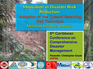
Understanding Inductive Bias in Machine LearningSUTEJAS
This presentation explores the concept of inductive bias in machine learning. It explains how algorithms come with built-in assumptions and preferences that guide the learning process. You'll learn about the different types of inductive bias and how they can impact the performance and generalizability of machine learning models.
The presentation also covers the positive and negative aspects of inductive bias, along with strategies for mitigating potential drawbacks. We'll explore examples of how bias manifests in algorithms like neural networks and decision trees.
By understanding inductive bias, you can gain valuable insights into how machine learning models work and make informed decisions when building and deploying them.
6th International Conference on Machine Learning & Applications (CMLA 2024)ClaraZara1
6th International Conference on Machine Learning & Applications (CMLA 2024) will provide an excellent international forum for sharing knowledge and results in theory, methodology and applications of on Machine Learning & Applications.
A review on techniques and modelling methodologies used for checking electrom...nooriasukmaningtyas
The proper function of the integrated circuit (IC) in an inhibiting electromagnetic environment has always been a serious concern throughout the decades of revolution in the world of electronics, from disjunct devices to today’s integrated circuit technology, where billions of transistors are combined on a single chip. The automotive industry and smart vehicles in particular, are confronting design issues such as being prone to electromagnetic interference (EMI). Electronic control devices calculate incorrect outputs because of EMI and sensors give misleading values which can prove fatal in case of automotives. In this paper, the authors have non exhaustively tried to review research work concerned with the investigation of EMI in ICs and prediction of this EMI using various modelling methodologies and measurement setups.
Literature Review Basics and Understanding Reference Management.pptxDr Ramhari Poudyal
Three-day training on academic research focuses on analytical tools at United Technical College, supported by the University Grant Commission, Nepal. 24-26 May 2024
Embedded machine learning-based road conditions and driving behavior monitoringIJECEIAES
Car accident rates have increased in recent years, resulting in losses in human lives, properties, and other financial costs. An embedded machine learning-based system is developed to address this critical issue. The system can monitor road conditions, detect driving patterns, and identify aggressive driving behaviors. The system is based on neural networks trained on a comprehensive dataset of driving events, driving styles, and road conditions. The system effectively detects potential risks and helps mitigate the frequency and impact of accidents. The primary goal is to ensure the safety of drivers and vehicles. Collecting data involved gathering information on three key road events: normal street and normal drive, speed bumps, circular yellow speed bumps, and three aggressive driving actions: sudden start, sudden stop, and sudden entry. The gathered data is processed and analyzed using a machine learning system designed for limited power and memory devices. The developed system resulted in 91.9% accuracy, 93.6% precision, and 92% recall. The achieved inference time on an Arduino Nano 33 BLE Sense with a 32-bit CPU running at 64 MHz is 34 ms and requires 2.6 kB peak RAM and 139.9 kB program flash memory, making it suitable for resource-constrained embedded systems.
2. Initiative came out of a framework
partnership agreement between Martinique
General Counsel and Jamaica (ODPEM)
Knowledge transfer from Martinique to
Jamaica (Technical Agencies, Melbrook
CDRM Group)
Implementation by partnership with Local
DRR partners (MGD,NSWMA,NWA)
Implementation under existing World Bank
Community Based Landslide Risk Reduction
project
3. Framework partnership agreement
to implement five projects :
1) Knowledge Transfer-Tyresoil Retaining Wall Technique
2) Earthquake Resistant retrofitting of buildings,
3) Cliff protection through dynamic screening,
4) Multi risks simulator,
5) Sharing of experience on communities’ evacuation techniques
+
4. Fact : Society produces waste in the form of tyres ((it is estimated that 35 Million in
France, 290Million in USA)
History :
Tyresoil system developed by the Professor NGUYEN THANH LONG of the LCPC
(French research institute)
- 1978 : Beginning of the research and pilot projects
- 1993 : in 15 years >250 tyresoil works completed in several different countries
(France, Algeria, USA, Switzerland, Brazil, Indonesia …)
- 1996 : First project completed by the Martinican General Council on Department
Road 28 with PR3+500.
- After 1996 : Numerous works in Martinique, many of them completed by private
individuals. No negative side effects known to this day.
Advantages :
- Waste recycling
- Economical (tyresoil cost = 50% less than a traditional retaining method)
- Materials for this technique are easy to obtain : used tires are readily available
worldwide
- Multiple uses within different domains of civil engineering: retaining wall, light
backfill, energy absorber, pressure distributer, slope and bank protector…
5. TYRESOIL = the association of 2 elements : Tyre and the soil
•Tyre = 2 sides + 1 tread band
2 types of tyres :
* Trucks = Exterior diameter :1.10 m to 1.20 m
Interior diameter : 0.50 m to 0.60 m
Thickness : 0,26 m to 0,33 m
Mass : 40 to 70 Kg
* Cars = Exterior diameter : 0.60 m
Interior diameter : 0.30 m
Thickness : 0.12 m to 0.16m
* Soil = large range of soils, ideally pulverulent (= sandy) containing elements which must not be bigger
than 5 cm (to allow for efficient compacting)
Sides
Tread band
6. Type 1 = Light backfill and energy absorbers.
-Preserve empty space to reduce backfill mass
-Allow for Deformation for energy absorption
-Applicable for variety of infrastructure applications
Type 2 = Retaining tyresoil :
-Construct the densest wall possible, which will withstand upward and
downward pressure
-Internal resistance is obtained through layers of linked tyres.
-The top side of the tyre is cut out to allow for quick filling.
9. •Coastal Limestone
•Variable poor alluvial
deposits such as sand, silt
and clays.
•Subject to rotational
failures
•Slope stability is dependent
on soil strength particularly
cohesion
•Slope gradients ranging
from 0- 40°.
•Moderately steep slopes
(21-30°) accounting for
approximately 60% of the
community.
10. • Widespread
cutting into slopes
• Major landslides
• Houses threatened
• Rapid rate of
development
• Poor Construction
practices
11.
12.
13.
14.
15.
16. Wall A (Road Protection)
•Dimension - 2.5mX2mX20m.
•Location: Scarp of Slide
•Estimated Tyres Required 990
Wall B (Slope Stabilization)
•Dimension 3mX4mX26m.
•Location: at the toe (base of landslide)
•Number of Rows: 21
•Estimated tyres required: 3360
•Contract Period: 20 working days
WALL A WALL B
17.
18. Community Engagement/ Mobilization
-Encourage Ownership
-Encourage Sweat Equity
-Testing Community Skills Bank
Delivery of Tyres
-Sorted and delivered by National
Solid Waste Management Authority
-Unlimited supply
19. Uniform Laying out of Tyres
Tyre size: R14/ R15
Cutting of Rope
-Polyproplene Rope used (non
biodegradable)
-New method of cutting devised
20. Linkage of tyres
-Rope affixed to link layers
vertically and horizontally
-Special tie used to ensure
stability of wall
Compaction of Fill
-Fill compacted to achieve maximum
homogeneity of each layer
-Fill compacted using water to allow
for greater cohesion of particles
22. Number of walls built - 2
Total budget approximately 3 Million JAD
dollars
- Estimates for conventional Wall 15Million
JAD
Total Number of tyres used – 4600
Number of community members trained-
>20
24. Excellent case of Knowledge Transfer and Regional
cooperation in DRR
Low cost mitigation interventions pay/ reduces risk exposure
of vulnerable communities
Reinforces the importance of partnership in DRR
Provides platform for sharing DRR experiences with regional
and international DM community.
Capacity of vulnerable communities strengthened
Technique to be packaged as part of ODPEM’s training suite.
Multiple opportunities for replication
- Member of Parliament/ Councillors
- NSWMA
- Parish Councils
- NGO’s