SlideShare a Scribd company logo
1 of 10
WELCOME
GEOREFERENCING
GIS
(BASIC COURSE)
By
Dr. Jaweria Shamshad
Ph.D. Environmental Sciences
College of Earth and Environmental Sciences
University of the Punjab, Lahore
3
Dr. Jaweria Shamshad, CEES , University of the Punjab
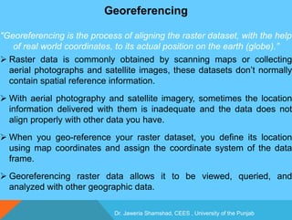
Georeferencing
"Georeferencing is the process of aligning the raster dataset, with the help
of real world coordinates, to its actual position on the earth (globe).”
 Raster data is commonly obtained by scanning maps or collecting
aerial photographs and satellite images, these datasets don’t normally
contain spatial reference information.
 With aerial photography and satellite imagery, sometimes the location
information delivered with them is inadequate and the data does not
align properly with other data you have.
 When you geo-reference your raster dataset, you define its location
using map coordinates and assign the coordinate system of the data
frame.
 Georeferencing raster data allows it to be viewed, queried, and
analyzed with other geographic data.
Dr. Jaweria Shamshad, CEES , University of the Punjab
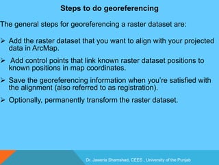
Steps to do georeferencing
The general steps for georeferencing a raster dataset are:
 Add the raster dataset that you want to align with your projected
data in ArcMap.
 Add control points that link known raster dataset positions to
known positions in map coordinates.
 Save the georeferencing information when you’re satisfied with
the alignment (also referred to as registration).
 Optionally, permanently transform the raster dataset.
Dr. Jaweria Shamshad, CEES , University of the Punjab
Types of georeferencing
There are two general types of georeferencing, that are:
1) Absolute Geo-referencing
 The image is georeferenced by taking GCPs (Ground Control
Points) with the help of GPS device, Google earth, Topo sheets
etc.
2) Relative Geo-referencing (Image to Image Registration)
 The image is georeferenced with the help of another already
georeferenced image
Dr. Jaweria Shamshad, CEES , University of the Punjab
GCP (Ground Control Point)
 Ground Control Point (GCP) could be defined as a point on the
surface of the earth of known location (i.e. fixed within an
established co-ordinate system) which is used to geo-reference
image data sources, such as remotely sensed images or
scanned maps.
It is also known as Control Point (CP).
Geo referencing
Geo referencing

More Related Content

What's hot

Digital Elevation Models
Digital Elevation ModelsDigital Elevation Models
Digital Elevation ModelsBernd Flmla
 
Remote sensing and digital image processing
Remote sensing and digital image processingRemote sensing and digital image processing
Remote sensing and digital image processingDocumentStory
 
Lec_6_Intro to geo-referencing
Lec_6_Intro to geo-referencingLec_6_Intro to geo-referencing
Lec_6_Intro to geo-referencingAtiqa khan
 
Application of RS and GIS in Groundwater Prospects Zonation
Application of RS and GIS in Groundwater Prospects ZonationApplication of RS and GIS in Groundwater Prospects Zonation
Application of RS and GIS in Groundwater Prospects ZonationVishwanath Awati
 
Gis Geographical Information System Fundamentals
Gis Geographical Information System FundamentalsGis Geographical Information System Fundamentals
Gis Geographical Information System FundamentalsUroosa Samman
 
Digital image processing
Digital image processingDigital image processing
Digital image processingVandana Verma
 
Microwave remote sensing
Microwave remote sensingMicrowave remote sensing
Microwave remote sensingMohsin Siddique
 
Spatial analysis and modeling
Spatial analysis and modelingSpatial analysis and modeling
Spatial analysis and modelingTolasa_F
 
Introduction and Application of GIS
Introduction and Application of GISIntroduction and Application of GIS
Introduction and Application of GISSatish Taji
 
Network analysis in gis
Network analysis in gisNetwork analysis in gis
Network analysis in gisstudent
 
Digitization in ArcGIS
Digitization in ArcGISDigitization in ArcGIS
Digitization in ArcGISKU Leuven
 
Scale and resolution
Scale and resolutionScale and resolution
Scale and resolutionshabir dar
 

What's hot (20)

Digital Elevation Models
Digital Elevation ModelsDigital Elevation Models
Digital Elevation Models
 
Remote sensing and digital image processing
Remote sensing and digital image processingRemote sensing and digital image processing
Remote sensing and digital image processing
 
Lec_6_Intro to geo-referencing
Lec_6_Intro to geo-referencingLec_6_Intro to geo-referencing
Lec_6_Intro to geo-referencing
 
Application of RS and GIS in Groundwater Prospects Zonation
Application of RS and GIS in Groundwater Prospects ZonationApplication of RS and GIS in Groundwater Prospects Zonation
Application of RS and GIS in Groundwater Prospects Zonation
 
GIS Map Projection
GIS Map ProjectionGIS Map Projection
GIS Map Projection
 
Gis Geographical Information System Fundamentals
Gis Geographical Information System FundamentalsGis Geographical Information System Fundamentals
Gis Geographical Information System Fundamentals
 
Digital image processing
Digital image processingDigital image processing
Digital image processing
 
Digital elevation model in GIS
Digital elevation model in GISDigital elevation model in GIS
Digital elevation model in GIS
 
Coordinate systems
Coordinate systemsCoordinate systems
Coordinate systems
 
Microwave remote sensing
Microwave remote sensingMicrowave remote sensing
Microwave remote sensing
 
Spatial analysis and modeling
Spatial analysis and modelingSpatial analysis and modeling
Spatial analysis and modeling
 
Land use cover pptx.
Land use cover pptx.Land use cover pptx.
Land use cover pptx.
 
Introduction and Application of GIS
Introduction and Application of GISIntroduction and Application of GIS
Introduction and Application of GIS
 
Network analysis in gis
Network analysis in gisNetwork analysis in gis
Network analysis in gis
 
Digitization in ArcGIS
Digitization in ArcGISDigitization in ArcGIS
Digitization in ArcGIS
 
GPS-errors-1
GPS-errors-1GPS-errors-1
GPS-errors-1
 
Scale and resolution
Scale and resolutionScale and resolution
Scale and resolution
 
Types of GIS Data
Types of GIS DataTypes of GIS Data
Types of GIS Data
 
DTM
DTMDTM
DTM
 
Datum
DatumDatum
Datum
 

Similar to Geo referencing

Commonly used ground truth equipments
Commonly used ground truth equipmentsCommonly used ground truth equipments
Commonly used ground truth equipmentsHimangshuKalita10
 
Understandingprojectionsforarcgis 12794889760059-phpapp01
Understandingprojectionsforarcgis 12794889760059-phpapp01Understandingprojectionsforarcgis 12794889760059-phpapp01
Understandingprojectionsforarcgis 12794889760059-phpapp01Manisha Tomar
 
geodesy-1 (1).pptx
geodesy-1 (1).pptxgeodesy-1 (1).pptx
geodesy-1 (1).pptxDrOmegaYT
 
Georeferencing
GeoreferencingGeoreferencing
GeoreferencingSBL-corp
 
Geo referencing by Mashhood Arif
Geo referencing by Mashhood ArifGeo referencing by Mashhood Arif
Geo referencing by Mashhood ArifKU Leuven
 
A Software Tool for Rapid Acquisition of Streetwise Geo-Referenced Maps
A Software Tool for Rapid Acquisition of Streetwise Geo-Referenced MapsA Software Tool for Rapid Acquisition of Streetwise Geo-Referenced Maps
A Software Tool for Rapid Acquisition of Streetwise Geo-Referenced MapsVladimir Kulyukin
 
Pages from AAS_ST55-Sep-Oct_Final-for-AAS-Website_pages_4-16
Pages from AAS_ST55-Sep-Oct_Final-for-AAS-Website_pages_4-16Pages from AAS_ST55-Sep-Oct_Final-for-AAS-Website_pages_4-16
Pages from AAS_ST55-Sep-Oct_Final-for-AAS-Website_pages_4-16Michelangelo Ambrosini
 
Spatial analysis & interpolation in ARC GIS
Spatial analysis & interpolation in ARC GISSpatial analysis & interpolation in ARC GIS
Spatial analysis & interpolation in ARC GISKU Leuven
 
GPS (Global Positioning System) Overview
GPS (Global Positioning System) OverviewGPS (Global Positioning System) Overview
GPS (Global Positioning System) OverviewAndi Anriansyah
 
TH1.L09 - GEODETICALLY ACCURATE INSAR DATA PROCESSOR FOR TIME SERIES ANALYSIS
TH1.L09 - GEODETICALLY ACCURATE INSAR DATA PROCESSOR FOR TIME SERIES ANALYSISTH1.L09 - GEODETICALLY ACCURATE INSAR DATA PROCESSOR FOR TIME SERIES ANALYSIS
TH1.L09 - GEODETICALLY ACCURATE INSAR DATA PROCESSOR FOR TIME SERIES ANALYSISgrssieee
 
Object Classification of Satellite Images Using Cluster Repulsion Based Kerne...
Object Classification of Satellite Images Using Cluster Repulsion Based Kerne...Object Classification of Satellite Images Using Cluster Repulsion Based Kerne...
Object Classification of Satellite Images Using Cluster Repulsion Based Kerne...IOSR Journals
 
9-IJTPE-Issue53-Vol14-No4-Dec2022-pp75-79.pdf
9-IJTPE-Issue53-Vol14-No4-Dec2022-pp75-79.pdf9-IJTPE-Issue53-Vol14-No4-Dec2022-pp75-79.pdf
9-IJTPE-Issue53-Vol14-No4-Dec2022-pp75-79.pdfMohammed_82
 
9-IJTPE-Issue53-Vol14-No4-Dec2022-pp75-79.pdf
9-IJTPE-Issue53-Vol14-No4-Dec2022-pp75-79.pdf9-IJTPE-Issue53-Vol14-No4-Dec2022-pp75-79.pdf
9-IJTPE-Issue53-Vol14-No4-Dec2022-pp75-79.pdfMohammedKareem58
 
Fundamentals of geo processing techniques
Fundamentals of geo processing techniquesFundamentals of geo processing techniques
Fundamentals of geo processing techniquesTejaReddy453140
 

Similar to Geo referencing (20)

Commonly used ground truth equipments
Commonly used ground truth equipmentsCommonly used ground truth equipments
Commonly used ground truth equipments
 
Understandingprojectionsforarcgis 12794889760059-phpapp01
Understandingprojectionsforarcgis 12794889760059-phpapp01Understandingprojectionsforarcgis 12794889760059-phpapp01
Understandingprojectionsforarcgis 12794889760059-phpapp01
 
Introductory GIS
Introductory GISIntroductory GIS
Introductory GIS
 
geodesy-1 (1).pptx
geodesy-1 (1).pptxgeodesy-1 (1).pptx
geodesy-1 (1).pptx
 
Georeferencing
GeoreferencingGeoreferencing
Georeferencing
 
Geo referencing by Mashhood Arif
Geo referencing by Mashhood ArifGeo referencing by Mashhood Arif
Geo referencing by Mashhood Arif
 
A Software Tool for Rapid Acquisition of Streetwise Geo-Referenced Maps
A Software Tool for Rapid Acquisition of Streetwise Geo-Referenced MapsA Software Tool for Rapid Acquisition of Streetwise Geo-Referenced Maps
A Software Tool for Rapid Acquisition of Streetwise Geo-Referenced Maps
 
Assignment arc gis
Assignment arc gisAssignment arc gis
Assignment arc gis
 
Pages from AAS_ST55-Sep-Oct_Final-for-AAS-Website_pages_4-16
Pages from AAS_ST55-Sep-Oct_Final-for-AAS-Website_pages_4-16Pages from AAS_ST55-Sep-Oct_Final-for-AAS-Website_pages_4-16
Pages from AAS_ST55-Sep-Oct_Final-for-AAS-Website_pages_4-16
 
Geomatics
Geomatics Geomatics
Geomatics
 
Introduction to geomatics
Introduction to geomaticsIntroduction to geomatics
Introduction to geomatics
 
Spatial analysis & interpolation in ARC GIS
Spatial analysis & interpolation in ARC GISSpatial analysis & interpolation in ARC GIS
Spatial analysis & interpolation in ARC GIS
 
GPS (Global Positioning System) Overview
GPS (Global Positioning System) OverviewGPS (Global Positioning System) Overview
GPS (Global Positioning System) Overview
 
TH1.L09 - GEODETICALLY ACCURATE INSAR DATA PROCESSOR FOR TIME SERIES ANALYSIS
TH1.L09 - GEODETICALLY ACCURATE INSAR DATA PROCESSOR FOR TIME SERIES ANALYSISTH1.L09 - GEODETICALLY ACCURATE INSAR DATA PROCESSOR FOR TIME SERIES ANALYSIS
TH1.L09 - GEODETICALLY ACCURATE INSAR DATA PROCESSOR FOR TIME SERIES ANALYSIS
 
TH1.L09 - GEODETICALLY ACCURATE INSAR DATA PROCESSOR FOR TIME SERIES ANALYSIS
TH1.L09 - GEODETICALLY ACCURATE INSAR DATA PROCESSOR FOR TIME SERIES ANALYSISTH1.L09 - GEODETICALLY ACCURATE INSAR DATA PROCESSOR FOR TIME SERIES ANALYSIS
TH1.L09 - GEODETICALLY ACCURATE INSAR DATA PROCESSOR FOR TIME SERIES ANALYSIS
 
gis-unit1_2.pdf
gis-unit1_2.pdfgis-unit1_2.pdf
gis-unit1_2.pdf
 
Object Classification of Satellite Images Using Cluster Repulsion Based Kerne...
Object Classification of Satellite Images Using Cluster Repulsion Based Kerne...Object Classification of Satellite Images Using Cluster Repulsion Based Kerne...
Object Classification of Satellite Images Using Cluster Repulsion Based Kerne...
 
9-IJTPE-Issue53-Vol14-No4-Dec2022-pp75-79.pdf
9-IJTPE-Issue53-Vol14-No4-Dec2022-pp75-79.pdf9-IJTPE-Issue53-Vol14-No4-Dec2022-pp75-79.pdf
9-IJTPE-Issue53-Vol14-No4-Dec2022-pp75-79.pdf
 
9-IJTPE-Issue53-Vol14-No4-Dec2022-pp75-79.pdf
9-IJTPE-Issue53-Vol14-No4-Dec2022-pp75-79.pdf9-IJTPE-Issue53-Vol14-No4-Dec2022-pp75-79.pdf
9-IJTPE-Issue53-Vol14-No4-Dec2022-pp75-79.pdf
 
Fundamentals of geo processing techniques
Fundamentals of geo processing techniquesFundamentals of geo processing techniques
Fundamentals of geo processing techniques
 

Recently uploaded

Painted Grey Ware.pptx, PGW Culture of India
Painted Grey Ware.pptx, PGW Culture of IndiaPainted Grey Ware.pptx, PGW Culture of India
Painted Grey Ware.pptx, PGW Culture of IndiaVirag Sontakke
 
Capitol Tech U Doctoral Presentation - April 2024.pptx
Capitol Tech U Doctoral Presentation - April 2024.pptxCapitol Tech U Doctoral Presentation - April 2024.pptx
Capitol Tech U Doctoral Presentation - April 2024.pptxCapitolTechU
 
Employee wellbeing at the workplace.pptx
Employee wellbeing at the workplace.pptxEmployee wellbeing at the workplace.pptx
Employee wellbeing at the workplace.pptxNirmalaLoungPoorunde1
 
Like-prefer-love -hate+verb+ing & silent letters & citizenship text.pdf
Like-prefer-love -hate+verb+ing & silent letters & citizenship text.pdfLike-prefer-love -hate+verb+ing & silent letters & citizenship text.pdf
Like-prefer-love -hate+verb+ing & silent letters & citizenship text.pdfMr Bounab Samir
 
MARGINALIZATION (Different learners in Marginalized Group
MARGINALIZATION (Different learners in Marginalized GroupMARGINALIZATION (Different learners in Marginalized Group
MARGINALIZATION (Different learners in Marginalized GroupJonathanParaisoCruz
 
MICROBIOLOGY biochemical test detailed.pptx
MICROBIOLOGY biochemical test detailed.pptxMICROBIOLOGY biochemical test detailed.pptx
MICROBIOLOGY biochemical test detailed.pptxabhijeetpadhi001
 
Difference Between Search & Browse Methods in Odoo 17
Difference Between Search & Browse Methods in Odoo 17Difference Between Search & Browse Methods in Odoo 17
Difference Between Search & Browse Methods in Odoo 17Celine George
 
Organic Name Reactions for the students and aspirants of Chemistry12th.pptx
Organic Name Reactions  for the students and aspirants of Chemistry12th.pptxOrganic Name Reactions  for the students and aspirants of Chemistry12th.pptx
Organic Name Reactions for the students and aspirants of Chemistry12th.pptxVS Mahajan Coaching Centre
 
ECONOMIC CONTEXT - LONG FORM TV DRAMA - PPT
ECONOMIC CONTEXT - LONG FORM TV DRAMA - PPTECONOMIC CONTEXT - LONG FORM TV DRAMA - PPT
ECONOMIC CONTEXT - LONG FORM TV DRAMA - PPTiammrhaywood
 
Blooming Together_ Growing a Community Garden Worksheet.docx
Blooming Together_ Growing a Community Garden Worksheet.docxBlooming Together_ Growing a Community Garden Worksheet.docx
Blooming Together_ Growing a Community Garden Worksheet.docxUnboundStockton
 
Introduction to AI in Higher Education_draft.pptx
Introduction to AI in Higher Education_draft.pptxIntroduction to AI in Higher Education_draft.pptx
Introduction to AI in Higher Education_draft.pptxpboyjonauth
 
ENGLISH 7_Q4_LESSON 2_ Employing a Variety of Strategies for Effective Interp...
ENGLISH 7_Q4_LESSON 2_ Employing a Variety of Strategies for Effective Interp...ENGLISH 7_Q4_LESSON 2_ Employing a Variety of Strategies for Effective Interp...
ENGLISH 7_Q4_LESSON 2_ Employing a Variety of Strategies for Effective Interp...JhezDiaz1
 
CELL CYCLE Division Science 8 quarter IV.pptx
CELL CYCLE Division Science 8 quarter IV.pptxCELL CYCLE Division Science 8 quarter IV.pptx
CELL CYCLE Division Science 8 quarter IV.pptxJiesonDelaCerna
 
Historical philosophical, theoretical, and legal foundations of special and i...
Historical philosophical, theoretical, and legal foundations of special and i...Historical philosophical, theoretical, and legal foundations of special and i...
Historical philosophical, theoretical, and legal foundations of special and i...jaredbarbolino94
 
Proudly South Africa powerpoint Thorisha.pptx
Proudly South Africa powerpoint Thorisha.pptxProudly South Africa powerpoint Thorisha.pptx
Proudly South Africa powerpoint Thorisha.pptxthorishapillay1
 
Pharmacognosy Flower 3. Compositae 2023.pdf
Pharmacognosy Flower 3. Compositae 2023.pdfPharmacognosy Flower 3. Compositae 2023.pdf
Pharmacognosy Flower 3. Compositae 2023.pdfMahmoud M. Sallam
 
AmericanHighSchoolsprezentacijaoskolama.
AmericanHighSchoolsprezentacijaoskolama.AmericanHighSchoolsprezentacijaoskolama.
AmericanHighSchoolsprezentacijaoskolama.arsicmarija21
 
EPANDING THE CONTENT OF AN OUTLINE using notes.pptx
EPANDING THE CONTENT OF AN OUTLINE using notes.pptxEPANDING THE CONTENT OF AN OUTLINE using notes.pptx
EPANDING THE CONTENT OF AN OUTLINE using notes.pptxRaymartEstabillo3
 
What is Model Inheritance in Odoo 17 ERP
What is Model Inheritance in Odoo 17 ERPWhat is Model Inheritance in Odoo 17 ERP
What is Model Inheritance in Odoo 17 ERPCeline George
 

Recently uploaded (20)

Painted Grey Ware.pptx, PGW Culture of India
Painted Grey Ware.pptx, PGW Culture of IndiaPainted Grey Ware.pptx, PGW Culture of India
Painted Grey Ware.pptx, PGW Culture of India
 
Capitol Tech U Doctoral Presentation - April 2024.pptx
Capitol Tech U Doctoral Presentation - April 2024.pptxCapitol Tech U Doctoral Presentation - April 2024.pptx
Capitol Tech U Doctoral Presentation - April 2024.pptx
 
Employee wellbeing at the workplace.pptx
Employee wellbeing at the workplace.pptxEmployee wellbeing at the workplace.pptx
Employee wellbeing at the workplace.pptx
 
Like-prefer-love -hate+verb+ing & silent letters & citizenship text.pdf
Like-prefer-love -hate+verb+ing & silent letters & citizenship text.pdfLike-prefer-love -hate+verb+ing & silent letters & citizenship text.pdf
Like-prefer-love -hate+verb+ing & silent letters & citizenship text.pdf
 
MARGINALIZATION (Different learners in Marginalized Group
MARGINALIZATION (Different learners in Marginalized GroupMARGINALIZATION (Different learners in Marginalized Group
MARGINALIZATION (Different learners in Marginalized Group
 
MICROBIOLOGY biochemical test detailed.pptx
MICROBIOLOGY biochemical test detailed.pptxMICROBIOLOGY biochemical test detailed.pptx
MICROBIOLOGY biochemical test detailed.pptx
 
Difference Between Search & Browse Methods in Odoo 17
Difference Between Search & Browse Methods in Odoo 17Difference Between Search & Browse Methods in Odoo 17
Difference Between Search & Browse Methods in Odoo 17
 
Organic Name Reactions for the students and aspirants of Chemistry12th.pptx
Organic Name Reactions  for the students and aspirants of Chemistry12th.pptxOrganic Name Reactions  for the students and aspirants of Chemistry12th.pptx
Organic Name Reactions for the students and aspirants of Chemistry12th.pptx
 
ECONOMIC CONTEXT - LONG FORM TV DRAMA - PPT
ECONOMIC CONTEXT - LONG FORM TV DRAMA - PPTECONOMIC CONTEXT - LONG FORM TV DRAMA - PPT
ECONOMIC CONTEXT - LONG FORM TV DRAMA - PPT
 
Blooming Together_ Growing a Community Garden Worksheet.docx
Blooming Together_ Growing a Community Garden Worksheet.docxBlooming Together_ Growing a Community Garden Worksheet.docx
Blooming Together_ Growing a Community Garden Worksheet.docx
 
Introduction to AI in Higher Education_draft.pptx
Introduction to AI in Higher Education_draft.pptxIntroduction to AI in Higher Education_draft.pptx
Introduction to AI in Higher Education_draft.pptx
 
ENGLISH 7_Q4_LESSON 2_ Employing a Variety of Strategies for Effective Interp...
ENGLISH 7_Q4_LESSON 2_ Employing a Variety of Strategies for Effective Interp...ENGLISH 7_Q4_LESSON 2_ Employing a Variety of Strategies for Effective Interp...
ENGLISH 7_Q4_LESSON 2_ Employing a Variety of Strategies for Effective Interp...
 
CELL CYCLE Division Science 8 quarter IV.pptx
CELL CYCLE Division Science 8 quarter IV.pptxCELL CYCLE Division Science 8 quarter IV.pptx
CELL CYCLE Division Science 8 quarter IV.pptx
 
Historical philosophical, theoretical, and legal foundations of special and i...
Historical philosophical, theoretical, and legal foundations of special and i...Historical philosophical, theoretical, and legal foundations of special and i...
Historical philosophical, theoretical, and legal foundations of special and i...
 
Proudly South Africa powerpoint Thorisha.pptx
Proudly South Africa powerpoint Thorisha.pptxProudly South Africa powerpoint Thorisha.pptx
Proudly South Africa powerpoint Thorisha.pptx
 
Pharmacognosy Flower 3. Compositae 2023.pdf
Pharmacognosy Flower 3. Compositae 2023.pdfPharmacognosy Flower 3. Compositae 2023.pdf
Pharmacognosy Flower 3. Compositae 2023.pdf
 
AmericanHighSchoolsprezentacijaoskolama.
AmericanHighSchoolsprezentacijaoskolama.AmericanHighSchoolsprezentacijaoskolama.
AmericanHighSchoolsprezentacijaoskolama.
 
Model Call Girl in Tilak Nagar Delhi reach out to us at 🔝9953056974🔝
Model Call Girl in Tilak Nagar Delhi reach out to us at 🔝9953056974🔝Model Call Girl in Tilak Nagar Delhi reach out to us at 🔝9953056974🔝
Model Call Girl in Tilak Nagar Delhi reach out to us at 🔝9953056974🔝
 
EPANDING THE CONTENT OF AN OUTLINE using notes.pptx
EPANDING THE CONTENT OF AN OUTLINE using notes.pptxEPANDING THE CONTENT OF AN OUTLINE using notes.pptx
EPANDING THE CONTENT OF AN OUTLINE using notes.pptx
 
What is Model Inheritance in Odoo 17 ERP
What is Model Inheritance in Odoo 17 ERPWhat is Model Inheritance in Odoo 17 ERP
What is Model Inheritance in Odoo 17 ERP
 

Geo referencing

  • 1.
  • 3. GEOREFERENCING GIS (BASIC COURSE) By Dr. Jaweria Shamshad Ph.D. Environmental Sciences College of Earth and Environmental Sciences University of the Punjab, Lahore 3
  • 4. Dr. Jaweria Shamshad, CEES , University of the Punjab Georeferencing "Georeferencing is the process of aligning the raster dataset, with the help of real world coordinates, to its actual position on the earth (globe).”  Raster data is commonly obtained by scanning maps or collecting aerial photographs and satellite images, these datasets don’t normally contain spatial reference information.  With aerial photography and satellite imagery, sometimes the location information delivered with them is inadequate and the data does not align properly with other data you have.  When you geo-reference your raster dataset, you define its location using map coordinates and assign the coordinate system of the data frame.  Georeferencing raster data allows it to be viewed, queried, and analyzed with other geographic data.
  • 5. Dr. Jaweria Shamshad, CEES , University of the Punjab Steps to do georeferencing The general steps for georeferencing a raster dataset are:  Add the raster dataset that you want to align with your projected data in ArcMap.  Add control points that link known raster dataset positions to known positions in map coordinates.  Save the georeferencing information when you’re satisfied with the alignment (also referred to as registration).  Optionally, permanently transform the raster dataset.
  • 6. Dr. Jaweria Shamshad, CEES , University of the Punjab Types of georeferencing There are two general types of georeferencing, that are: 1) Absolute Geo-referencing  The image is georeferenced by taking GCPs (Ground Control Points) with the help of GPS device, Google earth, Topo sheets etc. 2) Relative Geo-referencing (Image to Image Registration)  The image is georeferenced with the help of another already georeferenced image
  • 7. Dr. Jaweria Shamshad, CEES , University of the Punjab GCP (Ground Control Point)  Ground Control Point (GCP) could be defined as a point on the surface of the earth of known location (i.e. fixed within an established co-ordinate system) which is used to geo-reference image data sources, such as remotely sensed images or scanned maps. It is also known as Control Point (CP).
  • 8. Dr. Jaweria Shamshad, CEES , University of the Punjab GCP (Ground Control Point)  Ground Control Point (GCP) could be defined as a point on the surface of the earth of known location (i.e. fixed within an established co-ordinate system) which is used to geo-reference image data sources, such as remotely sensed images or scanned maps. It is also known as Control Point (CP).