Techniques of Land Surveying
•
15 likes•7,552 views

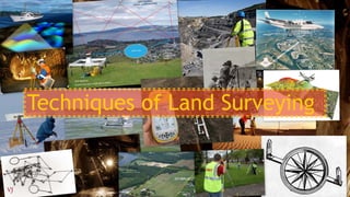
Techniques of Land Surveying The structure of Presentation: Introduction to Land Survey History of Land Survey Types of Land Survey Measurements Modern Technologies Geographical Information System Photogrammetry LiDAR Airborne LiDAR 3D laser scanners

Recommended
More Related Content
What's hot
What's hot (20)
Viewers also liked
Viewers also liked (20)
Similar to Techniques of Land Surveying
Similar to Techniques of Land Surveying (20)
More from Vijay Meena
More from Vijay Meena (13)
Recently uploaded
Recently uploaded (20)
Techniques of Land Surveying
- 1. Techniques of Land Surveying VIJAY MEENA 2013BPLN037
- 2. Definition Surveying or land surveying is the technique, profession, and science of accurately determining the terrestrial or three-dimensional position of points and the distances and angles between them. Geographic positions are specified relative to a fixed reference. Positions on the globe, for instance, may be specified in terms of angles relative to the centre of the Earth, the equator, and the prime meridian. Surveys are often used to establish land maps and boundaries for ownership, locations (building corners, surface location of subsurface features) or other governmentally required or civil law purposes (property sales). Earlier astronomers were able to determine longitude only by careful observation of recurring celestial events, such as eclipses of the moons of Jupiter. Nowadays, geodesists produce extremely precise positional data by analysing radio waves emitted by distant stars. Once a control network is established, surveyors produce positions using instruments that measure angles and distances between locations on the Earth's surface. VIJAY MEENA 2013BPLN037
- 3. History of Surveying Land Surveying is one of the oldest professions in the world. The first land surveys date back to nearly 3,000 years ago, when Egyptian Surveyors subdivided the fertile land around the Nile River and worked on re-marking the land after the annual flooding of the Nile River. The early settlement of Australia also required help from Land Surveyors. The majority of famous early explorers including Burke and Wills had a Surveying background and their work allowed the land to be settled, by defining property boundaries in the city and the country. Back then Surveyors used primitive technology including chains and steel bands, which made their measurements difficult to record and often required the use of logarithmic tables and slide rulers. VIJAY MEENA 2013BPLN037
- 4. Different types of Surveys Geodetic SurveysCadastral Surveys Engineering Surveys Hydrographic Surveys Mining SurveysAerial Surveys VIJAY MEENA 2013BPLN037
- 5. Measuring Angles and Distances A standard compass can give you a rough estimate of angles, but the Earth’s magnetic field is not constant and the magnetic poles, which slowly move over time, do not perfectly align with the planet’s axis of rotation, because of this true (geographic) north and magnetic north are different. Moreover, some rocks can become magnetized and introduce subtle local anomalies when using compass. For this reasons Land Surveyors use transits (or their more modern equivalents, called theodolites) to measure angles. A transit consists of a telescope for sighting distant target objects, two measurement wheels that work like protractors for reading horizontal and vertical angles, and bubble levels to ensure that the angles are true. A theodolite is essentially the same instrument, except that it is somewhat more complex and capable of higher precision. In modern theodolites, some mechanical parts are replaced with electronics. Traditional transit used by surveyors around 1948 VIJAY MEENA 2013BPLN037
- 6. Measuring Distances To measure distances, land surveyors once used 100-foot long metal tapes that are graduated in hundredths of a foot. Distances along slopes were measured in short horizontal segments. Sources of error included flaws in the tape itself, such as kinks; variations in tape length due to extremes in temperature; and human errors such as inconsistent pull, allowing the tape to stray from the horizontal plane, and incorrect readings. Surveying team measuring a baseline distance with a metal (Invar) tape in 1916. VIJAY MEENA 2013BPLN037
- 7. Modern Technology Since the 1980s, electronic distance measurement (EDM) devices have allowed surveyors to measure distances more accurately and more efficiently than they can with tapes. To measure the horizontal distance between two points, one surveyor uses an EDM instrument to shoot an energy wave toward a reflector held by the second surveyor. The EDM records the elapsed time between the wave's emission and its return from the reflector. It then calculates distance as a function of the elapsed time. Typical short-range EDMs can be used to measure distances as great as 5 kilometres at accuracies up to one part in 20,000, twice as accurate as taping. Instruments called total stations combine electronic distance measurement and the angle measuring capabilities of theodolites in one unit. By using total station surveyors can calculate distances 100’s of metres away, to centimetre accuracy. Robotic versions are also available, allowing Surveyors to single-handedly operate a total station by remote control. A modern total station VIJAY MEENA 2013BPLN037
- 8. Satellite positioning systems allow the measurement of features or points anywhere in the world, from space. The data collected by these systems can be used to control large infrastructure projects or provide the information for In-car navigation systems. VIJAY MEENA 2013BPLN037
- 9. GIS software is used to capture and analyse data to create digital maps of areas. The high-tech software is used to create programs such as google maps, used by over 100 million people a month. VIJAY MEENA 2013BPLN037
- 10. Photogrammetry is the practice of determining the geometric properties of objects from photographic images. This involves estimating the three dimensional coordinates of points on an object. These are determined by measurements made in two or more photographic images taken from different positions. Common points are identified on each image. A line of sight (or ray) can be constructed from the camera location to the point on the object. It is the intersection of these rays (triangulation) that determines the three‐dimensional location of the point. Photogrammetry is more accurate in the x and y direction while range data is generally more accurate in the z direction. The range data can be supplied by techniques like LiDAR and laser scanners. y x z VIJAY MEENA 2013BPLN037
- 11. LiDAR – Light Detection and Ranging is a method of detecting distant objects and determining their position or other characteristics by analysis of pulsed laser light reflecting from their surfaces. Basically a laser pulse is reflected from a rotating mirror inside a laser scanner. By measuring the time delay between when the laser pulse is emitted, and when it returns to the scanner, the distance between the scanner and the object can be precisely determined. The scanner can also accurately measure angles. NOTE: Also used for Hydrographic Surveying. VIJAY MEENA 2013BPLN037
- 12. Ship scanning the ocean floor Sonar image of a wreck on the ocean floor VIJAY MEENA 2013BPLN037
- 13. Typical scan of a pylon network (note the cables between pylons are scanned as well)VIJAY MEENA 2013BPLN037
- 14. Airborne LiDAR is a highly cost effective means of collecting detailed topographic survey information, and offers significant advantages over traditional forms of topographical survey in terms of speed, access, resolution, accuracy and canopy penetration, for a variety of applications. VIJAY MEENA 2013BPLN037
- 15. Some other modern techniques 3D laser scanners are used to understand and interpret the shape of things such as buildings or land by collecting clouds of points to create digital 3-D models. These instruments are used by surveyors to provide data to architects to accurately visualise the land they are going to build or design on. 3D image created by a Laser ScannerVIJAY MEENA 2013BPLN037