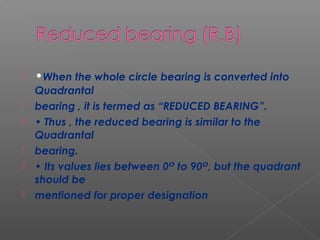
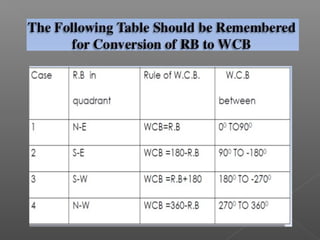
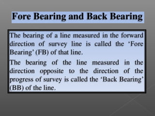
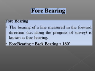
Downloaded 126 times

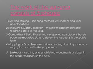
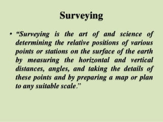


This document discusses various topics related to surveying including: the objectives and processes involved in surveying like decision making, fieldwork, data processing, mapping, and stakeout; different types of surveys like plane, geodetic, topographic, route, hydrographic, land, and military surveys; instruments used like theodolites, tacheometers, planes tables, and compasses; and concepts like bearings, meridians, and reducing bearings. The key aspects covered are the goal of producing maps, the consideration or disregard of earth's curvature depending on survey type, and classification based on area, instruments, or purpose.


