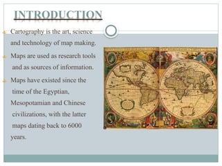
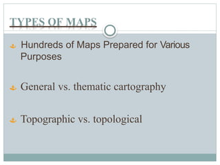
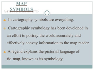
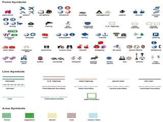
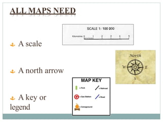
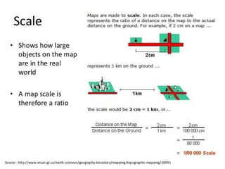
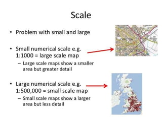
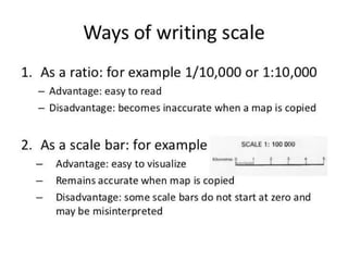
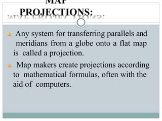
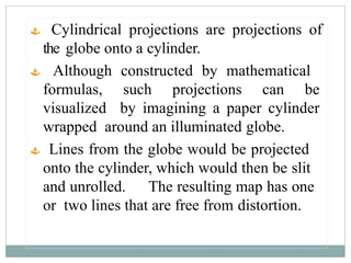
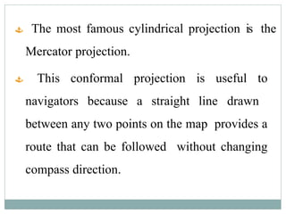
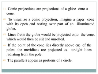
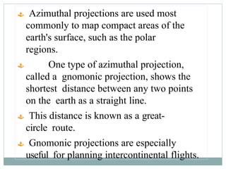
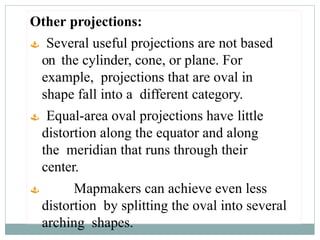
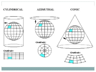
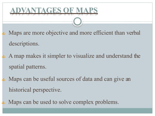
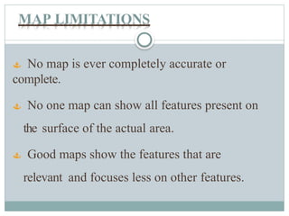
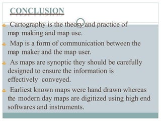
BASIC CONCEPT OF
CARTOGRAPHY
CONTENTS
 INTRODUCTION
 CARTOGRAPHIC PROCESSES
 USES & FUNCTIONS OF MAPS
 TYPES OF MAP & MAP SYMBOLS
 MAP PROJECTIONS
 TECHNOLOGICAL CHANGES
 ADVANTAGES OF MAPS & LIMITATIONS
 CONCLUSION
 BIBLIOGRAPHY
INTRODUCTION
 Cartography is the art, science
and technology of map making.
 Maps are used as research tools
and as sources of information.
 Maps have existed since the
time of the Egyptian,
Mesopotamian and Chinese
civilizations, with the latter
maps dating back to 6000
years.
CARTOGRAPHIC PROCESSES
 The communications model of Cartography
emphasizes maps are used by variety of users.
 The role of the cartographer is to understand the
subject matter of maps and also how the map will be
likely used.
 Map making involves three stages:
1. Collection, Organization and manipulation of data.
2. Design and preparation of Maps
3. Map Reproduction
1. Collection, Organization and
manipulation of data.
 Data collection from existing maps, aerial
photographs or digital imagery, documents e.g. legal
descriptions of property boundaries, historical
documents, etc., field work or questionnaire
surveys.
 Data organized to understand the phenomena
being represented.
 Data manipulation - in a form suitable for map
making i.e. aggregating data to some specified set
of spatial units, percentages, densities or other
summary measures.
2. Design and Preparation of Maps
 Many decisions go into the design of an
effective map.
 These include geographic features and
thematic attributes.
 The choices depend upon purpose of the map,
the intended audience and the cartographer’s
understanding of the phenomena being
represented.
 Maps of large areas it is a must to choose
an appropriate map projection.
 Small scale maps are less detailed but
covers a larger area.
3. Map Reproduction
  Map reproduction methods acts as a constraint
on the map design process.
  If only few copies of maps are required then black
and white and colour laser printing and Xeroxing
technology is ideal.
  If large number of copies then offset printing is the
only practical alternative.
  Digital formats on tapes, disks or CD-ROM is
replacing or reducing the need for printed maps.
USES OF MAPS
 It is a learned process requiring a variety of
skills.
 Using a Map involves, three processes:
Map reading
Analysis
Interpretation
FUNCTIONS OF
MAPS
1.
Navigation
 2. Visualization
Measurement
TYPES OF MAPS
 Hundreds of Maps Prepared for Various
Purposes
 General vs. thematic cartography
 Topographic vs. topological
MAP
SYMBOLS
 In cartography symbols are everything.
 Cartographic symbology has been developed in
an effort to portray the world accurately and
effectively convey information to the map reader.
 A legend explains the pictorial language of
the map, known as its symbology.
ALL MAPS NEED
 A scale
 A north arrow
 A key or
legend
MAP
PROJECTIONS:
 Any system for transferring parallels and
meridians from a globe onto a flat map
is called a projection.
 Map makers create projections according
to mathematical formulas, often with the
aid of computers.
 It is impossible to project a sphere,
such as the earth's surface, onto a flat
surface with complete accuracy.
 Every flat map has inaccuracies in
scale that result from shrinking the
globe in some places and stretching it
in others to flatten it.
 Projections by surface
 Cylindrical
 Pseudocylindrical
 Hybrid
 Conic
 Pseudoconic
 Azimuthal (projections onto a plane)
 Projections by preservation of a metric property
 Conformal
 Equal-area
 Equidistant
 Gnomonic
 Retroazimuthal
 Compromise projections
 A map projection may be classified according to which
properties of the globe it distorts least.
 Equal-area projections represent the sizes of regions
in correct relation to one another but distort shapes.
 Conformal projections show angles and directions at
any point accurately but distort size relationships.
 A map cannot be both equal-area and conformal, but
many maps are neither.
 There is no name for this third category of projections
classified by distortion.
 A second way of classifying projections is according to the
geometrical shape of the surface onto which the projection
is drawn.
 Many maps are--in theory--
projections onto a cylinder, a cone, or a
plane.
 Cylindrical projections are projections of
the globe onto a cylinder.
 Although constructed by mathematical
formulas, such projections can be
visualized by imagining a paper cylinder
wrapped around an illuminated globe.
 Lines from the globe would be projected
onto the cylinder, which would then be slit
and unrolled. The resulting map has one
or two lines that are free from distortion.
 The most famous cylindrical projection is the
Mercator projection.
 This conformal projection is useful to
navigators because a straight line drawn
between any two points on the map provides a
route that can be followed without changing
compass direction.
 Conic projections are projections of a globe onto a
cone.
 To visualize a conic projection, imagine a paper cone
with its open end resting over part of an illuminated
globe.
 Lines from the globe would be projected onto the cone,
which would then be slit and unrolled.
 If the point of the cone lies directly above one of the
poles, the meridians are projected as straight lines
radiating from the pole.
 The parallels appear as portions of a circle.
 Azimuthal projections are used most
commonly to map compact areas of the
earth's surface, such as the polar
regions.
 One type of azimuthal projection,
called a gnomonic projection, shows the
shortest distance between any two points
on the earth as a straight line.
 This distance is known as a great-
circle route.
 Gnomonic projections are especially
useful for planning intercontinental flights.
Other projections:
 Several useful projections are not based
on the cylinder, cone, or plane. For
example, projections that are oval in
shape fall into a different category.
 Equal-area oval projections have little
distortion along the equator and along
the meridian that runs through their
center.
 Mapmakers can achieve even less
distortion by splitting the oval into several
arching shapes.
TECHNOLOGICAL
CHANGES
 In cartography, technology has continually changed in order to
meet the demands of new generations of mapmakers and map
users.
 The first maps were manually constructed with brushes and
parchment; therefore, varied in quality and were limited in
distribution.
 Advances in mechanical devices such as the printing press,
quadrant and vernier, allowed for the mass production of maps
 Advances in photochemical technology, such as the lithographic and
photochemical processes, have allowed for the creation of maps that
have fine details, do not distort in shape and resist moisture and wear.
 Advancements in electronic technology in the 20th century ushered in
another revolution in cartography.
 These days most commercial-quality maps are made using software that
falls into one of three main types: CAD, GIS and specialized illustration
software.
Toughbook Rugged Computer
Laser Rangefinder
ADVANTAGES OF MAPS
 Maps are more objective and more efficient than verbal
descriptions.
 A map makes it simpler to visualize and understand the
spatial patterns.
 Maps can be useful sources of data and can give an
historical perspective.
 Maps can be used to solve complex problems.
MAP LIMITATIONS
 No map is ever completely accurate or
complete.
 No one map can show all features present on
the surface of the actual area.
 Good maps show the features that are
relevant and focuses less on other features.
CONCLUSION
 Cartography is the theory and practice of
map making and map use.
 Map is a form of communication between the
map maker and the map user.
 As maps are synoptic they should be carefully
designed to ensure the information is
effectively conveyed.
 Earliest known maps were hand drawn whereas
the modern day maps are digitized using high end
softwares and instruments.
BIBLIOGRAPHY
 Reddy, Anji, M., 2000, Remote Sensing and
Geographical Information Systems. BS
Publications, Hyderabad, pP 1-21.

http://www.slideshare.net/GavinMalavolta/introducti
on-to-cartography-geography1-14174414
 http://en.wikipedia.org/wiki/Cartography
 http://en.wikipedia.org/wiki/Map_projection
T
H
A
N
K Y
O
U
!
!
!

Basic Concepts of Cartography and Map Making.pptx

  • 1.
  • 2.
    CONTENTS  INTRODUCTION  CARTOGRAPHICPROCESSES  USES & FUNCTIONS OF MAPS  TYPES OF MAP & MAP SYMBOLS  MAP PROJECTIONS  TECHNOLOGICAL CHANGES  ADVANTAGES OF MAPS & LIMITATIONS  CONCLUSION  BIBLIOGRAPHY
  • 3.
    INTRODUCTION  Cartography isthe art, science and technology of map making.  Maps are used as research tools and as sources of information.  Maps have existed since the time of the Egyptian, Mesopotamian and Chinese civilizations, with the latter maps dating back to 6000 years.
  • 4.
    CARTOGRAPHIC PROCESSES  Thecommunications model of Cartography emphasizes maps are used by variety of users.  The role of the cartographer is to understand the subject matter of maps and also how the map will be likely used.  Map making involves three stages: 1. Collection, Organization and manipulation of data. 2. Design and preparation of Maps 3. Map Reproduction
  • 5.
    1. Collection, Organizationand manipulation of data.  Data collection from existing maps, aerial photographs or digital imagery, documents e.g. legal descriptions of property boundaries, historical documents, etc., field work or questionnaire surveys.  Data organized to understand the phenomena being represented.  Data manipulation - in a form suitable for map making i.e. aggregating data to some specified set of spatial units, percentages, densities or other summary measures.
  • 6.
    2. Design andPreparation of Maps  Many decisions go into the design of an effective map.  These include geographic features and thematic attributes.  The choices depend upon purpose of the map, the intended audience and the cartographer’s understanding of the phenomena being represented.  Maps of large areas it is a must to choose an appropriate map projection.  Small scale maps are less detailed but covers a larger area.
  • 7.
    3. Map Reproduction  Map reproduction methods acts as a constraint on the map design process.   If only few copies of maps are required then black and white and colour laser printing and Xeroxing technology is ideal.   If large number of copies then offset printing is the only practical alternative.   Digital formats on tapes, disks or CD-ROM is replacing or reducing the need for printed maps.
  • 8.
    USES OF MAPS It is a learned process requiring a variety of skills.  Using a Map involves, three processes: Map reading Analysis Interpretation
  • 9.
  • 10.
  • 11.
  • 12.
    TYPES OF MAPS Hundreds of Maps Prepared for Various Purposes  General vs. thematic cartography  Topographic vs. topological
  • 13.
    MAP SYMBOLS  In cartographysymbols are everything.  Cartographic symbology has been developed in an effort to portray the world accurately and effectively convey information to the map reader.  A legend explains the pictorial language of the map, known as its symbology.
  • 15.
    ALL MAPS NEED A scale  A north arrow  A key or legend
  • 19.
    MAP PROJECTIONS:  Any systemfor transferring parallels and meridians from a globe onto a flat map is called a projection.  Map makers create projections according to mathematical formulas, often with the aid of computers.
  • 20.
     It isimpossible to project a sphere, such as the earth's surface, onto a flat surface with complete accuracy.  Every flat map has inaccuracies in scale that result from shrinking the globe in some places and stretching it in others to flatten it.
  • 21.
     Projections bysurface  Cylindrical  Pseudocylindrical  Hybrid  Conic  Pseudoconic  Azimuthal (projections onto a plane)  Projections by preservation of a metric property  Conformal  Equal-area  Equidistant  Gnomonic  Retroazimuthal  Compromise projections
  • 22.
     A mapprojection may be classified according to which properties of the globe it distorts least.  Equal-area projections represent the sizes of regions in correct relation to one another but distort shapes.  Conformal projections show angles and directions at any point accurately but distort size relationships.  A map cannot be both equal-area and conformal, but many maps are neither.  There is no name for this third category of projections classified by distortion.
  • 23.
     A secondway of classifying projections is according to the geometrical shape of the surface onto which the projection is drawn.  Many maps are--in theory-- projections onto a cylinder, a cone, or a plane.
  • 24.
     Cylindrical projectionsare projections of the globe onto a cylinder.  Although constructed by mathematical formulas, such projections can be visualized by imagining a paper cylinder wrapped around an illuminated globe.  Lines from the globe would be projected onto the cylinder, which would then be slit and unrolled. The resulting map has one or two lines that are free from distortion.
  • 25.
     The mostfamous cylindrical projection is the Mercator projection.  This conformal projection is useful to navigators because a straight line drawn between any two points on the map provides a route that can be followed without changing compass direction.
  • 26.
     Conic projectionsare projections of a globe onto a cone.  To visualize a conic projection, imagine a paper cone with its open end resting over part of an illuminated globe.  Lines from the globe would be projected onto the cone, which would then be slit and unrolled.  If the point of the cone lies directly above one of the poles, the meridians are projected as straight lines radiating from the pole.  The parallels appear as portions of a circle.
  • 27.
     Azimuthal projectionsare used most commonly to map compact areas of the earth's surface, such as the polar regions.  One type of azimuthal projection, called a gnomonic projection, shows the shortest distance between any two points on the earth as a straight line.  This distance is known as a great- circle route.  Gnomonic projections are especially useful for planning intercontinental flights.
  • 28.
    Other projections:  Severaluseful projections are not based on the cylinder, cone, or plane. For example, projections that are oval in shape fall into a different category.  Equal-area oval projections have little distortion along the equator and along the meridian that runs through their center.  Mapmakers can achieve even less distortion by splitting the oval into several arching shapes.
  • 30.
    TECHNOLOGICAL CHANGES  In cartography,technology has continually changed in order to meet the demands of new generations of mapmakers and map users.  The first maps were manually constructed with brushes and parchment; therefore, varied in quality and were limited in distribution.  Advances in mechanical devices such as the printing press, quadrant and vernier, allowed for the mass production of maps
  • 31.
     Advances inphotochemical technology, such as the lithographic and photochemical processes, have allowed for the creation of maps that have fine details, do not distort in shape and resist moisture and wear.  Advancements in electronic technology in the 20th century ushered in another revolution in cartography.  These days most commercial-quality maps are made using software that falls into one of three main types: CAD, GIS and specialized illustration software.
  • 32.
  • 33.
    ADVANTAGES OF MAPS Maps are more objective and more efficient than verbal descriptions.  A map makes it simpler to visualize and understand the spatial patterns.  Maps can be useful sources of data and can give an historical perspective.  Maps can be used to solve complex problems.
  • 34.
    MAP LIMITATIONS  Nomap is ever completely accurate or complete.  No one map can show all features present on the surface of the actual area.  Good maps show the features that are relevant and focuses less on other features.
  • 35.
    CONCLUSION  Cartography isthe theory and practice of map making and map use.  Map is a form of communication between the map maker and the map user.  As maps are synoptic they should be carefully designed to ensure the information is effectively conveyed.  Earliest known maps were hand drawn whereas the modern day maps are digitized using high end softwares and instruments.
  • 36.
    BIBLIOGRAPHY  Reddy, Anji,M., 2000, Remote Sensing and Geographical Information Systems. BS Publications, Hyderabad, pP 1-21.  http://www.slideshare.net/GavinMalavolta/introducti on-to-cartography-geography1-14174414  http://en.wikipedia.org/wiki/Cartography  http://en.wikipedia.org/wiki/Map_projection
  • 37.