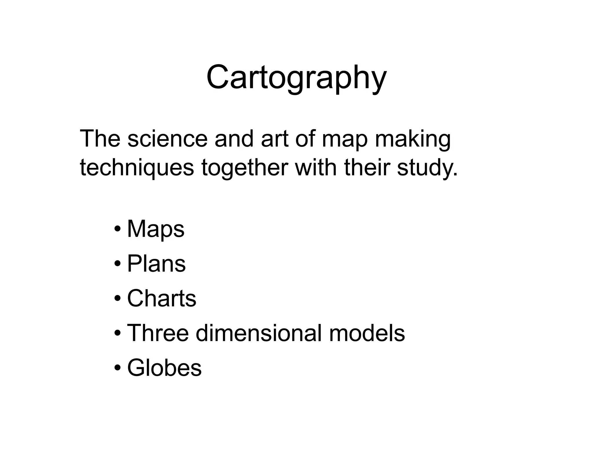
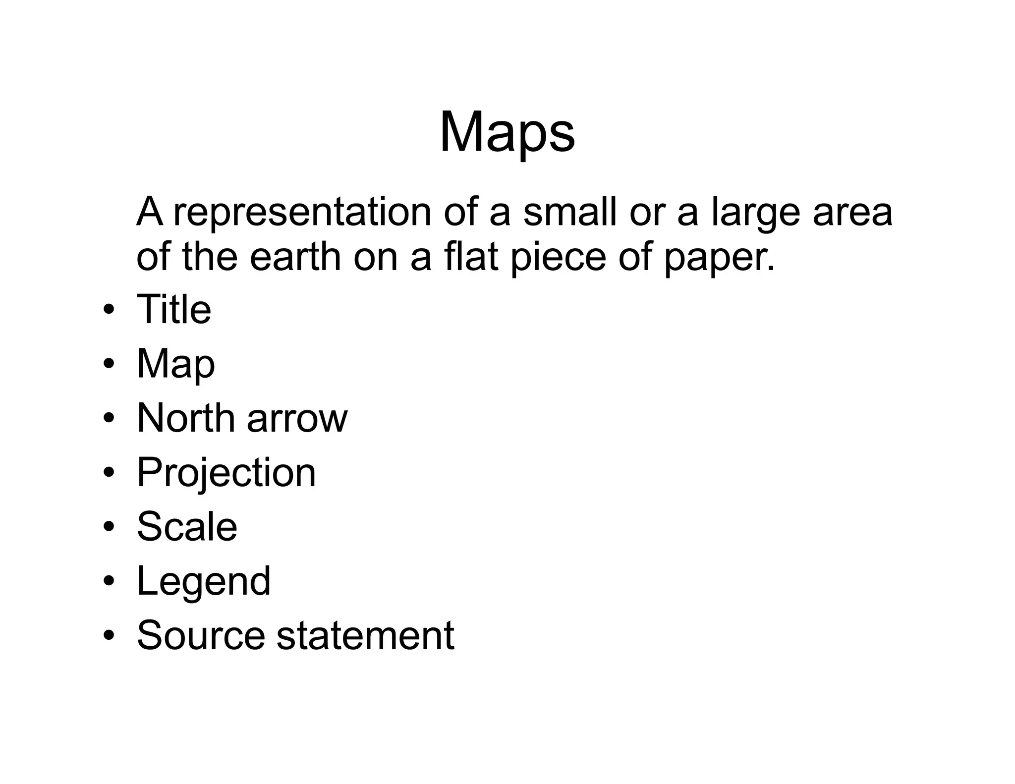
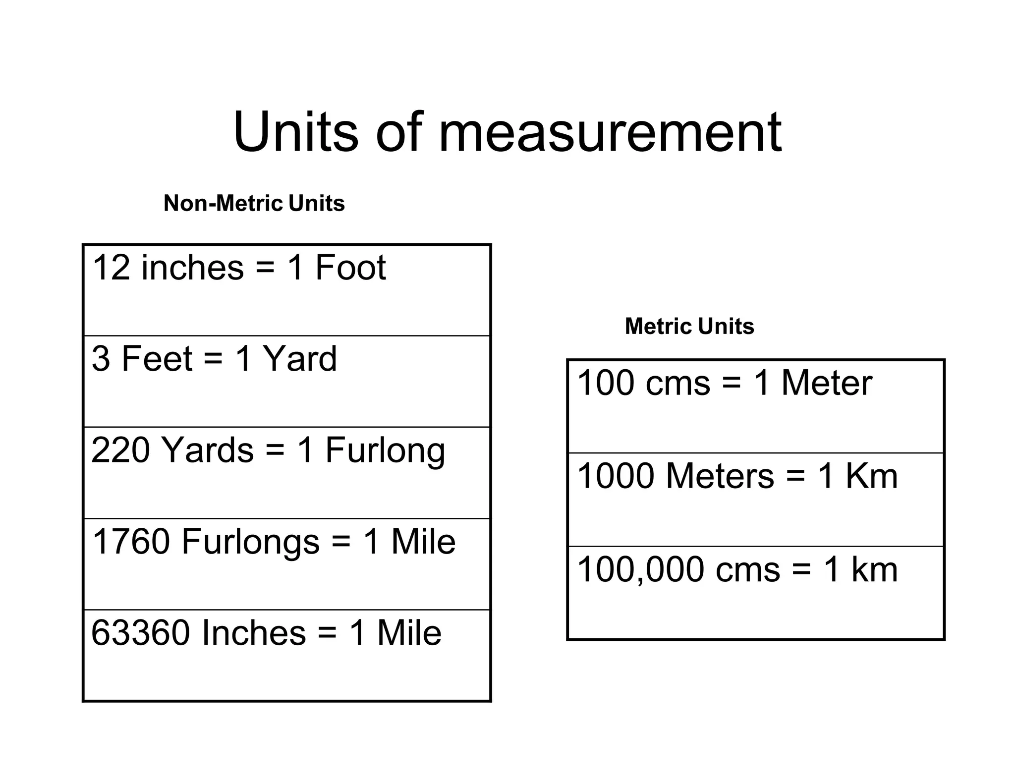
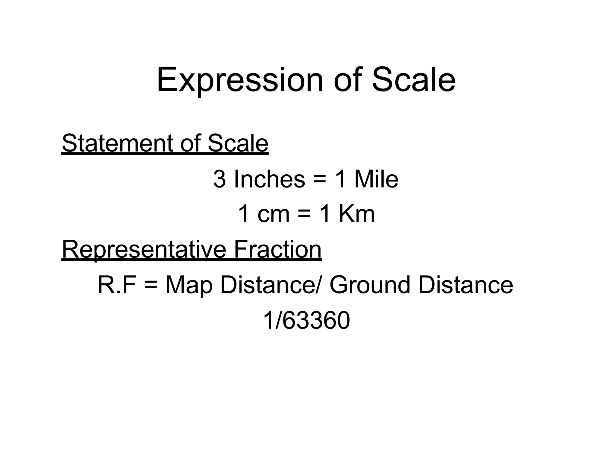
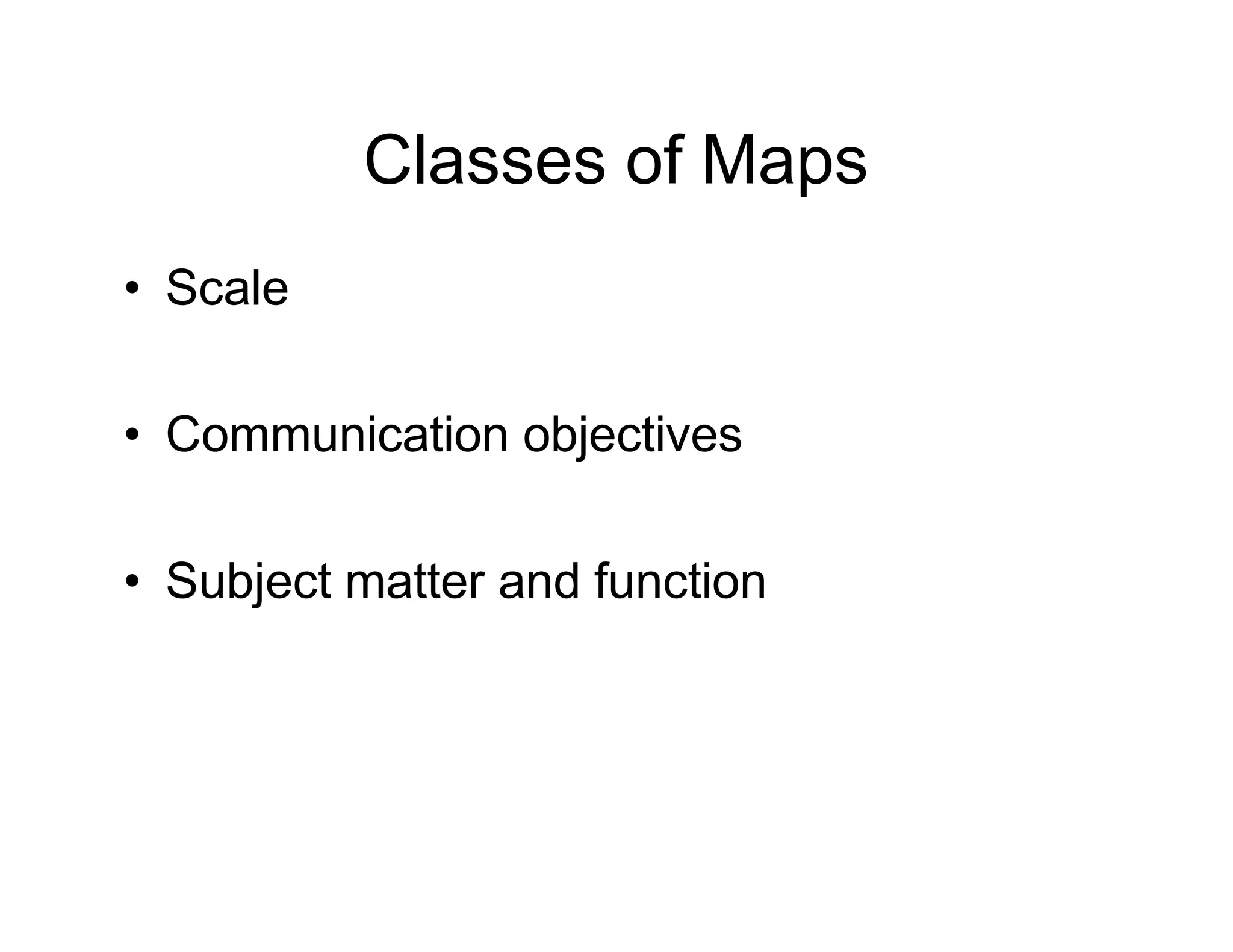
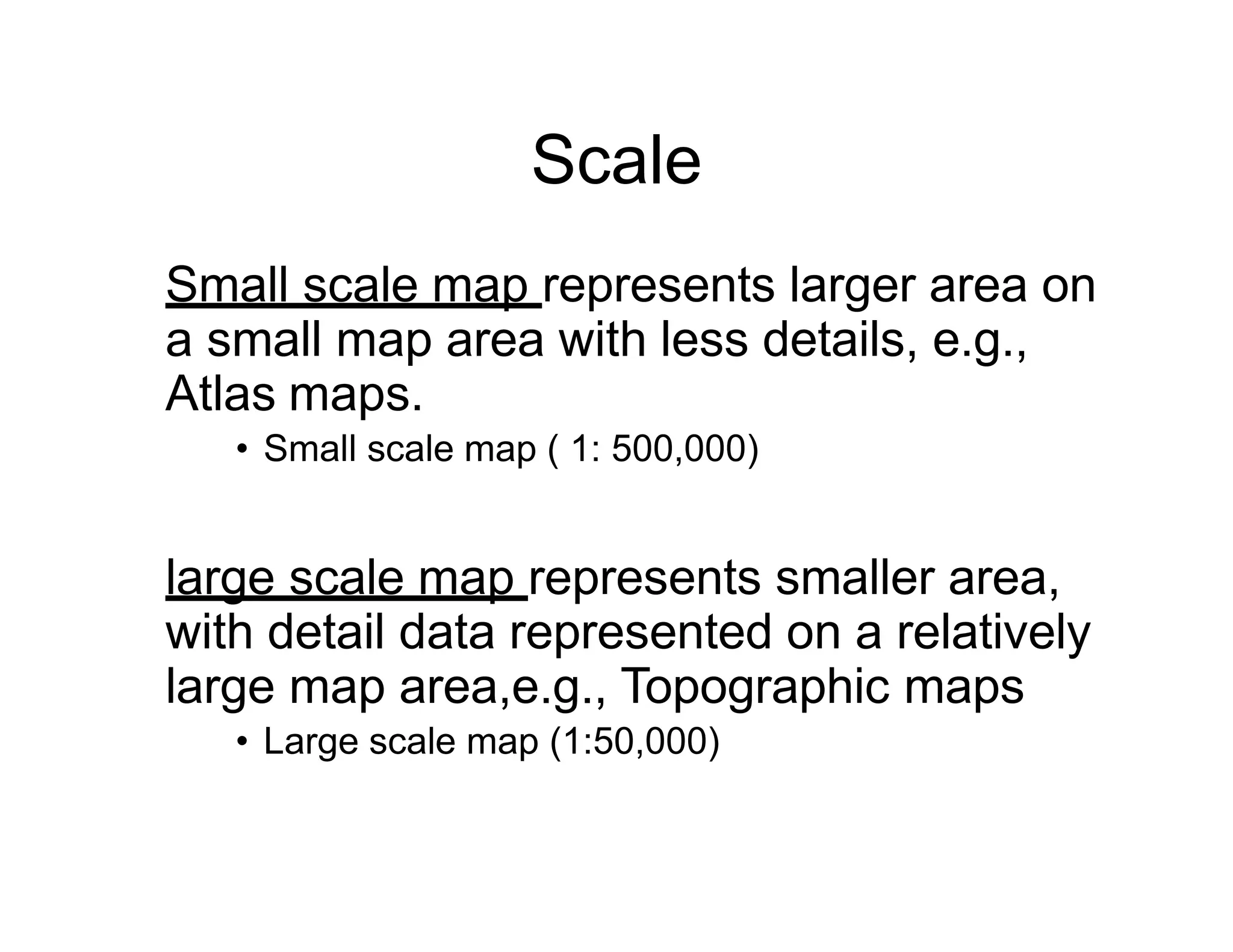
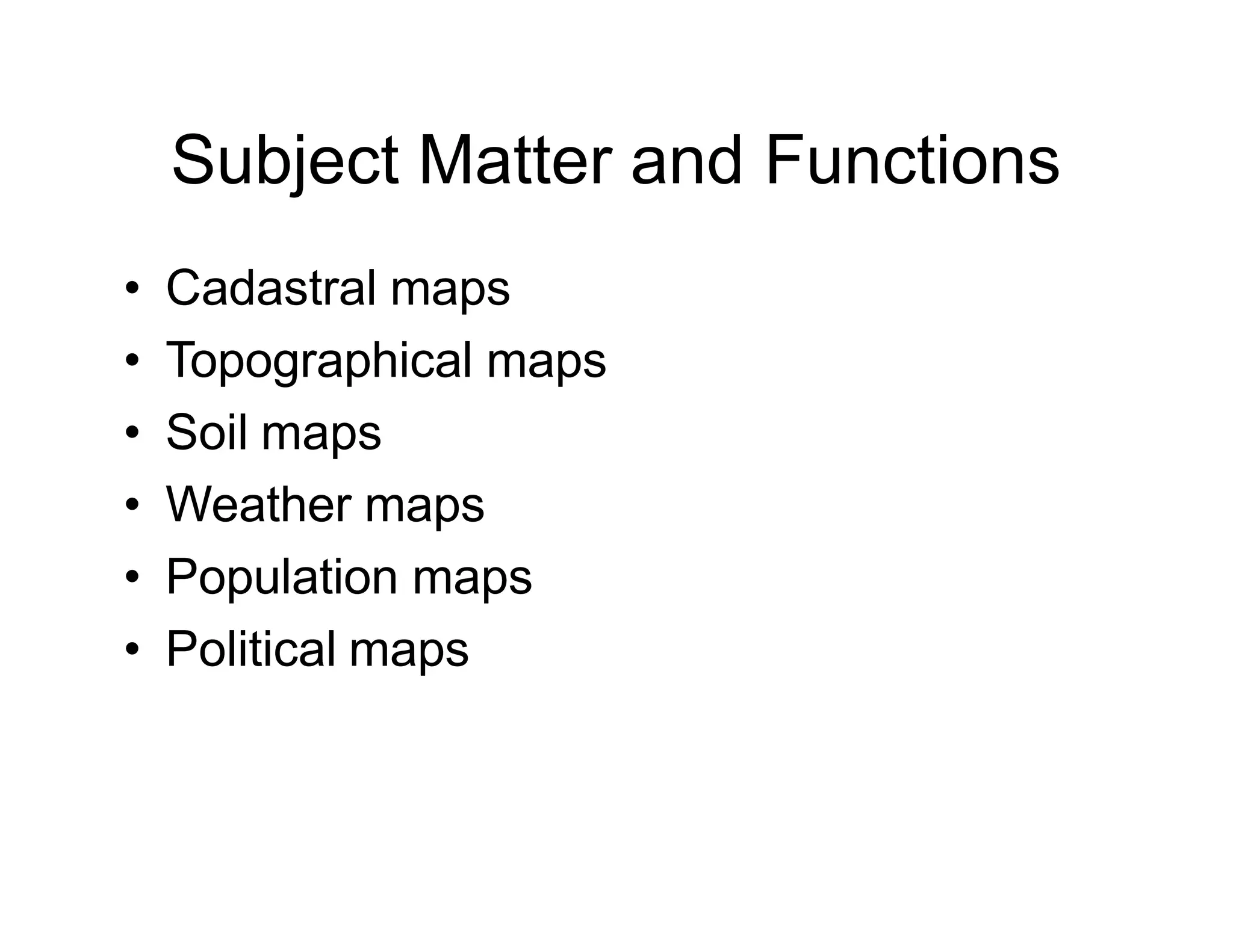
CARTOGRAPHY
By MOHAMMAD
NAZIR
Cartography
The science and art of map making
techniques together with their study.
• Maps
• Plans
• Charts
• Three dimensional models
• Globes
Maps
A representation of a small or a large area
of the earth on a flat piece of paper.
• Title
• Map
• North arrow
• Projection
• Scale
• Legend
• Source statement
Scale
Ratio between map distance and ground
distance is termed as map scale
Expression of Scale
• Statement of Scale
• Representative Fraction
• Linear Scale
Units of measurement
12 inches = 1 Foot
3 Feet = 1 Yard
220 Yards = 1 Furlong
1760 Furlongs = 1 Mile
63360 Inches = 1 Mile
100 cms = 1 Meter
1000 Meters = 1 Km
100,000 cms = 1 km
Non-Metric Units
Metric Units
Expression of Scale
Statement of Scale
3 Inches = 1 Mile
1 cm = 1 Km
Representative Fraction
R.F = Map Distance/ Ground Distance
1/63360
Expression of Scale
1 inch = 4 miles
1 mile = 63360 inches
4 miles= 63360 * 4 = 253440 inches
R.F. = 1 / 253440
1/250,000 (miles)
63360 inches = 1 mile
250,000 inches = 250,000/63360 = 3.95 miles
1 inch = 3.95 miles
Expression of Scale
Linear Scale
300200100 400 miles
1 inch = 100 miles
1/6336000
Express 1 / 1,000,000 by a plain scale to show kilometers
025
Classes of Maps
• Scale
• Communication objectives
• Subject matter and function
Scale
Small scale map represents larger area on
a small map area with less details, e.g.,
Atlas maps.
• Small scale map ( 1: 500,000)
large scale map represents smaller area,
with detail data represented on a relatively
large map area,e.g., Topographic maps
• Large scale map (1:50,000)
Communicative Objectives
• General reference maps show the location
of variety of different features. They supply
a general image of the earth surface and
are also termed as base maps
• Thematic maps represent distribution of
one particular attribute or the relationship
among several and instead of focusing on
representation of location these maps
mainly focus on illustrating structures.
Thematic maps tended to be of small scale.
Subject Matter and Functions
• Cadastral maps
• Topographical maps
• Soil maps
• Weather maps
• Population maps
• Political maps

Cartography lec #4

  • 1.
  • 2.
    Cartography The science andart of map making techniques together with their study. • Maps • Plans • Charts • Three dimensional models • Globes
  • 3.
    Maps A representation ofa small or a large area of the earth on a flat piece of paper. • Title • Map • North arrow • Projection • Scale • Legend • Source statement
  • 5.
    Scale Ratio between mapdistance and ground distance is termed as map scale Expression of Scale • Statement of Scale • Representative Fraction • Linear Scale
  • 6.
    Units of measurement 12inches = 1 Foot 3 Feet = 1 Yard 220 Yards = 1 Furlong 1760 Furlongs = 1 Mile 63360 Inches = 1 Mile 100 cms = 1 Meter 1000 Meters = 1 Km 100,000 cms = 1 km Non-Metric Units Metric Units
  • 7.
    Expression of Scale Statementof Scale 3 Inches = 1 Mile 1 cm = 1 Km Representative Fraction R.F = Map Distance/ Ground Distance 1/63360
  • 8.
    Expression of Scale 1inch = 4 miles 1 mile = 63360 inches 4 miles= 63360 * 4 = 253440 inches R.F. = 1 / 253440 1/250,000 (miles) 63360 inches = 1 mile 250,000 inches = 250,000/63360 = 3.95 miles 1 inch = 3.95 miles
  • 9.
    Expression of Scale LinearScale 300200100 400 miles 1 inch = 100 miles 1/6336000 Express 1 / 1,000,000 by a plain scale to show kilometers 025
  • 11.
    Classes of Maps •Scale • Communication objectives • Subject matter and function
  • 12.
    Scale Small scale maprepresents larger area on a small map area with less details, e.g., Atlas maps. • Small scale map ( 1: 500,000) large scale map represents smaller area, with detail data represented on a relatively large map area,e.g., Topographic maps • Large scale map (1:50,000)
  • 13.
    Communicative Objectives • Generalreference maps show the location of variety of different features. They supply a general image of the earth surface and are also termed as base maps • Thematic maps represent distribution of one particular attribute or the relationship among several and instead of focusing on representation of location these maps mainly focus on illustrating structures. Thematic maps tended to be of small scale.
  • 14.
    Subject Matter andFunctions • Cadastral maps • Topographical maps • Soil maps • Weather maps • Population maps • Political maps