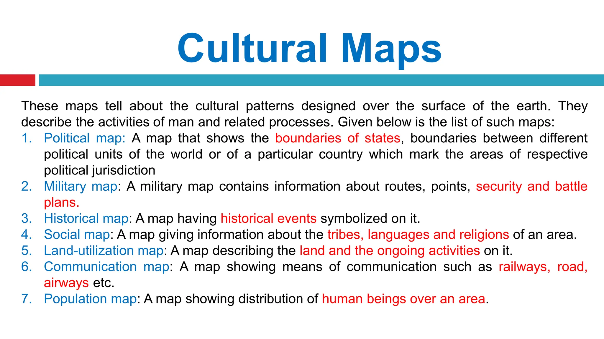
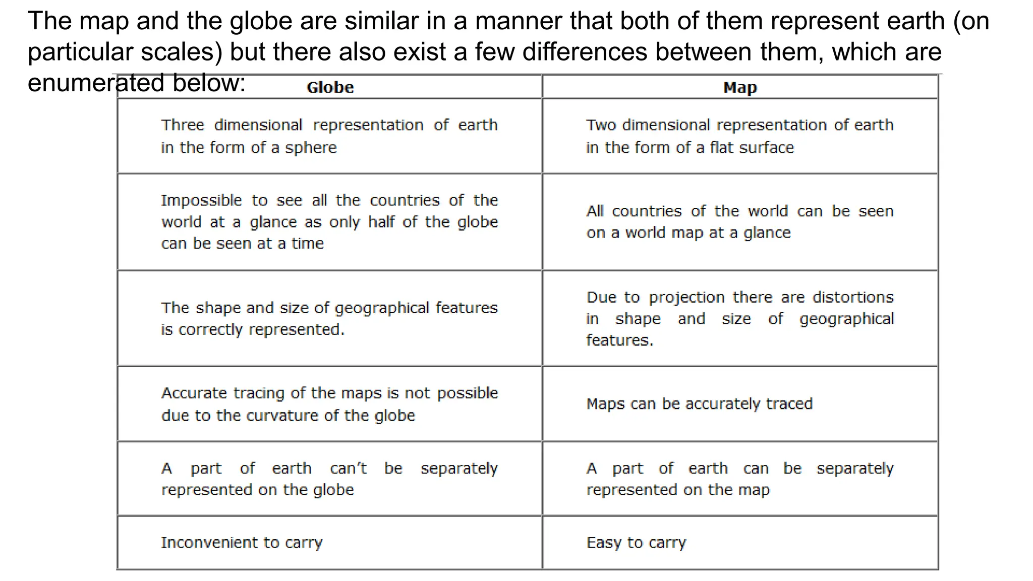
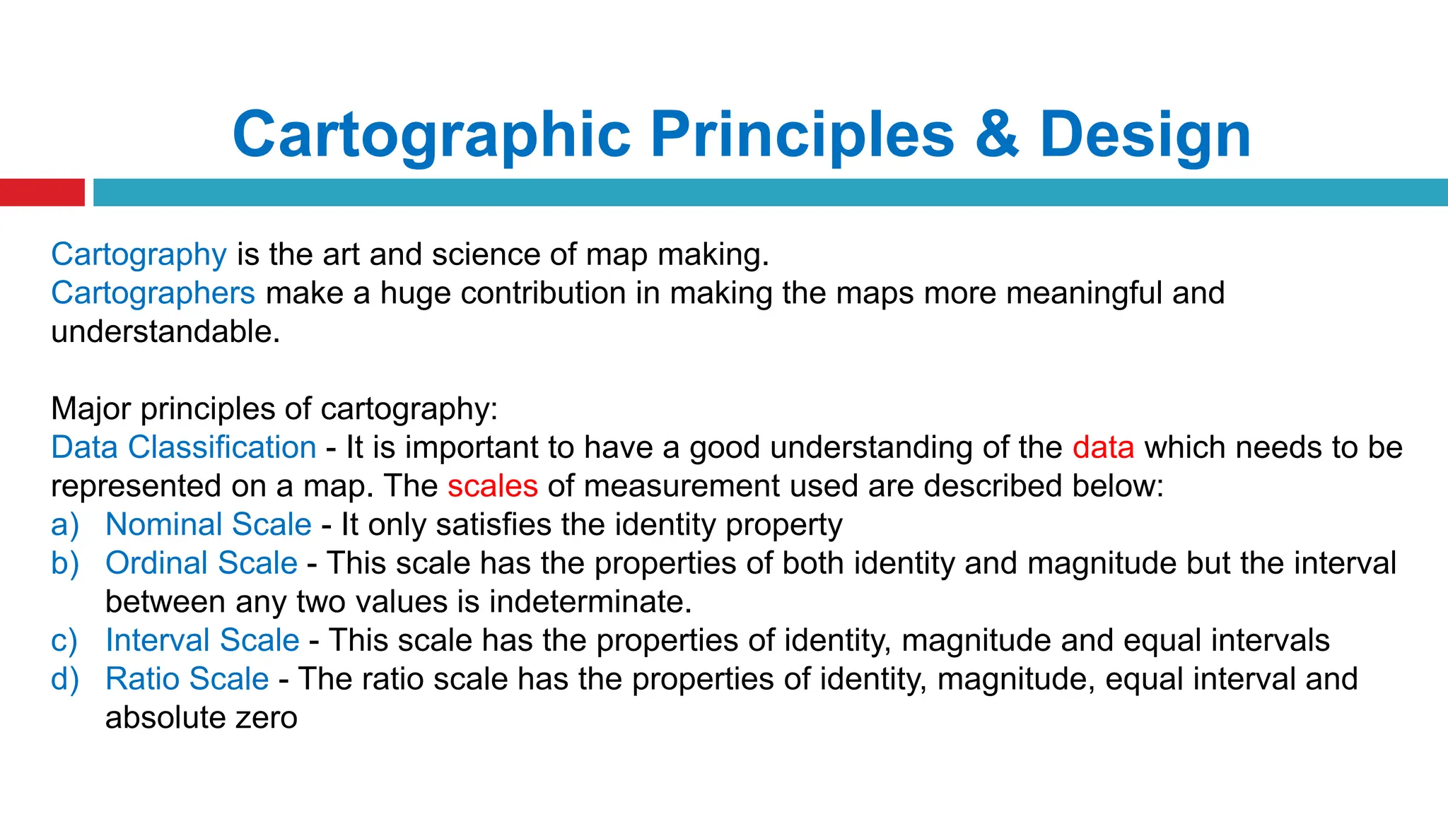
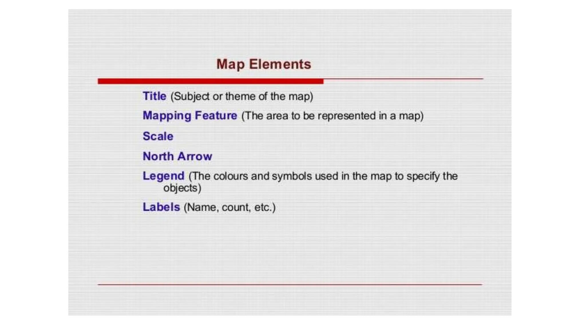
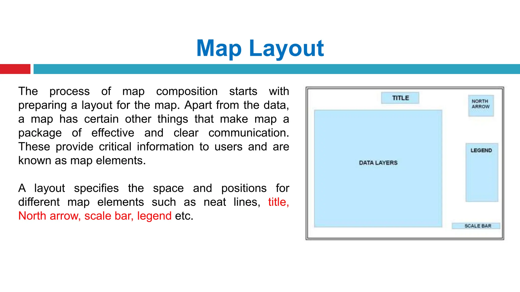
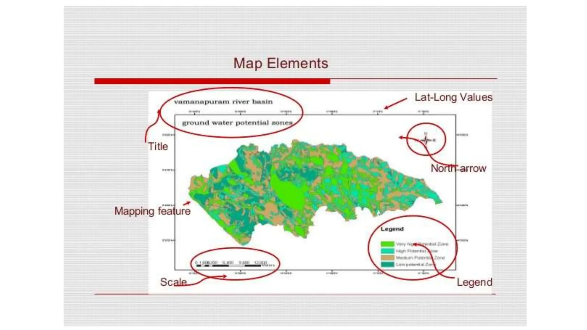
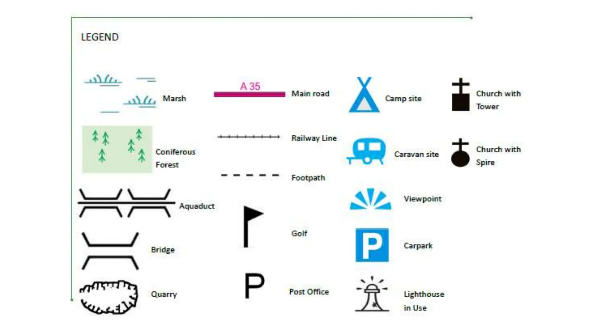
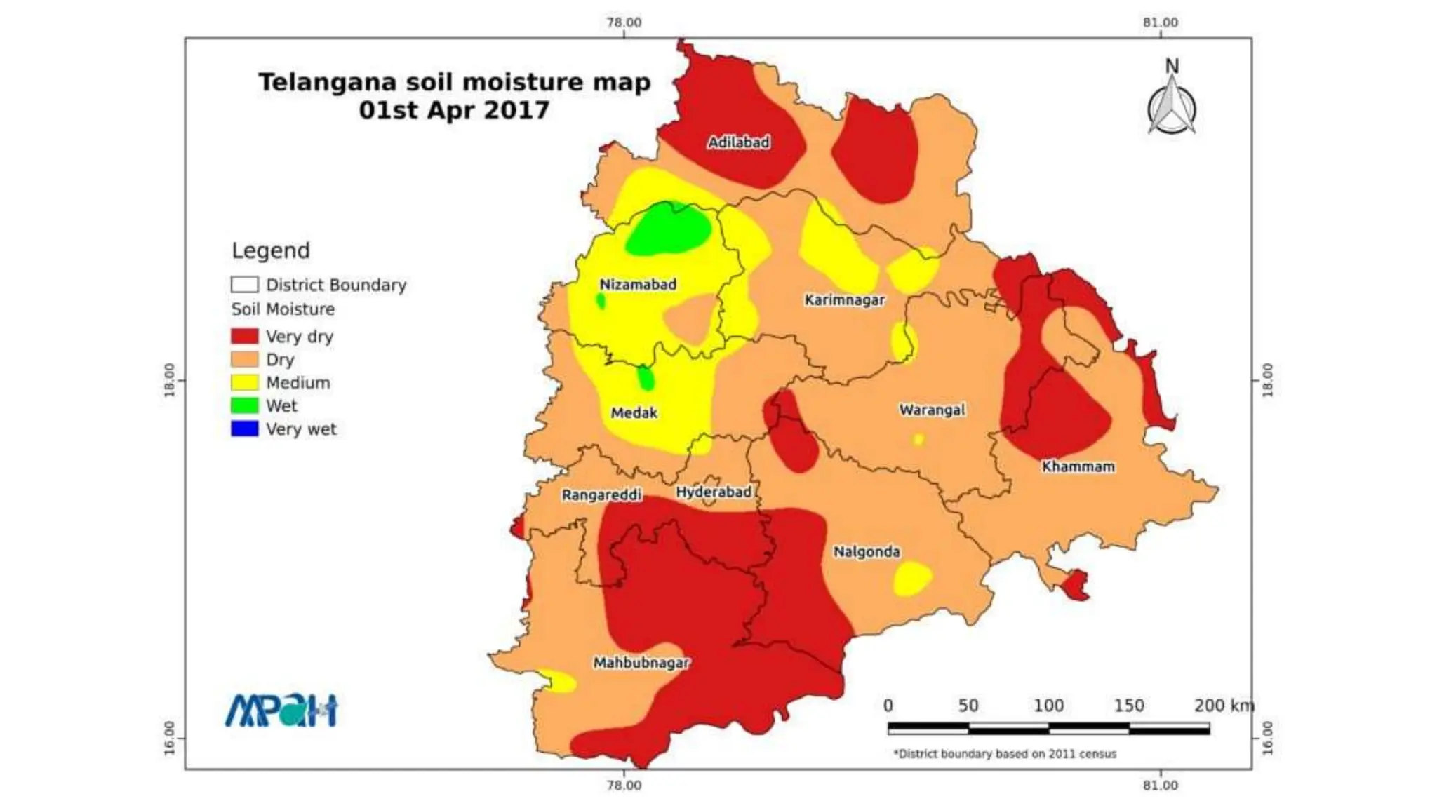
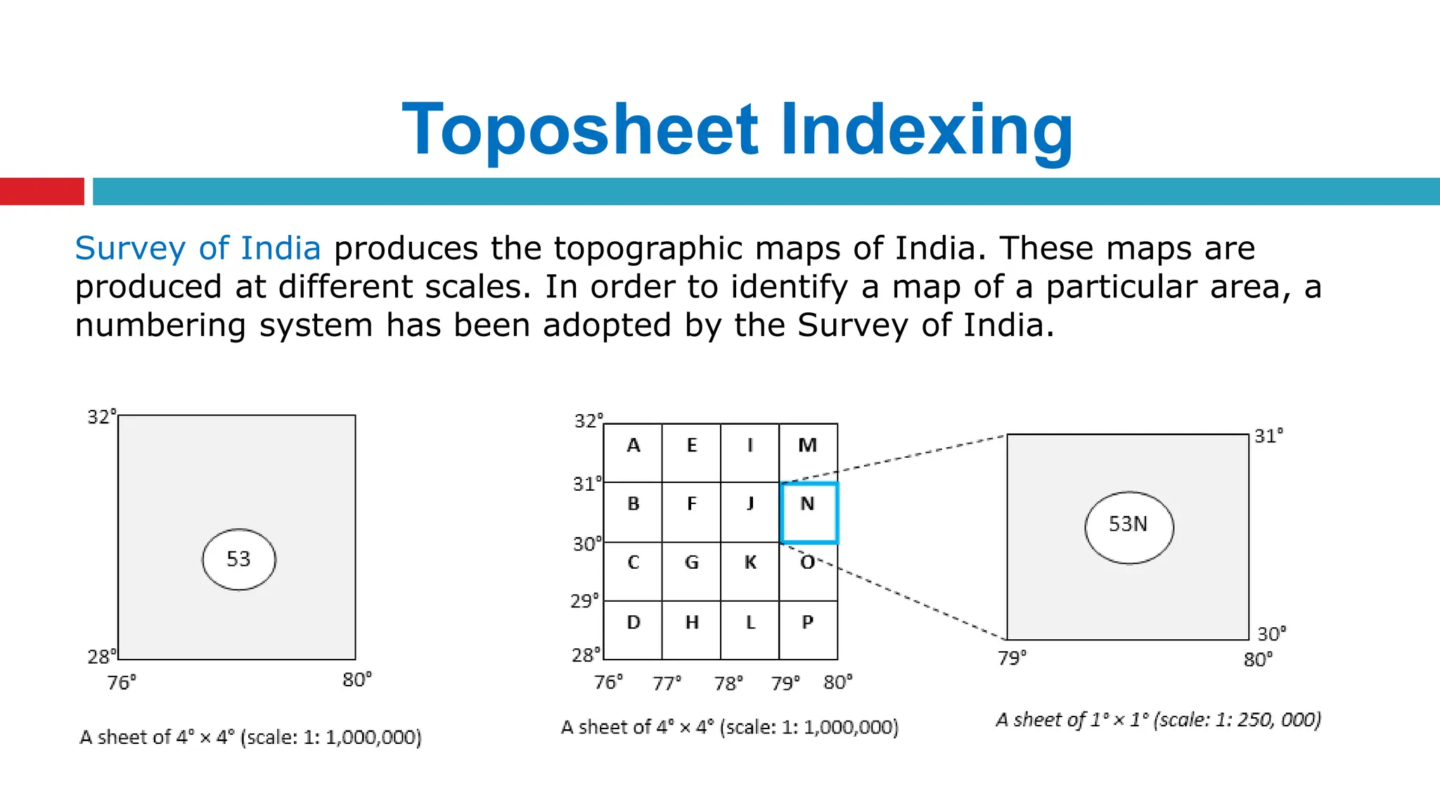
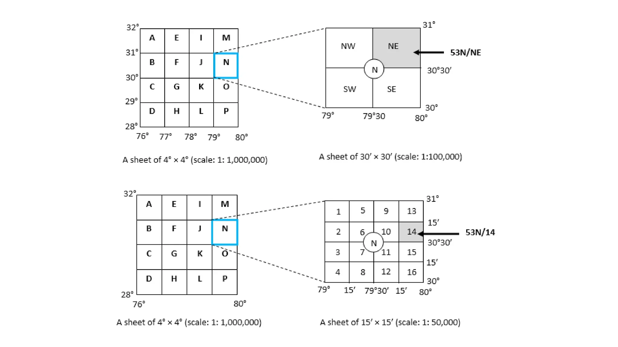
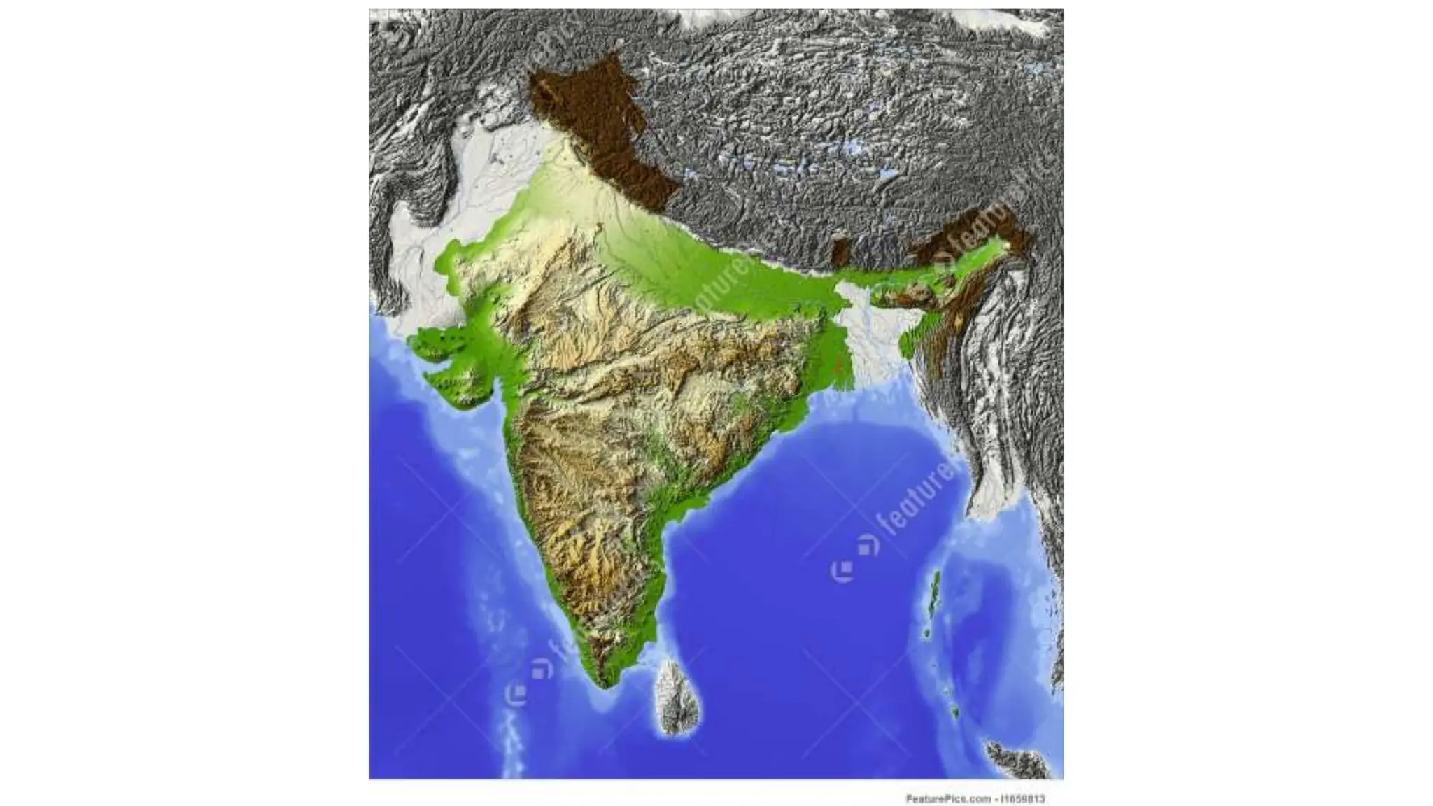
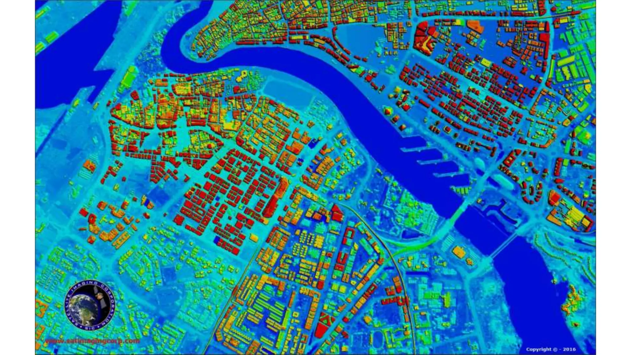
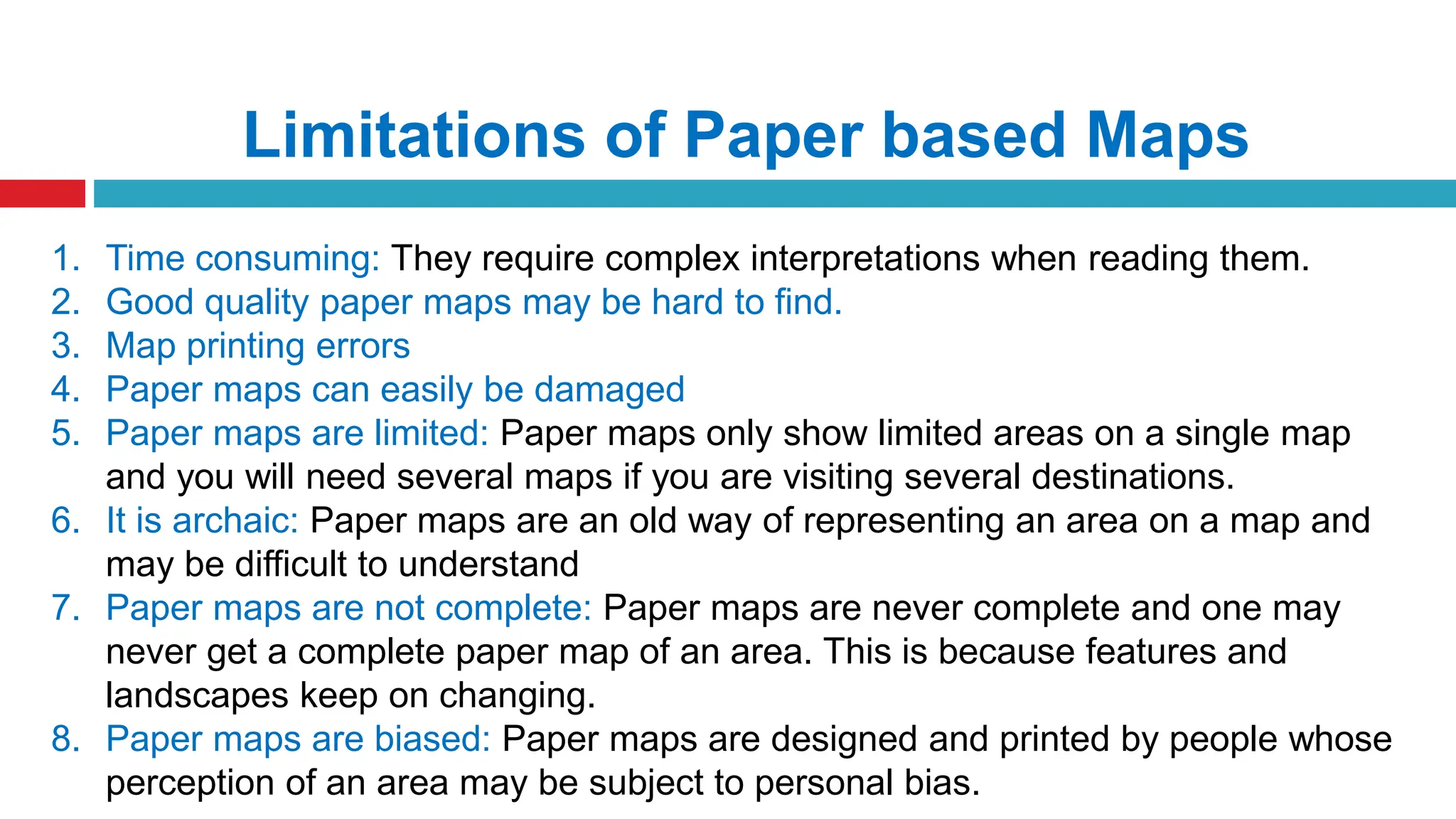
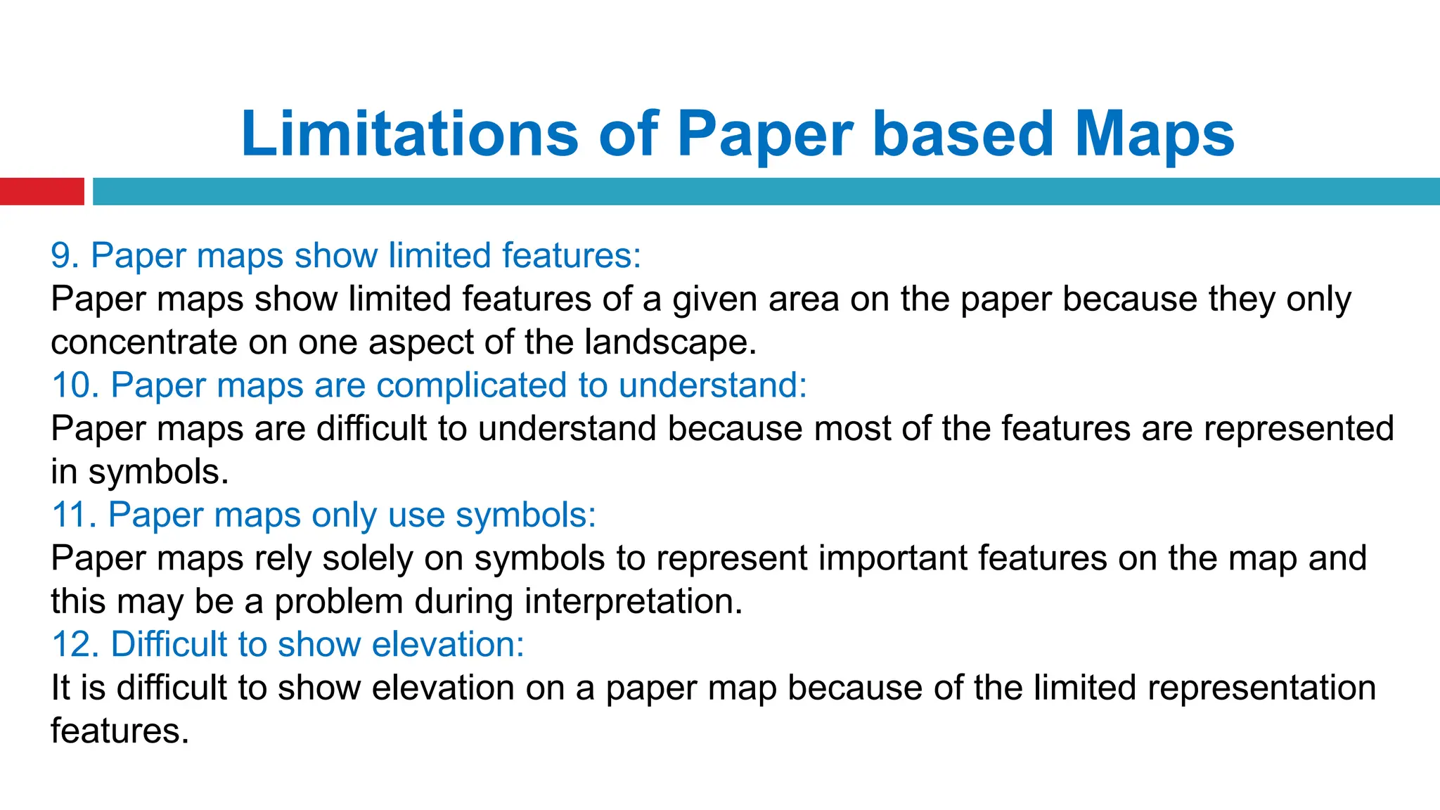
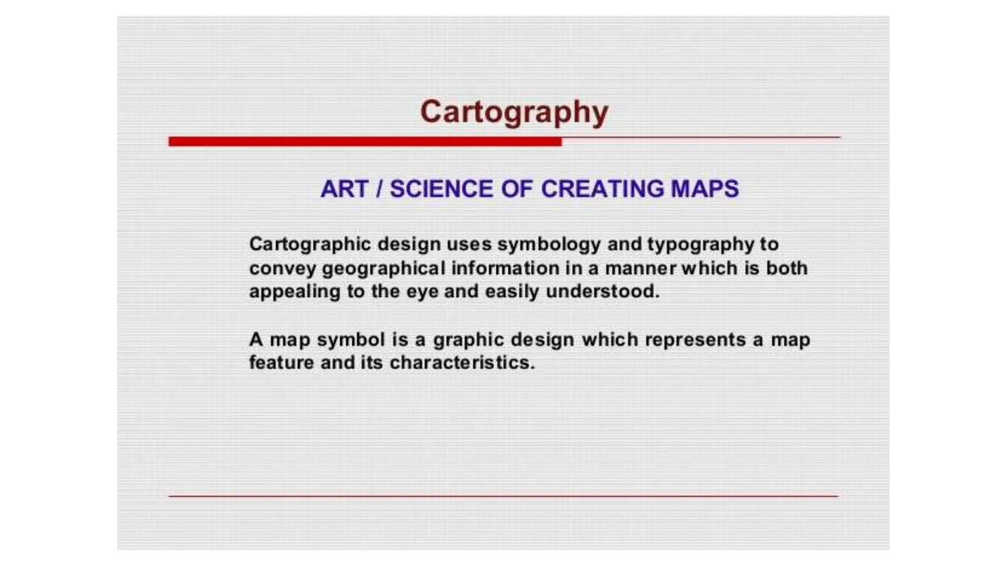
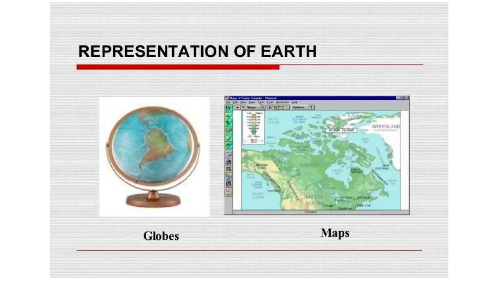
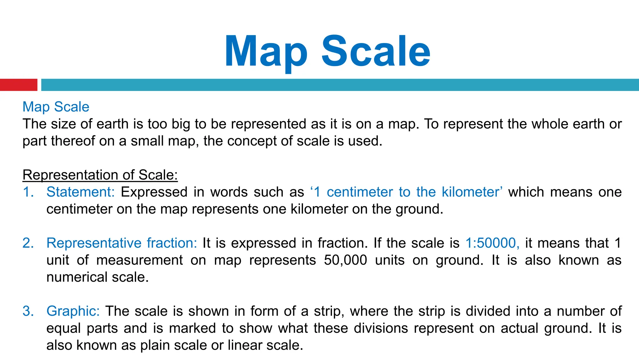
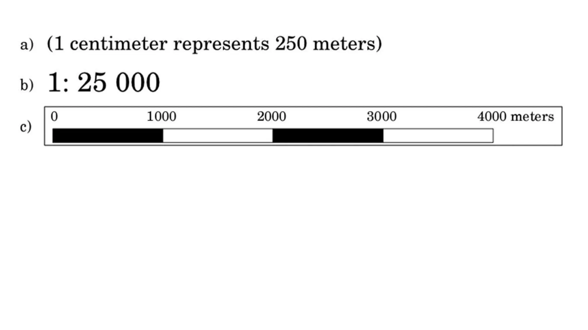
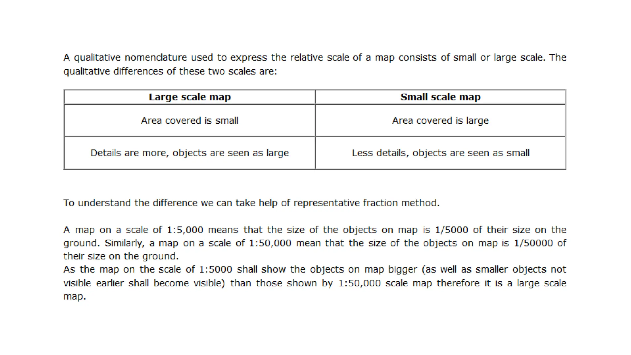
This document provides an introduction to maps and geographical information systems (GIS). It defines what a map is and discusses key map elements like scale, legend, and projection. It outlines different types of maps based on scale (e.g. topographic) and purpose (e.g. political, climate). The document also covers cartographic principles, vector vs. raster data formats, and the limitations of paper maps. Finally, it introduces digital mapping and GIS, highlighting advantages like interactivity, ability to overlay data, and keeping maps up-to-date.
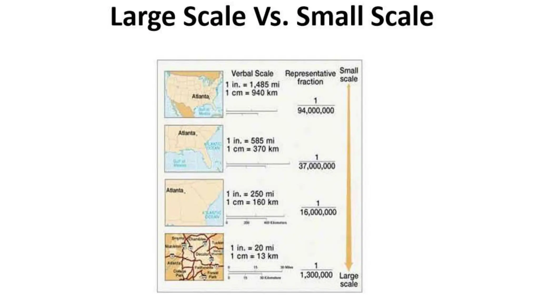
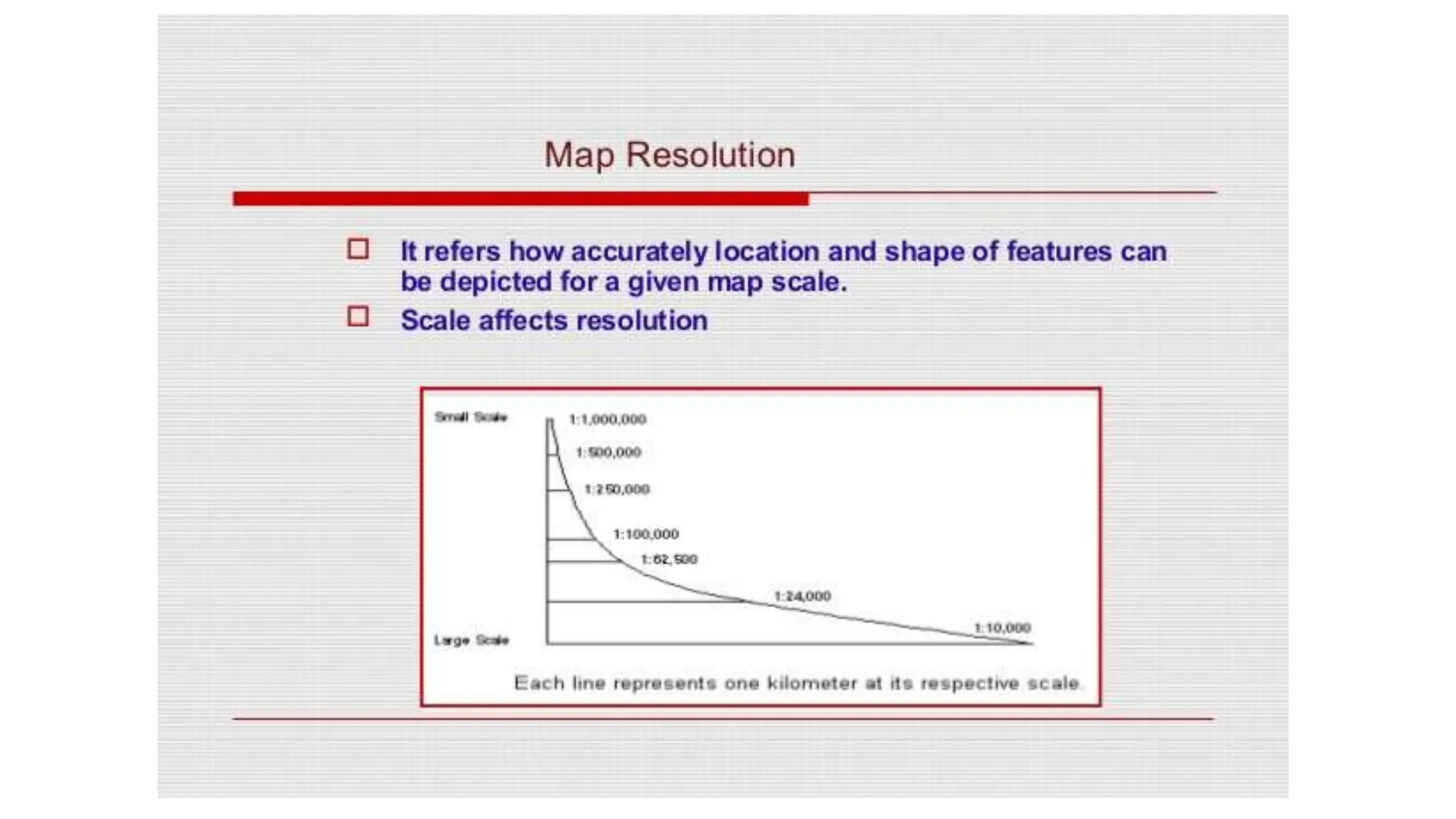
![(a) 1:25,000 [Large scale] (b) 1:50,000 [Small scale]](https://image.slidesharecdn.com/uniti-introductiontomaps-231118154914-7eb59330/75/Unit-I-Introduction-to-Maps-pptx-12-2048.jpg)