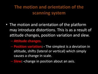
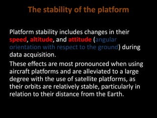
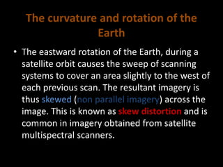
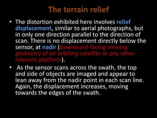
1. Geometric distortions are inherent in remote sensing images and can occur due to several factors including the sensor optics and platform stability.
2. Sources of errors include the perspective of sensor optics, motion and orientation of the scanning system, stability of the platform, platform altitude and attitude, terrain relief, and Earth's curvature and rotation.
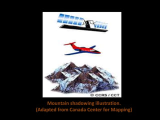
3. In mountainous regions, a satellite-based scanning system would be preferable to an aircraft-based system due to less amplification of geometric distortions from relief displacement and shadowing effects at satellite altitudes.
![References
The Canada Centre for Mapping, n.d., Fundamentals of Remote Sensing [online].
Available at http://www.nrcan.gc.ca/earth-sciences/geomatics/satellite-imagery-air-
photos/satellite-imagery-products/educational. [Accessed on 20/10/2015]
Philpot, W., 1990. Digital Image Processing, Topic 4, Geometric correction.
Conrady, Alexander E., 2001. Decentred Lens-Systems. Monthly notices of the Royal
Astronomical Society 79 (1919): 384–390.
Kir'yanovK., Sizikov V., 2012. C/C++ Programming of Distorted Image Restoration
Problem In Texas Instruments Signal Microprocessors, Scientific and Technical
Journal of Information Technologies, Mechanics and Optics, Number 6, Volume 12,](https://image.slidesharecdn.com/d0dc3e78-93c3-420b-8389-5f99e33f0cb8-160130174852/85/Remote-Sensing-error-sources-17-320.jpg)