Analisi Idrologica e Geomorfologica su base DEM in ambiente GISFernando Nardi
Corso sull'utilizzo di software GIS per la redazione dei Piani di Assetto Idrogeologico (PAI) per Autorità di bacino del fiume Tevere.
Titolo lezione: Analisi Idrologica e Geomorfologica su base DEM in ambiente GIS
Slide show for the webinar on "Spatial Data Science with R" organized for the GeoDevelopers.org community. The video of the webinar and all the related materials including source code and sample data can be downloaded from this link: http://amsantac.co/blog/en/2016/08/07/spatial-data-science-r.html
In this webinar I talked about Data Science in the context of its application to spatial data and explained how we can use the R language for the analysis of geographic information within the different stages of a data science workflow, from the import and processing of spatial data to visualization and publication of results.
GIS student project ideas, GIS case studies, GIS projects, GIS uses – From over 50 industries, this guide of 1000 GIS applications will open your mind to our amazing planet and its inter-connectivity.
Getting It Done with limited staff, time and budget.
This slide show shares a process of developing a GIS plan and framework, shows tools to track and implement the plan, and shows examples of how the GIS plan is directly tied with City initiatives and budget.
Speckle is the major multiplicative noise in the SAR(Radar) images, Improvement is done by using stochastic distance methods by assuming data as gamma distribution which enhances the images by 78% overall....
Nus utilisons une application SIG pour traiter l’information spatiale projetée sur un périphérique informatique.
Un SIG est constitué :
Base de données –– l’information géographique que vous visualiserez et analyserez en utilisant des composants matériels et logiciels informatiques.
Composants matériels –– ordinateurs utilisés pour stocker les données, afficher les graphiques et traiter les données.
Logiciel informatique –– programme informatique qui s’exécute sur un composant matériel informatique et qui vous permet de travailler avec des données numériques spatiales ou autre. Un programme informatique qui fait partie du SIG est appelé une application SIG.
Avec une application SIG vous pouvez ouvrir et afficher des cartes numériques sur votre ordinateur, créer de nouvelles données spatiales à ajouter sur une carte.
This course gives keys to understand the SAR image and specificities: geometry, speckle, penetration capabilities, layovers, multipath, dielectric properties.
Advanced modes: polarimetry, interferomety and POLINSAR are also presented.
LiDAR acronym as Light Detection and Ranging is remote sensing technology having several technical and socialite advantages. This technology is basically used to make high resolution digital map to provide the real time data. This data can be processed and used to extract the useful information. A typical LIDAR system consists of three main components, a GPS system to provide position information, an INS unit for attitude determination, and a LASER system to provide range (distance) information between the LASER firing point and the ground point. In addition to range data, modern LIDAR systems can capture intensity images over the mapped area. Therefore, LIDAR is being more extensively used in mapping and GIS applications.
This presentation introduces open source, open source GIS, OSGeo. This talk was given to the people who attended 'Capacity Building For National Surveying and Geographic Information Institute' program.
Geodatabase: The ArcGIS Mechanism for Data ManagementEsri South Africa
This presentation is about understanding the content that goes into a geodatabase, advantages of using geodatabases, data management and maintaining data integrity.
SAR is a type of radar which works with antenna and receiver using radio waves which can create two dimension or three dimension of the objects . A synthetic-aperture radar is an imaging radar mounted on a moving platform. SAR gives high resolution data and works 24*7.
Raster Data In GeoServer And GeoTools: Achievements, Issues And Future Develo...GeoSolutions
The purpose of this presentation is to discuss the developments during last years in raster data support in GeoTools and GeoServer, and also to introduce and discuss future development directions.
The purpose of choosing this topic is to aware you about sentinel satellites that leads to new discoveries and ultimately changes the arena of Remote Sensing.
Web GIS, statistical geospatial data visualization and real time monitoringALESSANDRO CAPEZZUOLI
Web Gis platform, autocorrelation, geospatial statistical data, density maps, real time monitoring, earthquake monitoring, transport monitoring, heatmaps
Come dimensionare una rete di fognatura bianca usando GISWATERRiccardo Rigon
This is part of the class of hydraulic Constructions at University of Trento. We use QGIS and GISWATER to prepare the inputs for SWMM and see how much the discharges are.
Corso «I GIS come strumenti di ricerca e di comunicazione»
Università di Pisa - Moduli trasversali per i dottorandi
Nicola Gabellieri, Università di Trento
Massimiliano Grava, Università di Pisa
Quick and easy to create maps scopriamo insieme q gisCity Planner
Il progetto QGis è attualmente alla versione 3.0, ma si consiglia, ad oggi di installare la versione 2.18.17.
OpenSource oltre a significare “libero” significa che ognuno può intervenire aggiungendo caratteristiche … anche di altri software OpenSource, come ad esempio GRASS, R e GIMP.
Valentina Spanu: esempi di applicazioni di GIS Partecipativo; gestione delle riserve idriche, energia solare, ristrutturazione di un edificio scolastico in Marocco; riduzione del rischio di disastro naturale in Georgia.
Introduzione a openstreetmap gter 30-03-2012Ale ZenaIT
Intervento tenuto al B.I.C. di Genova il 30 marzo 2012 durante la conferenza 'Passa a Openstreetmap' organizzata da Gter srl
http://www.gter.it/?q=conferenza_OSM
Il GIS nel monitoraggio delle attività di caveGeosolution Srl
Attraverso l'utilizzo di strumentazione laser scanner, integrata, per l’idonea georeferenziazione a strumentazione topografica tradizionale (stazione totale) e GNSS (Global Navigation Satellite System), è possibile acquisire, con altissimo dettaglio, nuvole di punti dalla quale ricostruire il modello tridimensionale del terreno (DTM - Digital Terrain Model), definito in modo tale da poter essere gestito in successive elaborazioni specialistiche CAD (Computer Aided Drafting) e GIS (Geographical Information System).
Progetto Pilota presso l'ufficio tecnico di Gabiley (Somaliland) per il rilie...Maurizio Foderà
Lavoro presentato Giovedì 30 maggio 2013, presso l'Auditorium dell' Istituto Tecnico Statale “V.Accardi” - Settore tecnologico Costruzioni Ambiente e Territorio - di Campobello di Mazara in collaborazione con il Collegio Provinciale Geometri e Geometri Laureati di Trapani, in occasione del convegno: "LE INNOVAZIONI DELLA GEOMATICA A SUPPORTO DEI PROFESSIONISTI E DELLE ISTITUZIONI".
This describe the NewAGE database, some operations that can be done on the database, and other general information about the database of river Adige. Further information is available at http://abouthydrology.blogspot.it/2016/09/the-adige-database-or-database-newage.html
Similar to A little introduction to GIS and QGIS (20)
This reminds that evapotranspiration is highly variable but depends upon some indicators that can be estimated from remote and, therefore suggest a method get it spatially.
This introduces the transpiration from plants phenomenon. It starts from Dalton treatment of the topic and introduces (a little) the Jarvis scheme for estimating stomatal resistances.
This illustrate Niccolo Tubini's integrator of Richards equation in 1D using the nested Newton method by Casulli and Zanolli. The integrator contains van Genucthen, Brooks and Corey and Kosugi schemes for soil water retention curves.
Verification of a aqueduct network. This presentation contains the simplification of the general equations used to verify the correct working of an aqueduct
15.1 reti di distribuzione idrica - equazioniRiccardo Rigon
Here we present the equations that are used to verify aqueducts networks. It is the formal part where the equation are written properly trough the adjacency matrix, and proper vectorial notation.
A variation on the linear reservoir method to design culverts. It use the so called "metodo italiano". It is actually known to have problems. However, for historical reasons, I explain it to students.
Queste slides descrivono le problematiche relative alla progettazione ex-novo di una rete di fognatura e l'analisi di una fognatura già esistente in un contesto urbano importante. Serve a delineare i nuovi problemi che sorgono quando si inseriscano i problemi legati alle fognature nel contesto più ampio della progettazione urbanistica.
3.0 reti di fognatura - Elementi per la progettazione moderna delle reti di...Riccardo Rigon
Si enunciano le linee guida per la progettazione di una fognatura pluviale. Si inquadra la progettazione della fognatura nel problema, più ampio della progettazione della città e delle sue reti.
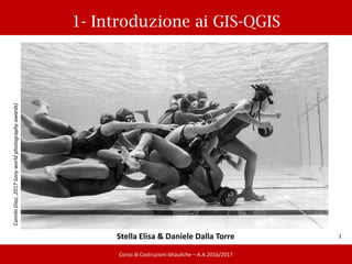
1. 1- Introduzione ai GIS-QGIS
30/03/2017
1
Corso di Costruzioni Idrauliche – A.A 2016/2017
CamiloDiaz,2017Sonyworldphotographyawards)
Stella Elisa & Daniele Dalla Torre
2. Geographyc Information Systems (GIS)
2
Corso di Costruzioni Idrauliche – A.A 2016/2017
Insieme di strumenti per acquisire,
estrarre, elaborare, archiviare e
RAPPRESENTARE dati spaziali del mondo
reale” (Burrough 1986)
Insieme di procedure basate sull’uso di
sistemi informatici, usate per archiviare ed
elaborare dati georeferenziati” (Aronoff
1989)
Visualizzazione di diversi livelli
informativi sovrapposti, relativi a un’area
di interesse.
Informazioni spaziali e temporali.
I dati geografici possono essere messi in
relazione tra di loro, organizzati in
strutture ed organizzati secondo le
esigenze
3. Geographyc Information Systems (GIS)
3
Corso di Costruzioni Idrauliche – A.A 2016/2017
Due tipi di file:
• VETTORIALI: punti, polilinee,
poligoni + database associato.
SHAPEFILE (5 files):
• .shp: informazioni geografiche
• .dbf: database degli attributi
• .shx: indice degli attributi
• .shp.xml : metadati collegati agli
attributi
• .prj: sistema di coordinate
• RASTER: matrici di dati, immagini
(.tiff, .jpg, .geotiff, .ecw, .asc)
!!!!!!! I file caricati nel progetto devono
essere tutti georeferenziati, sempre
!!!!!!
4. Geographyc Information Systems (GIS)
4
Corso di Costruzioni Idrauliche – A.A 2016/2017
GIS OPEN SOURCE:
-GGRASS: (www.grass.itc.it )
-QGIS: interfaccia grafica semplice di GRASS
(www.qgis.org )
-JGRASS: GIS dedicato all’analisi ambientale,
consente visualizzazione ed analisi
di dati sia raster che vettoriali (
www.jgrass.org )
-uDig: visualizzatore di dati vettoriali ed
immagini (http://udig.refractions.net )
-etc.
GIS DESKTOP COMMERCIALI:
- ESRI: ArcGIS, Arcview, Arcreader...
(www.esri.com)
- etc.
5. 5
28/03/2017
LINK UTILI:
• www.pcn.minambiente.it
• http://www.sinanet.isprambiente.it
• http://www.egeo.unisi.it
• http://www.territorio.provincia.tn.it
• https://grasswiki.osgeo.org/wiki/GRASS-Wiki
• http://www.slideshare.net/SlidesIdrologia/2-
introduzione-gis-la-nuova-versione
Geographyc Information Systems (GIS)
Corso di Costruzioni Idrauliche – A.A 2016/2017
6. 6
30/03/2017
Installazione di QGIS
Corso di Costruzioni Idrauliche – A.A 2016/2017
http://qgis.org/it/site/forusers/download.html
http://growworkinghard.altervista.org/qgis-2-18-how-to-install-step-by-step-on-
windows/
JAVA JRE:
http://growworkinghard.altervista.org/install-jre-step-by-step-on-windows-march-
2017/?doing_wp_cron=1490871123.1779060363769531250000
7. 7
28/03/2017
Interfaccia utente
Corso di Costruzioni Idrauliche – A.A 2016/2017
http://download.osgeo.org/qgis/doc/manual/qgis-1.7.0_user_guide_it.pdf
Barra dei menu
Barra degli strumenti
Legenda-
visualizzazione
layers
Vista mappa
13. 13
28/03/2017
Creare uno shapefile
Corso di Costruzioni Idrauliche – A.A 2016/2017
LayerNuovoNuovo shapefile
Specificare se punto, linea o poligono
Specificare SR
….e attributi
15. 15
28/03/2017
Modificare uno shapefile
Corso di Costruzioni Idrauliche – A.A 2016/2017
ModificaAggiungi elementodisegnare gli elementi e modificare gli
attributiSALVARE le modifiche
1 2
17. 17
29/03/2017
Distanze, aree e informazioni
Corso di Costruzioni Idrauliche – A.A 2016/2017
VisualizzaMisuraMisura linea/misura area
18. 18
29/03/2017
Distanze, aree e informazioni
Corso di Costruzioni Idrauliche – A.A 2016/2017
VisualizzaInformazioni elementi
19. 19
28/03/2017
Inserire valori raster in file vettore
Corso di Costruzioni Idrauliche – A.A 2016/2017
Plugins Gestisci e installa pluginTutti POINT SAMPLING TOOL
20. 20
30/03/2017
Inserire valori raster in file vettore
Corso di Costruzioni Idrauliche – A.A 2016/2017
Plugins Gestisci e installa pluginTutti POINT SAMPLING TOOL
Scegliere il layer
da campionare Scegliere gli
attributi per il
file di output
Scegliere il
percorso dove
salvare l’output
22. I dati Grass/JGrass devono essere organizzati secondo una logica
precisa che prevede il raggruppamento degli stessi in:
Organizzazione dei dati in formato Grass/Jgrass
Database cartella di lavoro sul proprio hard disk in cui saranno
contenuti i dati trattati
Location cartella contenente le informazioni relative al sistema di
coordinate ed alla proiezione dei dati contenuti
Mapset cartella all’interno della Location: rappresenta l’ambiente
di lavoro principale, contiene i dati veri e propri
Corso di Costruzioni Idrauliche – A.A 2016/2017
23. Organizzazione dei dati in formato Grass/Jgrass
Corso di Costruzioni Idrauliche – A.A 2016/2017
24. Creare nuovo mapset- GRASS plugin
Corso di Costruzioni Idrauliche – A.A 2016/2017
Plugins GRASS Nuovo Mapset
Scegliere Cartella dove salvare il mapset GRASSNext
25. Creare nuovo mapset- GRASS plugin
Corso di Costruzioni Idrauliche – A.A 2016/2017
Scegliere Cartella dove salvare il mapset GRASSNext
Crea nuova Location (nominarla)Next
26. Creare nuovo mapset- GRASS plugin
Corso di Costruzioni Idrauliche – A.A 2016/2017
Sistema di CoordinateProiezione (WGS84/UTM zone 32N)Next
Regione di GRASS: Italy Next (nb: estensione QGIS dà l’estensione
max dei layer che state utilizzando)
27. Creare nuovo mapset- GRASS plugin
Corso di Costruzioni Idrauliche – A.A 2016/2017
Nuovo Mapset nominare la cartellaNext
Pagina riassuntiva (check) Finish Definisce in uso il nuovo mapset creato
Nb: per aprirne uno già creato PluginsGRASSApri Mapset
28. Importare file nel mapset di grass
Corso di Costruzioni Idrauliche – A.A 2016/2017
PluginsGRASSApri Strumenti GRASSAlbero ModuliGestione File
Importa in GRASS
29. Importare file nel mapset di grass
Corso di Costruzioni Idrauliche – A.A 2016/2017
PluginsGRASSApri Strumenti GRASSAlbero ModuliGestione File
Importa in GRASS
Esegui visualizza Output
30. Esercitazione
Corso di Costruzioni Idrauliche – A.A 2016/2017
Per un’area di circa 0.5 km2 progettare una rete di fognatura bianca,
considerando i dati di pioggia precedentemente ricavati (o dati attinenti alla
zona scelta). La rete fognaria deve avere almeno 10 rami.
Si effettui il dimensionamento di tutti gli elementi della fognatura e
successivamente si
ottimizzi la soluzione in modo da ridurre i costi totali.
Si consideri, in secondo luogo, l’ipotesi di procedere alla riqualificazione
(urbanistica e/o ambientale) di una zona in disuso: discutere gli effetti sulla rete
e sulla portata in uscita.
31. GISwater-SWMM-Installazione
Corso di Costruzioni Idrauliche – A.A 2016/2017
GISwater:
https://www.giswater.org/downloads/?lang=en
http://growworkinghard.altervista.org/giswater-11-install-windows/
https://www.youtube.com/channel/UCuuFlmjnu3HWVrXcyO3I-ow
SWMM:
https://www.epa.gov/water-research/storm-water-management-model-swmm
http://growworkinghard.altervista.org/epa-swmm-how-to-install-step-by-step/