Downloaded 145 times
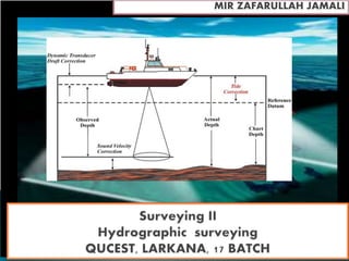
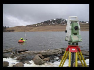


This document discusses hydrographic surveying methods. It describes establishing horizontal and vertical control by traversing and using tide gauges. Soundings are taken along perpendicular range lines using equipment like sounding poles, lead lines, and echo sounders. Depth measurements are referenced to benchmarks and tide gauges. Angle measuring instruments like sextants are used to locate soundings. Soundings are reduced, plotted, and used to produce charts and for engineering projects involving water bodies.


