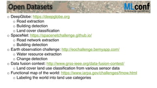
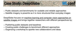
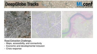
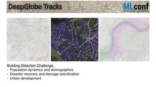
Download as PDF, PPTX


![39Geometric Shape Processing: Satellite Images
[*] I. Demir et al., 2018. “Generative Street Addresses from Satellite Imagery”.
International Journal on Geo-Information (IJGI).](https://image.slidesharecdn.com/geospatialmachinelearningforurbandevelopment-181114165928/85/Geospatial-machine-learning-for-urban-development-39-320.jpg)
![Completion & Reconstruction 47
• Voxelize building proxy from
footprint
• Find roofs with photo-
consistency in aerial images
• Apply graph-cuts:
•Building
•Building-ground
•Ground
[*] I. Garcia-Dorado I. Demir, D. Aliaga.
2013. “Automatic Urban Modeling Using
Volumetric Reconstruction with Surface
Graph-cuts”. Computers & Graphics.](https://image.slidesharecdn.com/geospatialmachinelearningforurbandevelopment-181114165928/85/Geospatial-machine-learning-for-urban-development-47-320.jpg)

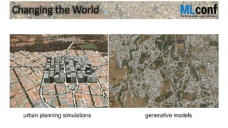
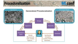
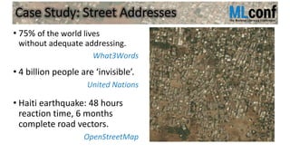
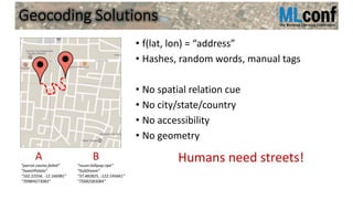
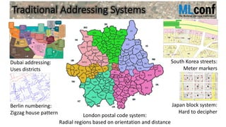
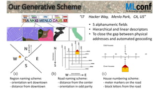
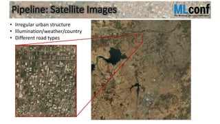
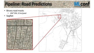
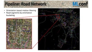
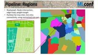
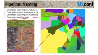
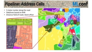
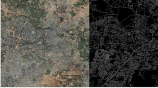
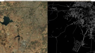
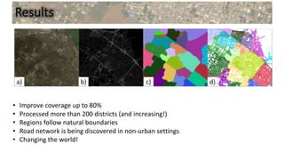
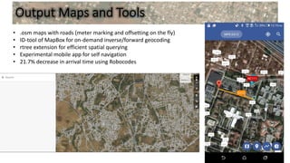
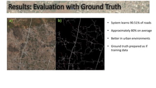
This document discusses using machine learning and computer vision techniques with satellite imagery to generate addressing systems for areas that currently lack adequate street addressing. It describes a generative addressing scheme that uses hierarchical and linear descriptors, such as region names indicating orientation and distance from downtown and road names indicating distance from the center and orientation. The document outlines a pipeline that involves predicting road networks from satellite imagery, partitioning regions based on road connectivity, and assigning addressing cells along roads with distance and block offsets. Results show this approach can improve street address coverage to 80% for unmapped developing areas by discovering road networks in non-urban settings and defining regions according to natural boundaries.