Artificial intelligence and Machine learning in remote sensing and GIS
1.
AI & MLIN REMOTE SENSING
AND GIS
Dhivya G 3rd Year CSE U
Sangeetha S 3rd Year CS
2.
CONTENT
ABSTRACT
INTRODUCTION
BASICS OF REMOTE SENSING
GEOGRAPHIC INFORMATION SYSTEM
APPLICATIONS OF REMOTE SENSING USING AI&ML
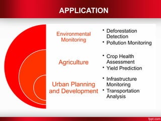
APPLICATIONS
PYTHON BASED APPROACH
RESULT
CONCLUSION
REFERENCES
3.
ABSTRACT
The use ofArtificial Intelligence (AI) and Machine Learning (ML) in
remote sensing and Geographic Information Systems (GIS) is
transforming geospatial analysis. AI/ML techniques improve feature
extraction from satellite and aerial imagery, enabling applications in
environmental monitoring, urban planning, and natural resource
management. This paper presents methods and results demonstrating
AI/ML’s role in automating large-scale geospatial analysis with
enhanced accuracy. Additionally, a Python-based approach provides
insights into water, land, and vegetation distribution from map imagery.
4.
INTRODUCTION
AI andMachine Learning are transforming geospatial analysis,
improving efficiency, accuracy, and scalability.
Traditional remote sensing relied on manual or rule-based analysis, limiting
large-scale insights.
Recent advances in deep learning, particularly Convolutional Neural
Networks (CNNs), have enabled complex image classification and pattern
recognition tasks.
This paper explores how AI/ML enhances geospatial analysis, automating
traditionally manual processes and enabling efficient, large-scale
interpretation of imagery data.
Additionally, it presents a basic Python-based approach to classify regional
land cover, demonstrating the potential of AI/ML in advancing GIS
applications.
5.
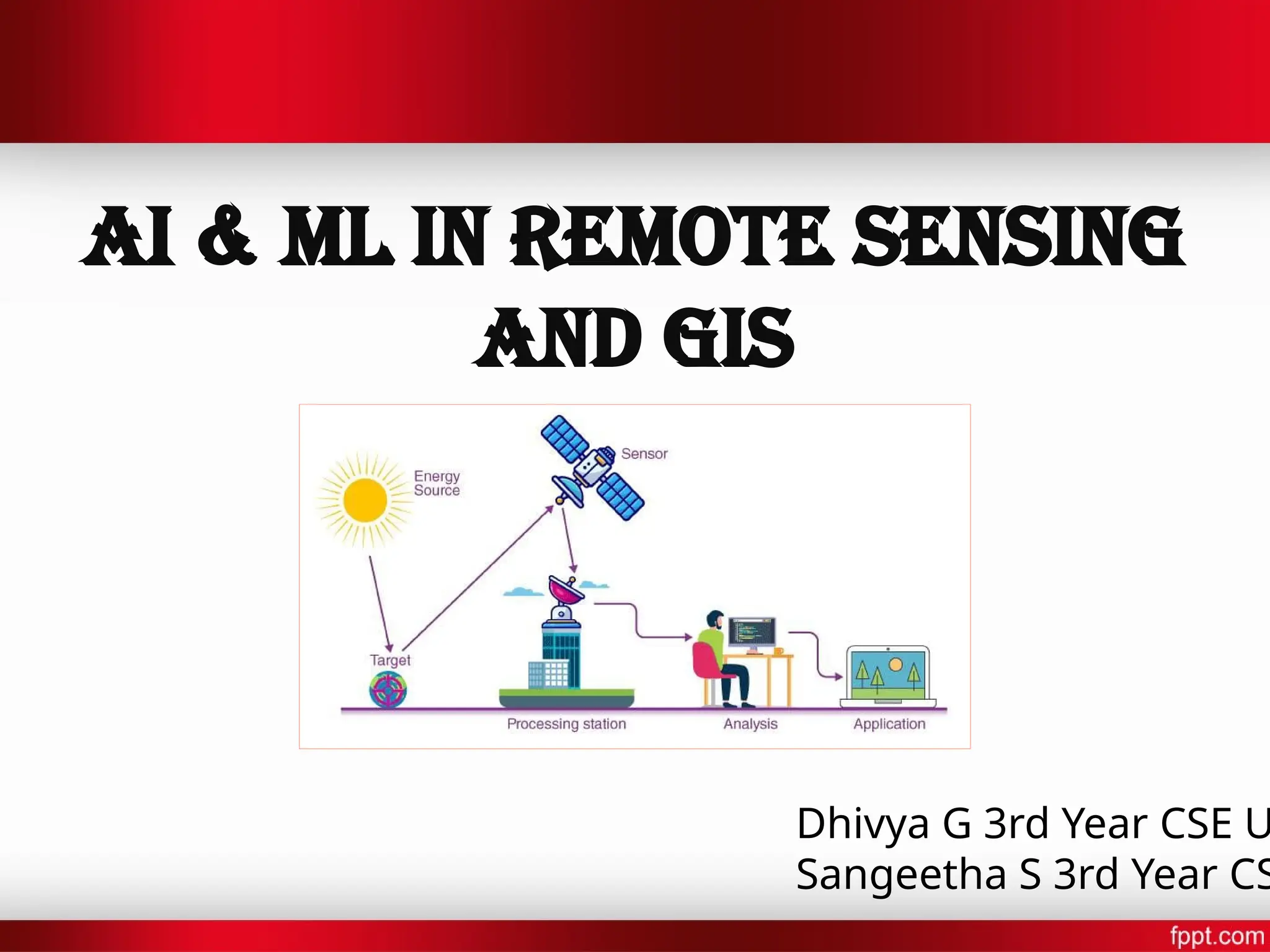
REMOTE SENSOR
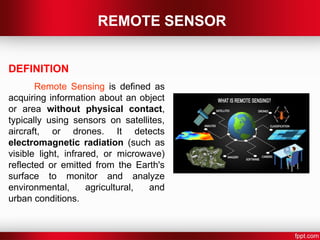
DEFINITION
Remote Sensingis defined as
acquiring information about an object
or area without physical contact,
typically using sensors on satellites,
aircraft, or drones. It detects
electromagnetic radiation (such as
visible light, infrared, or microwave)
reflected or emitted from the Earth's
surface to monitor and analyze
environmental, agricultural, and
urban conditions.
6.
REMOTE SENSING TYPES
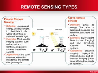
PassiveRemote
Sensing
Definition: Uses natural
energy, usually sunlight,
to collect data. It only
works when there is
sufficient ambient light.
Examples: Most satellite
imaging systems, such
as Landsat and
Sentinel, are passive
systems that rely on
sunlight.
Applications: Land cover
mapping, vegetation
monitoring, and climate
change analysis.
Active Remote
Sensing
Definition: Emits its
energy (like radar or
laser) and measures the
reflection back from the
surface.
Examples: LiDAR (Light
Detection and Ranging)
and SAR (Synthetic
Aperture Radar)
systems.
Applications: Elevation
mapping, topographic
measurements, and all-
weather imaging (radar
is not affected by clouds
or nighttime).
7.
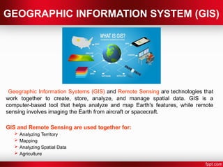
GEOGRAPHIC INFORMATION SYSTEM(GIS)
Geographic Information Systems (GIS) and Remote Sensing are technologies that
work together to create, store, analyze, and manage spatial data. GIS is a
computer-based tool that helps analyze and map Earth's features, while remote
sensing involves imaging the Earth from aircraft or spacecraft.
GIS and Remote Sensing are used together for:
Analyzing Territory
Mapping
Analyzing Spatial Data
Agriculture
8.
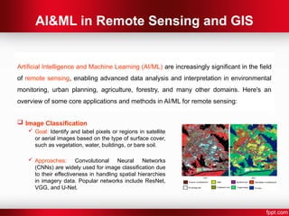
AI&ML in RemoteSensing and GIS
Image Classification
Goal: Identify and label pixels or regions in satellite
or aerial images based on the type of surface cover,
such as vegetation, water, buildings, or bare soil.
Approaches: Convolutional Neural Networks
(CNNs) are widely used for image classification due
to their effectiveness in handling spatial hierarchies
in imagery data. Popular networks include ResNet,
VGG, and U-Net.
Artificial Intelligence and Machine Learning (AI/ML) are increasingly significant in the field
of remote sensing, enabling advanced data analysis and interpretation in environmental
monitoring, urban planning, agriculture, forestry, and many other domains. Here's an
overview of some core applications and methods in AI/ML for remote sensing:
9.
AI&ML in RemoteSensing and GIS
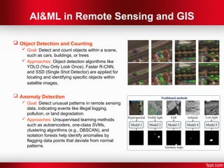
Object Detection and Counting
Goal: Detect and count objects within a scene,
such as cars, buildings, or trees.
Approaches: Object detection algorithms like
YOLO (You Only Look Once), Faster R-CNN,
and SSD (Single Shot Detector) are applied for
locating and identifying specific objects within
satellite images.
Anomaly Detection
Goal: Detect unusual patterns in remote sensing
data, indicating events like illegal logging,
pollution, or land degradation.
Approaches: Unsupervised learning methods
such as autoencoders, one-class SVMs,
clustering algorithms (e.g., DBSCAN), and
isolation forests help identify anomalies by
flagging data points that deviate from normal
patterns.
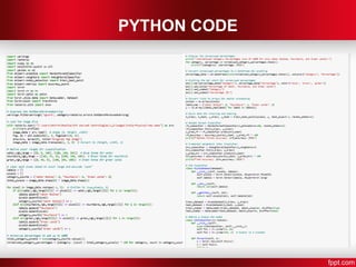
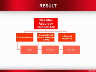
PYTHON BASED APPROACH
Thiscode classifies an image of India's physical map
into three categories - water bodies, mountains, and green
lands, using Random Forest, KNN, and CNN classifiers.
After labeling the image pixels based on their RGB values,
the classifiers are trained and evaluated. The accuracies of
each model are compared, and the results are visualized in
bar charts.
RESULT
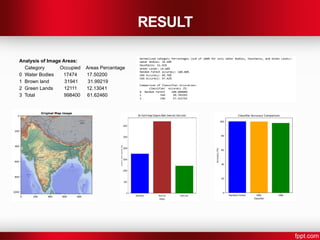
Analysis of ImageAreas:
Category Occupied Areas Percentage
0 Water Bodies 17474 17.50200
1 Brown land 31941 31.99219
2 Green Lands 12111 12.13041
3 Total 998400 61.62460
CONCLUSION
This paperexplores the impact of Artificial Intelligence (AI) and Machine
Learning (ML) in transforming remote sensing and Geographic Information
Systems (GIS) through automation and improved accuracy.
Techniques like Convolutional Neural Networks (CNNs), Random Forest, and
K-Nearest Neighbors (KNN) enable precise classification of land types - such
as water bodies, mountains, and green lands, supporting applications in
environmental monitoring, urban planning, and resource management.
The Python-based approach effectively processes large geospatial datasets,
facilitating fast and accurate analysis. The paper underscores the potential of
AI/ML to innovate geospatial analysis, aiding responses to complex issues like
climate change and disaster management.
16.
REFERENCES
Zhu, X.,& Woodcock, C. E."Object-based analysis of land cover and land use for remote sensing." IEEE Transactions on
Geoscience and Remote Sensing, vol. 53, no. 4, pp. 1800-1820, 2015.DOI: 10.1109/TGRS.2014.2368656
Ma, L., Liu, Y., Zhang, X., Ye, Y., Yin, G., & Johnson, B. A."Deep learning in remote sensing applications: A meta-analysis
and review."IEEE Journal of Selected Topics in Applied Earth Observations and Remote Sensing, vol. 13, pp. 447-460,
2020.DOI: 10.1109/JSTARS.2020.2965959
Li, W., Fu, H., Yu, L., & Cracknell, A."Deep learning based land cover classification using hyperspectral data."IEEE Journal
of Selected Topics in Applied Earth Observations and Remote Sensing, vol. 10, no. 6, pp. 2354-2368,
2017.DOI:10.1109/JSTARS.2017.2681126
Sheng, Y., & Li, X."A survey of machine learning algorithms for big data in remote sensing." IEEE Geoscience and Remote
Sensing Magazine, vol. 6, no. 4, pp. 27-38,2018.DOI:10.1109/MGRS.2018.2866244
Cai, Z., Fan, J., Hu, W., & Li, X."A novel approach to land cover change detection using machine learning and remote
sensing data."2018 IEEE International Geoscience and Remote Sensing Symposium (IGARSS), Valencia, Spain, pp.
6044-6047.DOI: 10.1109/IGARSS.2018.8517882