Downloaded 30 times

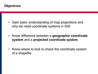
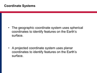
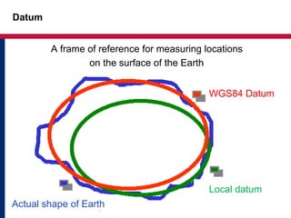
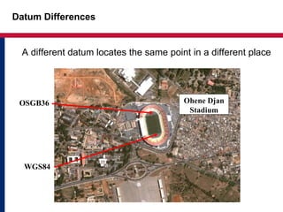
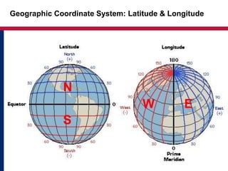
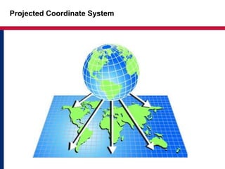
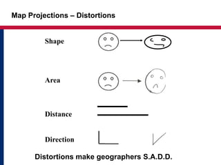
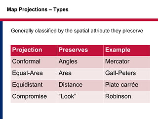
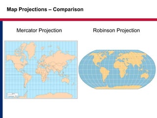
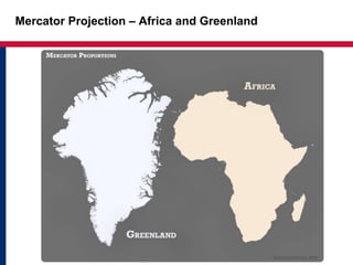
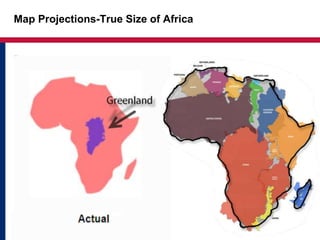
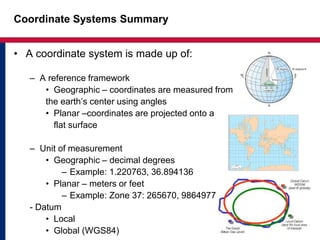
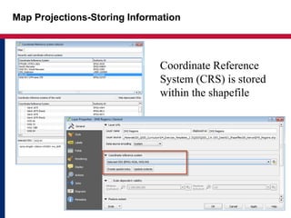
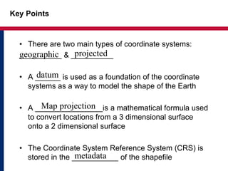


This document discusses map projections and coordinate systems in GIS. It explains that there are two main types of coordinate systems: geographic and projected. Geographic coordinate systems use spherical coordinates to identify Earth surface features, while projected coordinate systems use planar coordinates to identify features by projecting them onto a flat surface. It also discusses datums, which provide a reference framework for measuring locations on the Earth's surface, as well as how map projections introduce distortions like changes to shape, area, distance and direction when converting from a spherical to planar surface.


![Sketchnotes-SF Meetup :: Round 11 [Mon Oct 13, 2014]](https://cdn.slidesharecdn.com/ss_thumbnails/snsf112014-10-13slideshare-141014171818-conversion-gate02-thumbnail.jpg?width=640&height=640&fit=bounds)

![Sketchnotes-SF Meetup :: Round 20 :: Basic Practice [Wed Jul 16, 2015]](https://cdn.slidesharecdn.com/ss_thumbnails/snsf202015-07-15slideshare-150716235329-lva1-app6891-thumbnail.jpg?width=640&height=640&fit=bounds)


![Sketchnotes-SF Meetup :: Round 19 :: Down & Dirty Lettering [Tue Jun 16, 2015]](https://cdn.slidesharecdn.com/ss_thumbnails/snsf192015-06-16slideshare-150617052813-lva1-app6891-thumbnail.jpg?width=640&height=640&fit=bounds)

![Sketchnotes-SF Meetup :: Round 17 :: People & Faces [Wed Apr 29, 2015]](https://cdn.slidesharecdn.com/ss_thumbnails/snsf172015-04-29peoplefacesslideshare-150513181615-lva1-app6892-thumbnail.jpg?width=640&height=640&fit=bounds)
![Sketchnotes-SF Meetup :: Round 24 :: People & Faces [Tue May 17, 2016]](https://cdn.slidesharecdn.com/ss_thumbnails/snsf242016-05-17peoplefacesslideshare-160727185554-thumbnail.jpg?width=640&height=640&fit=bounds)

![Measuring What Matters: A UX Approach to Metrics :: UX Days Tokyo [April 2015]](https://cdn.slidesharecdn.com/ss_thumbnails/uxdayswkshopmeasurewhatmatters2015-04-19slideshare-150423114153-conversion-gate01-thumbnail.jpg?width=640&height=640&fit=bounds)


