Downloaded 155 times

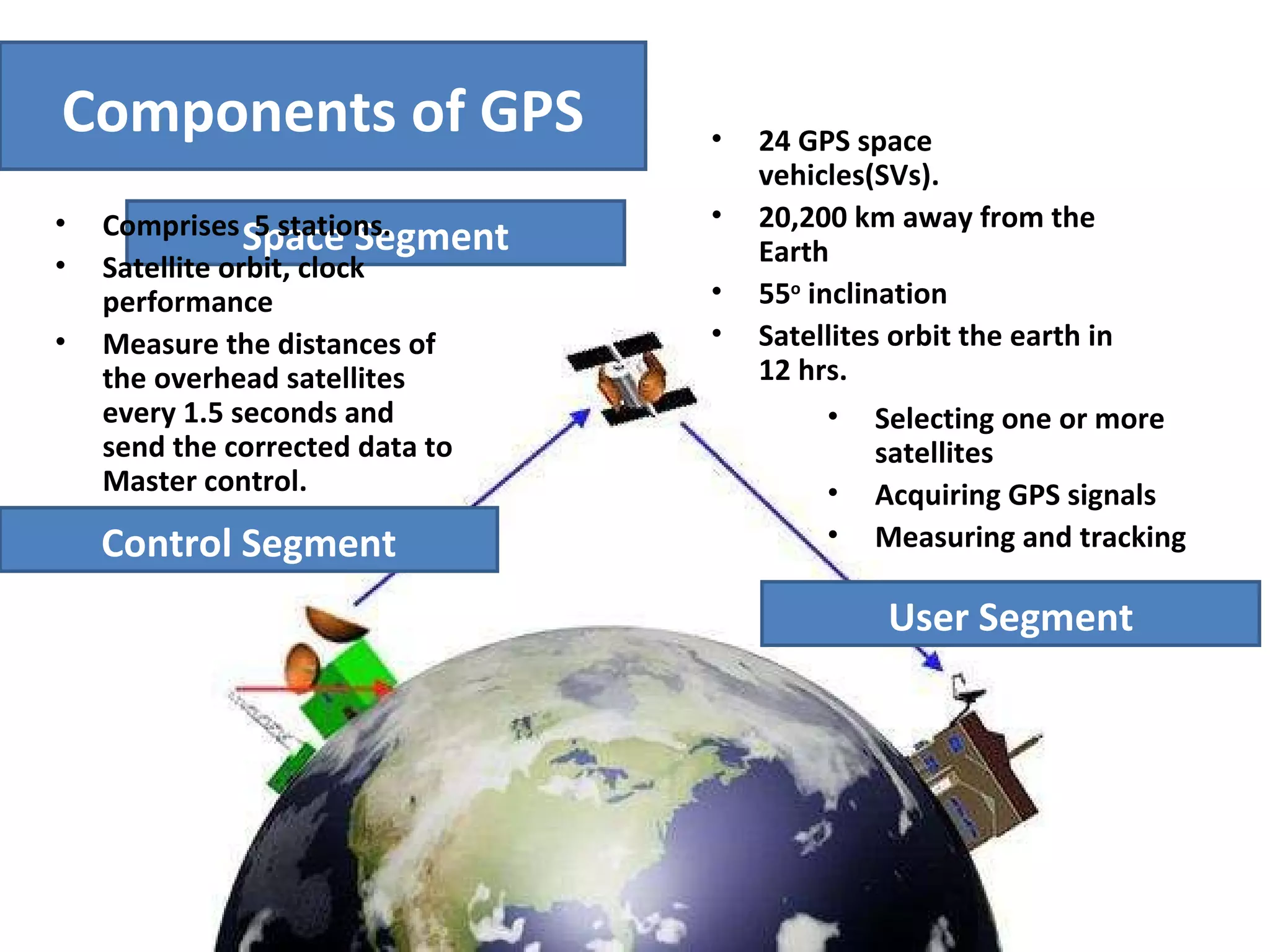


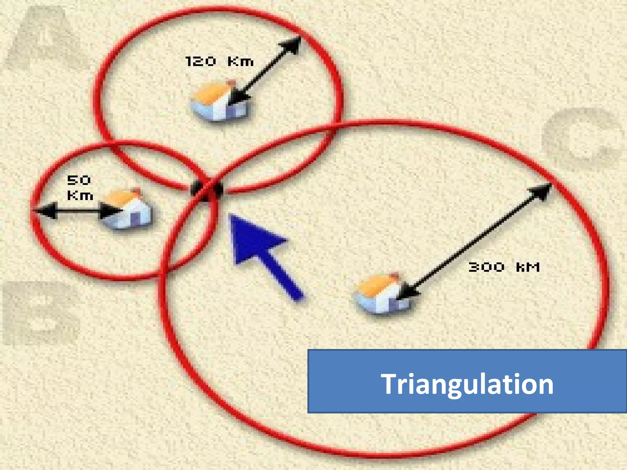


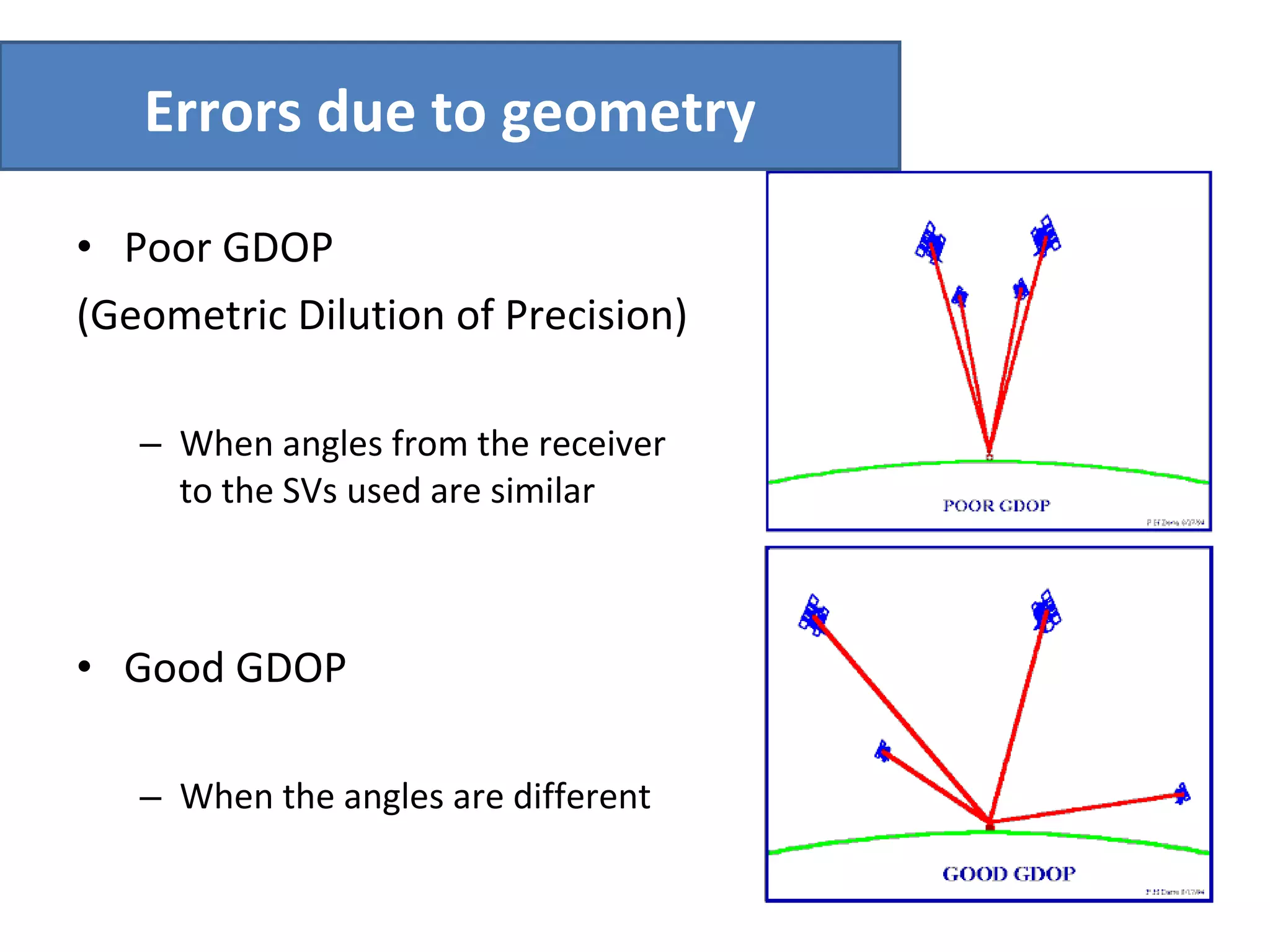


GPS uses 24 satellites orbiting Earth to enable positioning, navigation, and timing services worldwide. It works by using triangulation based on distance measurements from at least 3 satellites, determining the user's location at the intersection of spherical surfaces. Sources of error include clock errors, atmospheric delays, and receiver noise. Differential GPS can correct some errors by using data from fixed ground stations.


![Introduction to gps [compatibility mode]](https://cdn.slidesharecdn.com/ss_thumbnails/introductiontogpscompatibilitymode-131231040925-phpapp01-thumbnail.jpg?width=640&height=640&fit=bounds)

!["GPS" Global Positioning System [PDF]](https://cdn.slidesharecdn.com/ss_thumbnails/globalpositioningsystemgpsmainpdf-101105164539-phpapp01-thumbnail.jpg?width=640&height=640&fit=bounds)


