Download as PPSX, PPTX


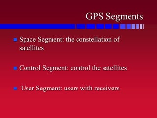
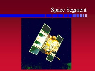
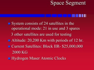
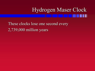


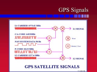


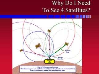


The document provides an overview of the global positioning system (GPS) including its history, components, and functionality. GPS uses a constellation of 24 satellites that precisely transmit timing signals to allow GPS receivers to determine their location, speed and time. The system was developed by the US military to provide accurate navigation and timing information around the world.


![Pipe materials and types of joints [autosaved]](https://cdn.slidesharecdn.com/ss_thumbnails/pipematerialsandtypesofjointsautosaved-180719140405-thumbnail.jpg?width=640&height=640&fit=bounds)


![Attack surfaces and attack tress[inform]](https://cdn.slidesharecdn.com/ss_thumbnails/lecture03-260108015941-a4dee53b-thumbnail.jpg?width=640&height=640&fit=bounds)