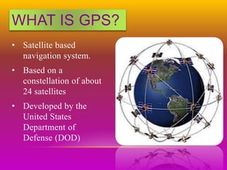
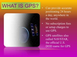
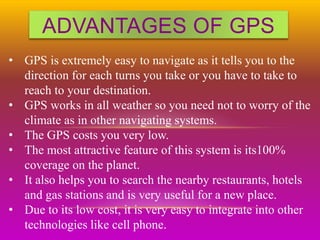
SlideShare a Scribd company logo
WHAT IS GPS?
• Satellite based
navigation system.
• Based on a
constellation of about
24 satellites
• Developed by the
United States
Department of
Defense (DOD)
WHAT IS GPS? • Can provide accurate
positioning 24 hours
a day, anywhere in
the world.
• No subscription fees
or setup charges to
use GPS.
• GPS satellites also
called NAVSTAR,
the official U.S.
DOD name for GPS
STRUCTURE
Space Segment Control Segment
User Segment
STRUCTURE
SPACE SEGMENT:
• GPS Satellite constellation composed of 24
operational satellites in space.
• These 24 satellites are placed in 6 circular
orbits of period equal to 12hrs and these orbits
are equally spaced with 60 degrees apart and
at an inclination angle of 55 degrees to equator
STRUCTURE
CONTROL SEGMENT:
• The control segment comprises of 5 ground stations
located on equator.(4-monitor and 1-master station)
• Monitor stations measure the distances of the
overhead satellites every 1.5 seconds and send the
corrected data to Master station.
• In Master station the satellite orbit, clock
performance and health of the satellite are determined
and determines whether repositioning is required.
• This information is sent back to the satellites using
ground antennas.
Control Segment
Space Segment
User Segment
Monitor Stations
Ground
Antennas
Master Station
STRUCTURE
STRUCTURE
USER SEGMENT:
• The User Segment consists of all earth-based
GPS receivers.
• The user segment is totally user community,
both civilian and military.
HOW GPS
DETERMINES
A LOCATION
HOW GPS
DETERMINES
A LOCATION
Things which need to be determined:
• Current Locations of GPS Satellites
• The Distance Between Receiver’s Position and the GPS
Satellites
CURRENT LOCATIONS OF
GPS SATELLITES
• GPS satellites are orbiting the earth at an altitude
of 11,000 miles.
• The orbits, and the locations of the satellites, are
known in advance.
• GPS receivers store this orbit information for all of
the GPS satellites in an ALMANAC*.
* THE ALMANAC IS A FILE WHICH CONTAINS POSITIONAL INFORMATION FOR ALL OF THE
GPS SATELLITES
• All 24 satellites are
divided into 6 parts.
• There are 4 satellites
in each part.
• A definite orbit is
defined for each part.
• Each of these 3,000-
to 4,000-pound solar-
powered satellites.
DISTANCE BETWEEN
RECEIVER’S POSITION
& THE GPS SATELLITES
• By measuring the amount of time taken by
radio signal (the GPS signal) to travel from
the satellite to the receiver.
• Radio waves travel at the speed of light, i.e.
about 186,000 miles per second.
• The distance from the satellite to the receiver
can be determined by the formula “distance =
speed x time”.
GPS ERROR BUDGET
Different errors can cause a deviation of +/- 50 -
100 meters from the actual GPS receiver position
which are :
ATMOSPHERIC CONDITIONS:
• Speed of GPS signal is affected by ionosphere
& troposphere.
• Which cause a deviation of 0 to 30 m. from the
actual position of receiver.
EPHEMERIS ERRORS:
• The predicted changes in the orbit of a
satellite.
• Which cause a deviation of 0 to 5 m.
from the actual position of receiver
CLOCK DRIFT:
• Due to different code generations in
satellite and receiver simultaneously.
• Which cause a deviation of 0 to 1.5 m.
from the actual position of receiver
MULTIPATH:
• Bouncing of GPS signal due to a
reflecting surface before reaching to
receiver antenna.
• Which cause a deviation of 0 to 1 m.
from the actual position of receiver
MEASURING GPS
ACCURACY
The geometry of the constellation is evaluated by
Dilution Of Precision, or DOP.
DOP
INCREASING
ACCURACY OF GPS
• Differential correction provides accuracy within 1-5 m.
• Coarse Acquisition receiver provides accuracy within
1-5m.
• Carrier Phase receivers provides accuracy within 10-30
cm.
• Dual-Frequency receivers are capable of providing sub-
centimeter GPS position accuracy.
GPS SIGNALS
• Coarse/Acquisition code.
• Precision code.
• Navigation message.
• Almanac.
• Data updates.
GPS FREQUINCIES
• L1 (1575.42 MHz)
• L2 (1227.60 MHz)
• L3 (1381.05 MHz)
• L4 (1379.913 MHz)
• L5 (1176.45 MHz)
FREQUENCY INFORMATION
• The C/A code is transmitted on the L1 frequency.
• The Precision-code is transmitted on both the L1 and L2
frequencies.
• L3 is used by the Defense Support Program to signal
detection of missile launches, nuclear detonations, and
other applications.
• L4 is used for additional correction to the part of the
atmosphere that is ionized by solar radiation.
• L5 is used as a civilian safety-of-life signal.
ADVANTAGES OF GPS
• GPS is extremely easy to navigate as it tells you to the
direction for each turns you take or you have to take to
reach to your destination.
• GPS works in all weather so you need not to worry of the
climate as in other navigating systems.
• The GPS costs you very low.
• The most attractive feature of this system is its100%
coverage on the planet.
• It also helps you to search the nearby restaurants, hotels
and gas stations and is very useful for a new place.
• Due to its low cost, it is very easy to integrate into other
technologies like cell phone.
DISADVANTAGES OF GPS
• GPS satellite signals are weak, so it doesn't work as well
indoors, underwater, under trees, etc.
• The highest accuracy requires line-of-sight from the
receiver to the satellite, this is why GPS doesn't work
very well in an urban environment.
• The US DoD (dept. of defence) can, at any time, deny
users use of the system (i.e. they degrade/shut down the
satellites).
• If you are using GPS on a battery operated device, there
may be a battery failure and you may need a external
power supply which is not always possible.
APPLICATIONS
AVIATION AGRICULTURE
MARINE TIMING
SPACE RAILWAYS
ROADWAYS DISASTER RELIEF
Name Launch Date
NAVSTAR 64 (USA 206) August 17, 2009
NAVSTAR 63 (USA 203) March 24, 2009
NAVSTAR 62 (USA 201) March 15, 2008
NAVSTAR 61 (USA 199) December 20, 2007
NAVSTAR 60 (USA 196) October 17, 2007
NAVSTAR 59 (USA 192) November 17, 2006
NAVSTAR 58 (USA 190) September 25, 2006
NAVSTAR 57 (USA 183) September 26, 2005
NAVSTAR 56 (USA 180) November 6, 2004
NAVSTAR 55 (USA 178) June 23, 2004
NAVSTAR 54 (USA 177) March 20, 2004
NAVSTAR 53 (USA 175) December 21, 2003
NAVSTAR 52 (USA 168) March 31, 2003
GPSOperationalSatellites
Name Launch Date
NAVSTAR 51 (USA 166) January 29, 2003
NAVSTAR 50 (USA 156) January 30, 2001
NAVSTAR 49 (USA 154) November 10, 2000
NAVSTAR 48 (USA 151) July 16, 2000
NAVSTAR 47 (USA 150) May 11, 2000
NAVSTAR 46 (USA 145) October 7, 1999
NAVSTAR 44 (USA 134) November 6, 1997
NAVSTAR 43 (USA 132) July 23, 1997
NAVSTAR 39 (USA 128) September 12, 1996
NAVSTAR 38 (USA 126) July 16, 1996
NAVSTAR 37 (USA 117) March 28, 1996
NAVSTAR 36 (USA 100) March 10, 1994
GPSOperationalSatellites
Presentationmobilecommunication 150531192712-lva1-app6891

More Related Content

What's hot

Introduction to Navigation Systems
Introduction to Navigation SystemsIntroduction to Navigation Systems
Introduction to Navigation Systems
Joseph Hennawy
 
Seminar Report For GPS Technology
Seminar Report For GPS TechnologySeminar Report For GPS Technology
Seminar Report For GPS Technology
Rahul Jain
 
Navr4030 16(tides)
Navr4030 16(tides)Navr4030 16(tides)
Navr4030 16(tides)
Salah Mahmood
 
Latest Advances in GPS technology Seminar report
Latest Advances in GPS technology Seminar reportLatest Advances in GPS technology Seminar report
Latest Advances in GPS technology Seminar report
Mode Gautam Raj
 
Gps presentation
Gps presentationGps presentation
Gps presentation
pavimalpani
 
GPS DOCUMENT
GPS DOCUMENTGPS DOCUMENT
GPS DOCUMENT
Tuhin_Das
 
GPS(Global Positioning system
GPS(Global Positioning systemGPS(Global Positioning system
GPS(Global Positioning system
tanmoy chakrabortty
 
Psa final presentation on gps ....for Rethwan Faiz sir
Psa final presentation on gps ....for Rethwan Faiz sirPsa final presentation on gps ....for Rethwan Faiz sir
Psa final presentation on gps ....for Rethwan Faiz sir
Sadman Sakib
 
Introduction of gps global navigation satellite systems
Introduction of gps   global navigation satellite systems Introduction of gps   global navigation satellite systems
Introduction of gps global navigation satellite systems
DocumentStory
 
Latest Advances in GPS Technology
Latest Advances in GPS TechnologyLatest Advances in GPS Technology
Latest Advances in GPS Technology
Mode Gautam Raj
 
Ajal gps
Ajal gpsAjal gps
Ajal gps
AJAL A J
 
Indian satellite based navigation system description and implementation status
Indian satellite based navigation system description and implementation statusIndian satellite based navigation system description and implementation status
Indian satellite based navigation system description and implementation status
huangxj73
 
Gps ppt
Gps pptGps ppt
GPS
GPSGPS
gps technology
gps technologygps technology
gps technology
Naga Dinesh
 
Introduction to global position system
Introduction to global position systemIntroduction to global position system
Introduction to global position system
University of Technology
 
Gps
GpsGps
Global Positing System
Global Positing SystemGlobal Positing System
Global Positing System
Pranay Mondal
 
Global Positioning System (GPS)
Global Positioning System (GPS) Global Positioning System (GPS)
Global Positioning System (GPS)
ManjuChauhan16
 

What's hot (19)

Introduction to Navigation Systems
Introduction to Navigation SystemsIntroduction to Navigation Systems
Introduction to Navigation Systems
 
Seminar Report For GPS Technology
Seminar Report For GPS TechnologySeminar Report For GPS Technology
Seminar Report For GPS Technology
 
Navr4030 16(tides)
Navr4030 16(tides)Navr4030 16(tides)
Navr4030 16(tides)
 
Latest Advances in GPS technology Seminar report
Latest Advances in GPS technology Seminar reportLatest Advances in GPS technology Seminar report
Latest Advances in GPS technology Seminar report
 
Gps presentation
Gps presentationGps presentation
Gps presentation
 
GPS DOCUMENT
GPS DOCUMENTGPS DOCUMENT
GPS DOCUMENT
 
GPS(Global Positioning system
GPS(Global Positioning systemGPS(Global Positioning system
GPS(Global Positioning system
 
Psa final presentation on gps ....for Rethwan Faiz sir
Psa final presentation on gps ....for Rethwan Faiz sirPsa final presentation on gps ....for Rethwan Faiz sir
Psa final presentation on gps ....for Rethwan Faiz sir
 
Introduction of gps global navigation satellite systems
Introduction of gps   global navigation satellite systems Introduction of gps   global navigation satellite systems
Introduction of gps global navigation satellite systems
 
Latest Advances in GPS Technology
Latest Advances in GPS TechnologyLatest Advances in GPS Technology
Latest Advances in GPS Technology
 
Ajal gps
Ajal gpsAjal gps
Ajal gps
 
Indian satellite based navigation system description and implementation status
Indian satellite based navigation system description and implementation statusIndian satellite based navigation system description and implementation status
Indian satellite based navigation system description and implementation status
 
Gps ppt
Gps pptGps ppt
Gps ppt
 
GPS
GPSGPS
GPS
 
gps technology
gps technologygps technology
gps technology
 
Introduction to global position system
Introduction to global position systemIntroduction to global position system
Introduction to global position system
 
Gps
GpsGps
Gps
 
Global Positing System
Global Positing SystemGlobal Positing System
Global Positing System
 
Global Positioning System (GPS)
Global Positioning System (GPS) Global Positioning System (GPS)
Global Positioning System (GPS)
 

Viewers also liked

3º encontro
3º encontro3º encontro
3º encontro
SolVenezzani
 
10 encontro
10 encontro10 encontro
10 encontro
SolVenezzani
 
Quero seu sorriso
Quero seu sorrisoQuero seu sorriso
Quero seu sorriso
Clara Civille Rodrigues
 
Roman polansky
Roman polanskyRoman polansky
Roman polansky
Pedro Pessoa
 
Programação de Games com CodeSkulptor
Programação de Games com CodeSkulptorProgramação de Games com CodeSkulptor
Programação de Games com CodeSkulptor
Marcos Castro
 
Rangkuman ahli waris dan permasalahannya
Rangkuman ahli waris dan permasalahannyaRangkuman ahli waris dan permasalahannya
Rangkuman ahli waris dan permasalahannya
Ahayiwinaningsih
 
Vários graffitis
Vários graffitisVários graffitis
Vários graffitis
sandrinho669
 
Injunção
InjunçãoInjunção
Estefania ortega gerenciapublica yprivada
Estefania ortega gerenciapublica yprivadaEstefania ortega gerenciapublica yprivada
Estefania ortega gerenciapublica yprivada
EstefaniaOrtegaGarcia
 
Hissa consultoria - Apresentação
Hissa consultoria - ApresentaçãoHissa consultoria - Apresentação
Hissa consultoria - Apresentação
hissaconsultoria
 
2014 04-30 guías-de-apoyo-relativas-a-trámites-del-rfc-y-uso-del-sistema-de-r...
2014 04-30 guías-de-apoyo-relativas-a-trámites-del-rfc-y-uso-del-sistema-de-r...2014 04-30 guías-de-apoyo-relativas-a-trámites-del-rfc-y-uso-del-sistema-de-r...
2014 04-30 guías-de-apoyo-relativas-a-trámites-del-rfc-y-uso-del-sistema-de-r...
El Conta Puntocom
 
Induccion metodologica k
Induccion metodologica kInduccion metodologica k
Induccion metodologica k
metodologia000
 
Cárie de esmalte
Cárie de esmalteCárie de esmalte
Cárie de esmalte
Lucas Diniz
 
La Pedabobía.
La Pedabobía.La Pedabobía.
La Pedabobía.
Luis J López B
 
Pirataria / Contrafação
Pirataria / ContrafaçãoPirataria / Contrafação
Pirataria / Contrafação
mmcegal
 
Unos empreendedores oficial 2.0
Unos empreendedores oficial 2.0Unos empreendedores oficial 2.0
Unos empreendedores oficial 2.0
Joao Unos
 
Refman 4.1-(português).a4
Refman 4.1-(português).a4Refman 4.1-(português).a4
Refman 4.1-(português).a4
saf0847
 
CV new'-No photo
CV new'-No photoCV new'-No photo
CV new'-No photo
MOUSA ABU NEMAH
 
Graffitis
GraffitisGraffitis
Graffitis
sandrinho669
 

Viewers also liked (20)

3º encontro
3º encontro3º encontro
3º encontro
 
10 encontro
10 encontro10 encontro
10 encontro
 
Quero seu sorriso
Quero seu sorrisoQuero seu sorriso
Quero seu sorriso
 
Roman polansky
Roman polanskyRoman polansky
Roman polansky
 
Programação de Games com CodeSkulptor
Programação de Games com CodeSkulptorProgramação de Games com CodeSkulptor
Programação de Games com CodeSkulptor
 
Rangkuman ahli waris dan permasalahannya
Rangkuman ahli waris dan permasalahannyaRangkuman ahli waris dan permasalahannya
Rangkuman ahli waris dan permasalahannya
 
Vários graffitis
Vários graffitisVários graffitis
Vários graffitis
 
Injunção
InjunçãoInjunção
Injunção
 
Escola e Trabalho
Escola e TrabalhoEscola e Trabalho
Escola e Trabalho
 
Estefania ortega gerenciapublica yprivada
Estefania ortega gerenciapublica yprivadaEstefania ortega gerenciapublica yprivada
Estefania ortega gerenciapublica yprivada
 
Hissa consultoria - Apresentação
Hissa consultoria - ApresentaçãoHissa consultoria - Apresentação
Hissa consultoria - Apresentação
 
2014 04-30 guías-de-apoyo-relativas-a-trámites-del-rfc-y-uso-del-sistema-de-r...
2014 04-30 guías-de-apoyo-relativas-a-trámites-del-rfc-y-uso-del-sistema-de-r...2014 04-30 guías-de-apoyo-relativas-a-trámites-del-rfc-y-uso-del-sistema-de-r...
2014 04-30 guías-de-apoyo-relativas-a-trámites-del-rfc-y-uso-del-sistema-de-r...
 
Induccion metodologica k
Induccion metodologica kInduccion metodologica k
Induccion metodologica k
 
Cárie de esmalte
Cárie de esmalteCárie de esmalte
Cárie de esmalte
 
La Pedabobía.
La Pedabobía.La Pedabobía.
La Pedabobía.
 
Pirataria / Contrafação
Pirataria / ContrafaçãoPirataria / Contrafação
Pirataria / Contrafação
 
Unos empreendedores oficial 2.0
Unos empreendedores oficial 2.0Unos empreendedores oficial 2.0
Unos empreendedores oficial 2.0
 
Refman 4.1-(português).a4
Refman 4.1-(português).a4Refman 4.1-(português).a4
Refman 4.1-(português).a4
 
CV new'-No photo
CV new'-No photoCV new'-No photo
CV new'-No photo
 
Graffitis
GraffitisGraffitis
Graffitis
 

Similar to Presentationmobilecommunication 150531192712-lva1-app6891

Gpsppt 130412005659-phpapp01
Gpsppt 130412005659-phpapp01Gpsppt 130412005659-phpapp01
Gpsppt 130412005659-phpapp01
Gurinder Singh
 
Global positioning system
Global positioning systemGlobal positioning system
Global positioning system
Siva Kumar
 
GPS ppt.
GPS ppt. GPS ppt.
GPS ppt.
Jawad Ali
 
AFUSbjbiCiPL7EJ5488.pptx
AFUSbjbiCiPL7EJ5488.pptxAFUSbjbiCiPL7EJ5488.pptx
AFUSbjbiCiPL7EJ5488.pptx
VishuBaniyan
 
GROUP 3 (GPS).pptxbskfkdkfjndkfkdkfkdksk
GROUP 3 (GPS).pptxbskfkdkfjndkfkdkfkdkskGROUP 3 (GPS).pptxbskfkdkfjndkfkdkfkdksk
GROUP 3 (GPS).pptxbskfkdkfjndkfkdkfkdksk
KingKong787511
 
Global Positioning System
Global Positioning SystemGlobal Positioning System
Global Positioning System
Rishi Shukla
 
Gps and remote sensing
Gps and remote sensingGps and remote sensing
Gps and remote sensing
Sanila Khalid
 
GPS.ppt
GPS.pptGPS.ppt
GPS.ppt
johny151906
 
GPS (GLOBAL POSITIONING SYSTEM)
GPS (GLOBAL POSITIONING SYSTEM)GPS (GLOBAL POSITIONING SYSTEM)
GPS (GLOBAL POSITIONING SYSTEM)
Abdul mannan Karim
 
Global Positioning system GPS - Dr. S. Balamurugan
Global Positioning system GPS - Dr. S. BalamuruganGlobal Positioning system GPS - Dr. S. Balamurugan
Global Positioning system GPS - Dr. S. Balamurugan
Prakash Kumar Sekar
 
GPS.pptx
GPS.pptxGPS.pptx
GPS.pptx
sivaganesan23
 
Physics seminar
Physics seminarPhysics seminar
Physics seminar
Ankit Siddharth
 
Role of Sensors-Applications.pdf
Role of Sensors-Applications.pdfRole of Sensors-Applications.pdf
Role of Sensors-Applications.pdf
GOWTHAMMS6
 
Global position system
Global position systemGlobal position system
Global position system
Iqbal Khan
 
An Introduction to GNSS(Global Navigation Satellite Systems) .pptx
An Introduction to GNSS(Global Navigation Satellite Systems)  .pptxAn Introduction to GNSS(Global Navigation Satellite Systems)  .pptx
An Introduction to GNSS(Global Navigation Satellite Systems) .pptx
ChShakeelAhmedMayo
 
Global Positioning System (GPS) in Helthcare
Global Positioning System (GPS) in HelthcareGlobal Positioning System (GPS) in Helthcare
Global Positioning System (GPS) in Helthcare
Zulfiquer Ahmed Amin
 
survey method "Tendua Geo-Special & Construction (OPC) Private Limited"
survey method "Tendua Geo-Special & Construction (OPC) Private Limited"survey method "Tendua Geo-Special & Construction (OPC) Private Limited"
survey method "Tendua Geo-Special & Construction (OPC) Private Limited"
HimanshuSinghGaharwa
 
The global positioning system an overview
The global positioning system an overviewThe global positioning system an overview
The global positioning system an overview
Gurubasavaraj M
 
SUBSIDENCE MONITORING USING THE GLOBAL POSITIONING SYSTEM(GPS)
SUBSIDENCE MONITORING USING THE GLOBAL POSITIONING SYSTEM(GPS)SUBSIDENCE MONITORING USING THE GLOBAL POSITIONING SYSTEM(GPS)
SUBSIDENCE MONITORING USING THE GLOBAL POSITIONING SYSTEM(GPS)
maneeb
 
GPS World wide navigation and tracking system
GPS World wide navigation and tracking systemGPS World wide navigation and tracking system
GPS World wide navigation and tracking system
arafyghazali
 

Similar to Presentationmobilecommunication 150531192712-lva1-app6891 (20)

Gpsppt 130412005659-phpapp01
Gpsppt 130412005659-phpapp01Gpsppt 130412005659-phpapp01
Gpsppt 130412005659-phpapp01
 
Global positioning system
Global positioning systemGlobal positioning system
Global positioning system
 
GPS ppt.
GPS ppt. GPS ppt.
GPS ppt.
 
AFUSbjbiCiPL7EJ5488.pptx
AFUSbjbiCiPL7EJ5488.pptxAFUSbjbiCiPL7EJ5488.pptx
AFUSbjbiCiPL7EJ5488.pptx
 
GROUP 3 (GPS).pptxbskfkdkfjndkfkdkfkdksk
GROUP 3 (GPS).pptxbskfkdkfjndkfkdkfkdkskGROUP 3 (GPS).pptxbskfkdkfjndkfkdkfkdksk
GROUP 3 (GPS).pptxbskfkdkfjndkfkdkfkdksk
 
Global Positioning System
Global Positioning SystemGlobal Positioning System
Global Positioning System
 
Gps and remote sensing
Gps and remote sensingGps and remote sensing
Gps and remote sensing
 
GPS.ppt
GPS.pptGPS.ppt
GPS.ppt
 
GPS (GLOBAL POSITIONING SYSTEM)
GPS (GLOBAL POSITIONING SYSTEM)GPS (GLOBAL POSITIONING SYSTEM)
GPS (GLOBAL POSITIONING SYSTEM)
 
Global Positioning system GPS - Dr. S. Balamurugan
Global Positioning system GPS - Dr. S. BalamuruganGlobal Positioning system GPS - Dr. S. Balamurugan
Global Positioning system GPS - Dr. S. Balamurugan
 
GPS.pptx
GPS.pptxGPS.pptx
GPS.pptx
 
Physics seminar
Physics seminarPhysics seminar
Physics seminar
 
Role of Sensors-Applications.pdf
Role of Sensors-Applications.pdfRole of Sensors-Applications.pdf
Role of Sensors-Applications.pdf
 
Global position system
Global position systemGlobal position system
Global position system
 
An Introduction to GNSS(Global Navigation Satellite Systems) .pptx
An Introduction to GNSS(Global Navigation Satellite Systems)  .pptxAn Introduction to GNSS(Global Navigation Satellite Systems)  .pptx
An Introduction to GNSS(Global Navigation Satellite Systems) .pptx
 
Global Positioning System (GPS) in Helthcare
Global Positioning System (GPS) in HelthcareGlobal Positioning System (GPS) in Helthcare
Global Positioning System (GPS) in Helthcare
 
survey method "Tendua Geo-Special & Construction (OPC) Private Limited"
survey method "Tendua Geo-Special & Construction (OPC) Private Limited"survey method "Tendua Geo-Special & Construction (OPC) Private Limited"
survey method "Tendua Geo-Special & Construction (OPC) Private Limited"
 
The global positioning system an overview
The global positioning system an overviewThe global positioning system an overview
The global positioning system an overview
 
SUBSIDENCE MONITORING USING THE GLOBAL POSITIONING SYSTEM(GPS)
SUBSIDENCE MONITORING USING THE GLOBAL POSITIONING SYSTEM(GPS)SUBSIDENCE MONITORING USING THE GLOBAL POSITIONING SYSTEM(GPS)
SUBSIDENCE MONITORING USING THE GLOBAL POSITIONING SYSTEM(GPS)
 
GPS World wide navigation and tracking system
GPS World wide navigation and tracking systemGPS World wide navigation and tracking system
GPS World wide navigation and tracking system
 

Recently uploaded

Electric vehicle and photovoltaic advanced roles in enhancing the financial p...
Electric vehicle and photovoltaic advanced roles in enhancing the financial p...Electric vehicle and photovoltaic advanced roles in enhancing the financial p...
Electric vehicle and photovoltaic advanced roles in enhancing the financial p...
IJECEIAES
 
Recycled Concrete Aggregate in Construction Part III
Recycled Concrete Aggregate in Construction Part IIIRecycled Concrete Aggregate in Construction Part III
Recycled Concrete Aggregate in Construction Part III
Aditya Rajan Patra
 
RAT: Retrieval Augmented Thoughts Elicit Context-Aware Reasoning in Long-Hori...
RAT: Retrieval Augmented Thoughts Elicit Context-Aware Reasoning in Long-Hori...RAT: Retrieval Augmented Thoughts Elicit Context-Aware Reasoning in Long-Hori...
RAT: Retrieval Augmented Thoughts Elicit Context-Aware Reasoning in Long-Hori...
thanhdowork
 
Embedded machine learning-based road conditions and driving behavior monitoring
Embedded machine learning-based road conditions and driving behavior monitoringEmbedded machine learning-based road conditions and driving behavior monitoring
Embedded machine learning-based road conditions and driving behavior monitoring
IJECEIAES
 
sieving analysis and results interpretation
sieving analysis and results interpretationsieving analysis and results interpretation
sieving analysis and results interpretation
ssuser36d3051
 
ACEP Magazine edition 4th launched on 05.06.2024
ACEP Magazine edition 4th launched on 05.06.2024ACEP Magazine edition 4th launched on 05.06.2024
ACEP Magazine edition 4th launched on 05.06.2024
Rahul
 
5214-1693458878915-Unit 6 2023 to 2024 academic year assignment (AutoRecovere...
5214-1693458878915-Unit 6 2023 to 2024 academic year assignment (AutoRecovere...5214-1693458878915-Unit 6 2023 to 2024 academic year assignment (AutoRecovere...
5214-1693458878915-Unit 6 2023 to 2024 academic year assignment (AutoRecovere...
ihlasbinance2003
 
basic-wireline-operations-course-mahmoud-f-radwan.pdf
basic-wireline-operations-course-mahmoud-f-radwan.pdfbasic-wireline-operations-course-mahmoud-f-radwan.pdf
basic-wireline-operations-course-mahmoud-f-radwan.pdf
NidhalKahouli2
 
Advanced control scheme of doubly fed induction generator for wind turbine us...
Advanced control scheme of doubly fed induction generator for wind turbine us...Advanced control scheme of doubly fed induction generator for wind turbine us...
Advanced control scheme of doubly fed induction generator for wind turbine us...
IJECEIAES
 
6th International Conference on Machine Learning & Applications (CMLA 2024)
6th International Conference on Machine Learning & Applications (CMLA 2024)6th International Conference on Machine Learning & Applications (CMLA 2024)
6th International Conference on Machine Learning & Applications (CMLA 2024)
ClaraZara1
 
Generative AI leverages algorithms to create various forms of content
Generative AI leverages algorithms to create various forms of contentGenerative AI leverages algorithms to create various forms of content
Generative AI leverages algorithms to create various forms of content
Hitesh Mohapatra
 
Technical Drawings introduction to drawing of prisms
Technical Drawings introduction to drawing of prismsTechnical Drawings introduction to drawing of prisms
Technical Drawings introduction to drawing of prisms
heavyhaig
 
14 Template Contractual Notice - EOT Application
14 Template Contractual Notice - EOT Application14 Template Contractual Notice - EOT Application
14 Template Contractual Notice - EOT Application
SyedAbiiAzazi1
 
Series of visio cisco devices Cisco_Icons.ppt
Series of visio cisco devices Cisco_Icons.pptSeries of visio cisco devices Cisco_Icons.ppt
Series of visio cisco devices Cisco_Icons.ppt
PauloRodrigues104553
 
DfMAy 2024 - key insights and contributions
DfMAy 2024 - key insights and contributionsDfMAy 2024 - key insights and contributions
DfMAy 2024 - key insights and contributions
gestioneergodomus
 
Low power architecture of logic gates using adiabatic techniques
Low power architecture of logic gates using adiabatic techniquesLow power architecture of logic gates using adiabatic techniques
Low power architecture of logic gates using adiabatic techniques
nooriasukmaningtyas
 
Properties Railway Sleepers and Test.pptx
Properties Railway Sleepers and Test.pptxProperties Railway Sleepers and Test.pptx
Properties Railway Sleepers and Test.pptx
MDSABBIROJJAMANPAYEL
 
BPV-GUI-01-Guide-for-ASME-Review-Teams-(General)-10-10-2023.pdf
BPV-GUI-01-Guide-for-ASME-Review-Teams-(General)-10-10-2023.pdfBPV-GUI-01-Guide-for-ASME-Review-Teams-(General)-10-10-2023.pdf
BPV-GUI-01-Guide-for-ASME-Review-Teams-(General)-10-10-2023.pdf
MIGUELANGEL966976
 
CSM Cloud Service Management Presentarion
CSM Cloud Service Management PresentarionCSM Cloud Service Management Presentarion
CSM Cloud Service Management Presentarion
rpskprasana
 
[JPP-1] - (JEE 3.0) - Kinematics 1D - 14th May..pdf
[JPP-1] - (JEE 3.0) - Kinematics 1D - 14th May..pdf[JPP-1] - (JEE 3.0) - Kinematics 1D - 14th May..pdf
[JPP-1] - (JEE 3.0) - Kinematics 1D - 14th May..pdf
awadeshbabu
 

Recently uploaded (20)

Electric vehicle and photovoltaic advanced roles in enhancing the financial p...
Electric vehicle and photovoltaic advanced roles in enhancing the financial p...Electric vehicle and photovoltaic advanced roles in enhancing the financial p...
Electric vehicle and photovoltaic advanced roles in enhancing the financial p...
 
Recycled Concrete Aggregate in Construction Part III
Recycled Concrete Aggregate in Construction Part IIIRecycled Concrete Aggregate in Construction Part III
Recycled Concrete Aggregate in Construction Part III
 
RAT: Retrieval Augmented Thoughts Elicit Context-Aware Reasoning in Long-Hori...
RAT: Retrieval Augmented Thoughts Elicit Context-Aware Reasoning in Long-Hori...RAT: Retrieval Augmented Thoughts Elicit Context-Aware Reasoning in Long-Hori...
RAT: Retrieval Augmented Thoughts Elicit Context-Aware Reasoning in Long-Hori...
 
Embedded machine learning-based road conditions and driving behavior monitoring
Embedded machine learning-based road conditions and driving behavior monitoringEmbedded machine learning-based road conditions and driving behavior monitoring
Embedded machine learning-based road conditions and driving behavior monitoring
 
sieving analysis and results interpretation
sieving analysis and results interpretationsieving analysis and results interpretation
sieving analysis and results interpretation
 
ACEP Magazine edition 4th launched on 05.06.2024
ACEP Magazine edition 4th launched on 05.06.2024ACEP Magazine edition 4th launched on 05.06.2024
ACEP Magazine edition 4th launched on 05.06.2024
 
5214-1693458878915-Unit 6 2023 to 2024 academic year assignment (AutoRecovere...
5214-1693458878915-Unit 6 2023 to 2024 academic year assignment (AutoRecovere...5214-1693458878915-Unit 6 2023 to 2024 academic year assignment (AutoRecovere...
5214-1693458878915-Unit 6 2023 to 2024 academic year assignment (AutoRecovere...
 
basic-wireline-operations-course-mahmoud-f-radwan.pdf
basic-wireline-operations-course-mahmoud-f-radwan.pdfbasic-wireline-operations-course-mahmoud-f-radwan.pdf
basic-wireline-operations-course-mahmoud-f-radwan.pdf
 
Advanced control scheme of doubly fed induction generator for wind turbine us...
Advanced control scheme of doubly fed induction generator for wind turbine us...Advanced control scheme of doubly fed induction generator for wind turbine us...
Advanced control scheme of doubly fed induction generator for wind turbine us...
 
6th International Conference on Machine Learning & Applications (CMLA 2024)
6th International Conference on Machine Learning & Applications (CMLA 2024)6th International Conference on Machine Learning & Applications (CMLA 2024)
6th International Conference on Machine Learning & Applications (CMLA 2024)
 
Generative AI leverages algorithms to create various forms of content
Generative AI leverages algorithms to create various forms of contentGenerative AI leverages algorithms to create various forms of content
Generative AI leverages algorithms to create various forms of content
 
Technical Drawings introduction to drawing of prisms
Technical Drawings introduction to drawing of prismsTechnical Drawings introduction to drawing of prisms
Technical Drawings introduction to drawing of prisms
 
14 Template Contractual Notice - EOT Application
14 Template Contractual Notice - EOT Application14 Template Contractual Notice - EOT Application
14 Template Contractual Notice - EOT Application
 
Series of visio cisco devices Cisco_Icons.ppt
Series of visio cisco devices Cisco_Icons.pptSeries of visio cisco devices Cisco_Icons.ppt
Series of visio cisco devices Cisco_Icons.ppt
 
DfMAy 2024 - key insights and contributions
DfMAy 2024 - key insights and contributionsDfMAy 2024 - key insights and contributions
DfMAy 2024 - key insights and contributions
 
Low power architecture of logic gates using adiabatic techniques
Low power architecture of logic gates using adiabatic techniquesLow power architecture of logic gates using adiabatic techniques
Low power architecture of logic gates using adiabatic techniques
 
Properties Railway Sleepers and Test.pptx
Properties Railway Sleepers and Test.pptxProperties Railway Sleepers and Test.pptx
Properties Railway Sleepers and Test.pptx
 
BPV-GUI-01-Guide-for-ASME-Review-Teams-(General)-10-10-2023.pdf
BPV-GUI-01-Guide-for-ASME-Review-Teams-(General)-10-10-2023.pdfBPV-GUI-01-Guide-for-ASME-Review-Teams-(General)-10-10-2023.pdf
BPV-GUI-01-Guide-for-ASME-Review-Teams-(General)-10-10-2023.pdf
 
CSM Cloud Service Management Presentarion
CSM Cloud Service Management PresentarionCSM Cloud Service Management Presentarion
CSM Cloud Service Management Presentarion
 
[JPP-1] - (JEE 3.0) - Kinematics 1D - 14th May..pdf
[JPP-1] - (JEE 3.0) - Kinematics 1D - 14th May..pdf[JPP-1] - (JEE 3.0) - Kinematics 1D - 14th May..pdf
[JPP-1] - (JEE 3.0) - Kinematics 1D - 14th May..pdf
 

Presentationmobilecommunication 150531192712-lva1-app6891

  • 1.
  • 2.
  • 3.
  • 4. WHAT IS GPS? • Satellite based navigation system. • Based on a constellation of about 24 satellites • Developed by the United States Department of Defense (DOD)
  • 5. WHAT IS GPS? • Can provide accurate positioning 24 hours a day, anywhere in the world. • No subscription fees or setup charges to use GPS. • GPS satellites also called NAVSTAR, the official U.S. DOD name for GPS
  • 6. STRUCTURE Space Segment Control Segment User Segment
  • 7. STRUCTURE SPACE SEGMENT: • GPS Satellite constellation composed of 24 operational satellites in space. • These 24 satellites are placed in 6 circular orbits of period equal to 12hrs and these orbits are equally spaced with 60 degrees apart and at an inclination angle of 55 degrees to equator
  • 8. STRUCTURE CONTROL SEGMENT: • The control segment comprises of 5 ground stations located on equator.(4-monitor and 1-master station) • Monitor stations measure the distances of the overhead satellites every 1.5 seconds and send the corrected data to Master station. • In Master station the satellite orbit, clock performance and health of the satellite are determined and determines whether repositioning is required. • This information is sent back to the satellites using ground antennas.
  • 9. Control Segment Space Segment User Segment Monitor Stations Ground Antennas Master Station STRUCTURE
  • 10. STRUCTURE USER SEGMENT: • The User Segment consists of all earth-based GPS receivers. • The user segment is totally user community, both civilian and military.
  • 12. HOW GPS DETERMINES A LOCATION Things which need to be determined: • Current Locations of GPS Satellites • The Distance Between Receiver’s Position and the GPS Satellites
  • 13. CURRENT LOCATIONS OF GPS SATELLITES • GPS satellites are orbiting the earth at an altitude of 11,000 miles. • The orbits, and the locations of the satellites, are known in advance. • GPS receivers store this orbit information for all of the GPS satellites in an ALMANAC*. * THE ALMANAC IS A FILE WHICH CONTAINS POSITIONAL INFORMATION FOR ALL OF THE GPS SATELLITES
  • 14. • All 24 satellites are divided into 6 parts. • There are 4 satellites in each part. • A definite orbit is defined for each part. • Each of these 3,000- to 4,000-pound solar- powered satellites.
  • 15. DISTANCE BETWEEN RECEIVER’S POSITION & THE GPS SATELLITES • By measuring the amount of time taken by radio signal (the GPS signal) to travel from the satellite to the receiver. • Radio waves travel at the speed of light, i.e. about 186,000 miles per second. • The distance from the satellite to the receiver can be determined by the formula “distance = speed x time”.
  • 16. GPS ERROR BUDGET Different errors can cause a deviation of +/- 50 - 100 meters from the actual GPS receiver position which are : ATMOSPHERIC CONDITIONS: • Speed of GPS signal is affected by ionosphere & troposphere. • Which cause a deviation of 0 to 30 m. from the actual position of receiver.
  • 17. EPHEMERIS ERRORS: • The predicted changes in the orbit of a satellite. • Which cause a deviation of 0 to 5 m. from the actual position of receiver CLOCK DRIFT: • Due to different code generations in satellite and receiver simultaneously. • Which cause a deviation of 0 to 1.5 m. from the actual position of receiver
  • 18. MULTIPATH: • Bouncing of GPS signal due to a reflecting surface before reaching to receiver antenna. • Which cause a deviation of 0 to 1 m. from the actual position of receiver
  • 19. MEASURING GPS ACCURACY The geometry of the constellation is evaluated by Dilution Of Precision, or DOP. DOP
  • 20. INCREASING ACCURACY OF GPS • Differential correction provides accuracy within 1-5 m. • Coarse Acquisition receiver provides accuracy within 1-5m. • Carrier Phase receivers provides accuracy within 10-30 cm. • Dual-Frequency receivers are capable of providing sub- centimeter GPS position accuracy.
  • 21. GPS SIGNALS • Coarse/Acquisition code. • Precision code. • Navigation message. • Almanac. • Data updates.
  • 22. GPS FREQUINCIES • L1 (1575.42 MHz) • L2 (1227.60 MHz) • L3 (1381.05 MHz) • L4 (1379.913 MHz) • L5 (1176.45 MHz)
  • 23. FREQUENCY INFORMATION • The C/A code is transmitted on the L1 frequency. • The Precision-code is transmitted on both the L1 and L2 frequencies. • L3 is used by the Defense Support Program to signal detection of missile launches, nuclear detonations, and other applications. • L4 is used for additional correction to the part of the atmosphere that is ionized by solar radiation. • L5 is used as a civilian safety-of-life signal.
  • 24. ADVANTAGES OF GPS • GPS is extremely easy to navigate as it tells you to the direction for each turns you take or you have to take to reach to your destination. • GPS works in all weather so you need not to worry of the climate as in other navigating systems. • The GPS costs you very low. • The most attractive feature of this system is its100% coverage on the planet. • It also helps you to search the nearby restaurants, hotels and gas stations and is very useful for a new place. • Due to its low cost, it is very easy to integrate into other technologies like cell phone.
  • 25. DISADVANTAGES OF GPS • GPS satellite signals are weak, so it doesn't work as well indoors, underwater, under trees, etc. • The highest accuracy requires line-of-sight from the receiver to the satellite, this is why GPS doesn't work very well in an urban environment. • The US DoD (dept. of defence) can, at any time, deny users use of the system (i.e. they degrade/shut down the satellites). • If you are using GPS on a battery operated device, there may be a battery failure and you may need a external power supply which is not always possible.
  • 28. Name Launch Date NAVSTAR 64 (USA 206) August 17, 2009 NAVSTAR 63 (USA 203) March 24, 2009 NAVSTAR 62 (USA 201) March 15, 2008 NAVSTAR 61 (USA 199) December 20, 2007 NAVSTAR 60 (USA 196) October 17, 2007 NAVSTAR 59 (USA 192) November 17, 2006 NAVSTAR 58 (USA 190) September 25, 2006 NAVSTAR 57 (USA 183) September 26, 2005 NAVSTAR 56 (USA 180) November 6, 2004 NAVSTAR 55 (USA 178) June 23, 2004 NAVSTAR 54 (USA 177) March 20, 2004 NAVSTAR 53 (USA 175) December 21, 2003 NAVSTAR 52 (USA 168) March 31, 2003 GPSOperationalSatellites
  • 29. Name Launch Date NAVSTAR 51 (USA 166) January 29, 2003 NAVSTAR 50 (USA 156) January 30, 2001 NAVSTAR 49 (USA 154) November 10, 2000 NAVSTAR 48 (USA 151) July 16, 2000 NAVSTAR 47 (USA 150) May 11, 2000 NAVSTAR 46 (USA 145) October 7, 1999 NAVSTAR 44 (USA 134) November 6, 1997 NAVSTAR 43 (USA 132) July 23, 1997 NAVSTAR 39 (USA 128) September 12, 1996 NAVSTAR 38 (USA 126) July 16, 1996 NAVSTAR 37 (USA 117) March 28, 1996 NAVSTAR 36 (USA 100) March 10, 1994 GPSOperationalSatellites