
Recommended
More Related Content
What's hot
What's hot (20)
Similar to Maps project1
Similar to Maps project1 (20)
Recently uploaded
Recently uploaded (20)
Maps project1
- 1. Page 1 of 24
- 2. Page 2 of 24 DID YOU KNOW The word "map" comes from the Medieval Latin Mappa mundi, wherein mappa meant napkin or cloth and mundi the world. Thus, "map" became the shortened term referring to a two-dimensional representation of the surface of the world. Maps are mostly used to depict Geography but they can also be used to represent any space, real or fictional without regard to context or scale, such as in Brain mapping, DNA mapping or Computer Network topology mapping. But here today we will look at geographical maps. Geographical maps of territory have a very long tradition and exist from ancient times.
- 3. Page 3 of 24 ELEMENTS ON A MAP Every map has five important elements: Title: Tells you the purpose of the map. Legend/Key: Shows you what symbols on the map mean. Compass Rose: Is a directional arrow that shows cardinal and sometimes intermediate directions on a map. Inset Map: This shows a “larger” area of land around the map. Scale: Shows the distance between objects on the map. Some maps which do not contain scale has “Map not to scale” written on them.
- 4. Page 4 of 24
- 5. Page 5 of 24 WHY SO MANY DIFFERENT MAPS? Different Cartographers (map-makers) use different map projections. Another reason for this difference is that maps can be created to represent different features of the same places. One map of Europe might show only its major cities and state capitals. Another might depict the Continent’s different vegetation zones. Yet another map might show its physical characteristics.
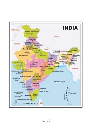
- 6. Page 6 of 24 There are 8 Different Types of Maps: 1. Political Map A political map shows the state and national boundaries of a place. A political map does not have any topographic features. It also shows the location of cities, with respect to each other.
- 7. Page 7 of 24
- 8. Page 8 of 24 2. Physical Map A physical map is one which shows the physical features of a place or country, like rivers, mountains, forests and lakes. The physical features are usually shown in different colours. Rivers and lakes are shown in blue. Places of low elevation are shown in dark green and as the elevation increases, the color becomes light green and eventually orange. Mountains are shown in brown.
- 9. Page 9 of 24
- 10. Page 10 of 24 3. Topographic Map Topographic maps are similar to physical maps, which show the physical features of an area. In topographic maps, differences in elevation and changes in landscape are shown with the help of contour lines and not colours.
- 11. Page 11 of 24
- 12. Page 12 of 24 4. Climatic Map A climatic map shows the information about the climate of different areas. It shows areas which receive: More rainfall Snow or Have dry weather Humid weather Temperate weather It uses colours to depict areas with different climate.
- 13. Page 13 of 24
- 14. Page 14 of 24
- 15. Page 15 of 24 5. Economic/Resource Map Economic/Resource mapsshow the different economic activity (crops grown or minerals found i.e. natural resources) in that region. The map could be on anything such as agriculture, manufacturing, mining, and other economic activities of a region. Shading or colour indicates the land location devoted to the particular activity. Cartographers use symbols to show the location of natural resources.
- 16. Page 16 of 24
- 17. Page 17 of 24 6. Road Map Road map is the most widely used map which shows different roads, highways or railways present in the area. It is a very detailed map and is generally used for direction purposes. Road maps are usually made individually (of a single city) i.e. city-wise. There are road maps present for an entire country too, but they cannot be made very detailed.
- 18. Page 18 of 24
- 19. Page 19 of 24
- 20. Page 20 of 24 7. Maps for location on Earth On many maps you see crisscrossing lines with numbers written besides them. The lines running east to west around the Earth are called lines of Latitude. They measure degrees north and south of the Equator. The lines running north to south around the Earth are called lines of Longitude. They measure degrees east and west of the Prime Meridian.
- 21. Page 21 of 24
- 22. Page 22 of 24 8. Maps for location on Earth (Contd.) These lines and numbers form a grid system that allows us to describe the absolute, or exact location of any place on Earth. Together, lines of latitude and longitude form a grid system called the Coordinate system. When you state the coordinates of a place on the Earth you are giving its absolute location.
- 23. Page 23 of 24
- 24. Page 24 of 24 But I bet the best map is the Road Map to your House from anywhere in the world.