The integration of space born and ground remotely sensed data in exploring the environmental stresses and deterioration in ras gharib area, gulf of suez, egypt
Spatial variability of nutrients (N, P) in a deep, temperate lake with a low trophic level supported by global navigation satellite systems, geographic information system and geostatistics
evaluation of water resources in wadi el natrun, western desert, egyptIJEAB
Groundwater of the Pliocene aquifer in Wadi El Natrun area represents the primary source of reliable water for drinking and agriculture uses. This research focuses on the study of the different sources of water in the study area and determines the origin and quality of this waterand also is interested in studying hydrogeochemical processes that affect them and the movement of water through the analysis and determine the activity of different elements, and also to changes in hypothetical salts with the direction of water flow in three sectors of the region and the statement of the most important geochemical processes that occur. Finally it is evaluated the suitability of the water for different purposes. The results show that, there is a zonation of chemical composition; this zonation is characterized by a change of cation species from dominantly Ca and Mg near the east to Na-dominated waters in the west. Mirroring this, anions change from HCO3 type to Cl and SO4 type.The ions displays two grades of metasomatism along flow path, first the stage of mineralization(HCO3>Cl>So4) at the east then the advanced stage of mineralization (Cl>SO4 >HCO3) at the west. According to the(W.H.O.2005), 45 % of tested groundwater samples are permissible for drinking. Most groundwater samples of the Pliocene according to SAR andRSC are suitable for irrigation purposes under normal condition, but all surface water samples (lakes) are saline water,so it is not valid for drinking or irrigation purposes.
The Quality of Ground Water for Selected Area in South of Babylon Governorate...iosrjce
City of Hillasuffers from the high shallow groundwater levels which causes serious problems to
agricultural and civil construction activities. five different tracks perpendicular to Shatt Al-Hilla channel are
selected beside large number of hand dug wells within the area to monitor the relationships among the levels of
water between these two water resources during one year,the results of many hydrochemical parameters
confirm the similar pattern of inter-relationships between the two water bodies. According to hydrogeochemical
measurements ,we find that the proportion of sulfates rate for these wells high and it hurts in the use of water
for several purposes ,the ratio of chlorides and other high and this shows that the water wells unfit for uses of
Agriculture purposes, but there is one well we have that shows the proportion of chlorides is a few , a high
proportion of sulfates From Sholler classification of study area with high concentration of Na +k and SO4was
observed because of the Fat'ha Formation, which contains gypsum, anhydrite and dolomite , are believed to be
the major source of SO4 and Mg in the water
Geophysical techniques work through applying one of several types of force to the ground, to measure the
resulting energy with use of geophysical equipment and infer the geology from this. Geophysics is generally
much quicker than the aforementioned methods, however, requires more data processing (oìce-based work)
to develop the geological picture. A great advantage of these methods is that certain instruments can be
attached to small aircraft for covering large areas during regional airborne surveys. This provides sparser
geological information, but can highlight potential metal anomalies on a county-country scale, which can be
followed up by more detailed, ground-based geophysical surveys. However, as the material is being tested
indirectly, there is no 100% guarantee of its conclusions; in addition to being susceptible to contamination by
many man-made metallic structures e.g. power-lines. Therefore, should geophysical surveys prove suìciently
interesting, drilling will be required afterwards to conêrm the accuracy of the results.
Geohydrological study of weathered basement aquifers in Oban Massif and envir...iosrjce
The focus of this research is to model the geohydrology of the precambrian Oban Massif using
geospatial techniques. Groundwater control indicators such as geology, geomorphology, drainage density,
lineament density, land use / land cover and slope steepness were derived from landsat ETM+
imagery, ASTER
DEM and SRTM DEM. Image processing software such as ENVI 3.2, ARC GIS9.2 and PCI Geomatica were
used for image processing , digitizing and lineament density computation respectively. Weighted averages of the
groundwater controlling factors were used to produce thematic maps of geology, lineament density, drainage
density, slope steepness, land use/land cover and geomorphological units. The thematic maps were overlaid in a
GIS environment to model the ground water potential map of the area. Arc GIS, Arc View and Map Info were
used for geographic Information System analysis. ERDAS imagine 8.6 and ENVI 4.2 were used for
georeferencing, image analysis and coordinate transformation. ASTER DEM was used for analysis of
geomorphology. For vegetation, discrimination in land cover / land use mapping band 4: 3: 2 for landsat ETM+
was used. Unsupervised was used to have a general idea of the area. Supervised classification was used for
final land use/ land cover mapping. Result show that geology, lineament density, and slope steepness are the
most influential groundwater controlling factors of groundwater potential. Their degree of influence can be
summarized as geology > lineament density> slope>geomorphology>drainage density>land use / land cover.
From the groundwater potential map, four groundwater potential zones: very good, moderately good, fair and
poor. Successful boreholes drilled in the groundwater favourable potential areas should be reticulated to the
neighbourhood with poor groundwater potentials to salvage groundwater problem in the study area.
Generally, the reconstitution of palaeo-geography and related environments
is based on the study of sediment markers such as grain size and clay mineralogy. In
this research, 90 surface and subsurface sediment samples from eight cores were
analyzed for grain size and clay mineralogy in southern part of Urmia lake coast and
adjacent areas. Abundant minerals are quartz, feldspars, calcite and dolomite. Heavy
minerals identified were epidote, hornblende and zircon. Clay minerals are Kaolinite
and Smectite mainly. Clay mineralogy and mean grain size of sediments in eight cores
of Urmia Lake; reflect climatic conditions in this region. Relatively coarse sediments
usually deposited during Urmia Lake low stands and relatively fine sediments
deposited during high stands. The mineralogy of the clay-size fraction was determined
by X-ray diffraction (XRD). Mineral assemblages display two climate conditions: Those
having large Kaolinite, quartz, and feldspar peaks but a small smectite peak
(interpreted to be cold times), and those with small Kaolinite, quartz and feldspar
peaks and a large smectite peak-(warm sediments). In addition, smectite content
correlate well with high mean grain size in Urmia Lake sediments, whereas sediments
rich in Kaolinite, quartz, and feldspar correlate well with finer mean grain size.
Chemical elements of the total sample are mainly of terrigenous origin, supplied by
“Discharge Rivers”, which discharges in Urmia Lake. Variations in clay mineralogy and
grain size didn’t indicate that the lake-level variations and nature of sediments
delivered to the lake vary in concert with global climate changes, recently. Human
activities such as Dams’ constructions and agriculture have probably induced
variations in the mobilization of chemical elements.
Methods and stages of Mineral Exploration: Adaptive Resource Management PlanNgatcha Bryan
Exploration can be divided into a number of interlinked and sequential stages which involve increasing
expenditure and decreasing risk. Early stages of exploration are planning and prospecting. The planning
stage covers the selection of commodity, type of deposit, exploration methods, and the seĴing up of an
exploration entity. Prospecting covers activities leading to the selection of an area for detailed ground
work; this is the point at which land is acquired. The subsequent stages involve targeted prospecting and
exploration in order to quantify and qualify the mineral resources. Pre-feasibility study is then
performed for evaluating the commercial viability of the deposit (Adapted from Moon et al., 2006).
Assessment of Spatial and Temporal Variations of Soil Salinity using Remote S...Hamdi Zurqani
“The aim of this paper is to identify the change in saline soils (Sebkha) using Remote Sensing (RS) and geographic information system (GIS) techniques”.
Image interpretation is related with the identification of remote sensed objects or images and knowing about their significance. To see the useful result of image interpretation the primary tasks are Detection, Identification, Measurement, Problem solving.
Lecture 1 for Digital Image Processing (2nd Edition)Moe Moe Myint
-What is Digital Image Processing?
-The Origins of Digital Image Processing
-Examples of Fields that Use Digital Image Processing
-Fundamentals Steps in Digital Image Processing
-Components of an Image Processing System
Research Inventy : International Journal of Engineering and Science is published by the group of young academic and industrial researchers with 12 Issues per year. It is an online as well as print version open access journal that provides rapid publication (monthly) of articles in all areas of the subject such as: civil, mechanical, chemical, electronic and computer engineering as well as production and information technology. The Journal welcomes the submission of manuscripts that meet the general criteria of significance and scientific excellence. Papers will be published by rapid process within 20 days after acceptance and peer review process takes only 7 days. All articles published in Research Inventy will be peer-reviewed.
Evaluation of Heterogeneous Aquifers in Crystalline Rocks from Resistivity So...theijes
The International Journal of Engineering & Science is aimed at providing a platform for researchers, engineers, scientists, or educators to publish their original research results, to exchange new ideas, to disseminate information in innovative designs, engineering experiences and technological skills. It is also the Journal's objective to promote engineering and technology education. All papers submitted to the Journal will be blind peer-reviewed. Only original articles will be published.
Identification Of Soil Erosion Prone Zones Using Geomatics Technology In Part...IJERA Editor
Soil erosion is the removal and subsequent loss of soil by the action of water, ice, wind and gravity. Soil erosion is a process that occurs naturally at a slow rate. The average natural geologic rate of soil erosion is approximately 0.2 tons per acre per year. Erosion is the process were by the earth or rock is loosened or dissolved and removed from any part of earth‟s surface. Geological erosion is the rate at which the catchment or land would normally be eroded without any disturbance by human activity. If man alters the natural system by means of various land use practices that is caused accelerated erosion. The present study area is covering Parts of North Arcot The area is lies between E78°30'-E78°45' lattitudes N12°15'-N12°30„. The total aerial extent of the study area is 720 sq.km. It falls in the survey of India Toposheet 58 L11 on 1:50,000 scale. The IRS – 1D satellite imagery data were subjected to different types of image enhancement techniques and soil erosion areas were mapped out and GIS databases were generated showing the soil erosion areas using Arc Map 9.1 version. GIS overlay function was executed between soil erosion prone areas and the various controlling variables and the area has been fragmented into a number of polygons of land segments depending upon the controlling variables. Finally, the remedial measures were suggested for each land segment according to the controlling variables.
Geostatistical approach to the estimation of the uncertainty and spatial vari...IOSR Journals
Abstract. This article presents a case of application of geostatistical methods in geotechnical engineering:
There is a railway platform, going to be built on compressible soils which presents important settlement.
Geotechnical data were analyzed by a geostatistical approach using GIS software to characterize the spatial
variability of the thickness of the compressible soils and their deformation Module.
Then these data were crossed with settlement calculations by oedometer method to estimate the distribution of
soil compaction on the entire site.
Key words: Morocco, Kenitra, geotechnical studies, settlement, geostatistics, kriging.
Artificial Recharge to Alluvial Aquifer, Northeastern Nuba Mountains, Sudan.IJRES Journal
Many engineering geology and structural geology aspects have been used in this study, to point out the suitability of the site for artificial recharge to alluvial aquifer, such as; rocks and soil types, seepage rate, structures and lineaments. The area is under lied by basement rocks with considerable thickness (10 to 15 m) of alluvial deposit. Overall soil type is sandy soil and its seepage rate is 34.56 Liter per hour. The most existing lineaments are trending toward NW direction while rocks foliation dipping toward WWN direction. The site is satisfied to be artificial recharge.
Integrated ERT and Magnetic Surveys in a Mineralization Zone in Erkowit - Red...IJERA Editor
The present study focus on integrated geophysical surveys carried out in the mineralization zone in Erkowit region, Eastern Sudan to determine the extensions of the potential ore deposits on the topographically high hilly area and under the cover of alluvium along the nearby wadi and to locate other occurrences if any. The magnetic method (MAG) and the electrical resistivity tomography (ERT) were employed for the survey. Eleven traverses were aligned approximately at right angles to the general strike of the rock formations. The disseminated sulfides are located on the alteration shear zone which is composed of granitic and dioritic highly ferruginated rock occupying the southwestern and central parts of the area, this was confirmed using thin and polished sections mineralogical analysis. The magnetic data indicates low magnetic values for wadi sedimentary deposits in its southern part of the area, and high anomalies which are suspected as gossans due to magnetite formed during wall rock alteration consequent to mineralization. The significant ERT imagesdefinelow resistivity zone as traced as sheared zones which may associated with the main loci of ore deposition. The study designates that correlation of magnetic and ERT anomalies with lithology are extremely useful in mineral exploration due to variations in some specific physical properties of rocks.
The International Journal of Engineering & Science is aimed at providing a platform for researchers, engineers, scientists, or educators to publish their original research results, to exchange new ideas, to disseminate information in innovative designs, engineering experiences and technological skills. It is also the Journal's objective to promote engineering and technology education. All papers submitted to the Journal will be blind peer-reviewed. Only original articles will be published.
Research Inventy : International Journal of Engineering and Science is published by the group of young academic and industrial researchers with 12 Issues per year. It is an online as well as print version open access journal that provides rapid publication (monthly) of articles in all areas of the subject such as: civil, mechanical, chemical, electronic and computer engineering as well as production and information technology. The Journal welcomes the submission of manuscripts that meet the general criteria of significance and scientific excellence. Papers will be published by rapid process within 20 days after acceptance and peer review process takes only 7 days. All articles published in Research Inventy will be peer-reviewed.
Final project report on grocery store management system..pdfKamal Acharya
In today’s fast-changing business environment, it’s extremely important to be able to respond to client needs in the most effective and timely manner. If your customers wish to see your business online and have instant access to your products or services.
Online Grocery Store is an e-commerce website, which retails various grocery products. This project allows viewing various products available enables registered users to purchase desired products instantly using Paytm, UPI payment processor (Instant Pay) and also can place order by using Cash on Delivery (Pay Later) option. This project provides an easy access to Administrators and Managers to view orders placed using Pay Later and Instant Pay options.
In order to develop an e-commerce website, a number of Technologies must be studied and understood. These include multi-tiered architecture, server and client-side scripting techniques, implementation technologies, programming language (such as PHP, HTML, CSS, JavaScript) and MySQL relational databases. This is a project with the objective to develop a basic website where a consumer is provided with a shopping cart website and also to know about the technologies used to develop such a website.
This document will discuss each of the underlying technologies to create and implement an e- commerce website.
Sachpazis:Terzaghi Bearing Capacity Estimation in simple terms with Calculati...Dr.Costas Sachpazis
Terzaghi's soil bearing capacity theory, developed by Karl Terzaghi, is a fundamental principle in geotechnical engineering used to determine the bearing capacity of shallow foundations. This theory provides a method to calculate the ultimate bearing capacity of soil, which is the maximum load per unit area that the soil can support without undergoing shear failure. The Calculation HTML Code included.
Industrial Training at Shahjalal Fertilizer Company Limited (SFCL)MdTanvirMahtab2
This presentation is about the working procedure of Shahjalal Fertilizer Company Limited (SFCL). A Govt. owned Company of Bangladesh Chemical Industries Corporation under Ministry of Industries.
CFD Simulation of By-pass Flow in a HRSG module by R&R Consult.pptxR&R Consult
CFD analysis is incredibly effective at solving mysteries and improving the performance of complex systems!
Here's a great example: At a large natural gas-fired power plant, where they use waste heat to generate steam and energy, they were puzzled that their boiler wasn't producing as much steam as expected.
R&R and Tetra Engineering Group Inc. were asked to solve the issue with reduced steam production.
An inspection had shown that a significant amount of hot flue gas was bypassing the boiler tubes, where the heat was supposed to be transferred.
R&R Consult conducted a CFD analysis, which revealed that 6.3% of the flue gas was bypassing the boiler tubes without transferring heat. The analysis also showed that the flue gas was instead being directed along the sides of the boiler and between the modules that were supposed to capture the heat. This was the cause of the reduced performance.
Based on our results, Tetra Engineering installed covering plates to reduce the bypass flow. This improved the boiler's performance and increased electricity production.
It is always satisfying when we can help solve complex challenges like this. Do your systems also need a check-up or optimization? Give us a call!
Work done in cooperation with James Malloy and David Moelling from Tetra Engineering.
More examples of our work https://www.r-r-consult.dk/en/cases-en/
Hierarchical Digital Twin of a Naval Power SystemKerry Sado
A hierarchical digital twin of a Naval DC power system has been developed and experimentally verified. Similar to other state-of-the-art digital twins, this technology creates a digital replica of the physical system executed in real-time or faster, which can modify hardware controls. However, its advantage stems from distributing computational efforts by utilizing a hierarchical structure composed of lower-level digital twin blocks and a higher-level system digital twin. Each digital twin block is associated with a physical subsystem of the hardware and communicates with a singular system digital twin, which creates a system-level response. By extracting information from each level of the hierarchy, power system controls of the hardware were reconfigured autonomously. This hierarchical digital twin development offers several advantages over other digital twins, particularly in the field of naval power systems. The hierarchical structure allows for greater computational efficiency and scalability while the ability to autonomously reconfigure hardware controls offers increased flexibility and responsiveness. The hierarchical decomposition and models utilized were well aligned with the physical twin, as indicated by the maximum deviations between the developed digital twin hierarchy and the hardware.
NO1 Uk best vashikaran specialist in delhi vashikaran baba near me online vas...Amil Baba Dawood bangali
Contact with Dawood Bhai Just call on +92322-6382012 and we'll help you. We'll solve all your problems within 12 to 24 hours and with 101% guarantee and with astrology systematic. If you want to take any personal or professional advice then also you can call us on +92322-6382012 , ONLINE LOVE PROBLEM & Other all types of Daily Life Problem's.Then CALL or WHATSAPP us on +92322-6382012 and Get all these problems solutions here by Amil Baba DAWOOD BANGALI
#vashikaranspecialist #astrologer #palmistry #amliyaat #taweez #manpasandshadi #horoscope #spiritual #lovelife #lovespell #marriagespell#aamilbabainpakistan #amilbabainkarachi #powerfullblackmagicspell #kalajadumantarspecialist #realamilbaba #AmilbabainPakistan #astrologerincanada #astrologerindubai #lovespellsmaster #kalajaduspecialist #lovespellsthatwork #aamilbabainlahore#blackmagicformarriage #aamilbaba #kalajadu #kalailam #taweez #wazifaexpert #jadumantar #vashikaranspecialist #astrologer #palmistry #amliyaat #taweez #manpasandshadi #horoscope #spiritual #lovelife #lovespell #marriagespell#aamilbabainpakistan #amilbabainkarachi #powerfullblackmagicspell #kalajadumantarspecialist #realamilbaba #AmilbabainPakistan #astrologerincanada #astrologerindubai #lovespellsmaster #kalajaduspecialist #lovespellsthatwork #aamilbabainlahore #blackmagicforlove #blackmagicformarriage #aamilbaba #kalajadu #kalailam #taweez #wazifaexpert #jadumantar #vashikaranspecialist #astrologer #palmistry #amliyaat #taweez #manpasandshadi #horoscope #spiritual #lovelife #lovespell #marriagespell#aamilbabainpakistan #amilbabainkarachi #powerfullblackmagicspell #kalajadumantarspecialist #realamilbaba #AmilbabainPakistan #astrologerincanada #astrologerindubai #lovespellsmaster #kalajaduspecialist #lovespellsthatwork #aamilbabainlahore #Amilbabainuk #amilbabainspain #amilbabaindubai #Amilbabainnorway #amilbabainkrachi #amilbabainlahore #amilbabaingujranwalan #amilbabainislamabad
Student information management system project report ii.pdfKamal Acharya
Our project explains about the student management. This project mainly explains the various actions related to student details. This project shows some ease in adding, editing and deleting the student details. It also provides a less time consuming process for viewing, adding, editing and deleting the marks of the students.
Immunizing Image Classifiers Against Localized Adversary Attacksgerogepatton
This paper addresses the vulnerability of deep learning models, particularly convolutional neural networks
(CNN)s, to adversarial attacks and presents a proactive training technique designed to counter them. We
introduce a novel volumization algorithm, which transforms 2D images into 3D volumetric representations.
When combined with 3D convolution and deep curriculum learning optimization (CLO), itsignificantly improves
the immunity of models against localized universal attacks by up to 40%. We evaluate our proposed approach
using contemporary CNN architectures and the modified Canadian Institute for Advanced Research (CIFAR-10
and CIFAR-100) and ImageNet Large Scale Visual Recognition Challenge (ILSVRC12) datasets, showcasing
accuracy improvements over previous techniques. The results indicate that the combination of the volumetric
input and curriculum learning holds significant promise for mitigating adversarial attacks without necessitating
adversary training.
Immunizing Image Classifiers Against Localized Adversary Attacks
The integration of space born and ground remotely sensed data
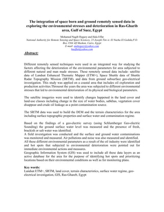
1. The integration of space born and ground remotely sensed data in exploring the environmental stresses and deterioration in Ras-Gharib area, Gulf of Suez, Egypt
Mohamed Nagib Hegazy and Hala Effat
National Authority for Remote Sensing and Space Sciences, 23 Joseph Tito st. El Nuzha El Gedida,P.O. Box 1564 Alf Maskan, Cairo, Egypt
E-mail: mnhegazy@yahoo.com
haeffat@yahoo.com
Abstract:
Different remotely sensed techniques were used in an integrated way for studying the factors affecting the deterioration of the environmental parameters for area subjected to different natural and man made stresses. These remotely sensed data include: satellite data of Landsat Enhanced Thematic Mapper (ETM+), Space Shuttle data of Shuttle Radar Topography Mission (SRTM), and data from ground subsurface geo-electrical investigation. This study was applied on a coastal area that includes oil exploration and production activities.Throuout the years the area was subjected to different environmental stresses that led to environmental deterioration of its physical and biological parameters.
The satellite imageries were used to identify changes happened in the land cover and land-use classes including change in the size of water bodies, sabkhas, vegetation cover disappear and crude oil leakage as a point contamination source.
The SRTM data was used to build the DEM and the terrain characteristics for the area including surface topographic properties and surface water and contamination regime.
Based on the findings of a geo-electric survey (using Schlumberger Geo-electric Sounding) the ground surface water level was measured and the presence of fresh, brackish or salt water was identified.
A field investigation was conducted and the surface and ground water contaminations was monitored and measured. Air pollutions and noise was also measured and identified.
All these different environmental parameters as a result of the oil industry were identified and hot spots that subjected to environmental deterioration were pointed out for immediate environmental actions and measures.
Geographic Information System (GIS) was used to include all these data layers as an active database for the area for the purpose of identifying hot spots and prioritizing locations based on their environmental conditions as well as for monitoring plans.
Key words:
Landsat ETM+, SRTM, land cover, terrain characteristics, surface water regime, geo- electrical investigation, GIS, Ras-Ghareb, Egypt
2. 1. Assessment Methodology
1.1 Approach
1.1.1 Remote Sensing
Satellite images were obtained and analyzed to get acquainted with the drainage basins, flood routes and general ecology of the area.
Two different types of remotely sensed data were used for the production of the physical environment baseline maps:
- A Shuttle Radar Topography Mission Scene (SRTM) of a resolution of 3 Arc. Second was used to produce all the terrain characteristics maps.
- Two Landsat Scenes were used to conduct this study. The first is a TM image acquired on 1984 while the second is an ETM+ acquired on 2000.
Data processing was carried out using two powerful wide-spread software:
- ERDAS IMAGINE Version 8.7 for remotely sensed data processing.
- ARC/GIS Version 9.0 for Geographic Information Systems.
Using different satellite data, field studies, measurements and verifications, different thematic maps for the physical environment baseline were produced.
1.1.2 Geophysical Survey
The geophysical survey comprised electrical exploration of the geological and hydrogeological features of the area. The survey dealt with the electrical state of the earth and provided conclusions concerning the electrical properties of rocks and minerals under different geological environments, as well as their influences upon various geological phenomena.
The resistivity method was carried out using Schlumberger configuration (vertical electrical sounding) to detect the subsurface geologic sections and to determine the thickness of the different lithologic layers through the subsurface sections. In this method, an electric current (a direct or very low frequency alternating current) is introduced into the ground by two or more electrodes and the potential difference is measured between two points (probes) suitably chosen with respect to the current electrodes. The potential difference for a unit current sent through the ground is a measure of electrical resistance of the ground between the probes (Battacharya and Patra, 1968).
More details about the application of the method and interpretation of data are presented in Annex 2.
1.1.3 Surface Water Sampling
Six locations were identified in the exposed surface waters and salt marshes of Area "A". Samples were collected for laboratory analysis. The objective of the sampling exercise was to acquire quantifiable characterization of the surface
3. water quality and to assess the impacts, in relation to Area "A" operations.
Grab samples were collected from the six locations on 17th of April and were transported to laboratory on the same day for analysis. The samples were analyzed for chemical parameters (COD, TDS, TKN, oil and grease, H2S, heavy metals, TOC, and BTEX).
1.1.4 Groundwater and Soil Sampling
Groundwater level and flow characteristics were assessed by the geophysical survey as mentioned in Section 2.1.4. According to the basins of the area, slopes and aspect, 15 locations were identified for drilling groundwater monitoring wells. These 15 locations were selected to detect the fate of spills resulting from the activities at the four oil fields.
Four other locations were identified for drilling boreholes and collecting soil samples. The objectives of the boreholes were to identify the depth of soil impacted by oil spills from storage tanks in block stations. Furthermore, four other locations were selected for excavating trial pits in order to take shallow soil samples from certain areas.
2. Description of the Environment
2.1 Geology and Hydrogeology
2.1.1 Regional Geology
The studied area is composed of three main geomorphic units; namely from west to east: (1) mountain terrain, (2) pediment, and (3) coastal plain.
The mountain terrain occupies an area twice that of the low-lying terrain (including pediment and coastal plain). It is built up of high altitudes, up to 1745 m ASL (Gabal Gharib), more or less coherently trending parallel to the coast and interrupted by a number of detached masses and peaks. It is composed essentially of crystalline Precambrain rocks, dominated by Granitoid rocks and Metavolcanics, and subordinate upper Cretaceous sedimentary succession. On the other hand, the low-lying terrain is gently sloping and is covered mainly by Quaternary deposits and less dominantly by low-lying beds of upper Cretaceous, Miocene and Pliocene sedimentary units. The boundary between mountains and low-lying terrain is distinct and runs commonly along NNW-SSE trending normal faults. Fractures (including faults and joints) are the dominant structural elements present. The density and persistence of the mapped fractures are variable. They attain different extensions and directions, and strike mainly NE (N30-40E), NNW (N20-30W) or NNE (N10-20E).
4. 2.1.2 Drainage Network
The drainage network of the Ras Gharib area (Figure 4-3), as a whole, is external, well-developed, highly integrated, variably dense, and partially affected by the structural grain of the district.
The drainage system, dissecting the mountainous terrain, is narrow, persistent, deep, and steep sided, highly integrated and ramified. It is dominated by dendritic and trellis patterns. Faults and fractures control large parts of the main streams and their tributaries. On the other hand, the drainage system, crossing the peneplained terrain, is wide, shallow and tributaries are rather long. It is arranged in parallel, braided and dichotomic fashions.
The drainage network of the study area is composed principally of a number of large hydrographic basins.
5. Wadi tributary maps of different orders show that:
(1) The characteristics and patterns of wadis draining the mountainous terrain differ grossly from those draining the low-lying terrain,
(2) Low order wadis in the mountainous terrain are relatively short and partly oriented due to structural and/ lithological control.
The Quaternary fluviatile deposits map indicates that:
(1) The fluviatile deposits occupy more than 50% of the total area, which are suitable for grazing after rainfall,
(2) The fluvial plains attain different forms (linear and irregular), widths, orientations, angles of junction and angularity,
(3) The wide alluvial plains present in the mountainous terrain probably represent shallow basins or old dry lakes (local base levels), which are mostly suitable to act as unconfined shallow groundwater reservoirs, and
(4) Large segments of the alluvial plains, particularly those in the crystalline basement rocks are linear and mostly guided by fractures and faults. Such segments are forecasted as suitable zones for shallow groundwater, particularly at fault intersections.
2.1.3 Hydro-Morphometric Analysis
The geo-morphological parameters of the basins and the hydro-morphometric analysis of these data indicate that these basins are of high flooding probability and low groundwater potential. It means that the effect of surface, or near surface, runoff is higher than that of groundwater in terms of point contamination from oil surface leakage allover the area.
Flash flood-vulnerable sites along the boundary of the Area "A" are identified and pointed out in Figure 4-4.
6. 2.1.4 Groundwater
The alluvium deposits in Ras Gharib-Ras Gemsa represent an insignificant water bearing formation, which is locally detected, in the coastal plain, e.g. Ras Gharib area. It is lithologically composed of coarse to very coarse sand and gravel with minor clay streaks. The thickness varies from few meters to about 200m (Gharib area). Generally, this thickness increases towards the Gulf of Suez. The water salinity of the alluvium aquifer ranges around 8.36 g/l (Gharib costal-western well). Generally, the salinity (mainly sodium chloride) of the water increases towards the Gulf of Suez, this is due to seawater intrusion, as well as the leaching processes. According to the results of the geophysical survey carried out at Area "A", the following was concluded:
- The study area consists of several units, including a surface layer of high receptivity values. A polluted water zone exhibiting different thicknesses also exists. The polluted water zone is saturated with surface waters resulting from Area "A" operations.
- A sea water saturated zone exists at different depths and reflects very low receptivity values.
- Yosr and Shokeir Oil Fields are characterized by the presence of Sabkha layer (high gypsum and Halite soil)
- The groundwater saturated zone exists at a depth ranging from 5 to 22 meters
7. 2.2 Surface Water
Surface topography:
The surface topography was studied using SRTM DEM and ARC/GIS software to create different maps including elevation zones, aspect and slope maps Figures ( ).
8. A surface water body, existing within Area "A", is composed of a large salt marsh or "Sabkha". Parts of the sabkha are exposed (surface water lakes), while other parts are composed of shallow subsurface water (from 0.1 to 0.5 meters deep). The exposed surface water portion of the sabkha varies according to variation in water table.
The largest exposed surface water area (lake) of the Sabkha is located in the southern part of Area "A" (Shokeir field). The lake extends from near well Shokeir 8 up to a few kilometers to the northwest. Smaller sabkha lakes exist in different parts, from the eastern side (near the coastal road) to the western side (near the internal main road connecting Area "A" fields). The sabkha also includes salt concentration ponds, located between Um El Yosr and Shokeir fields. Photos 4-1 to 4-4 illustrate different parts of the sabkha.
The Sabkha occupies an area of about 57 km2. The area of the sabkha has increased in the past 20 years. Figure 4-5 illustrates the increase in sabkha area, which was estimated through digitizing and comparing a satellite image taken in 1984 with another one taken in year 2000. This increase, estimated as approximately 0.3 km2, mainly took place in the northern part near Um El Yusr block station.
9. The increase of sabkha area in the northern part is probably related to the discharge of produced water from Um El Yosr block station. The water is discharged to two large evaporation ponds (in series), to be finally dissipated to the sabkha. The physical nature and water quality were obviously affected by the discharges. Stretches of produced water with obvious oil contamination were detected in wide areas of the sabkha near Um El Yosr (Photos 4-5 and 46).
2.3 Groundwater Contamination
Features of the groundwater aquifers and drainage systems were determined through examining satellite images as well as through conducting a geophysical (geoelectric) survey. The survey concluded that depths to groundwater saturated zones in the four fields. Hydro-morphometric analysis indicated that pollutant transport in the area follows a horizontal surface, or near surface, runoff pattern rather than a vertical leaching pattern. As such, lower elevation areas in the drainage network are more subject to groundwater pollution impact resulting from spills. This particularly applies to the points where drainage lines intersect with the sabkha. Accordingly, 15 locations for establishing groundwater monitoring wells were identified around Area "A", where spills are likely to be detected. Some locations were selected in highlands in order to detect water quality variation with land altitude. Figure 5-6 presents the proposed locations of the monitoring wells.
2.3.1 Groundwater
-The results of the geophysical survey showed that the depth to the groundwater saturated
10. zone varies between 5 meters to 25 meters.
-Hydro-morphometric analysis indicated that pollutant transport in the area is taking horizontal surface, or near surface, runoff pattern rather than a vertical leaching pattern. Therefore, the locations where groundwater quality is most liable to be impacted by spills are at the intersections of the drainage lines with the sabkha body.
2.4. Results of the quantitative interpretation
The thirty vertical electrical sounding stations of the studied area are interpreted in terms of actual receptivity and depths for the encountered layers constituting the shallow section of the study area. This interpretation is carried out by using manual interpretation as an initial model for Sclumberger and IPI2win program. Accordingly, the varieties of limestone, which reflect higher values of resistivities, while. Groundwater saturated zone exhibit lower resistivity values. .Moreover, the sea water saturated zones reflect very low resistivity values. The interpretation of the vertical electrical sounding curves reveals that, the number of interpreted layers is ranged between four and seven layers. Also, the true resistivity values are carried from 0.1 to 25000 ohm.m. Added, the thicknesses of these layers are ranged from 0.225 to 122 m, as shown in Figures of the VES interpretation . The final result of the interpretation of the VES curves indicate that the study area consist of different layers such as surface layer of high resistivity values, polluted water saturated zone, groundwater saturated zone and sea water saturated zone can be indicated as follows:
1. The study area consists of several units such as surface layer of high receptivity values, the polluted water zone which saturated from the surface water from the processing stations, which exhibit different thicknesses.
2. Sea water saturated zone at different depths and reflect very low receptivity values.
3. Groundwater saturated zone at depth ranged from 5 to 22 meters.
4. Yusr and Shukeir Oil Fields characterized by the presence of Sabkha layer (high gypsum and Halite soil)
5. Dry zone, which show high receptivity values.
6. At kareem Oil Field the depth of the test wells must ranged from 10 to 15m.
11. 7. At Ayun Oil Field the depth of the test wells must ranged from 20 to 25m.
8. At yusr Oil Field the depth of the test wells must ranged from 10 to 15m.
9. At Shukeir Oil Field the depth of the test wells must ranged from 5 to 10m.
The study identified the major potential sources of contamination and mapped hot-spot areas Figure (), where visible contamination was detected.
Based on the findings of a geoelectric survey (using Schlumberger Geoelectric Sounding), the study identified 15 locations for collection of groundwater samples for analyses in order to reflect the state of groundwater contamination. Groundwater sampling and analyses was completed following the submission of the report. Accordingly, this addendum was prepared to present and discuss these findings.
2.1 Selection of Groundwater Monitoring Locations
The study area generally comprises several layers, including; a surface layer; a polluted water zone exhibiting different thickness, which is saturated with surface waters resulting from Area "A" operations; a sea water saturated zone at different depths; and, a Sabkha layer (high gypsum and Halite soil) characterizing Yosr and Shokeir Oil Fields. The groundwater saturated zone exists at a depth ranging from 5 to 22 meters as follows:
• Dry zone.
• Groundwater depth ranging from 10 to15m (Kareem Oil Field).
• Groundwater depth ranging from 20 to 25m (Ayoun Oil Field).
• Groundwater depth ranging from 10 to 15m (Yosr Oil Field).
• Groundwater depth ranging from 5 to 10m (Shokeir Oil Field).
The geo-morphological parameters of the drainage basins and the hydro-morphometric analysis carried out in the baseline study indicated that the basins are of high flooding
12. probability and low groundwater potential. This means that the effect of surface or near surface, runoff is higher than that of groundwater in terms of point contamination from oil surface leakage allover the area. In other words, the pollutant transport in the area is following a horizontal surface, or near surface, runoff pattern rather than a vertical leaching pattern.
Accordingly, the areas where maximum effect on groundwater quality, as result of pollutants spills in the area, are the low elevation areas within drainage network. This particularly applies to the points where drainage lines intersect with the sabkha. 15 locations were identified, using Geographic Information System (GIS), for groundwater analyses at these intersections to reflect the fate of spills resulting from the activities at the four oil fields. The selected locations were then prioritized, where seven locations were finally selected.
Figure: Groundwater monitoring locations
2.2 Well Preparation and Sample Collection
Monitoring wells were developed in accordance to ASTM standards. The wells were of 4” diameter and approximately 20 m in depth, within the subsurface saturated zone. No drilling fluids were used except for tap water and no fueling or lubricating of machinery was undertaken on sampling sites.
Wells were purged for 5 well volumes, requiring approximately 12 hours at 4 bars. Samples were collected by the laboratory technician and were stored in suitable containers, preserved in cool boxes at 4°C, and dispatched to the laboratory.
3. Results of Groundwater Sample Analyses
Table 1 below provides the results of the groundwater analyses. The table also provides Dutch threshold limits indicating the necessity for remedial action as follows:
14. 3.1 TPH and BTEX (Benzene, Toluene, Ethyle Benzene and Xylene)
Total petroleum hydrocarbons were measured to determine the concentration of petroleum in the soil. The results indicated the existence of low levels of TPH in the groundwater. BTEX, were also measured in the groundwater. The total measured BTEX levels were found lower than the intervention values of any of its individual components (Benzene,Toluene,EthyleBenzeneorXylene)
3.2 Heavy Metals
Zinc, chromium, selenium, arsenic, cyanide and mercury were found below the intervention values. Copper levels were found around the intervention values, whereas lead and cadmium are above the intervention values
4. Analysis of Results
In general, the results of the groundwater analyses were found consistent throughout the sampled locations, values exceeded the intervention levels for lead and cadmium in all the samples. However, highest levels of cadmium were found near Karim and Ayoun.
Groundwater analyses results also showed that the highest levels of BTEX and TPH were detected at well numbers 10 and 15 respectively, which are downstream Um El Yosr station.
It is expected that the high levels recorded at point 9 resulted from surface leakage (almost continuous) from the pipelines linking the oil fields to Shukeir station. This area is of lower altitude in comparison to the surroundings, which creates higher pressure on the pipelines, making it of more potential to leak.
Crude oil is generally composed of a wide range of hydrocarbons and a small amount of impurities. The composition of the crude varies significantly according to its source. Crude may also include different types of heavy metals including arsenic, cadmium, mercury and nickel. However, analyses of the crude oil produced in the area are unavailable. Moreover, the produced water during exploration and production activities could generally be a source of brine, petroleum hydrocarbons, natural radioactivity and heavy metals. Leaks, spills and releases of this water may contaminate both soil and groundwater. Heavy metals could also result from additives used in petroleum activities, disposal of drilling muds, disposal of batteries, transformers, etc.
15. Surface transport of petroleum wastes generally occurs when large amounts are discharged onto ground, especially in the existence of storm water runoff. Hydrocarbons move with surface runoff as they are lighter than water. Subsurface transport could occur above the water table or through the geologic formations (especially when abandoned wells are improperly plugged), where hydrocarbons, salt and heavy metals may flow into formations that contain fresh water.
In conclusion, the investigations proved that there has been a detectable negative impact on the groundwater quality. It is difficult to relate the contribution of each activity in the area to this impact. However, and as mentioned earlier, it is expected that the pollutants were transported, from their potential sources (production and other activities in the area), through surface and near surface runoff towards the lower elevation areas, which were selected for groundwater analyses. Figure 2 relates each monitoring location to its potential contamination source (represented in different colors) in the upstream area.
Currently, groundwater is of no use in the area as it is of high salinity. Surface water appears to be healthy, with the exception of the northern parts of the sabkha and other locations upstream operations in wells and block stations. The survey team could see fish living in these waters. It is expected that if the sources of pollution in the area are cleaned and discontinued, the quality of both surface and groundwater would improve with time.
Environmental Baseline Survey – Area "A” (Addendum)
Figure 2: Monitoring Points and their Relation to Identified Hotspots as well as their Relation to Oil and Other Activities