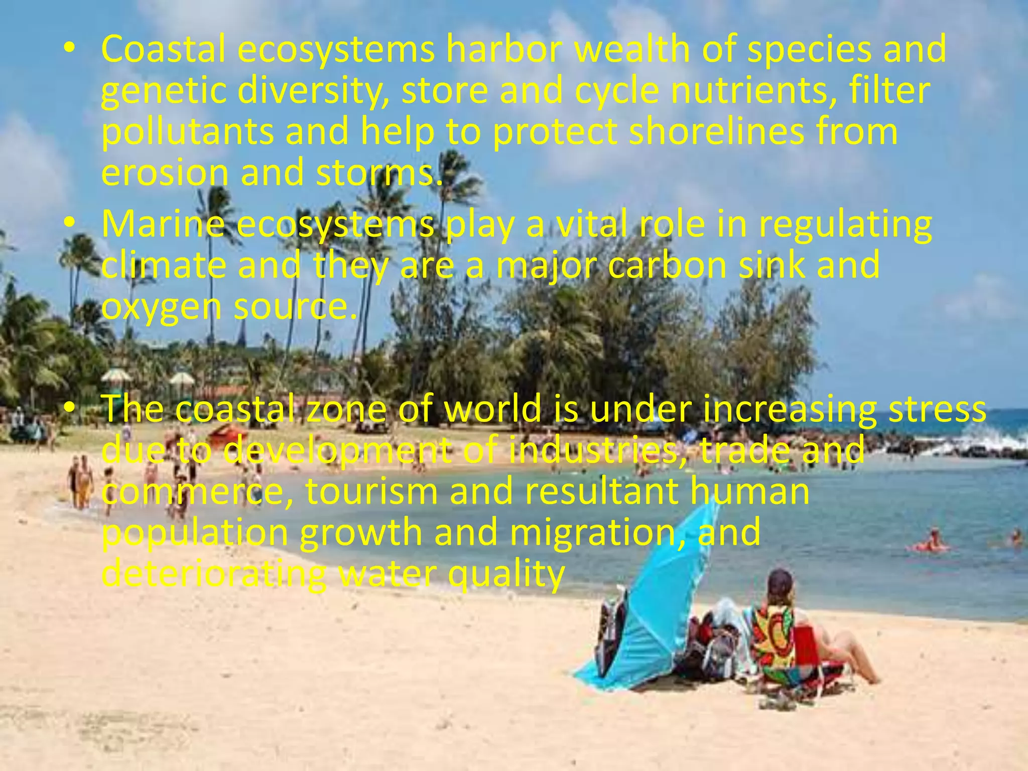
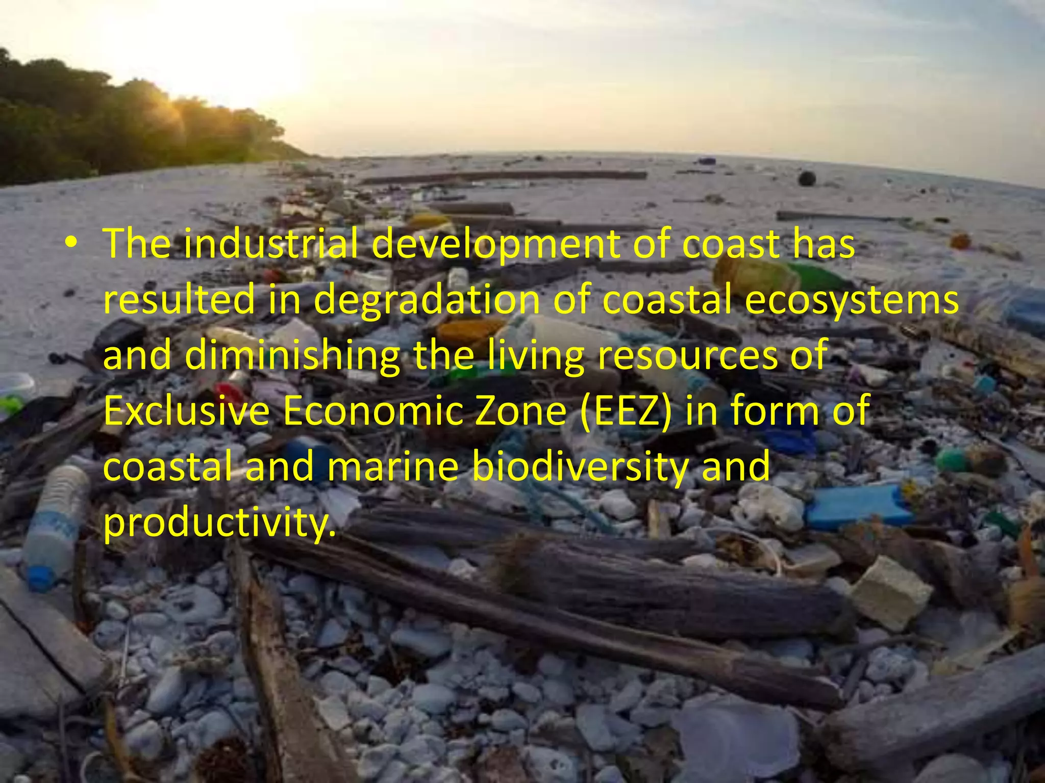
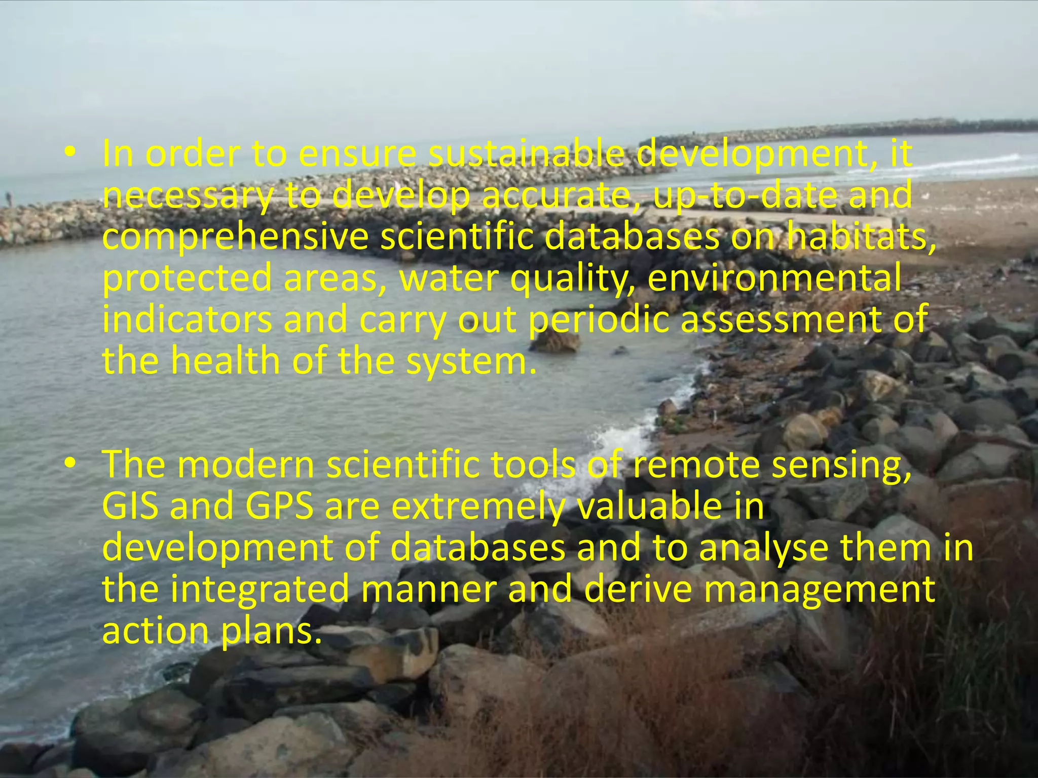
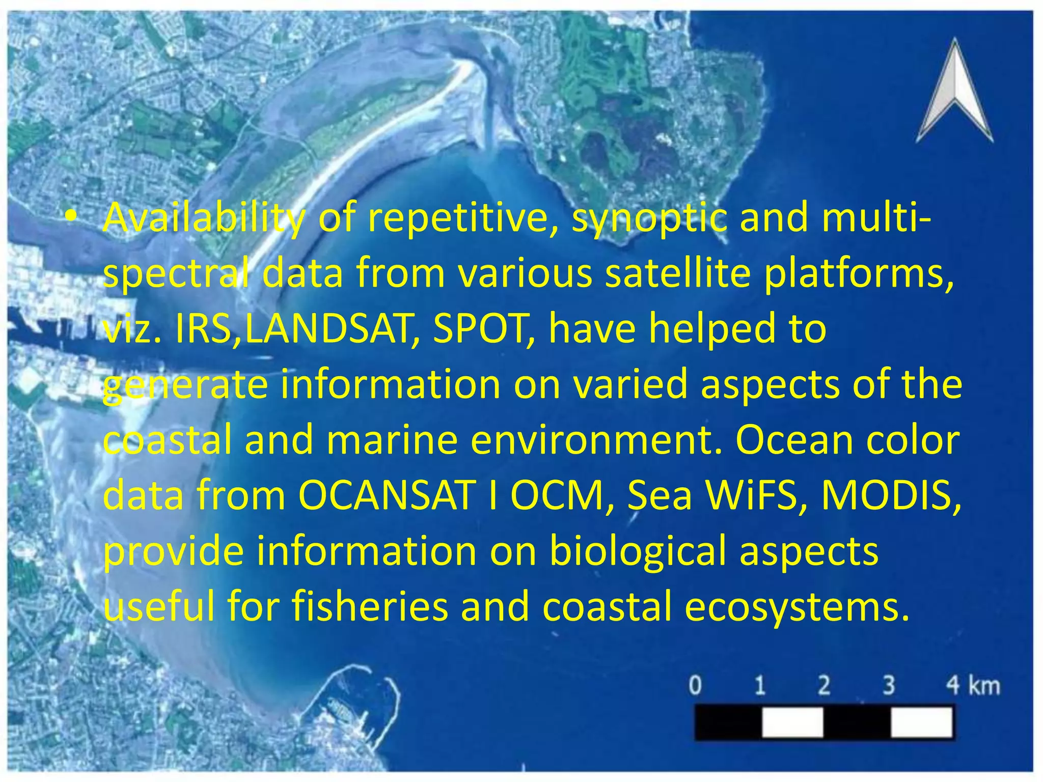
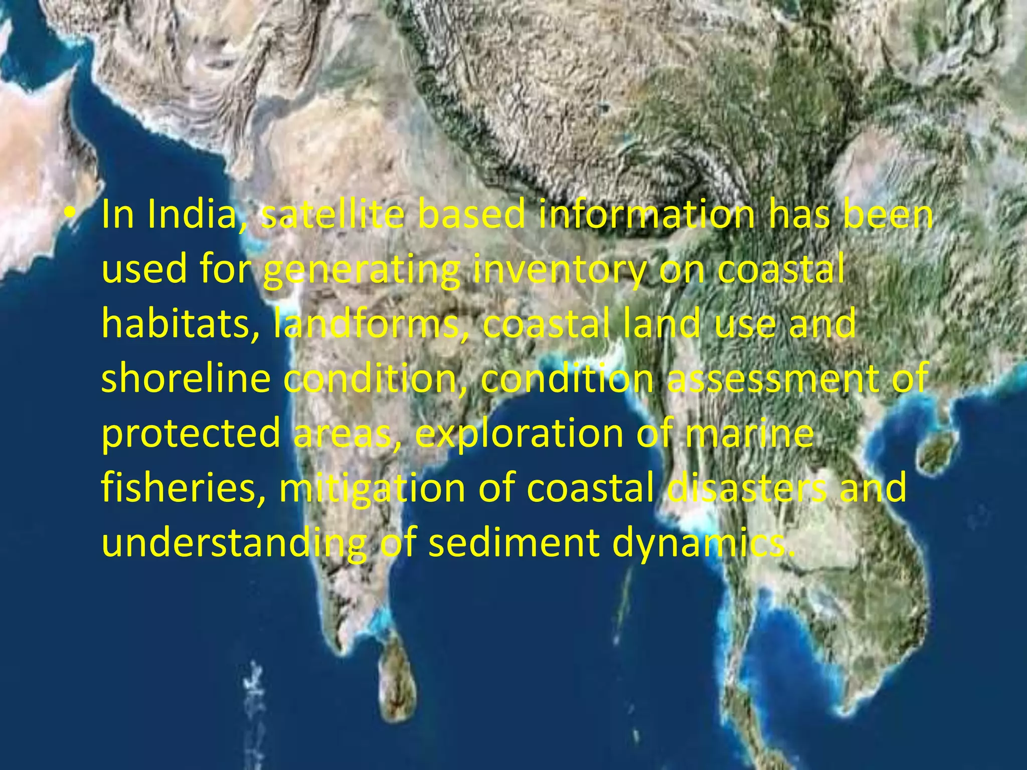
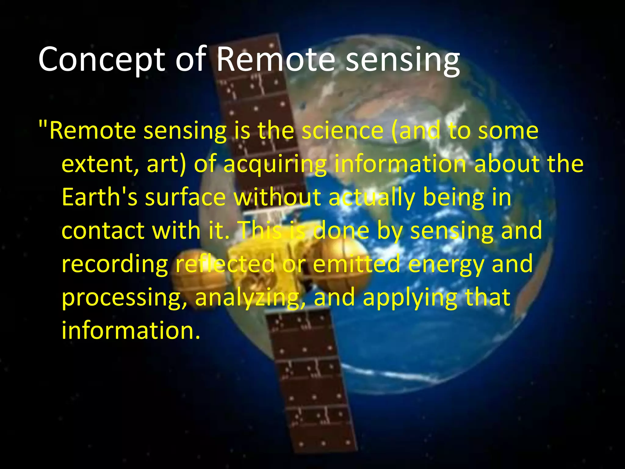
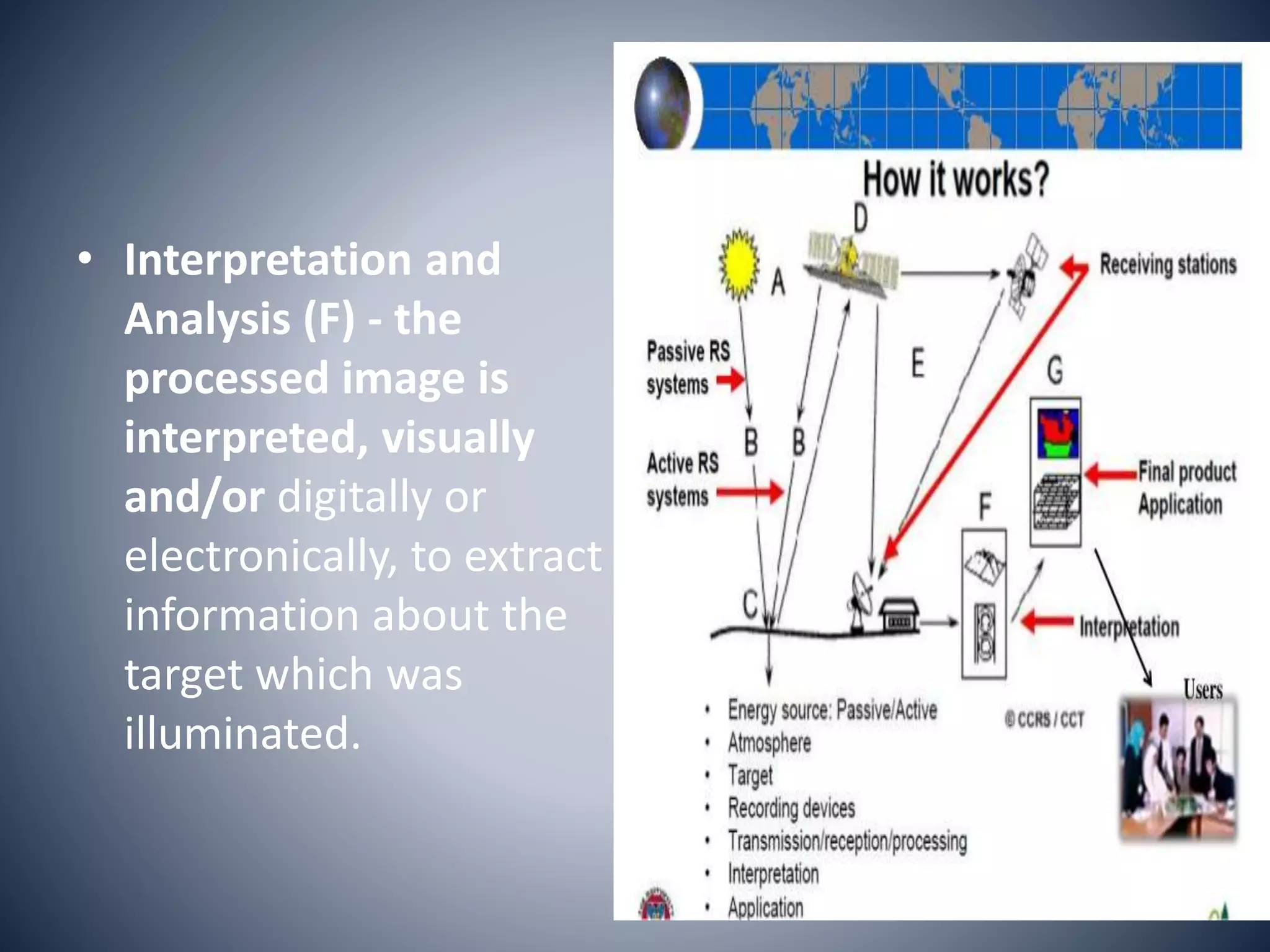
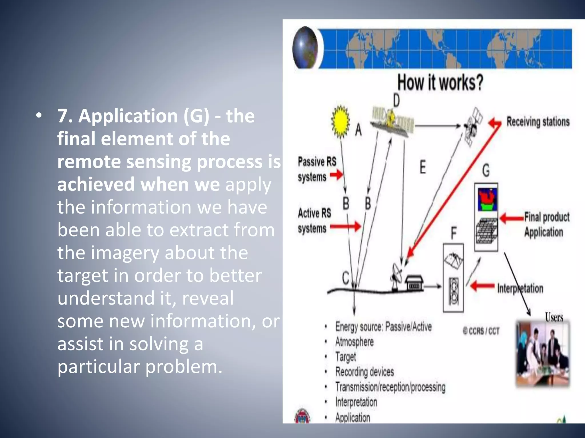
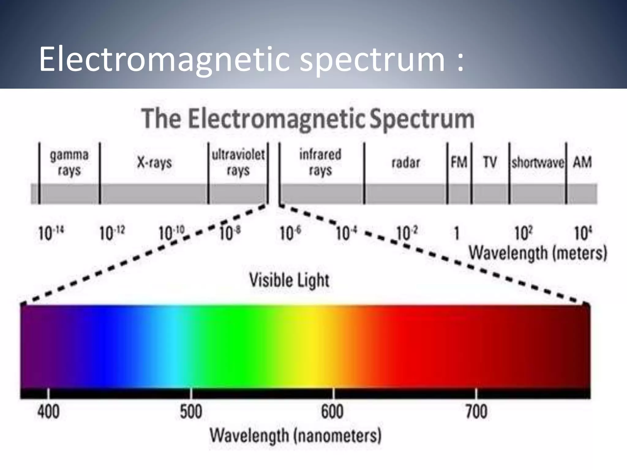
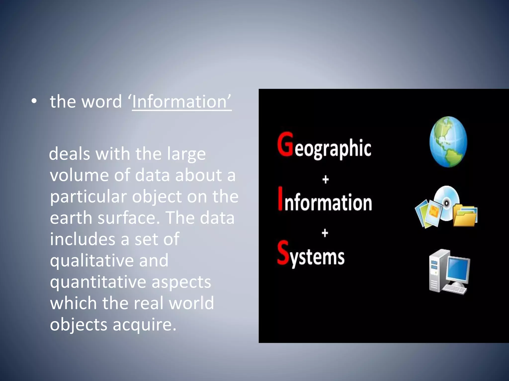
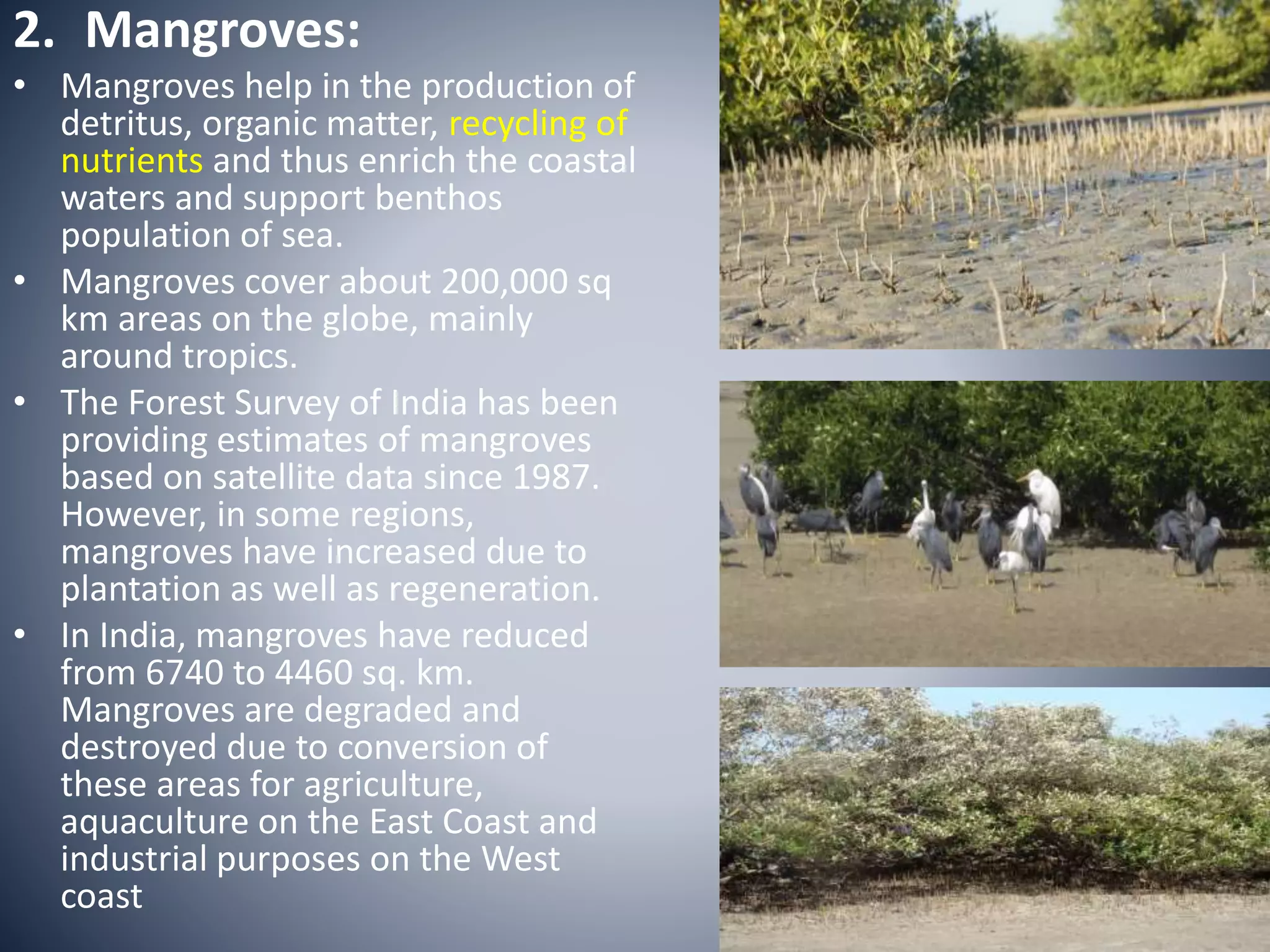
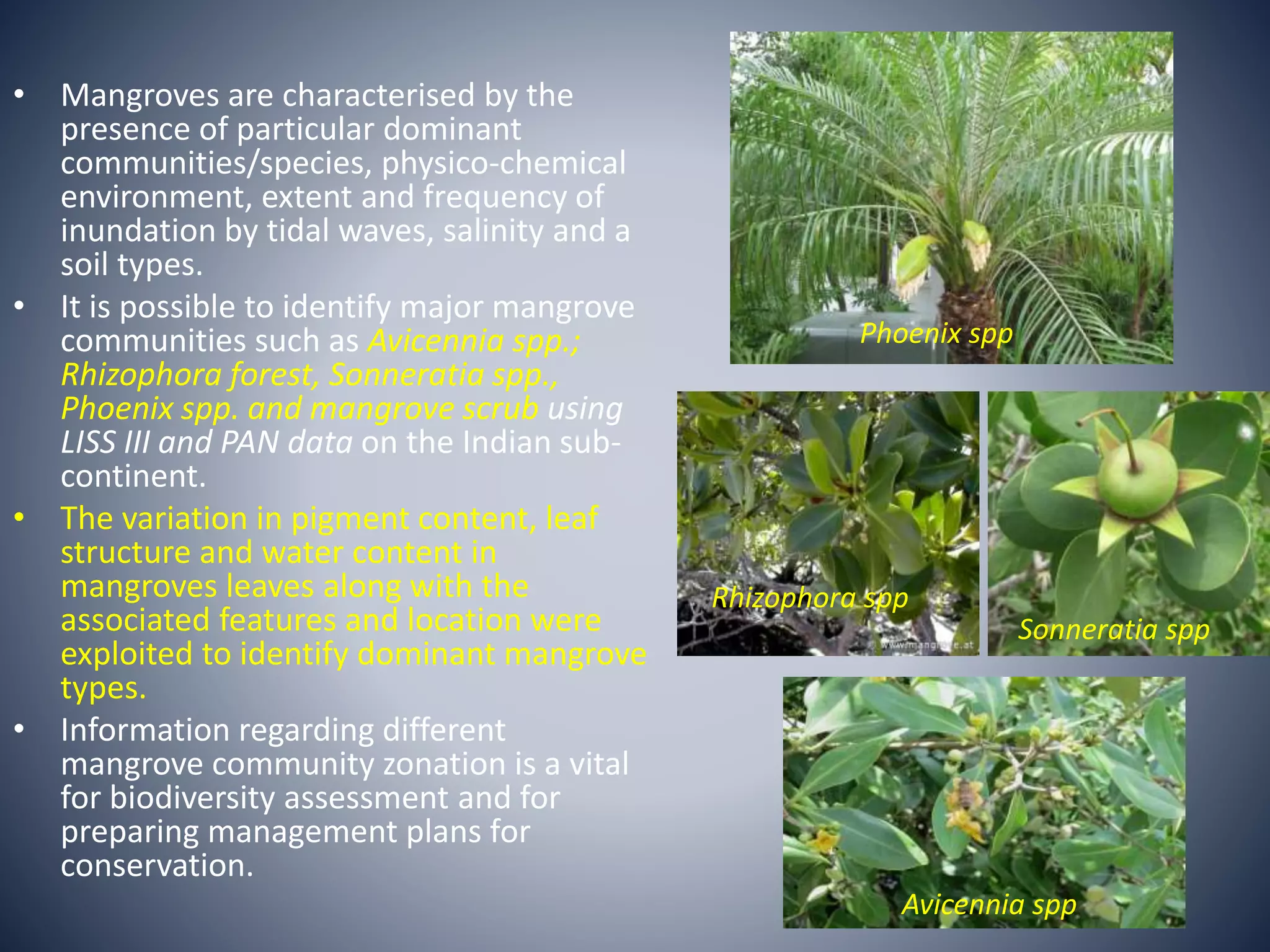
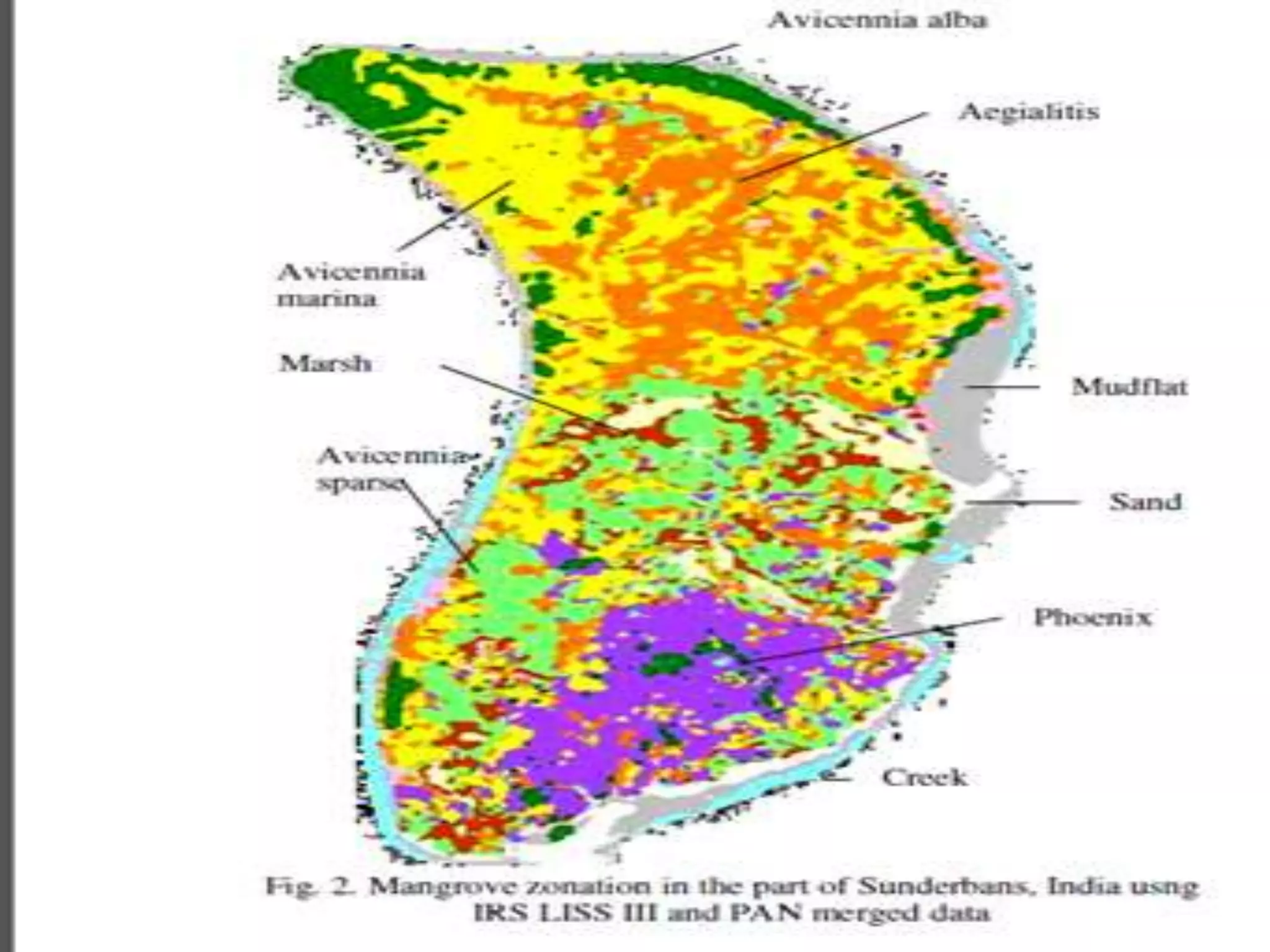
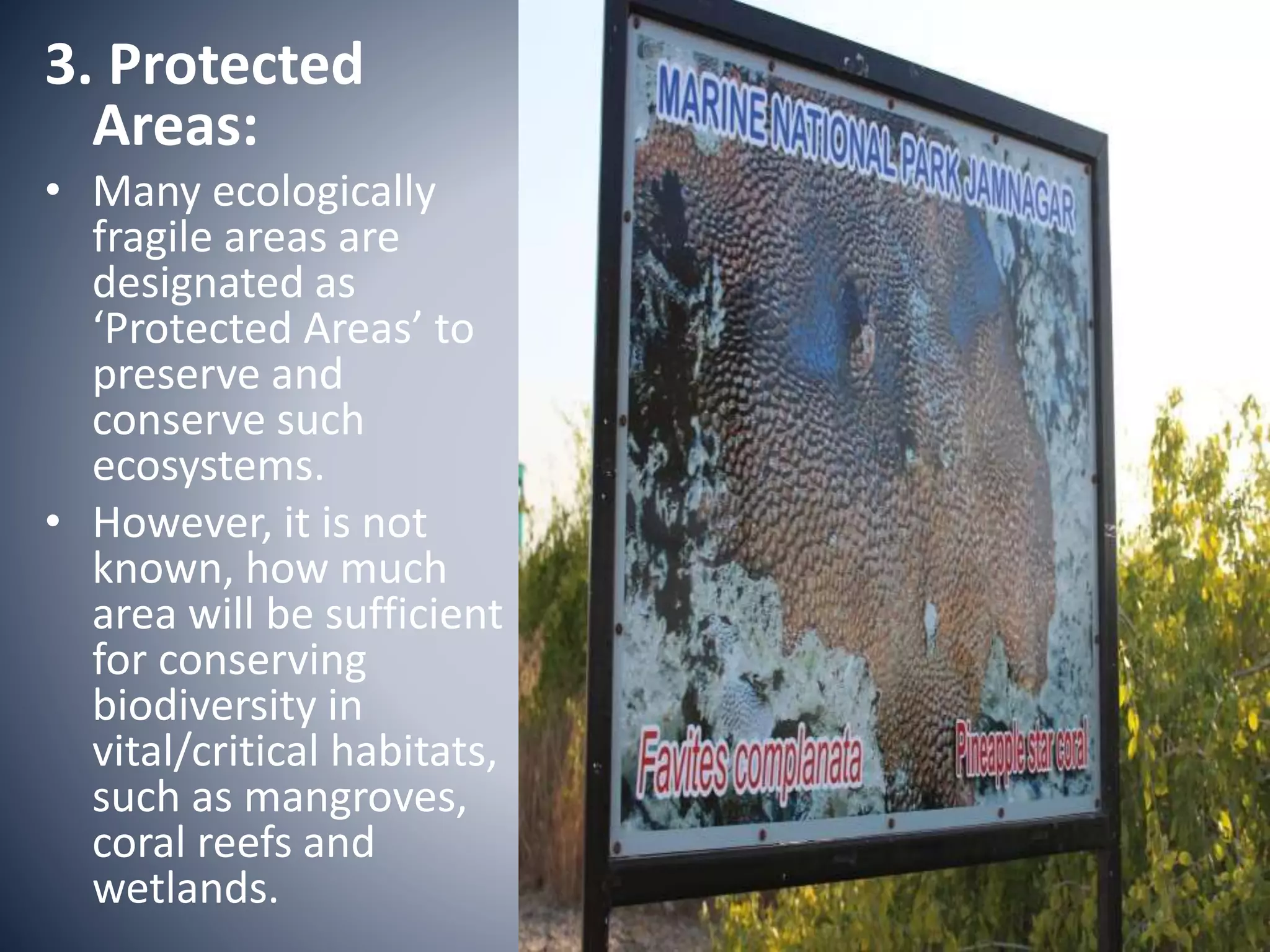
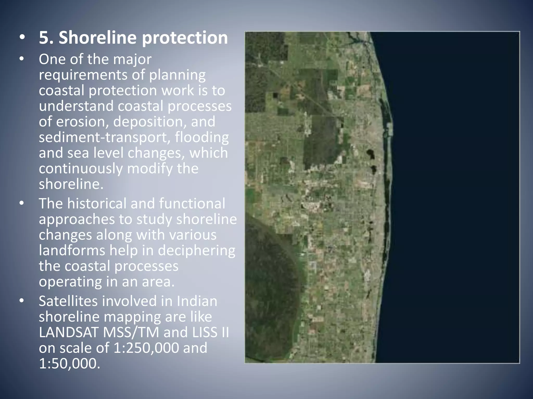
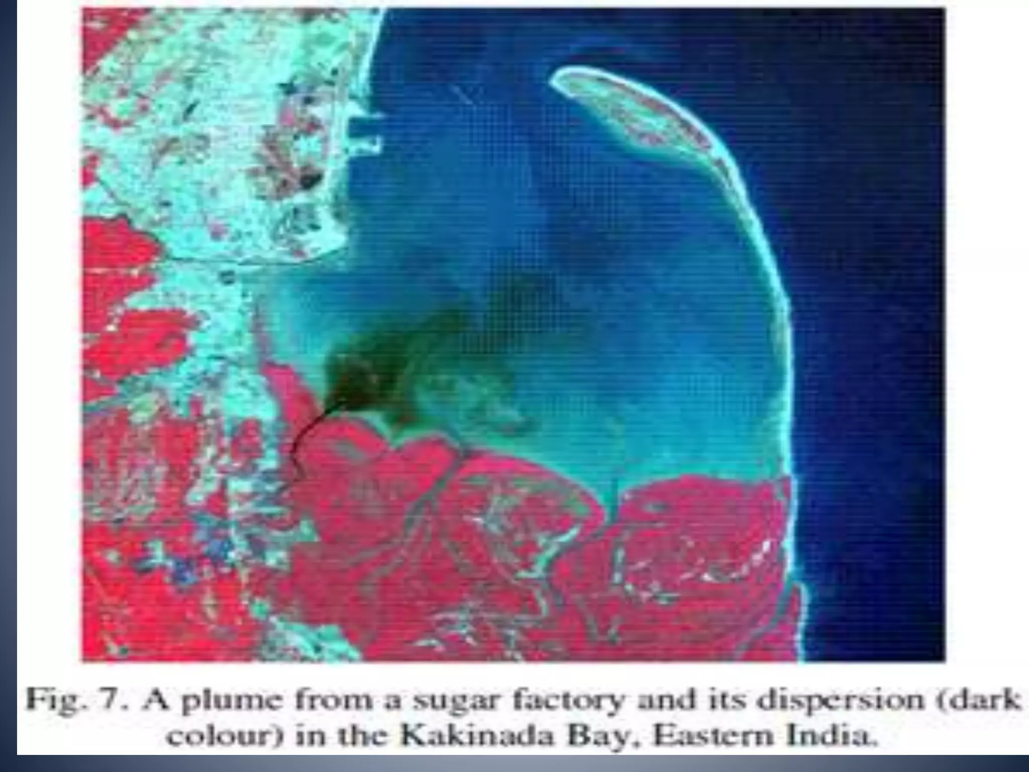
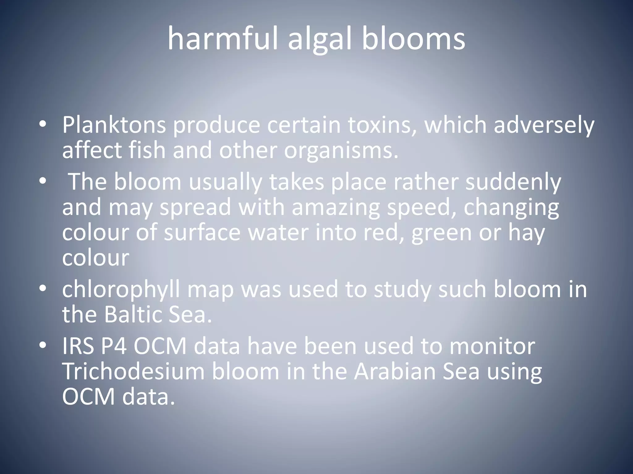
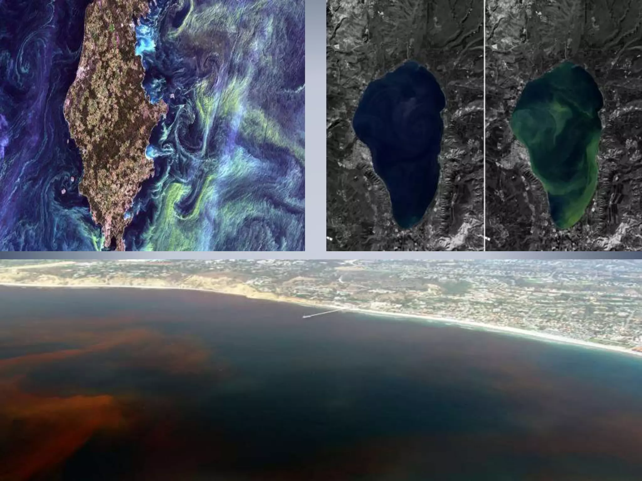
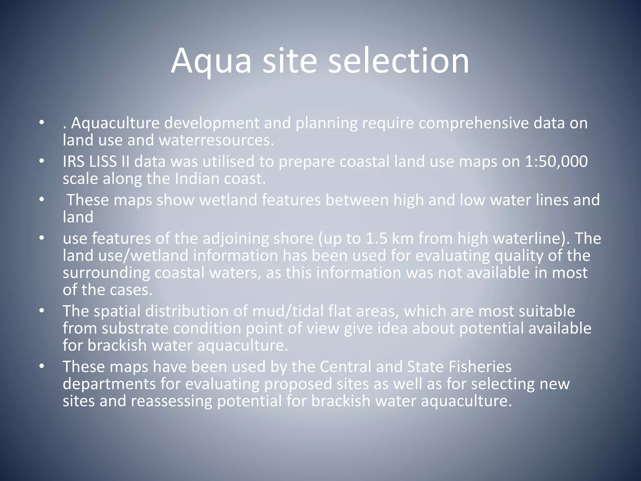
This document discusses the application of remote sensing in coastal zone management. It begins with an introduction to coastal zones and their importance. It then discusses remote sensing concepts like the electromagnetic spectrum and geographical information systems (GIS). The main applications of remote sensing discussed are the study of coastal habitats like coral reefs and mangroves, shoreline protection, monitoring marine water quality, understanding marine environment and climate change impacts, and aiding coastal zone management. Specific examples are provided of how remote sensing has been used to map and monitor these coastal features and issues in India.
Oceans also contain a huge amount of mineral resources. Deep ocean basins are the zones of continuous sedimentation. The oceans are the final destination for many of all the sediments to be deposited. About 200 million years of earth history are available in the fossiliferous sediments deposited within the ocean basins. This module explains the characteristics of marine sediments.
Seas and oceans are very huge bodies of saline waters. Their distribution and dynamics are very influential in several ways. Understanding the properties of seawater is inevitable in oceanographic studies. Seawater is one of the most fascinating and plentiful substances on the planet. The basic properties of seawater and their distribution, the interchange of properties between sea and atmosphere or land, the transmission of energy within the sea, and the geochemical laws which are governing the composition of seawater and marine sediments, are the fundamental aspects studied in the subject oceanography.
The study of physical oceanography helps in understanding all these aspects in detail. Let us see most of these factors and processes in our future modules. Mathematical models of all these processes are also developed using these phenomena and mechanisms. The individual aspects of all the elements of physical oceanography are to be studied in detail.
It is my academic presentation file which I presented with my friend in the last semester exam. It describe the major estuaries in Bangladesh. Also input these estuaries geographical location , characteristics , physio - chemical parameters , species abundance ,importance etc. ...
Chemical Oceanography is fundamentally interdisciplinary. The chemistry of the ocean is closely tied to ocean circulation, climate, the plants and animals that live in the ocean, and the exchange of material with the atmosphere, cryosphere, continents, and mantle
Detailed account of difference between Biosp[here Reserves and various MPAs were given; MPAs of India were listed with its key biodiversity resources...
coastal water resoueces, this issue really great, because of day by in coastal region population increses but main problems are that area s water is almost salty so thats why majors problems are created about water.
Marine & Coastal Fisheries Resources of Bay of BengalMishal Roy
Presentation about marine and coastal resources of bay of bengal in Bangladesh. Submission date: 14th March, 2017. Course: Fisheries Resources; Code: FISH-117.
seawater is life to many organisms and plants.
it consists of various nutrients which help in the growth and developments of flora and fauna present in the seawater
Marine Resources: Physical and biological resources, marine energyihn FreeStyle Corp.
Marine resources are physical and biological entities that are found in seas and oceans that are beneficial to man. They include fish, coral reefs and crabs, fungi, etc. A lot of conservation effort is required to protect these resources from human destruction activities like pollution and over fishing. Marine natural resources include both biological and physical sources. Biological sources include anything attributed to life forms whereas physical sources are considered to be those things that are not part of life processes. In a few instances some resources are both biological and physical. In considering the outlook of our oceans it is important to first identify the main natural resources and their status.
This ppt will help to understand the concept of water mass in the world ocean. It gives an overview of it's origin, formation, distribution etc. in the world. It is also helpfull for Fisheries Science students.
DSD-NL 2018 Evolutie in het leveren van ruimtelijke en temporele water gerela...Deltares
Presentatie door Arnold Dekker, SatDek, Australian National University, op de Delft-FEWS NL Gebruikersdag 2018, tijdens de Deltares Software Dagen - Editie 2018. Dinsdag, 5 juni 2018, Delft.
Abstract Remote sensing has its application in various fields like geology and mineral exploration, geomorphology and modern geomorphic process modeling, nature mitigation studies, hazard zone mapping, eco system study in hills, plains, riverine, coastal, marine and volcanic landforms, forest and biomass inventory, fishery. Remote sensing plays a vital in various fields. This technique along with the GIS has been to study the geomorphological, hydro geological, land use/land cover, lithological, structural aspects/ features in the parts of Anaimalai, Pollachi and Udumalpet block of TamilNadu. Integrated approach using geographic information system provides cost effective support in resources inventory including land use mapping, comprehensive data base for resources, analytical tools for decision making and impact analysis for plan evaluation. GIS accept large volumes of spatial data derived from a variety of sources and effectively store, retrieve, manipulate, analyze and display all forms of geographically referenced information. Maps and statistical data can be obtained from the spatial integration and analysis of an area using GIS software. In order to assess the natural resource availability and its potentiality in parts of Anaimalai, Pollachi and Udumalpet block, Tamil Nadu, an integrated remote sensing and GIS based study has been conducted by adopting the standard procedures. The groundwater potential zone of any area is depends on geological formations; geomorphologic unit’s recharges characters, topography, and thickness of weathered and fractured zones. In the present study, area was taken to locate groundwater potential zones by integrated different thematic maps, remote sensing and geographic information system techniques. To find out the ground water potential zones, different thematic maps have been prepared and integrated each of them. They are mainly geology, geomorphology, land use / land cover, lineament etc. Groundwater potential zones have been prepared with help of integrating different thematic maps. This study area is finally to get the groundwater potential zones we have to classified few area such as high, moderate and low potential zones. Index Terms: Remote sensing, GIS, lithology, Geomorphology, Hydrology, landforms etc.
IJRET : International Journal of Research in Engineering and Technology is an international peer reviewed, online journal published by eSAT Publishing House for the enhancement of research in various disciplines of Engineering and Technology. The aim and scope of the journal is to provide an academic medium and an important reference for the advancement and dissemination of research results that support high-level learning, teaching and research in the fields of Engineering and Technology. We bring together Scientists, Academician, Field Engineers, Scholars and Students of related fields of Engineering and Technology.
Status of seagrass ecosystem in Kauswagan, Lanao Del Norte and Laguindingan, ...Innspub Net
The study was conducted to determine the present status of seagrass resources of Laguindingan, Misamis Oriental and Kauswagan, Lanao del Norte and compared this through time with secondary data. It employed the transect-quadrat methods. Perpendicular to the shoreline, three (3) 100-m transect lines at 200-m interval between each transect were laid. Seven seagrass species were recorded comprising 38.6% of the total number (19) of seagrass species found in the Philippines. The seagrass community in all sites surveyed showed that it is highly dominated by Thalassia hemprichii species. However, there were no significant differences in species richness and diversity based on single-factor ANOVA statistical analysis (p>0.5). The abundance of T. hemprichii could probably be due to the prominent characteristic of this species where it could grow well in different types of habitat with various environmental conditions. The condition of seagrass beds in both areas were fair and the low Shannon-Wiener Diversity Index of seagrass in Kauswagan, Lanao del Norte (H’=0.76±0.22) and in Laguindingan, Misamis Oriental respectively (H’=0.40±0.35) indicate low stability in the community, which means that the condition of the seagrass ecosystem could be under threat, both from natural and anthropogenic activities. Over time, a fluctuating trend in species composition and a notable decline in seagrass species diversity and abundance have been observed in both areas. This present status calls an immediate response from the decision makers concerned for the sustainable management and conservation of the seagrass resources.
BENTHIC DIVERSITY MAPPING AND ANALYSIS BASE ON REMOTE SENSING AND SEASCAPE EC...IAEME Publication
Mapping of coral reef ecosystem by using remote sensing either from satellite
platform has been acknowledging as an essential tool. Seascape ecology is the study
of seascape patterns, interaction among patches within a seascape mosaic and how
these patterns and interactions change over time. The objectives of this study are to
produce a benthic map, measure the benthic diversity matrix and to compare the
diversity matrix among different seascape area at Parang Islands shallow waters in
the eastern part of Karimunjawa National Park, Indonesia. The high-resolution
satellite image that has been used in this study was from GeoEye-1 to map the
benthic. Fragstats is used to measure and analyze the diversity metric values for the
benthic consist of live coral, DCA, seagrass, etc. This research produces benthic
ecosystem map consists of eight benthic classes. The diversity metric index shows that
the southern seascape region of this island has the highest diversity
Research Inventy : International Journal of Engineering and Scienceinventy
Research Inventy : International Journal of Engineering and Science is published by the group of young academic and industrial researchers with 12 Issues per year. It is an online as well as print version open access journal that provides rapid publication (monthly) of articles in all areas of the subject such as: civil, mechanical, chemical, electronic and computer engineering as well as production and information technology. The Journal welcomes the submission of manuscripts that meet the general criteria of significance and scientific excellence. Papers will be published by rapid process within 20 days after acceptance and peer review process takes only 7 days. All articles published in Research Inventy will be peer-reviewed.
Similar to Application of remote sensing in coastal zone management (20)
The Art Pastor's Guide to Sabbath | Steve ThomasonSteve Thomason
What is the purpose of the Sabbath Law in the Torah. It is interesting to compare how the context of the law shifts from Exodus to Deuteronomy. Who gets to rest, and why?
Students, digital devices and success - Andreas Schleicher - 27 May 2024..pptxEduSkills OECD
Andreas Schleicher presents at the OECD webinar ‘Digital devices in schools: detrimental distraction or secret to success?’ on 27 May 2024. The presentation was based on findings from PISA 2022 results and the webinar helped launch the PISA in Focus ‘Managing screen time: How to protect and equip students against distraction’ https://www.oecd-ilibrary.org/education/managing-screen-time_7c225af4-en and the OECD Education Policy Perspective ‘Students, digital devices and success’ can be found here - https://oe.cd/il/5yV
Ethnobotany and Ethnopharmacology:
Ethnobotany in herbal drug evaluation,
Impact of Ethnobotany in traditional medicine,
New development in herbals,
Bio-prospecting tools for drug discovery,
Role of Ethnopharmacology in drug evaluation,
Reverse Pharmacology.
Synthetic Fiber Construction in lab .pptxPavel ( NSTU)
Synthetic fiber production is a fascinating and complex field that blends chemistry, engineering, and environmental science. By understanding these aspects, students can gain a comprehensive view of synthetic fiber production, its impact on society and the environment, and the potential for future innovations. Synthetic fibers play a crucial role in modern society, impacting various aspects of daily life, industry, and the environment. ynthetic fibers are integral to modern life, offering a range of benefits from cost-effectiveness and versatility to innovative applications and performance characteristics. While they pose environmental challenges, ongoing research and development aim to create more sustainable and eco-friendly alternatives. Understanding the importance of synthetic fibers helps in appreciating their role in the economy, industry, and daily life, while also emphasizing the need for sustainable practices and innovation.
How to Make a Field invisible in Odoo 17Celine George
It is possible to hide or invisible some fields in odoo. Commonly using “invisible” attribute in the field definition to invisible the fields. This slide will show how to make a field invisible in odoo 17.
We all have good and bad thoughts from time to time and situation to situation. We are bombarded daily with spiraling thoughts(both negative and positive) creating all-consuming feel , making us difficult to manage with associated suffering. Good thoughts are like our Mob Signal (Positive thought) amidst noise(negative thought) in the atmosphere. Negative thoughts like noise outweigh positive thoughts. These thoughts often create unwanted confusion, trouble, stress and frustration in our mind as well as chaos in our physical world. Negative thoughts are also known as “distorted thinking”.
2024.06.01 Introducing a competency framework for languag learning materials ...Sandy Millin
http://sandymillin.wordpress.com/iateflwebinar2024
Published classroom materials form the basis of syllabuses, drive teacher professional development, and have a potentially huge influence on learners, teachers and education systems. All teachers also create their own materials, whether a few sentences on a blackboard, a highly-structured fully-realised online course, or anything in between. Despite this, the knowledge and skills needed to create effective language learning materials are rarely part of teacher training, and are mostly learnt by trial and error.
Knowledge and skills frameworks, generally called competency frameworks, for ELT teachers, trainers and managers have existed for a few years now. However, until I created one for my MA dissertation, there wasn’t one drawing together what we need to know and do to be able to effectively produce language learning materials.
This webinar will introduce you to my framework, highlighting the key competencies I identified from my research. It will also show how anybody involved in language teaching (any language, not just English!), teacher training, managing schools or developing language learning materials can benefit from using the framework.
The French Revolution, which began in 1789, was a period of radical social and political upheaval in France. It marked the decline of absolute monarchies, the rise of secular and democratic republics, and the eventual rise of Napoleon Bonaparte. This revolutionary period is crucial in understanding the transition from feudalism to modernity in Europe.
For more information, visit-www.vavaclasses.com
Application of remote sensing in coastal zone management
1. Application of Remote sensing in
coastal zone management
Dept of AEM
Course: AEM 503
Presented by : Tade Mayur S
2. Outline of seminar
• Introduction of Coastal zone area
• Concept of remote sensing
• Electromagnetic spectrum
• What is Geographical information system(GIS)
• Application of remote sensing in coastal zone
management
3. Introduction
• Coastal zone are the area at the interface between land
and sea, where the sea influences the land, and vice
versa.
• it include intertidal habitats (mangroves, marshes, mud
flats, rocky shores, sandy beaches), semi-enclosed bodies
of water (estuaries, bays, fjords, gulfs, seas), benthic
habitats (coral reefs, sea grass beds, kelp forests, hard
and soft bottoms) and
• The open waters of the coastal ocean to the seaward
limits of the Exclusive Economic Zone (EEZ), i.e. from the
head of the tidal waters to the outer limits of the EEZ.
4. • Coastal ecosystems harbor wealth of species and
genetic diversity, store and cycle nutrients, filter
pollutants and help to protect shorelines from
erosion and storms.
• Marine ecosystems play a vital role in regulating
climate and they are a major carbon sink and
oxygen source.
• The coastal zone of world is under increasing stress
due to development of industries, trade and
commerce, tourism and resultant human
population growth and migration, and
deteriorating water quality
5. • The industrial development of coast has
resulted in degradation of coastal ecosystems
and diminishing the living resources of
Exclusive Economic Zone (EEZ) in form of
coastal and marine biodiversity and
productivity.
6. • In order to ensure sustainable development, it
necessary to develop accurate, up-to-date and
comprehensive scientific databases on habitats,
protected areas, water quality, environmental
indicators and carry out periodic assessment of
the health of the system.
• The modern scientific tools of remote sensing,
GIS and GPS are extremely valuable in
development of databases and to analyse them in
the integrated manner and derive management
action plans.
7. • Availability of repetitive, synoptic and multi-
spectral data from various satellite platforms,
viz. IRS,LANDSAT, SPOT, have helped to
generate information on varied aspects of the
coastal and marine environment. Ocean color
data from OCANSAT I OCM, Sea WiFS, MODIS,
provide information on biological aspects
useful for fisheries and coastal ecosystems.
8. • In India, satellite based information has been
used for generating inventory on coastal
habitats, landforms, coastal land use and
shoreline condition, condition assessment of
protected areas, exploration of marine
fisheries, mitigation of coastal disasters and
understanding of sediment dynamics.
9. Concept of Remote sensing
"Remote sensing is the science (and to some
extent, art) of acquiring information about the
Earth's surface without actually being in
contact with it. This is done by sensing and
recording reflected or emitted energy and
processing, analyzing, and applying that
information.
10. • Energy Source or
Illumination (A) – the first
requirement for remote
sensing is to have an
energy source which
illuminates or provides
electromagnetic energy to
the target of interest.
11. • Radiation and the
Atmosphere (B) – as the
energy travels from its
source to the target, it
will come in contact with
and interact with the
atmosphere it passes
through. This interaction
may take place a second
time as the energy travels
from the target to the
• sensor.
12. • Interaction with the
Target (C) - once the
energy makes its way
to the target through
the atmosphere, it
interacts with the target
depending on the
properties of both the
target and the
• radiation.
13. • Recording of Energy by
the Sensor (D) - after
the energy has been
scattered by, or emitted
from the target, we
require a sensor
(remote - not in contact
with the target) to
collect and record the
electromagnetic
radiation.
14. • Transmission, Reception,
and Processing (E) - the
energy recorded by the
sensor has to be
transmitted, often in
electronic form, to a
receiving and processing
station where the data
are processed into an
image (hardcopy and/or
digital).
15. • Interpretation and
Analysis (F) - the
processed image is
interpreted, visually
and/or digitally or
electronically, to extract
information about the
target which was
illuminated.
16. • 7. Application (G) - the
final element of the
remote sensing process is
achieved when we apply
the information we have
been able to extract from
the imagery about the
target in order to better
understand it, reveal
some new information, or
assist in solving a
particular problem.
18. Geographical information system(GIS)
• Indian Society of Geomatics (ISG) and Indian
Space Application Centre (ISRO) defined GIS as
a system which provides a computerised
mechanism for integrating various
geoinformation data sets and analysing them
in order to generate information relevant to
planning needs in a context.
19. • the word ‘Geographic’
deals with spatial
objects or features
which can be
referenced or related to
a specific location on
the earth surface. The
object may be physical /
natural or may be
cultural / man made.
20. • the word ‘Information’
deals with the large
volume of data about a
particular object on the
earth surface. The data
includes a set of
qualitative and
quantitative aspects
which the real world
objects acquire.
21. • ‘System’
is used to represent systems
approach where the complex
environment (consists of a
large number, of objects /
features on the earth surface
and their complex
characteristics) is broken down
into their component parts for
easy understanding and
handling, but is considered to
form an integrated whole for
managing and decision
making.
22. Application of Remote Sensing in CZM
They are..
• Study of coastal habitat
• Shoreline protection
• Marine water quality
• Marine environment and climate change
• Coastal zone management
23. Study of coastal habitat
1. Coral reefs
• Knowledge about the extent and condition of coral
reefs is useful in planning conservation and
preventive measures to protect this fragile ecosystem.
• Coral reefs features such as type( fringing, atoll,
platform,patchcoral heads,etc..),reef flats reef
vegetation, degraded reef, lagoons,live coral and
coralline shelf can be mapped by using a various
satellites(IRS LISS II and III)
• These maps can be used as a basic input for
identifying the boundaries of protected areas and
biosphere reserve.
24. • Coral reef features have been mapped using IRS LISS II
and III data on 1:50,000 scale for the Indian reefs.
• It was observed that coral reef degradation is more
serious problem than total destruction
• Coral reefs show distinct morphological and ecological
characters. Water column modifies the apparent
reflectance spectrum of an object on the sea bottom.
Water column correction and contextual editing
increased the classification accuracy. IRS-1C LISS III and
PAN merged data have been used for coral reef
zonation study .
25.
26. 2. Mangroves:
• Mangroves help in the production of
detritus, organic matter, recycling of
nutrients and thus enrich the coastal
waters and support benthos
population of sea.
• Mangroves cover about 200,000 sq
km areas on the globe, mainly
around tropics.
• The Forest Survey of India has been
providing estimates of mangroves
based on satellite data since 1987.
However, in some regions,
mangroves have increased due to
plantation as well as regeneration.
• In India, mangroves have reduced
from 6740 to 4460 sq. km.
Mangroves are degraded and
destroyed due to conversion of
these areas for agriculture,
aquaculture on the East Coast and
industrial purposes on the West
coast
27. • Mangroves are characterised by the
presence of particular dominant
communities/species, physico-chemical
environment, extent and frequency of
inundation by tidal waves, salinity and a
soil types.
• It is possible to identify major mangrove
communities such as Avicennia spp.;
Rhizophora forest, Sonneratia spp.,
Phoenix spp. and mangrove scrub using
LISS III and PAN data on the Indian sub-
continent.
• The variation in pigment content, leaf
structure and water content in
mangroves leaves along with the
associated features and location were
exploited to identify dominant mangrove
types.
• Information regarding different
mangrove community zonation is a vital
for biodiversity assessment and for
preparing management plans for
conservation.
Sonneratia spp
Rhizophora spp
Avicennia spp
Phoenix spp
30. 3. Protected
Areas:
• Many ecologically
fragile areas are
designated as
‘Protected Areas’ to
preserve and
conserve such
ecosystems.
• However, it is not
known, how much
area will be sufficient
for conserving
biodiversity in
vital/critical habitats,
such as mangroves,
coral reefs and
wetlands.
31. • It is necessary to monitor these areas to assess impact of conservation
measures as well as anthropogenic activities. The repetitive coverage of
the IRS satellites is quite adequate for monitoring such changes.
• In one such study, in the Marine National Park, Jamnagar, on the Gujarat
coast significant changes in the mangrove vegetation and coral reef area
were observed during the period 1975 to 2000.
• Degradation and loss of both ecosystems continued till 1985 on account of
mining of coralline sand and use of mangroves as fuel and fodder.
• The loss of coastal habitats is a direct measure of declining condition of
biodiversity in coastal habitats. Hence, In 1983, this area was declared as a
marine park (protected area).
• Extensive measures were initiated for conservation of mangrove and coral
reef areas by the marine park authorities.
• This resulted in reversing the trend of degradation after 1985 and has
certainly helped towards restoring the environment
32. • However, recent industrialisation,
development of ports, etc. have again put
these ecosystems under stress, as evident
from recent satellite data.
• Remote sensing data has been proved to be
extremely useful for routine monitoring of the
protected areas.
33. 4. Marine fishery :
• The assessment of stock is one of
the important activities for
conserving the marine living
resources. India has high
potential for marine fisheries
development.
• Identification of the marine living
resources (PFZ)
• Detection of primary productivity
for the prediction of tertiary
productivity.
• Also help to understand the
carbon uptake of oceans from
the atmosphere
• Various satellites like IRS P4
(OCM),NOAA AVHRR,SST
provides the PFZ areas.
• Forecast is 70-80% correct.
34. • 5. Shoreline protection
• One of the major
requirements of planning
coastal protection work is to
understand coastal processes
of erosion, deposition, and
sediment-transport, flooding
and sea level changes, which
continuously modify the
shoreline.
• The historical and functional
approaches to study shoreline
changes along with various
landforms help in deciphering
the coastal processes
operating in an area.
• Satellites involved in Indian
shoreline mapping are like
LANDSAT MSS/TM and LISS II
on scale of 1:250,000 and
1:50,000.
35. • Erosion has been observed north of
Visakhapatnam, Paradip, and Ennore, north of
Madras, near Nagapattiam and Kanyakumari
ports on the East Coast of India while
deposition has been observed south of these
ports.
• These changes are attributed to construction
of artificial barriers like breakwater, jetties,
etc.
36. 6. Marine water Qulity:
• Anthropogenic activities – i.e discharge of
industrial and municipal sewage, land use,
tourism, maritime transport, offshore oil
exploration and production, dumping at sea
degrade the marine environment.
• Turbidity, temperature and colour are indicators
of water quality.
• Chlorophyll indicates trophic status, nutrient load
and possibility of pollutants in coastal waters.
37.
38. harmful algal blooms
• Planktons produce certain toxins, which adversely
affect fish and other organisms.
• The bloom usually takes place rather suddenly
and may spread with amazing speed, changing
colour of surface water into red, green or hay
colour
• chlorophyll map was used to study such bloom in
the Baltic Sea.
• IRS P4 OCM data have been used to monitor
Trichodesium bloom in the Arabian Sea using
OCM data.
39.
40. Aqua site selection
• . Aquaculture development and planning require comprehensive data on
land use and waterresources.
• IRS LISS II data was utilised to prepare coastal land use maps on 1:50,000
scale along the Indian coast.
• These maps show wetland features between high and low water lines and
land
• use features of the adjoining shore (up to 1.5 km from high waterline). The
land use/wetland information has been used for evaluating quality of the
surrounding coastal waters, as this information was not available in most
of the cases.
• The spatial distribution of mud/tidal flat areas, which are most suitable
from substrate condition point of view give idea about potential available
for brackish water aquaculture.
• These maps have been used by the Central and State Fisheries
departments for evaluating proposed sites as well as for selecting new
sites and reassessing potential for brackish water aquaculture.
41. Referances:
• Campbell, J.B (1987), introduction to Remote sensing. The Guilford Press,
New York.
• Lillesand, T.M and Kiefer, R.W(1994). Remote Sensing and Image
Interpertation. John wiley and Sons Inc.New York.
• Introduction to Fundamentals(what is remote sensing), Fundamentals of
Remote sensing. A canada centre for Remote sensing Remote sensing
tutorial.
• Gayatri K devi, Ganasri B.P, Dwarakish GS, 2015, Application of Remote
Sensing in Satellite Oceanography, A Review; science Direct, Article no 2,3
• Multi spec:http:// dynamo.ecm.purdue.edu/biehl/multispec.
• Dr Punyatoya Patra; Remote sensing and Geographical Information
system(GIS); The Association for Geographical studies; Article 2 ( Remote
sensing.meaning)
• Shailesh nayak, Role of Remote sensing to integrated coastal zone
management. Article(1,2,3,4,5,6,7)