Study of Volcanism and volcano

what are Volcanism and volcano, Distribution of Volcanoes Kinds of Volcanoes Types of Volcanic Hazards Preparing for Volcanic Emergencies A volcano is generally a conical shaped hill or mountain built by accumulations of lava flows, tephra, and volcanic ash. About 95% of active volcanoes occur at the plate subduction zones and at the mid-oceanic ridges. The other 5% occur in areas associated with lithospheric hot spots. These hot spots have no direct relationships with areas of crustal creation or subduction zones. It is believed that hot spots are caused by plumes of rising magma that have their origin within the asthenosphere. Over the last 2 million years, volcanoes have been depositing lava, tephra, and ash in particular areas of the globe. These areas occur at hot spots, rift zones, and along plate boundaries where tectonic subduction is taking place within the asthenosphere. The most prevalent kinds of volcanoes on the Earth's surface are the kind which form the "Pacific Rim of Fire". Those are volcanoes which form as a result of subduction of the nearby lithosphere.

Recommended
More Related Content
What's hot
What's hot (20)
Similar to Study of Volcanism and volcano
Similar to Study of Volcanism and volcano (20)
More from Jahangir Alam
More from Jahangir Alam (20)
Recently uploaded
Recently uploaded (20)
Study of Volcanism and volcano
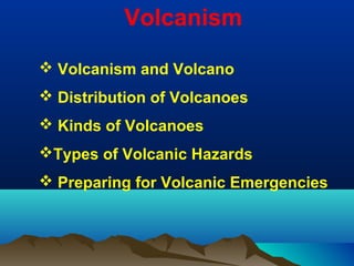
- 1. Volcanism Volcanism and Volcano Distribution of Volcanoes Kinds of Volcanoes Types of Volcanic Hazards Preparing for Volcanic Emergencies
- 2. VolcanismVolcanism • Volcanism is part of the process of bringing material from the deep interior ofVolcanism is part of the process of bringing material from the deep interior of a planet and spilling it forth on the surface.a planet and spilling it forth on the surface. EruptionsEruptions also eject new moleculesalso eject new molecules into the atmosphere. Volcanism is part of the process by which a planetinto the atmosphere. Volcanism is part of the process by which a planet cools offcools off. Even though they are not volcanoes, geysers and hot springs are. Even though they are not volcanoes, geysers and hot springs are also part of the volcanic process, involving water and hydrothermal activity.also part of the volcanic process, involving water and hydrothermal activity. Some planetary bodies, like Jupiter's moon Europa, exhibit icy volcanism,Some planetary bodies, like Jupiter's moon Europa, exhibit icy volcanism, which is another form of volcanism involving water.which is another form of volcanism involving water. • There are several ways in which a volcanoThere are several ways in which a volcano formsforms, just as there are several, just as there are several differentdifferent kindskinds of volcanoes.of volcanoes. On Earth, the most general cause of volcanismOn Earth, the most general cause of volcanism is caused byis caused by subductionsubduction of the Earth's crust.of the Earth's crust. •There are quite a few other planets which have volcanoes on the surface,There are quite a few other planets which have volcanoes on the surface, includingincluding VenusVenus,, MarsMars, and Jupiter's moon, and Jupiter's moon IoIo. Other planets exhibit the results. Other planets exhibit the results of volcanic activity. These include Mercury, the Earth'sof volcanic activity. These include Mercury, the Earth's MoonMoon, Jupiter's moon, Jupiter's moon EuropaEuropa, and perhaps Neptune's moon, and perhaps Neptune's moon TritonTriton..
- 3. Volcanic Rocks and Associated LandformsVolcanic Rocks and Associated Landforms
- 4. This is an image of the eruption of Stromboli volcano.This is an image of the eruption of Stromboli volcano.
- 5. Low viscosity basaltic lava flowLow viscosity basaltic lava flow
- 6. Volcanism - VolcanoesVolcanism - Volcanoes • A volcano is generally a conical shaped hill or mountain built by accumulations of lava flows, tephra, and volcanic ash. About 95% of active volcanoes occur at the plate subduction zones and at the mid-oceanic ridges. The other 5% occur in areas associated with lithospheric hot spots. These hot spots have no direct relationships with areas of crustal creation or subduction zones. It is believed that hot spots are caused by plumes of rising magma that have their origin within the asthenosphere. • Over the last 2 million years, volcanoes have been depositing lava, tephra, and ash in particular areas of the globe. These areas occur at hot spots, rift zones, and along plate boundaries where tectonic subduction is taking place within the asthenosphere. • The most prevalent kinds of volcanoes on the Earth's surface are the kind which form the "Pacific Rim of Fire". Those are volcanoes which form as a result of subduction of the nearby lithosphere.
- 7. Location of the Earth's major volcanoesLocation of the Earth's major volcanoes
- 8. KINDS OF VOLCANOESKINDS OF VOLCANOES • Hot magma, rising from lower reaches of the Earth, eventually, but not always, erupts onto the surface in the form of lava. During the eruption of a volcano, flowing lava and ash form a large cone. This cone is what we know as a volcano. • Among the different kinds of volcanoes are: • composite volcanoes • shield volcanoes • cinder cones • spatter cones
- 10. COMPOSITE VOLCANOCOMPOSITE VOLCANO • The most majestic of the volcanoes are composite volcanoes, also known as strato-volcanoes. Unlike the shield volcanoes which are flat and broad, composite volcanoes are tall, symmetrically shaped, with steep sides, sometimes rising 10,000 feet high. They are built of alternating layers of lava flows, volcanic ash, cinders, blocks, and bombs. • Famous composite volcanoes include Mount Fuji in Japan, Mount Cotopaxi in Ecuador, Mount Shasta and Lassen in California, Mount Hood in Oregon, Mount St. Helens and Mount Rainier in Washington, Mt Pinatubo in the Philipenes, and Mt. Etna in Italy.
- 11. Mauna Kea erupting.Mauna Kea erupting.
- 12. SHIELD VOLCANOESSHIELD VOLCANOES • Shield volcanoes can grow to be very big. In fact, the oldest continental regions of Earth may be the remains of ancient shield volcanoes. • Unlike the composite volcanoes which are tall and thin, shield volcanoes are tall and broad, with flat, rounded shapes. The Hawaiian volcanoes exemplify the common type of shield volcano. They are built by countless outpourings of lava that advance great distances from a central summit vent or group of vents. The outpourings of lava are typically not accompanied by pyroclastic material, which make the shield volcanoes relatively safe. • Mauna Loa, the largest of the shield volcanoes, is 13,677 feet above sea level, which means it rises over 28,000 feet above the deep ocean floor, and would be the worlds tallest mountain if much of it were not underwater. • Famous shield volcanoes include Mauna Loa, Kilauea, (two of the world's most active volcanoes), and Olympus Mons of Mars.
- 13. CALDERACALDERA • The most explosive type of volcano is the caldera. The cataclysmic explosion of these volcanoes leaves a huge circular depression at the Earth's surface. This depression is usually less than 40 kilometers in diameter. These volcanoes form when "wet" granitic magma quickly rises to the surface of the Earth. When it gets to within a few kilometers of the surface the top of the magma cools to form a dome. Beneath this dome the gaseous water in the magma creates extreme pressures because of expansion. When the pressure becomes too great the dome and magma are sent into the Earth's atmosphere in a tremendous explosion. On the island of Krakatau, a caldera type volcano exploded in 1883 ejecting 75 cubic kilometers of material in the air and left a depression in the ground some 7 kilometers in diameter. A potentially very destructive caldera covering an area of about 2000 square kilometers exists under Yellowstone National Park in the United States
- 14. CINDER CONESCINDER CONES • Cinder cones are simple volcanoes which have a bowl-shaped crater at the summit and only grow to about a thousand feet, the size of a hill. They usually are created of eruptions from a single opening, unlike a strato-volcano or shield volcano which can erupt from many different openings. • They are usually made of piles of lava, not ash. During the eruption, blobs ("cinders") of lava, blown into the air, break into small fragments that fall around the opening to the volcano. The pile forms an oval-shaped small volcano, as shown in the next picture. • Famous cinder cones include Paricutin in Mexico. Another well known cinder cone is in the middle of Crater Lake.
- 15. Cinder cone volcano in the Mojave National Preserve, California
- 16. Spatter ConesSpatter Cones • When erupting magma contains enough gas to prevent the formation of lava flow, but not enough to shatter into small fragments, the lava is torn to fluid clots ranging in size from 1cm to 50 cm across called spatter. • when the spatter falls back and welded together around the vent forming a cone is known as the spatter cone.
- 17. IMAGE OF Mt. COTOPAXI IN ECUADORIMAGE OF Mt. COTOPAXI IN ECUADOR
- 18. Mount St. Helens eruption on May 18, 1980Mount St. Helens eruption on May 18, 1980
- 19. • Volcanic Hazards • Volcanic Gases o Volcanic Gas and Climate Change o Air Pollution oSO2 Aerosols • Lahars • Pyroclastic Flows • Volcanic Landslides • Lava Flows •T ephra •Hazards Preparedness Types Volcanic Hazards
- 20. Volcanic eruptions are one of Earth's most dramatic and violent agents of change. Not only can powerful explosive eruptions drastically alter land and water for tens of kilometers around a volcano, but tiny liquid droplets of sulfuric acid erupted into the stratosphere can change our planet's climate temporarily. Eruptions often force people living near volcanoes to abandon their land and homes, sometimes forever. Those living farther away are likely to avoid complete destruction, but their cities and towns, crops, industrial plants, transportation systems, and electrical grids can still be damaged by tephra, ash, lahars, and flooding. Fortunately, volcanoes exhibit precursory unrest that if detected and analyzed in time allows eruptions to be anticipated and communities at risk to be forewarned with reliable information in sufficient time to implement response plans and mitigation measures. Types Volcanic Hazards
- 21. Magma contains dissolved gases that are released into the atmosphere during eruptions. Gases are also released from magma that either remains below ground (for example, as an intrusion) or is rising toward the surface. In such cases, gases may escape continuously into the atmosphere from the soil, volcanic vents, fumaroles, (a volcano, through which hot sulfurous gases emerge) and hydrothermal systems. At high pressures deep beneath the earth's surface, volcanic gases are dissolved in molten rock. But as magma rises toward the surface where the pressure is lower, gases held in the melt begin to form tiny bubbles. The increasing volume taken up by gas bubbles makes the magma less dense than the surrounding rock, which may allow the magma to continue its upward journey. Closer to the surface, the bubbles increase in number and size so that the gas volume may exceed the melt volume in the magma, creating a magma foam. The rapidly expanding gas bubbles of the foam can lead to explosive eruptions in which the melt is fragmented into pieces of volcanic rock, known as tephra. Together with the tephra and entrained air, volcanic gases can rise tens of kilometers into Earth's atmosphere during large explosive eruptions. Once airborne, the prevailing winds may blow the eruption cloud hundreds to thousands of kilometers from a volcano. The gases spread from an erupting vent primarily as acid aerosols (tiny acid droplets), compounds attached to tephra particles, and microscopic salt particles. Volcanic Gases and Their Effects
- 22. The most abundant gas typically released into the atmosphere from volcanic systems is water vapor (H2O), followed by carbon dioxide (CO2) and sulfur dioxide (SO2). Volcanoes also release smaller amounts of others gases, including hydrogen sulfide (H2S), hydrogen (H2), carbon monoxide (CO), hydrogen chloride (HCL), hydrogen fluoride (HF), and helium (He). Sulfur dioxide (SO2) The effects of SO2 on people and the environment vary widely depending on (1) the amount of gas a volcano emits into the atmosphere; (2) whether the gas is injected into the troposphere or stratosphere; and (3) the regional or global wind and weather pattern that disperses the gas. Sulfur dioxide (SO2) is a colorless gas with a pungent odor that irritates skin and the tissues and mucous membranes of the eyes, nose, and throat. Sulfur dioxide chiefly affects upper respiratory tract and bronchi. The World Health Organization recommends a concentration of no greater than 0.5 ppm over 24 hours for maximum exposure. A concentration of 6-12 ppm can cause immediate irritation of the nose and throat; 20 ppm can cause eye irritation; 10,000 ppm will irritate moist skin within minutes. Sulfur dioxide gas reacts chemically with sunlight, oxygen, dust particles, and water to form volcanic smog known as vog. Measurements from recent eruptions such as Mount St. Helens, Washington (1980), El Chichon, Mexico (1982), and Mount Pinatubo, Philippines (1991), clearly show the importance of sulfur aerosols in modifying climate, warming the stratosphere, and cooling the troposphere. Research has also shown that the liquid drops of sulfuric acid Volcanic Gases and Their Effects
- 23. Hydrogen sulfide (H2S) Hydrogen sulfide (H2S) is a colorless, flammable gas with a strong offensive odor. It is sometimes referred to as sewer gas. At low concentrations it can irritate the eyes and acts as a depressant; at high concentrations it can cause irritation of the upper respiratory tract and, during long exposure, pulmonary edema. A 30-minute exposure to 500 ppm results in headache, dizziness, excitement, staggering gait, and diarrhea, followed sometimes by bronchitis or bronchopneumonia. Carbon dioxide (CO2) Volcanoes release more than 130 million tonnes of CO2 into the atmosphere every year. This colorless, odorless gas usually does not pose a direct hazard to life because it typically becomes diluted to low concentrations very quickly whether it is released continuously from the ground or during episodic eruptions. But in certain circumstances, CO2 may become concentrated at levels lethal to people and animals. Carbon dioxide gas is heavier than air and the gas can flow into in low-lying areas; breathing air with more than 30% CO2 can quickly induce unconsciousness and cause death. In volcanic or other areas where CO2 emissions occur, it is important to avoid small depressions and low areas that might be CO2 traps. The boundary between air and lethal gas can be extremely sharp; even a single step upslope may be adequate to escape death. Secondary Gas Emissions Another type of gas release occurs when lava flows reach the ocean. Extreme heat from molten lava boils and vaporizes seawater, leading to a series of chemical reactions. The boiling and reactions produce a large white plume, locally known as lava haze or laze,
- 24. Lahar is an Indonesian term that describes a hot or cold mixture of water and rock fragments flowing down the slopes of a volcano and (or) river valleys. When moving, a lahar looks like a mass of wet concrete that carries rock debris ranging in size from clay to boulders more than 10 m in diameter. Lahars vary in size and speed. Small lahars less than a few meters wide and several centimeters deep may flow a few meters per second. Large lahars hundreds of meters wide and tens of meters deep can flow several tens of meters per second--much too fast for people to outrun. As a lahar rushes downstream from a volcano, its size, speed, and the amount of water and rock debris it carries constantly change. By eroding rock debris and incorporating additional water, lahars can easily grow to more than 10 times their initial size. But as a lahar moves farther away from a volcano, it will eventually begin to lose its heavy load of sediment and decrease in size. Eruptions may trigger one or more lahars directly by quickly melting snow and ice on a volcano or ejecting water from a crater lake. More often, lahars are formed by intense rainfall during or after an eruption--rainwater can easily erode loose volcanic rock and soil on hillsides and in river valleys. Some of the largest lahars begin as landslides of saturated and hydrothermally altered rock on the flank of a volcano or adjacent hillslopes. Lahars almost always occur on or near stratovolcanoes because these volcanoes tend to erupt explosively and their tall, steep cones are either snow covered, topped with a crater lake, constructed of weakly consolidated rock debris that is easily eroded, or internally weakened by hot hydrothermal fluids. Lahars are also common from the snow- and ice-covered shield volcanoes in Iceland. Lahars
- 25. Lahars Grow in Size Through Erosion Lahars Deadly Lahars from Nevado del Ruiz, Colombia
- 26. Hundreds of lahars sweeping down from nearby Unzen Volcano in Japan buried, crushed, or carried away more than a thousand homes like this one along the Mizunashi River. Between August 1992 and July 1993, lahars triggered by heavy rains damaged about 1,300 houses. Each period of heavy rain required the sudden evacuation of several thousand residents along two rivers heading on the volcano. The deposits from these lahars consisted chiefly of lava fragments derived from partial collapses of the summit lava dome located 5 to 8 km upstream. Lahars can bury valleys and communities with debris Photograph by T. Pierson on February 3, 1995
- 27. Pyroclastic Flows and Their Effects Pyroclastic flows are high-density mixtures of hot, dry rock fragments and hot gases that move away from the vent that erupted them at high speeds. They may result from the explosive eruption of molten or solid rock fragments, or both. They may also result from the nonexplosive eruption of lava when parts of dome or a thick lava flow collapses down a steep slope. Most pyroclastic flows consist of two parts: a basal flow of coarse fragments that moves along the ground, and a turbulent cloud of ash that rises above the basal flow. Ash may fall from this cloud over a wide area downwind from the pyroclastic flow.
- 28. Remnant of a building in Francisco Leon that was destroyed by pyroclastic flows and surges during the eruption of El Chichon volcano in southeastern Mexico between March 29 and April 4, 1982. Francisco Leon was located about 5 km SSE of the volcano. The reinforcement rods in the concrete wall are bent in the direction of flow (right to left). Photograph by R.I. Tilling on June 1, 1982
- 29. Effects of Pyroclastic Flows A pyroclastic flow will destroy nearly everything in its path. With rock fragments ranging in size from ash to boulders traveling across the ground at speeds typically greater than 80 km per hour, pyroclastic flows knock down, shatter, bury or carry away nearly all objects and structures in their way. The extreme temperatures of rocks and gas inside pyroclastic flows, generally between 200°C and 700°C, can cause combustible material to burn, especially petroleum products, wood, vegetation, and houses. Pyroclastic flows vary considerably in size and speed, but even relatively small flows that move less than 5 km from a volcano can destroy buildings, forests, and farmland. And on the margins of pyroclastic flows, death and serious injury to people and animals may result from burns and inhalation of hot ash and gases. Pyroclastic flows generally follow valleys or other low-lying areas and, depending on the volume of rock debris carried by the flow, they can deposit layers of loose rock fragments to depths ranging from less than one meter to more than 200 m. Such loose layers of ash and volcanic rock debris in valleys and on hillslopes can lead to lahars indirectly by: 1. Damming or blocking tributary streams, which may cause water to form a lake behind the blockage, overtop and erode the blockage, and mix with the rock fragments. 2. Increasing the rate of stream runoff and erosion during subsequent rainstorms. Hot pyroclastic flows and surges can also directly generate lahars by eroding and mixing with snow and ice on a volcano's flanks, thereby sending a sudden torrent of water surging down adjacent valleys.
- 30. Volcano Landslides and their Effects Landslides are large masses of rock and soil that fall, slide, or flow very rapidly under the force of gravity. These mixtures of debris move in a wet or dry state, or both. Landslides commonly originate as massive rockslides or avalanches which disintegrate during movement into fragments ranging in size from small particles to enormous blocks hundreds of meters across. If the moving rock debris is large enough and contains a large content of water and fine material (typically, >3-5 percent of clay-sized particles), the landslide may transform into a lahar and flow downvalley more than 100 km from a volcano! Landslides are common on volcanoes because their massive cones (1) typically rise hundreds to thousands of meters above the surrounding terrain; and (2) are often weakened by the very process that created them--the rise and eruption of molten rock. Each time magma moves toward the surface, overlying rocks are shouldered aside as the molten rock makes room for itself, often creating internal shear zones or oversteepening one or more sides of the cone. A large landslide often buries valleys with tens to hundreds of meters of rock debris, forming a chaotic landscape marked by dozens of small hills and closed depressions. If the deposit is thick enough, it may dam tributary streams to form lakes in the subsequent days to months; the lakes may eventually drain catastrophically and generate lahars and floods downstream. Landslides also generate some of the largest and most deadly lahars, either by transforming directly into a lahar or, after it stops moving, from dewatering of the deposit.
- 31. his house is partially buried in a lahar deposit that was formed by the dewatering of a large volcano landslide from Mount St. Helens, Washington. Early on the morning of May 18, 1980, the landslide swept into the upper North Fork Toutle River valley and came to rest within about 22 km of the volcano. The landslide deposit, however, was saturated with water, and contained snow and ice blocks from the volcano's former glaciers. As soon as the landslide stopped moving, water percolated to the top of the deposit and poured across its irregular surface, forming many lahars that merged as they rushed down the valley. The peak flow swept from the deposit about 5 hours after the landslide was emplaced! generate lahars that travel far downstream Photograph by L. Topinka in 1981. Effect of Volcanic landslides
- 32. Fluid basalt lava flow, Mauna Loa, Hawai`i Lava flows are streams of molten rock that pour or ooze from an erupting vent. Lava is erupted during either nonexplosive activity or explosive lava fountains. Lava flows destroy everything in their path, but most move slowly enough that people can move out of the way. The speed at which lava moves across the ground depends on several factors, including (1) type of lava erupted and its viscosity; (2) steepness of the ground over which it travels; (3) whether the lava flows as a broad sheet, through a confined channel, or down a lava tube; and (4) rate of lava production at the vent. Lava Flows and their Effects Fluid basalt lava flow, Mauna Loa, Hawai`i
- 33. Everything in the path of an advancing lava flow will be knocked over, surrounded, or buried by lava, or ignited by the extremely hot temperature of lava. When lava erupts beneath a glacier or flows over snow and ice, meltwater from the ice and snow can result in far-reaching lahars. If lava enters a body of water or water enters a lava tube, the water may boil violently and cause an explosive shower of molten spatter over a wide area. Methane gas, produced as lava buries vegetation, can migrate in subsurface voids and explode when heated. Thick viscous lava flows, especially those that build a dome, can collapse to form fast- moving pyroclastic flows. Lava Flows and their Effects `A`a lava flow moves through an intersection in the Royal Garderns subdivision on the south flank of Kilauea Volcano, Hawai`i. Photograph by J.D. Griggs in 1984.
- 34. Tephra is a general term for fragments of volcanic rock and lava regardless of size that are blasted into the air by explosions or carried upward by hot gases in eruption columns or lava fountains. Such fragments range in size from less than 2 mm (ash) to more than 1 m in diameter. Large-sized tephra typically falls back to the ground on or close to the volcano and progressively smaller fragments are carried away from the vent by wind. Volcanic ash, the smallest tephra fragments, can travel hundreds to thousands of kilometers downwind from a volcano. Tephra and its effect
- 35. Mount St. Helens Tephra: ash & pumice Kilauea Tephra: reticulite Kilauea Tephra: Pele's hair Mount St. Helens Tephra: block Tephra consists of a wide range of rock particles (size, shape, density, and chemical composition), including combinations of pumice, glass shards, crystals from different types of minerals, and shattered rocks of all types (igneous, sedimentary, and metamorphic). A great variety of terms are used to describe the range of rock fragments thrown into the air by volcanoes. The terms classify the fragments according to size, shape, or the way in which they form and travel. Different sizes of Tephra
- 36. Ash usually covers a much larger area and disrupts the lives of far more people than the other more lethal types of volcano hazards. Unfortunately, the size of ash particles that fall to the ground and the thickness of ashfall downwind from an erupting volcano are difficult to predict in advance. Not only is there a wide range in the size of an eruption that might occur and the amount of tephra injected into the atmosphere, but the direction and strength of the prevailing wind can vary widely. Volcanic ash: how far will it fall downwind from an erupting volcano? Pumice and ash cover cars and airport runways
- 37. Communication is key to saving lives Recent advances in volcano monitoring, new and refined volcano-hazard assessments, and better warning schemes have significantly improved our capability to warn of volcano hazards and impending eruptions. Our volcano information and warnings, however, no matter how timely or precise, will reduce volcanic risk only if they are communicated effectively to a wide audience, especially to people who live and work in potentially hazardous areas and to emergency-management specialists. Increasing public awareness of volcano hazards In addition to carrying out specialized studies on volcanoes and hazards posed by them, we participate in a wide variety of projects and activities intended to increase awareness of volcano hazards and minimize future consequences of volcano activity in the United States. Preparing for Volcanic Emergencies
- 38. participates in volcano-emergency planning workshops and emergency-response exercises convenes international, regional, and local workshops focused on volcano-hazard issues prepares educational materials with partners, including exhibits, fact sheets, booklets, video programs, and maps collaborates with emergency-management specialists to develop effective warning schemes, meets with community leaders and residents wanting information about potentially dangerous volcanoes in their area works with the news media and media producers leads educational field trips to active and potentially dangerous volcanoes for the public, officials, local residents, educators, and students helps educators and students with classroom presentations, teacher workshops, field trips, an The Volcano Hazards Program:
- 39. REALLY CUTE
Editor's Notes
- Volcanic Hazards
- Different sizes of Tephra
- REALLY CUTE