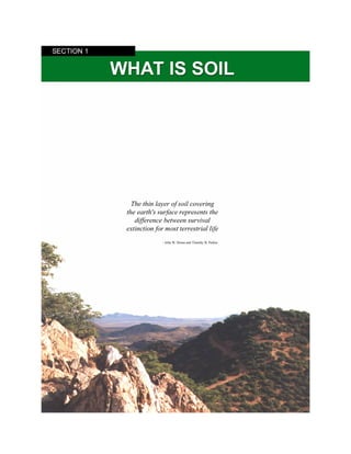
Soil is formed through the interaction of the lithosphere, atmosphere, hydrosphere, and biosphere. It is the biologically active, porous medium that develops below the land surface. Soil consists of mineral and organic components, with pore spaces filled with either air or water. As the interface between these spheres, soil impacts ecosystem dynamics and the Earth system as a whole. It is classified based on its horizons, which form layers with different properties over time through soil-forming factors like climate, organisms, relief, and parent material.
1) The document discusses land evaluation procedures including land capability classification, land productivity index, and land suitability assessment.
2) Key factors in land evaluation include soil profile characteristics, texture, slope, rainfall, and miscellaneous limitations to determine a land's production potential.
3) There are eight land capability classes ranging from suitable arable land to non-arable land unsuitable for cultivation based on limitations.
4) The land productivity index is calculated based on ratings for soil, texture, slope, and other factors.
5) Land suitability assessment involves comparing land qualities to land use requirements to determine suitability for different land utilization types.
Soils can process and hold considerable amount of water. They can take in water, and will keep doing so until they are full, or until the rate at which they can transmit water into and through the pores is exceeded. Some of this water will steadily drain through the soil (via gravity) and end up in the waterways and streams, but much of it will be retained, despite the influence of gravity. Much of this retained water can be used by plants and other organisms, thus contributing to land productivity and soil health.
The document discusses the key factors that influence soil formation - parent material, climate, organisms, relief, and time. It describes how climate, especially precipitation and temperature, has one of the most significant impacts on soil development processes like leaching, translocation, and profile differentiation. The type of vegetation and parent material also determine properties of the resulting soil, such as texture, color, and acidity. Steeper slopes generally result in shallower, less developed soils due to increased erosion. Soil properties continue to change as more time passes and the soil matures.
This document presents information about soil profiles and horizons. It discusses the key components of soil including minerals, organic material, air and water. It describes the distinct layers that make up a soil profile from the surface down to the bedrock. These layers are known as horizons, including the O, A, E, B, C and R horizons. Each horizon is defined by its composition, depth and role in soil formation and nutrient transport. The document provides details on the characteristics of each individual horizon that makes up the soil profile.
1. Soil aeration is the exchange of gases like oxygen and carbon dioxide between the soil pores and atmosphere. It ensures sufficient oxygen for plant roots and microbes while preventing excess carbon dioxide build up.
2. Gaseous exchange occurs through both mass flow and diffusion. Mass flow is driven by pressure gradients while diffusion occurs down partial pressure gradients between the soil pores and atmosphere.
3. Factors like soil texture, structure, moisture and organic matter influence the gas composition and aeration status of soils by affecting the pore space available for gas exchange. Well-aerated soils support better plant growth.
Land degradation and their restoration technologyIGKV
This document provides an overview of land degradation, restoration techniques, and the Indian scenario. It discusses the types and causes of land degradation including soil erosion, fertility decline, waterlogging, and salinization. It then outlines methods used in India to assess and classify land degradation. The document concludes by describing various land restoration methods like improving soil carbon, establishing plantations, using organic farming techniques, and bioremediation.
The document discusses land capability classification (LCC), which classifies land based on its potentialities and limitations for agricultural use. LCC takes into account soil profile characteristics, external land features, and climate factors to assign lands to capability classes. There are two main groups - arable land classes suitable for cultivation, and non-arable land classes where cultivation is limited. The classification aims to properly match land use to its capabilities to prevent degradation. However, LCC has constraints as it does not consider special crops or economic factors, and assumes a moderate management level.
This document discusses waterlogged soils, their properties, distribution, impacts on agriculture, and management strategies. It defines waterlogged soils as soils that are saturated with water for long periods annually, resulting in distinct soil layers. Common types include riverine flood, oceanic flood, seasonal, perennial, and sub-soil waterlogging. Factors like rainfall, irrigation, drainage, topography, and groundwater levels can lead to waterlogging. The document then outlines the physical, chemical, and biological properties of waterlogged soils. It also discusses the global distribution of waterlogged soils and some major regions before detailing approaches to manage waterlogging issues in agriculture.
This document provides an overview of assessing soil quality. It discusses the importance of evaluating soil quality to understand the impacts of management practices on soil functions. Key parameters for assessing soil quality are organized into physical, chemical, and biological indicators. Common methods for evaluating soil quality indicators include statistical analysis, soil quality indexing, and case studies. Maintaining or improving soil quality is important for ensuring soil health and sustainable agricultural productivity over the long term.
This document summarizes key topics related to soil science and tree nutrition. It discusses the components and properties of soil, including texture, structure, pH, and moisture content. Soil provides nutrients, water, and gas exchange for plant growth. The document also covers urban soil challenges, irrigation methods, and water conservation. Maintaining proper soil conditions is important for tree health.
The document discusses 15 key processes involved in soil formation:
1) Humification transforms raw organic matter into humus through decomposition.
2) Laterization concentrates iron and aluminum oxides in tropical soils.
3) Eluviation mobilizes and translocates constituents like clay from top to lower layers.
4) Illuviation deposits translocated materials in lower layers, forming distinct horizons.
soil water energy concept is all about potential energy,gravitational potential,osmotic potential,pressure potential and total potential energies including units
Erosion control involves preventing soil loss from wind and water through principles like using land appropriately, maintaining soil cover, and controlling runoff. Simple solutions include establishing vegetation, contour farming, building retaining walls, using wind breaks, conservation tillage, and mulching. Vegetation helps stabilize soil with roots and decreases erosion through transpiration and soil binding. Contour farming reduces runoff velocity. Retaining walls and wind breaks lessen wind speed to limit soil transport. Conservation tillage and mulching maintain ground cover throughout the year.
This document discusses soil formation processes and factors that influence soil formation. It begins with an introduction to pedogenesis and soil genesis. The main soil forming processes discussed are translocation, organic changes, podzolization, gleying, and desilication. Translocation includes leaching, eluviation, illuviation, calcification, and salinization. The key factors that influence the pace and direction of soil formation are the parent rock material, climate, biotic activity, topography, and time. The document provides examples to illustrate each soil forming process and influencing factor. It concludes with references used.
This document provides an overview of the chemical properties of soils. It discusses the major components of soils including organic matter, minerals, water, air, and living organisms. It describes the types and roles of organic matter such as humus. It also examines the inorganic components of soils including primary and secondary minerals as well as metal oxides. Additionally, it explores the colloidal properties of soil particles and how organic and inorganic colloids influence soil characteristics like water retention and nutrient holding capacity.
Soil Colloids: Properties, Nature, Types and Significance. sources of chargesDrAnandJadhav
This document discusses properties of soil colloids and their significance. It defines soil colloids as soil particles less than 0.002 mm in size that possess colloidal properties. The key types of soil colloids discussed are layer silicate clays, iron and aluminum oxide clays, allophane, and humus. Sources of charge on colloid particles include pH-dependent charge, isomorphous substitution within the crystal lattice, and broken bonds on particle edges. The document outlines various properties of soil colloids and their importance for soil chemistry, nutrient availability, physical properties, and interactions with soil management and pollutants.
This document summarizes key concepts related to weathering and soil formation processes. It describes how weathering breaks down rocks through physical and chemical processes, forming regolith. The main factors that influence soil formation are then outlined, including parent material, climate, topography, organisms/vegetation, and time. Specific weathering and soil forming processes are also defined, such as podzolization, laterization, and gleization. Key minerals and their weatherability are discussed. The role of various physical and chemical weathering agents such as water, wind, temperature changes are also summarized.
The document discusses soil degradation, quality, and health. It defines soil degradation as changes that diminish a soil's ability to provide goods and services. Several types of degradation are described, including water erosion, chemical degradation like acidification, and physical degradation like compaction. Causes include deforestation, overgrazing, and inappropriate irrigation. Key processes are discussed, such as the degradation of physical, chemical, and biological soil properties. Soil quality and health are defined as a soil's ability to perform functions like supporting plant growth and nutrient cycling. Important indicators for assessing soil quality and health are identified, including physical, chemical, and biological properties. Characteristics of healthy soils include good structure, sufficient nutrients, low pollution, and
This document discusses the key properties and components of soil. It notes that soil acts as a key resource for crop production by supporting physical, chemical, and biological processes. Soils can be classified based on their particle size and amount of organic matter. Different soil types like sandy, loamy, and clay soils are described along with their characteristics. Organic matter, soil fertility, drainage, pH, and microbes are also discussed as important factors that influence soil quality and plant growth. Maintaining healthy soil through proper management is emphasized.
Soil is a vital part of the natural environment and is made up of mineral material, organic material, air, and water. The soil profile consists of horizontal layers called horizons that vary in thickness, structure, consistency, porosity, acidity, and composition. The major horizons from top to bottom are O (organic matter), A (topsoil), E (leaching layer), B (subsoil), C (saprolite), and R (bedrock). Soil structure is determined by the combination of primary particles like sand, silt, and clay, while soil composition includes approximately 45% minerals and nutrients, 5% organic matter, 25% water, and 25% air.
This document discusses key concepts in soil science related to soil water. It defines several soil moisture constants including field capacity, wilting coefficient, hygroscopic coefficient, and available water capacity. It also describes the processes of infiltration, percolation, and permeability that govern the entry and movement of water into and through soil. Finally, it discusses saturated and unsaturated water flow in soil and the phenomenon of soil moisture hysteresis.
Soil Forming Rocks and Minerals ClassificationDINESH KUMAR
This document discusses the classification of rocks and minerals. It describes three main types of rocks: igneous, sedimentary, and metamorphic. Igneous rocks form from the cooling of magma, sedimentary rocks form through the accumulation and cementation of sediments, and metamorphic rocks form from alterations to existing rocks by heat, pressure, and chemically active fluids. Within each rock type are various sub-classifications. The document also examines the classification of important rock-forming minerals and describes their structures, weathering properties, and physical characteristics.
Soil formation or pedogenesis is the combined effect of human impact on the environment, physical, chemical and biological processes working on soil parent material.
This document discusses evapotranspiration, which is the total amount of water lost as vapor from soil, plant surfaces, and water bodies. It defines evaporation as movement of water to the air from sources like soil and water bodies, while transpiration is movement of water within plants and subsequent loss of water vapor through leaf stomata. The document outlines different types of evapotranspiration and factors that affect the process, like plant/crop characteristics, soil properties, and geographical factors. It also describes methods to determine evapotranspiration rates, including indirect methods like water balance and energy balance approaches, and direct methods like using lysimeters to measure actual evapotranspiration.
Pedology is the study of soil formation, genesis, classification, and properties from a natural perspective. Edaphology focuses on how soil relates to plant growth, nutrition, and crop yields. Both fields examine the composition of soil, but pedology views soil as a natural body while edaphology emphasizes soil's relationship to agricultural production.
This document discusses methods for estimating soil moisture content. It defines soil moisture as the water held in the spaces between soil particles, particularly in the top 200 cm that is available to plants. There are direct methods that measure the moisture content through gravimetric techniques like oven drying samples, and volumetric methods using bulk density. Indirect methods measure water potential or tension, including tensiometers, gypsum blocks, and neutron probes. Remote sensing techniques estimate soil moisture from visible/infrared reflectance, thermal infrared surface temperature, and passive/active microwave emissions and backscattering related to dielectric properties.
The soil system integrates aspects of living systems and biogeochemical cycles. Soil forms through weathering of parent material and incorporates organic matter from decomposing organisms. Soil profiles develop distinct horizontal layers or horizons over time. Soil types are classified based on their texture, which depends on proportions of sand, silt, and clay. Primary productivity relies on soil properties like mineral content, drainage, and water-holding capacity. Soil degradation occurs through erosion, acidification, salinization, and other human impacts. Conservation strategies aim to reduce erosion, maintain vegetation cover, and manage irrigation and grazing.
Soil is a natural medium composed of minerals, organic matter, gases, liquids, and organisms that together support plant growth. It performs important functions like supporting plant growth, storing water, and providing habitat for decomposer organisms.
Soil consists of distinct horizontal layers called horizons that vary in composition from rich organic layers on top to underlying rocky layers. The horizons include the O horizon of leaf litter and humus, the topsoil A horizon where plants root and seeds germinate, the clay-rich subsoil B horizon, the partially weathered bedrock C horizon, and the unweathered bedrock R horizon.
Different types of soils like clay, silt, sand, loam, chalk
The document defines phytoremediation as using plants to clean up contaminated environments like soil and water. Plants can absorb, break down, or prevent the spread of various contaminants such as metals, pesticides, and oil. Phytoremediation works slowly over several years as plants and their roots work to remediate contamination. It is considered a safe, low-cost and environmentally-friendly alternative to other remediation methods.
This document describes the natural ecosystem of a river, including animals like snakes, frogs, birds, fish and ducks, as well as plants like grass, flowers and trees. The river contains water and flows under a bridge, surrounded by the sky.
The document describes three species of animals found in Colombia: vultures of the Andes which are black, white, and red with brown and endangered; pink dolphins that live in the Amazonas river and eat fish, with about 5 species remaining in Colombia; and flag macaws that live in forests in America, eat fruits and insects, with approximately 4000 remaining in America.
The document discusses a quote about how a river represents the entire valley that feeds it. It then provides 3 sentences summarizing key information about rivers: Rivers undergo natural processes that distribute nutrients globally and are part of the water cycle; they can be divided into zones defined by biological and physical factors; and support diverse ecosystems ranging from bacteria to fish and other vertebrates.
The biosphere is the global sum of all ecosystems on Earth, consisting of all living things and their interactions with each other and non-living elements of the planet. It forms a closed, self-regulating system sustained by energy from the sun and interior of Earth, apart from solar, cosmic, and geothermal influences. The biosphere integrates all life and biological processes within the lithosphere, hydrosphere, and atmosphere.
The document discusses the platypus and freshwater biomes. It describes how platypuses feed on freshwater insects, create burrows for shelter, and have venom to defend against predators like snakes, rats, and foxes. Additionally, it provides unique facts about platypuses like how they are mammals that lay eggs and can stay underwater for 10 minutes. The document also notes that freshwater biomes have cooler temperatures and rainfall between 10 to 80 inches annually with water having low salt concentrations under 1%.
Ameena’s collection of endangered species in IndiaArif Zafar
The document lists 27 endangered species found in India, including the Anaimalai flying frog, dhole, Eld's deer, onager, white-bellied musk deer, Indian wild ass, Asiatic lion, banteng, South Asian river dolphins, Gee's golden langur, hispid hare, markhor, Malabar large-spotted civet, lion-tailed macaque, tiger, snow leopard, pygmy hog, Phayre's leaf monkey, white-bellied heron, Indian vulture, Indirana gundia, Javan rhinoceros, Ganges shark, Pondicherry shark, Nilgiri thar. Many
Looks at the question of:
HOW MANY BIOMES?
There is no clear answer and the powerpoint goes through the possible answers.
It concludes to five basic biomes that include ‘sub-biomes’.
You need to download PowerPoint in order to view animations.
There is a WORKSHEET that accompanies this POWERPOINT at:
http://www.slideshare.net/yaryalitsa/biomes-worksheet
Rivers are characterized by their velocity, discharge, gradient, channel development, drainage area, and sediment yield. Velocity is the speed of water flow, discharge is the volume of water flowing per second, and gradient refers to the steepness of the river channel and floodplain. Drainage area is the land area that drains into the river, and sediment yield measures the amount of sediment exported from the drainage basin.
This document provides an overview of several critically endangered species in India, including a summary of their threats. It discusses the Amur leopard which has a population of around 30 individuals and is threatened by illegal wildlife trade. It also discusses the Hawksbill turtle which is threatened by illegal wildlife trade for its shell, and the Leatherback turtle which faces threats from fisheries bycatch and habitat loss. It provides information on other critically endangered species such as the Cross River gorilla threatened by hunting, the Sumatran tiger threatened by illegal wildlife trade and habitat loss, the Javan rhino with only around 35 individuals left threatened by reduced genetic diversity and natural disasters, and the Sumatran orangutan threatened by habitat loss and
1) A biome is a specific area characterized by its climate, plants, animals, soil, and location. Biomes include forests, grasslands, deserts, and aquatic ecosystems.
2) Key factors like latitude and altitude determine different biomes across Earth. Areas near the equator tend to be tropical rainforests, while higher latitudes support temperate forests, grasslands, and tundra ecosystems.
3) Biomes are classified as terrestrial, freshwater, or marine based on whether they are found on land, in freshwater, or in oceans. Examples of different biomes like tropical rainforests, grasslands, and wetlands are described.
This document discusses stratification in lakes. It describes how lakes are vertically divided into three layers - the epilimnion on top which is mixed by wind, the metalimnion in the middle where temperature drops rapidly, and the hypolimnion on the bottom which remains cool and unaffected by wind. It also explains how the stability of this stratification depends on the energy required to uniformly mix the layers, and discusses differences between eutrophic and oligotrophic lakes in terms of biomass, diversity, and water quality.
This document discusses endangered and endemic plant and animal species found in India. It notes that India has a wide variety of species, many of which are threatened by human activity. The Wildlife Protection Act categorizes endangered species and protects them. Some major threatened species include tigers, elephants, rhinos, and various plants like teak and sal trees. The document provides details on 20 common plant species found in India, describing their characteristics and importance. It emphasizes the need to conserve biodiversity and protect endangered species.
Freshwater biomes include ponds, lakes, and rivers. Plants typically grow along the edges of freshwater bodies, which have a surface temperature that matches the air but get colder with depth, with the bottom layer not receiving sunlight and averaging 4-8 degrees C. Some ponds are seasonal, filling only during rainy times of year. Freshwater lacks waves and has a bottom covered in mud.
This document provides information about various freshwater biomes including wetlands, rivers, lakes, and how humans interact with these environments. Wetlands are found globally and have waterlogged soils that support over 5,000 plant species. Rivers flow from headwaters to mouths, changing in characteristics along their path. Lakes range widely in size and depth, supporting diverse shoreline and open water ecosystems. Freshwater biomes are crucial for human water supply but are threatened by pollution and activities like dam construction that can harm native species.
Freshwater ecosystems include lakes, ponds, rivers and streams. Lakes are large bodies of freshwater surrounded by land, while ponds are smaller. Lake Baikal contains about one fifth of the world's freshwater. Rivers and streams are moving bodies of freshwater that originate in mountains and flow into oceans. Plants in freshwater ecosystems provide oxygen through photosynthesis and food for animals. Many animals live in freshwater ecosystems, with some adapted to fast moving waters and others to still waters. People rely on freshwater ecosystems for drinking water, energy, transportation, recreation and jobs like fishing.
The document discusses different types of lakes categorized based on their nutrient levels and source. There are three main types: oligotrophic lakes which have very low nutrient levels and clear water; mesotrophic lakes which have moderate nutrient levels; and eutrophic lakes which have high nutrient levels and murky water. Other lake types include tectonic, volcanic, glacier, salty, artificial, oxbow, and meromictic lakes which have specific geological or environmental characteristics.
Freshwater biomes can be characterized by their salt concentration, links to surrounding terrestrial environments, and water flow patterns. Lakes and ponds are bodies of standing freshwater that can be classified as oligotrophic, mesotrophic, or eutrophic depending on their nutrient levels. Rivers and streams transport water from headwaters to mouths, with zones that change from clear and rocky to wider and silty based on elevation and sediment load. Wetlands are rich freshwater habitats that support hydrophytic plants like marshes, swamps, and bogs.
Soil is the biologically active, porous medium that develops below the land surface as a result of interactions between the atmosphere, biosphere, lithosphere, and hydrosphere. It consists of mineral and organic components, air and water. The pedosphere refers to the envelope where soils occur and soil formation processes are active. Soils form through weathering of parent materials like rock and consist of horizontal layers called horizons that differ in properties. The pedon is the three-dimensional unit of soil.
This document provides an overview of key concepts in physical geography, including the four realms of the Earth (atmosphere, lithosphere, hydrosphere, biosphere), scales in physical geography from global to individual, systems like flow and feedback systems, and definitions of weather and climate. It discusses how physical geography examines natural processes on Earth's surface and their interaction with human activities.
The document discusses environmental studies and provides definitions and explanations of key concepts. It begins by describing the physical elements of the environment including landforms, water bodies, climate, and soils. It then defines the environment as the total set of circumstances surrounding life, including both living and non-living things. Environmental science is described as integrating various sciences to study our life-supporting environment and understand causes and solutions to problems. The document outlines various components of the environment such as the atmosphere, hydrosphere, lithosphere and biosphere. It also discusses the importance of environmental education, awareness, and management.
This document provides an introduction to earth sciences by Zainal Abidin from SMAN 3 Bandar Lampung on July 27, 2014. It discusses key concepts in earth sciences including the hydrosphere, lithosphere, atmosphere, and biosphere. It emphasizes that earth sciences study the interactions between these spheres and treat the earth as an integrated system using principles from various disciplines. Contact information is provided for the author.
This document provides information about a 5th grade science unit on Earth systems that lasts 20 instructional days. The unit focuses on how the geosphere, biosphere, hydrosphere, and atmosphere interact as systems and how communities use science to protect Earth's resources. Students will develop models of how two systems interact and research how human activities impact the environment and what communities are doing to address this. The unit is designed to help students understand Earth's major systems and our relationship with the natural world.
This document proposes a new framework called "planetary boundaries" to define a safe operating space for humanity to avoid dangerous global environmental change. It identifies nine key Earth system processes and attempts to quantify boundary levels for seven of them, beyond which risks crossing thresholds into uncontrollable change. The boundaries are climate change, ocean acidification, stratospheric ozone depletion, interference with biogeochemical nitrogen and phosphorus cycles, global freshwater use, land system change, and rate of biodiversity loss. The paper argues humanity has already exceeded boundaries for climate change, biodiversity loss and nitrogen cycle. Crossing boundaries increases risks and impacts, and boundaries are interconnected, so exceeding one could impact others.
Urbanecology and environmental planningSamanth kumar
This document outlines the course contents for a master's program in environmental architecture at Anna University. It covers 5 units: (1) introduction to urban ecosystems, ecology, and environmental science concepts; (2) concepts and approaches to ecological planning; (3) human influence on ecosystems; (4) effects of growing population on ecosystems; and (5) global environmental issues and policies. Key topics include urban ecosystem structure, major ecosystem types, energy and nutrient flows, ecological pyramids, predation, and human impacts such as pollution, resource exploitation, and urbanization effects.
Sub categories-of-environmental-scienceivy buncaras
This document outlines 5 sub-categories of environmental science: 1) Atmospheric Science which studies the earth's atmosphere and includes meteorology, climatology and aerology. 2) Ecology which examines relationships between living organisms and their environment at multiple levels. 3) Environmental Chemistry which studies chemical processes in the environment from human activities. 4) Geosciences which involves the study of geology, geography, and challenges faced by communities through disciplines like physical geography, geomorphology, and hydrology. 5) Environmental Assessment which evaluates the environmental impacts of plans, policies, projects and programs before decisions are made.
Humanity has substantially transformed Earth's ecosystems. Approximately one-third to one-half of Earth's land surface has been converted for human use, such as agriculture and urbanization. Humans also dominate global biogeochemical cycles, such as fixing more atmospheric nitrogen than natural terrestrial sources. Additionally, about one-quarter of bird species have gone extinct due to human influences. No ecosystem on Earth is free from significant human impact. The growth of the human population and economy drives land transformation and disruption of biogeochemical cycles through activities like agriculture, industry, and fishing. These changes then further alter global climate and cause biodiversity loss. Land transformation, in particular, represents humanity's most substantial alteration to Earth and is the primary driver of
1. The document examines tropical hydrology and the need for further research on moisture cycling, catchment processes, and long-term data collection across the humid tropics.
2. It discusses the highly variable and intense nature of the tropical hydrological cycle compared to other regions, and how human activities are rapidly altering tropical landscapes and hydrology.
3. The research vision calls for integrated studies of water fluxes from subsurface to atmosphere across strong environmental gradients, as well as coordinated long-term monitoring networks to understand low-frequency dynamics in the context of a warming climate and continued land use change.
Here are two examples of interactions between Earth's subsystems:
1. Volcanic eruptions (geosphere) release large amounts of gases and ash into the atmosphere. The ash and particles can serve as nuclei for formation of raindrops, influencing precipitation patterns and potentially increasing rainfall (hydrosphere). The changes in rainfall can impact plant growth and ecosystems (biosphere).
2. Photosynthesis by plants (biosphere) releases oxygen and absorbs carbon dioxide from the atmosphere. Plants also take in water and minerals from the soil (geosphere) through their roots. Transpiration by plants releases water vapor into the air (hydrosphere), influencing the water cycle and climate.
The scope of studying environmental aspects is extremely wide and covers several crucial aspects of almost all disciplines.
The survival of any organism requires a steady supply of food and other materials and removal of waste products from its environment. The degradation of the environment is becoming a serious problem for the existence of human beings and other life. Pollution of soil, water and air causes harm to living organisms as well as loss to valuable natural resources. Several important aspects are studied under the field called as Environmental Studies.
An Expository Essay On Ecology And Environmental PlanningMonica Franklin
This document provides an overview of ecology, environment, planning, and ecological and environmental planning. It defines ecology as the scientific study of organism's interactions with each other and their environment. Environment refers to the natural and built surroundings that influence organisms. Planning involves decision making to achieve future goals using limited resources. Ecological and environmental planning integrates environmental and ecological factors into planning to manage human impacts on the environment and balance human activities with natural ecosystems. It has become important for sustainable development and enhancing environments.
This document outlines 12 branches of physical geography: geomorphology, climatology, oceanography, biogeography, soil geography, hydrology, meteorology, environmental geography, ecology, glaciology, paleogeography, and astronomical geography. It provides a brief 1-2 sentence definition of each branch, describing what each field studies and its focus of inquiry.
This document provides an introduction to a unit on the terrestrial environment and the biosphere. It begins by outlining the objectives and overview of the unit. The unit will introduce the components of the biosphere, ecosystems and biomes, and interactions among the spheres. It then defines key terms like biosphere, environment, and discusses the three main spheres of the biosphere - the atmosphere, hydrosphere, and lithosphere. The document provides examples of terrestrial and aquatic biomes and discusses abiotic and biotic factors within ecosystems. It also explores interactions between the spheres through examples like the water cycle and food chains/webs.
Pedology is the branch of soil science that studies soil development and classification. Pedologists seek to understand the processes that govern soil formation and the properties and distribution of soils worldwide. They examine how factors like climate, topography, geology, biology and time interact to produce unique soil properties at various scales, from microscopic to global. Pedologists play an important role in developing models of soil systems and applying their understanding of soil variability to problems in areas like agriculture, natural resource management and reconstructing past environments.
Earth is the third planet from the sun, formed 4.54 billion years ago. It rotates on its axis 366.26 times per year while orbiting the sun, creating seasons and years. The moon stabilizes Earth's axis and causes ocean tides. Earth's surface is divided into tectonic plates that migrate over millions of years. 71% is water and 29% is land with rivers and lakes. The interior remains active with a molten core generating a magnetic field and mantle driving plate tectonics. Earth system science considers interactions between the atmosphere, hydrosphere, cryosphere, geosphere, biosphere, and magnetosphere and human impacts on these. Climate change and the carbon cycle are central to
This document provides an introduction to earth sciences by Zainal Abidin. It discusses key concepts in earth sciences like geology, oceanography, meteorology, and astronomy. It also provides contact information for Zainal Abidin and lists some relevant websites for earth science resources.
The document provides an introduction to key concepts relating to the environment including definitions of environment, ecology, ecosystems, and environmental science. It describes the main components of the environment as the atmosphere, hydrosphere, lithosphere, and biosphere. It also discusses the impact of human activities and development on the environment such as through pollution, resource depletion, and urbanization. The document emphasizes the importance of environmental education and sustainable development for protecting the environment and meeting needs of present and future generations.
This dissertation examines whether computer programmers exhibit enhanced executive control, as seen in bilinguals. The author conducted two executive function tasks with 10 professional and 10 adolescent programmers, compared to monolingual controls. In the Attention Networks Test, programmers had significantly faster reaction times, supporting the hypothesis. In the Stroop task, programmers were slower but not significantly so. Overall, the results provide preliminary evidence that programming experience may enhance executive control, as with bilingualism, warranting future research.
Soil degradation is a serious threat to developing country food security by 2020. According to recent global studies, agricultural soil quality has declined substantially in 16% of developing world cropland, with almost 75% of Central American and 20% of African agricultural land being seriously degraded. Soil degradation is estimated to have reduced crop yields by 13% over the past 50 years and pastoral land yields by 4%. It also diminishes agricultural income and economic growth, with estimates of annual losses ranging from under 1% to over 9% of agricultural GDP in various countries. Soil degradation is projected to most severely impact food production and incomes in densely populated marginal lands in sub-Saharan Africa and Asia if not adequately addressed through policies and investments
Soil is a complex mixture of inorganic materials, living organisms, and dead organic matter that sustains physical, chemical, and biological functions to support plant and animal life. Soils form through physical and chemical weathering of rocks and biological processes. Soil characteristics include physical composition, pore content, permeability, organic material, temperature, mineral content, and water content. Soil can be degraded through erosion, acidification, salinization, compaction, and pollution from various natural and human-caused sources. Actions must be taken to assess, isolate, and eliminate soil pollution to prevent further environmental damage.
Land degradation and soil erosion are major global problems. Approximately 5 billion hectares of land, or 43% of the Earth's vegetated surface, is degraded with reduced productivity. Overgrazing accounts for about one-third of degraded land, while 3.6 billion hectares are associated with desertification. A major cause is overgrazing, while 0.5 billion hectares have been degraded due to tree felling in humid tropics. Soil degradation is responsible for about 2 billion hectares of degraded land, with 85% caused by wind and water erosion which involves raindrop detachment of soil particles, transport by overland water flow or runoff, and deposition in other areas.
This document provides a summary of a report on addressing soil degradation in European Union agriculture. It discusses relevant soil degradation processes, soil conservation practices, and related policies. The key soil degradation processes addressed are erosion, organic carbon decline, compaction, salinization, contamination, and effects on biodiversity. Conservation practices discussed include conservation agriculture, organic farming, ridge tillage, contour farming, and others. The regulatory environment and policy instruments related to soil protection under the Common Agricultural Policy and environmental legislation are also analyzed. The document aims to provide an overview of the current situation regarding soil degradation and conservation in EU agriculture.
Europe’s environment the third assessment soil degradationMichael Newbold
The document discusses soil degradation across Europe. It states that in many parts of Europe, soil is being irreversibly lost and degraded due to increasing demands from various economic sectors. Some key causes of degradation mentioned include unsustainable agricultural practices, soil sealing, erosion, contamination, acidification, salinization and compaction. The severity and distribution of degradation issues varies significantly across different regions of Europe based on factors like climate, geology, and human activities. Better integration of soil protection into sectoral policies is needed to promote more sustainable use of this limited resource.
1) Soil degradation refers to processes that reduce a soil's ability to produce goods and services for current and future generations. It occurs when inappropriate land use practices are adopted, such as deforestation, overgrazing, or unsustainable agricultural practices.
2) Agricultural activities can cause physical, chemical, and biological degradation through practices like excessive tillage, improper fertilizer and pesticide use, lack of crop rotations, and burning of crop residues. This leads to reduced soil organic matter, compaction, erosion, salinization, and loss of biodiversity.
3) The consequences of soil degradation include substantial reductions in agricultural productivity, yields, and farmers' livelihoods, as well as negative downstream impacts
Soil degradation occurs through two main processes: erosion by water and wind, which removes solid material; and leaching, which removes soluble matter. Erosion involves mobilization, transport, and deposition of solids, while leaching involves solubilization, transport, and precipitation/fixation of dissolved components through physicochemical and biological processes like hydration and hydrolysis. Models like the Universal Soil Loss Equation are used to estimate soil degradation from erosion and leaching over large areas based on local measurements and factors such as climate, landscape, soil type, and land use. Soil losses at one site result in deposition elsewhere through aquatic, wind, or precipitation transport.
This document discusses soils and their importance as a natural resource. It explains that soil is made up of weathered rock and organic material. The key factors that influence soil formation are identified as parent material, climate, living organisms, topography, and time. Parent material refers to the minerals and sediments from which soils are formed. Climate and living organisms help break down parent material over hundreds of years to create the thin, top layer of productive soil.
This document discusses the components and properties of soil. It explains that soil provides support and nutrients for plant growth. The five main components of soil are rock, sand, silt, clay, and humus. Humus adds many nutrients to the top layer of soil. There are three main layers of soil: topsoil, subsoil, and bedrock. Natural resources like soil must be conserved through practices like planting trees and grass, healthy farming, and planting gardens.
This document discusses key properties of soil, including the soil profile, horizons, texture, structure, composition, pH, and land capability. It describes:
- The soil profile has distinct horizons (layers) including the O, A, E, B, C horizons.
- Texture refers to particle size and influences properties like moisture holding. The three types are sand, silt, and clay.
- Structure is the way particles cling together, forming aggregates. Types include granular, blocky, and platy.
- Composition includes minerals, organic matter, air, and water. Proper levels are needed for plant growth.
- pH indicates acidity or alkalinity and greatly impacts nutrient
An introduction to soils, soil formation and terminologyMichael Newbold
The document provides an introduction to soils and soil terminology. It defines soil and discusses soil formation factors such as parent material, climate, organisms, relief, and time. It also examines soil processes like weathering, decomposition, humification, capillary action, leaching, and translocation. Key terms are explained, like soil horizons, soil texture, and different types of humus. Soil features including color, structure, and drainage properties are also covered.
The document discusses different types of forests and their role in the climate system. It describes the three main forest types: boreal forests, which are cold and slow-growing; temperate forests, which are resilient to disturbance; and tropical rainforests, which have high biodiversity but fragile soils. Tropical rainforests play a key role in the global water cycle by recycling rainfall and fueling more storms. Deforestation is a concern because it reduces biodiversity, increases carbon dioxide emissions, and impacts regional climates by decreasing evapotranspiration and rainfall.
This document summarizes the main causes and reasons for deforestation globally and in Turkey specifically. The key drivers of deforestation discussed are population growth, agriculture expansion, logging, fuel needs, and grazing. Deforestation results in declines in habitats, biodiversity, and forest resources. While forest management practices could help mitigate deforestation, many developing countries lack strong forestry institutions and local cooperation is sometimes lacking. The document also provides a brief overview of Turkey's forestation policies and goals to increase forest coverage from its current level of around 27% of land.
The document summarizes the causes and effects of deforestation. It notes that 11,000 years ago, forests covered most of the Earth but now cover only one-fifth due to clearing for fuel, commodities, livestock, and settlements. Deforestation results in habitat loss, biodiversity loss, soil erosion, disrupted water cycles, increased flooding and drought, and climate change through reduced carbon storage. Efforts are needed to reduce dependency on forests, practice reforestation, and educate communities on sustainable forest management.
This document summarizes research on deforestation throughout history. It discusses how deforestation has long been a major process transforming landscapes, but knowledge of deforestation before 1500 is limited due to sparse records. Recent scholarship has provided more details on prehistoric and classical era deforestation. The Neolithic era saw more permanent forest clearing for agriculture than previously believed. Deforestation increased greatly in medieval Europe to support growing populations.
The document discusses the benefits of exercise for mental health. Regular physical activity can help reduce anxiety and depression and improve mood and cognitive function. Exercise causes chemical changes in the brain that may help protect against mental illness and improve symptoms.
- Breaking the Climate Deadlock is an initiative led by former UK Prime Minister Tony Blair and The Climate Group to build support for a post-2012 international climate agreement. This document discusses issues related to reducing emissions from deforestation and forest degradation (REDD) in developing countries.
- Key issues discussed include the challenges of accurately setting a reference level for emissions reductions given varying deforestation rates among countries, concerns about equity outcomes if REDD is implemented at a large scale, and the importance of technical assistance and safeguards to ensure social and environmental protections.
- The document makes recommendations such as including REDD in post-2012 agreements as part of a deal with more ambitious emissions targets overall, and addressing concerns about
This document provides an introduction to marketing local food and discusses various direct and intermediate marketing options for farmers. It begins with a self-assessment tool to help farmers identify their preferences and strengths in terms of customer contact, regulations, liability, pricing, and paperwork/organization. This can help determine which marketing strategies may be the best fit. The document then provides overviews and profiles of different local food marketing approaches, including farmers' markets, community supported agriculture, agritourism, pick-your-own, roadside stands, restaurants/grocery stores, institutional food service, brokers/distributors, and collaboratives. Later sections cover general topics like regulations, food safety, liability, pricing, branding and more.
This document discusses the benefits of buying local food. It defines local and sustainable food systems as those that emphasize proximity, efficiency, and seasonality in food production, distribution and consumption. Local systems address issues like food security, community self-reliance and environmental sustainability by strengthening relationships between food producers and consumers. They also keep more of the financial benefits of the food system within the local community. The document encourages supporting local farms and businesses by making conscious purchasing decisions and voices that buying local food can help build a stronger, more resilient local food system.
Top 8 Strategies for Effective Sustainable Waste Management.pdfJhon Wick
Discover top strategies for effective sustainable waste management, including product removal and product destruction. Learn how to reduce, reuse, recycle, compost, implement waste segregation, and explore innovative technologies for a greener future.
Improving the viability of probiotics by encapsulation methods for developmen...Open Access Research Paper
The popularity of functional foods among scientists and common people has been increasing day by day. Awareness and modernization make the consumer think better regarding food and nutrition. Now a day’s individual knows very well about the relation between food consumption and disease prevalence. Humans have a diversity of microbes in the gut that together form the gut microflora. Probiotics are the health-promoting live microbial cells improve host health through gut and brain connection and fighting against harmful bacteria. Bifidobacterium and Lactobacillus are the two bacterial genera which are considered to be probiotic. These good bacteria are facing challenges of viability. There are so many factors such as sensitivity to heat, pH, acidity, osmotic effect, mechanical shear, chemical components, freezing and storage time as well which affects the viability of probiotics in the dairy food matrix as well as in the gut. Multiple efforts have been done in the past and ongoing in present for these beneficial microbial population stability until their destination in the gut. One of a useful technique known as microencapsulation makes the probiotic effective in the diversified conditions and maintain these microbe’s community to the optimum level for achieving targeted benefits. Dairy products are found to be an ideal vehicle for probiotic incorporation. It has been seen that the encapsulated microbial cells show higher viability than the free cells in different processing and storage conditions as well as against bile salts in the gut. They make the food functional when incorporated, without affecting the product sensory characteristics.
Evolving Lifecycles with High Resolution Site Characterization (HRSC) and 3-D...Joshua Orris
The incorporation of a 3DCSM and completion of HRSC provided a tool for enhanced, data-driven, decisions to support a change in remediation closure strategies. Currently, an approved pilot study has been obtained to shut-down the remediation systems (ISCO, P&T) and conduct a hydraulic study under non-pumping conditions. A separate micro-biological bench scale treatability study was competed that yielded positive results for an emerging innovative technology. As a result, a field pilot study has commenced with results expected in nine-twelve months. With the results of the hydraulic study, field pilot studies and an updated risk assessment leading site monitoring optimization cost lifecycle savings upwards of $15MM towards an alternatively evolved best available technology remediation closure strategy.
Presented by The Global Peatlands Assessment: Mapping, Policy, and Action at GLF Peatlands 2024 - The Global Peatlands Assessment: Mapping, Policy, and Action
Optimizing Post Remediation Groundwater Performance with Enhanced Microbiolog...Joshua Orris
Results of geophysics and pneumatic injection pilot tests during 2003 – 2007 yielded significant positive results for injection delivery design and contaminant mass treatment, resulting in permanent shut-down of an existing groundwater Pump & Treat system.
Accessible source areas were subsequently removed (2011) by soil excavation and treated with the placement of Emulsified Vegetable Oil EVO and zero-valent iron ZVI to accelerate treatment of impacted groundwater in overburden and weathered fractured bedrock. Post pilot test and post remediation groundwater monitoring has included analyses of CVOCs, organic fatty acids, dissolved gases and QuantArray® -Chlor to quantify key microorganisms (e.g., Dehalococcoides, Dehalobacter, etc.) and functional genes (e.g., vinyl chloride reductase, methane monooxygenase, etc.) to assess potential for reductive dechlorination and aerobic cometabolism of CVOCs.
In 2022, the first commercial application of MetaArray™ was performed at the site. MetaArray™ utilizes statistical analysis, such as principal component analysis and multivariate analysis to provide evidence that reductive dechlorination is active or even that it is slowing. This creates actionable data allowing users to save money by making important site management decisions earlier.
The results of the MetaArray™ analysis’ support vector machine (SVM) identified groundwater monitoring wells with a 80% confidence that were characterized as either Limited for Reductive Decholorination or had a High Reductive Reduction Dechlorination potential. The results of MetaArray™ will be used to further optimize the site’s post remediation monitoring program for monitored natural attenuation.
Epcon is One of the World's leading Manufacturing Companies.EpconLP
Epcon is One of the World's leading Manufacturing Companies. With over 4000 installations worldwide, EPCON has been pioneering new techniques since 1977 that have become industry standards now. Founded in 1977, Epcon has grown from a one-man operation to a global leader in developing and manufacturing innovative air pollution control technology and industrial heating equipment.
different Modes of Insect Plant InteractionArchita Das
different modes of interaction between insects and plants including mutualism, commensalism, antagonism, Pairwise and diffuse coevolution, Plant defenses, how coevolution started
WRI’s brand new “Food Service Playbook for Promoting Sustainable Food Choices” gives food service operators the very latest strategies for creating dining environments that empower consumers to choose sustainable, plant-rich dishes. This research builds off our first guide for food service, now with industry experience and insights from nearly 350 academic trials.
ENVIRONMENT~ Renewable Energy Sources and their future prospects.tiwarimanvi3129
This presentation is for us to know that how our Environment need Attention for protection of our natural resources which are depleted day by day that's why we need to take time and shift our attention to renewable energy sources instead of non-renewable sources which are better and Eco-friendly for our environment. these renewable energy sources are so helpful for our planet and for every living organism which depends on environment.
Microbial characterisation and identification, and potability of River Kuywa ...Open Access Research Paper
Water contamination is one of the major causes of water borne diseases worldwide. In Kenya, approximately 43% of people lack access to potable water due to human contamination. River Kuywa water is currently experiencing contamination due to human activities. Its water is widely used for domestic, agricultural, industrial and recreational purposes. This study aimed at characterizing bacteria and fungi in river Kuywa water. Water samples were randomly collected from four sites of the river: site A (Matisi), site B (Ngwelo), site C (Nzoia water pump) and site D (Chalicha), during the dry season (January-March 2018) and wet season (April-July 2018) and were transported to Maseno University Microbiology and plant pathology laboratory for analysis. The characterization and identification of bacteria and fungi were carried out using standard microbiological techniques. Nine bacterial genera and three fungi were identified from Kuywa river water. Clostridium spp., Staphylococcus spp., Enterobacter spp., Streptococcus spp., E. coli, Klebsiella spp., Shigella spp., Proteus spp. and Salmonella spp. Fungi were Fusarium oxysporum, Aspergillus flavus complex and Penicillium species. Wet season recorded highest bacterial and fungal counts (6.61-7.66 and 3.83-6.75cfu/ml) respectively. The results indicated that the river Kuywa water is polluted and therefore unsafe for human consumption before treatment. It is therefore recommended that the communities to ensure that they boil water especially for drinking.
2. Introduction to Soil Science and Soil Resources
2
1.1 Introduction
Soil is the biologically active, structured porous medium that has developed below the conti-
nental land surface on our planet. Many scientists have described soil as the skin of the Earth and
have studied it in great detail because its properties are different from the properties of each of its
components. The science of pedology emphasizes the study of soil as a natural phenomenon on the
surface of the Earth. Therefore, the pedologist is interested in the appearance of the soil, its mode
of formation, its physical, chemical and biological composition, and its classification and distribu-
tion (Bridges, 1997). The pedosphere is the envelope of the Earth where soils occur and soil form-
ing factors are active (Ugolini and Spaltenstein, 1992).
The pedosphere only develops when there is a dynamic interaction between the atmosphere,
biosphere, lithosphere and the hydrosphere (Fig. 1.1). The pore space in soil is either filled with air
or water, while the solid phase consists of the mineral (lithosphere) and organic living (biosphere)
and nonliving components. Soil is the foundation for life in terrestrial ecosystems and affects the
energy budget, water exchange, nutrient cycling and ecosystem productivity.
Over the past 50 years, there has been tremendous development in different disciplines of Earth
Sciences. Advances in space exploration, a holistic view of the Earth, instrumentation and infor-
mation technology have pushed the scientific research and teaching agendas from the discovery of
fundamental concepts in individual disciplines to the integration of data and the formulation of
hypotheses for larger, complex systems. The study of the connections and the interactions between
the atmosphere, hydrosphere, biosphere, cryosphere, pedosphere, solid earth, and near space is
emerging as the foundation for Earth System Science. The Earth System Science approach is now
being used to assess the impact of human activities on global environmental change.
Fig. 1.1. Relationships between the pedosphere, atmosphere, hydrosphere, lithosphere and biosphere.
3. What is Soil?
3
In 1996, the Earth System Science Education group in the United States initiated a formal
collaborative effort to create Earth System Science educational modules for the following topics
(Johnson et al., 1997):
1. Earth Energy Budget: This module focuses on the analysis of environmental/earth sys-
tems phenomena partially as a problem of the transformation and flow of energy within
organized systems. Potential areas of application include: global climate change; ecosys-
tem energetics; energy flow and material cycles of carbon, hydrogen, nitrogen and phospho-
rus; human energy infrastructure; ocean dynamics; and planetary formation and evolution.
Soils strongly impact global environmental change, ecosystem energetics, energy flow and
material cycles.
2. Atmospheric Ozone: The atmosphere is the air surrounding the Earth. It extends up to
200 km into the atmosphere and its composition changes over time. The atmosphere layer
at 15-30 km altitude has an ozone concentration of 1-10 parts per million. The ozone layer
limits the amount of ultraviolet radiation reaching the ground surface. Ultraviolet radiation
can cause damage to certain plant cells and affect the biotic activity in the pedosphere.
3. Hydrological Cycle: This module focuses on the global hydrological cycle, local hydro-
logical cycle, and human consumption of water. Key systems concepts include equilibrium,
feedback, closed versus open systems, residence times and the nature of transient responses
to perturbations. The local hydrological cycle is strongly controlled by soil and landscape
properties.
4. The Biosphere: The biosphere is the whole region of the Earth’s surface, the ocean and the
air that is inhabited by living organisms. The key emphases for this module are: putting the
biosphere into a time perspective - considering how organisms and the earth evolved to-
gether through interchanges of energy and pressure; and putting the biosphere into a spatial
perspective by examining the effect of the atmosphere, hydrosphere, lithosphere and
pedosphere on the distribution of biomes and ecosystems within the earth.
5. Biogeochemical Cycles: The global carbon cycle is a key element of the Earth System and
plays an important role in determining Earth’s climate. It is interconnected with the global
hydrologic cycle and the planetary energy cycle to determine climate. It is also intercon-
nected with the global cycles for elements such as nitrogen, phosphorus, sulfur, and heavy
metals. The pedosphere supports life in terrestrial ecosystems and impacts the cycling of
elements and energy flow of the Earth System.
6. Soil Processes, Land Use, Land Cover Change: This module focuses on: soils and their
function in terrestrial ecosystems; the linkage between soils and the biosphere; the different
time scales in which soils regenerate and humans degrade soils; the impact of land use
practices; and the long-term economic, ecological, and human consequences of good and
poor soil management.
4. Introduction to Soil Science and Soil Resources
4
7. Economics, Sustainability and Natural Resources: This module focuses on analyses of
linkages between economics and environmental change on local, regional and global scales
and addresses the role of economic analysis in the design and implementation of environ-
mental policy. The sustainable use of renewable natural resources (soil, air, water, mi-
crobes, plants and animals) in the context of non-renewable resources (oil, natural gas,
natural forests) is a major environmental issue facing human society at local, regional and
global levels.
8. The Antarctic: This module focuses on Antarctica, illustrating the interdisciplinary pro-
cesses of glaciology, geology, biology, and chemistry, which influence Earth phenomena
and human activities in an international context.
9. El Niño - Southern Oscillation: El Niño is a disruption of the ocean-atmosphere system in
the tropical Pacific having important consequences for weather around the globe. Among
these consequences are increased rainfall across the southern tier of the US and in Peru,
which has caused destructive flooding, and drought in the West Pacific, sometimes associ-
ated with devastating brush fires in Australia. The change in weather patterns impacts
water storage and plant growth in terrestrial ecosystems.
10. Observing Systems and Remote Sensing: The use of radars, sonars, spectroscopy, air-
borne and satellite photography allows for the gathering of information without actual physical
contact with what is being observed. Passive satellite remote sensing involves the measure-
ment of electromagnetic radiation (i.e. light, heat) upwelling to a satellite instrument. By
examining the electromagnetic spectrum of radiation emitted from the sun, or emitted from
the Earth system, as it interacts with the Earth system, one may discover signal information
for different processes or changes in the atmosphere, oceans, or on Earth’s surface. Some
applications connected to soil and landscape processes include land use, land cover change,
water pollution and flooding.
11. Human Population - Environment Interactions: This module focuses on issues of hu-
man population and environmental interaction and addresses issues such as the dynamics of
human population, the consumption of natural resources, social dimensions, and industrial
ecology. Integration of these issues could lead to assessment of the human impact on the
environment.
12. Health and Climate Change: This module focuses on the impact of climate change on
human health. Climate change affects the moisture and temperature regimes, the intensity
of ultraviolet radiation on the Earth’s surface and other processes which may affect ecosys-
tem health. These in turn could impact human health.
13. Earth System History: This modules provides an overview of the scales and development
of solid earth, oceans, atmosphere and life with focus on events or trends that are particu-
larly important to present-day earth system components and processes. It emphasizes the
inter-relatedness of life and earth processes. Human-induced climate changes will be super-
imposed on the background of natural variability and variations of temporal, spatial, and
5. What is Soil?
5
energy scales of processes in all aspects of the Earth systems.
14. System Concepts and the Earth System: This module focuses on the applicability of
systems theory to the real world, systems concepts and terminology, and an introduction to
integrative systems modeling. Systems theory focuses on the arrangement of and relations
between the parts which connect them to the whole. Mathematical systems theory is applied
to problems in such diverse fields as engineering, computing, ecology, and management.
The pedosphere is the interface between the atmosphere, lithosphere, hydrosphere and the bio-
sphere in terrestrial ecosystems. Knowledge of the discipline of Soil Science is needed to under-
stand ecosystem dynamics and can lead to a better understanding of the terrestrial portion of the
whole Earth System.
1.2 The Pedosphere
Definitions
Atmosphere: The air surrounding the Earth. The atmosphere has no precise upper limit, but for all
practical purposes, the absolute top can be regarded as being at about 200 km.
Biosphere: The part of the Earth’s environment in which living organisms are found, and with
which they interact to produce a steady-state system, effectively a whole planet ecosystem.
Hydrosphere:The total body of water that exists on or close to the surface of the Earth.
Lithosphere: The upper (oceanic and continental) layer of the solid Earth, comprising all crustal
rocks and the brittle part of the uppermost mantle.
Pedosphere: The envelope of the Earth where soils occur and where soil-forming processes are
active.
Landscape: All the natural features such as fields, hills, forests, and water that distinguish one
part of the earth’s surface from another part. Usually it is the portion of land or territory that the eye
can see in a single view, including all its natural characteristics.
Regolith: The unconsolidated mantle of weathered rock and soil material overlying solid rock.
Soil: The naturally occurring unconsolidated material on the surface of the earth that has been
influenced by parent material, climate (including the effects of moisture and temperature), macro-
and micro-organisms, and relief, all acting over a period of time to produce soil that may differ from
the material from which it was derived in many physical, chemical, mineralogical, biological, and
morphological properties.
6. Introduction to Soil Science and Soil Resources
6
Soil pedon: The smallest volume of what can be called a soil. A pedon has 3 dimensions. Its lower
limit is the vague and somewhat arbitrary limit between soil and “not soil”. Its area ranges from 1
to 10 square meters, depending upon the variability of horizons. The shape of the pedon is roughly
hexagonal.
Parent material: The unconsolidated and more or less chemically weathered mineral or organic
matter from which the solum of a soil has developed by pedogenic processes.
Soil solum: The upper horizons of a soil in which the parent material has been modified and in
which most plant roots are contained. It usually consists of A and B horizons.
Soil horizon: A layer of soil or soil material approximately parallel to the land surface; it differs
from adjacent genetically related layers in properties such as color, structure, texture, consistence,
and chemical, biological, and mineralogical composition.
Concepts
The pedosphere (soil) forms when there is an interaction of the lithosphere (minerals), bio-
sphere (life), atmosphere (air), and hydrosphere (water) (Fig. 1.2). A vertical cross-section of the
ecosystem contains air, vegetation, soil and subsoil, saturated and unsaturated weathered rock (par-
ent material from which the soil forms) and unweathered rock.
Fig. 1.2. Vertical cross-section of a ecosystem showing the relationships between different landscape
components.
7. What is Soil?
7
An image of the pedon (a three-dimensional body in a landscape) is shown in Fig 1.3a while its
composition is shown in Fig 1.3b. The soil is a natural body that forms from the interaction of the
atmosphere, hydrosphere, lithosphere and biosphere and has unique properties that will be dis-
cussed later. Generally, the soil air and soil water occupy about 50% of the volume of the pedon,
the organic matter consisting of living organisms and their products or by-products accounts for 5%
and the remainder is occupied by the mineral component. The arrangement of soil pores and soil
particles, peds or aggregates into layers, called soil horizons, allows a pedologist to classify soils.
The composition of soil allows soil scientists, engineers, and modelers to quantify the dynamics of
gases, water and solutes occurring within the pedon. These properties will also be discussed later.
The weathering of massive rocks along planes of weakness through physical and chemical
processes leads to the formation of unconsolidated residues called the regolith. The regolith occurs
above the consolidated rock and is the material from which the soil forms. In places where the
regolith is thin, the soil may include the entire regolith. In contrast, if the regolith is very thick, the
soil occupies only its upper part. The regolith is transformed through continual physical, chemical
and biological transformations into a sequence of horizontally differentiated layers called soil hori-
zons.
The soil profile can have one to four master horizons which are named, from the surface down-
ward, as A, B, and C horizons. The underlying consolidated rock is called R horizon. The major
organic horizons are L, F, H, which are mainly forest litter in various stages of decomposition, and
O, which is derived mainly from wetland vegetation. Subdivisions of horizons are labeled by
adding lower-case suffixes to some of the major horizon symbols and are covered in Section 4.8.
The soil pedon is a three-dimensional body in the landscape that can be divided into four main
components: air, water, mineral, and organic matter. In a practical sense, the presence of the hydro-
sphere, atmosphere, biosphere and lithosphere in soil is measured in terms of soil water, soil air,
soil organisms, soil organic matter and mineral (inorganic) components (Fig 1.3).
Fig. 1.3. The structure and composition of a pedon.
8. Introduction to Soil Science and Soil Resources
8
Some pedons contain rock, R, and water, W. In some cases, a pedon may have a sequence of
parent materials. In such cases, the parent materials are labeled sequentially as C, IIC, IIIC and so
on. The prefix in Roman numerals specifies different kinds of parent material. Generally, the
Roman numeral I is assumed for major mineral horizons in the upper part of the pedon and is not
included in horizon designations.
The pedosphere proper develops at the intersection of four spheres: the lithosphere, the hydro-
sphere, the atmosphere and the biosphere. In nature, it is possible to encounter three-sphere and
two-sphere systems in which one or two of the spheres are missing. Mattson (1938) schematically
illustrated these combinations (Fig. 1.4).
Examples of two-sphere and three-sphere systems from different combinations of the lithos-
phere, the hydrosphere, the atmosphere and the biosphere are presented below:
1. LA: Lithosphere + Atmosphere Systems. These can be found in barren, hot deserts or dried
river beds where the dispersed system consists of mineral particles and air. Water is the major
limiting factor for the establishment of living organisms in these systems.
2. AB:Atmosphere + Biosphere Systems. Organisms living on the soil surface in a dry area. For
example, termites growing inside a piece of straw encrusted with soil particles in semi-arid
tropical areas.
3. HB: Hydrosphere + Biosphere Systems. A pond or water with its organisms in the water
column. This system has neither mineral particles nor free air.
Fig. 1.4. Formation of two-sphere, three-sphere and four-sphere systems in nature.
The pedosphere (P) is a four-sphere system (Adapted from Mattson, 1938).
9. What is Soil?
9
4. LH: Lithosphere + Hydrosphere Systems. Water logged sand or clay materials in saturated,
unweathered rock. This system has neither organisms nor air.
5. LAH: Lithosphere + Atmosphere + Hydrosphere Systems. A systems with earth, air and
water but devoid of life due to extreme environmental conditions, e.g. high salt concentrations
or the presence of toxic elements.
6. LAB: Lithosphere + Atmosphere + Biosphere Systems. There cannot be life without water
but remains of biota in dry places may come close to this. For example, microorganisms which
live in the pore spaces of rocks in hot deserts. Their metabolism shuts down when the relative
humidity drops as the temperature of the rocks increases during the daytime.
7. HAB: Hydrosphere +Atmosphere + Biosphere Systems. Organic soils develop unsaturated
conditions because the rate of accumulation of organic material is greater than the rate of de-
composition. Organic soils do not have the lithosphere component in the top 50 cm.
8. LHB: Lithosphere + Hydrosphere + Biosphere Systems. Water logged soils and lake bot-
toms that have dissolved air but not free air.
Applications
The pedosphere is a four-sphere system in which there is a dynamic interaction of minerals,
organic matter, air and water. Here are some examples to illustrate systems which may lead to the
formation of soil.
1. In the northern areas of Pakistan, old dried river beds with sandy and gravelly materials are
brought into agricultural use by building rock terraces, which are irrigated, fertilized with ma-
nure and seeded with legumes, such as alfalfa. The objective of these practices is to convert
sandy parent materials into soil which will sustain agricultural production. Before the applica-
tion of these techniques, the parent material corresponded to a two-sphere system of lithosphere
and atmosphere. The addition of water, nutrients and living organisms and plants converts this
two-sphere system into a four-sphere system. Alfalfa is grown for at least five years to build
soil structure, and increase the nutrient supplying power and water holding capacity of this
sandy parent material. Eventually, the soil is able to support the growth of other crops, such as
wheat.
2. Saline parent materials have high pH and high concentrations of sodium ions. In some mining
operations, these materials are deposited on the surface of the landscape. If there is adequate
rainfall, salts are leached out and plants are able to grow in these soils. The introduction of
plants can eventually lead to the formation of soil. In this case a three-sphere system (lithos-
phere, atmosphere and hydrosphere) is converted to a four-sphere system.
3. The contamination of a soil by oil can lead to the formation of hydrophobic soils. These soils
do not take up water and do not support plant growth. In this case, a four-sphere system is
converted to a three-sphere system and the biological function is diminished due to a lack of
available water.
10. Introduction to Soil Science and Soil Resources
10
4. Severe wind and water erosion can lead to loss of the A and B horizons of shallow soils. Res-
toration of such severely eroded soils (three-sphere systems consisting of lithosphere, atmo-
sphere and hydrosphere) is difficult because the parent materials do not have favorable condi-
tions for plant growth. The reclamation of such soils can take decades or centuries, depending
upon the management techniques applied to convert this system back to a four-sphere system.
Producers are extremely aware of the long-term loss of crop productivity on severely eroded
soils and conserve the surface horizons of soils through proper management.
1.3 Pedosphere/Soilscape Relationships
Definitions
Landscape: All the natural features such as fields, hills, forests, and water that distinguish one part
of the earth’s surface from another part. Usually it is the portion of land or territory that the eye can
see in a single view, including all its natural characteristics.
Pedology: The aspects of soil science dealing with the origin, morphology, genesis, distribution,
mapping, and taxonomy of soils, and classification in terms of their usage.
Soilscape: A pedological portion of the landscape. A soilscape is commonly viewed from a van-
tage point in the landscape rather than from above it.
Soil polypedon: A soil volume, in situ, which consists of more than one pedon, is termed a polypedon.
A soil body on the landscape is a true soil individual and is a concrete example of the polypedon
concept. A soil polypedon is also called a soil individual or a soil body.
Soil pedon: The smallest volume of what can be called a soil. A pedon has 3 dimensions. Its lower
limit is the vague and somewhat arbitrary limit between soil and “not soil”. Its area ranges from 1
to 10 square meters, depending upon the variability of horizons. The shape of the pedon is roughly
hexagonal.
Soil profile: A vertical section of the soil through all its horizons and extending into the parent
material. It has two dimensions.
Soil horizon: A layer of soil or soil material approximately parallel to the land surface; it differs
from adjacent genetically related layers in properties such as color, structure, texture, consistence,
and chemical, biological, and mineralogical composition.
Soil solum: The upper horizons of a soil in which the parent material has been modified and in
which most plant roots are contained. It usually consists of A and B horizons.
Soil ped: A unit of soil structure, such as a prism, block, or granule, which is formed by natural
processes, in contrast with a clod, which is formed artificially.
11. What is Soil?
11
Soil aggregate: A group of soil particles cohering in such a way that they behave mechanically as
a unit.
Concepts
Fig 1.5. Hierarchical arrangement of different components of a soilscape (after Buol et al. 1989).
Reproduced with permission from Iowa State University Press, Ames.
12. Introduction to Soil Science and Soil Resources
12
A soil pedon is a three-dimensional conceptual unit used by pedologists. In contrast, soil
polypedons are related to three-dimensional natural soil bodies in the landscape. The pedon,
polypedon (soil body) and landscape approach of studying soils permits the study the dynamics of
air, water, nutrients, pollutants, and energy. Soils are open, dynamic systems and respond to natural
processes and human activities.
1.4 Soil as an Open System
Definitions
Biocycling: The cycling of materials through microorganisms, plants and animals.
Insolation: The amount of incoming solar radiation that is received over a unit area of the Earth’s
surface. This varies according to season, latitude, transparency of the atmosphere, and aspect or
ground slope.
Reradiation: To emit (energy) in the form of radiation after absorbing incident radiation.
Precipitation: The deposition of hail, mist, rain, sleet, or snow onto the earth.
Evapotranspiration: The combined loss of water from a given area, and during a specified period
of time, by evaporation from the soil surface and by transpiration from plants.
Deposition: The addition of materials to the surface.
Erosion: The wearing away of the land surface by running water, wind, ice, or other geological
agents, including such processes as gravitational creep. Erosion can also involve the detachment
and movement of soil or rock by water, wind, ice, or gravity.
Translocation: The movement of soil materials in solution or suspension from one horizon to
another.
Transformation: The process of changing the form of a substance.
Lateral gains: The entry of materials into a pedon from the side.
Lateral losses: The loss of materials from a pedon through the side.
Weathering: The breakdown of rocks and minerals at and below the Earth’s surface by the action
of physical and chemical processes.
Leaching: The removal from the soil of materials in solution.
Solute: A dissolved substance.
13. What is Soil?
13
Concepts
A soil has a budget of inputs and outputs and exchange gases (oxygen, carbon dioxide, water
vapor, methane, nitrous oxides) with the atmosphere. Soluble materials (nitrate, soluble organic
carbon) leach out of some soils. The physical, chemical, and biological processes operating in and
on the soil result in an unequal distribution of materials in the individual horizons and soil bodies.
Deposition and erosion of materials result in redistribution of materials in a soilscape.
Applications
Ecosystems exchange water, carbon dioxide, oxygen and nitrogen with the atmosphere; and
ions with the lithosphere (Fig.1.7). Water is the major transport agent for fluxes within and between
terrestrial ecosystems. It is a prerequisite for all active life, and participates in geochemical cycles
by weathering geological substrates, by leaching materials to groundwater and by moving ions and
Fig. 1.6. Schematic representation of the solum of a soil pedon as an open system (after Buol et al.
1989). Reproduced with permission from Iowa State University Press, Ames.
14. Introduction to Soil Science and Soil Resources
14
particles through the soil profile. Plants and other organisms within soil alter the suite of solutes in
percolating water which reach the groundwater system. A dynamic equilibrium is maintained de-
spite the fact that very different types of substances are exchanged and stored (Schulze and Zwolfer,
1987). Agricultural activity manipulates energy fluxes, nutrient dynamics and hydrologic cycles in
agroecosystems. Some major perturbations include tillage, crop residue management, fertilization,
selection of plant species, weed control and irrigation (Fig. 1.7). Processes such as evaporation,
transpiration, decomposition, nutrient cycling, intersolum translocations and transformations occur
in all soils. All these processes affect the ecological structure and function of agroecosystems. An
understanding of the magnitude of physical, chemical and biological processes in soil can lead to
better management of agroecosystems. It is clear that the increase of human population will lead to
intensive use of soils around the world, and therefore, better management will be required.
1.5 Energy Flow in the Soil
Definitions
Convection: A vertical circulation within a fluid that results from density differences caused by
temperature variations.
Conduction: The transfer of heat through matter by communication of kinetic energy from particle
to particle with no net displacement of the particles.
Condensation: The conversion of a substance (such as water) from the vapor state to a denser
liquid or solid state usually initiated by a reduction in temperature of the vapor.
Fig. 1.7. Agroecosystem properties and processes.
15. What is Soil?
15
Concepts
The soil pedon is a three-dimensional entity in which numerous physical, chemical and biologi-
cal processes take place. These processes are driven by changes in different kinds of energy (Fig.
1.8). For example, the erosion of a bare soil from an upper slope position and its deposition in a
lower slope position of a landscape is related to changes in the kinetic energy of moving rain water
on the soil surface. The diurnal temperature regime observed in soils is directly related to incoming
solar radiation at the soil surface. A portion of solar energy is converted to heat energy, which
results in an increase of soil temperature in the soil surface during the day. Soil temperature drops
in surface soils during the evening and at night. The heat balance also determines the rate of
weathering and soil formation, and the rate of biological activity in soil. Aportion of radiant energy
is converted to chemical energy by the process of photosynthesis and is stored in plants as carbohy-
drates. These carbohydrates are translocated to roots and deposited into soil by various processes
such as exudation and fine root turnover. The chemical energy added to soil in the form of carbon
compounds supports the food web in soil. All of the above examples show that that the pedon is a
reactor in which energy is added, organic materials and minerals are decomposed and resynthe-
sized, and materials and energy enter and leave the system.
Fig. 1.8. Schematic representation of energy sources and transformations in the solum of a soil pedon
(after Buol et al. 1989). Reproduced with permission from Iowa State University Press, Ames.
16. Introduction to Soil Science and Soil Resources
16
Applications
The concepts of energy flow and transformation in ecosystems have been described byAldo Leopold
(1966) as follows:
Land, then, is not merely soil; it is a fountain of energy flowing through a circuit of
soils, plants, and animals. Food chains are the living channels that conduct energy
upward; death and decay return it to the soil. The circuit is not closed; some energy
is dissipated in decay, some is added by absorption from the air, some is stored in
soils, peats, and long-lived forests.
1.6 Major Components of Soil
Definitions
Mineral:Ausually inorganic substance which occurs naturally, and typically has a crystalline struc-
ture whose characteristics of hardness, luster, color, cleavage, fracture and relative density can be
used to identify it. Each mineral has a characteristic mineral composition. Rocks are composed of
minerals.
Weathering: The breakdown of rocks and minerals at and below the Earth’s surface by the action
of physical and chemical processes.
Biogeochemical cycle: The movement of chemical elements from organism to physical environ-
ment to organism in more or less circular pathways.
Decomposition: The breakdown of complex organic molecules of dead protoplasm and cell walls
into simpler organic and inorganic molecules, which may be used again by other organisms.
Nutrient cycle: A biogeochemical cycle in which inorganic nutrients move through the soil, living
organisms, air, and water or through some of these.
Ecosystem: A discrete unit that consists of living and nonliving parts, interacting to form a stable
system. Fundamental concepts include a flow of energy via food chains and food webs, and the
cycling of elements biogeochemically.
Ion: Atom, a group of atoms or a compound that is electrically charged as a result of the loss of
electrons (cation) or the gain of electrons (anion).
Solute: A dissolved substance.
Percolation: The downward movement of water through soil, especially through soil that is satu-
rated or close to saturation.
17. What is Soil?
17
Groundwater: Water that is passing through or standing in the soil and the underlying strata. It is
free to move by gravity.
Equilibrium: A state of balance between opposing forces or actions that is either static (as in a
body acted on by forces whose resultant is zero) or dynamic (as in a reversible chemical reaction
when the velocities in both directions are equal).
Metabolism: The total of all the chemical reactions that occur within a living organism.
Concepts
The pedosphere is a dispersed system confined to the surface of the earth because it is only here
that the lithosphere, the hydrosphere, the atmosphere and the biosphere come in contact and inter-
act with one another. The constitution of the pedosphere varies with the proportions of the spheres
and the intensity of physical, chemical and biological processes occurring within individual pedons.
Thus, the lithosphere dominates in mineral soil, the biosphere dominates in organic soils, the hy-
drosphere dominates wet soils and the atmosphere dominates dry, porous soils (Mattson, 1938).
The arrangement of soil pores and soil aggregates can be studied by micromorphological meth-
ods. An image of an undisturbed cross-section of soil (a soil thin section) obtained with a micro-
scope shows the arrangement of solids and pores in soil (Fig. 1.9). The pores are filled with air or
water, while the solids are composed of mineral matter and living and nonliving organic materials.
The fundamental components of soil are minerals, organic matter, water and air. Mineral par-
ticles are inorganic materials derived from rocks and are extremely variable in size. The weather-
ing of minerals affects the composition of the soil solution because it can contain plant nutrients as
well as toxic substances. The rate of weathering is affected by the size and composition of miner-
als, soil pH, temperature, biotic activity, water and air content. The description of mineral compo-
nents is an integral part of soil profile descriptions of mineral soils.
Fig 1.9. Distribution of organic and mineral materials, and pores in a soil thin section.
Reproduced with permission from S. Pawluk, University of Alberta, Edmonton.
18. Introduction to Soil Science and Soil Resources
18
Soil organic matter consists of living organisms (soil biomass), the remains of organisms, and
organic compounds produced by current and past metabolism in the soil. The soil biota, consisting
of microorganisms, soil fauna and plants, form a food web in soil and control the decomposition of
plant and animal residues, anthropogenic compounds, and a wide variety of organic compounds
added to the soil. The food web also controls nutrient cycling and contributes to the formation of
soil structure. The organic materials modified or transformed by soil organisms react with the min-
eral component of soils to form organo-mineral complexes and soil aggregates. Soil organic matter
also affects the fundamental physical, chemical and biological properties of soil.
Water is the major transportation agent for fluxes within and between terrestrial ecosystems. It
is a prerequisite for all active life, and participates in geochemical cycles by weathering geological
substrates, by leaching materials to groundwater and by moving ions and particles through the soil
profile. Plants and other organisms within soil alter the suite of solutes in percolating water which
reaches the groundwater system. A dynamic equilibrium is maintained in soil because different
types of substances are exchanged and stored.
The pore space, which is not occupied by minerals, organic matter or living organisms, is filled
with air or water in soil. There is a dynamic equilibrium between water and air content within soil.
When water enters the soil, it displaces air from some of the pores. The composition of soil air is
different from the atmosphere above the soil because soil air cannot readily mix with the air above
the soil. Soil air composition is altered by the metabolic activity of plant roots, microbes and soil
fauna. For example, carbon dioxide in soil air is often several hundred times more concentrated
than the 0.03% found in the atmosphere. The amount and composition of air in a soil are deter-
mined to a large degree by the water content of the soil.
The soil is not merely the sum of minerals, organic matter, water and air but the product of their
interactions. These will be discussed in a greater detail in other sections of this book.
1.7 Soil Profiles
Definitions
Eluviation: The transportation of soil material in suspension or in solution within the soil by the
downward or lateral movement of water.
Eluvial horizon: A soil horizon that has been formed by the process of eluviation.
Illuviation: The process of depositing soil material removed from one horizon in the soil to an-
other, usually from an upper to a lower horizon in the soil profile. Illuviated substances include
silicate clay, hydrous oxides of iron and aluminum, and organic matter.
Illuvial horizon: A soil horizon in which material carried from an overlying layer has been precipi-
tated from solution or deposited from suspension as a layer of accumulation.
19. What is Soil?
19
Hydrolysis: The process by which a substrate is split by the intervention of a molecule of water to
form two end products.
Reduction: A reaction in which atoms or molecules either lose oxygen or gain hydrogen or elec-
trons.
Oxidation: A reaction in which atoms or molecules gain oxygen or lose hydrogen or electrons.
Gley: The product of waterlogged soil conditions, and hence an anaerobic environment; it encour-
ages the reduction of iron compounds by microorganisms and often causes the mottling of soil into
a patchwork of gray and rust colors. This process is known as gleying.
A horizon: A mineral horizon formed at or near the surface in the zone of removal of materials in
solution and suspension, or maximum in situ accumulation of organic carbon, or both.
B horizon: A mineral horizon characterized by one or more of the following:
1. An enrichment in silicate clay, iron, aluminum, or humus.
2. A prismatic or columnar structure that exhibits pronounced coatings or stainings associated
with significant amounts of exchangeable sodium.
3. An alteration by hydrolysis, reduction, or oxidation to give a change in color or structure from
the horizons above or below, or both.
C horizon:A mineral horizon comparatively unaffected by the pedogenic processes operative inA
and B, except gleying, and the accumulation of carbonates and more soluble salts.
Concepts
Fig. 1.10. Soil profile showing master horizons and the dominant processes that lead to their
development.
O
A
B
C
Organic horizons (>17% organic carbon) found in
Organic soils and commonly at the surface of wet
mineral soils
Mineral horizons unaffected by pedogenic processes
except for gleying and the accumulation of carbonates
and soluble salts.
Mineral horizons characterized by enrichment of illu-
vial organic matter, sesquioxides or clay; or by the de-
velopment of soil structure; or by a change in coloring
showing evidence of hydrolysis, reduction or oxidation.
Surface or near surface mineral horizons showing
evidence of eluviation and/or in situ accumulation of
organic matter.
20. Introduction to Soil Science and Soil Resources
20
Soil profiles show the master horizons and evidence of the dominant processes that led to their
development. Generally,A, B, and C are master mineral horizons and O or LFH are master organic
horizons. While some pedons may not have all these horizons, all pedons have some of them.
Applications
Soil landscapes evident around us are the product of soil forming factors acting on surface
geological deposits over time. Factors influencing soil formation (or soil development) include
kind of parent material, topography (or surface form), climate, vegetation, and activities of man
acting over a period of time. The surficial deposit which comprises the parent material of soil is
characterized by its physical and chemical properties such as soil texture (or mix of sand, silt, clay),
reaction and salinity. Over time, this parent material is transformed to yield unique soils and
soilscapes. Pictures of soil profiles that have developed in different parts of Canada are shown
below:
A number of soil classification systems have been developed around the world. In this text-
book, references will be made to the Canadian System of Soil Classification, the U. S. System of
Soil Classification (also known as Soil Taxonomy) and the World Reference Base for Soil Re-
sources. This is possible because taxonomic correlation tables at soil order and great group levels
are now available. These are products of the tremendous effort of soil scientists and pedologists
from around the world over a period of 40 years (1960-2000).
Luvisolic (Alfisol) Podzolic (Spodosol) Chernozemic (Mollisol)
Fig. 1.11. Profiles of soils belonging to three different Canadian soil orders. The names in the brackets
are corresponding names in the U. S. System of Soil Classification. The equivalent names in the
World Reference Base for Soil Resources are Luvisol, Podzol and Chernozem.
21. What is Soil?
21
1.8 Summary
1. The pedologist is interested in the appearance of the soil, its mode of formation, its physical,
chemical and biological composition, and its classification and distribution. The properties and
distribution of patterns of soils worldwide are collectively termed the pedosphere.
2. The study of the connections and the interactions between the atmosphere, hydrosphere, bio-
sphere, cryosphere, pedosphere, solid earth (lithosphere), and near space, in the context of glo-
bal environmental change and the impact of human activities, is emerging as the foundation for
Earth System Science.
3. The pedosphere (soils) only develops when there is interaction of the atmosphere, hydrosphere,
lithosphere and the biosphere. The soil is not merely the sum of minerals, organic matter, water
and air but the product of their interactions. These interactions can be studied at various scales
of resolution: microscopic, horizon, pedon, landscape, regional and global.
4. The weathering of massive rocks along planes of weakness through physical and chemical
processes leads to the formation of unconsolidated residues, called the regolith. The regolith
occurs above the consolidated rock and is the material from which the soil forms.
5. Soils are open, dynamic, natural bodies in the landscape. They exchange water and air with the
atmosphere, and ions and minerals with the lithosphere. Plants introduce reduced carbon, pri-
marily in the form of sugars and carbohydrates, into soil and support the heterotrophic biomass
in soil. Decomposition of these substrates results in their transformation and energy produc-
tion, which is used to cycle nutrients through the soil system.
6. The soil pedon is a three-dimensional natural body in the landscape in contrast to a soil profile
which is a two-dimensional view (length and depth) of soil. Examination of a soil profile
reveals soil horizons that show evidence of physical, chemical and biological transformations
of the regolith. The soil master horizons are named, starting from the surface downward, as A,
B, and C horizons. The consolidated rock is called the R horizon. Soil pedons may have some
or all of the master horizons.
References
Bridges, E. M. 1997. World Soils. Third edition. Cambridge University Press, Cambridge, UK.
Buol, S. W., Hole, F. D., and McCracken, R. J. 1989. Soil Genesis and Classification. Third Edition. Iowa State
University Press, Ames, USA.
Johnson, D. R., Ruzek, M., Kalb, M. 1997. What is Earth System Science? Proceedings of the 1997 International
Geoscience and Remote Sensing Symposium, Singapore, August 4 - 8, 1997, pp. 688 - 691.
Leopold, A. 1966. A Sand County Almanac. Oxford University Press, New York.
22. Introduction to Soil Science and Soil Resources
22
Mattson, S. 1938. The constitution of the pedosphere. Ann. R. Agric. College, Sweden. 5:261-279.
Schulze, E. -D. and Zwolfer. 1987. Potentials and limitations of ecosystems analysis. Springer-Verlag, Berlin.
Ugolini, F. C. and Spaltenstein, H. 1992. Pedosphere. In: Butcher, S. S., Charlson, R. J., Orians, G. H., and Wolfe, G.
V. (eds.), Global Biogeochemical Cycles. Academic Press, New York. pp. 123-154.
Pedosphere.Com Soil Science Test Center
Interactive questions and answers for this chapter are incoroporated in the Pedology section of the Test Center. The
URL for the Test Center is:
http://testcenter.pedosphere.com