Downloaded 5,531 times
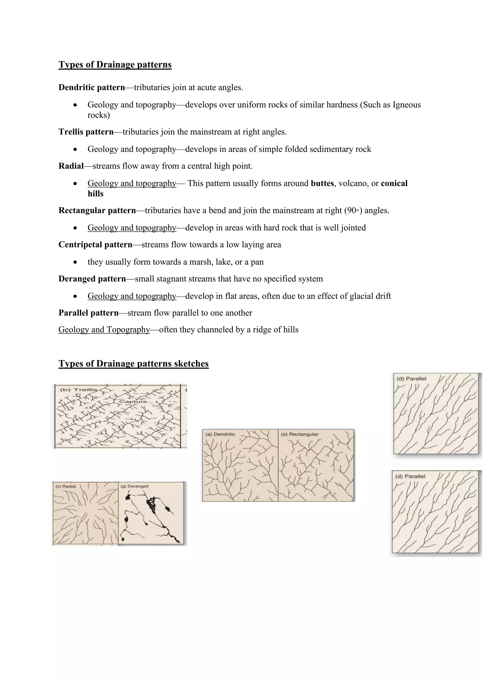

This document provides a summary of key concepts in geomorphology. It defines important terms like drainage basin, catchment area, river types and features. It describes different drainage patterns that form based on geology and topography. Factors that influence river discharge and landforms created by fluvial processes like meanders and waterfalls are also outlined. The document also discusses concepts like river grading, rejuvenation, and capture - how rivers gain or lose energy over time.


